BOU AVENUE
Dooly Knob, Frary Peak And Stringham Peak
For the finale of our Christmas holidays road trip, Zosia Zgolak and I visited Utah's Antelope Island State Park on 4 January 2020 to climb its highest point, Frary Peak.  The peak can be easily ascended via a well-designed trail, and a couple of other named summits--Dooly Knob and Stringham Peak--can also be tagged at the same time with very little extra effort.

From the city of Syracuse, head west along Highway 127 (West Antelope Drive South) to a fee station ($10 USD per vehicle) at the start of the Davis County Causeway.  Drive 11 kilometres west along the causeway to a junction on Antelope Island (turn right to reach the visitor centre in 2 kilometres).  Keep left and drive for 1 kilometre to another junction.  Turn left and drive 8.4 kilometres to the turnoff for Frary Peak trailhead.  Just before a seasonal gate, there is a small parking lot (vault toilet) located 130 metres from the turnoff.  If the gate is open, it is possible to drive an additional 850 metres to the signed trailhead (picnic tables but no toilet).

Upon our arrival, Zosia and I first went to the park's visitor centre to inquire about trail conditions since we already saw from the causeway that the upper parts of Frary Peak were plastered with snow.  The staff member we talked to was less than helpful.  She had no reports of recent ascents, and she even mildly insulted me by saying she hoped that I had better shoes than what I was wearing.  My North Face light hiking shoes currently look a little tattered after more than 1.5 years of heavy use, but the soles are still in decent shape.  These shoes have also carried me up many mountains that I would consider far more challenging than Frary Peak--thank you very much!  Our stop at the visitor centre was not a complete waste of time though; we made use of their comfortably heated washrooms.

Leaving the visitor centre, Zosia and I drove to the first parking lot near the turnoff to Frary Peak trailhead.  Although the remainder of the road was dry on this day, the seasonal gate was already closed, and we had to walk the additional distance to the actual trailhead.  From there, we hiked the moderately steep trail for about 1.2 kilometres to a signed junction with another trail leading to Dooly Knob (1.3 kilometres round-trip from the junction with 55 metres elevation gain).  This small rock outcrop has a commanding view of the island's north end and makes a great objective for hikers who are short on time or energy.  It took us 38 minutes to go tag the top of Dooly Knob and return to the junction.
WTF? The road is dry!! 
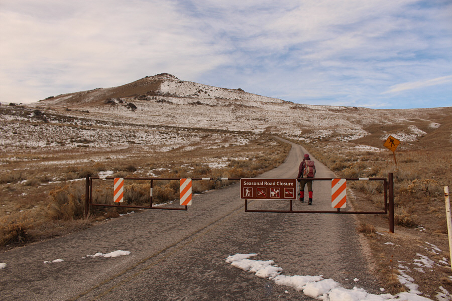
The seasonal closure of the access road forces Zosia to walk an extra kilometre (plus about 80 metres elevation gain) to get to the actual trailhead.
Blah, blah, blah... 
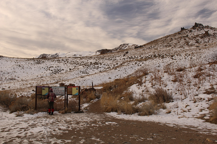
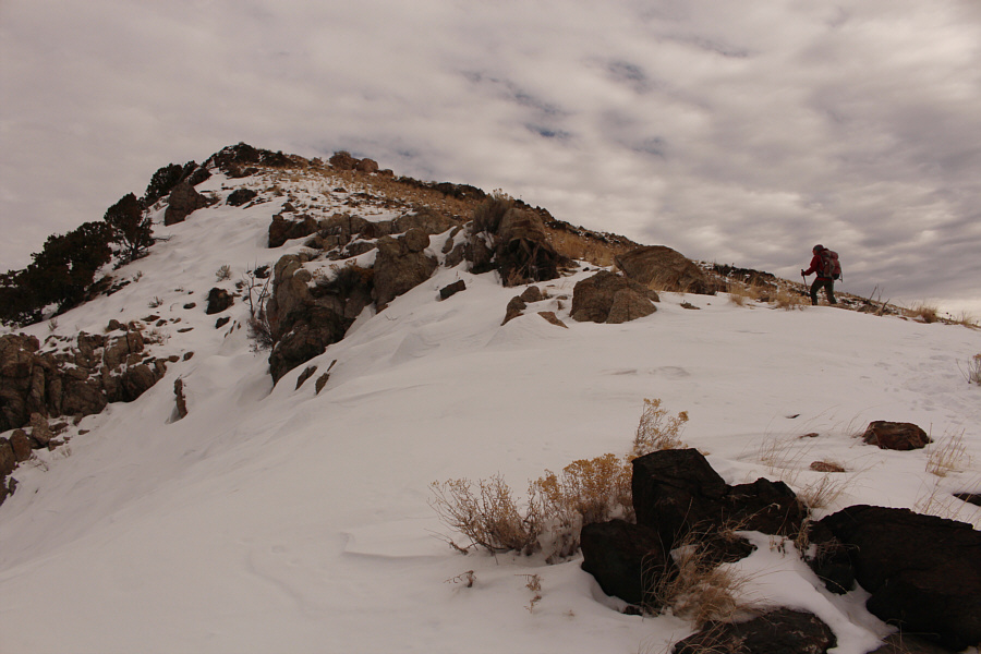
Zosia reads the information board at the actual trailhead (1376 metres).
This part was a bit muddy on our descent later. 
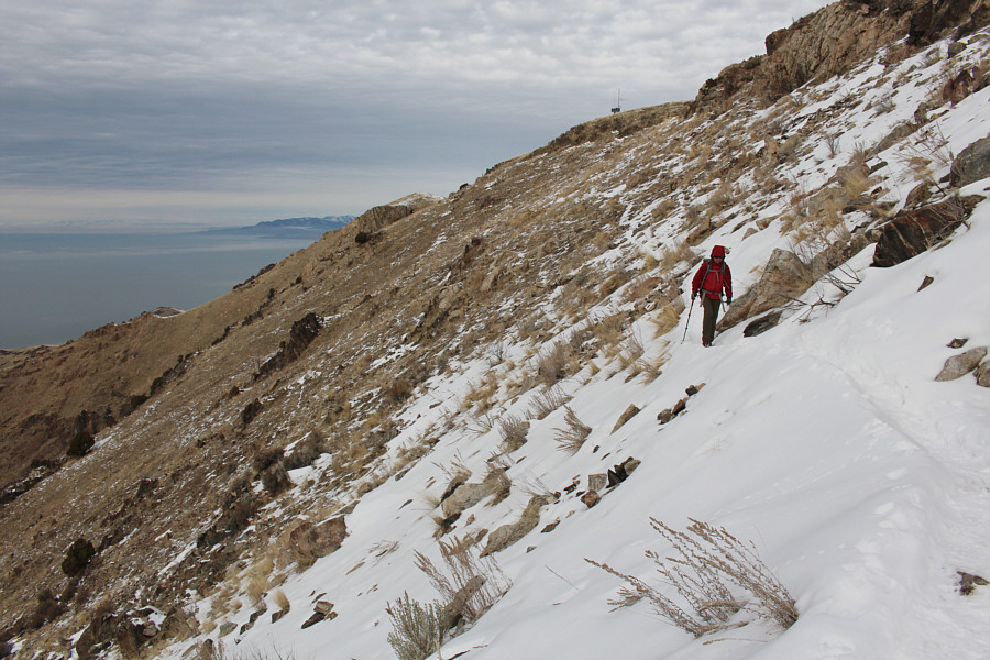
Sonny hikes along a good trail up a grassy slope.

Photo courtesy of Zosia Zgolak

Aha! Pilot Peak was just added to my to-do list! 
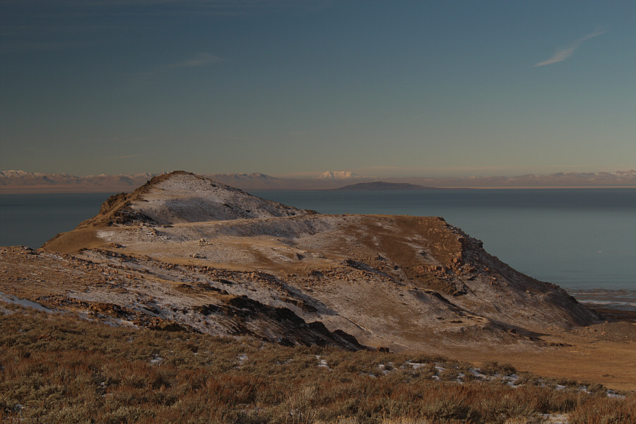
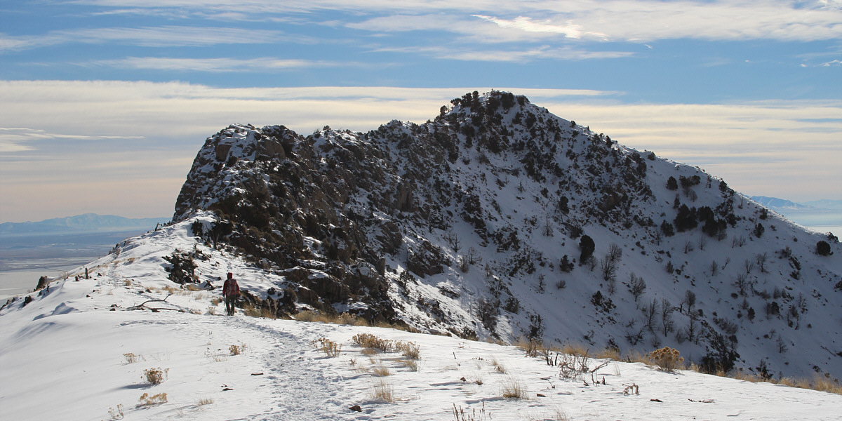
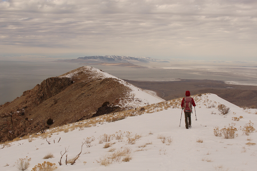
Elephant Head is a prominent hill on the west side of Antelope Island.  The snowy mountain on the horizon at centre is Pilot Peak which is actually on the Nevada side of the state border.
Why do I have the song, "Tom Dooley", running through my head? 
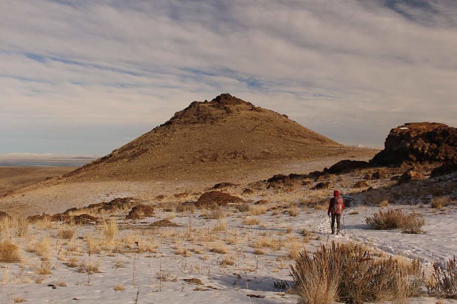
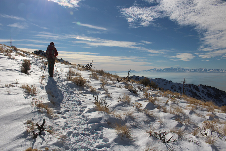
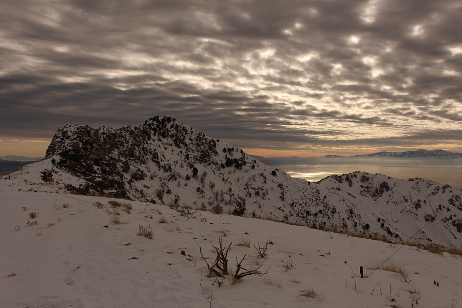
Zosia approaches Dooly Knob from the south.
Hang down your head, Tom Dooley...Poor boy, you're bound to die... 
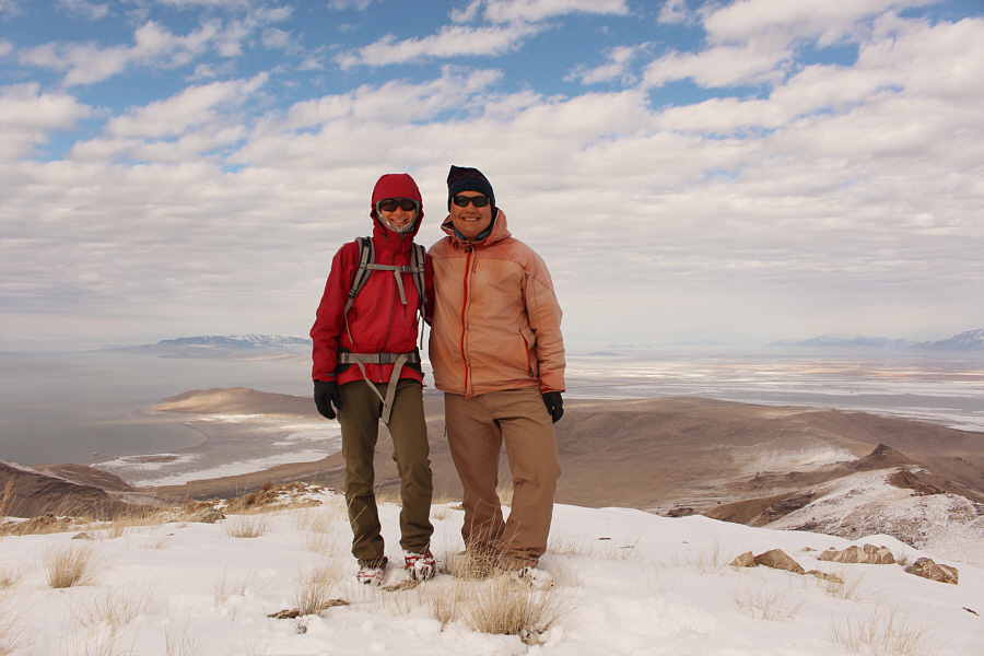
Sonny and Zosia stand on the summit of Dooly Knob (1607 metres).

Looks like a big inland sea...I guess it is!

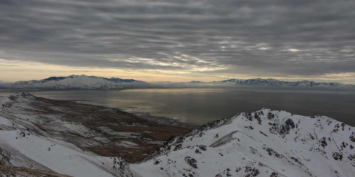
Here is a more comprehensive view of Elephant Head and part of Great Salt Lake from the top of Dooly Knob.


Oh give me a home, where the buffalo roam... The broad summit of Beacon Knob is at centre in this view to the north.  A herd of bison can be seen at left roaming the island's grasslands.

The Wasatch Mountains are a peak-bagger's paradise!

Some notable peaks visible to the northeast across Farmington Bay include Willard Peak, Ben Lomond (both on left horizon) and Mount Ogden (right of centre).


We still have a lot of climbing ahead of us!

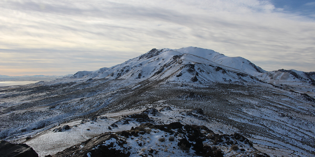
The view to the south includes Frary Peak (centre) and Stringham Peak (right of centre).


Back at the junction after returning from Dooly Knob, Zosia and I resumed our ascent of Frary Peak.  The trail swings to the west here and goes through a short tunnel among some boulders before climbing steadily up the ridge.  Zosia donned her cleats to climb up some icy spots near the boulders, but I managed just fine with my tattered North Face shoes.  We encountered more snow higher up the ridge, but thankfully, the passage of previous hikers saved us the trouble of route-finding and breaking trail.  We eventually bypassed another named summit--Stringham Peak--before gaining the ridge crest and arriving at an antenna with a view of the final approach to the top of Frary Peak.  Two different routes exist here.  The ridge beyond the antenna is a Class 3 scramble with mild exposure while the official trail dips slightly and traverses across the northwest face before winding up the south side of the summit.  On this day, the presence of snow made both routes look spicier than normal, and in the end, we opted to stick with the less technical official trail.  Although the snow-covered trail was already broken, some parts of the northwest face are unnervingly steep, and I would have felt more at ease with an ice axe in hand.  Fortunately, we made it across without any slips, and shortly after, we were standing on the highest point of Antelope Island.
The fun never ends! 
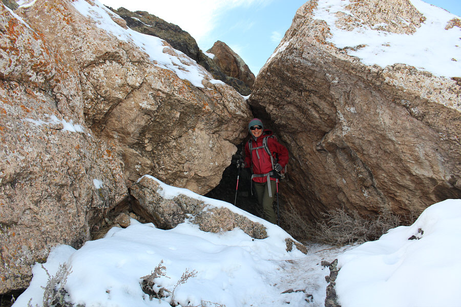
The trail to Frary Peak goes through a short tunnel.
Almost enough snow to ski! 
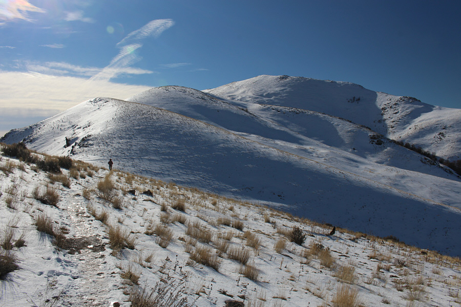
The trail winds its way up a series of successively higher bumps.  The highest bump right of centre is Stringham Peak.
Don't worry Stringham...we'll be back for you later! The trail heads left here and bypasses the top of Stringham Peak.
Beautiful view across the lake! 
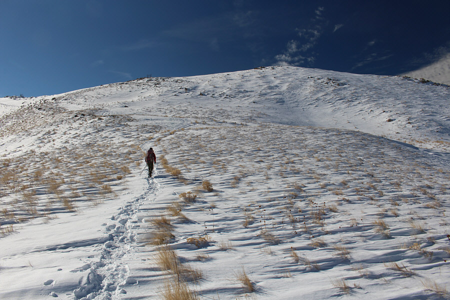
Zosia hikes along the ridge crest and approaches an antenna visible at far left.

Pick your poison!

The route along the left-hand ridge is a Class 3 scramble while the official trail traverses across the steep northwest face and goes over the right-hand ridge.


An ice axe and cleats would not be out of place here! Zosia begins the traverse across Frary Peak's northwest face.
I think we're gonna make it! Past all difficulties, Zosia climbs up the last few metres before the top.
Frary Jacques, Frary Jacques, Dormez-vous? Dormez-vous? Zosia and Sonny stand on the summit of Frary Peak (2005 metres), the highest point on Antelope Island.

Oquirrh Mountains are tricky to access because much of it is on private land.

Across the southern half of Great Salt Lake are the Oquirrh Mountains (left) and the Stansbury Mountains (right).


I'm gonna have to look into whether or not it's possible to get onto that island... 
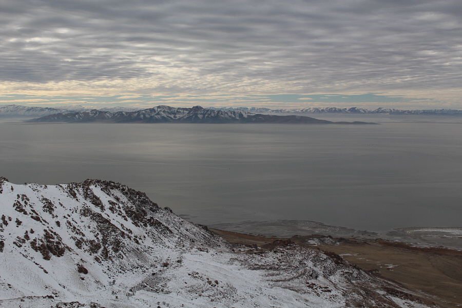
To the southwest, Stansbury Island is the second largest island within Great Salt Lake.
The north ridge below the summit looks like an interesting scramble. 
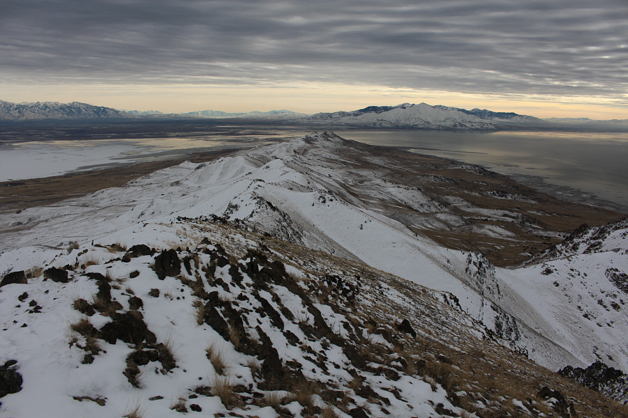
This is the northern half of Antelope Island as viewed from the summit of Frary Peak.
Might be worth exploring in the future... This is the southern half of Antelope Island as viewed from the summit of Frary Peak.
After taking a 30-minute break on the summit of Frary Peak, Zosia and I carefully retraced our steps back across the northwest face to the antenna.  Backtracking along the ridge crest, we temporarily abandoned the descending trail to easily tag the summit of Stringham Peak which we had skipped earlier.  From there, we took a shortcut down Stringham Peak's snow-covered east slope to regain the trail, and the rest of our descent back to the first parking lot was straightforward and uneventful.
Neat-looking sky! Here is one last look at the top of Frary Peak.
Some unfinished business left... Zosia hikes toward Stringham Peak.
Last summit of our road trip! Zosia and Sonny stand on the summit of Stringham Peak (1935 metres).
Can you spot the causeway? 
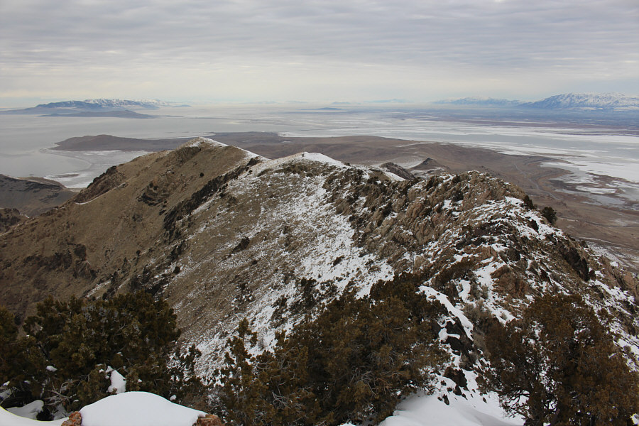
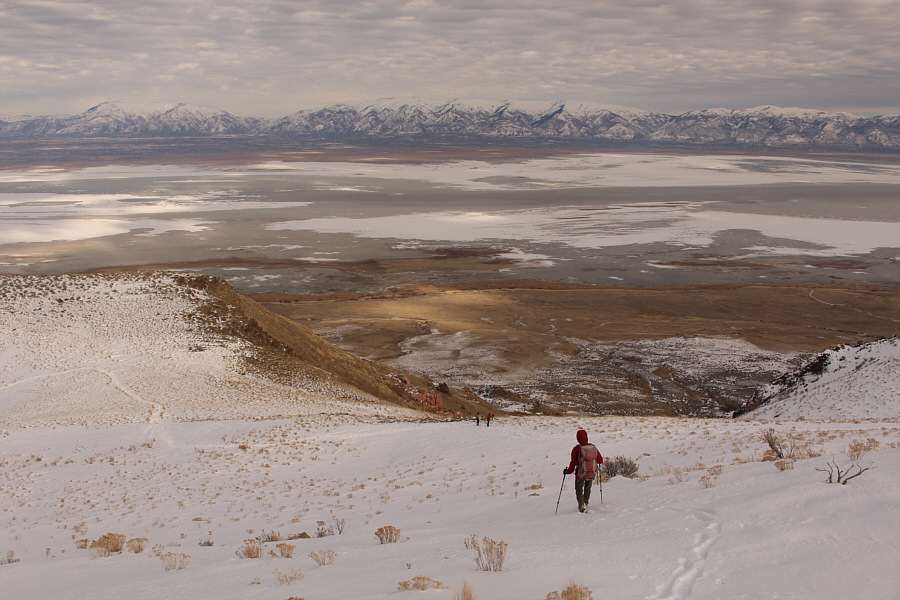
Here is the northern end of Antelope Island as viewed from the top of Stringham Peak.  Dooly Knob is visible at far right.
Okay...time to go home! Zosia takes a shortcut down the east slope of Stringham Peak.  A couple of hikers can be seen coming up the trail below.
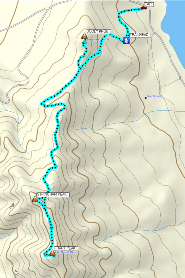
A most enjoyable hike with sublime views. Total Distance:  14.8 kilometres
Round-Trip Time:  5 hours 55 minutes
Total Elevation Gain:  914 metres

GPX Data

Leaving Antelope Island, Zosia and I drove north to check into a hotel in Idaho Falls later that night, and we would make it home the following evening to conclude yet another long and satisfying road trip.  Over the 16 days we were on the road, we bagged 16 peaks, slept in hotels for 5 nights and in the back of my Honda CR-V for 11 nights, drove 5932 kilometres, and had one leaky tire and one leaky air mattress.  I wish to thank Shin Goto for treating us to Christmas dinner in Las Vegas and giving us some very thoughtful presents.  I also want to thank Szymon Kijak and Aga Sokolowska for sharing their wonderful company while camping with us in Death Valley.  Special thanks go out to my good friend, Scott Warner, for generously looking after my cats, Bryce and Zion, back in Calgary while I was away.  Finally, a super dziękuję bardzo goes out to Zosia for being the "best ever" companion I could wish for.  These travel adventures mean so much more when shared with someone special.