BOU AVENUE
Gray Creek Pass Summits (Thanksgiving Mountain)
Zosia Zgolak and I ascended a number of unnamed high points in the vicinity of Gray Creek Pass in British Columbia on 14 August 2020.  We got the idea for this outing from Kathy & Craig Copeland's guidebook, Where Locals Hike in the West Kootenay, and they refer to the high points collectively as Gray Creek Pass Summits.  We would later learn from some actual locals that the high point to the north of the pass is more commonly referred to as Thanksgiving Mountain.

From Highway 3A, turn east onto Oliver Road about 7.0 kilometres south of Crawford Bay.  Drive for 350 metres and keep right to cross a bridge over Gray Creek before intersecting Anderson Road on the other side (Anderson Road can also be accessed from Highway 3A about 600 metres south of the Oliver Road junction if coming from Creston).  Go straight passing a sign advising the use of winter tires or chains.  Drive for 900 metres to the junction with Gray Creek Road and keep left.  Ignoring all minor side roads, drive 16.5 kilometres to reach Gray Creek Pass (the pass is about 800 metres east of Oliver Lake Recreation Site).  Park in a small pullout at the top of the pass.

From the pass, Zosia and I decided to first head north to ascend Thanksgiving Mountain.  A good trail climbs gently at first and then more steeply up the southeast aspect of the mountain.  When we reached the foot of a talus slope, we headed to climber's right to gain the crest of the east ridge, and from there, we continued up to the summit without difficulty.  A short distance to the south is a subsidiary summit which grants an aerial view of nearby Oliver Lake.  After taking a short break at the subsidiary summit, we backtracked a bit before taking a short cut down the aforementioned talus slope.  In retrospect, it would be easy enough to skip the east ridge and ascend this way.  In any case, we had no problems cutting down the slope, and upon regaining the trail, we quickly made our way back to the trailhead at Gray Creek Pass.
Easier and shorter than it looks! 
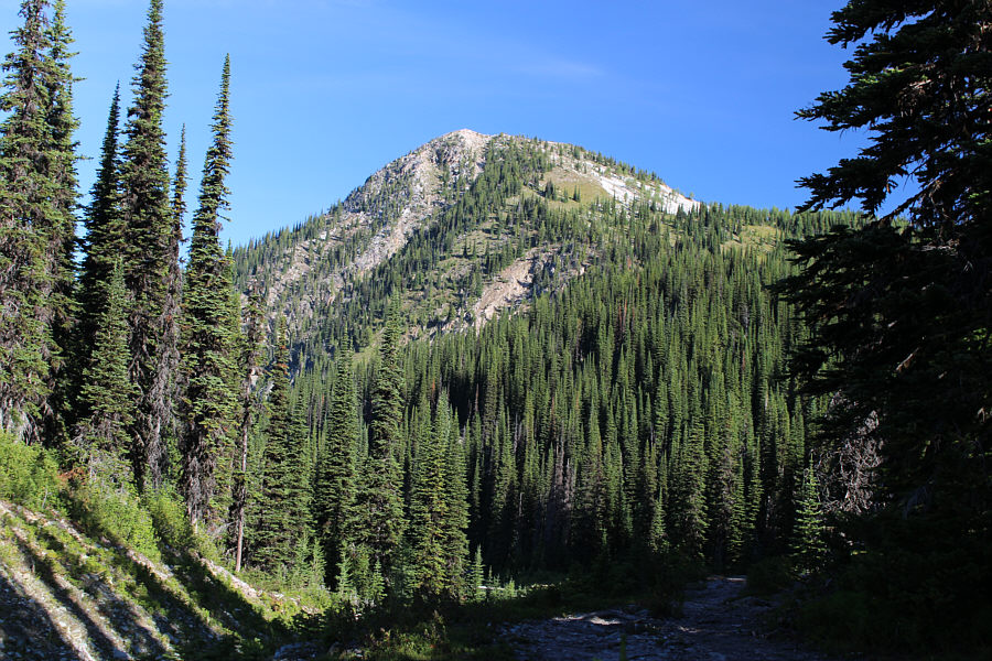
Thanksgiving Mountain is readily seen from the trailhead at Gray Creek Pass.
This would be a nice hike in the fall with all the larch trees here. 
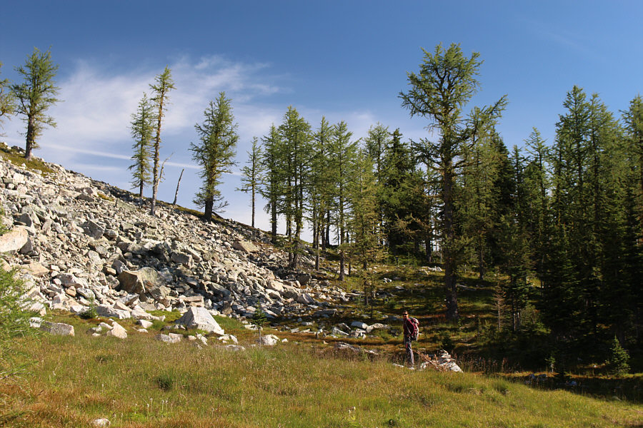
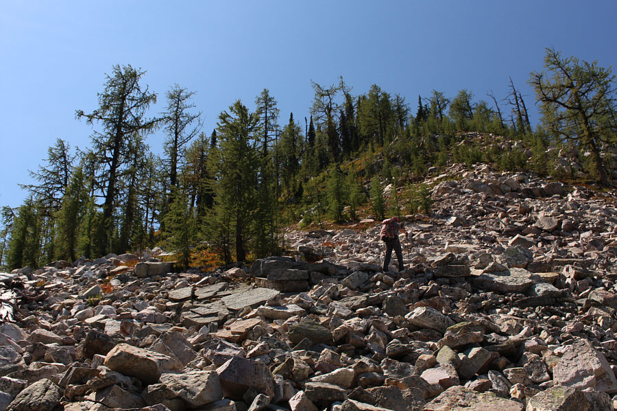
The trail skirts along the edge of the talus slope here before going up the ridge at left.
Only about 80 metres of elevation gain to the top from here! 
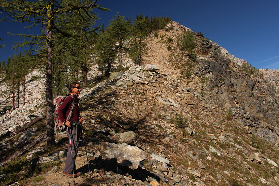
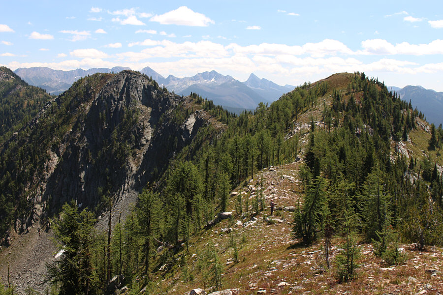
Zosia pauses to enjoy the views from the ridge she would subsequently ascend.
I can see how Sphinx Mountain got its name...after a couple of beers! 
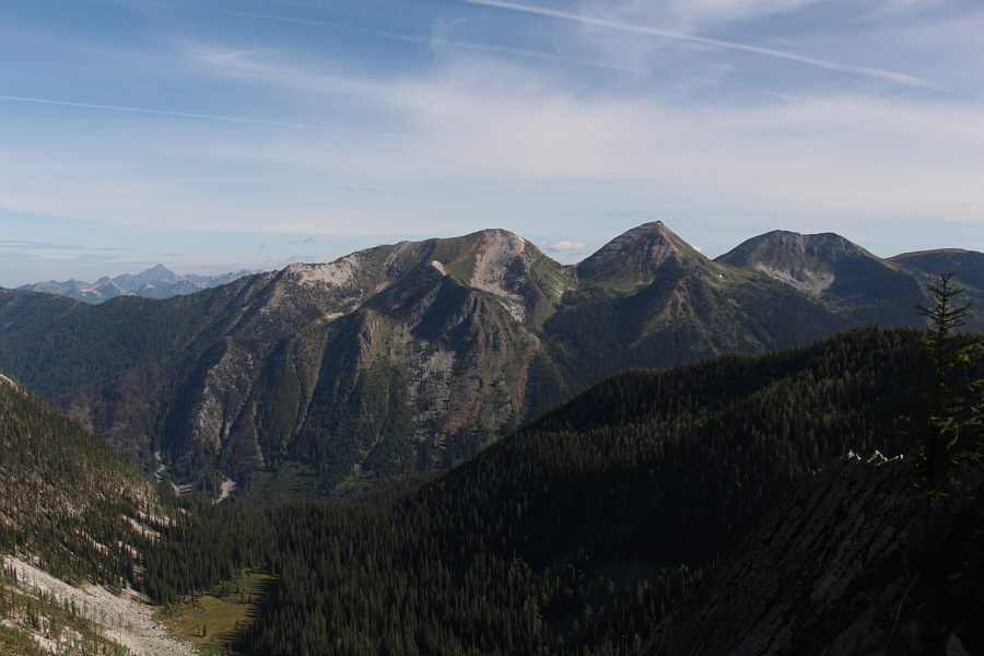
Sphinx Mountain (right) is visible to the north from the ridge.  The prominent mountain on the distant horizon at left is Mount Loki.
That was easy! Really! 
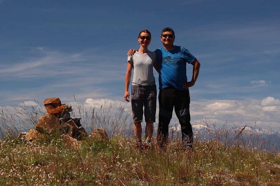
Zosia and Sonny stand on the summit of Thanksgiving Mountain (2364 metres).

Double summit?

Zosia wanders over to a subsidiary bump of Thanksgiving Mountain.


Good to the last drop! 
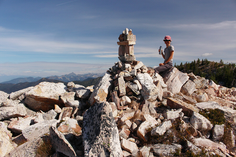
Zosia enjoys a drink beside the elaborate cairn on the subsidiary bump.
Good opportunity to scout out the best route here 'cause those trees at left hide a lot of grief! Oliver Lake sits at the foot of one of several unnamed peaks south of Gray Creek Pass.
Swipe right! 
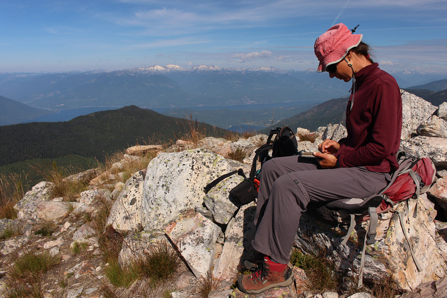
With cellular reception available here, Zosia checks for messages on Sonny's iPhone.
Making a short trip even shorter! Zosia takes a short cut down the talus slope she circumvented on the ascent.
Zosia and I took another break at our car before heading up another trail on the opposite side of the road.  Our plan was to skip the first high point and go straight to the subsequent high points further south.  Unfortunately, the trail quickly ends at a cabin hidden from the road, and after a fruitless search for a beaten path, we bit the bullet and headed southwest through moderately dense bush.  In contrast to the nice trail we enjoyed on Thanksgiving Mountain, the bushwhack on this side of the road was more than a little annoying.  Promising game trails disappeared as quickly as they appeared, and some elevation loss was necessary to avoid hidden short cliffs.  Even the odd cairn provided only puzzlement and false hope.  Fortunately, the thrash was relatively short, and we eventually stumbled across to a saddle separating the first high point from the second high point.  Skipping the first high point as planned, we hiked up the second high point via its north ridge.  Other than being very steep, this ridge presents no technical challenges.  Reaching the top of the second high point, we continued easily along the connecting ridge to a third high point where we stopped for lunch.  By the time we finished lunch, the warm weather sapped any desire to continue further along the ridge, and we simply retraced our steps over the second high point and back down to the saddle.  We endured another round of bushwhacking on the way back to Gray Creek Pass, but it seemed less arduous this time.

I am uncertain if Thanksgiving Mountain by itself is a worthwhile objective on its own given the lengthy drive to reach the trailhead and the shortness of the hike.  The other Gray Creek Pass Summits make for worthy extensions but only for experienced masochists hikers.  Novices may find the bushwhacking too unappealing to stomach.  Perhaps a better alternative would be to combine Thanksgiving Mountain with Sphinx Mountain further to the north.
Not really suitable for human habitation at the moment! 
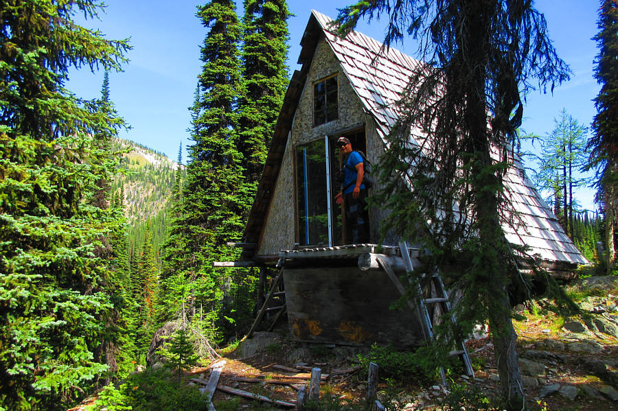
Despite its close proximity to the trailhead, this cabin is well-hidden from the road.  Unfortunately, it has been overrun by mice and is in need of some major cleaning.

Photo courtesy of Zosia Zgolak

The south side of Gray Creek Pass is not nearly as pleasant as the north side! 
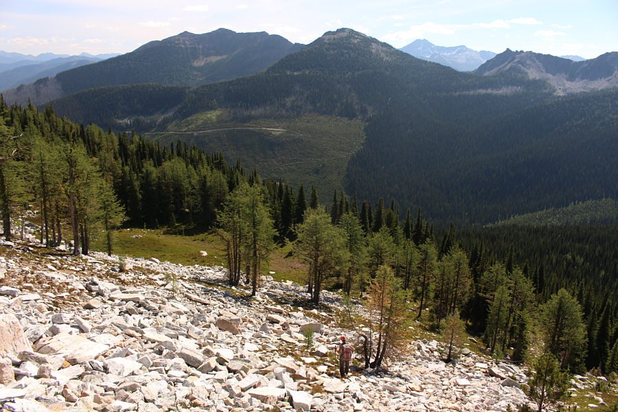
After a moderate thrash through forest, Zosia finds herself at the foot of yet another talus slope.  She would eventually head up the ridge in the background.
Better than the bushwhack near the start! Zosia grinds her way up the steep ridge.
Despite the nice vistas, our enthusiasm for more hiking is starting to wane here... 
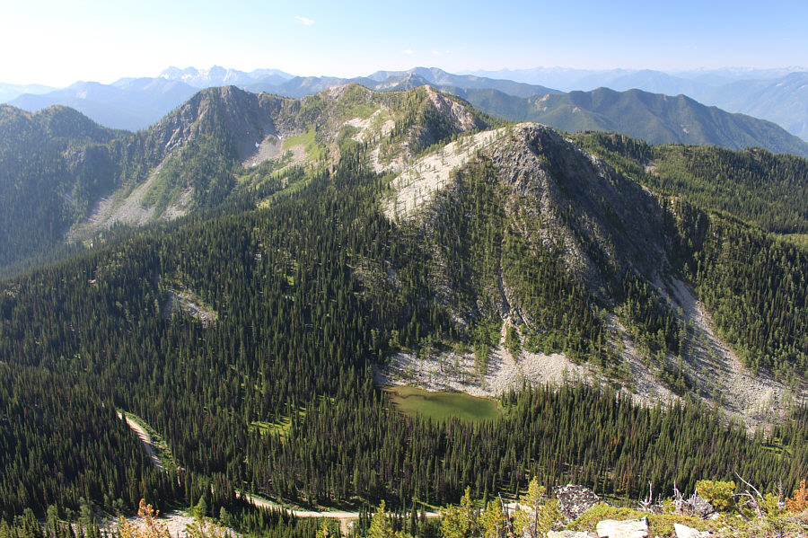
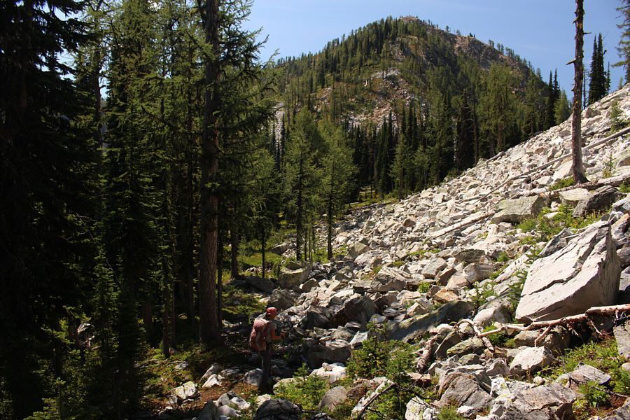
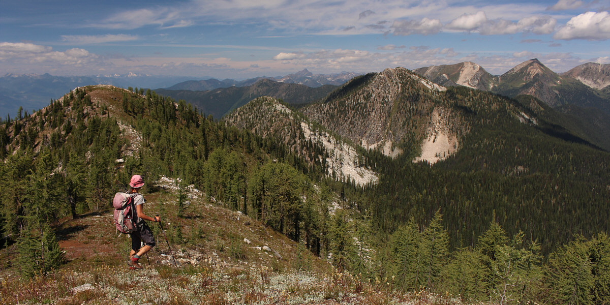
Zosia heads for the top of the unnamed high point to the right.  This unnamed high point is the third distinct summit south of Gray Creek Pass.
A siesta would be nice right about now! 
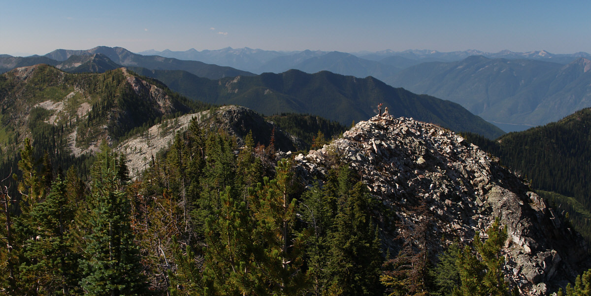
Zosia and Sonny stop atop the third unnamed high point (2320 metres) south of Gray Creek Pass.

At the moment, this whole peak-bagging business is starting to become pointless!

The summit at far left is the second high point south of Gray Creek Pass.  Also visible are the first high point (left of centre), Thanksgiving Mountain (right) and Sphinx Mountain (far right).
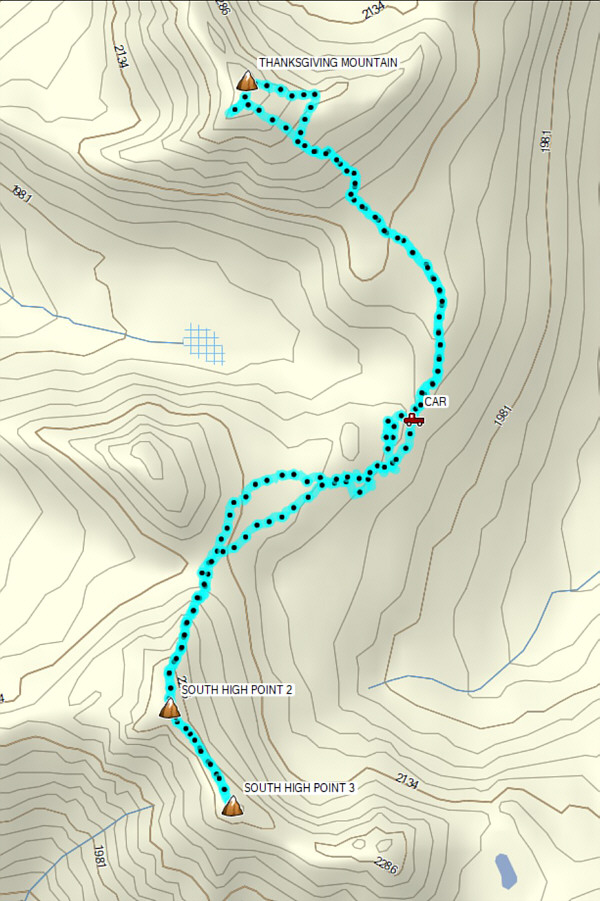
 

Thanksgiving Peak is easy; the south peaks--not so much! Total Distance:  7.4 kilometres
Round-Trip Time:  5 hours 37 minutes
Cumulative Elevation Gain:  614 metres

GPX Data