BOU AVENUE
Hollebeke Mountain
On 27 June 2020, Alda Sigvaldason,
Marta Wojnarowska, Zosia Zgolak and I made the long drive to Alberta's Castle Wildland Provincial Park to ascend Hollebeke Mountain.
Named after a Belgium village where Canadian troops fought during World
War I, Hollebeke Mountain is small in stature but commands far-reaching
views in all directions due to its prime location along the Continental
Divide. I knew that local climber, Brandon Boulier, had recently
climbed the mountain via the
route
pioneered by Matthew Clay, and with the weather forecast promising little
to no rain in the area, I felt confident that we could successfully reach
the summit as well.There are a
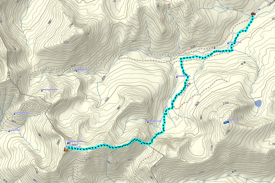
number of ways to access the trailhead for Hollebeke Mountain, but I
believe the following driving route description is probably the shortest.
From Highway 3, turn south onto East Hillcrest Drive about 11 kilometres
west of the junction with Highway 22. Follow East Hillcrest Drive
for 2.4 kilometres to the junction with Adanac Road. This junction
can also be accessed from the west via 232 Street in the town of
Hillcrest (drive southeast past the intersection with 12 Avenue for 1.4
kilometres). Drive south along Adanac Road for 14 kilometres to a
3-way intersection with Carbondale Road and Napay Road. Keep right
and drive west along Carbondale Road (passing Lynx Creek campground which
has vault toilets) for 4.2 kilometres to an intersection with Lost Creek
Road. Turn right and drive west along Lost Creek Road for 2.5
kilometres to another junction. Keep left on a rougher road
(high-clearance vehicle recommended) and drive a bumpy 3.6 kilometres to
the signed North Kootenay Pass trailhead just before a foot bridge.
From the trailhead, we crossed the foot bridge and hiked the road leading
to North Kootenay Pass for about 3.1 kilometres until we reached the
signed junction with a side road leading to Macdonald Pass. Turning
left, we hiked up the side road for about 3.4 kilometres to reach
Macdonald Pass. Along the way, we had to ford a tributary of
Macdonald Creek and also cross a couple of large and somewhat
uncomfortably steep snow patches covering the road. At Macdonald
Pass, we left the road and weaved through a bit of bush before climbing
up the ridge to the west. Although technically easy, the climb from
the pass to the ridge top is brutally steep, and rockfall can be a real
hazard if there is a large group ascending here. The top of the
ridge is also a bit bushy, but careful route-finding allowed us to
continue westward with very little thrashing. Following the crest
of the Continental Divide, we dropped into a slight dip before climbing
over a higher unnamed bump. While this bump initially looked
demoralizing to me, climbing it was much easier than expected, and we
were soon dropping down the far side onto a huge plateau just before the
final climb to the top of Hollebeke Mountain. This final slope was
also fairly easy to ascend, and it was not long before we were all
relaxing beside the huge summit cairn. As I had already mentioned,
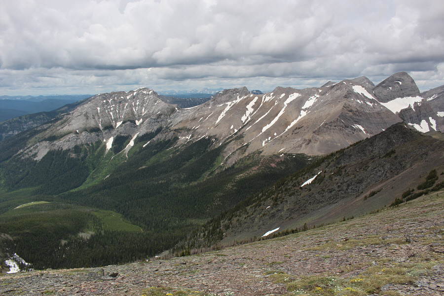
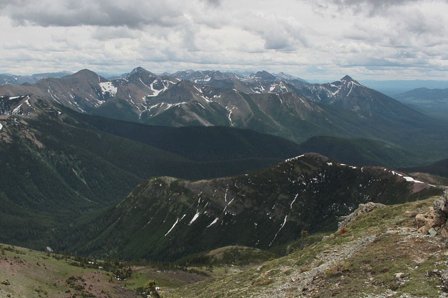
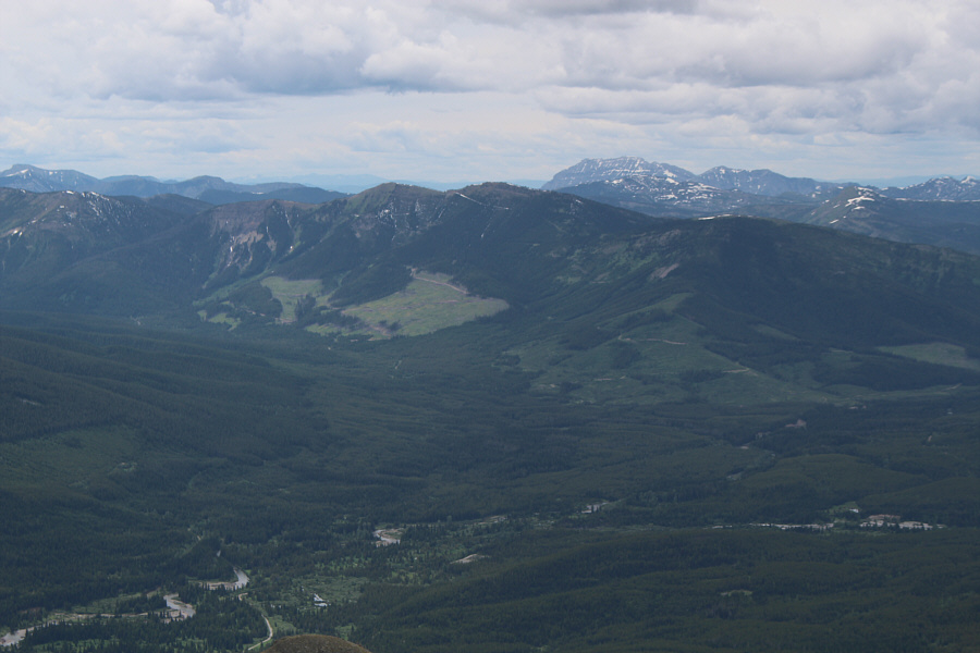
the elevation of Hollebeke Mountain is not particularly high; yet, the
views from its summit are surprisingly impressive. We had a lot of
fun trying to identify numerous peaks both near and distant in all
directions.
On our return trip, we tried to sidehill bash around the unnamed bump,
but we ended up climbing nearly over the top anyway. Just before
the steep descent back to Macdonald Pass, we stopped for another extended
break to snack and exchange more war stories. I think Alda and
Marta even contemplated traversing toward Mount McCarty, but the
complicated terrain east of Macdonald Pass likely quashed any serious
ambitions to do so. Instead, we easily descended to the pass after
our break, and except for the added challenge of descending the
aforementioned snow patches and fording the tributary, the hike back to
the trailhead was long but uneventful.
We drove through several heavy rain
storms on our way back to Calgary, and as such, I am very grateful for
the generally pleasant weather we enjoyed throughout our hike. Even
better was sharing the trail with most excellent company.
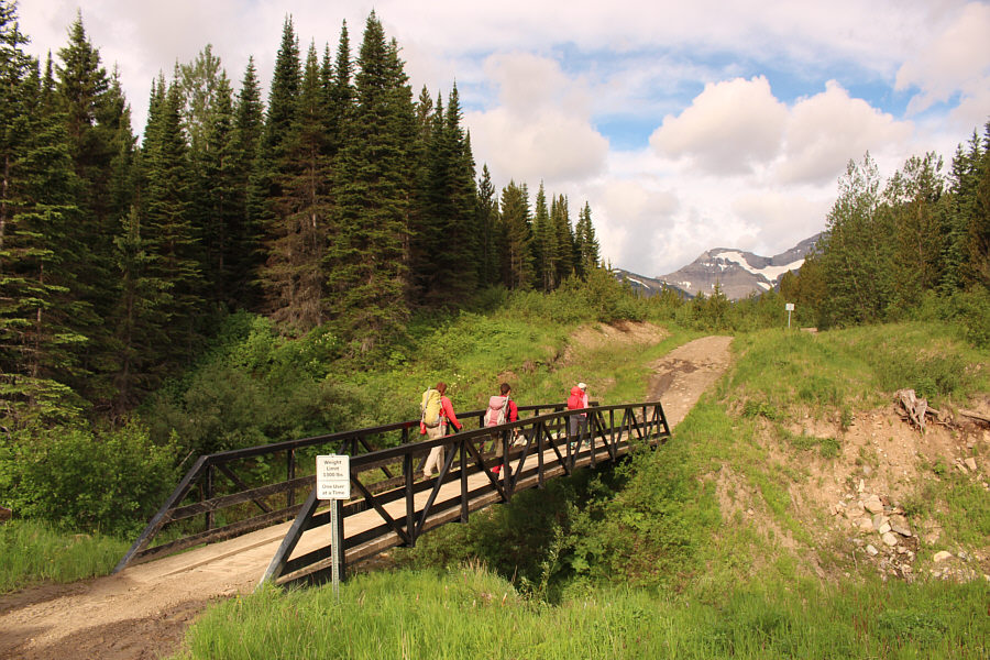 |
Several bridges like this one simplify
the approach. |
 |
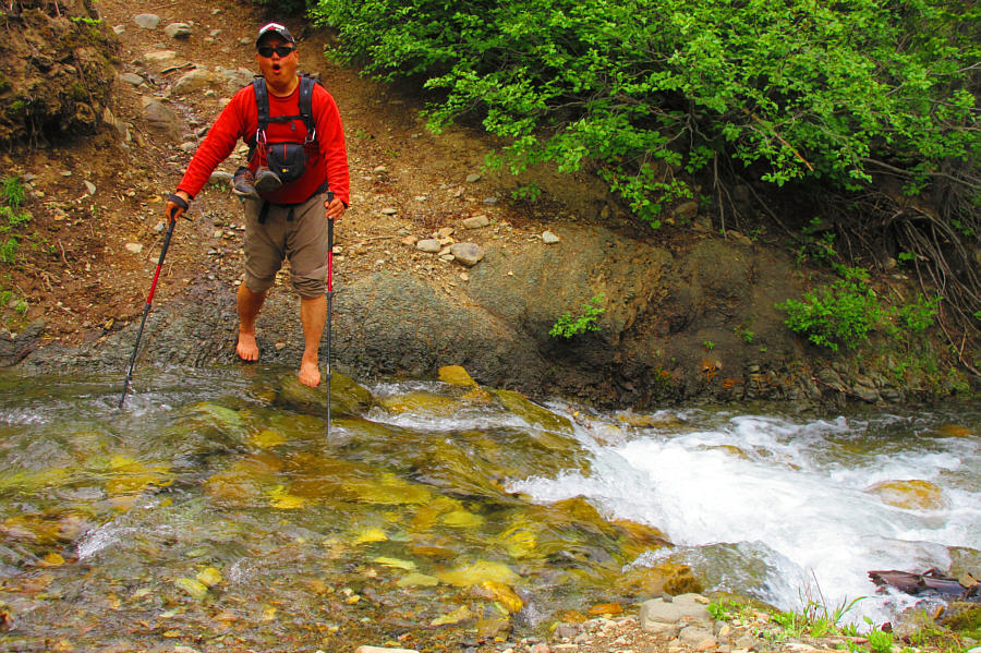
Zosia and Marta ford a tributary of Macdonald Creek. |
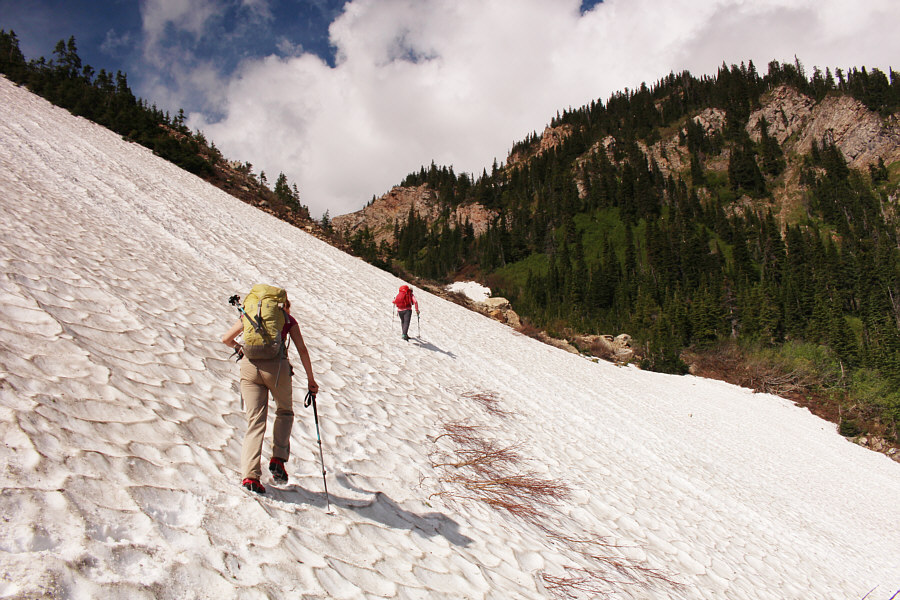 |
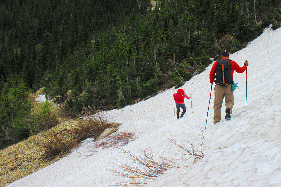
Marta follows Alda up a lingering snow patch covering the trail to
Macdonald Pass. |
 |
The climb above Macdonald Pass is brutally steep. |
 |
From the top of the ridge west of Macdonald Pass, the route dips slightly
before climbing over this unnamed bump along the Continental Divide. |
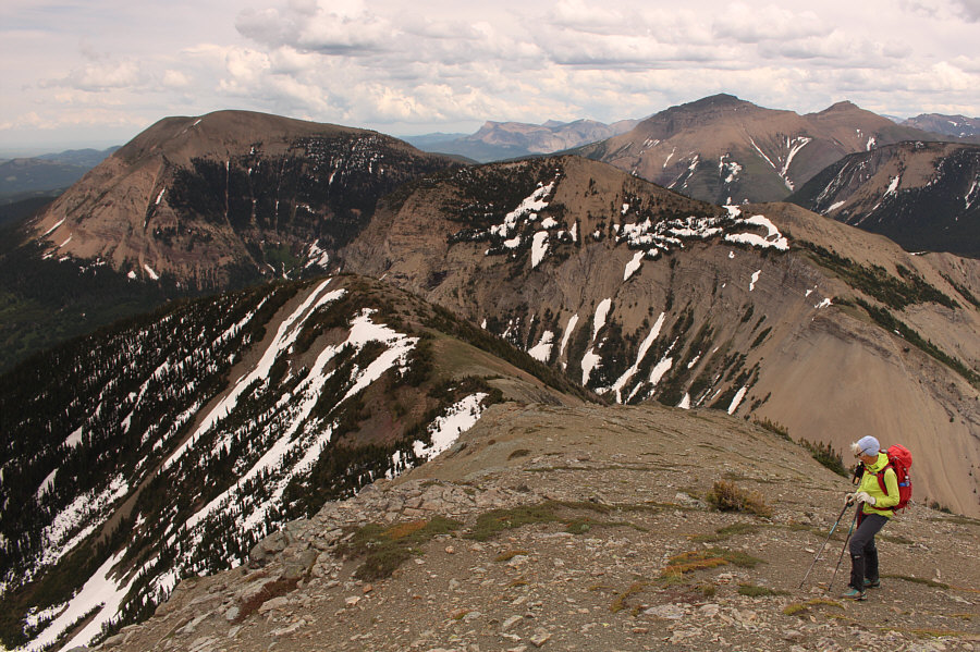
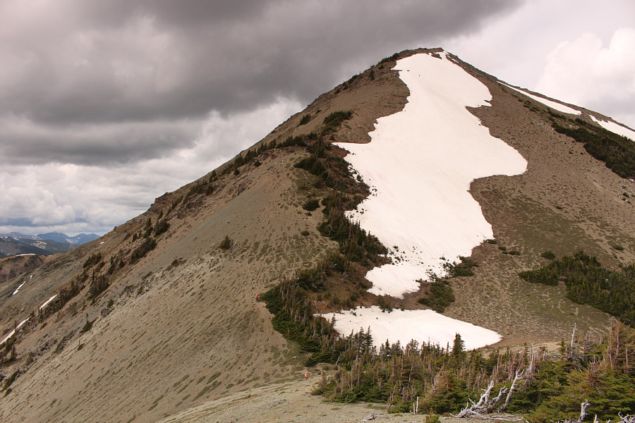
Hollebeke Mountain finally comes into view from the top
of the unnamed bump.
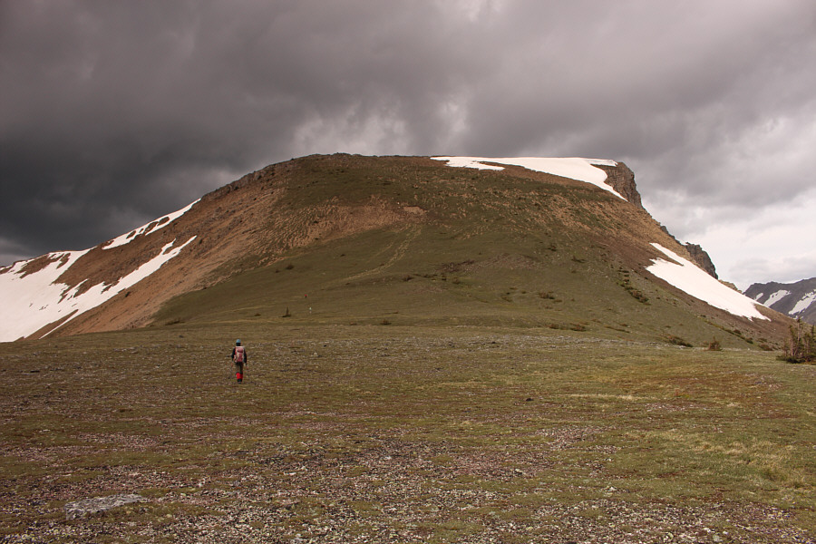 |
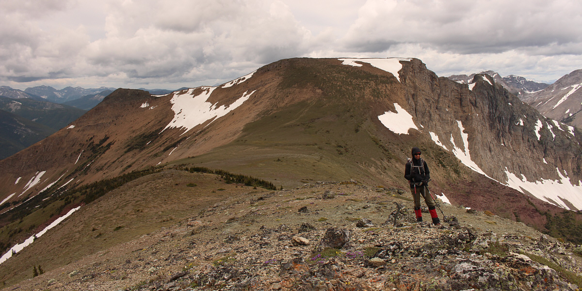
The eastern slopes of Hollebeke Mountain present no significant
difficulties. |
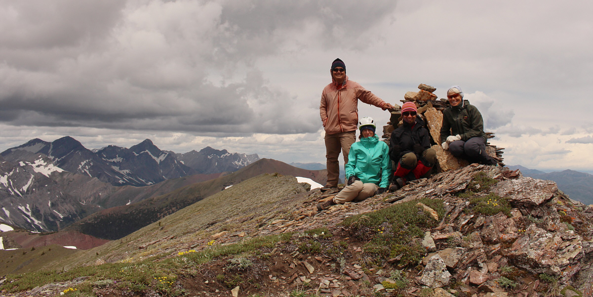
Sonny, Marta, Zosia and Alda gather around the summit
cairn of Hollebeke Mountain (2400 metres).