BOU AVENUE
Philosopher's Knoll

Zosia Zgolak and I hooked up with our friends, Houmaro Kone and Dorota Sokolowska, to hike up Philosopher's Knoll in Alberta's Banff National Park on 14 June 2020.  This unofficially-named little bump sits at the north end of Sulphur Mountain, and an ascent route is described in Mike Potter's guidebook, Backcountry Banff.  Because the climb of Philosopher's Knoll is so short, I proposed extending the trip by hiking Healy Creek trail.  Thus, we first set up a car shuttle by leaving a vehicle at the Healy/Brewster trailhead (on the east side of Sunshine Road near the interchange with Trans-Canada Highway) before driving to Banff townsite and starting our hike from Cave and Basin National Historic Site (west end of Cave Avenue).  The crux of the trip was trying to figure out how to get into the historic site's parking lot which has some convoluted and somewhat counter-intuitive access points.  Houmaro basically ignored all the directional arrows and drove straight to the open parking spot closest to the trailhead.

From the parking lot, we walked past the Cave and Basin buildings and briefly followed the paved trail to Sundance Canyon.  About 300 metres west of the trailhead information sign board, we abandoned the pavement and followed a signed horse trail climbing up into the forest to the left.  Less than a kilometre beyond this turnoff, we took a spur trail to the right and climbed up open slopes to the top of Philosopher's Knoll.  Despite its diminutive height, the knoll grants some fantastic views of the Bow River valley.
Why is the Union Jack flying here instead of the Maple Leaf? 
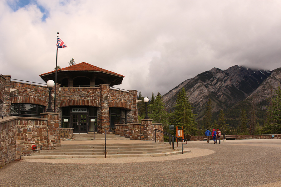
The group starts the hike from Cave and Basin National Historic Site.
Surprisingly, we didn't see a single soul on this usually popular pathway. 
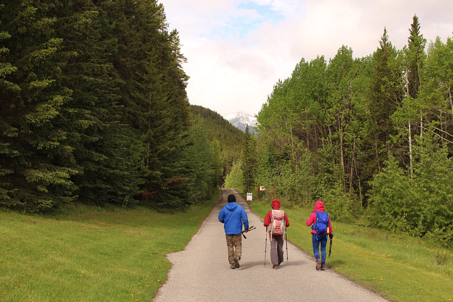
The first part of the hike follows part of the paved pathway to Sundance Canyon.
What? We have to climb uphill?? 
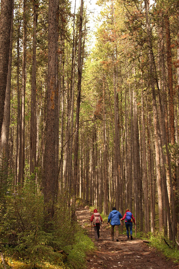
The group climbs up a horse trail which branches off from the paved pathway.
It's getting steeper...not really! 
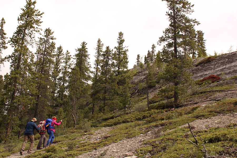
Leaving the horse trail, the group climbs a beaten path going up the south side of Philosopher's Knoll.
To maintain physical distancing, Houmaro and I are keeping two Pole-lengths between us! Sonny, Dorota, Zosia and Houmaro stand on a viewpoint near the top of Philosopher's Knoll (1528 metres).

Great bang for your buck, I'd say!

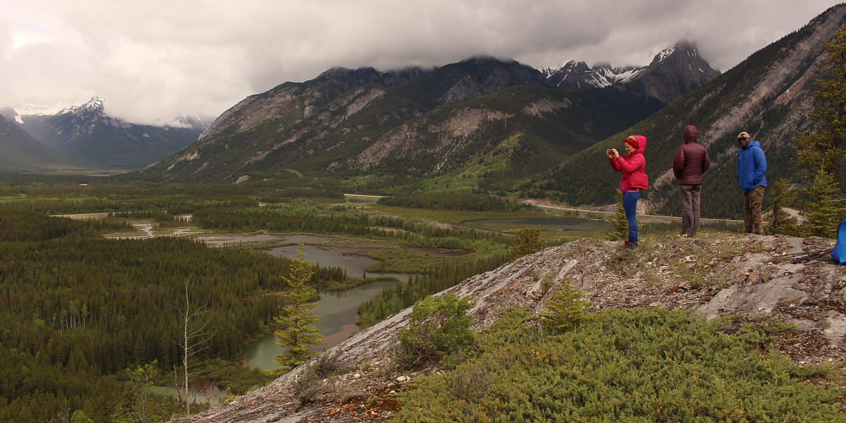
The viewpoint overlooks Bow River valley west of the town of Banff.


A possible future scramble? The northernmost peak of the Sundance Range is visible to the southwest.
After taking a short break on top of the knoll, we retreated to the horse trail and continued west where we soon intersected Cosmic Ray Road.  Turning right, we descended a short distance to a four-way intersection with the paved Sundance Canyon trail and the east end of Healy Creek trail.  We continued west along Healy Creek trail, and although views are generally limited along the trail, we quite enjoyed the pleasant walk and the solitude.

Near the west end of Healy Creek trail, we took a detour to the gravel flats alongside Brewster Creek for some nice views of the surrounding mountains.  We also stumbled upon a commercial horse outfitter's designated lunch stop here complete with convenient benches and even an outhouse.  Returning to the main trail, we soon crossed Brewster Creek on a very robust bridge, and after a bit of a long-winded loop around a popular rock-climbing area, we arrived at Healy/Brewster trailhead to complete our one-way hike.
A good, beaten path suggests that this part of the trail floods regularly. 
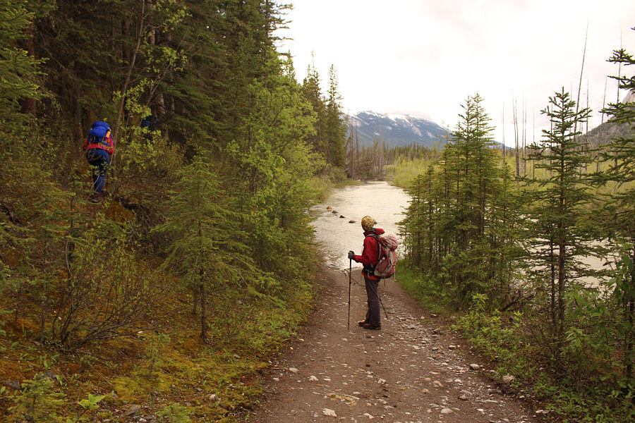
The group is forced to detour around a short inundated section of Healy Creek Trail.
There is a commercial horse outfitter's designated lunch spot with an outhouse in the trees behind Dorota. 
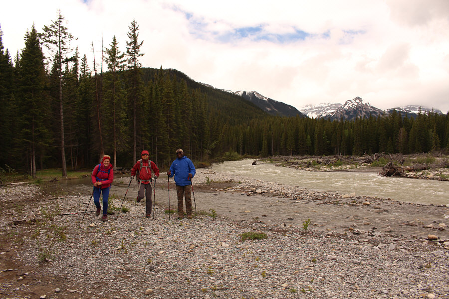
The group wanders out onto gravel flats next to raging Brewster Creek.
Please rise for the Polish anthem! 
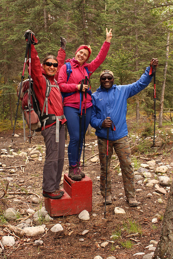
At a commercial horse outfitter's designated lunch spot, Zosia, Dorota and Houmaro re-enact an imaginary Olympic podium ceremony where Poland wins gold and silver while Côte d'Ivoire wins bronze.
Bridge over troubled waters. 
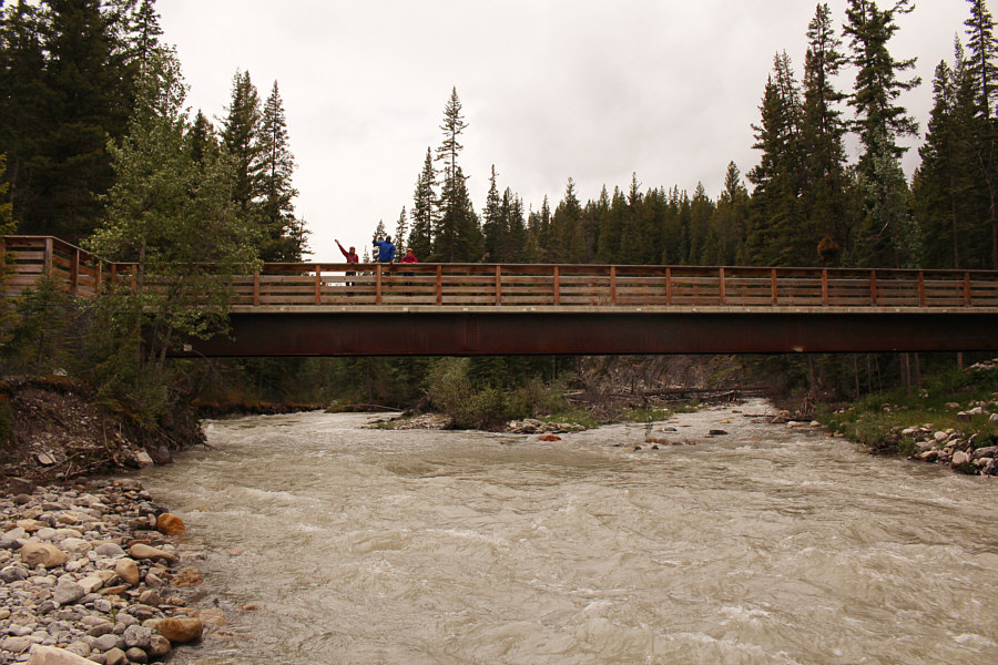
This newly-built bridge near the Healy/Brewster trailhead replaces an earlier one that was damaged in the 2013 floods.  Interestingly, this is commonly referred to as "Healy Creek Bridge" even though it spans what is technically Brewster Creek (Healy Creek flows into Brewster Creek further upstream).
I think I'll wait until the snow disappears before attempting this! 
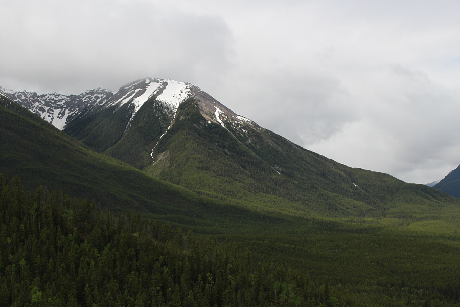
Here is another look at the northernmost peak of the Sundance Range from the Healy/Brewster trailhead.
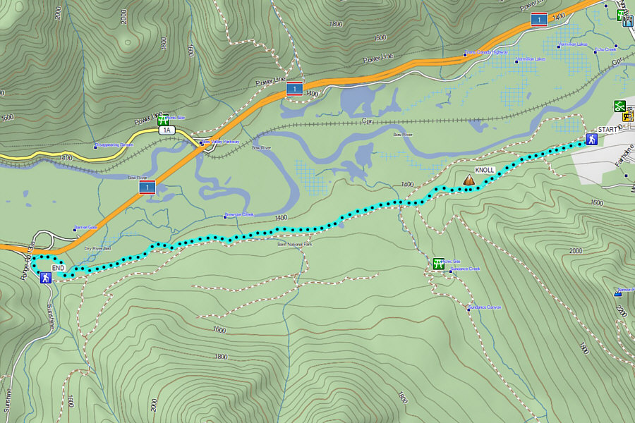
A much more pleasant hike than expected! Total One-Way Distance:  9.4 kilometres
Total Time:  3 hours 54 minutes
Net Elevation Gain:  133 metres

GPX Data