BOU AVENUE
Sparkle Lake Ridge

After spending a second night camping at Fish Lake in British Columbia's Top of the World Provincial Park, Shaun Luong, Zosia Zgolak and I got up before sunrise on the morning of 6 September 2020 with intentions of climbing Mount Dingley which sits along the southwest border of the park.  Much like with Mount Morro, we had very little route information other than knowing that the late Rick Collier considered Mount Dingley to be an easy to moderate scramble.  From studying topographical maps, I made the assumption that Collier approached the peak via the trail to Sparkle Lake, and we all agreed to give this route a try.  Knowing that the weather was going to change for the worse that evening, we also made plans to hike out of the park at the end of the day.  Therefore, we packed up our tent and camping gear and left them in the campground's food storage lockers prior to starting our hike.

Crossing the bridge over the outlet stream for Fish Lake at the west end of the campground, Shaun, Zosia and I hiked the signed and well-maintained trail to Sparkle Lake which climbs 350 metres over a distance of 2.8 kilometres according to the park's trail description.  It took us about 75 minutes to reach Sparkle Lake, and from there, we scrambled up the ridge to the east of the lake.  The initial section is a bit bushy and steep, but once we gained the ridge crest, we settled into a more relaxed and pleasant ascent.  We eventually climbed high enough up this ridge to get a good look at Mount Dingley further south, and what we saw did not look promising.  From a distance, most of the northeast aspect of the mountain appeared to be guarded by cliffs or challenging terrain.  My assumption about Collier's approach was likely wrong, and given our limited time and motivation, we decided to pull the plug on our attempt of Mount Dingley.  As a consolation, we carried on up the ridge to its highest point south of Sparkle Lake.  This entailed some easy scrambling over a couple of false summits, but we encountered no serious difficulties.

The highest point of the ridge is in itself a wonderfully scenic perch, and though it is officially unnamed, we chose to call it Sparkle Lake Ridge.  Shaun, Zosia and I took a 50-minute break here before retracing most of our route back down to Sparkle Lake.  We took a shorter break there before fighting our way past a host of hikers, children and dogs on the trail to get back to Fish Lake.  Upon returning to the campground, we took an extended break to load up our camping gear and soak our feet in Fish Lake one last time.  The hike back to the trailhead felt a bit monotonous but went without a hitch.  The subsequent drive back to the highway was long, bumpy and dusty--definitely something to look forward to the next time I come back to Top of the World Provincial Park!
No wide loads! 
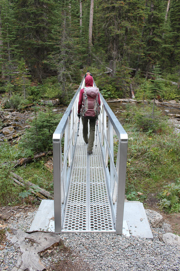
Shaun and Zosia cross the outlet stream for Fish Lake on a rather narrow bridge.
Little did we know... As Zosia and Shaun hike the trail to Sparkle Lake, the ridge through the gap would become their eventual destination.
It's a difficult lake to photograph! 
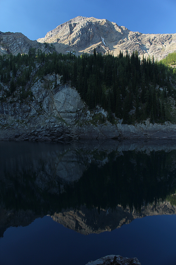
An unnamed outlier of Mount Dingley is reflected in Sparkle Lake.
Good route-finding is necessary here! 
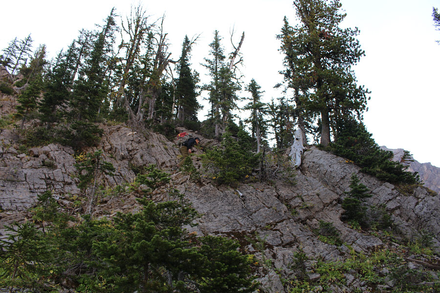
Shaun scrambles up a ridge to the east of Sparkle Lake.

We probably could have cut up the ridge to the right here.

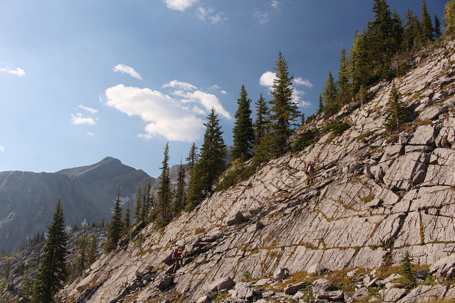
Shaun and Zosia hike past some tilted slabs.


Surprisingly, there is an easy route up this. Zosia follows Shaun up a seemingly daunting rock wall.
Great hike already, and we haven't even reached the top of the ridge yet. 
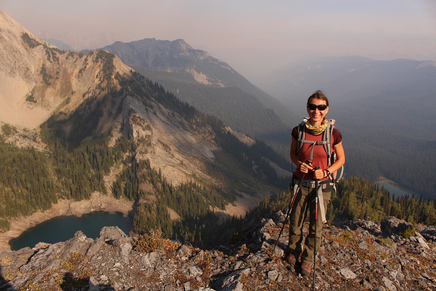
Zosia reaches the first of two false summits along the ridge above Sparkle Lake (bottom left).  Despite the presence of wildfire smoke, Mount Doolan (left of centre) and Fish Lake (bottom far right) are still visible.

Doesn't look like any easy ways to get up Dingley from here...

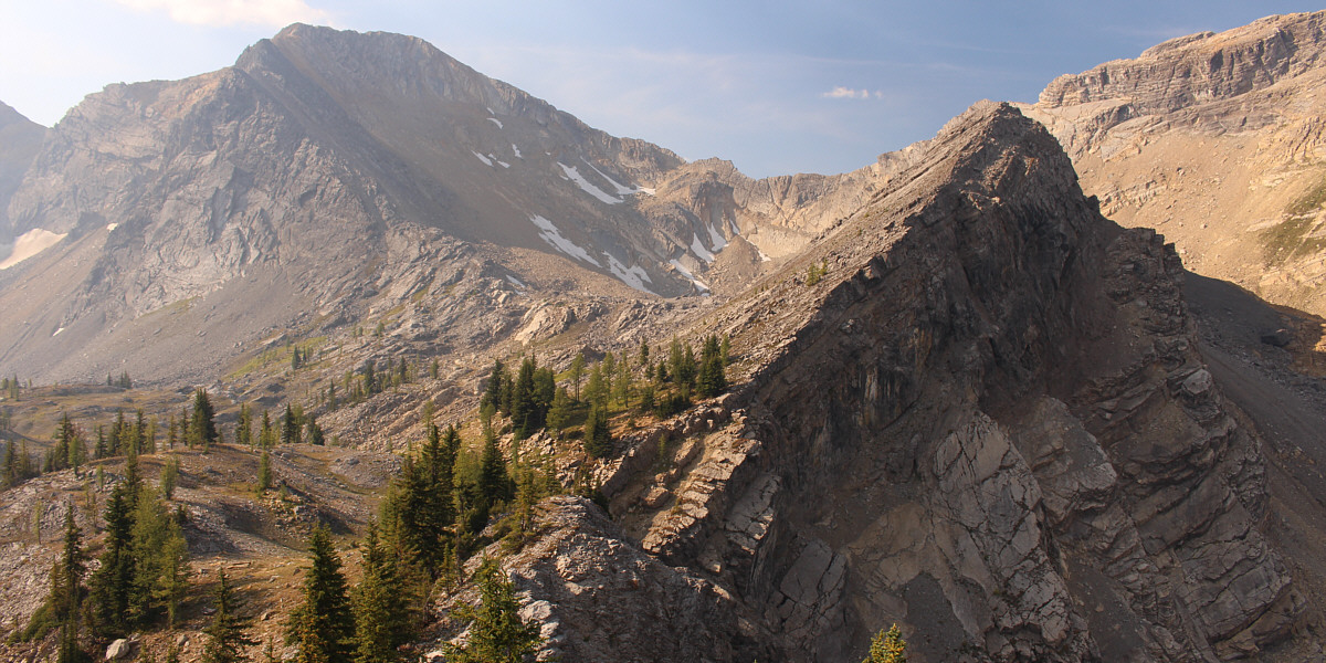
From the first high point, the remainder of the ridge above Sparkle Lake can be seen rising to the right.  At left is the highest summit of Mount Dingley.


Okay, I think we're giving up on Dingley for the day! Here is another view of the ridge above Sparkle Lake with the unnamed outlier of Mount Dingley in the background.
And enjoyable too! No bushwhacking! 
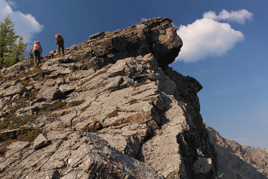
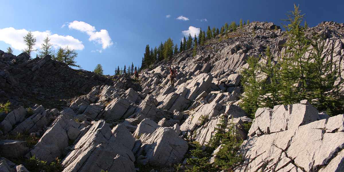
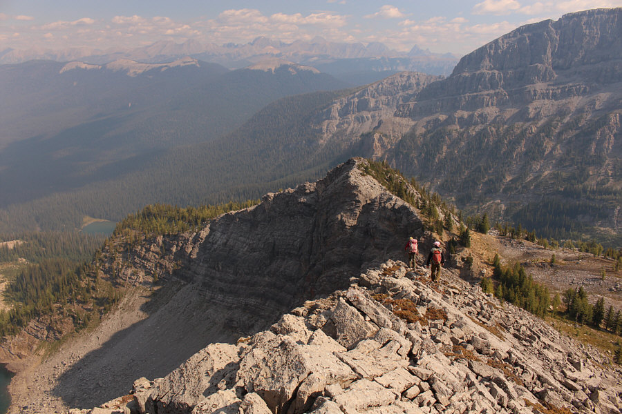
Climbing the ridge above Sparkle Lake is easier than expected.
Thankfully, there are no suicide drop-offs here! 
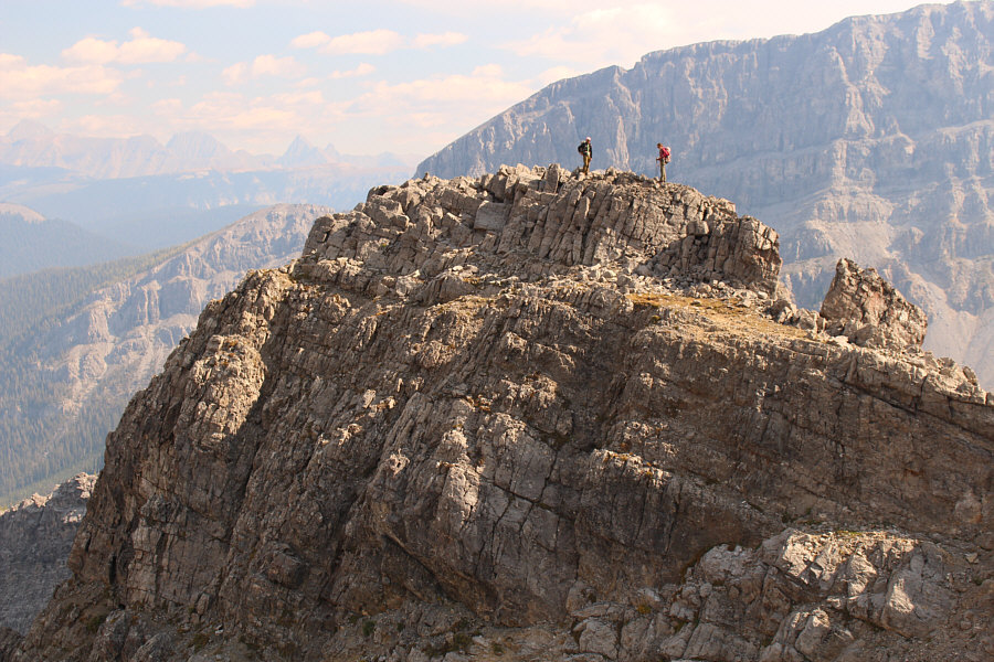
Zosia and Shaun pause at a second false summit with the true high point just ahead.
It looks like a giant mitochondrion! 
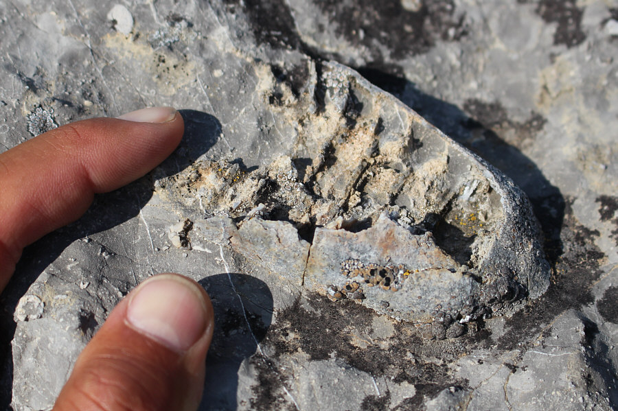
This appears to be some kind of fossil.
Ohm...we don't need to bag a named peak today...ohm! 
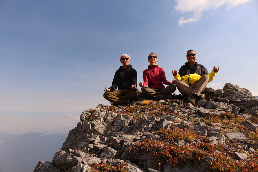
Shaun, Zosia and Sonny meditate on the highest point of Sparkle Lake Ridge (2454 metres).
The unnamed peak at left looks like it would be an easy but tedious scramble. 
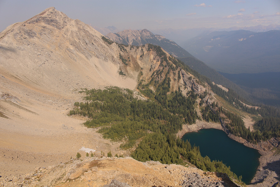
Here is an aerial view of Sparkle Lake from the highest point on the ridge.
I'm always trying to catch up to these two! On the return, Shaun and Zosia wait on the second false summit for Sonny to catch up to them.
Recognize any of those peaks on the horizon? Zosia and Shaun carefully descend the ridge back to Sparkle Lake (barely visible in the bottom left corner).  They would bypass the first false summit to the right.
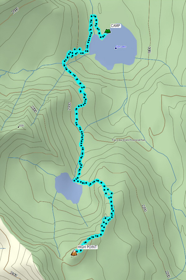
Excellent consolation prize if you can't figure out how to get up Mount Dingley! Total Distance:  8.7 kilometres
Round-Trip Time:  6 hours 7 minutes
Net Elevation Gain:  697 metres

GPX Data