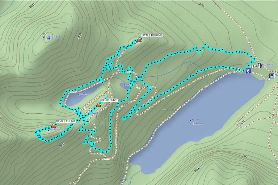
On 16 October 2022, Zosia Zgolak and I
ascended Little Beehive, Big Beehive, and Devils Thumb in the Lake Louise
area of Alberta's Banff National Park. We normally avoid hiking at
Lake Louise in summer and fall because of overcrowding and parking
difficulties, but after staying the previous night at the local hostel,
we wanted to take advantage of the short drive and the first weekend of
free parking in the off-season. The unusually pleasant weather was
also a big determining factor for braving the still-crowded trails in the
area. As such, this felt more like a visit to an amusement park
than a true wilderness adventure.
From Chateau Lake Louise, Zosia and I followed the pavement along the
shoreline briefly before branching off on the signed trail to Lake Agnes.
Not surprisingly, the trail was very busy, but almost everyone we
encountered was courteous and pleasant. At Mirror Lake, we took a
right turn, and shortly after, we took another right turn onto a shortcut
trail which leads to an intersection with the trail between Lake Agnes
and Little Beehive. Turning right again, we hiked past the turnoff
to Mount St. Piran and subsequently reached the top of unofficially-named
Little Beehive. We briefly poked around the concrete foundations of
a former fire lookout building here before hiking back along the same
trail and proceeding to Lake Agnes.
 |
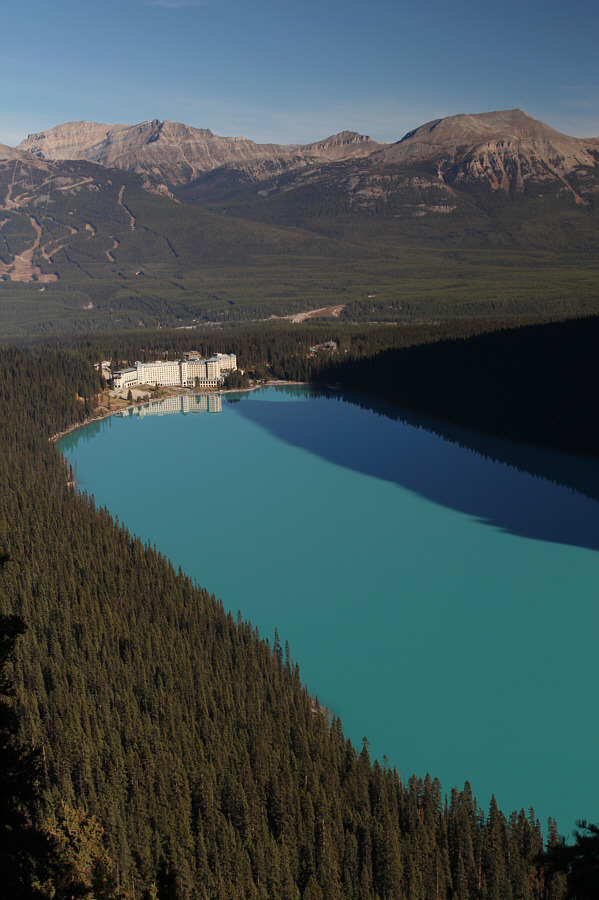
This is the classic view of Lake Louise with Mount Lefroy and Mount
Victoria at the back of the valley. |
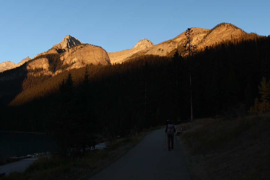 |
Morning sunlight illuminates Big Beehive (left) and Little Beehive (far
right) as Zosia starts up the trail to Lake Agnes. |
 |
Big Beehive towers over Mirror Lake. |
 |
Here is another perspective of Big Beehive from further up the trail to
Lake Agnes. Devils Thumb is also visible to the right. |
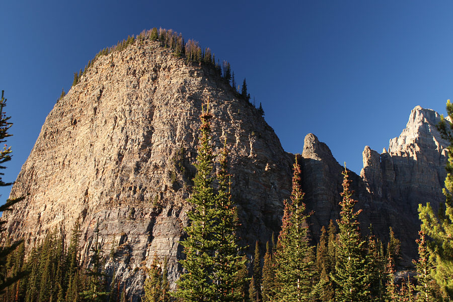
The precipitous east face of Big Beehive is more
evident from this angle. Devils Thumb also looks prominent at upper
right while
Haddo Peak,
Mount Aberdeen, and Mount Lefroy fill out the background.
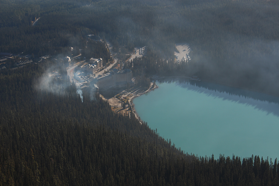 |
A prescribed burn near Chateau Lake
Louise creates a lot of smoke over the area. |
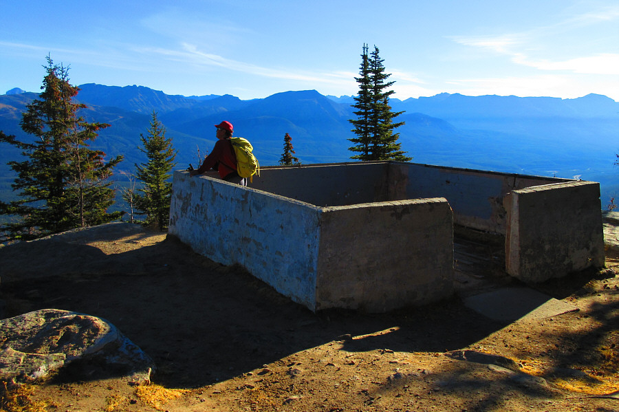 |
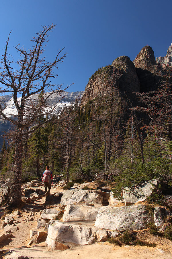
Sonny arrives at a former fire lookout
site near the high point of Little Beehive (2235
metres).
Photo courtesy of Zosia Zgolak |
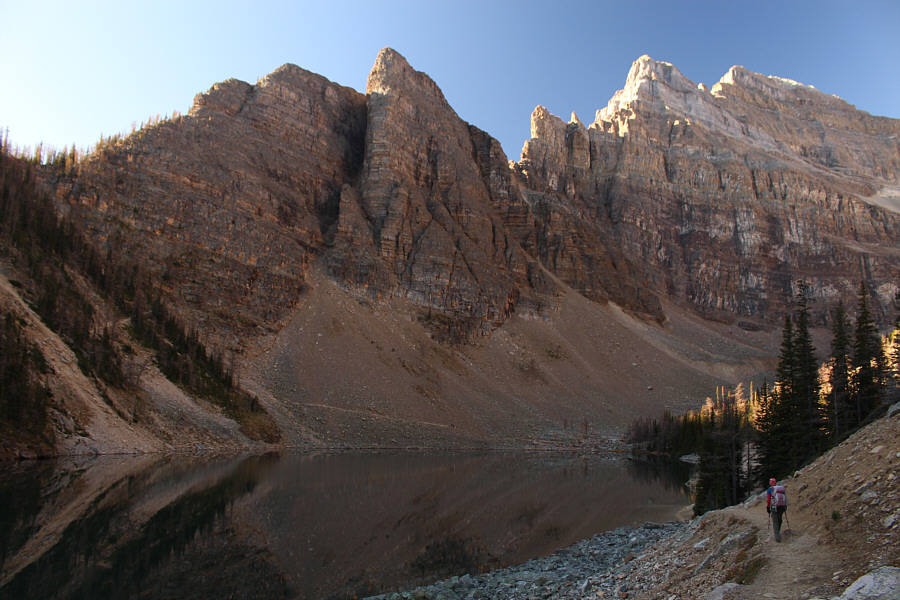
The teahouse was already closed for the season when Zosia and I
arrived at the east end of Lake Agnes. From there, we hiked along
the north shore and circled around the west end of the lake before
climbing up a series of switchbacks to the saddle separating Devils Thumb
and Big Beehive (officially named The Beehive on topographical
maps). Turning left at the saddle, we walked over a bit of
undulating terrain to reach an interpretive gazebo near the east end of
Big Beehive. Because it was a bit crowded there, we backtracked to
the high point of Big Beehive before stopping for a short break.
 |
The waters of Lake Agnes are amazingly
still. Devils Thumb is at left while
Mount Whyte
is at right. |
 |
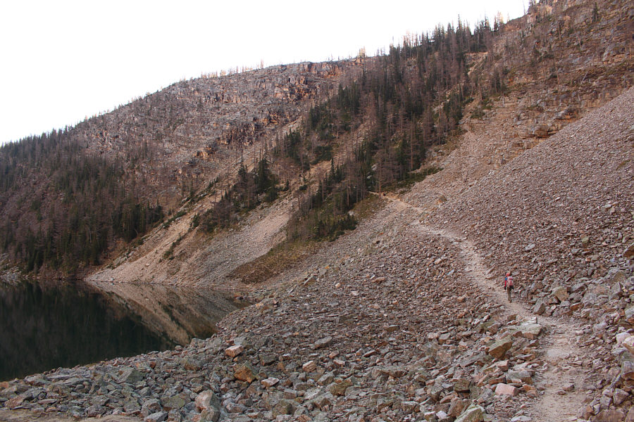
Zosia hikes along the north shore of
Lake Agnes. The trail leading to the saddle (far left) between
Big Beehive and Devils Thumb can be seen on the far side of the lake. |
 |
Zosia hikes up the trail on the west
side of Lake Agnes. |
 |
Here is a look back eastward across
Lake Agnes. |
 |
Zosia ascends the trail underneath
Devils Thumb (centre). |
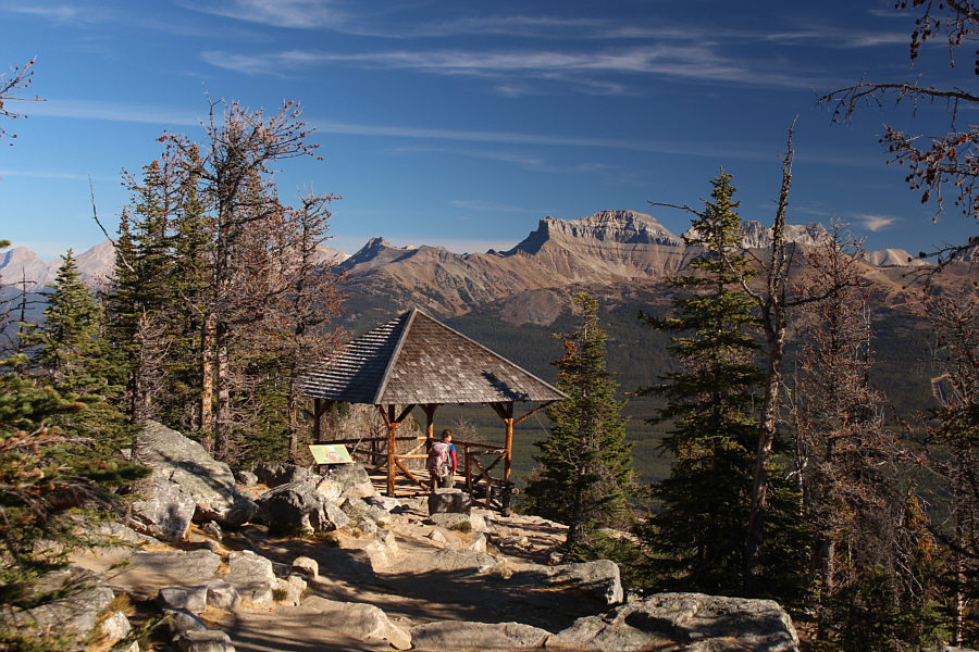 |
An interpretive gazebo (2264 metres)
is situated near the east end of Big Beehive. |
When we resumed hiking, Zosia and I returned to the saddle and
continued straight on a narrower unofficial trail. Not far from the
saddle, we had to scramble up a short and mildly exposed step before
traversing westward on an airy ledge under the south-facing cliffs of
Devils Thumb. Past the cliffs, the trail turns right (north) up a
broad but steep gully. Some sections of trail here are very loose
and heavily eroded, and although there really is not any exposure, some
care and attention are required to minimize slips and rockfall.
Upon reaching a col at the top of the gully, we turned eastward and made
short work of the remaining easy scramble up limestone blocks to the top
of Devils Thumb.
After stopping for an extended break, Zosia and I carefully descended to
the col and down the steep gully before traversing once again under the
cliffs of Devils Thumb. We had no trouble descending the mildly
exposed step, and upon returning to the official trails at the saddle, we
turned right (south) to take a connector down to the Lake Louise Highline
Trail. At the intersection with the Highline Trail, we turned left
and hiked back to Mirror Lake to complete a loop. For the return to
Chateau Lake Louise, we took an alternate descent along a horse trail
likely used for hauling provisions to the teahouse. The horse trail
is slightly shorter than the usual approach, and although there was a
fair bit of horse dung to tiptoe around, the solitude here was rather
refreshing after rubbing elbows with so many other hikers all day.
The trail actually led us through a prescribed burn that was taking place
just behind the hotel, but the workers there did not seem to care about
us traipsing through the area. What business was it of theirs if we
wished to self-immolate? Ironically, hiking through horse dung and
burning forest was kind of an ugly end to an otherwise beautiful day
spent in one of the world's premiere outdoor settings.
 |
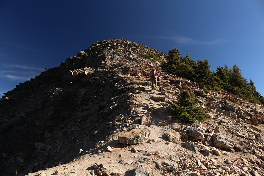
Some hikers can be seen at the very
top of Devils Thumb (upper right) in this view from the true high
point of Big Beehive (2280 metres). |
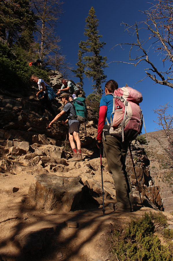 |
Zosia waits for another group of
hikers to descend a short but mildly exposed step along the trail to
Devils Thumb. |
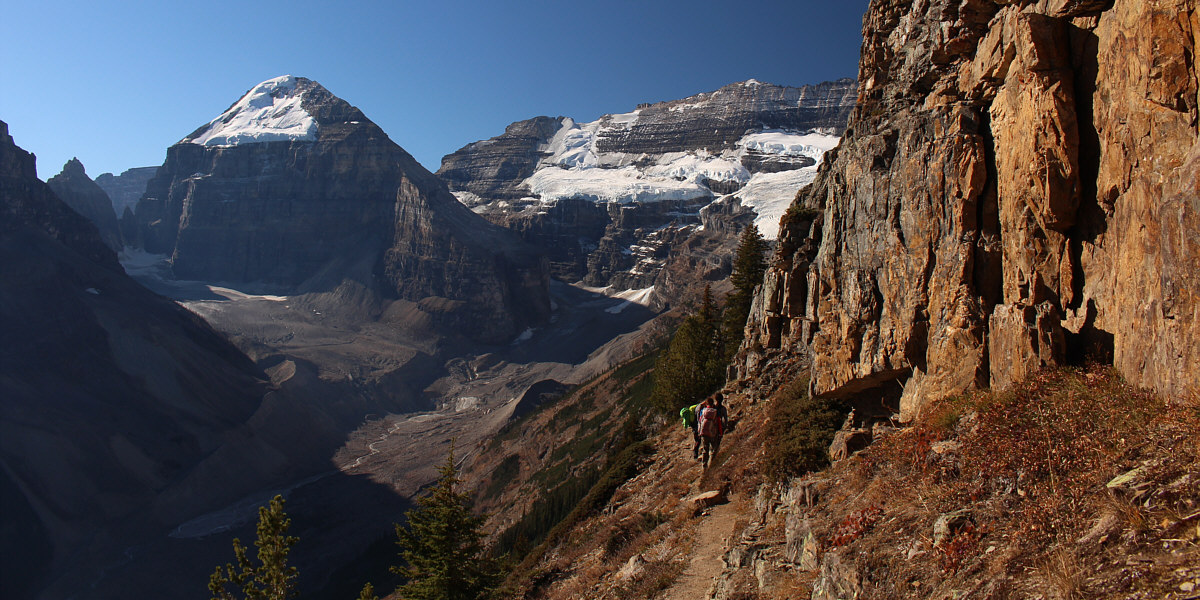
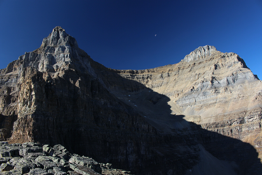
Mount Lefroy and Mount Victoria provide a stunning
backdrop for an airy traverse below the south-facing cliffs of Devils
Thumb.
 |
Zosia climbs up a broad and steep
gully leading to a high col. |
 |
From the high col, Zosia pushes up the
final easy section before the top of Devils Thumb. |

Some of the cracks amidst the limestone rocks near the
top are quite deep.
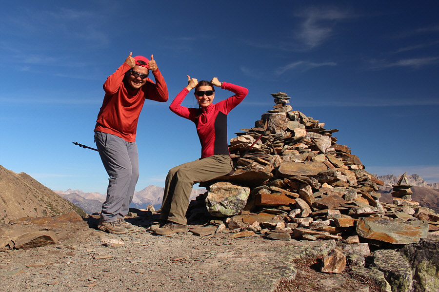 |
Sonny and Zosia had a helluva
fun time climbing up Devils Thumb (2464 metres). |
 |
Mount Whyte and
Mount
Niblock dominate the view to the west. |
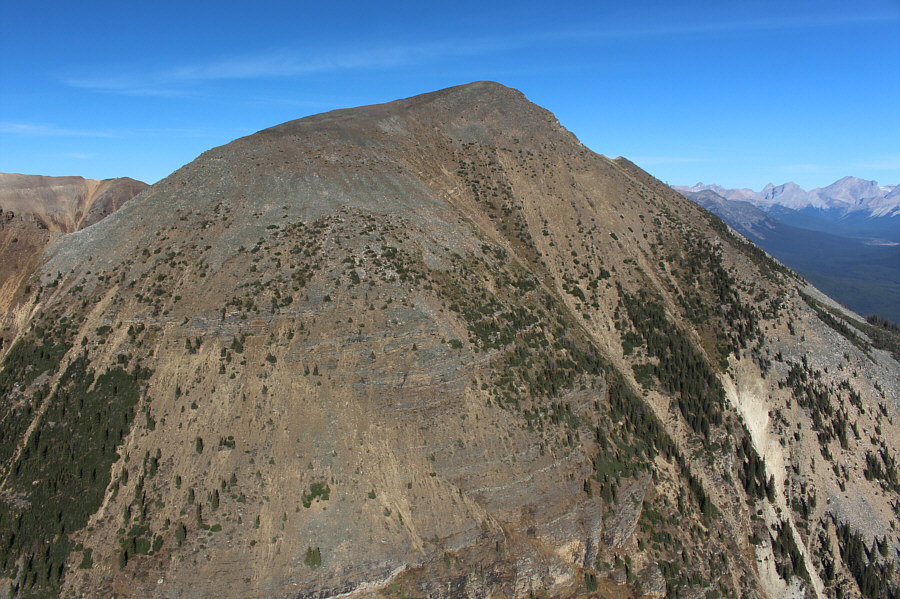 |
Directly north is
Mount St. Piran. |
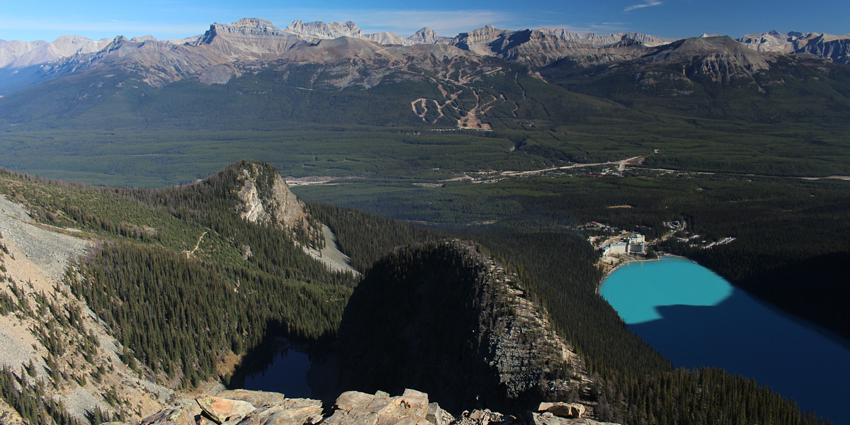
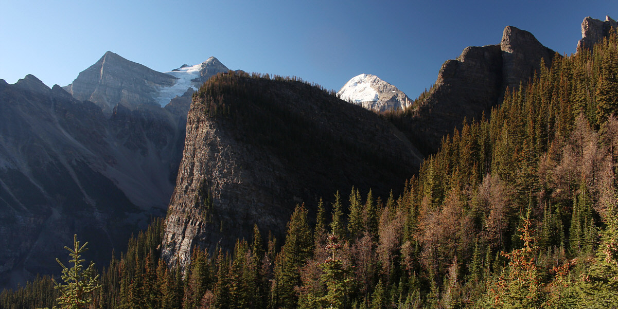
The top of Devils Thumb grants a commanding view of
Little Beehive (left), Big Beehive (centre) and Lake Louise as well as
lots of familiar peaks across the eastern horizon.