BOU AVENUE
Unity Peak
Taking advantage of some fine fall weather, Zosia Zgolak and I scrambled up Unity Peak in Alberta's Banff National Park on 2 October 2022.  In Alan Kane's Scrambles in the Canadian Rockies, this officially-named peak is described as an extension to the ascent of Lipalian Mountain, but we would take a more direct route much like the one used by Bob Spirko in 2020.  While Spirko and his party opted to walk up the Temple Lodge access road for their approach, we would instead bring our bicycles.

Starting from the Fish Creek trailhead near Lake Louise ski resort, Zosia and I rode and pushed our bicycles up the Temple Lodge access road and reached the Skoki trailhead in about 35 minutes.  After stashing our bicycles behind a maintenance building, we started hiking along the signed trail to Skoki Lodge.  About 600 metres from the Skoki trailhead, we turned off onto an unsigned but distinct trail climbing up the forested slope to the right (south).  This trail led us into Wolverine Valley which we have previously visited several times but never when snow was absent.  At some point, we abandoned the trail and headed across the valley through some boggy meadows.  We then hopped across a creek and began climbing over talus slopes aiming for the connecting ridge between Redoubt Mountain and Unity Peak.  Just as Spirko's party had done, we stuck to vegetated terrain where possible for better footing and gravitated toward a prominent pinnacle on the skyline as we ascended.  Once past this pinnacle, we traversed easy slopes to gain the crest of the connecting ridge, and then we turned south to hike up the final rise before the top of Unity Peak.  The summit ridge is a jumble of large quartzite boulders, and although some of them were a bit awkward to maneuver over, we had no serious difficulties scrambling up to the highest one.  Because there is not a lot of room on the actual summit atop a precariously balanced quartzite block, we only stopped there long enough to snap a few photographs before moving to a more spacious rock pile to take an extended break.

When we finished our break, Zosia and I returned to the connecting ridge, and although we could have easily retraced our steps to descend the mountain, we wanted to take advantage of loose scree slopes further to skier's left (south) of where we ascended.  There are several gullies here that breach a long cliff band above the scree slopes, and as Spirko and his party discovered, the most obvious one is not necessarily the easiest to descend.  Two gullies further to skier's right looked more promising, and we ultimately just chose the rightmost one to descend.  I later found out that Kane had descended the left-hand gully, but I think either one works.  We actually had more problems on the slope immediately below the cliff band.  Here, the scree was not yet deep enough to plunge-step, but worse, it was overlying down-sloping shale creating treacherous footing.  Fortunately, we made it past this troublesome section without serious mishap and subsequently enjoyed some nice scree-surfing down to the valley bottom.  In retrospect, it might have been easier to avoid the gullies altogether and descend from the aforementioned prominent pinnacle before veering over to the scree--in effect, circumventing the section with the down-sloping shale.  In any case, we hiked off-trail in the valley bottom until we regained our approach trail, and the rest of the walk back to our bicycles went without a hitch.  The cherry on top of an already wonderful outing was a fast and exhilarating bicycle ride back to the Fish Creek trailhead.
Lotsa pushing along the way, but it will all be worth it at the end of the day!

Zosia finishes her ride up Temple Lodge access road.

Easy to miss if you're not paying attention!

Zosia takes the turnoff to Wolverine Valley.

Don't f**k with me! This spruce grouse looks a bit fierce.
It's cold outside!

Frost coats some leaves on the ground.

Photo courtesy of Zosia Zgolak

Look, larches! Zosia abandons the trail here and heads for the talus slopes at far left.  Unity Peak is visible in the background.
Yep, stay out of dem rocks!

Zosia finds easier travel along the edge of the talus slope.

Try to avoid the rocks--they're all loose!

Zosia tries to stay on vegetated ground while climbing toward the prominent pinnacle above her.

The "larch valley" nobody knows about!

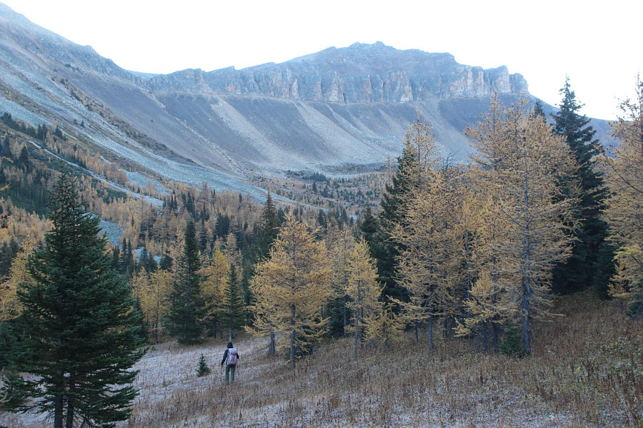
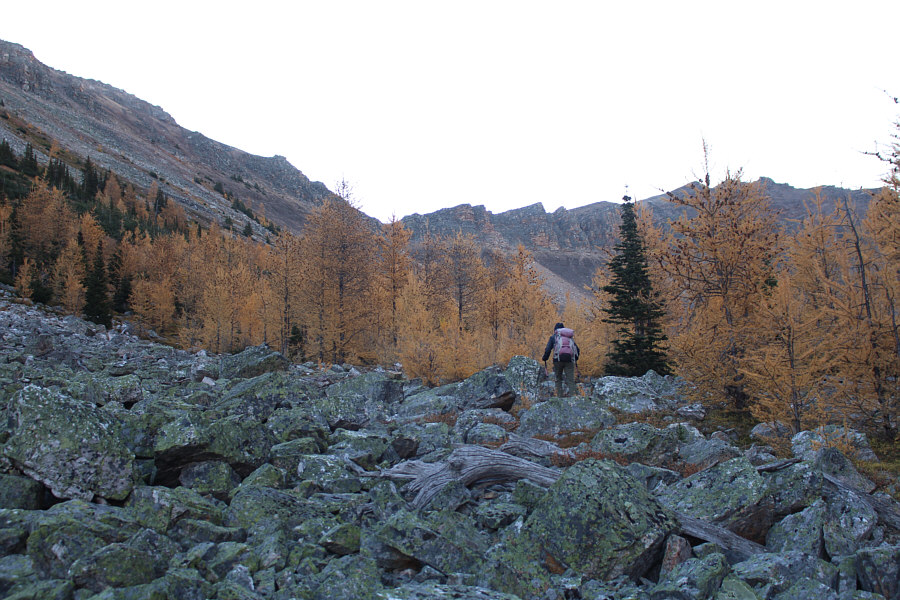
Golden larches abound on the slopes of Wolverine Ridge across the valley.


The long grind is almost over!

Zosia prepares to go around the left side of the prominent pinnacle.

Everything looks so clear today! Redoubt Mountain is behind Zosia as she gains the connecting ridge to Unity Peak.

Can you spot Skoki Mountain?

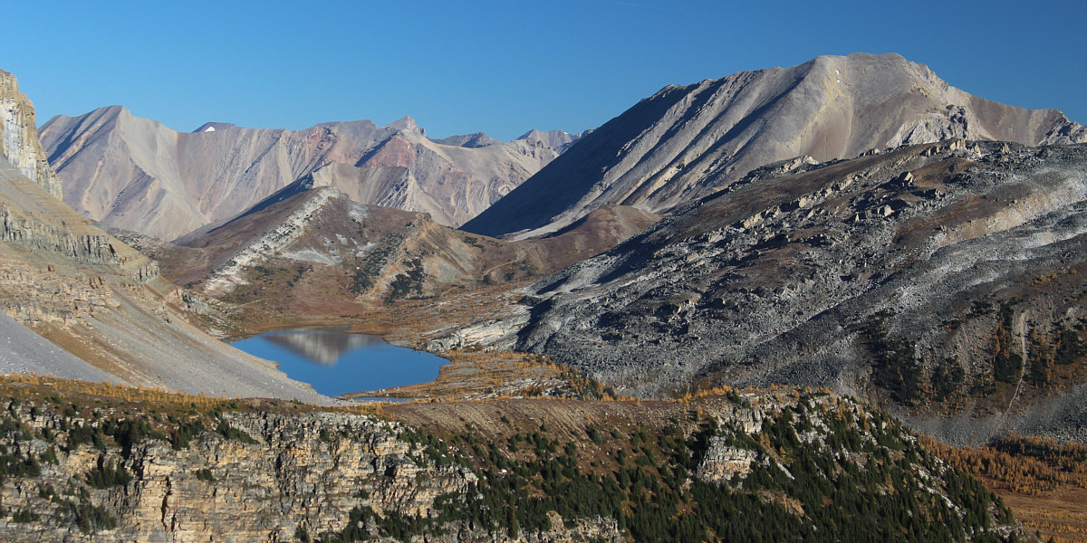
The view to the north from the connecting ridge includes the top of Packer's Pass Peak reflected in Redoubt Lake.


Looks easy enough!

Zosia hikes up the gentle north ridge of Unity Peak.

The larches were amazing everywhere we looked on this day.

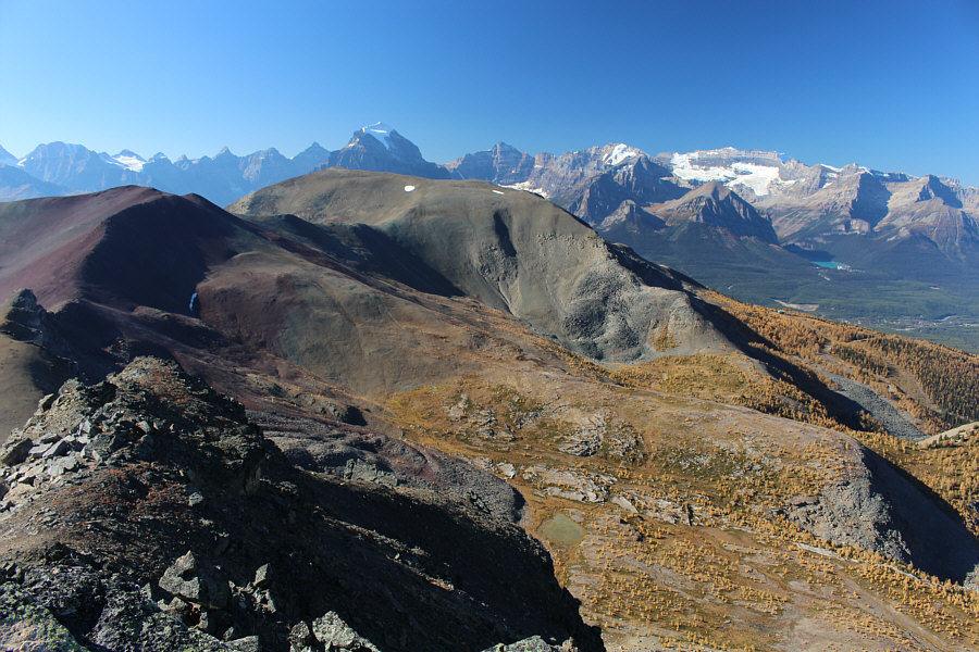
Here is a closer look at some of the familiar mountains near Lake Louise as seen from Unity Peak's north ridge.  In the foreground is the upper terminal of Lake Louise Ski Resort's "Larch" chairlift.


Easier than it looks!

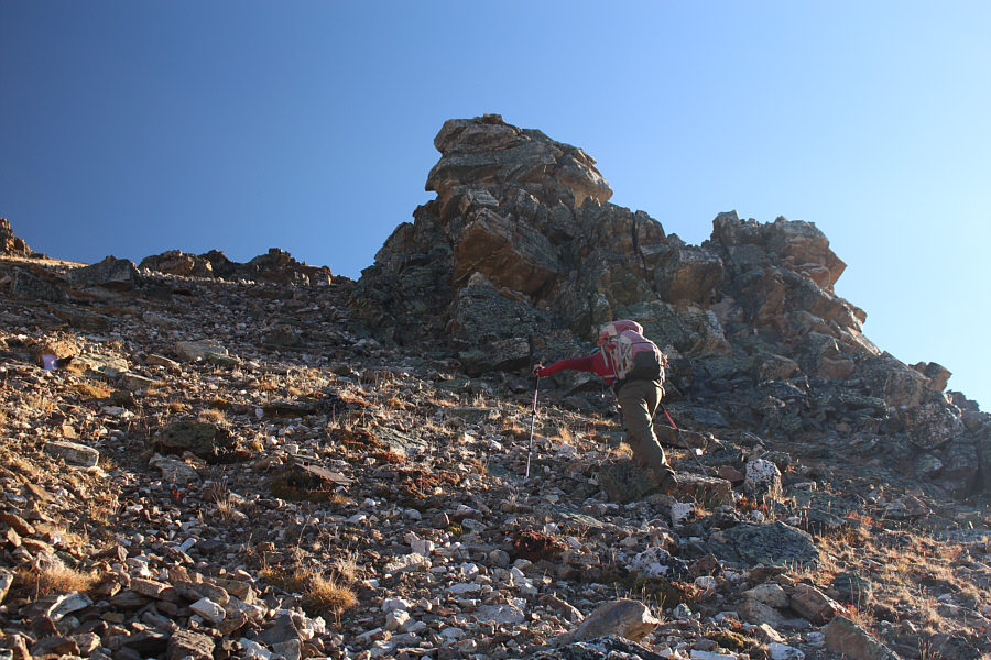
Zosia scrambles up the west face of Unity Peak.  The summit is on the rock pile to right of centre.

It's like a Rosetta Stone for deciphering the First Nations' language. 
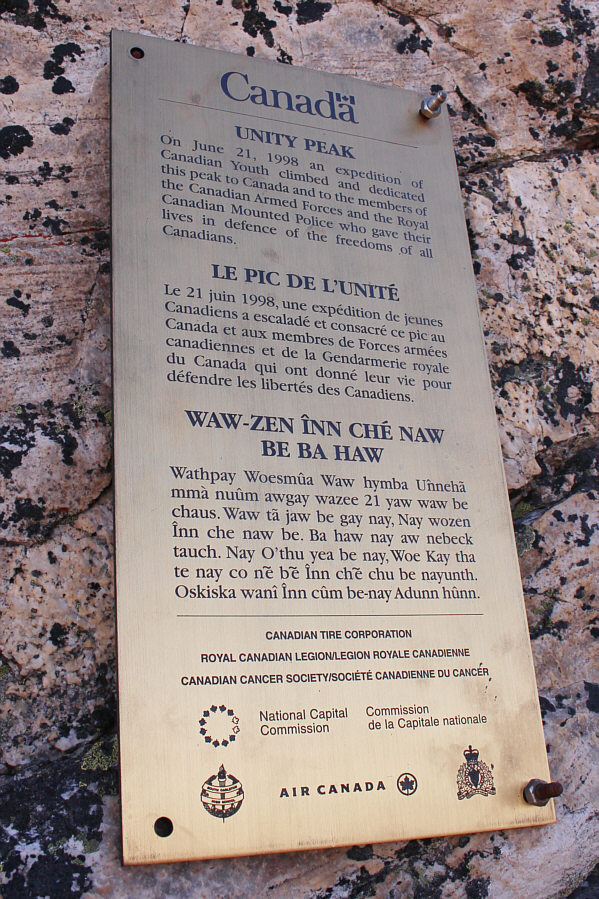
An informative plaque is fixed to one of the quartzite boulders on the summit ridge.
Mount Temple looks really beautiful today! Zosia reaches the summit of Unity Peak (2695 metres).
Yep, not a lot of room up here! 
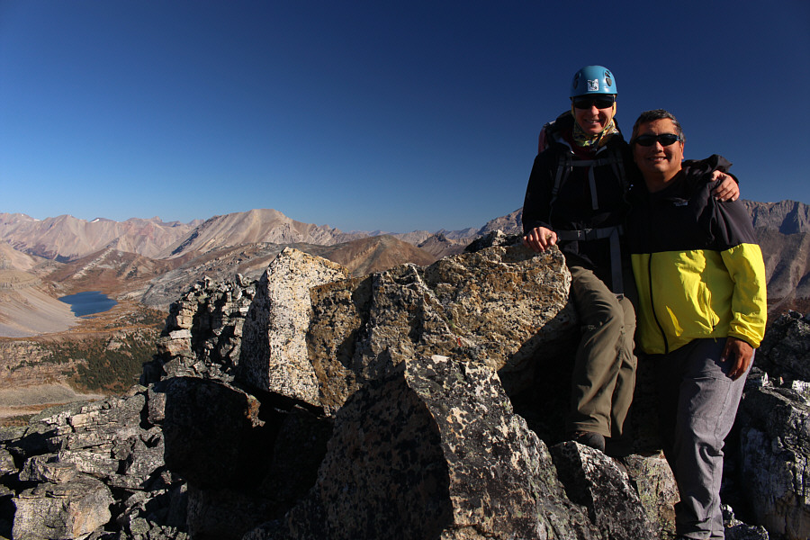
Zosia is joined by Sonny on the summit.
Here's another area with larches that probably seldom sees visitors...

Across the valley to the southeast is Protection Mountain.  Mount Assiniboine can also be seen on the hazy right horizon.

Both mountains look nicer with snow covering them, I think!

Neighbouring peaks to the southwest include Purple Mound (far left) and Lipalian Mountain.

That rock is gonna slide off one of these days!

Sonny cannot resist standing on the very highest point of the summit.

Photo courtesy of Zosia Zgolak

Here's a challenge: Can you spot Skoki Mountain?

Here is a more complete view of Redoubt Mountain to the north.  At left on the distant horizon is Mount Hector.

Maybe there used to be a block above the plaque that would have been the true summit...until it fell off!

Mount Douglas and Mount St. Bride stand out to the northeast as Zosia prepares to down-climb the quartzite block to which the plaque is attached.

It's easy; just take your time!

Zosia descends the west face of Unity Peak.

And hardly any people here! They must all be at Highwood Pass!

Zosia pauses to soak in the wonderful scenery.

I just couldn't stop photographing this mountain and lake!

Here is one last look at Redoubt Mountain and its namesake lake as Zosia heads back along the connecting ridge.


Eeny, meeny, miny, moe...

Sonny tries to figure out which gully to descend.

Photo courtesy of Zosia Zgolak

Not a great place to be...

The slope immediately below the gullies is more tricky to descend because of the poor footing.

Ah well, it's all good! 
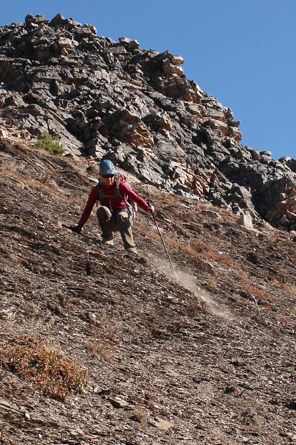
Zosia enjoys some nice scree surfing after getting through the tricky section which is indicated by the dark band above her.  Note at upper left the prominent pinnacle that was targeted during the ascent.
Some of the grassy meadows are boggy, so the edge of the talus is the sweet spot!

Zosia again finds easier travel along the edge of the talus slope.

Unbelievably, we saw only one couple and their dog on our way out the valley!

Zosia is nearly swallowed up by golden larches.

Thanks for the memories!

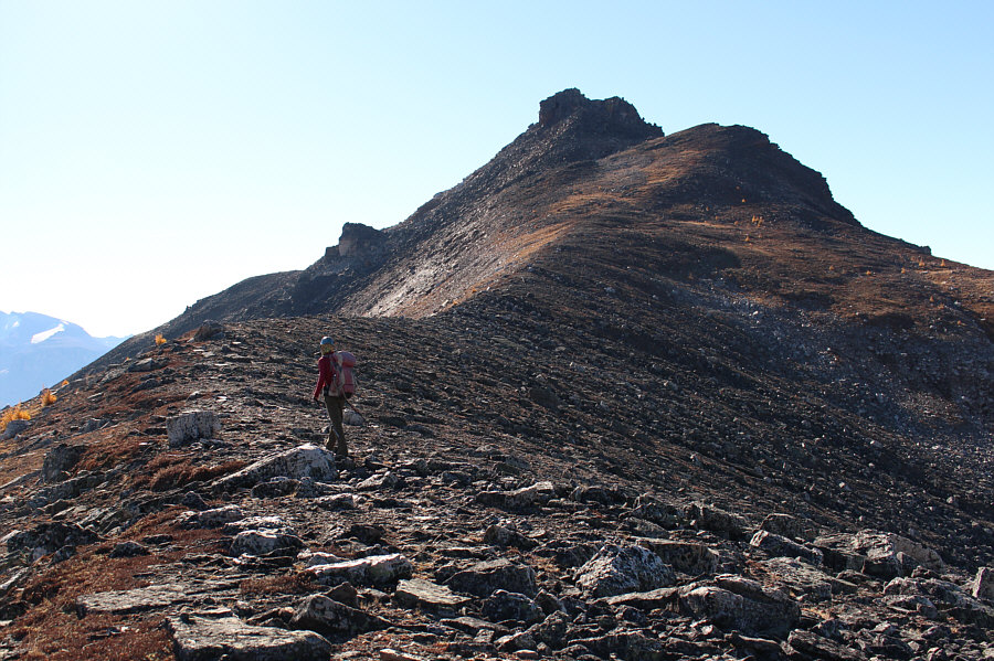
Zosia takes one last look back at Unity Peak before exiting Wolverine Valley.

Don't even need the electrical assist for the ride down!

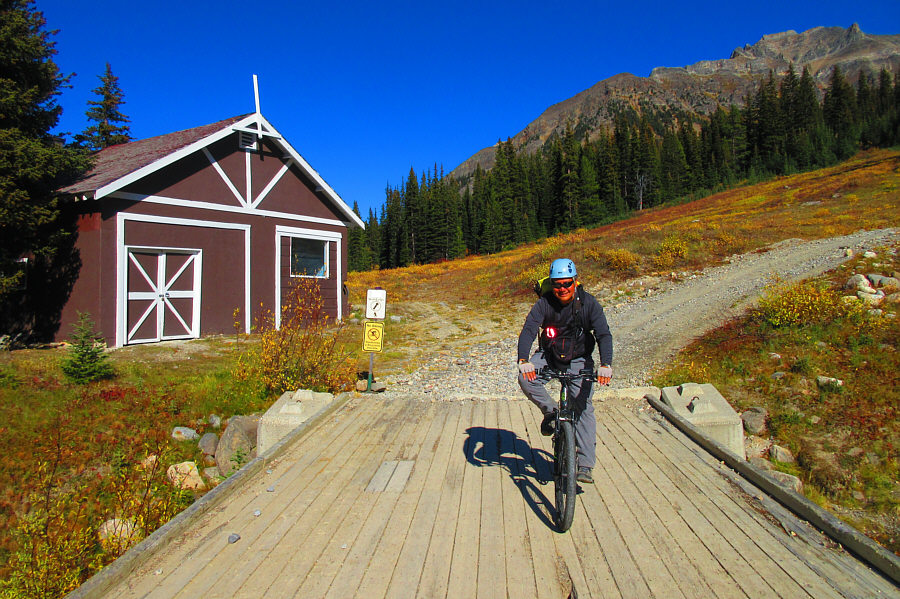
After retrieving his e-bike from behind this maintenance building, Sonny is ready to zip back down to the trailhead.

Photo courtesy of Zosia Zgolak

I feel the need...the need for speed!

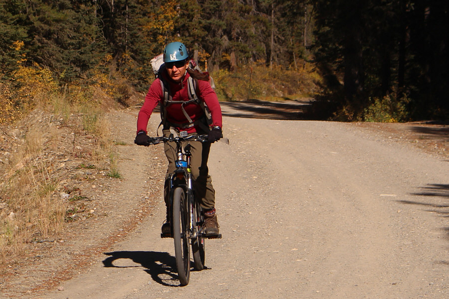
Zosia hangs on tight as she flies down the road.

A fantastic trip especially during larch season. Something worth repeating! Total Distance:  16.1 kilometres
Round-Trip Time:  7 hours 31 minutes
Net Elevation Gain:  1020 metres

GPX Data