BOU AVENUE
Castle Peak
Castle Peak is the highest point of the White Cloud Mountains in central Idaho, and I have been itching to climb it for years.  Different climbing routes for this beautiful mountain can be found in numerous sources, but I was most inspired by the 2002 trip report by Dan Robbins who ascended via the main gully on the south face.  When Zosia Zgolak and I tried to climb the peak in 2019, we abandoned our attempt due to excessive snow still choking the route in the gully.  On that trip, we started our hike from Fourth of July trailhead which entails a relatively easy drive but a longer approach on foot.  This time, I decided to try the approach from Washington Creek trailhead further to the south.  This starting point allows for a much shorter hike to Chamberlain Basin, but the price of admission is a long and very arduous drive.

On 13 August 2022, Zosia and I drove northwest of Ketchum along Highway 75 over Galena Summit before turning east onto Pole Creek Road.  The ensuing drive to Washington Creek trailhead was quite an adventure in itself.  The first half of the approach is easy driving on a good gravel road, but beyond a junction at about the 10.5-kilometre mark, the road becomes narrower and rougher.  Zosia got out of the car regularly to remove some of the larger rocks protruding in the middle of the road, and a couple of crossings of Germania Creek took a bit of courage to drive through.  Beyond Three Cabins Creek trailhead at about the 20.0-kilometre mark, the road deteriorates even more as it climbs over a steep hill before descending to a pullout and campsite just before the trailhead (the rough road continues into Washington Basin).  It is a bit of a minor miracle that my Honda CR-V was able to make it all the way there especially when we passed a large group of dirt bikers who had to stop after one of them got a flat tire.

My GPS track for the drive to Washington Creek trailhead can be found here, but to be honest, I really cannot recommend this approach even for those who have a high-clearance vehicle with 4x4 capability.  It is a nerve-racking and punishing drive, and not even dirt bikes or possibly ATVs are invulnerable.  It is perhaps telling that Zosia and I were all alone while camping near the trailhead that night, and as far as I know, no one else we would later encounter in Chamberlain Basin used the same approach as us.
Not deep but still a bit intimidating to cross...

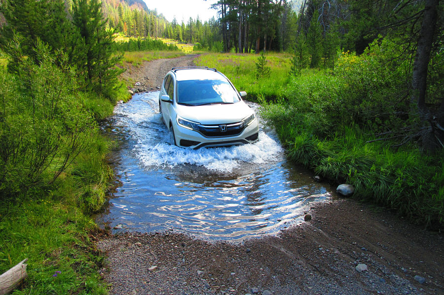
This is the first of two crossings of Germania Creek on the long and arduous drive to Washington Creek trailhead.  Watch a video of this crossing here.  A video of the second crossing is available here.

Photo courtesy of Zosia Zgolak


Zosia managed to roll this log aside!

Hazards abound on the road to the trailhead.

Photo courtesy of Zosia Zgolak


Zosia and I got up before dawn on 14 August 2022, and after finishing a quick breakfast, we loaded up our backpacks and crossed Washington Creek on a log to reach the start of the actual trail.  Although we could have conceivably climbed Castle Peak from here as a long day trip, we felt that it was worth hauling camping gear to stay overnight at Chamberlain Basin in order to enjoy a more relaxed ascent either later in the day or the following morning depending on how we were feeling.  With the exception of a few switchbacks which seemed a bit long-winded, the hike to Chamberlain Basin was generally straightforward as we followed forestry trails #051, #109, and #047.  Signs at all junctions kept us always pointed in the right direction.  At the saddle known as Chamberlain Divide, we got our first unobstructed view of Castle Peak, and much to our relief, it looked nearly bone-dry.  When we subsequently descended into Chamberlain Basin, we made the mistake of taking a short cut trail down to one of the lakes where we had planned to set up camp.  Although the short cut is not terrible, it does add some unnecessary route-finding challenges, and in retrospect, I would recommend just sticking to the official trail.  From Washington Creek trailhead, it took us four hours to reach our intended lake, and upon arrival, we pitched our tent and ditched all our camping gear before taking a well-deserved break for lunch.
Balancing act.

Early in the proceedings, Zosia crosses Washington Lake Creek--not to be confused with Washington Creek which is crossed near the trailhead.

And we won't have to worry about sharing the trail with motorbikes! Zosia reaches an important junction and points which way to go.
Feels warm already!

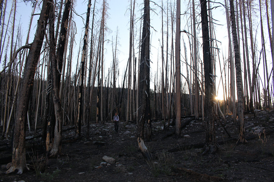
The morning sun peeks through some burnt timber.

See the moon? This clearing along the trail grants views of several unnamed ridges to the south.
And we won't have to worry about sharing the trail with bicycles! 
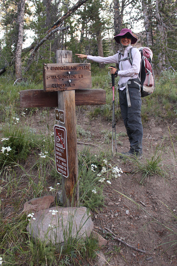
Zosia reaches another important junction and again points which way to go.
I guess it's safe to have a cigarette here? The trail to Chamberlain Basin passes through another stretch of forest scorched by wildfires.

Magnificent!

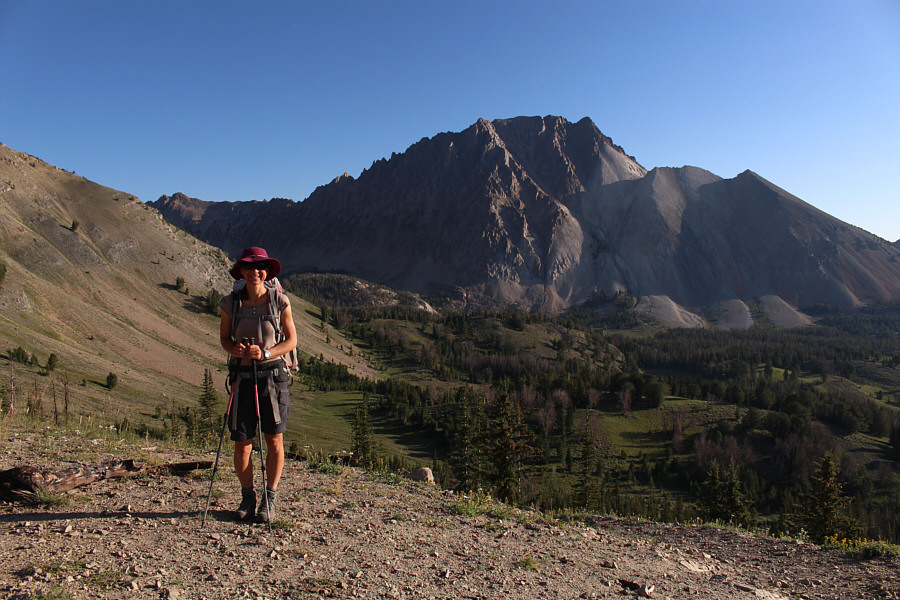
Zosia arrives at Chamberlain Divide and has her first unobstructed view of Castle Peak and its south face.


It's best to stick to the main trail; don't take the short cut to the lake like we did!

Zosia descends into Chamberlain Basin on a good trail.

Time to set up camp and eat lunch!

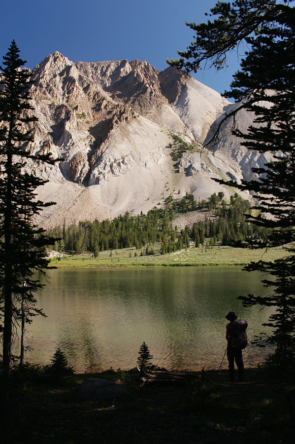
Zosia arrives at one of the more popular campsites beside an unnamed lake in Chamberlain Basin.

Feeling refreshed and not wanting to squander the great weather, Zosia and I decided to ascend Castle Peak after lunch.  When we resumed hiking, we followed the continuation of the official trail and crossed the outlet of our lake to a signed T-intersection.  By a strange coincidence, several other groups of hikers also congregated there just as we arrived, and the intersection felt like an outdoor party at that moment.  Zosia and I did not linger for the chit-chats and immediately headed off-trail to begin climbing the lower slopes of Castle Peak's south face.  No one else at the party bothered to follow us.  On the lower slopes, we initially headed for an obvious grassy strip in hopes that it would provide better footing, and perhaps not surprisingly, we found a good beaten path here that led us to the base of the main gully.  This obvious wide gully rises diagonally from right to left on the south face and is mostly an easy scramble until near the top.  Note that there is a narrower and steeper gully to climber's right which is also frequently ascended by peak-baggers.  The main gully also gets narrower and steeper near the top, and on this day, there were still some lingering snow patches there.  Fortunately, we were able to avoid all the snow completely as we moved out of the gully and began scrambling up the vertically-tilted slabs to climber's right.  There is some mild exposure here, but the rocks are generally solid and easy to climb.  A few cairns help point the way, and we were soon clambering over large awkward boulders on the summit ridge.

The top of Castle Peak has at least three distinct and separate high points, and although the easternmost one is unquestionably lower, there is some dispute about which of the other two--the middle and westernmost high points--is truly higher.  Upon reaching the westernmost high point, Zosia and I were delighted to find a summit register and surveyor's benchmark.  Unfortunately, the connecting ridge to the middle high point looked too technical for my liking, and I did not bother to make the traverse to check its elevation.  Regardless, I think both high points are, at worst, roughly of equal height, and I have no problem accepting the westernmost high point as the true summit just like everyone else who had previously signed the register.

Blessed with fabulous weather and in no rush to get back to camp, Zosia and I took an extended break at the top of Castle Peak before reluctantly retracing our steps down the mountain.  The trickiest part of the descent was down-climbing the steep slabs to get back into the main gully, but fortunately, we made it down safely without any mishaps.  The subsequent hike down the gully felt long and a bit tedious but was otherwise uneventful.  When we returned to our camp beside the lake, we enjoyed a leisurely dinner before retiring to our tent for the night.
Start of a long uphill grind...

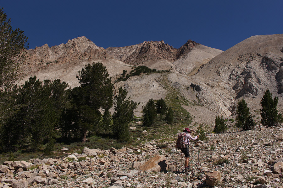
Zosia begins her ascent of Castle Peak by following the grassy strip ahead.

Some people scramble up another gully out of view to the right.

Zosia follows an obvious and wide gully which rises from right to left on the south face of the mountain.

It's almost like a stairway to heaven!

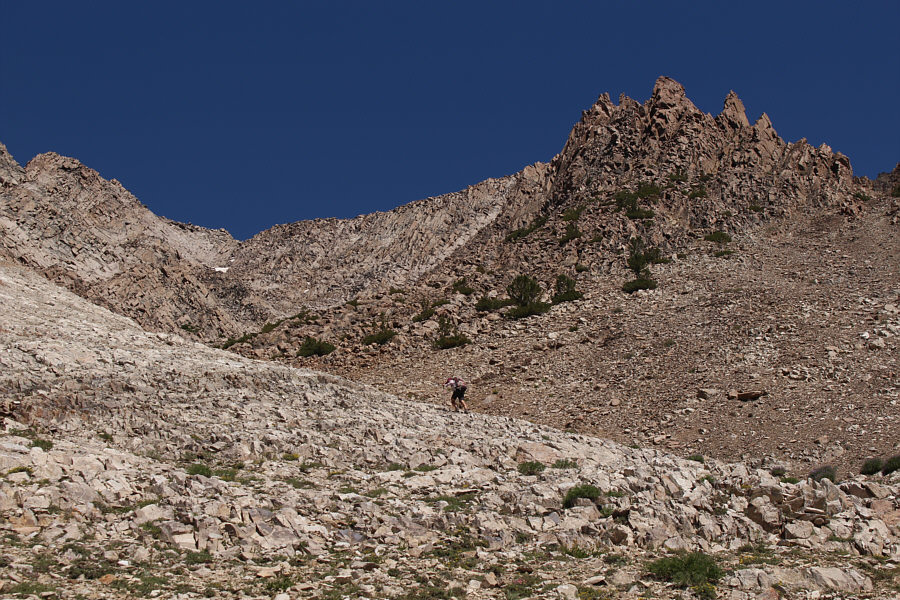
Most of the gully is not technically difficult to ascend.

Scrambling time! Higher up, the gully becomes narrower and steeper.  It is necessary here to scramble up the rocks to climber's right.
Steep but doable--look for cairns!

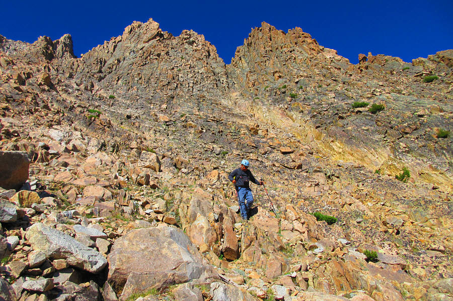
The scrambling here requires Zosia's full attention.

Crossed off another peak that was very high on my to-do list!

Sonny and Zosia stand on the summit of Castle Peak (3598 metres).


Might not be the true high point...

Here is the surveyor's benchmark on the summit of Castle Peak.

Thankfully, the smoke wasn't drifting this way.

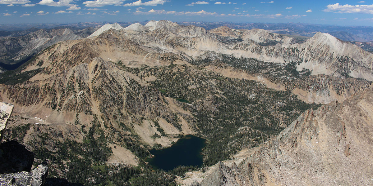
The view to the southwest includes some of the lakes in Chamberlain Basin and the ridge (centre) which Zosia and Sonny ascended in 2019.  Note the huge wildfire at distant right.

Amazing. Simply amazing.

The rest of the White Cloud Peaks are a dazzling sight to the north.  At bottom is Quiet Lake.


The ridges at distant right look intriguing...

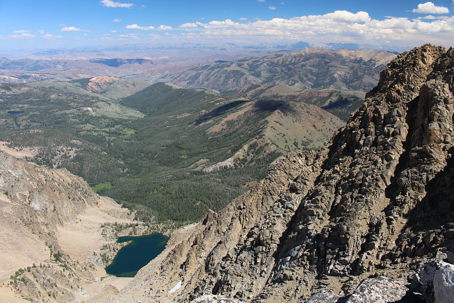
Castle Lake is the most notable feature in this view to the northeast.

Really need to watch your footing here!

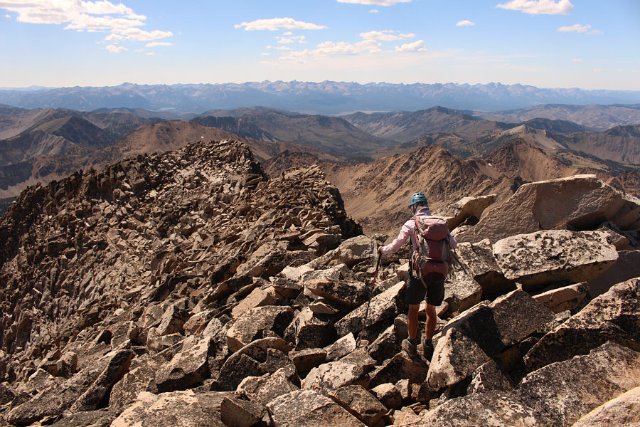
Leaving the top, Zosia has to contend with big awkward boulders on the summit ridge.

No need to rush...we have lotsa daylight left!

Sonny carefully picks his way down the mountain in the late afternoon.

Photo courtesy of Zosia Zgolak

This peak simply looks amazing at any time of the day.

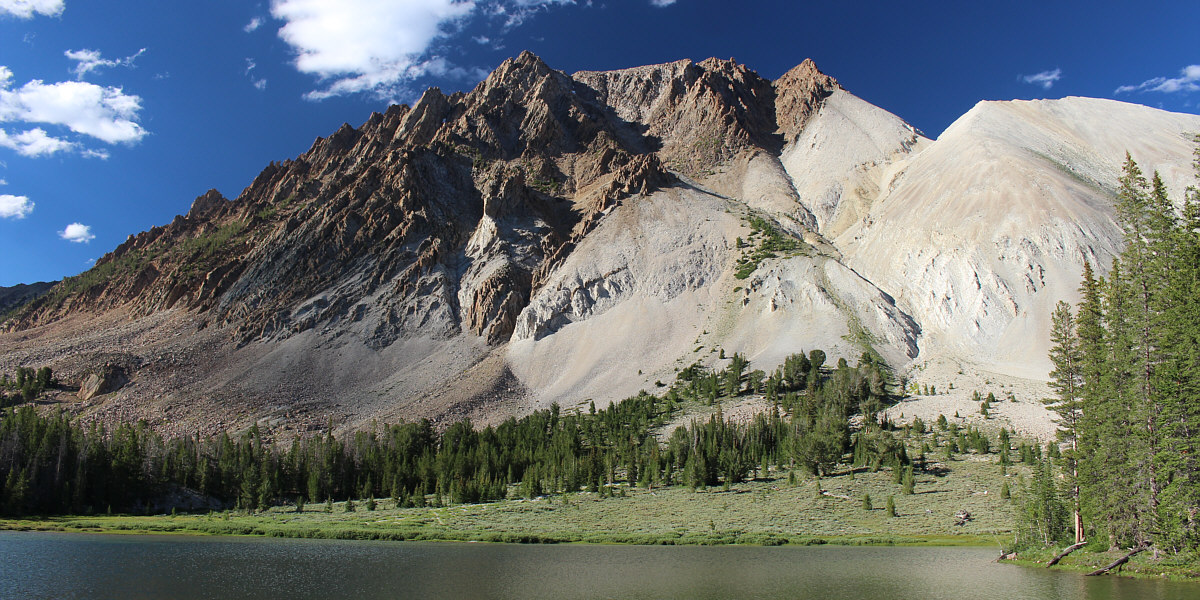
Here is another view of Castle Peak from the campsite late in the day.


The following morning (15 August 2022), Zosia and I had a nice breakfast before striking camp and hiking out Chamberlain Basin.  We stuck to the official trail this time and had no issues climbing back over Chamberlain Divide.  The remainder of our hike back to Washington Creek trailhead went without a hitch, and the only worry we had was the drive out of the area.

I believe that knowing what to expect lessens the anxiety of driving rough roads, and going mostly downhill also helps.  Zosia again got out of the car a few times to move rocks, but generally, I think we had a much more efficient drive on the way out.  After making it past the roughest sections--the 3.5-kilometre stretch between Washington Creek trailhead and Three Cabins Creek trailhead--in one piece, we had no problems with the two crossings of Germania Creek.  The remainder of the drive back to the highway was still slow but comparatively easy, and once we hit pavement again, we vowed never to drive such horrible roads again...at least for the rest of the week!
Peaceful.

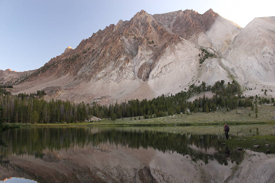
In the morning, Zosia enjoys a last tranquil moment at the campsite before departing.

Mirror, mirror...

Castle Peak is reflected in a smaller lake in Chamberlain Basin.

Adios, Castle Peak!

Here is one last look at Castle Peak from Chamberlain Divide.

Giving my car a bath!

Sonny again drives his car through Germania Creek on the way out.

Photo courtesy of Zosia Zgolak

A fantastic and rewarding adventure! Total Distance:  24.0 kilometres
Round-Trip Time:  28 hours 19 minutes
Cumulative Elevation Gain:  1749 metres

GPX Data