BOU AVENUE
Mount Idaho
After a long hiatus, I was back in Idaho's Lost River Range again on 9 August 2022 to scramble up unofficially-named Mount Idaho.  Joining me for this ascent was Zosia Zgolak who would be climbing her first Idaho 12,000-footer.  The usual ascent route via the west ridge is described in Tom Lopez's Idaho: A Climbing Guide and also in numerous internet blog sites.  Despite all this available beta, the route is far from being straightforward and demands a fair bit of route-finding both on the approach and on the upper mountain.

From Highway 93, turn east onto a rough road (high-clearance strongly recommended) signed "Elkhorn Creek", 58.0 kilometres south of the junction with Highway 75 in Challis or 25.0 kilometres north of the junction with Main Street in Mackay.  The road braids in a couple of places, but the general idea is to follow the east bank of Elkhorn Creek for about 1.5 kilometres to a dead end near the mouth of the valley.

When Zosia and I drove up the rough road the previous evening, we ended up on another road which crosses Elkhorn Creek and heads northward.  Instead of backtracking, we decided to camp in a pullout near the creek and walk the remaining distance to the dead end in the morning.  This added a little bit of extra walking and elevation gain but was not a big deal.  At the dead end, we picked up a trail which twice crosses Elkhorn Creek--the creek bed was dry here--before climbing steadily up the valley.  The trail eventually peters out, and we then followed a few cairns before they too disappeared below a headwall of sorts.  We veered a little to climber's left here to avoid climbing over tedious boulders and eventually entered the basin at the head of the valley.  Where the trees begin to thin out, we gravitated toward an obvious gully which rises steeply up to the crest of Mount Idaho's west ridge.  We mostly ascended to climber's right of the gully where the terrain is more craggy but offers better footing.  Once we gained the crest of the west ridge, we turned eastward and followed it as much as we could up the rest of the mountain. There are plenty of beaten paths and cairns that help point the way, but we still had to do some route-finding to get through some of the steeper sections.  The terrain eventually forced us to climber's right onto the southwest face, but by then, we only had a short scramble left to reach the summit.

Zosia and I took a lengthy break on the summit before commencing our descent.  For the most part, we backtracked the way we came with occasional route variations to take advantage of plunge-stepping down loose scree.  We both suffered some minor scrapes while descending the upper mountain, and we felt some measure of relief once we cleared the most difficult sections.  When we returned to where we first gained the crest of the ridge, we traversed a little further west before plunging down more loose scree into the access gully.  Unfortunately, the surfable scree does not extend all the way to the basin, and we had to carefully pick our way down the steep craggy terrain we ascended earlier in the day.  The remainder of the hike out along Elkhorn Creek was also somewhat tedious and wearisome, but at least we were able to stop at one point to replenish our water supply and soak our tired feet in the creek.  Upon returning to my car, we drove out to the highway and headed to Mackay for refreshments and a much-needed shower.
The road gets rough in a hurry! 
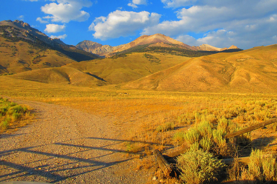
This is the turnoff leading to the trailhead.  Mount Idaho is visible at distant left.

Photo courtesy of Zosia Zgolak

Technically easy, but some route-finding is still necessary. 
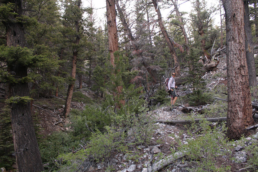
Zosia works her way up Elkhorn Creek valley.
Unless you wanna scramble up tedious boulders... 
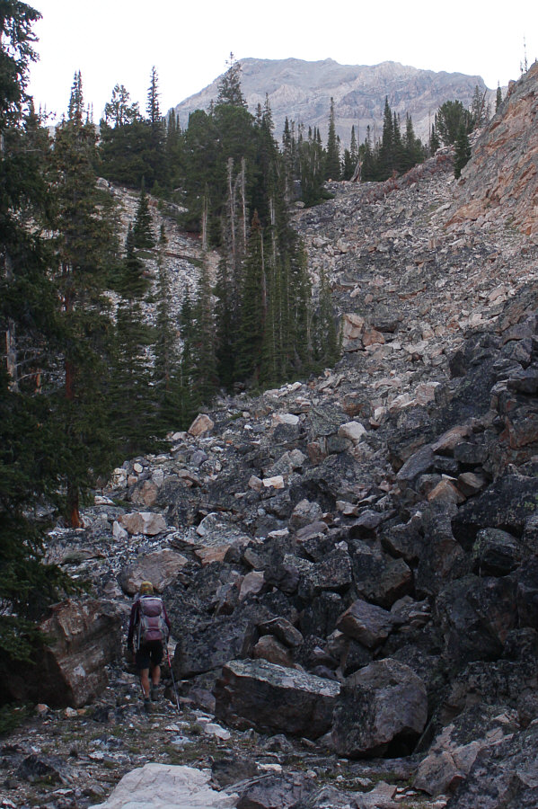
Zosia faces a steep headwall of rubble on her way up the valley.  The best course is to avoid the rubble by heading to climber's left.
It would take us about 75 minutes to gain the ridge. In the basin at the head of the valley, Zosia turns up a broad gully aiming for the ridge above.
Ugh! What a brutally steep grunt! 
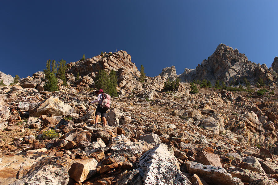
On her way up to the ridge, Zosia tries to stick to bigger and more stable rocks.
Finally, a bit of a reprieve from the steep grind!

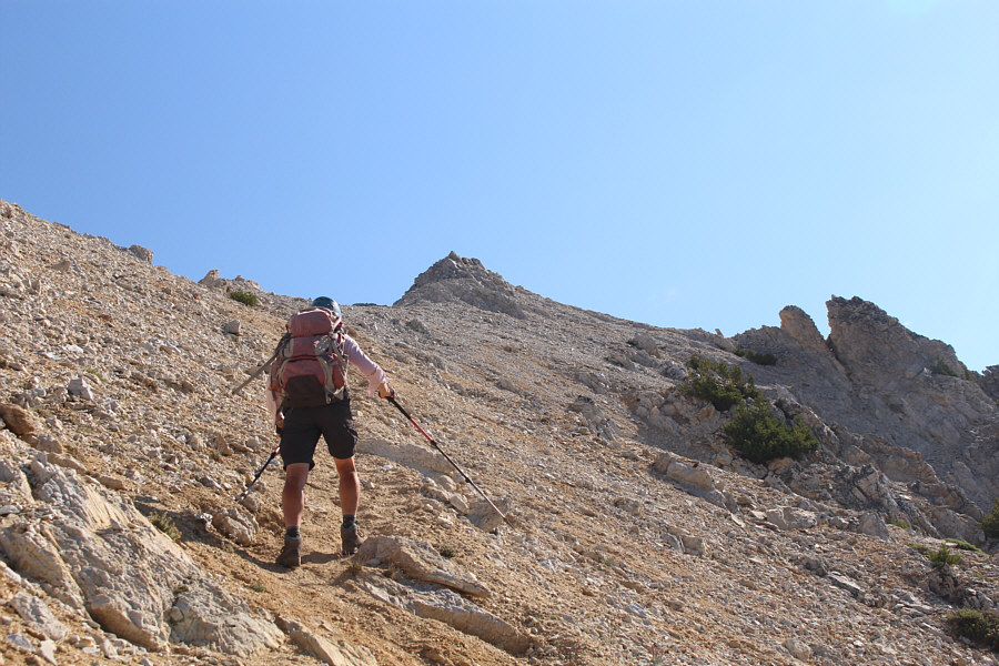
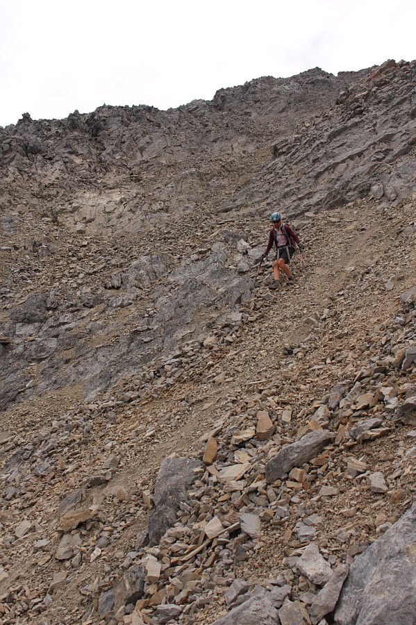
Zosia picks up a trail not far below the ridge crest.

Definitely some challenging terrain ahead of us...

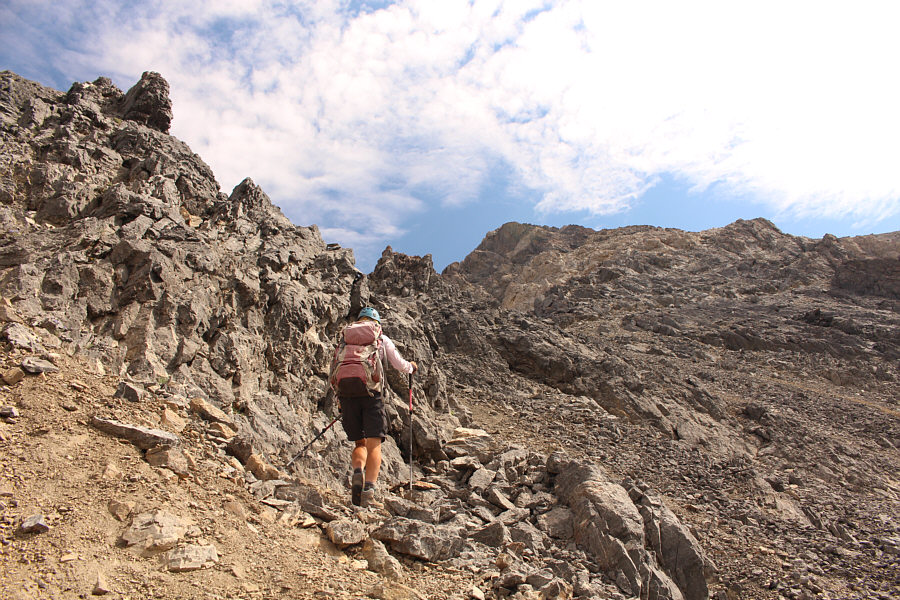
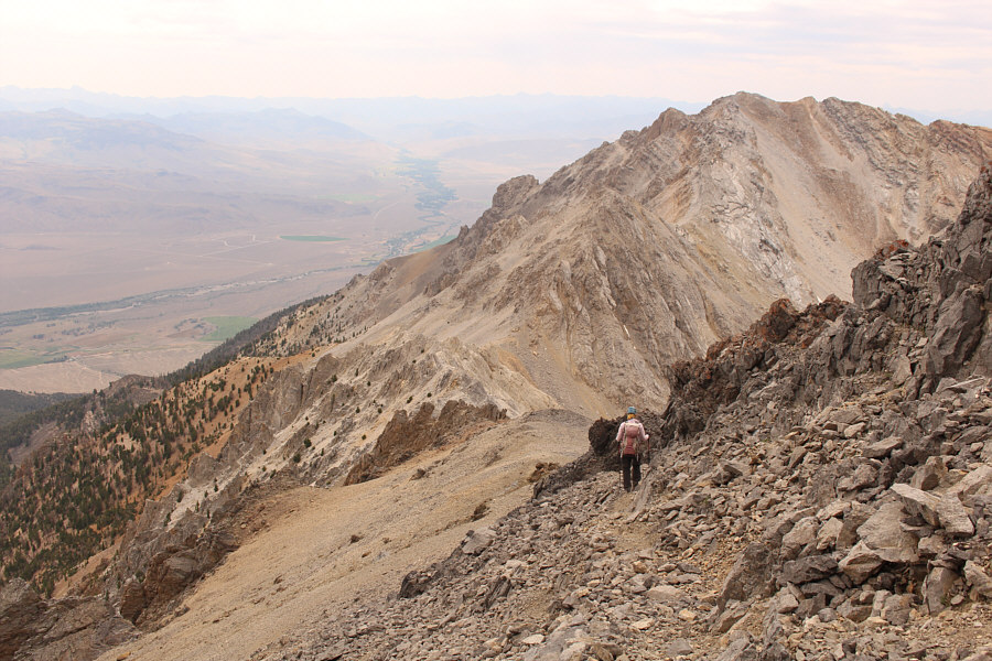
Zosia works her way up the west ridge of Mount Idaho.

Interesting colours in the rock!

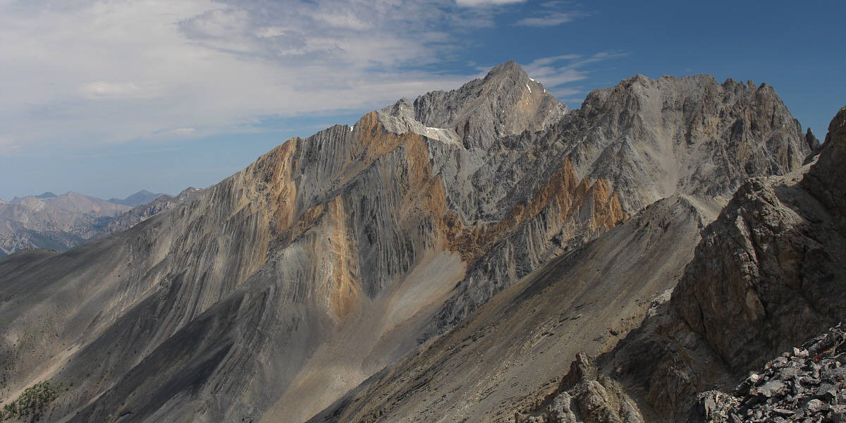
The west ridge of Mount Idaho grants some nice views of Borah Peak to the north.


Take it one rock step at a time! 
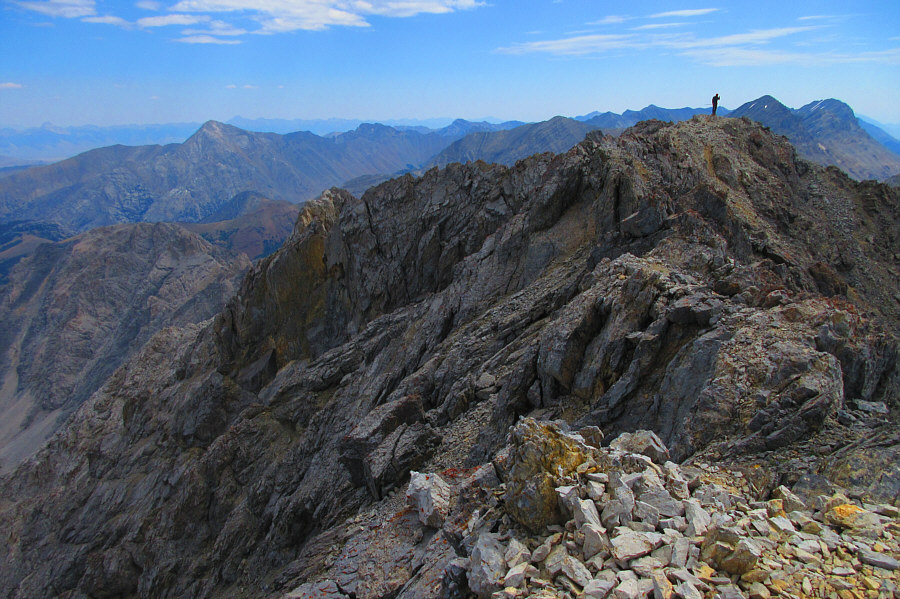
As Zosia climbs higher, she tries to stick close to the ridge crest as much as possible.
Guess what song I've got running through my head... Sonny continues to grind his way up the west ridge.  In the background are the western outliers of Mount Idaho.

Photo courtesy of Zosia Zgolak

Lotsa loose rock but not too much exposure. 
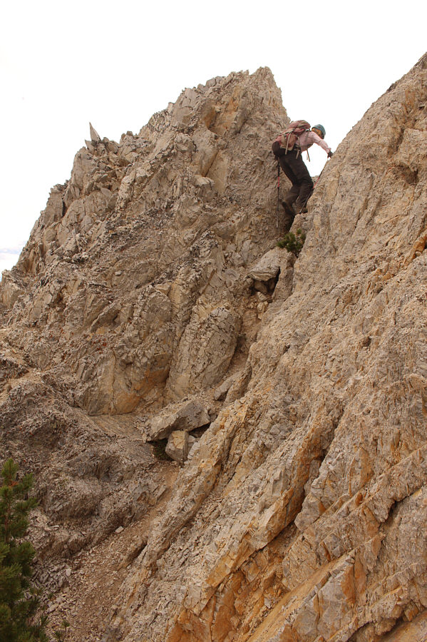
Ascending the upper mountain entails a fair bit of scrambling and route-finding.

My GPS reading was about 5 feet (1.6 metres) higher than the normally accepted figure for Mount Idaho's height.

Sonny and Zosia stand on the summit of Mount Idaho (3680 metres).


It's more or less about the same height.

Sonny checks the elevation at the southeast end of the summit ridge.

Photo courtesy of Zosia Zgolak

Everything is loose...reminds me of the Canadian Rockies! Zosia carefully surfs down some loose scree.
Sticking to the Devil we know! Zosia retraces her steps back down the west ridge.
Nicely done, Zosia!

Zosia scrambles past a pinnacle guarding the ridge.

Too bad we couldn't surf all the way down. Zosia takes advantage of more loose scree to descend into the basin.
Yep, very pretty! Sonny still has time to admire some wildflowers as he surfs past them in the loose scree.

Photo courtesy of Zosia Zgolak

That water was freezing cold! 
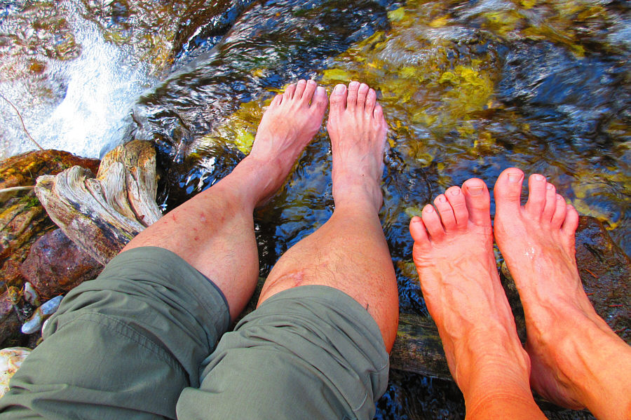
Sonny and Zosia soak their tired feet in Elkhorn Creek on the way out.

Photo courtesy of Zosia Zgolak

A long outing but also a fine scramble in retrospect. Total Distance:  15.0 kilometres
Round-Trip Time:  13 hours 32 minutes
Net Elevation Gain:  1627 metres

GPX Data