BOU AVENUE
Kinport Peak
Slowly working our way back home near the tail end of our spring break road trip, Zosia Zgolak and I stopped in Pocatello, Idaho on 23 April 2022 to hike up Kinport Peak.  Similar to Chinese Peak which we climbed only eight days earlier, Kinport Peak is a gently-rounded mountain that is apparently popular with local trail runners and mountain bikers.  There are at least two different trailheads used to access the mountain, and numerous trails and roads crisscrossing the area allow for possible loops to be done.  Since we were there mainly to stretch our legs and break up a long drive, we opted to just do a simple out-and-back hike from the Cusick Creek trailhead.

From central Pocatello, head southwest along Benton Street and turn left onto Grant Avenue.  Drive 600 metres and turn right onto Fore Road.  Follow this road for 1.6 kilometres and go left before the entrance to a women's correctional facility.  Drive another 650 metres to reach Cusick Creek trailhead (no toilets).  For the start of the hike, a doubletrack road leaves the west corner of the parking area and immediately turns southward going past some ruins.  Singletrack trails leaving the east end of the parking area eventually merge with the road.  Either route works.

From the trailhead, Zosia and I started on one of the singletrack trails but were soon hiking on the doubletrack road which runs for awhile along the north bank of Cusick Creek before crossing over to the south side.  We continued to follow the road up the valley for another 2.5 kilometres before increasing amounts of snow prompted us to abandon it.  At this point, we crossed back over to the north side of the creek and gained a broad ridge which runs all the way up to the summit.  Despite some fresh snow coverage, we had no problems ascending the ridge.  There are two distinct summits at the top separated by a short dip, and both are cluttered with an assortment of telecommunications infrastructure.  The broader south summit appears to be higher, and we simply eyeballed a spot we thought was the highest point to take our requisite summit photograph.

Since Zosia and I still had a lot of driving ahead of us, we did not stick around on the summit for long before retracing our steps down the mountain.  The only issue on our descent was that the warm sun had melted much of the snow lower down and softened up the ground.  Consequently, much of the doubletrack road was quite muddy on our hike out, and we resorted to tiptoeing on snow patches or the grassy margins to avoid accumulating mud on our boots.  Upon returning to the trailhead, we drove back out to the highway and resumed our northward progress toward home.
There's more over the rise behind the bricks.

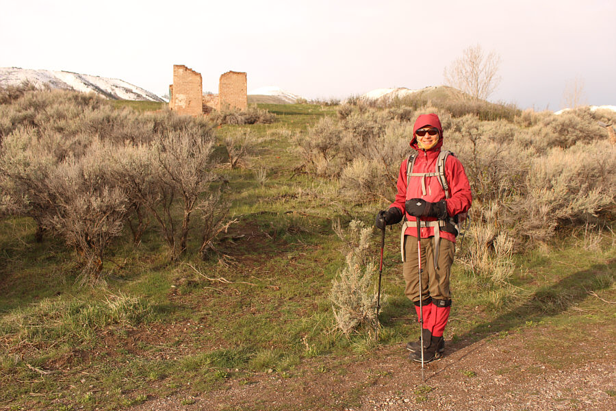
Near the trailhead are some modern ruins.

Watch out for trail runners!

Zosia follows a mountain biking trail toward the obvious drainage at left.  Kinport Peak is visible in the distance just right of centre.

Easy walking so far! Zosia hikes up a road which runs along Cusick Creek.
Stick to the road for now.

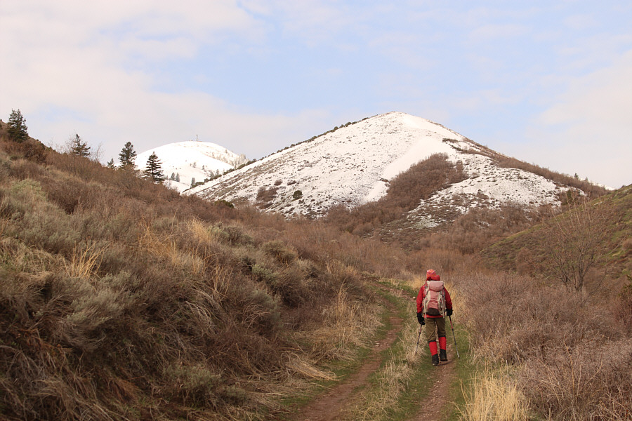
Zosia will eventually ascend the broad ridge at right.

Winter just won't go away this year! 
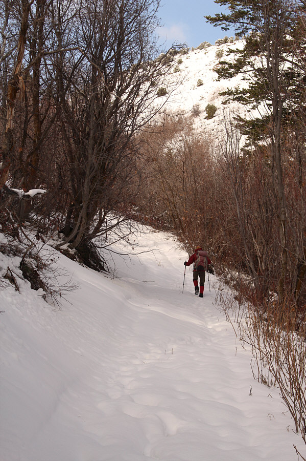
The snow gets deeper further up the road.
Watch out for cacti buried in the snow! After leaving the road, Zosia climbs up the broad northeast ridge of Kinport Peak.
Some of the snow drifts here almost appear skiable! 
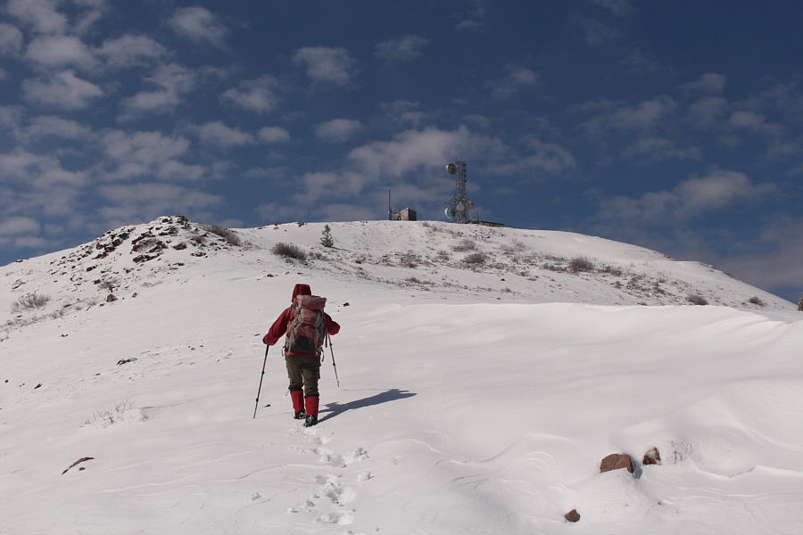
Zosia approaches some telecommunications infrastructure atop Kinport Peak.  The actual summit is not visible here.

Seems like all the mountains surrounding Pocatella have antennas on them!

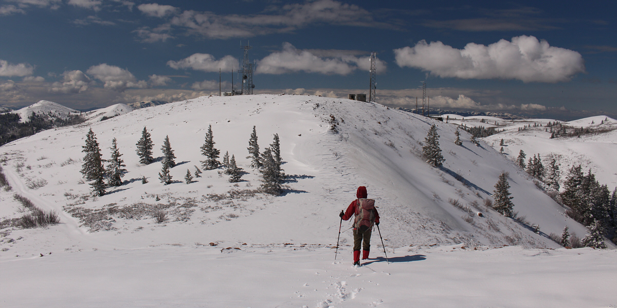
The actual summit is located behind the antennas at left.


With a bit more snow, this could have been a very nice ski ascent... 
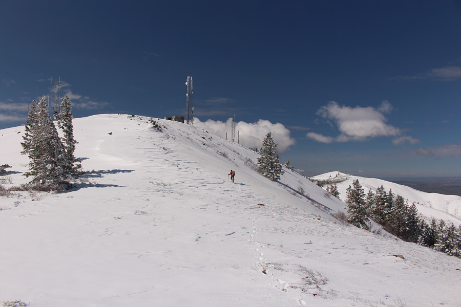
Zosia climbs up the final slope before the summit plateau.
Close enough, anyways! Sonny and Zosia stand on the summit of Kinport Peak (2206 metres).

Surprisingly nice views!

Across the valley to the east is Chinese Peak (right of centre).


Just found some new peaks to pursue in Idaho! 
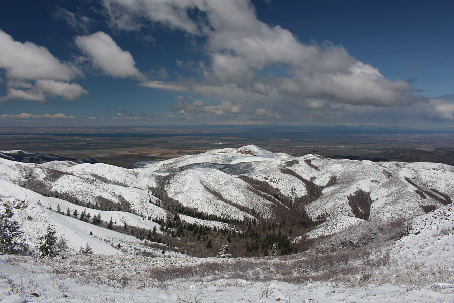
In this view to the southwest, the snowy hill at far left is Rock Knoll.  At centre on the horizon is Deep Creek Peak while Bannock Peak is visible at far right.
Always nice to see a lake from the top of a mountain! American Falls Reservoir is visible to the northwest beyond an unnamed outlier of Kinport Peak.

My favourite city in Idaho!

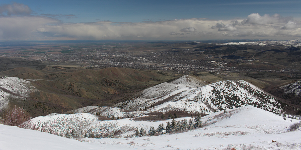
To the north is a comprehensive view of the city of Pocatello.


The weather really turned out to be surprisingly nice on this day! Zosia retraces her steps down the snowy ridge she came up.
Lots of muddy sections to tiptoe through on the way back! 
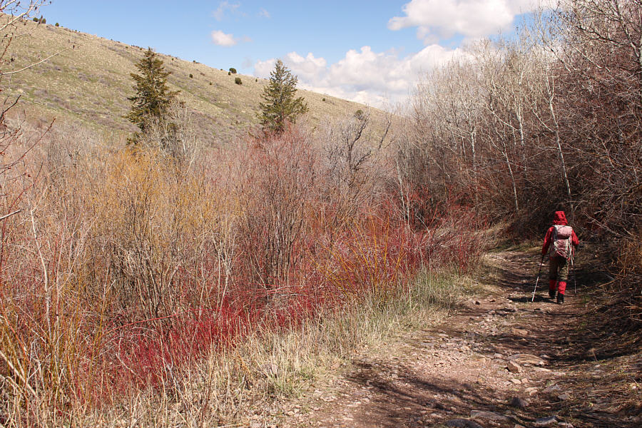
Zosia hikes out along the road beside Cusick Creek.
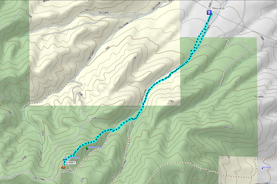
Possibly the best peak to climb in Pocatello. Total Distance:  11.0 kilometres
Round-Trip Time:  5 hours 18 minutes
Net Elevation Gain:  686 metres

GPX Data