BOU AVENUE
Lost River Mountain
Wrapping up our fifth straight day in Idaho's Lost River Range, Zosia Zgolak and I squeezed in an ascent of unofficially-named Lost River Mountain on 12 August 2022.  The normal ascent route is described in Tom Lopez's Idaho: A Climbing Guide and essentially goes up what is referred to as the "super gully" on the southwest aspect of the mountain.  As I had explained in my trip report for Mount Breitenbach, the usual driving access for Lost River Mountain was recently closed to public access.  Since the two mountains are so close to each other, Zosia and I opted to stay put and camp for a second night at the Pete Creek trailhead after returning from our ascent of Mount Breitenbach.  We would then start our ascent of Lost River Mountain from there the following morning.  Here is the GPS track for the drive to Pete Creek trailhead.

Starting out in the dark from the Pete Creek trailhead, Zosia and I headed southeast through a brief stretch of forest before traversing an open grassy slope.  We then crossed a drainage hoping to intersect the normal approach trail but were unable to find it in the dark (we did not traverse far enough eastward).  Undaunted, we climbed the steep hillside across the drainage and then traversed to climber's right to avoid some short cliff bands.  During this time, Zosia noticed some lightning flashes far away to the north, and although the weather forecast predicted the possibility of afternoon thunderstorms in our area, we were both a little surprised to see such activity so early in the morning.  After circumventing the short cliff bands, we continued to climb a steep open slope as dawn slowly broke over the area.  We eventually stumbled onto the approach trail we had been seeking, and although our route-finding issues were solved, we still faced a pretty stiff climb up the trail.  At this time, I was hampered by a massive nose bleed which forced me to stop several times along the trail, and although the bleeding eventually stopped, I looked like quite a bloody mess by the time we reached the last trees on the ridge.  Beyond the last trees, the trail enters the obvious super gully and continues upward, and I erroneously thought that the rest of the ascent would be an easy walk-up.  How wrong I would be!

As Zosia and I started up the super gully, we both noticed a dark cloud rapidly moving toward us from the southwest.  As it came closer, we began hearing thunder, and more alarmingly, we saw flashes of lightning.  Before we could make a decision to retreat to the last trees about 125 metres below us, rain began falling heavily, and we quickly hunkered down under Zosia's rain poncho next to a conspicuous rock outcrop beside the trail.  We were quite exposed to the elements at that spot, but fortunately, we were spared from any lightning strikes and never experienced any buzzing metals.  During the thirty minutes that it took for the storm to pass, Zosia's poncho did its job in keeping us relatively dry, and the only unpleasant aspect was discovering some old toilet paper under the rubble we were sitting on.  Someone had previously used the rock outcrop as a makeshift bathroom, and I henceforth nicknamed it the "poopy rock"!

Once the rain stopped, Zosia and I resumed our grind up the super gully.  Higher up, the super gully begins to narrow, and the slope here is steeper while the rocks are noticeably looser.  We both gravitated toward the edges of the super gully where we could grab onto firmer rock, but our upward progress still slowed considerably.  Above the narrowing, the super gully widens into a vast bowl of treadmill scree, and while Zosia seemingly danced her way up the slope, I floundered badly.  Every step I took was inevitably followed by some backward sliding and a few choice curse words.  In retrospect, it might have been better to veer to climber's left after exiting the narrow part of the super gully since the ridge there looked like it would offer firmer footing.  Unfortunately by the time I realized this, it would have been more work to traverse over to the ridge than to simply bull my way straight up the frustrating scree.  After what felt like an eternity, I finally caught up to Zosia who had been waiting patiently for me just below the summit ridge.  I paused long enough to catch my breath and let loose a few remaining curse words before I was ready to tackle the remainder of the ascent.  In contrast to the bowl of scree, the summit ridge was a cakewalk, and we had no further issues reaching the top of Lost River Mountain.

Even as Zosia and I congratulated each other for reaching the summit of Lost River Mountain, we were already eyeing another dark cloud developing to the southwest and moving our way.  We stayed only long enough to snap a few photographs and sign the register before retreating quickly along the summit ridge.  The loose scree bowl that was so horrible to ascend worked wonderfully on descent as we plunge-stepped almost effortlessly to the narrow part of the super gully and continued in similar fashion further down.  Just before exiting the super gully near the last trees, we were surprised to see a trio of scramblers coming up from below us.  The three men from Boise had started similarly as we did from the Pete Creek trailhead but had missed the normal approach trail entirely.  While the trio continued their ascent, Zosia and I exited the super gully and took shelter at the last trees just as rain began to fall again.  Although we were partially sheltered by trees this time, we still needed Zosia's poncho to stay dry, and I shuddered to think how the trio from Boise were getting drenched higher up in the super gully.  This second rainstorm lasted much longer than the earlier one, and we were stuck for well over an hour before the rain had abated enough for us to resume our descent.  Oddly enough, I had another nose bleed while descending the ridge, but otherwise, we had no other issues following the trail all the way down to the normal trailhead for Lost River Mountain.  From there, we easily traversed the same open grassy slope to return to our car at the Pete Creek trailhead.  The subsequent drive back to the highway was another adventure in itself, but we ultimately made it out in one piece.

Lost River Mountain was my ninth and last Idaho 12,000-footer and seemingly the most troublesome to ascend.  This trip had more drama and tribulations than all my other Idaho 12,000-footer ascents combined, but perhaps that was a fitting way to finish off the list.  I am eternally grateful to Zosia for her tremendous company, her enthusiastic support, and most of all, her awesome poncho!
Close enough! 
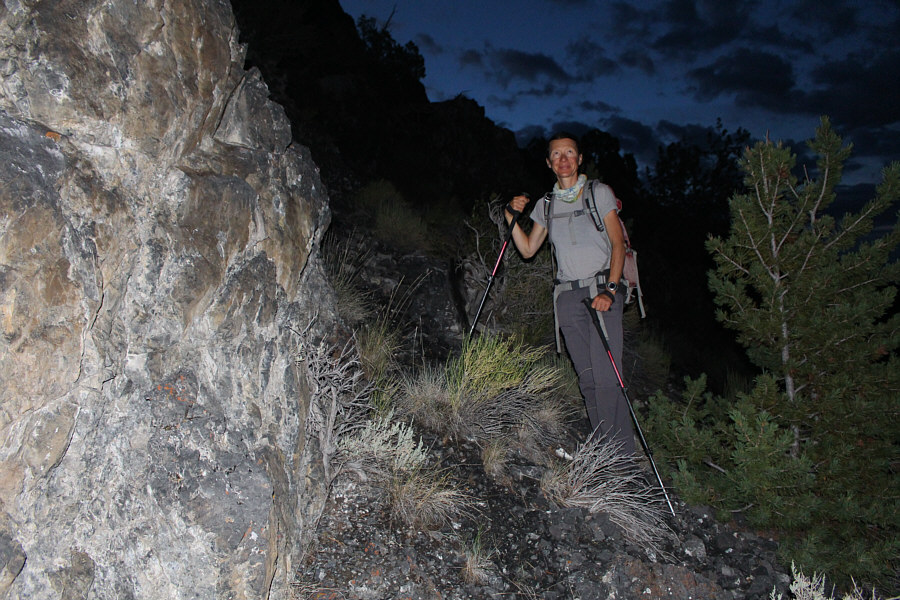
Climbing in darkness before sunrise, Zosia wonders if this is even the correct route up Lost River Mountain.
The approach trail itself is also bloody steep! 
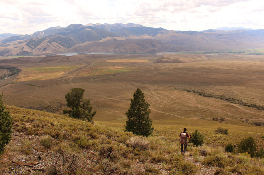
Ascending a steep open slope, Zosia would eventually stumble onto the main approach trail somewhere up ahead.
It was odd to see morning thunderstorms in the distance as well. 
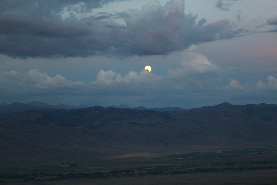
The moon slowly disappears behind some clouds in the sky to the west.
Get used to this view for the next several hours! 
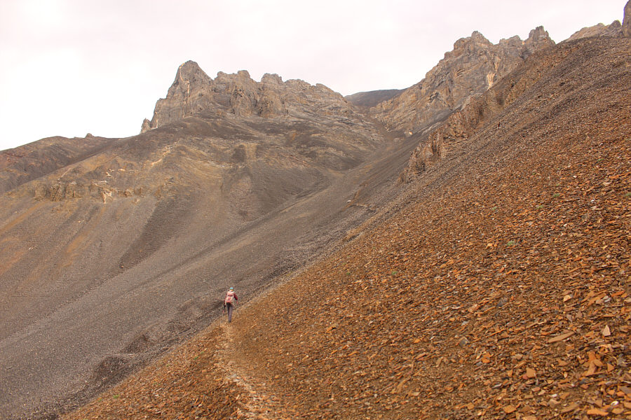
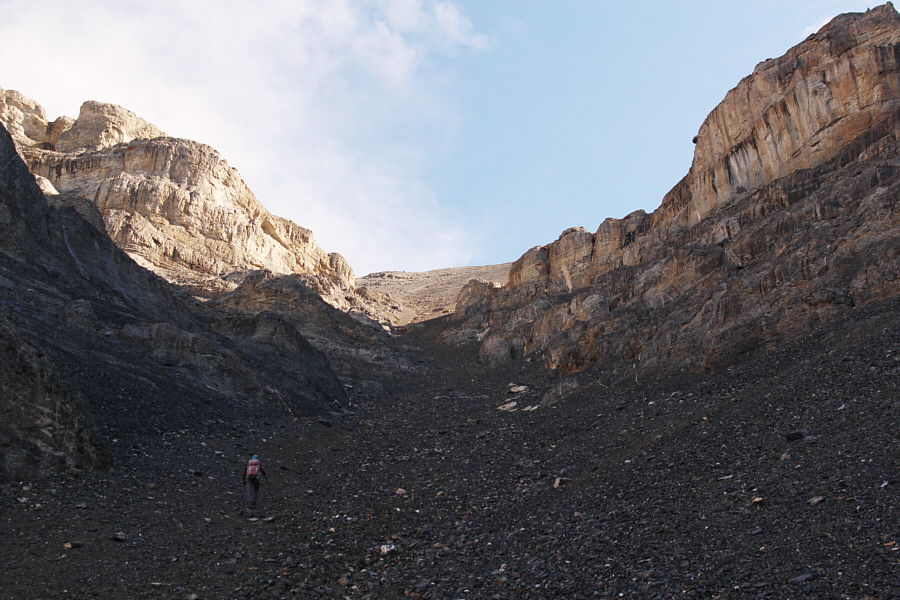
Past the last trees, Zosia enters Lost River Mountain's so-called "super gully".
Yikes... 
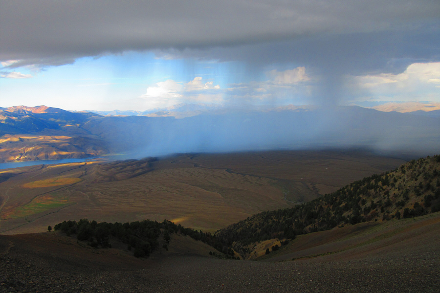
A thunderstorm moves rapidly across the valley in this direction.

Photo courtesy of Zosia Zgolak

We avoided getting struck by lightning! After safely waiting out the thunderstorm, Zosia resumes her upward progress in the super gully.
And the worst is yet to come... At a narrowing of the super gully, the terrain becomes steeper and looser.
Why you here? A golden-mantled ground squirrel looks disapprovingly at the people climbing up the super gully.

Photo courtesy of Zosia Zgolak

This was so not fun! Sonny grinds his way up miserably loose rocks in the upper part of the super gully.

Photo courtesy of Zosia Zgolak

Worst...scree...ever! 
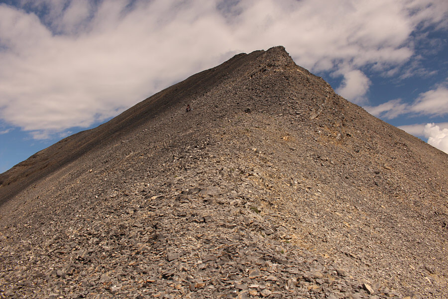
Sonny is a mere speck in this vast bowl of treadmill scree.

Photo courtesy of Zosia Zgolak

Zosia has a lot of patience. Just below the summit ridge, Zosia waits patiently for Sonny to catch up to her.
So nice to be walking again without rocks shifting underneath your feet! Zosia finds easier travel on the summit ridge.
Kinda forgot about the views with all the scree bashing! 
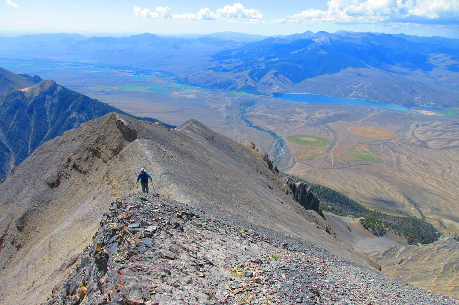
Sonny follows Zosia up the summit ridge.  The town of Mackay is visible at distant left while at right is Mackay Reservoir.

Photo courtesy of Zosia Zgolak

Hallelujah! The summit of Lost River Mountain is in sight.
It's like a rocky fist pump! Zosia easily circumvents a rock outcrop on the summit ridge.
My last Idaho 12,000er! Sonny and Zosia stand on the summit of Lost River Mountain (3678 metres).

There are still lots of interesting peaks for me to climb in the Lost River Range.

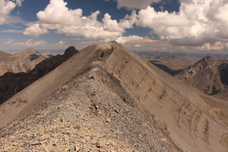
Five of Idaho's nine 12,000-foot peaks are visible to the northwest (Donaldson Peak is in front of Mount Church but hard to discern from this angle).


Bell Mountain is now high on my peak-bagging radar! The two highest peaks of the Lemhi Range are visible to the east.
Another objective for a future trip to this area...

Mount McCaleb (left) is the next prominent peak to the southeast.

Yep, this is not a good place to be if another thunderstorm hits! Zosia hurries back along the summit ridge with another storm cloud approaching the area.
Now we're laughin'! Zosia plunges down the scree bowl into the super gully.
I will never go back up here. Sonny makes much better progress on descent of the super gully.

Photo courtesy of Zosia Zgolak

These boots don't owe me anything anymore!

Sonny's $40 Walmart hiking boots are ready to be retired permanently.

Photo courtesy of Zosia Zgolak

F**cking private land owners!

Zosia descends the lower slopes of Lost River Mountain.  Upper Cedar Creek Road--the usual driving access for Lost River Mountain which is currently closed--is visible at left.

You would hardly know that there is a trail here!

Sonny emerges at the normal trailhead for Lost River Mountain.  The slope at centre is where he and Zosia ascended in the morning before stumbling onto the normal approach trail which starts up the grassy slope at far right.

Photo courtesy of Zosia Zgolak

This worked out beautifully with minimal route-finding problems.

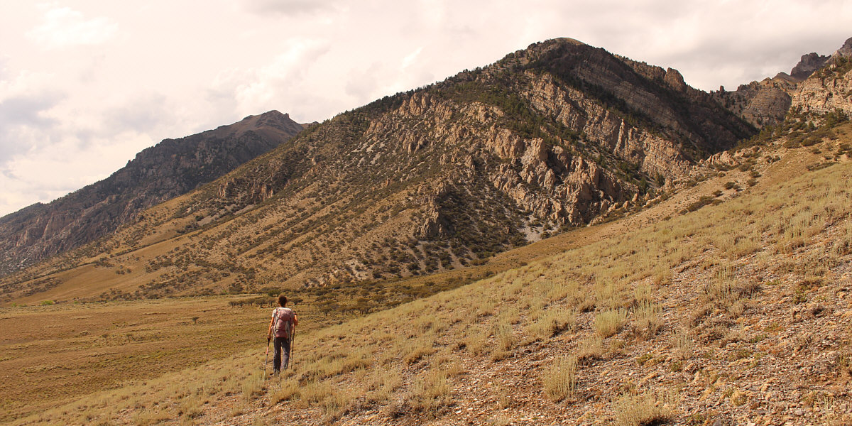
Zosia traverses an open grassy slope while returning to her starting point at the Pete Creek trailhead.
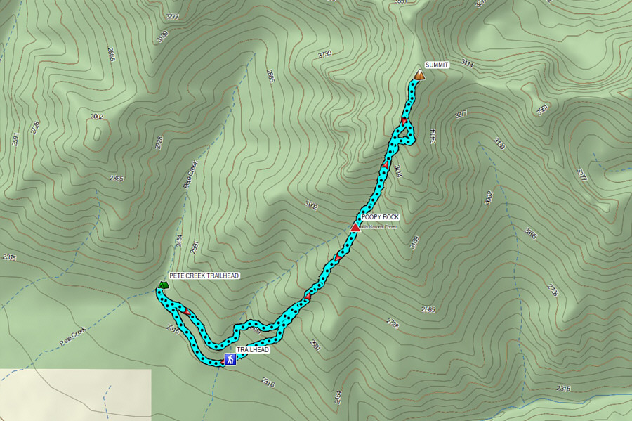
 

Probably the worst Idaho 12,000er to climb because of the horrid scree! Total Distance:  11.5 kilometres
Round-Trip Time:  11 hours 41 minutes
Cumulative Elevation Gain:  1546 metres

GPX Data