BOU AVENUE
McLean Hill East
Looking for a simple hike not far from home on 3 April 2022, Zosia Zgolak and I climbed up an unnamed bump just northeast of McLean Hill in Alberta's McLean Creek Off-Highway Vehicle Public Land Use Zone.  Given the bump's low elevation and scrubby nature, I am not surprised that I could find no references for it, and as such, I have taken the liberty to name it McLean Hill East.  I used Google Maps to come up with a fairly straightforward approach using logging roads, and my only concern was the possibility that the roads might become unpleasantly muddy with the spring thaw.

Zosia and I started our hike from a campground dump station located on the south side of Highway 66 (6.3 kilometres west of the junction with Highway 22).  At the southeast corner of the dump station, we picked up a gravel road heading southward.  Shortly after passing under a telephone line, we veered left at a T-junction and briefly headed eastward to cross Connop Creek before making a hard right turn at a second T-junction (it is also possible to follow the telephone line directly to this second T-junction).  From the second T-junction, we settled into a long but easy walk along a gravel road which gradually climbs up the northeast side of McLean Hill.  The dirt on the road was still conveniently frozen in the morning, and any lingering snow patches were shallow or already broken by ATV traffic.  About 3.4 kilometres from the second T-junction, the road crosses an obvious cut line before ending in a small cut block.  Heading eastward, we dropped down into a dip to cross Priddis Creek before bushwhacking up the far slope.  Partway up this slope, we stumbled onto a mountain biking trail running parallel to the creek, but we ignored it to continue uphill until we entered a much larger cut block.  Turning north here, we picked up a faint trail running along a reclaimed logging road which soon bends to the northeast.  Just after the bend, we inadvertently climbed up a small forested knoll thinking it was our objective of the day, but after consulting my GPS unit, we quickly realized that we were still a bit short and returned to the reclaimed road.  Where the reclaimed road seemingly ends, we turned southward and waded into moderate bush for a short distance to reach the rather nebulous high point of McLean Hill East.

Zosia and I took an extended break on the high point of McLean Hill East before making our way back to the reclaimed logging road.  We walked back along the reclaimed road for a short distance before turning north into a corridor through the bush.  This led us to the same cut line we crossed earlier.  Following this cut line westward entailed quite a steep descent to Priddis Creek followed by an equally steep but shorter climb up to the intersection with our original approach road.  Once we regained the road, we retraced our steps to the second T-junction where we took a short cut along the aforementioned telephone line before easily finishing off the remainder of the hike back to the dump station.  The warm afternoon temperatures had softened up the road considerably, but for the most part, we were able to tiptoe around the muddy sections without too much trouble.
When was the last time you started a hike from a dump station?

The road to McLean Hill East starts at the back of this dump station.

We saw a vole darting about here. Beware...

Zosia hikes southward along the still-frozen road.  McLean Hill is visible at right.

Makes it easier to hang Christmas lights! This tree seems to be growing sideways.
Oddly, it wasn't that windy here, and it still felt chilly.

Zosia stops to marvel at the Chinook arch in the sky.

Some light bushwhacking here. Zosia crosses snow-choked Priddis Creek.
Yep, it's about as exciting as it looks!

After climbing out of Priddis Creek, Zosia works her way through an old cut block.

What were you expecting? The Matterhorn? Zosia follows a faint trail along a reclaimed logging road.  The top of McLean Hill East is somewhere on the low rise in the distance.

It's a real shame that Mount Cornwall is so inaccesible for skiers!

The reclaimed logging road grants some distant views including this one to the southwest of (L to R) Banded Peak, Outlaw Peak, Mount Cornwall and Mount Glasgow.


Zosia and I still have some places to explore on Moose Mountain.

Moose Mountain stands out in the sunlight to the northwest.


Only worth it for diehard hill-baggers! 
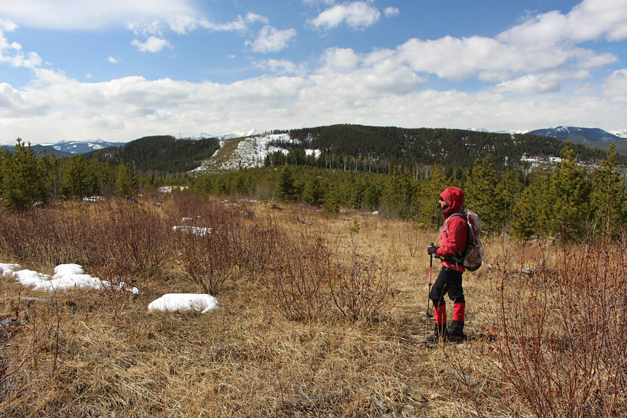
After leaving the reclaimed logging road, Zosia thrashes through some moderate bush to find the nebulous high point of McLean Hill East.
Close enough for jazz! 
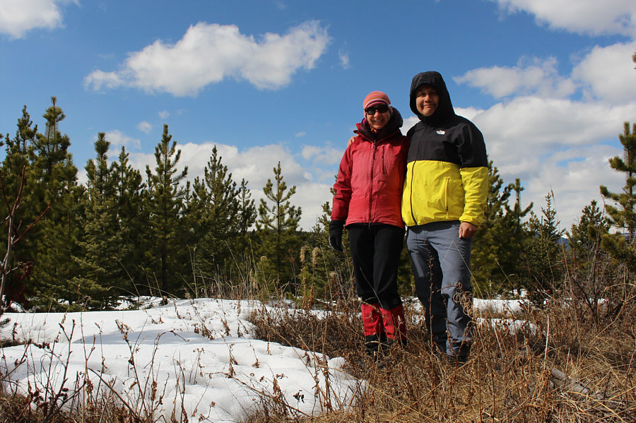
Zosia and Sonny stand approximately on the high point of Mclean Hill East (1615 metres).
We couldn't tell if this was actually downtown until seeing this zoomed-in photo!

From near the top of McLean Hill East, downtown Calgary is visible on the eastern horizon.

Photo courtesy of Zosia Zgolak

With more snow, that bare patch on McLean Hill might make a good ski run!

Zosia appreciates the warmth of the sun as she returns to the reclaimed logging road.  In the background is a comprehensive view of McLean Hill's eastern slopes.

Quite steep in places but easy to follow with zero bushwhacking!

Zosia takes an alternate return route along a steep cut line.

Chicken on the way? This lone ruffed grouse blends in well with its surroundings.
Uphill both ways it seems!

After re-crossing Priddis Creek, Zosia climbs up a steep ATV track which parallels the cut line.

To be avoided in late spring or after a good rain! Sonny is careful to avoid mud as he hikes back along the thawing road.

Photo courtesy of Zosia Zgolak

That reminds me...I miss Tony Roma's all-you-can-eat ribs! 
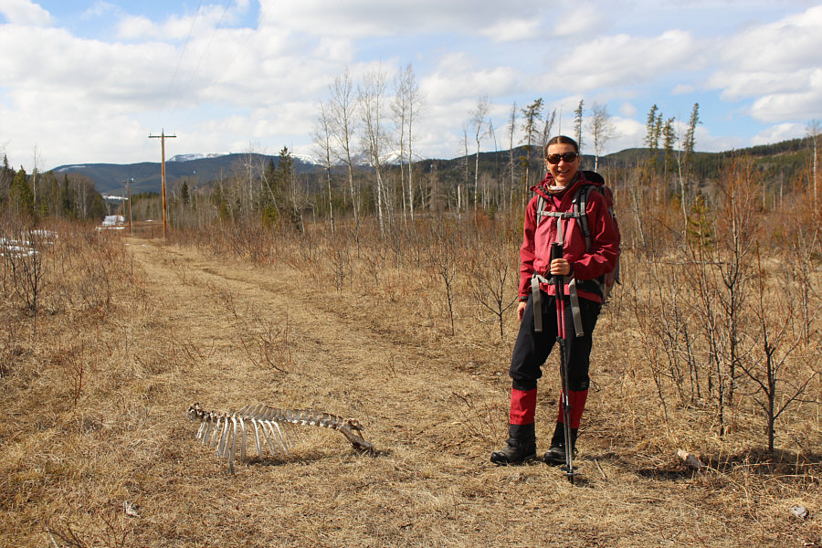
Along a telephone line, Zosia comes across a partial skeleton of likely a deer.
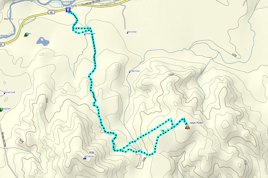
Ideal for those looking to hike in solitude without having to drive far. Total Distance:  13.8 kilometres
Round-Trip Time:  5 hours 17 minutes
Cumulative Elevation Gain:  464 metres

GPX Data