BOU AVENUE
Odlum Knoll
On 24 September 2022, Bob Spirko invited
Zosia Zgolak and me to accompany him for an exploratory hike up the west
end of Odlum Ridge in Alberta's Elbow-Sheep Wildland Provincial Park.
Bob's planned route entailed an approach along a trail which follows a
tributary of Storm Creek into the valley northeast of Mount Odlum.
This trail is described in Gillean Daffern's Kananaskis Country Trail
Guide as an alternate exit for hikers who traverse the entire length
of Odlum Ridge. In effect, we would essentially be bypassing all
the highest summits of Odlum Ridge and just visiting its western
terminus. Because the starting point is a bit difficult to
pinpoint, Bob actually went out a few weeks earlier to scout out the area
(thank you, Bob). With Bob's consent, Zosia and I also invited
Kevin Caron, Marta Heske, Aga Sokolowska, and Marta Wojnarowska to join
us for this adventure.
Park off the pavement on the south side of Highway 40, 29.0 kilometres
south of the winter gate past the turnoff to Kananaskis Lakes or 26.0
kilometres west of Highwood Junction.
Rendezvousing at the parking spot, Kevin, Marta H., Aga, Bob, Marta W.,
Zosia and I searched the bushes at the bottom of the embankment on the
south side of the highway until we found flagging marking the start of a
trail descending to Storm Creek. While Bob brought hip waders,
everyone else forded the creek in their bare feet. I managed to
cross a tangle of downed logs slightly downstream without taking off my
boots, but it was probably more difficult than it was worth. Once
we regrouped on the other side, we crossed a dry wash of Storm Creek and
found a cairn marking the start of Daffern's trail. At one point,
we briefly lost the trail in a small glade but found it again after a
short backtrack. From the cairn, we hiked southward for about 1.8
kilometres before abandoning the trail and rock-hopping across the
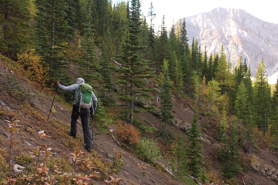
tributary running along the bottom of the valley. We then ascended
steep slopes to gain a spur ridge connected to the main spine of Odlum
Ridge. We had to endure a bit of unpleasant bushwhacking at the
beginning of this ascent, but the terrain became more open and easier to
navigate the higher we climbed. When we eventually gained the main
spine of Odlum Ridge, we took a break before continuing westward.
Despite some undulations along the way, travel was pretty straightforward
as we headed toward a rocky knob at the western terminus of Odlum Ridge.
A short cliff band guarding the rocky knob can be easily circumvented,
but most of us tackled it directly for a bit of extra scrambling fun.
When we reached the top of the rocky knob, we were surprised to see two
hikers already relaxing beside the large cairn. They had started
from the same place as us but had continued on the trail all the way up
the valley before coming up via the col to the southwest. We
apologized for disturbing their tranquility, but they were very
good-humoured about our intrusion. We took a second break here, and
since Daffern had neglected to name the rocky knob, there were some funny
discussions about what to name it. At one point, the name "Oddler"--a
progression from "Odlum Junior" to "Odlum Toddler" to "Toddler with a
silent T"--was a popular choice, but days later, Bob decided to go with
the less-quirky but more geographically-meaningful "Odlum Knoll".
In the spirit of minimizing confusion, I have chosen to follow suit.
For our descent, Kevin, Marta H., Aga, Bob, Marta W., Zosia and I chose
to follow Daffern's described alternate exit, but this turned out to be
less straightforward than we had hoped. The drop down to the col
from the top of Odlum Knoll was surprisingly steep and rugged with a fair
amount of forest to navigate through. We picked up a trail at the
col and followed it most of the way down into the basin to the north
where it disappeared in a marshy meadow. After skirting around the
edge of the meadow, we had some difficulty finding Daffern's trail, and
even after we found it, we had some trouble staying on track due to some
trail braiding alongside the valley's tributary. Ultimately, we
were able to resolve our route-finding issues and hike out the valley
without further grief. An unremarkable second ford of Storm Creek
capped off our adventure.
Be sure to check out Bob's
trip
report.
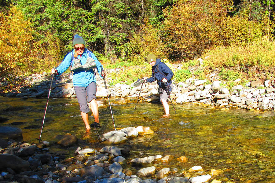 |
Aga and Kevin ford Storm Creek.
Photo courtesy of Zosia Zgolak |
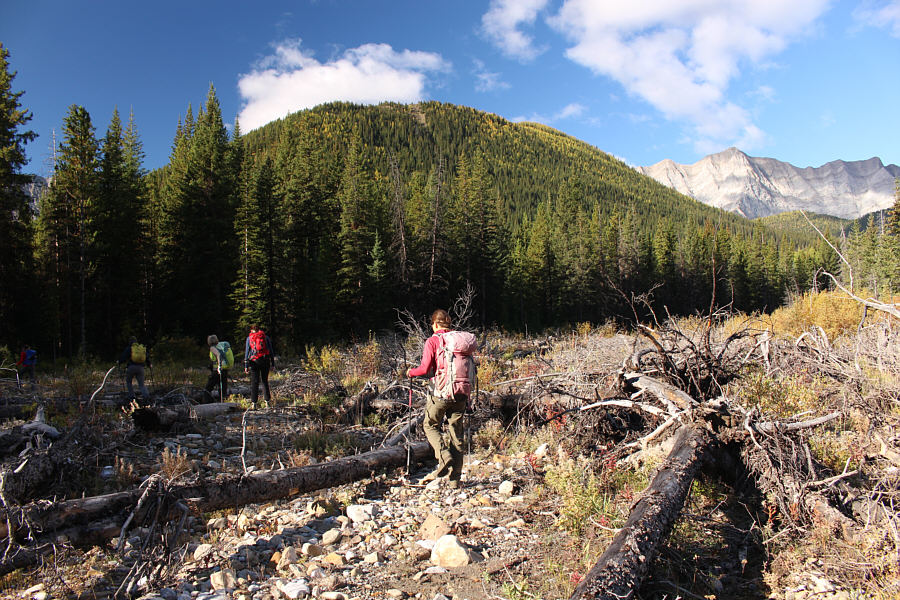 |
The group crosses a dry wash of Storm Creek in search of a cairn marking
the start of the access trail. |
 |
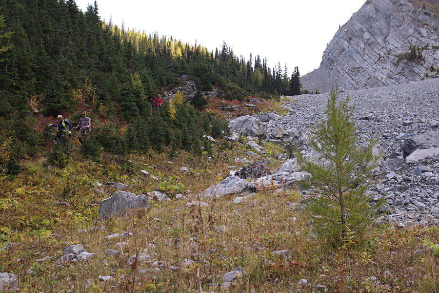
After abandoning the access trail,
Marta W. and Aga wait for Marta H. to rock-hop a creek before
starting a bushwhacking ascent. |
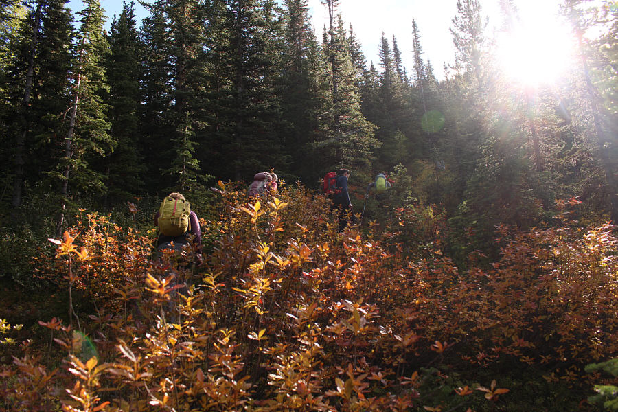 |
The bushwhack up the slope is steep but not too heinous. |
 |
Bob makes better progress as the slope
begins to open up. |
 |
The group stops for a breather after gaining a spur ridge. |
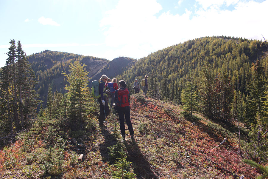 |
The spur ridge connects with the main spine of Odlum Ridge which is
ahead. |
 |
The group encounters more larches as they climb higher up the spur ridge. In the
background is Mist
Mountain. |
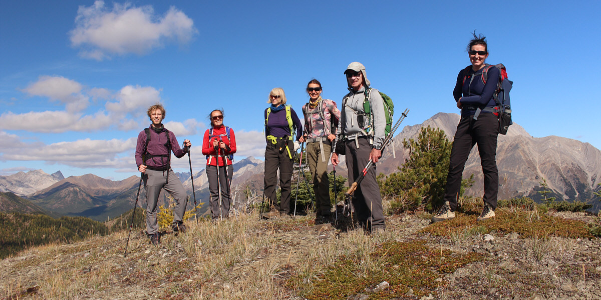
Kevin, Aga, Marta W., Zosia, Bob and Marta H. stand on
an open bump along the main spine of Odlum Ridge.
 |
The group continues westward along the crest of Odlum Ridge. |
 |
Odlum Knoll is finally within sight (left of centre) just in front of
Mount Odlum. |
 |
The group makes a final push to the top of Odlum Knoll. |
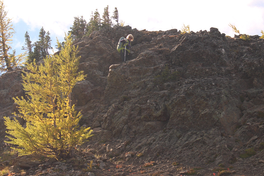 |
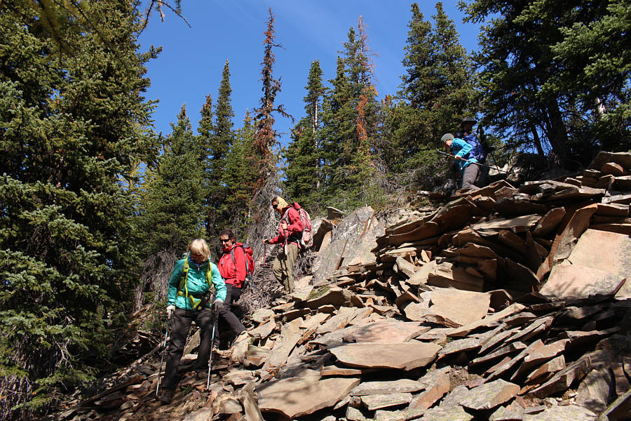
Marta W. scrambles up a short rock band near the top of Odlum Knoll. |
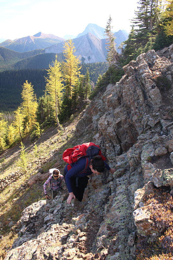 |
Zosia follows Marta H. up the short rock band. |
 |
The highest summits of
Odlum Ridge can be seen far in the distance as the group ascends a rubble
slope just below the top of Odlum Knoll. |
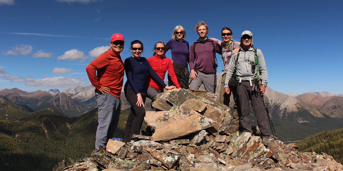
Sonny, Marta H., Aga, Marta W., Kevin, Zosia and Bob
stand next to the cairn atop Odlum Knoll (2375 metres).
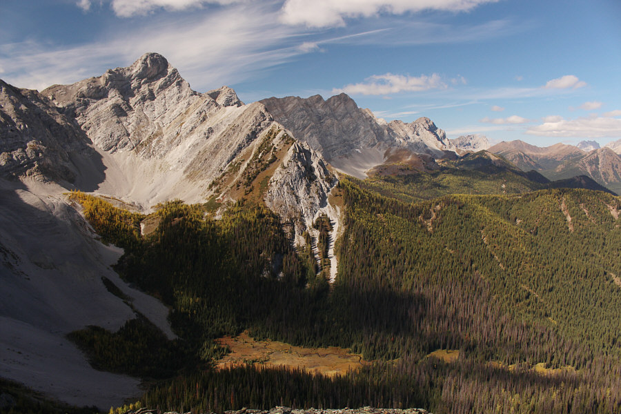 |
In this view from the top of Odlum Knoll, the Elk Range and
Continental Divide stretch far away to the northwest. |
 |
The Misty Range stretches across the northern horizon. |
 |
Mount Bishop
(right of centre) is the most prominent peak visible to the southeast. |
 |
The group carefully makes its way down some shattered rocks on the
southwest side of Odlum Knoll. |
 |
A convenient trail runs down from the col separating Odlum Knoll and
Mount Odlum. |
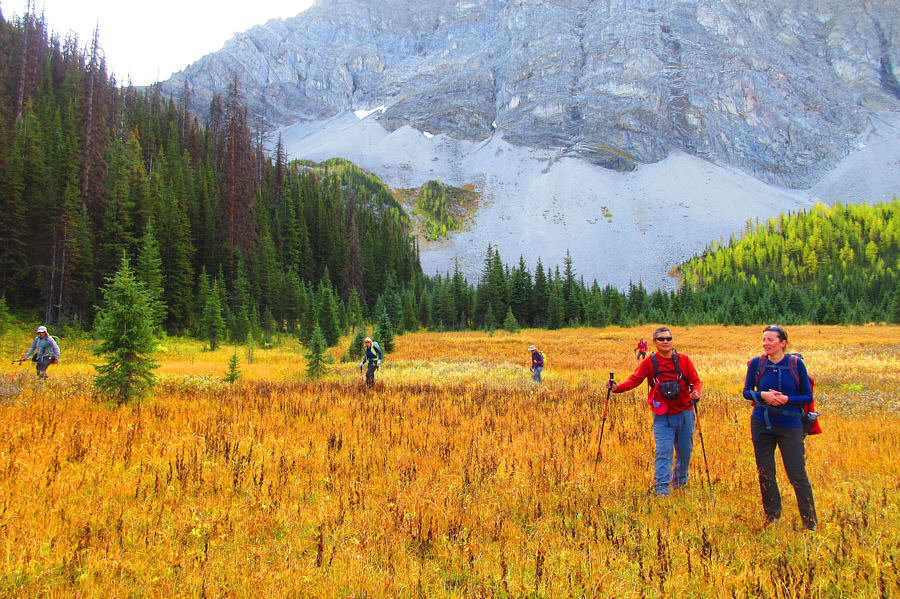 |
The group tries to avoid wet ground as they cross a marshy meadow below the
northeast face of Mount Odlum.
Photo courtesy of Zosia Zgolak |
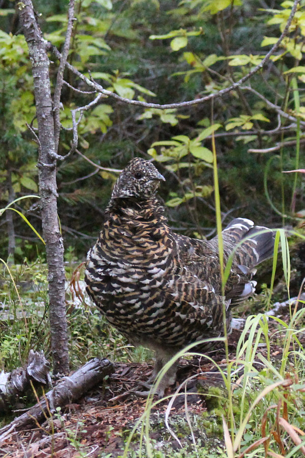 |
This is one of about half a dozen spruce grouse trying not to be noticed
on the side of the access trail. |
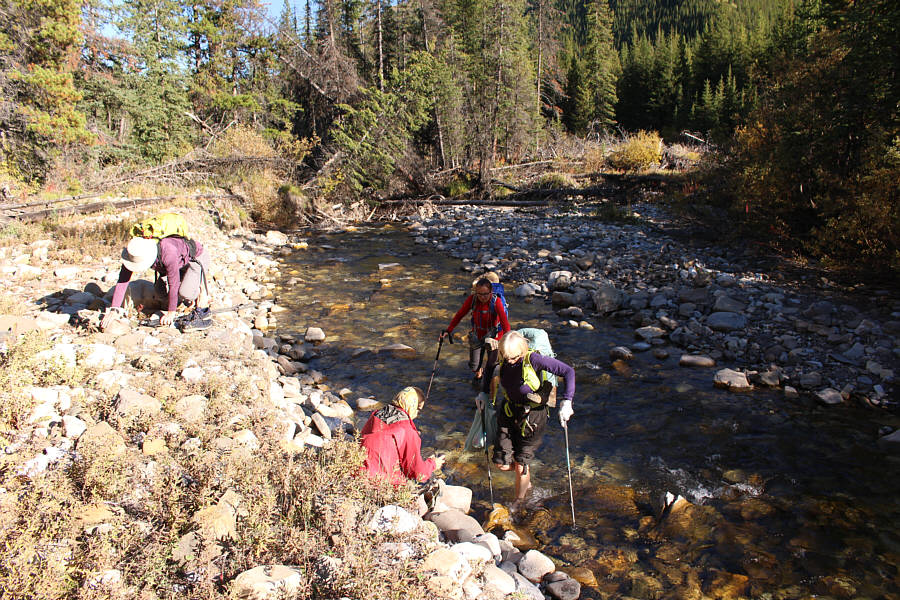 |
The group fords Storm Creek again near the end of the trip. |
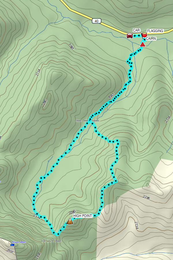 |
Total
Distance: 11.5 kilometres
Round-Trip Time: 7 hours 19 minutes
Cumulative Elevation Gain: 784 metres
GPX Data |