BOU AVENUE
Mount Thielsen
Among the Cascade volcanoes of Oregon, Mount Thielsen is one of the most striking with its distinctive summit pinnacle.  Located in Mount Thielsen Wilderness, this beautiful peak inevitably draws the gaze of visitors in nearby Crater Lake National Park as well as those hiking the Pacific Crest Trail (PCT).  A non-technical ascent route via the west ridge is described in 75 Scrambles in Oregon by Barbara I. Bond and also in summitpost.org.  While most of the ascent is merely easy hiking, the final climb up the summit pinnacle is an exposed Class 4 scramble that some may find exhilarating or terrifying or both!  Zosia Zgolak and I would find this out for ourselves during our ascent of Mount Thielsen on 18 August 2022.

The trailhead (vault toilet; fee or pass required) is located on the east side of Highway 138, 131.0 kilometres east of the junction with Highway 99 in Roseburg or 2.4 kilometres north of the junction with Highway 230 near Diamond Lake.

After camping the previous night at the trailhead, Zosia and I started hiking the Mount Thielsen Trail (forestry trail #1456) before dawn.  This is normally a well-maintained trail, but on this day, we encountered a fair amount of deadfall especially early in the trip.  Fortunately, the deadfall did not hamper our progress too much, and we had no serious difficulties reaching the four-way junction with the PCT a little more than 2.5 hours after leaving the trailhead.  There were a few tents at the junction; some people apparently bivouac here and split the ascent over two days.  Ignoring the PCT, we went straight through the junction and began climbing the west ridge of Mount Thielsen.  The good trail here continues beyond the last trees before deteriorating into a beaten path on a slope with a lot of loose rubble.  Although the footing here was initially not great, it improved once we transitioned to larger rubble higher up.  The beaten path eventually led us to the base of the summit pinnacle which looked much steeper than I was expecting.

As Zosia and I paused there wondering if we were maybe off-route, a man came up from behind and immediately started climbing the wall in front of us without hesitation.  Seeing that there were no easier lines, we tried to follow him, but he had already disappeared somewhere above us.  Once we were committed though, the route pretty much unfolded by itself as we took the most reasonable line up a series of exposed ledges and outcrops.  Partway up, we ran into the man at a bottleneck in the route.  He was already on his way down but was gracious enough to wait for us to climb past him before continuing his descent.  After that, we had no more issues scrambling up the remainder of the summit pinnacle.

With a light drizzle starting to fall and a difficult down-climb weighing on our minds, Zosia and I stopped at the summit only long enough to snap a few photographs before retreating the way we came.  Descending the summit pinnacle was certainly challenging, and we even removed our packs at one point in order to slither down a narrow and awkward crack.  Thankfully, the rock was generally solid and reliable, and we managed to get back down to the base of the wall without a slip.  We then followed the beaten path back down to the west ridge where we finally stopped for a lunch break in the shelter of a stunted tree.  From there, the remainder of our hike back to the trailhead was uneventful and maybe even a little boring in comparison to down-climbing the summit pinnacle.
The sign says, "You're up way too early for this hike!"

In the wee hours of the morning, Zosia stops to read a sign along the trail to Mount Thielsen.

That summit pinnacle looks like it could poke out someone's eye!

Zosia gets her first unobstructed view of Mount Thielsen and its summit pinnacle.

Why bother with a bivy at all especially at this terrible location? Sonny passes some tents beside the junction with the Pacific Crest Trail (PCT).

Photo courtesy of Zosia Zgolak

Getting excited yet?

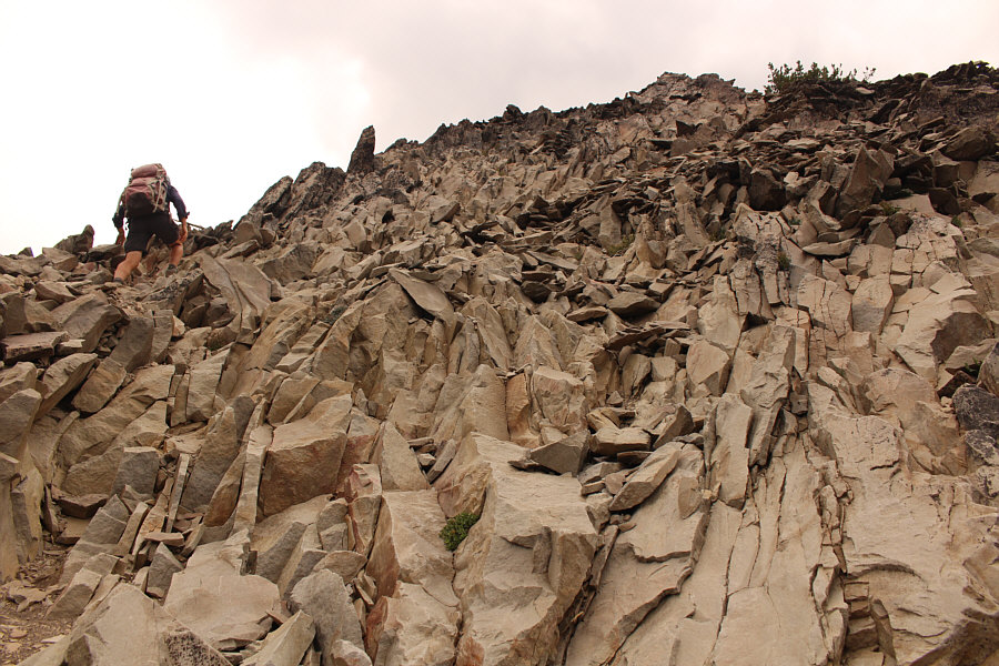
After crossing the PCT, Zosia begins climbing up the west ridge of Mount Thielsen.


The long uphill grind here is a good time to meditate on your life choices! A good trail runs most of the way up the west ridge.
The only place on the mountain where the rocks kinda sucked! The footing here is not great with lots of ball-bearing-like rubble lying atop down-sloping slabs.  The slope is also steeper than it appears in the photograph.
Very cool scrambling here... 
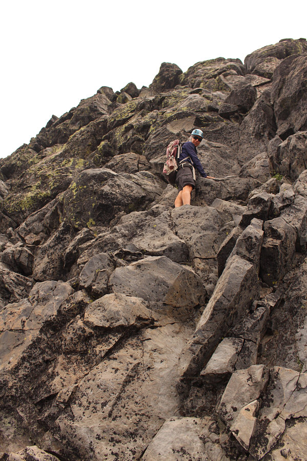
The rocks become more tilted on the upper mountain.

Keep on grindin'...we're coming up to the fun stuff!

The route swings around to the right (south) side of the summit pinnacle.


One of those rare occasions when the route actually looks harder up close! 
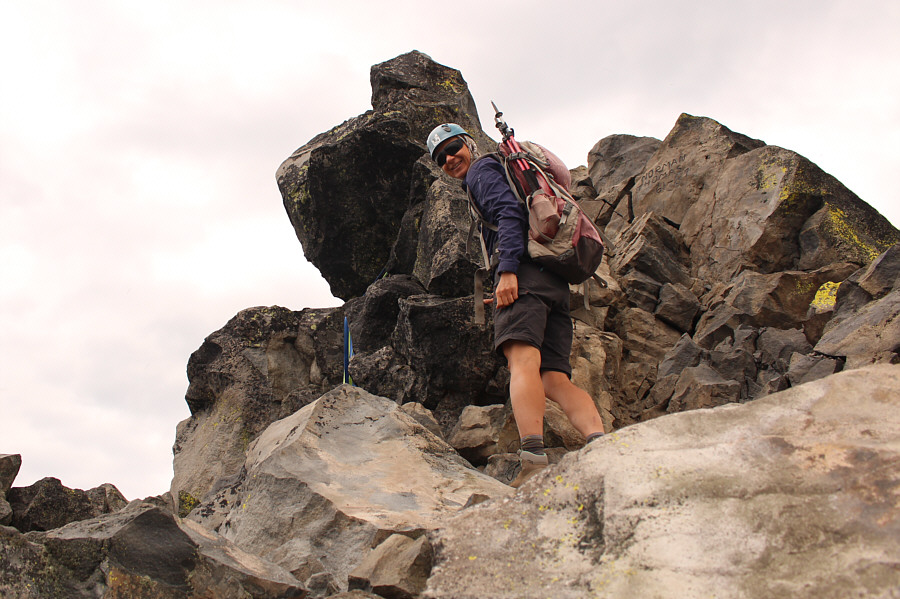
Zosia approaches the base of the summit pinnacle.
This is usually out of Zosia's comfort zone, and I was surprised that she was willing to continue up. Zosia climbs up the summit pinnacle.
A rope would definitely NOT be out of place here! Some slings near the top attest to the difficulty of climbing the summit pinnacle.
It was hard to set up my camera for a good group shot. 
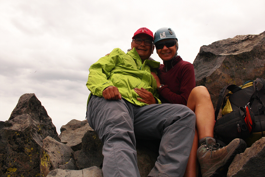
Sonny and Zosia huddle together on the tiny summit of Mount Thielsen (2792 metres).
Hopefully they didn't die here! Someone attached a small memorial disk to the summit rocks.
What a cool fun fact! Apparently, Mount Thielsen is the only place outside of Crater Lake National Park where the waters of the lake are visible.  On the left horizon is Mount Scott.
There's a lot of air below me! With a light drizzle falling, Sonny begins down-climbing the summit pinnacle.

Photo courtesy of Zosia Zgolak

In retrospect, that was actually quite fun! After safely descending the summit pinnacle, Zosia stops to convert her shorts to long pants.
We got this, so no need to rush! Sonny carefully descends easier but still steep terrain on the upper mountain.

Photo courtesy of Zosia Zgolak

We've got Mount Bailey in our sights the next time we come here! 
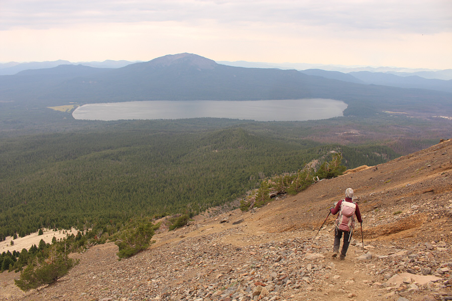
Zosia descends the west ridge with views of Mount Bailey and Diamond Lake.
Some more quality time for meditating on your life choices! 
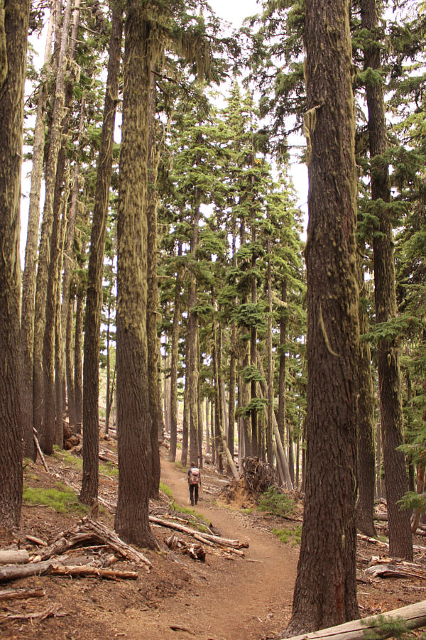
The hike back to the trailhead is quiet and peaceful.
A deservedly popular scramble but also one of the most difficult in Oregon. Total Distance:  15.5 kilometres
Round-Trip Time:  8 hours 30 minutes
Net Elevation Gain:  1144 metres

GPX Data