BOU AVENUE
Boundary Peak

On 25 November 2023, Zosia Zgolak and I scrambled up unofficially-named Boundary Peak located on the border between Alberta's Kananaskis Country Public Land Use Zone and Elbow-Sheep Wildland Provincial Park.  Zosia proposed this trip after reading a report by Bob Spirko, and we would use the same approach via South Lusk Meadows which is detailed in Gillean Daffern's Kananaskis Country Trail Guide.  Another impetus for this trip was to take advantage of the eastern access for Lusk Pass prior to the annual closure (December 1 to May 14) of Powderface Trail (2WD gravel road).  Joining us on this day were a couple of Polish hikers--Malgosia and Marcin--that we met on our recent Halloween hike.

Starting from our parking spot along Powderface Trail (50.98701, -114.95587), Malgosia, Marcin, Zosia and I walked north along the road for about 100 metres to the signed eastern trailhead for Lusk Pass.  We then hiked the official trail for about 500 metres before turning left onto an unmarked path which is easy to miss especially with any appreciable snow cover.  Heading southwest, we followed the path along an unnamed tributary of Jumpingpound Creek, and we had no issues with creek crossings and boggy sections since everything was mostly frozen.  About 1.3 kilometres from the turnoff, we passed through the campsite mentioned in Spirko's report.  The campsite is located at a split in the tributary, and we had to muddle around a bit here before picking up the path again alongside the northern branch.  Because of some downed trees, we briefly lost the path about 700 metres west of the campsite, but after checking our GPS, we were able to make a course correction and get back on track.  We eventually reached a narrow cutline which led us without fuss to the head of the valley where we made an abrupt right turn and climbed out of the trees onto South Lusk Meadows.  From there, we crossed a brief dip before climbing up a steep snow-covered rubble slope below what happens to be the extension of Boundary Peak's north ridge.  There were a few deep pockets of snow mostly around the last trees, but fortunately, we did not have to post-hole too much.  Upon gaining the ridge crest, we turned right and quickly tagged a minor high point which is labeled on OpenTopoMap as "Boundary Ridge".  We took a short break here before backtracking to where we first gained the ridge crest and continuing onward to Boundary Peak.  Other than one moderately steep but short section of easy scrambling, the north ridge of Boundary Peak presents no serious challenges, and we easily reached the summit about 70 minutes after leaving the high point of Boundary Ridge.

Malgosia, Marcin, Zosia and I stopped for a longer break on the summit of Boundary Peak before commencing our descent.  Retracing our footprints, we had no issues returning to where we first gained the ridge crest.  Interestingly, we encountered a bighorn sheep here going in the opposite direction, and as it kept coming toward us, we stood still and wondered if it would simply walk right past us on the ridge crest.  As it turned out, the sheep veered off the ridge crest at the last moment and quickly detoured around us before continuing on its merry way toward Boundary Peak.  After our close encounter with the sheep, we dropped down the steep snow-covered rubble slope back to South Lusk Meadows.  We had to be careful with the slippery footing here, but thankfully, we all made it down safely without any mishaps.  The ensuing hike down the cutline and out the valley felt monotonously long but was otherwise straightforward and uneventful.
Looks a bit daunting with all the snow... 
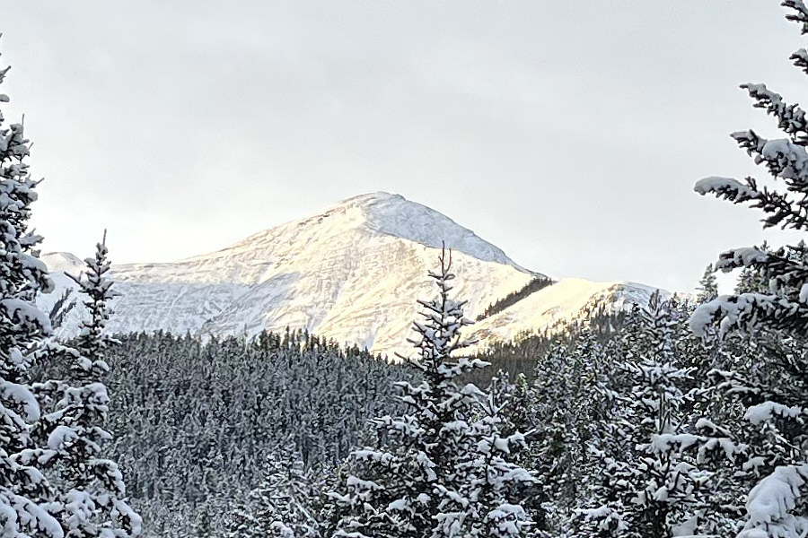
Here is a first look at Boundary Peak early in the day from a gap in the trees in the approach valley.
Mostly frozen...mostly!

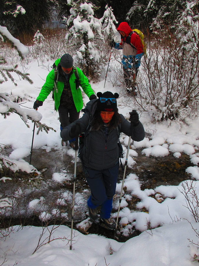
Malgosia, Marcin and Sonny make one of several frozen stream crossings in the valley.

Photo courtesy of Zosia Zgolak

Looks like camping season is over! Marcin, Malgosia and Zosia reach a hunter's camp partway up the valley.
Pretty narrow cutline!

The group follows a cutline in the upper valley.

Hey, where the heck are Marcin and Malgosia going? From South Lusk Meadows, the route gains the ridge just above the isolated stand of trees slightly left of centre.
Sticking close to the trees is best since the rocks here are friggin' loose! Sonny, Marcin and Malgosia approach the aforementioned isolated stand of trees.

Photo courtesy of Zosia Zgolak

Zosia's route-finding was excellent here! 
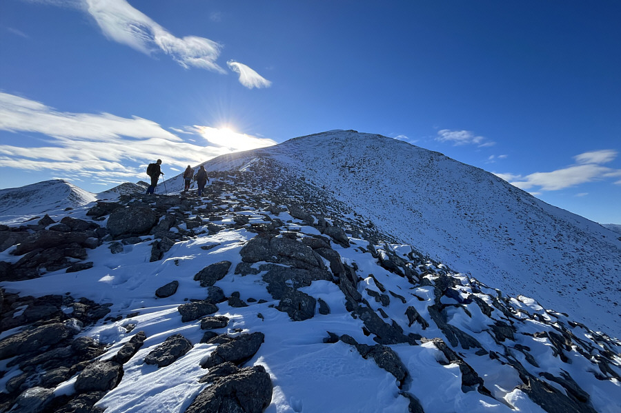
The group makes its way up the last steep section before the ridge crest.
Note the fresh sheep tracks here... 
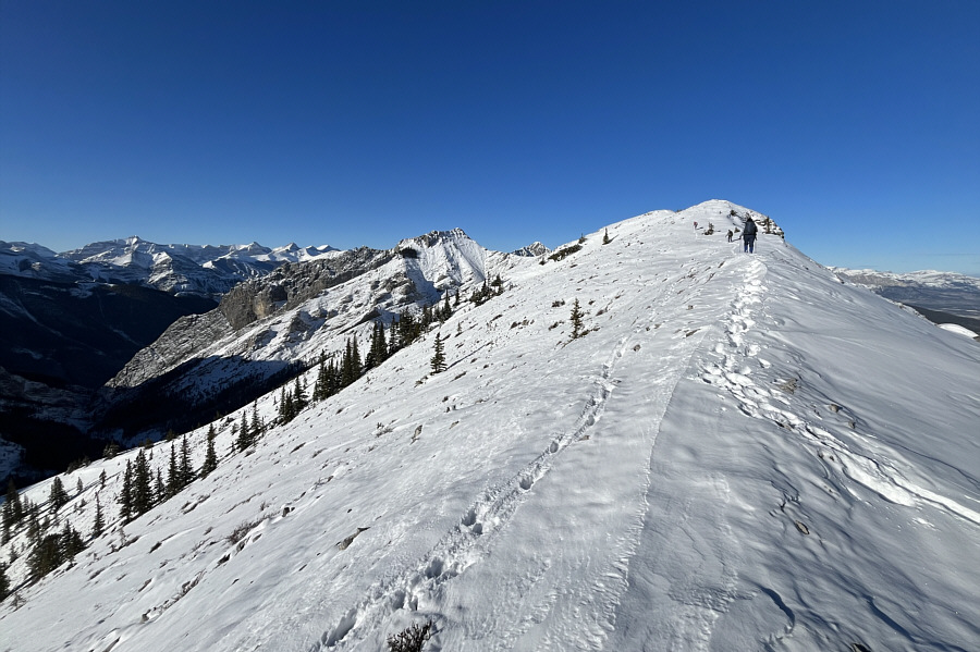
After gaining the ridge crest, the group heads northwest to a high point.

This would've been a good place to call it a day had the weather been less pleasant.

Malgosia joins Zosia and Marcin on the high point of unofficially-named Boundary Ridge (2181 metres).  At left is Midday Peak while Mount Baldy is visible at centre.


We saw what looked like sheep partway up the left-hand ridge. Here is the view of Boundary Peak from the high point of Boundary Ridge.
A very enjoyable ridge walk! 
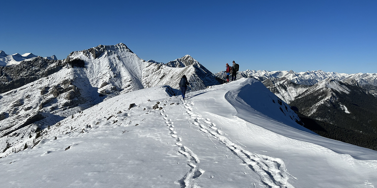
The group hikes along the connecting ridge to Boundary Peak.
No problemo even with the snow! Zosia scrambles up the steepest section of Boundary Peak's north ridge.
We got this! 
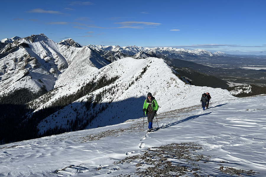
The remainder of the ascent is just an easy hike up snow-covered rubble.
All those clearcuts could be good for ski touring but would be hard to access with the winter road closure. Much of the approach can be seen behind Marcin and Malgosia as they finish their climb.  At far left is South Lusk Meadows, and the approach valley is visible at centre.
We didn't dig too hard to see if there was a summit register. 
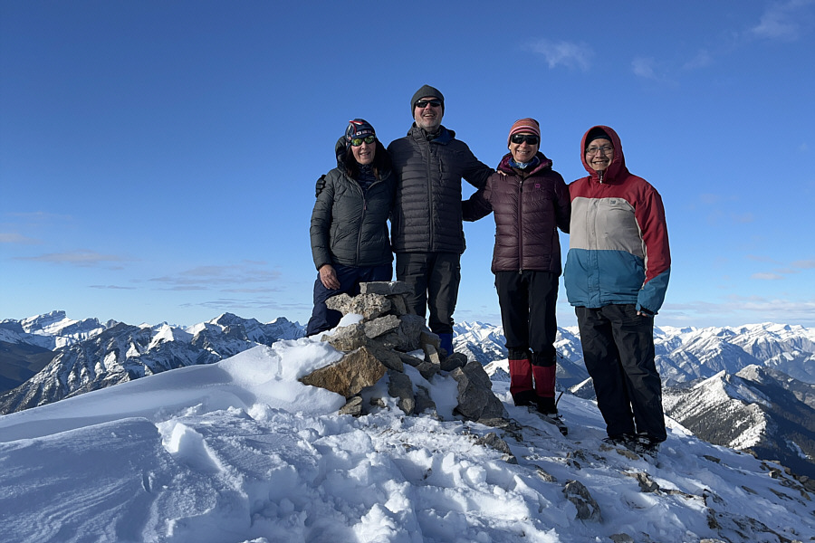
Malgosia, Marcin, Zosia and Sonny stand on the summit of Boundary Peak (2440 metres).
Seems like another lifetime when I was there... In the foreground to the southeast is Belmore Browne Peak.
I should climb Mount McDougall next year! 
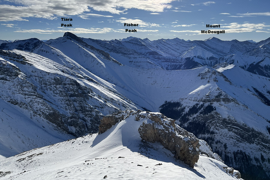
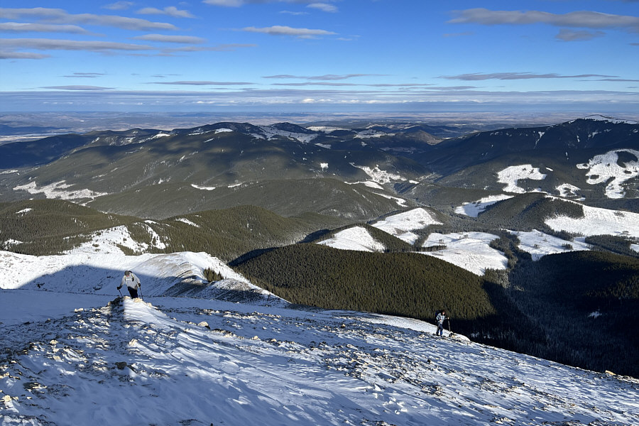
Here is the summit view to the south.

I didn't have room to label them, but you should also be able to pick out Mount Chester, Gusty Peak, Wind Mountain and Mount Collembola.

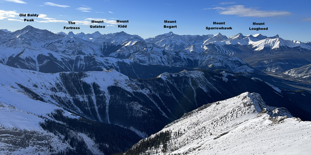
Numerous familiar peaks stretch across the western horizon.


Not bad for a November scramble! 
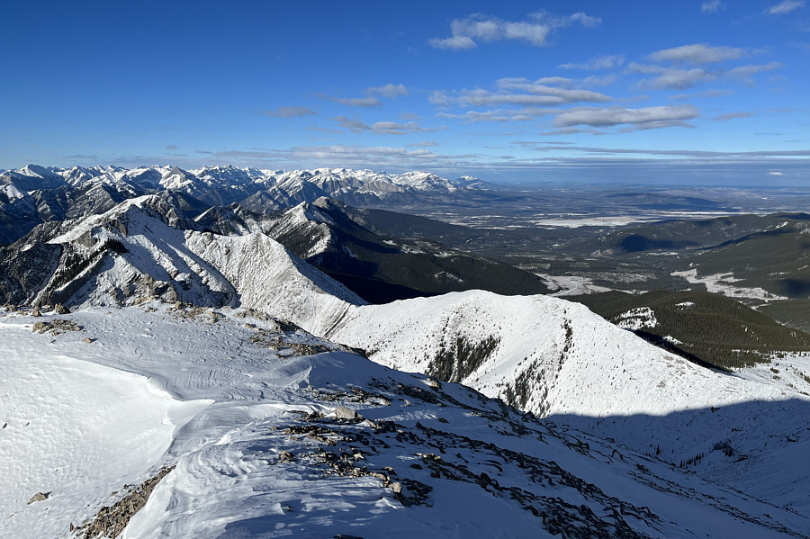
This is looking back down on Boundary Ridge (right of centre) to the north.
It will take us just a little over 3 hours to get back to our cars. Zosia, Malgosia and Marcin leave the summit to begin their descent.
The sheep actually jumped down the cliff band at centre like it was nothing! 
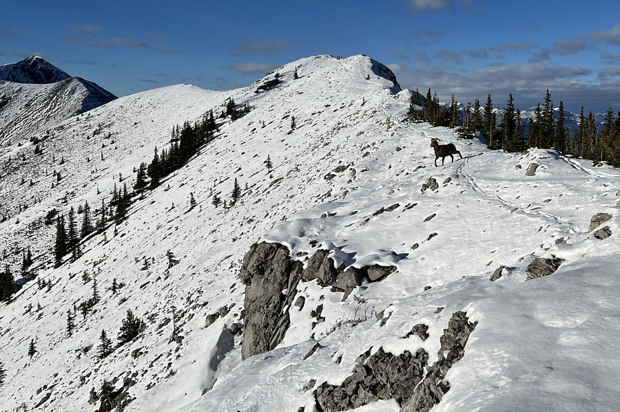
A bighorn sheep prepares to make a detour around some hikers hogging the ridge crest.
Most challenging part of the descent. 
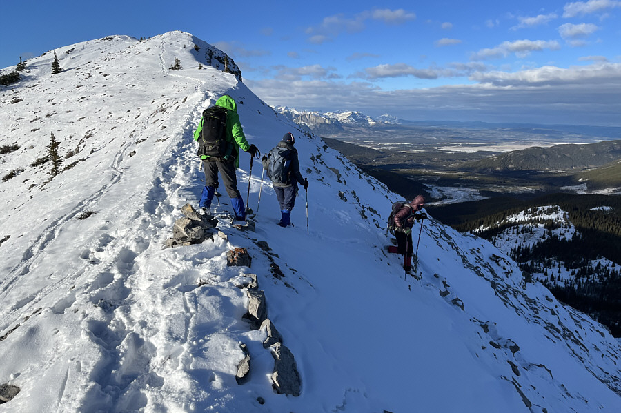
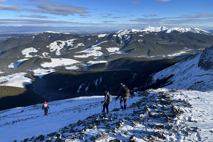
Marcin, Malgosia and Zosia drop off the ridge crest.
The snow was definitely easier on the knees than ankle-breaking rubble. The descent to South Lusk Meadows is steep but surprisingly easy with snow.
Maybe you can even spot that sheep somewhere up there... Here is a final look at Boundary Peak late in the day from the same gap in the trees in the approach valley.
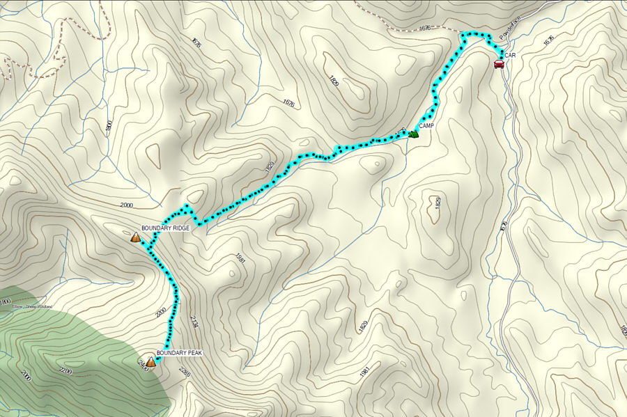
An awesome late-season scramble! Total Distance:  14.0 kilometres
Round-Trip Time:  8 hours 22 minutes
Cumulative Elevation Gain:  792 metres

GPX Data