BOU AVENUE
Rock Point Ridge

With an unsettled weather forecast in the mountains on 15 June 2024, Zosia Zgolak and I opted to ascend a mostly forested unnamed ridge located about 4.8 kilometres west of Prairie Mountain in Alberta's Kananaskis Country Public Land Use Zone.  We got our inspiration for this objective from Bob Spirko who, in turn, got the idea from a map in Gillean Daffern's Kananaskis Country Trail Guide.  The map shows a land feature marked as "Rock Point", but in her text, Daffern only mentions it in passing as a scenic detour from Prairie Creek trail.  Spirko ascended Rock Point a couple of days earlier and continued to a higher forested point which he calls "Rock Point Ridge".  Coincidentally, the Rocky Mountain Ramblers also ascended Rock Point twice in the preceding weeks, but I suspect that they did not bother with Spirko's extension to the true high point viewless as it may be.  As it turned out, Zosia and I would take a slightly different and less scenic ascent route than the one taken by the Ramblers and Spirko, but this was not necessarily a bad thing on this day.

Starting from the Prairie Creek (west) trailhead (50.87880, -114.89042), Zosia and I headed eastward and immediately crossed a wooden bridge spanning a side creek.  We then hiked along the pleasant trail for about 850 metres before crossing an obvious drainage.  Just past the drainage, we abandoned the trail and began grinding up a forested ridge.  Spirko had not yet published his report when we embarked on this trip, and therefore, we were left guessing where he and the Ramblers may have left the trail to begin ascending the ridge.  As we would eventually realize, we completely missed the southeast arm that they had ascended, but with that said, there was not much to dislike about the route we took.  Travel up the south ridge was generally easy, and even when the trees closed in tightly higher up, we were fortunate to find a flagged route that someone had made some effort to keep clear.  Although the trees on the south ridge obscured far-reaching views, they also sheltered us from a bone-chilling wind and the occasional sprinkle of rain.  We actually still garnered some respectable views from a series of rock outcrops along the upper part of the ridge.  Although easily avoidable, these rock outcrops were fun to scramble up and provided a welcome diversion from the monotony of the forest.  The top of the ridge is tree-covered and rather flat making it difficult to ascertain the actual highest point, but a nearby cairn with some limited views of Moose Mountain makes an adequate proxy.

Instead of backtracking for our descent, Zosia and I decided to try and complete a loop by continuing along the ridge to the northwest.  We passed a couple of glades in short order before dropping down forested slopes aiming for a low pass (50.89483, -114.89872).  While descending this section, we encountered some toothpick deadfall and more of the tight trees we hiked through earlier during our ascent.  Unfortunately, we did not have the benefit of a flagged and cleared route this time, and our descent felt slow and tedious.  When we finally reached the low pass, we were surprised to find what looked like an old exploration road.  Unbeknownst to us, we had stumbled onto the official Ford Creek trail which is well-described in Daffern's guidebook.  Aside from a few horse-churned boggy spots, we had few difficulties following this trail southward all the way to Powderface Trail (road; 50.88080, -114.89211).  A short walk along the road brought us back to the Prairie Creek trailhead and completed our loop.
Pretty elaborate bridge for a small marshy creek! 
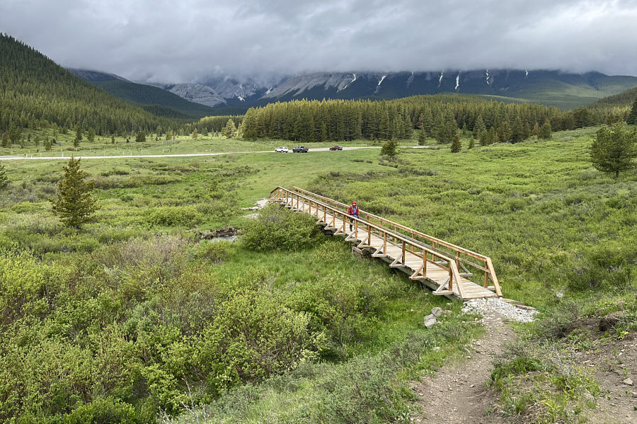
Zosia crosses a bridge near the Prairie Creek (west) trailhead.
Quite beautiful here actually. 
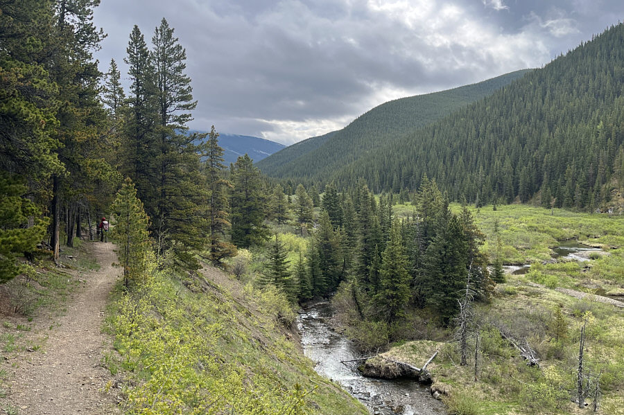
The first part of the hike is along a well-maintained trail beside Prairie Creek.
We're in for a long uphill grind. 
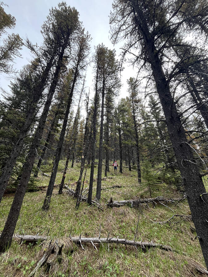
Leaving the trail, Zosia climbs up a forested ridge.
Not for claustrophobes!

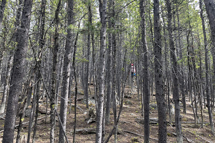
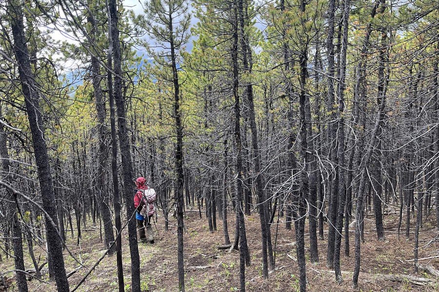
Higher up the ridge, the trees seemingly close in.

Like little oases of interest among a sea of boring trees! 
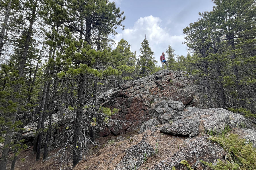
Zosia stands atop the first of a series of rock outcrops along the ridge.
Isn't this great fun? 
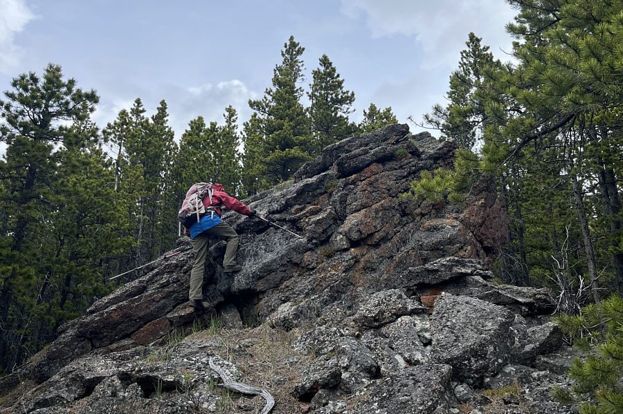
Zosia scrambles up a second rock outcrop.
You can pick how difficult a line you want! 
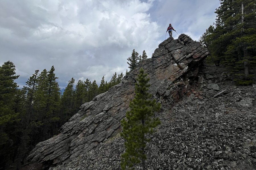
A third rock outcrop is a little more difficult to tackle head-on.  Fortunately, there is an easier route behind the trees at right.
This was also a great spot for a snack break! The third rock outcrop grants an unobstructed view of Nihahi Ridge to the southwest.
That's why this hike is not destined to become a classic! 
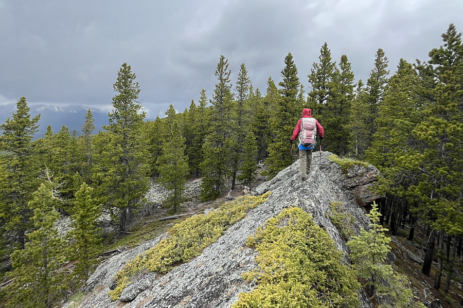
Zosia traverses a final rock outcrop before re-entering forest for the remainder of the ascent.
The least interesting part of the entire hike! 
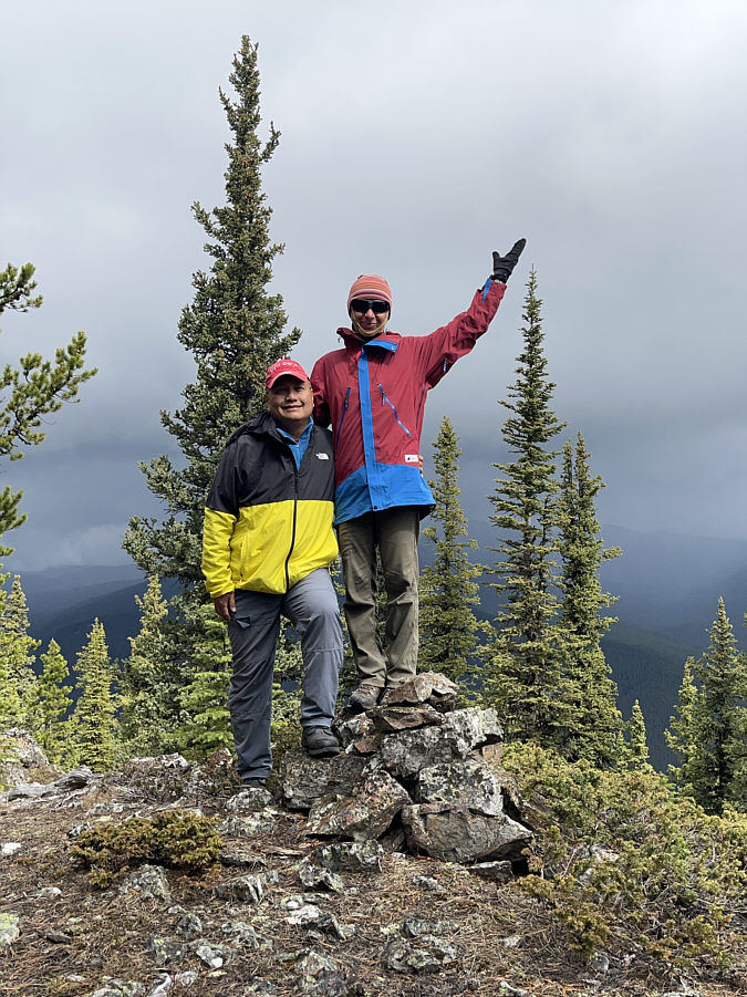
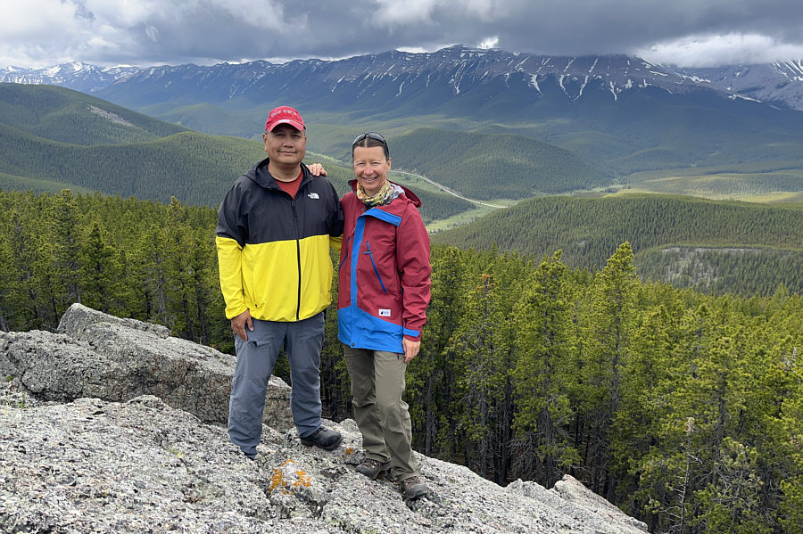
Sonny and Zosia stand on a cairn a short distance from the ill-defined high point of Rock Point Ridge (2091 metres).
Sigh, looks like more rain is on the way! 
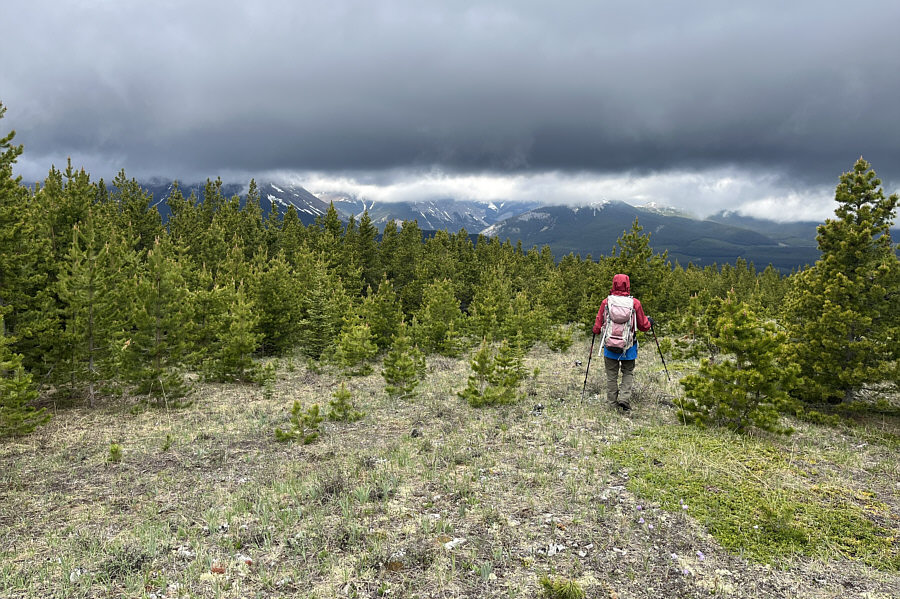
Low clouds obscure all the distant mountains in this view from a glade along the northwest ridge.
Thought these were mostly done by this time of year! 
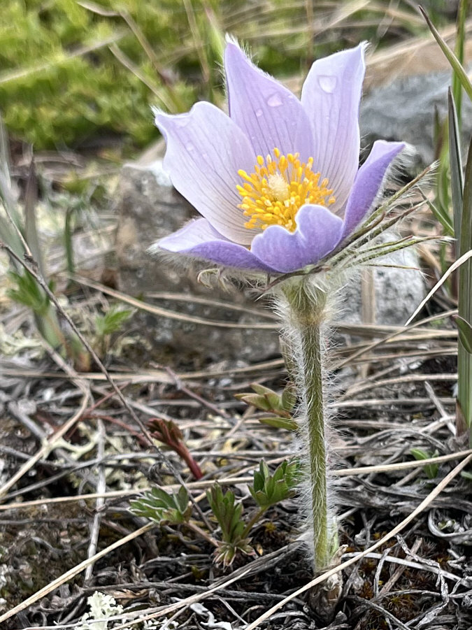
Pasque flowers abound in the glade.
Possibly no other humans have ever set foot here... Descending the west slopes of Rock Point Ridge is a slow and tedious affair.
Beats having to bushwhack and squeeze between trees! 
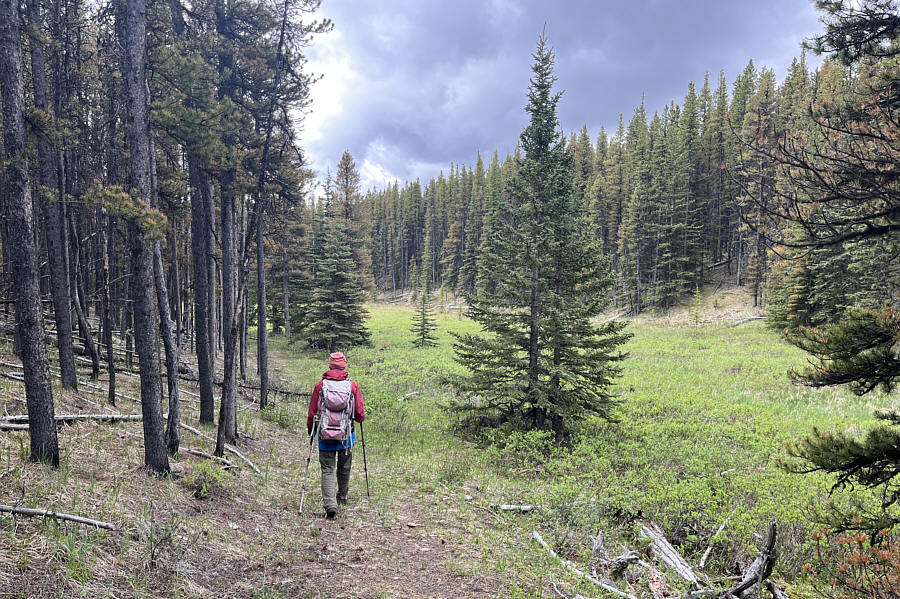
Zosia passes a marshy meadow while hiking out Ford Creek trail.
One for Zosia, and one for me! 
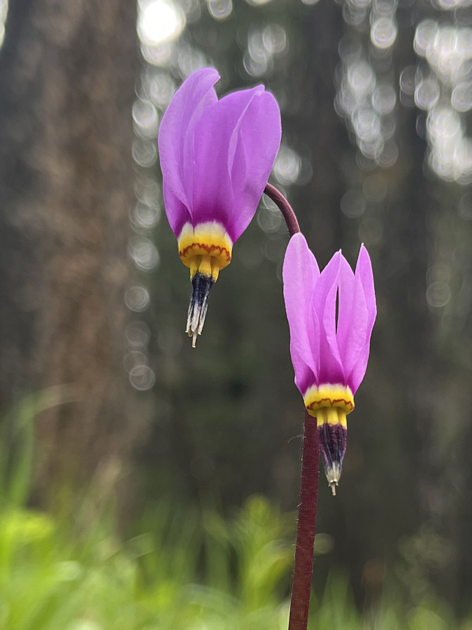
A couple of shooting stars help enrich the pleasant walk along Ford Creek trail.
Watch for speeding motorists! 
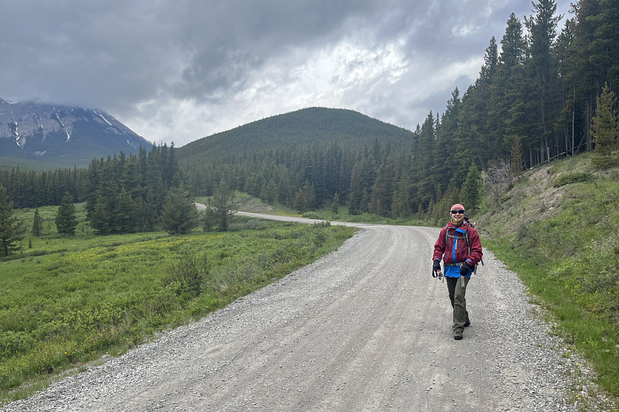
Ford Creek trail pops out onto Powderface Trail (road) just behind Zosia's right shoulder.
Been there, done that. 'Nuff said! 
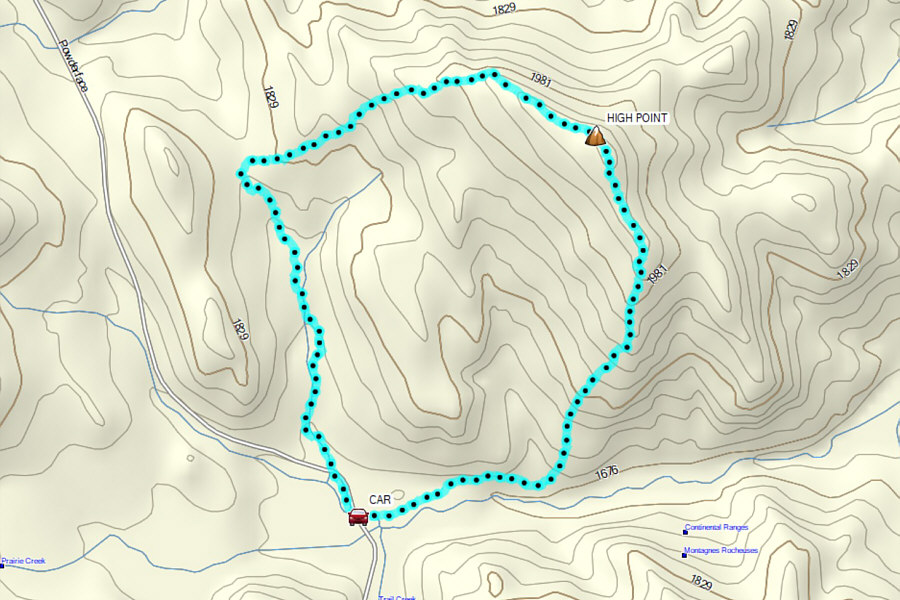
Total Distance:  7.9 kilometres
Round-Trip Time:  4 hours 41 minutes
Cumulative Elevation Gain:  401 metres

GPX Data