BOU AVENUE
Anti-Ghost Ridge

Taking advantage of a great weather forecast on 3 May 2025, Zosia Zgolak and I headed to Alberta's Ghost Public Land Use Zone to hike unofficially-named Anti-Ghost Ridge.  The hike is described in Gillean Daffern's Kananaskis Country Trail Guide, but the overwhelming maze of trails and roads in the area make navigation a challenge even with a good route description in hand.  Joining us for this hike were Asieh Ghodratabadi, Barbara Golya, Ali Shariat, and Aga Sokolowska.

From the village of Waiparous, drive west along Highway 40 for 7.5 kilometres and keep right at the intersection with Richards Road.  In another 160 metres, turn left onto Ghost River Road (2WD gravel).  Drive 16.0 kilometres and park in a large pullout on the right just before the road descends a big hill down into Ghost River valley.  Ghost River Road is generally good for about the first 2.8 kilometres to the Lesueur Ridge trailhead but is then heavily pot-holed for most of the remaining distance to the pullout.  Go slow!

Following Daffern's sketch map of the starting point, Asieh, Barbara, Ali, Aga, Zosia and I initially had no trouble finding our way to the bottom of the so-called "Motocross Hill" near the lower south end of the ridge.  In retrospect, we should have scrambled straight up the steep and loose dirt track here, but instead, we tried to find a more gentle ascent route, as promised by Daffern, which winds around further to the east.  Unfortunately, we had a difficult time reconciling her route description with the numerous trails and landmarks we encountered, and as a result, we wasted a significant amount of time and energy muddling about in this area.  Ultimately, we abandoned trying to find Daffern’s route and simply side-hill bashed our way across the southeast flanks of the ridge until we intersected the upper part of Motocross Hill.  We picked up a well-worn trail here and followed it uphill until we reached a split near the base of some cliffs guarding the upper ridge.  Turning left, we followed the trail along the base of the cliffs and eventually stopped for a break under a very impressive rock wall.  When we resumed hiking, we turned a corner near the end of the cliffs and climbed up simple terrain which led us easily to the high point of Anti-Ghost Ridge.

After taking an extended break on the high point, our group traversed to a subsidiary bump to the northwest.  From there, we descended into a gully separating Anti-Ghost Ridge from what Daffern describes as Black Rock Nubs--essentially the eastern outliers of Black Rock Mountain.  Had we not wasted so much time and energy on the east side of Anti-Ghost Ridge, we might have considered extending our hike to the Nubs, but given the lateness of the day and growing weariness among the group, we simply turned left and dropped down the gully.  We had some more route-finding issues here trying to find the trail heading back south along the western flank of Anti-Ghost Ridge, but even after we found it, we were dismayed by how much the trail undulates—a sure sign that it was designed for dirt bikers and not hikers.  Despite countless annoying uphill sections on the way back to the pullout, we at least had a trail to follow mindlessly.  The only remaining stressor was the long bumpy drive out Ghost River Road.
Maybe Ali wants to climb Devils Head! 
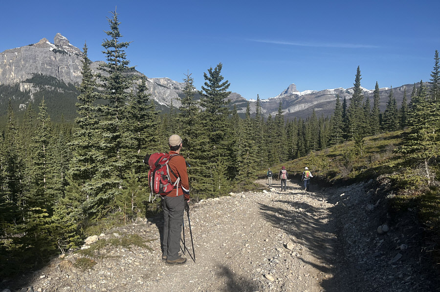
At the start of the hike, Ali looks toward the striking form of Devils Head in the distance.  Also visible at far left is Phantom Crag.
Who knew that it would take us another 4 hours before we got to the top of the ridge! Visible straight ahead is Anti-Ghost Ridge.
 

These women have been here before!

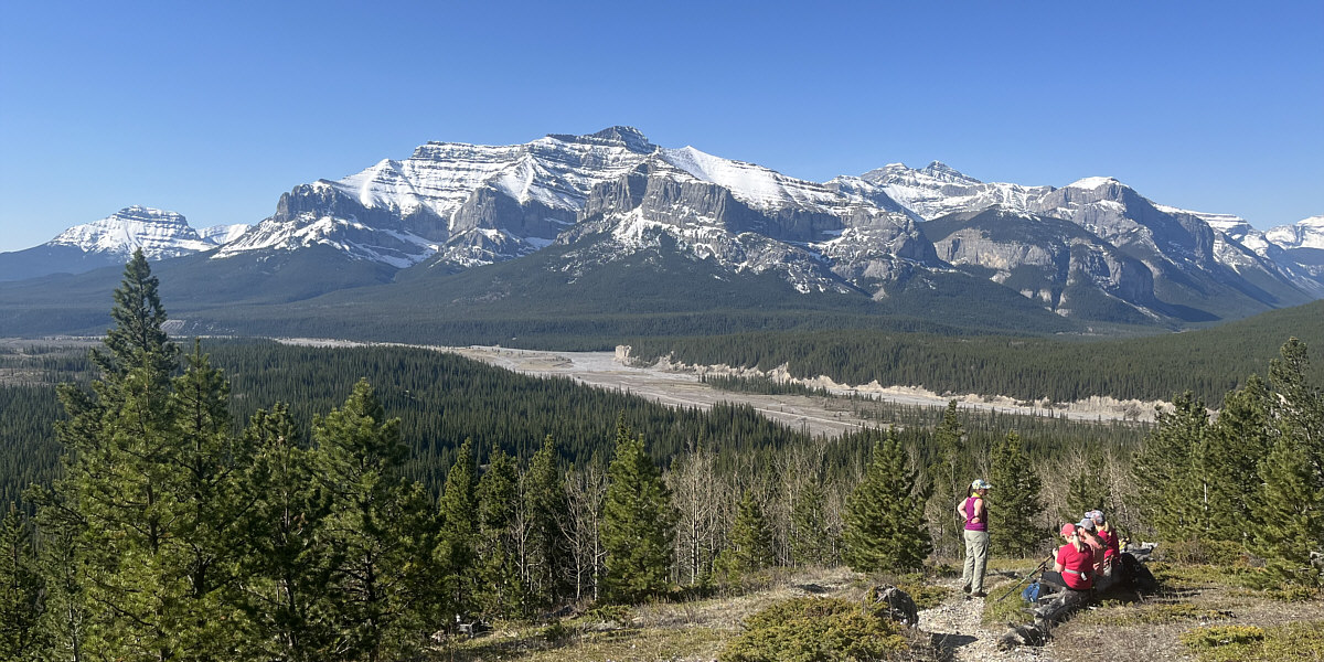
Across the valley, Orient Point (centre) looks brilliant in the morning sun.


We should've gone straight up here! 
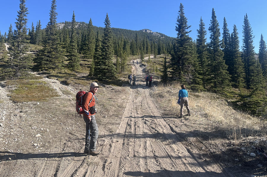
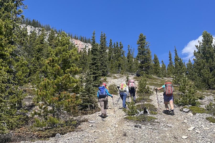
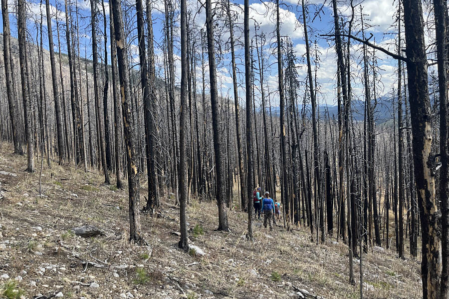
Barbara, Ali, Asieh and Zosia hike past the bottom of "Motocross Hill".
Don't come this way!

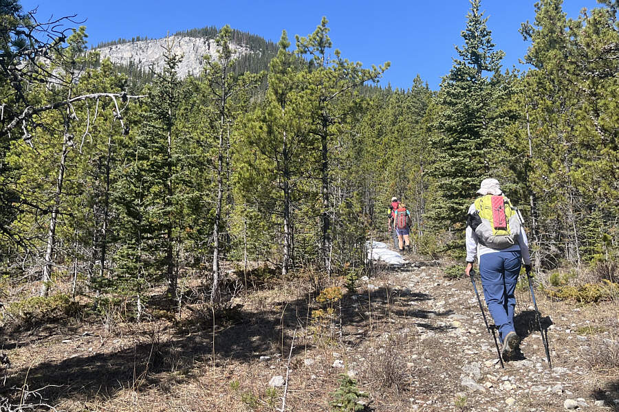
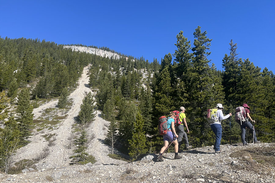
The group hikes up a promising-looking trail on the east side of Anti-Ghost Ridge, but this is not the way to the top.

Not bad, but we can do better! 
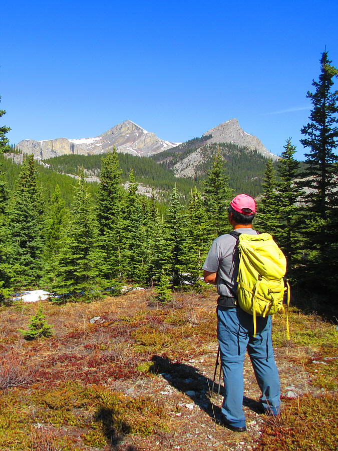
Sonny reaches a clearing on the east side of Anti-Ghost Ridge with views of Black Rock Mountain and Black Rock Nubs.

Photo courtesy of Zosia Zgolak

Maybe we should just order a pizza... 
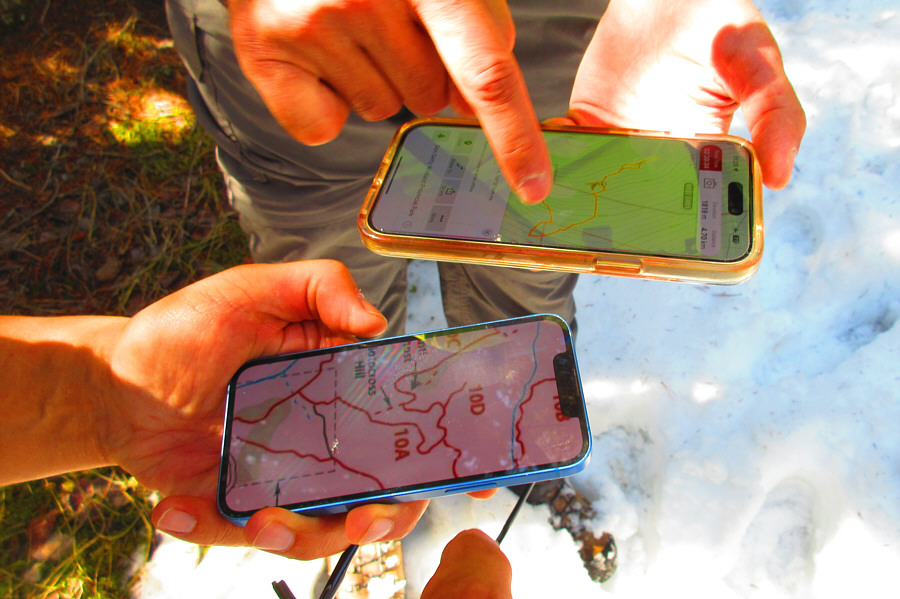
Sonny and Ali consult their phones to try and figure out which way to go.

Photo courtesy of Zosia Zgolak

Some pretty miserable hiking here! 
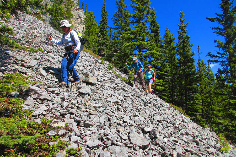
Asieh, Aga and Barbara side-hill bash across a steep rubble slope.

Photo courtesy of Zosia Zgolak

We should've been here 2 hours ago! The group finally gets back on track at the upper end of Motocross Hill.
Time for a much-needed break! 
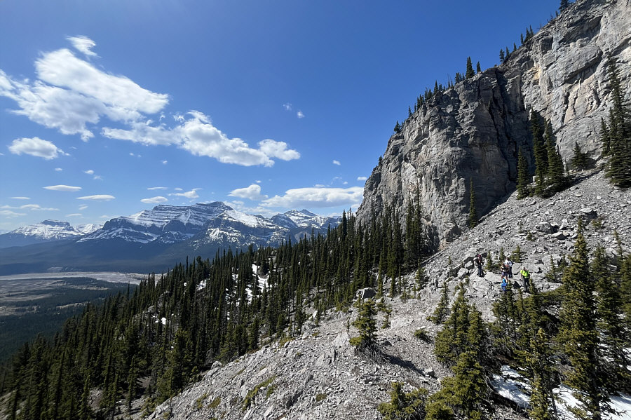
The group arrives at the base of an impressive rock wall.
This is the way! 
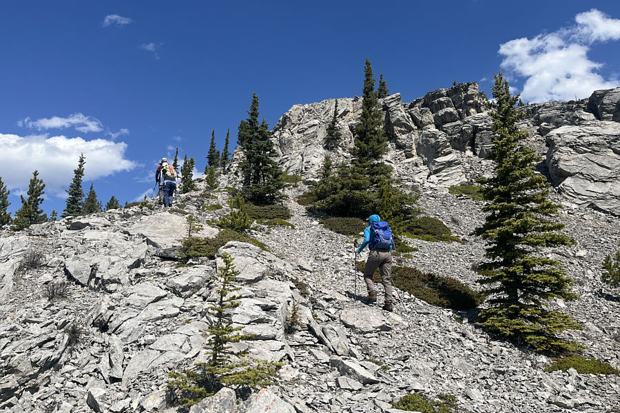
The cliffs begin to peter out on the west side of the ridge allowing easy access to the top.
Easy street! 
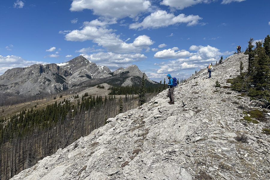
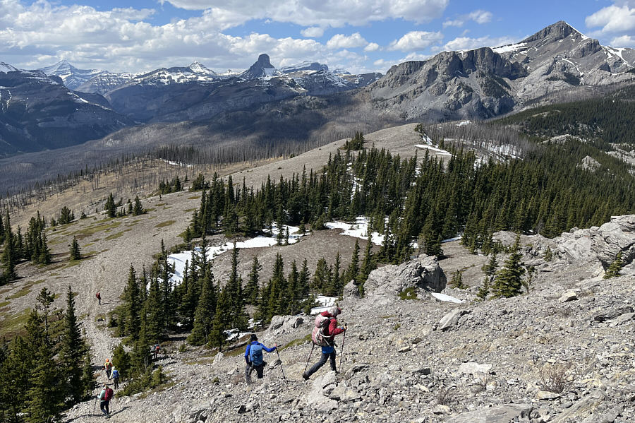
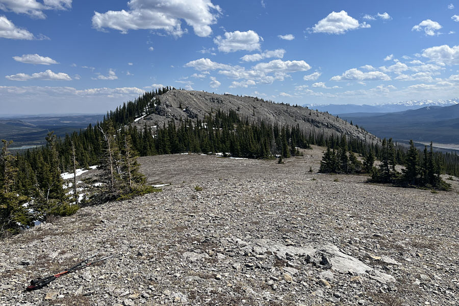
The remainder of the hike to the top of Anti-Ghost Ridge is straightforward.
Yeah, we finally made it! 
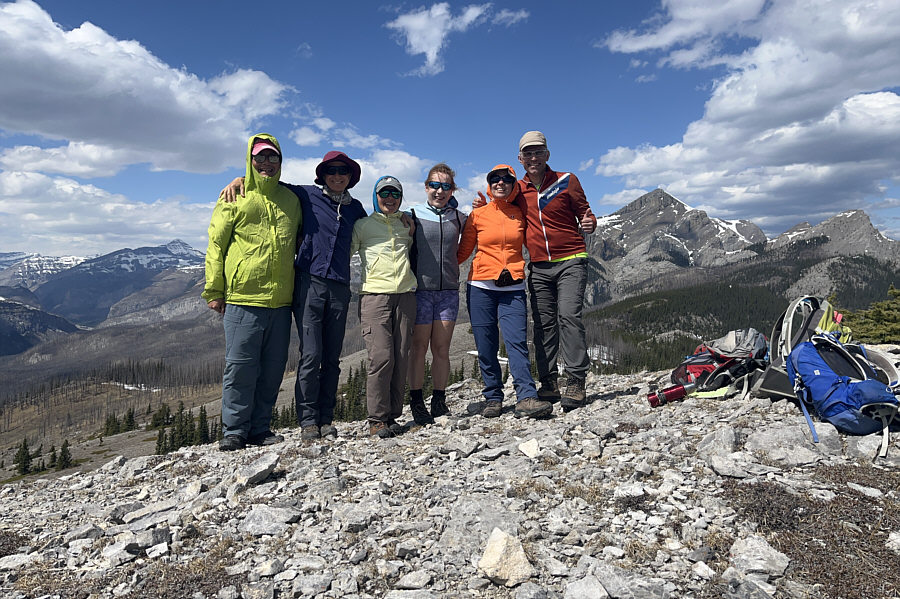
Sonny, Zosia, Aga, Barbara, Asieh and Ali stand on the high point of Anti-Ghost Ridge (1999 metres).
How many mountains are called "Saddle" in this world? 
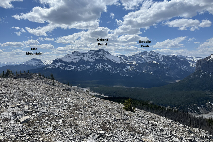
Here is the view to the south from the high point.
 

Too bad we can't see Lake Minnewanka from here!

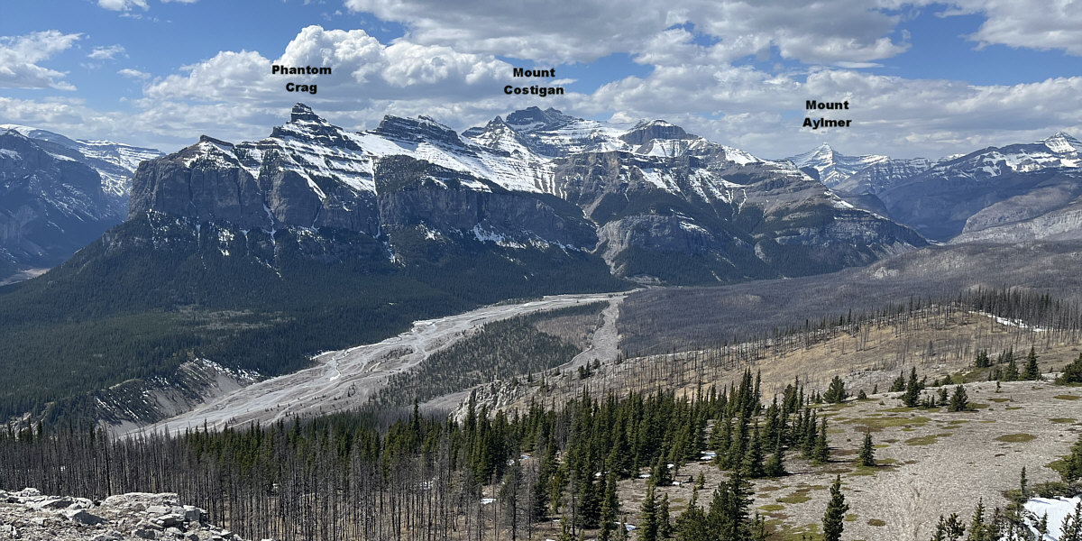
An impressive array of peaks line the Ghost River valley to the west.


Nice to explore further, but we shoulda gone back to the Motocross Hill! The group descends from the high point en route to a subsidiary bump to the north (right of centre).  Devils Head stands out like a sore thumb on the horizon.
Definitely not the place for a big group! 
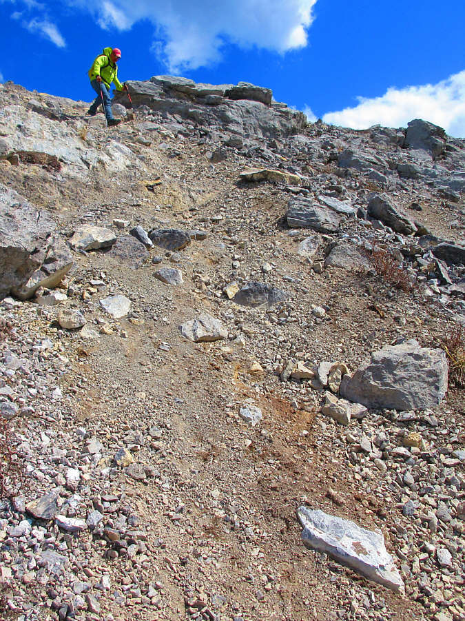
Sonny cautiously descends a loose and eroded slope below the high point.

Photo courtesy of Zosia Zgolak

Just like the photo in the guidebook! Here is a look back at the high point of Anti-Ghost Ridge from the subsidiary bump to the north.
 

We will be back for the Nubs...maybe next year!

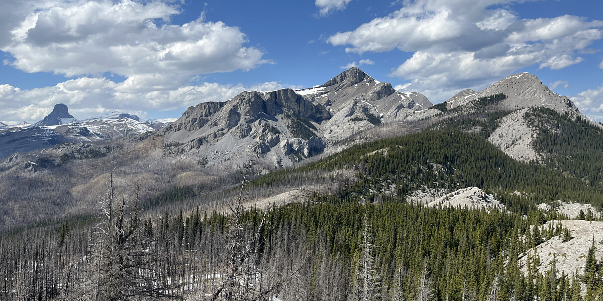
Here is one more closer look at Devils Head, Black Rock Mountain and Black Rock Nubs.


Never coming this way again! The return along the west side of Anti-Ghost Ridge is fraught with a lot of route-finding challenges.
A really great objective especially if you can find the most efficient route up and down. 
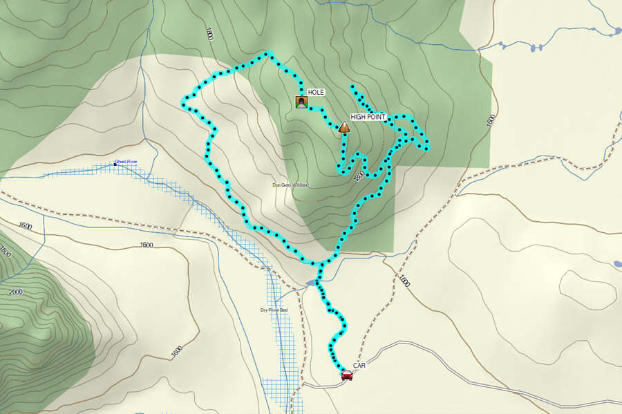
Total Distance:  12.9 kilometres
Round-Trip Time:  8 hours
Cumulative Elevation Gain:  528 metres

GPX Data