


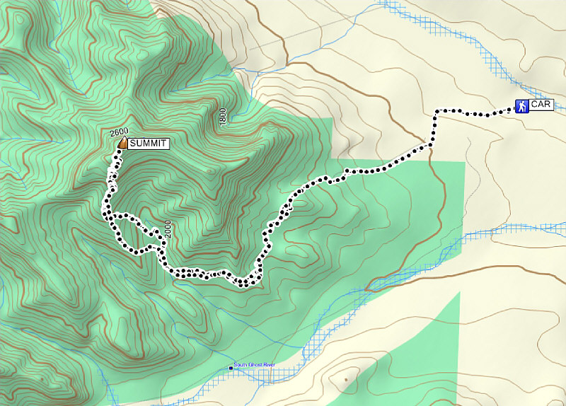
Total Distance: 20+ kilometres
Round-Trip Time: 10 hours 56 minutes
Net Elevation Gain: 1176 metres
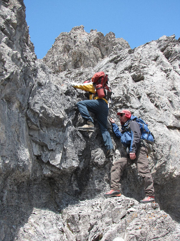
The approach trail for Orient Point was markedly drier, and we had a much easier time getting some distance and elevation under our feet. We followed the trail up and down over a couple of ridges before abandoning it to contour around the south side of the mountain. After a lengthy and tedious sidehill bash, we arrived at the access drainage directly south of the summit and had our first clear look at the upper mountain. We had some difficulty reconciling Vizbar's route description with what we could see, but we hiked up the drainage anyway hoping that everything would sort itself out once we got higher. Under clearing skies, we subsequently muddled our way up climber's left to a ridge that looked promising as an easy route to the summit. That illusion was shattered when we gained the crest of the ridge only to find an assortment of cliffs and other complicated terrain guarding the summit. Still convinced that we were on the right track, we continued to the base of a chimney where the ridge begins to get steep and exposed. There was much procrastination here, but after Raff climbed the chimney to scout the route ahead, the rest of us followed him up to find ever increasing difficulties. Liz turned around just before a crumbly knife-edge, and just beyond that, Al, Raff and I encountered the crux of the route--a three-metre wall with uncomfortably small holds. I believe this is where Vizbar turned around on his aborted first attempt (he used a slightly different route on his successful second attempt). All three of us were confident about climbing up the crux, but we were less certain about downclimbing it. Ironically, Al had brought along a rope for our short-lived attempt on Mount Costigan only to leave it behind in his car when we changed objectives. In retrospect, the crux is more awkward than exposed, and had it been necessary, I figured that we would only have had to leap down at most maybe 2 metres! After some more procrastination, Raff and Al both finally dropped their packs and climbed up the crux without too much problem. I followed suit but kept my pack on mostly because I had no other way to safely carry my bulky camera.
Above the crux, I was disheartened to see that there was still a great deal of steep scree bashing left before the summit ridge. Al and Raff were already far ahead of me, and though I had no hope of catching up to them, I was determined at this point to complete the remainder of the ascent. After a lengthy grovel up treadmill scree, I reached the summit ridge and saw Raff at the top while Al was already descending. I gave Al a thumbs up as he passed me in a hurry to rejoin Liz down below. Raff hung around to congratulate me at the summit, and we both snapped a boatload of photographs before starting our descent. Just as Raff and I were about to drop down a scree slope from the summit ridge, we were surprised to see Al still descending the same slope not far below us! Raff and I later learned that Al had taken a wrong turn and had to backtrack when he encountered some unfamiliar and impassable cliffs. All three of us separated a bit as we descended the scree in order to minimize rockfall hazard. At the crux, the downclimb was not as difficult as we had anticipated, and Al built up a pile of rocks at the base which made stepping down even easier. We soon rejoined Liz at the base of the chimney, and after a short break, we resumed our descent of the ridge and eventually worked our way down into the access drainage. A second round of tedious sidehill bashing ensued as we retraced our steps around the south side of Orient Point, but otherwise, the rest of our return trip was uneventful.
An incredible post script to this trip is that, while I was hobbling around stiff and sore the following day, Raff was back in the mountains 'enjoying' an 18-hour climb up Mount Louis. That guy is a machine!
Be sure to check out Raff's photos from Orient Point
here.
|
|
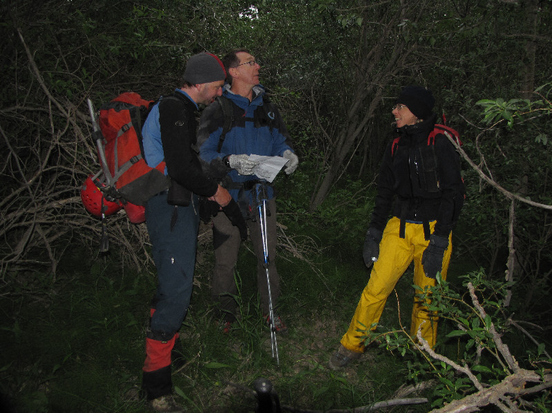
Raff, Al and Liz contemplate aborting the attempt on Mount Costigan. |
|
|
After rebooting, Al and Liz lead the way on the trail toward Orient Point. |
|
|
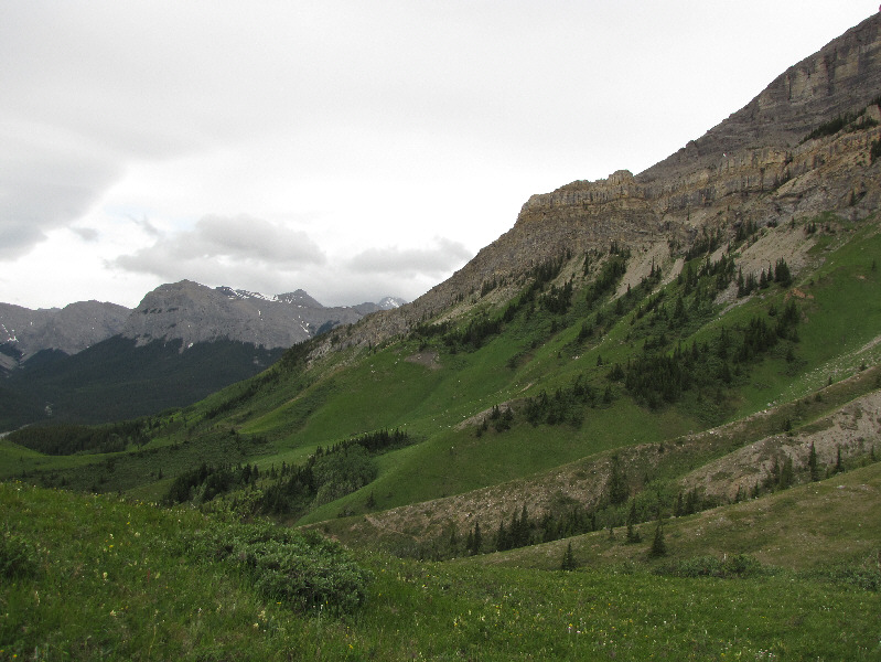
The southeastern slopes of Orient Peak are surprisingly scenic. |
|
|
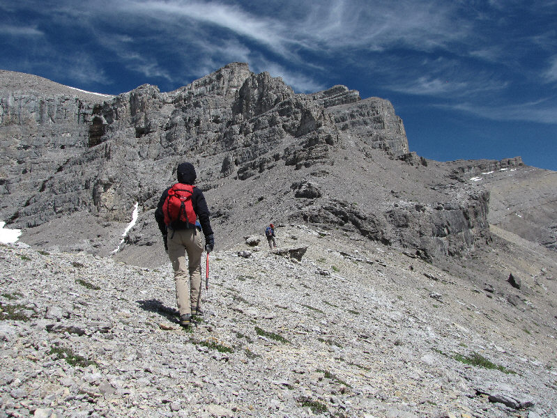
Al, Liz and Raff follow a trail which climbs over the ridge ahead. In the distance is End Mountain. |
|
|
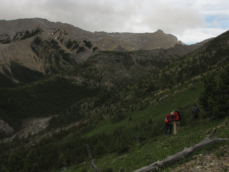
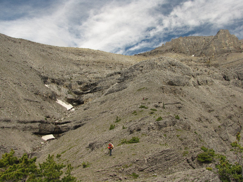
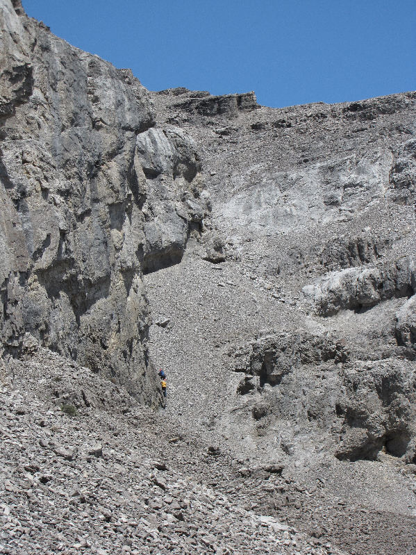
Raff, Liz and Al continue their sidehill bash around the south side of Orient Point. The access drainage is visible at lower left. |
|
|
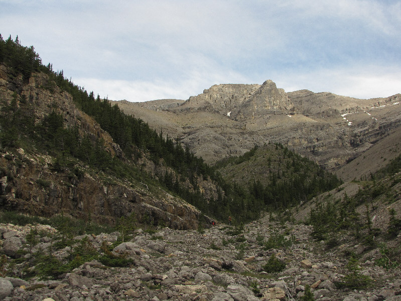
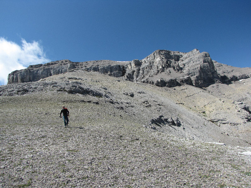
The upper mountain is visible at the head of the access drainage. |
|
|
Raff scrambles up an easy rock band. |
|
|
The ridge that Raff is on splits the access drainage. He would eventually work his way onto the left skyline. |
|
|
Liz approaches the cliff bands guarding the south side of Orient Point. |
|
|
Raff makes his way up the chimney at the start of the difficulties. |
|
|
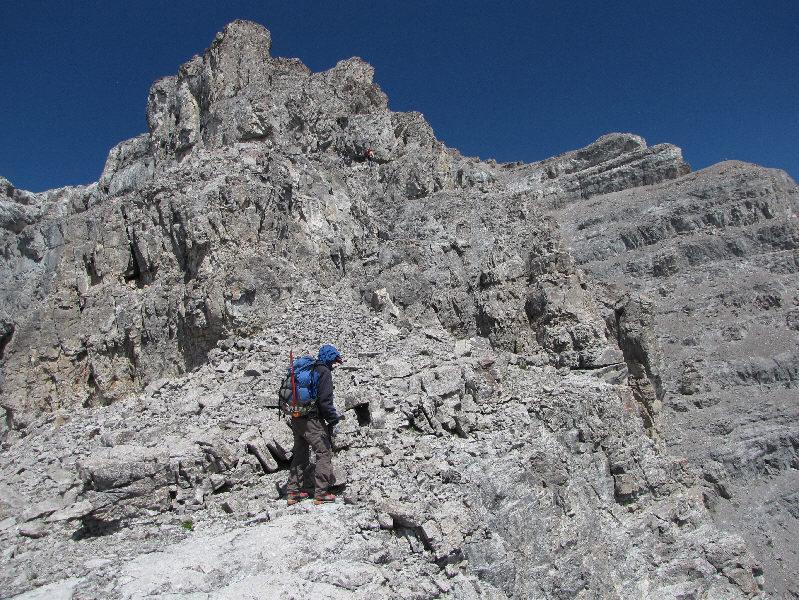
Al looks back down the route he just climbed. Raff, barely visible in the distance, is sizing up the crux. |
|
|
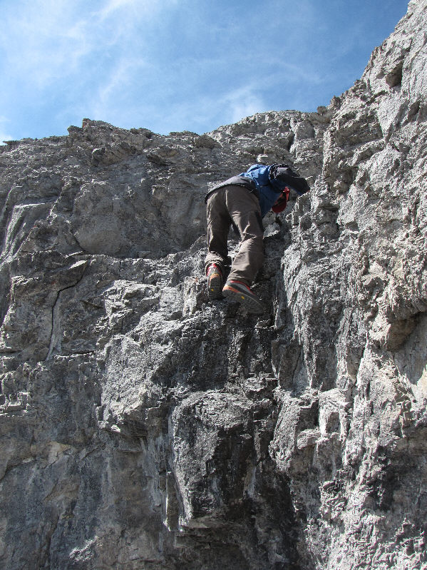
Raff tests the holds on the crux while Al backs him up in case of a slip. |
|
|
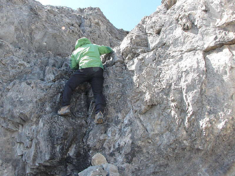
Al climbs up the crux. |
|
|
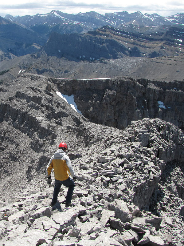
Beyond the crux, there is still an awful lot of scree bashing before the summit. |
|
|
The summit of Orient Point is finally within sight. |
|
|
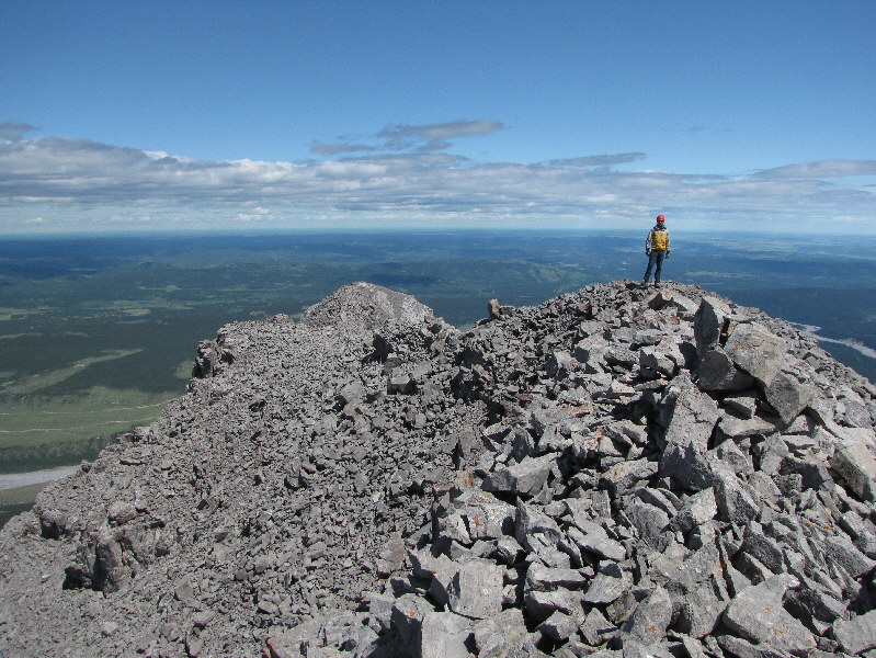
Sonny makes it to the 2664-metre summit of Orient Point. |
|
|
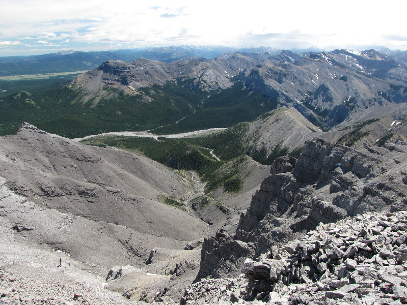
This is looking south toward the access drainage and the South Ghost River. |
|
|
Saddle Peak dominates the view to the southwest. |
|
|
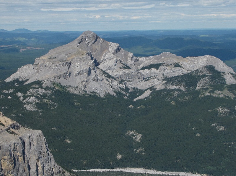
To the northwest, Mount Aylmer peeks over the shoulder of hulking Mount Costigan. |
|
|
This is a more expansive view to the northwest. At bottom centre is the easternmost of the Ghost Lakes |
|
|
The most eye-catching mountain to the northwest is Devils Head. |
|
|
Phantom Crag to the north has a less distinguishing profile. |
|
|
Black Rock Mountain sits alone further north. |
|
|
Here is the view to the east. |
|
|
Raff descends the summit ridge. |
|
|
Sonny downclimbs the crux. Note the rocks that Al piled up at the bottom. |
|
|
Raff continues his descent along an airy part of the ridge. |
|
|
This is also a tricky section to descend. |
|
|
Raff and Al (right) rejoin Liz (centre) below the chimney and take a break. |
|
|
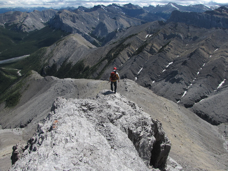
Raff descends the broad south ridge. |
|
|
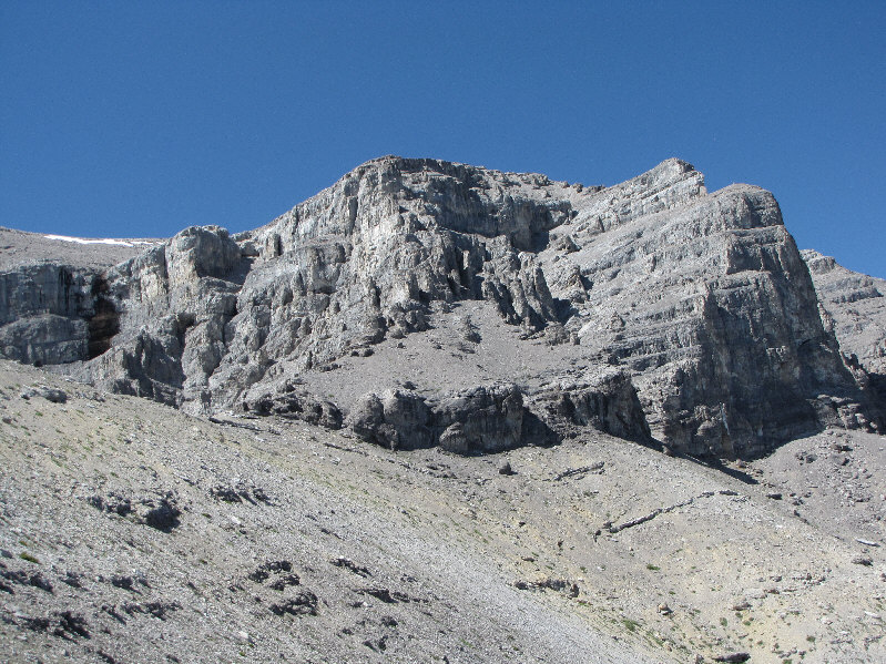
Here is a last look at the complex south face of Orient Point. |
|
|
Raff catches a ride on Al's jeep across the inundated road. |
|
|
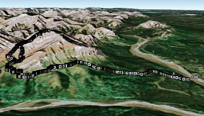
This is the route as viewed in Google Earth. |
|
|
Total Distance: 20+ kilometres |