BOU AVENUE
Mount Faith
Zosia Zgolak and I returned to British
Columbia's Gladstone Provincial Park on 30 June 2025 to ascend Mount
Faith, one of only two officially-named summits within the park.
The other is Mount
Gladstone which we climbed in 2020. Mount Faith also happens to
be the highest point in the park as well as the highest peak in the
Christina Range of the Monashee Mountains. The official park
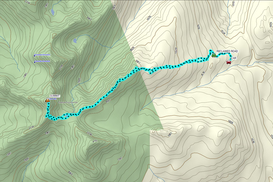
map shows a trail--called "Mt Faith Trail"--that starts from Lynch
Creek to the southwest and approaches the mountain via Morrell Creek, but
this is a very long approach along a horse trail that likely requires an
overnight camp. Fortunately, there is a shorter approach via Mount
Faith's east ridge which was first documented by Eliane and Steven Miros
in the
May/June 2006 issue of Kootenay Mountaineer, the official
newsletter of The
Kootenay Mountaineering Club. A refinement of their route was
subsequently published by Kim Kratky in the
November/December 2006 issue. To be honest, I initially got all
the route details and GPS tracks from the handful of recent trip reports
in
peakbagger.com, but all of them followed the same route pioneered by
the Miros couple and Kratky.
From Highway 3, turn north onto Paulson Detour Road 20 kilometres west
of the junction with Highway 3B or 30 kilometres east of the junction
with Highway 395. Follow the paved road for 2.6 kilometres to a
5-way junction. The Columbia & Western (C&W) Rail Trail--part of
the Trans-Canada Trail--passes through here, and there is a large pullout
with an information kiosk next to the section of trail heading north.
Drive north on the C&W Rail Trail (good 2WD gravel) for 6.7 kilometres
and veer left at a split (drive cautiously as the C&W Trail is very
popular with cyclists). Drive another 10.0 kilometres and make a
sharp left turn onto another 2WD gravel road. Ignore all uninviting
side roads and drive 4.5 kilometres to the first of four major junctions
along this road. Stay left here and drive another 1.2 kilometres to
a second junction. Keep straight (right) and drive 1.6 kilometres
to a third junction. Keep straight (right) again and drive another
350 metres to the final junction (49.37269, -118.19827) with a
significantly rougher road branching off to the left. Park here
(about 27 kilometres in total from Highway 3). A vehicle with high clearance and 4WD capability could probably
continue up the rough road, but saving about 600 metres (one-way) of
walking and 70 metres of elevation gain hardly justifies the extra
punishment on the vehicle.
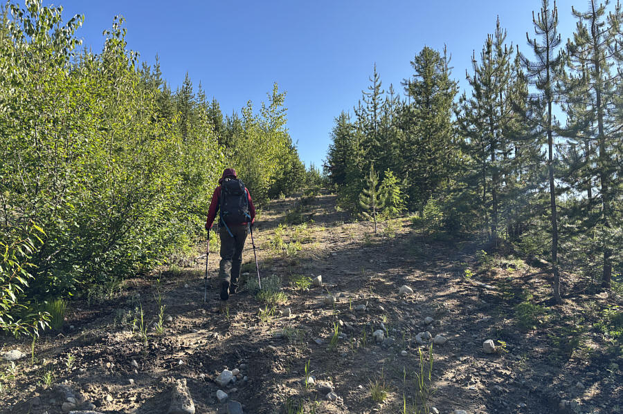
From the final junction, Zosia and I easily
marched up the rough road to where a downed log effectively blocks
further access for most normal vehicles. Even without the log, it
would be pretty difficult for a vehicle to continue further because the
road is almost completely reclaimed by alders past this point. We
could still follow remnants of the road by pushing through the
vegetation, but I was feeling disheartened by the fact that we were
already bushwhacking even before going "off-trail" or gaining much
elevation. After advancing another 375 metres past the log, we
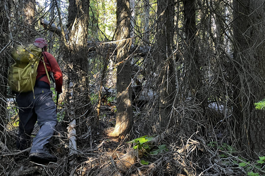
abandoned the road and simply headed uphill into forest. For the
next 70 minutes, we muddled our way through typical British Columbia bush
ranging anywhere from acceptably annoying to utterly odious. Adding
to our misery were relentless mosquitoes and the fact that we were both
suffering from different illnesses which sapped much of our energy.
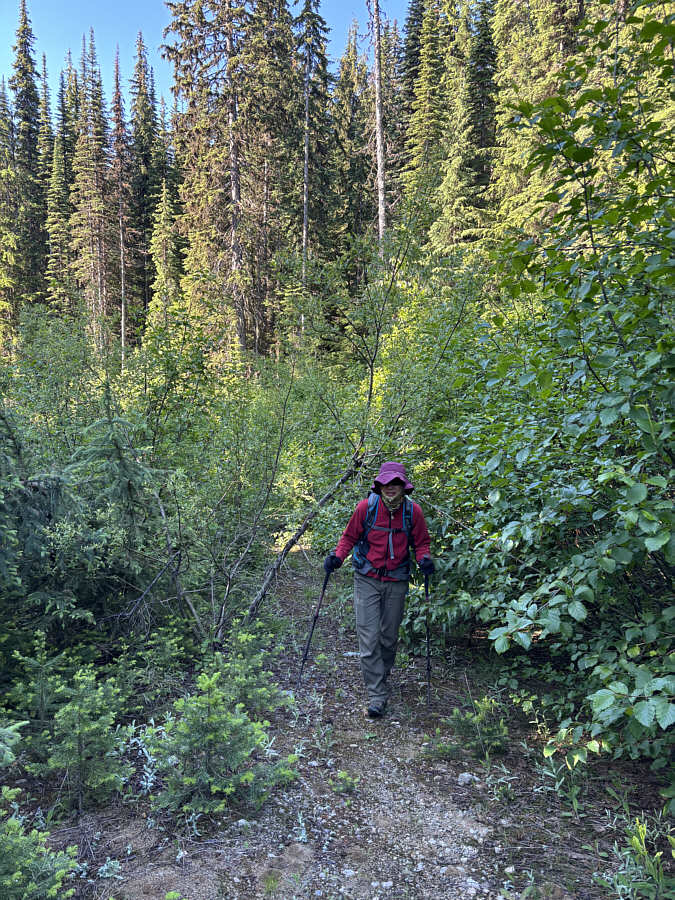
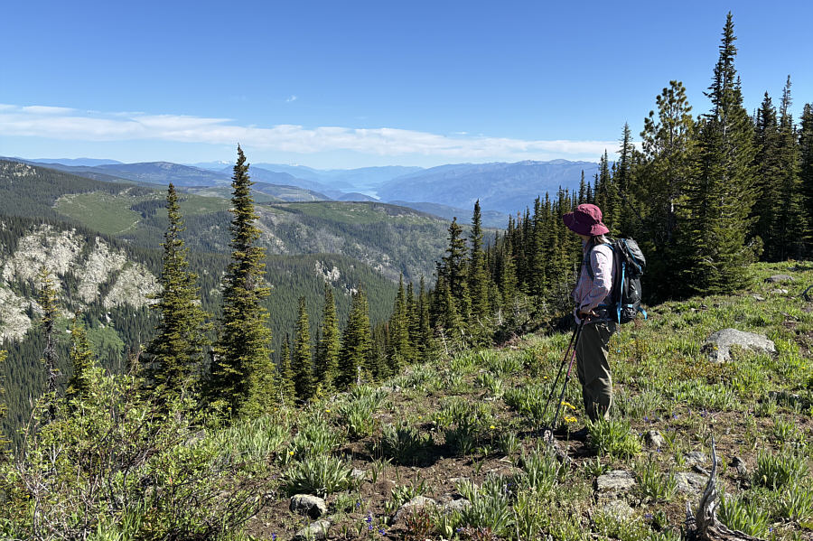
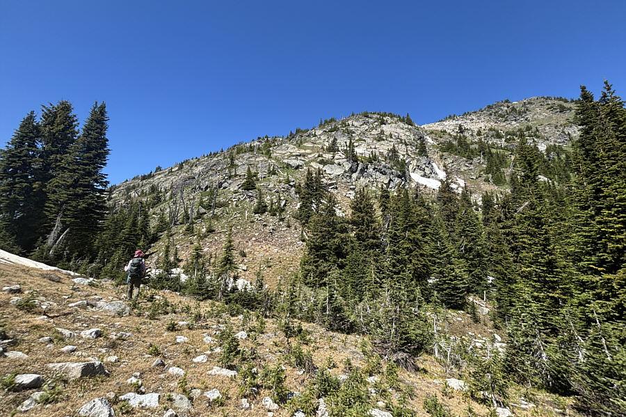
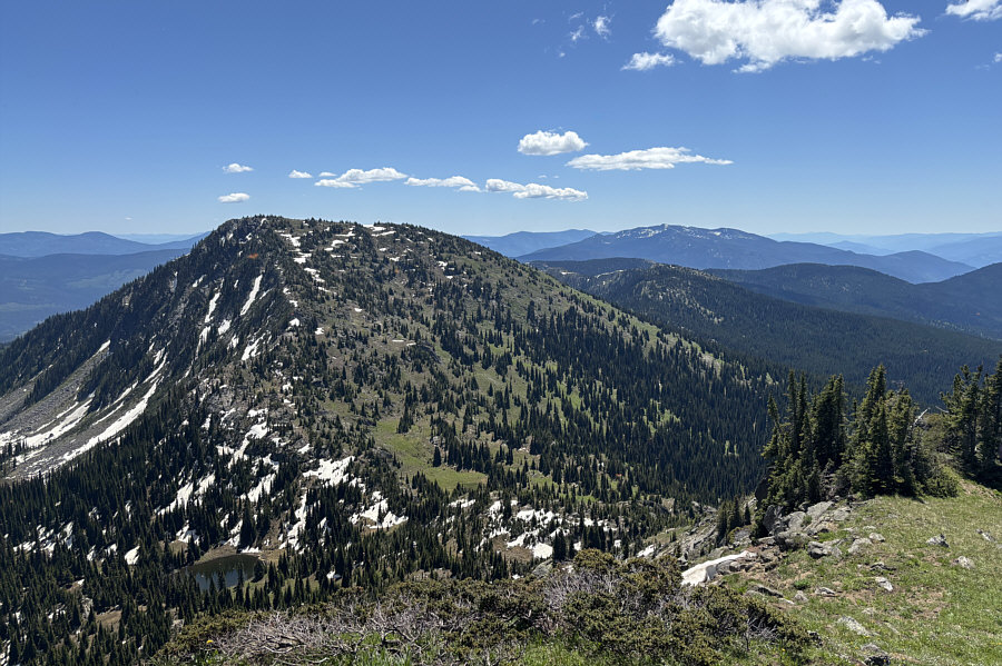
Somehow, we eventually stumbled out of the forest onto the east ridge of
Mount Faith, and we made better progress here with more open terrain.
The ridge still undulates a fair amount, and although this normally would
not have been a big deal for us, the extra ups and downs felt more
wearisome than usual since we were both physically operating at less than 100
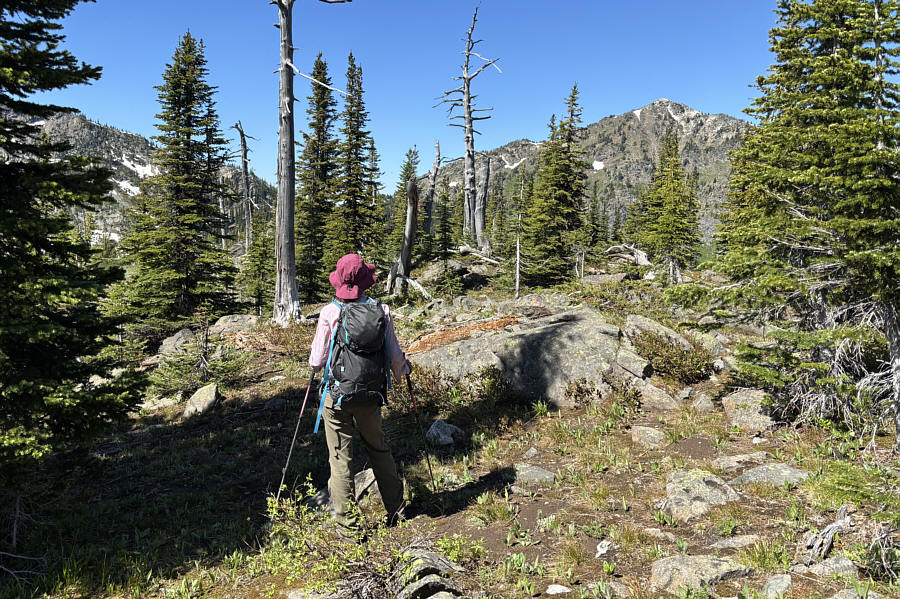
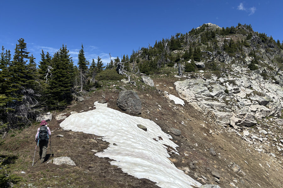
percent. After rambling for about two kilometres along the ridge,
we briefly re-entered forest and encountered some lingering snow patches
before reaching a small tarn. Fortunately, the snow was still
generally supportive and did not hinder our progress. The
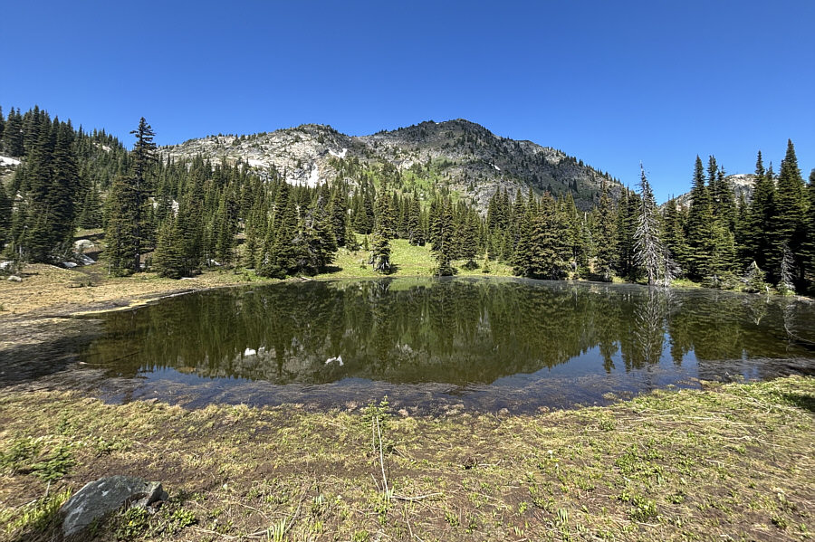
tarn--nicknamed "Cowpaddy Lake" by the Miros couple--is little more than a
forgettable snowmelt puddle, but its outlet creek provides an opportunity
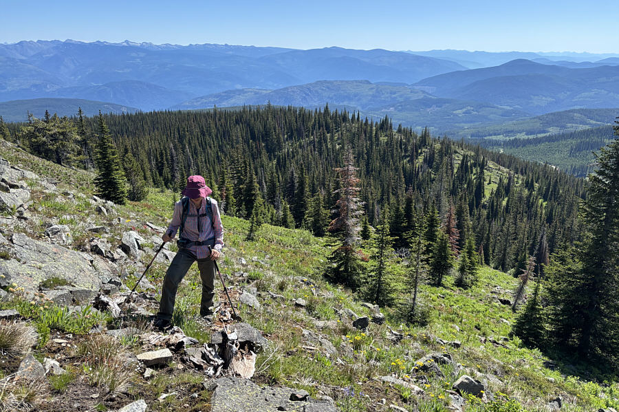
to replenish water bottles. Beyond Cowpaddy Lake, we climbed up
semi-open terrain to a narrow col separating Mount Faith from its
southeastern outlier. We stumbled onto a trail here, presumably the
same one that originates from Lynch Creek.
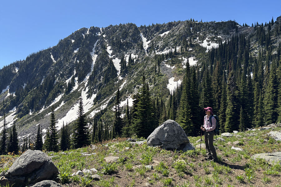
Unfortunately, the trail was of little use to us as we soon began
scrambling up steep slopes below Mount Faith's south ridge. Some
route-finding is necessary to avoid more technical terrain, and veering
to climber's left seemed to work best for us. The angle of the
slope relaxed significantly once we gained the crest of the south ridge,
and the remainder of the ascent was straightforward.
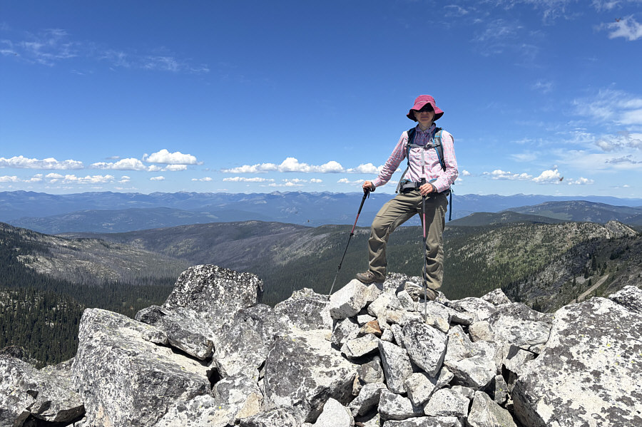
When Zosia and I reached the summit, we were
astonished to see swarms of ladybugs everywhere both on the rocks and
flying through the air. We had seen large aggregations of ladybugs
before on many other summits; they apparently gather to mate and enhance
their collective survival. However, what we witnessed on Mount
Faith was several orders of magnitude bigger than any ladybug gathering
we had ever seen before, and the flying swarms were definitely something
new to us. It was impossible to step anywhere around the summit
without crushing many ladybugs, and some of them responded by biting
us--another first. Perhaps it was appropriate that Mount Faith
would provide us with something of biblical proportions, and the
ladybugs proved to be overwhelming for us mere mortals. We
paused on the summit only long enough to snap a few requisite photographs
before retreating down the south ridge. Only when the clouds of
ladybugs finally dissipated did we stop to take a short break.
When we resumed hiking, Zosia and I
essentially backtracked the way we came with a few minor route
variations. As expected, climbing back over every undulation along
the east ridge was tiresome, but knowing that we were on our way out
somehow made each bump easier to surmount. Although I was dreading
the bushwhack at the end of the ridge, descending is always easier than
ascending, and our route-finding was also more efficient on the way down.
As a result, it only took us about 37 minutes to drop from tree line to
the reclaimed road. Following a final thrash along the road to the
downed log, we enjoyed a gloriously unencumbered stroll back to our
parked car to wrap up a physically-challenging day for us.
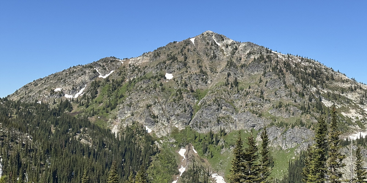
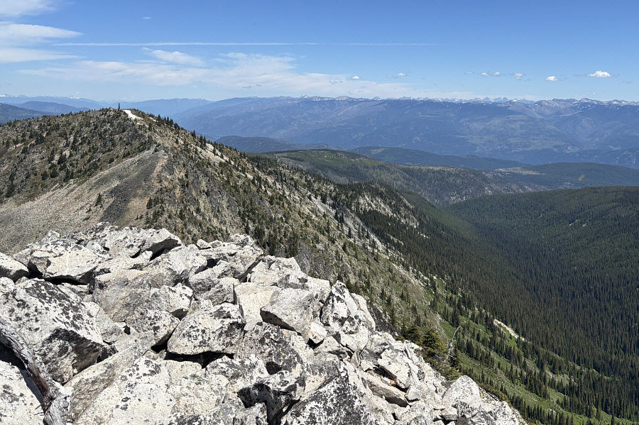
Here is an unobstructed view of Mount Faith.