|
|
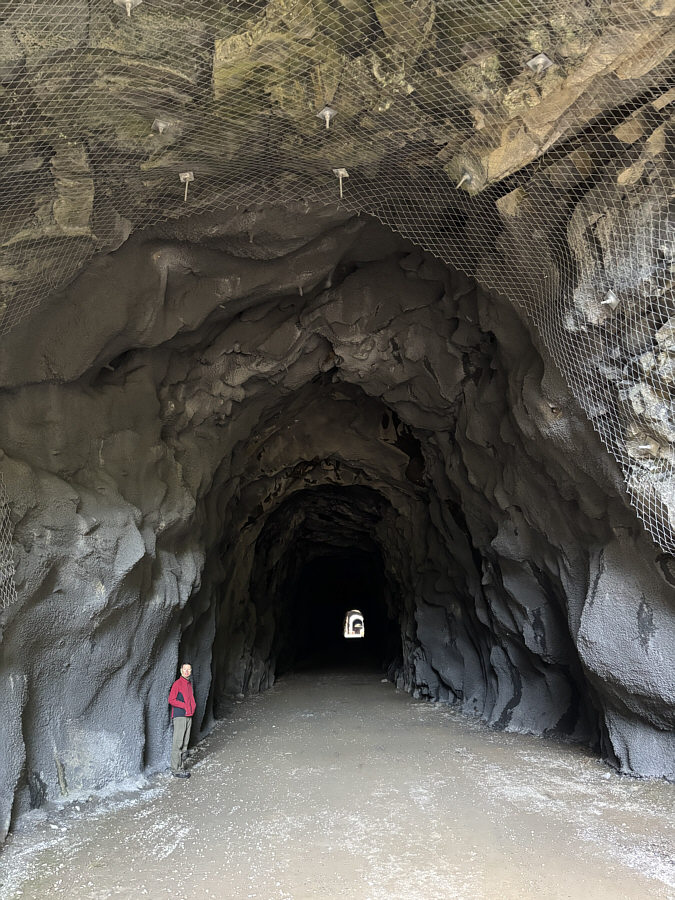
At the entrance to the first of the Othello Tunnels, Zosia takes note of the modern reinforcements to the tunnel walls and ceiling. |
|
|
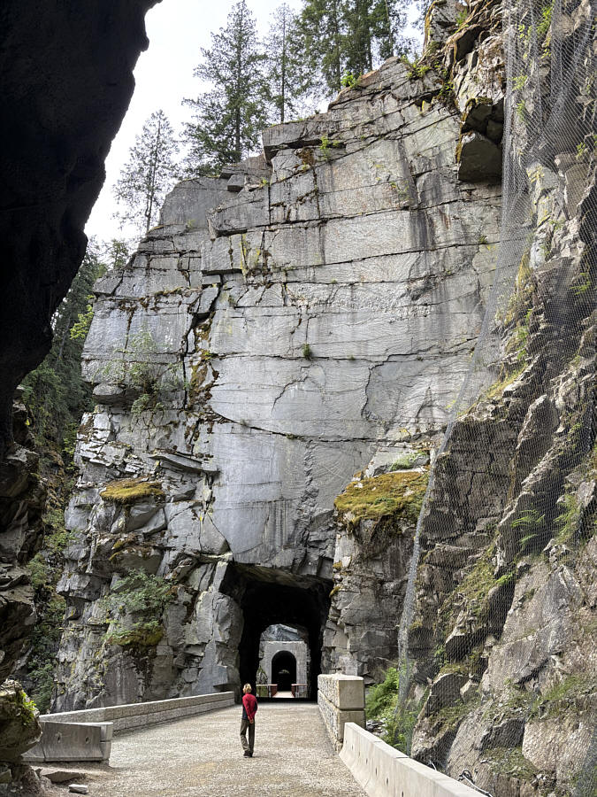
Beyond the first tunnel, Zosia arrives below the cliff face that was featured in the 1982 movie, "First Blood", starring Sylvester Stallone. In the movie, Stallone's character, John Rambo, leaps off this cliff face while trying to evade gunfire from a vengeful policeman. |
|
|
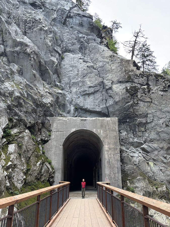
On this day, the third tunnel is closed off at the far end due to ongoing construction. |
|
|
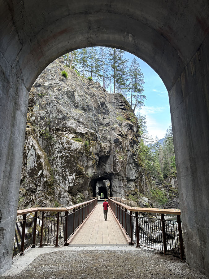
This is looking back at the first two tunnels from the entrance to the third tunnel. |
Despite it being a weekday, Raptors Knoll was already fairly busy when Zosia and I arrived, but we did not have to wait long to start our round. Most holes have three separate tee boxes to accommodate players with different skill levels, and the course turned out to be quite challenging for both of us even as we played from the easiest tees. Volunteers were working that day to prepare the course for a big weekend tournament, and because the tournament layout would be slightly different, some of the hole numbers were changed which created a lot of confusion for us as we tried to follow the normal layout in my phone's disc golfing application (UDisc). Furthermore, many of the tournament competitors showed up to try and get in a practice round, and because the tournament starting hole would be the same as the normal 18th hole, we ran into a surprising logjam of people there as we were trying to finish our round. Overall, the course was maybe a little too challenging for us--we each managed a birdie plus a handful of pars but floundered with double bogeys or worse on multiple holes--but perhaps this was partially due to our unfamiliarity with the layout. It would be interesting to see if our scores would improve after playing a few more rounds here, and I am willing to try whenever we pass this way again in the future.
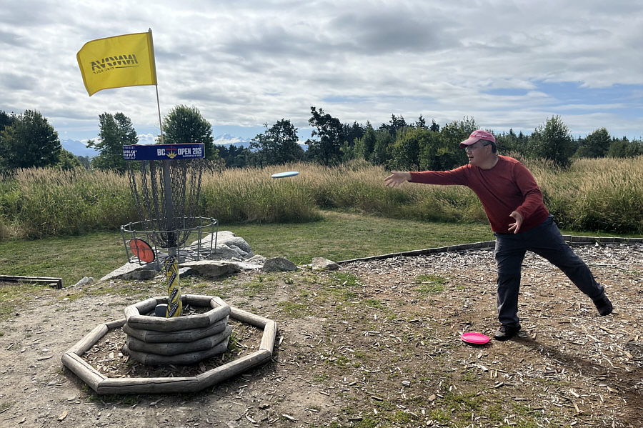 |
Sonny makes his bogey putt on Hole 8, the signature hole of Raptors Knoll Disc Golf Park. Visible through the trees in the background is Mount Baker (US). |
Zosia and I started with McKee Peak which is the closest to Abbotsford at the west end of Sumas Mountain. There are multiple access points for McKee Peak, but we chose the one at the corner of Westview Boulevard and Applewood Drive (49.06616, -122.23079) since there is ample free parking here along the streets. The maze of mountain biking trails here can be confusing to navigate, but with the help of my phone's GPS map, we basically tried to head eastward and uphill as much as we could. Inevitably, we intersected an access road which led us without fuss to a surprising glade, and shortly after, we arrived at the viewless summit topped with a fenced building.
With little reason to linger, Zosia and I promptly started our descent by following a different trail down from the summit, but this trail simply ended up at the same glade we ascended earlier. From there, we uneventfully retraced our steps back to the trailhead.
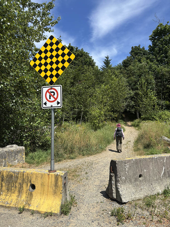 |
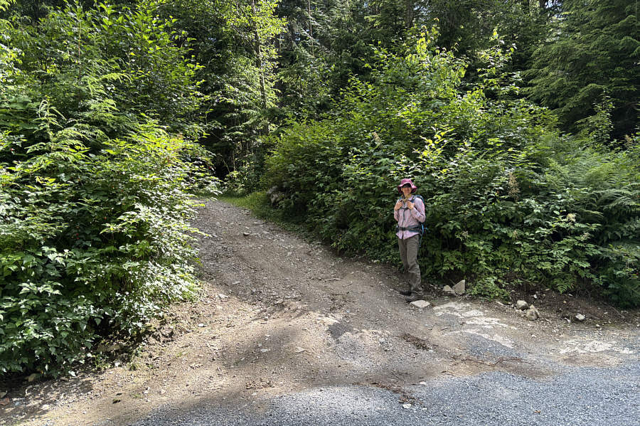
Zosia begins her hike up McKee Peak past these barricades at the corner of Westview Boulevard and Applewood Drive in Abbotsford. |
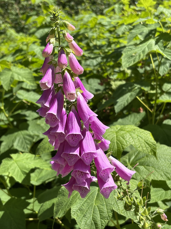 |
Foxgloves thrive throughout Sumas Mountain. |
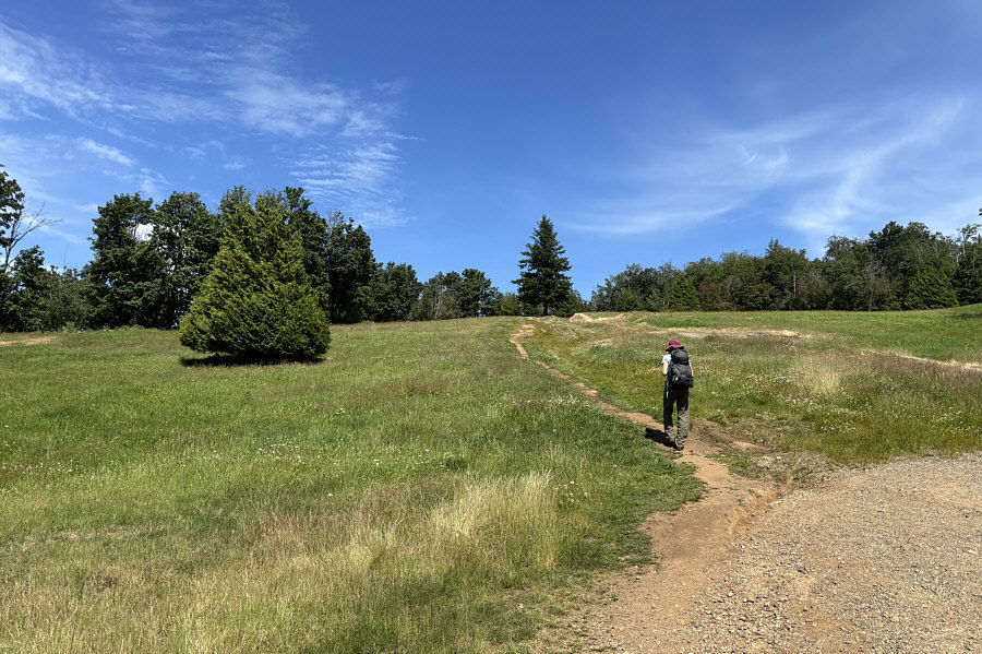 |
Zosia enters what appears to be a man-made glade not far from the top of McKee Peak. |
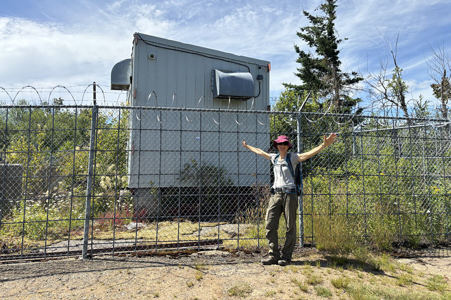 |
Zosia stands on the summit of McKee Peak (462 metres) beside a fenced building. |
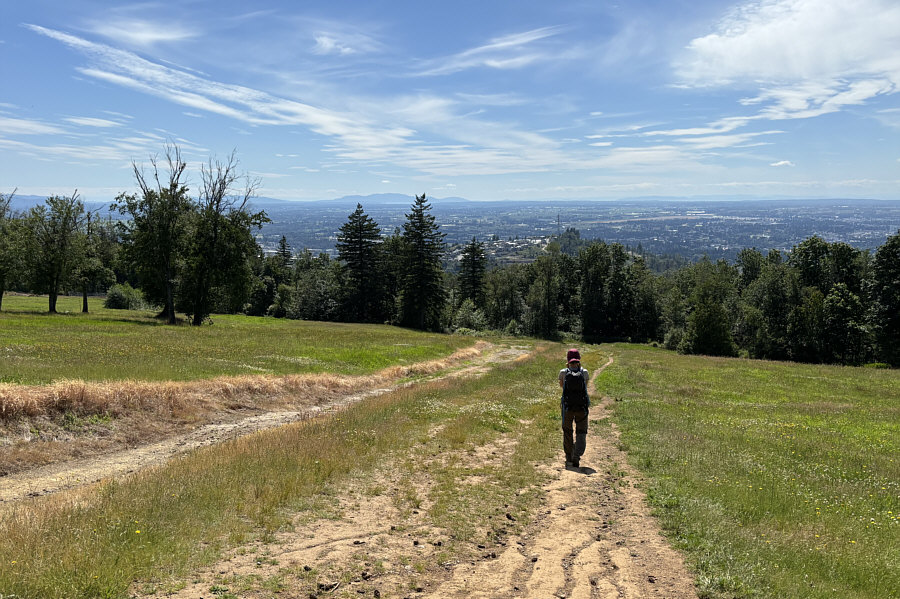 |
On the hike out, Zosia descends the glade with views of Abbotsford to the west. |
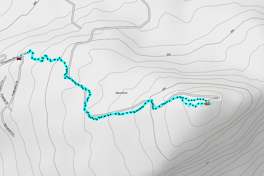 |
Total Distance: 4.0 kilometres Round-Trip Time: 1 hour 31 minutes Cumulative Elevation Gain: 187 metres |
Probably the easiest access from Abbotsford is to drive eastward along McKee Road past Ledgeview Golf Course to a T-intersection with Sumas Mountain Road. Turn left and drive 1.1 kilometres to the intersection with Dawson Road. Go straight and drive another 2.7 kilometres before turning right onto Batt Road. Drive 1.1 kilometres and turn right onto Taggart Road (road sign is spelled, "Taggert"). Drive 550 metres to a gate which is apparently closed daily between sunset and 7 AM. Taggart Road becomes Sumas Mountain Forest Service Road (2WD gravel) at this point. Drive another 280 metres and pass Sumas Mountain Staging Area (toilet available) on the right. Following signs for "Sumas Mountain" and ignoring all side roads, continue driving for 3.8 kilometres to a junction with a side road branching off to the right. This is the access road for Taggart Peak. Park here without blocking the main road.
Following the access road, Zosia and I walked about 200 metres before passing a locked gate. We then continued along the remainder of the winding road all the way to summit without difficulty. Like McKee Peak, the top of Taggart Peak is occupied by a fenced building as well as an antenna. The summit is open enough to allow a glimpse of nearby Sumas Peak and not much else. Many hikers ascend Taggart Peak via a trail from the valley bottom (nearly sea level), and this is known locally as the "Abby Grind" which entails an elevation gain of about 770 metres. Since descending this trail would leave us far from our parked car, we opted to simply return the same way.
 |
This is the start of an access road that branches off Sumas Mountain Forest Service Road and leads to the top of Taggart Peak. |
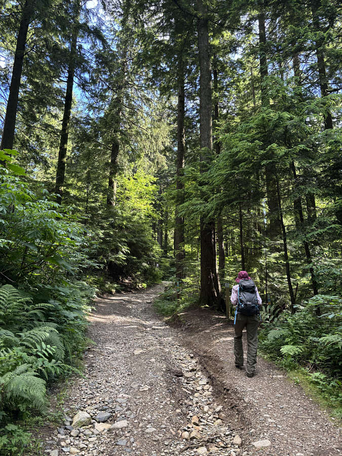 |
The road climbs steadily but is easy to walk. |
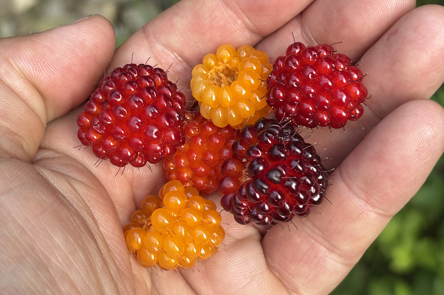 |
Salmonberries are plentiful throughout Sumas Mountain, and although edible, they taste rather bland compared to raspberries or blackberries. |
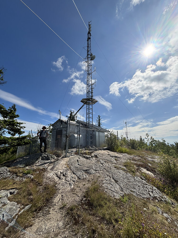 |
Zosia stands on the summit of Taggart Peak (794 metres) beside another fenced building. |
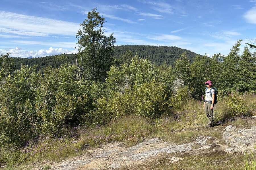 |
The top of Taggart Peak is open just enough to allow a view of Sumas Peak to the northeast. |
 |
Total Distance: 2.1 kilometres Round-Trip Time: 40 minutes Cumulative Elevation Gain: 100 metres |
For our return, Zosia and I retraced our steps past the gazetted summit, and then we bypassed the true summit on another mountain bike trail before reconnecting with the road. We stuck to the road for the remainder of the walk back to the parking lot. On our drive out, we had tentative plans to spend the night at the staging area near the beginning of the unpaved road, but surprisingly heavy traffic and crowds there prompted us to move on and find a quieter place to camp.
 |
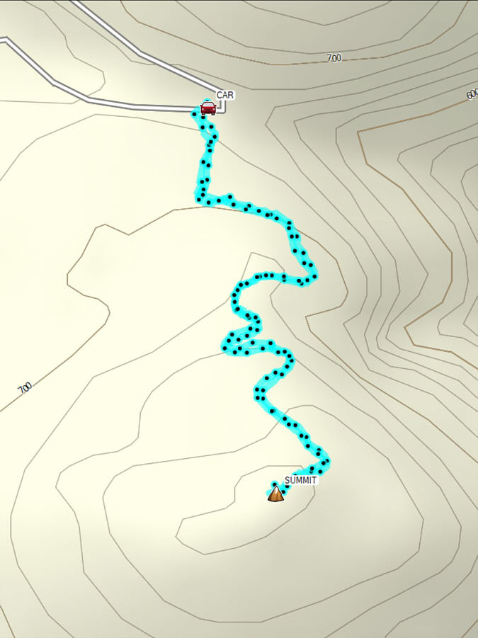
Zosia begins hiking up Sumas Peak from a parking lot about 500 metres short of a locked gate. |
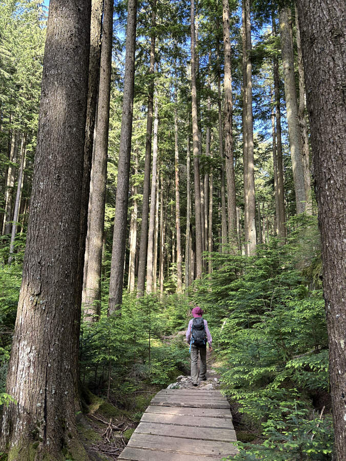 |
After walking along the continuation of the road for about a kilometre, Zosia takes a short cut along a mountain bike trail. |
 |
This first viewpoint is near the gazetted summit of Sumas Peak (902 metres), but the true summit of Sumas Mountain (910 metres) is about 285 metres to the west on a viewless hump next to a communications antenna. |
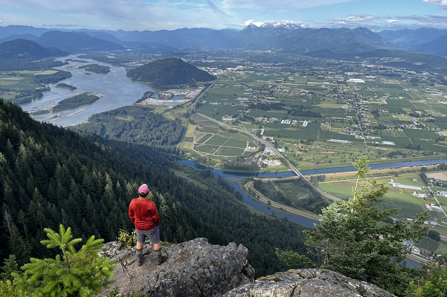 |
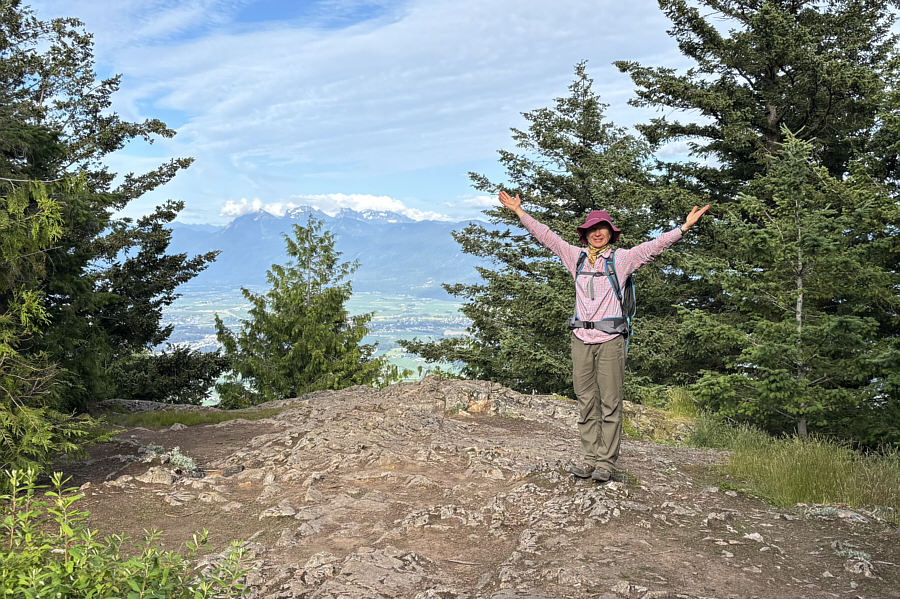
Sonny stands at a second viewpoint with
commanding views to the east of Fraser River (left) and the city of Chilliwack. Photo courtesy of Zosia Zgolak |
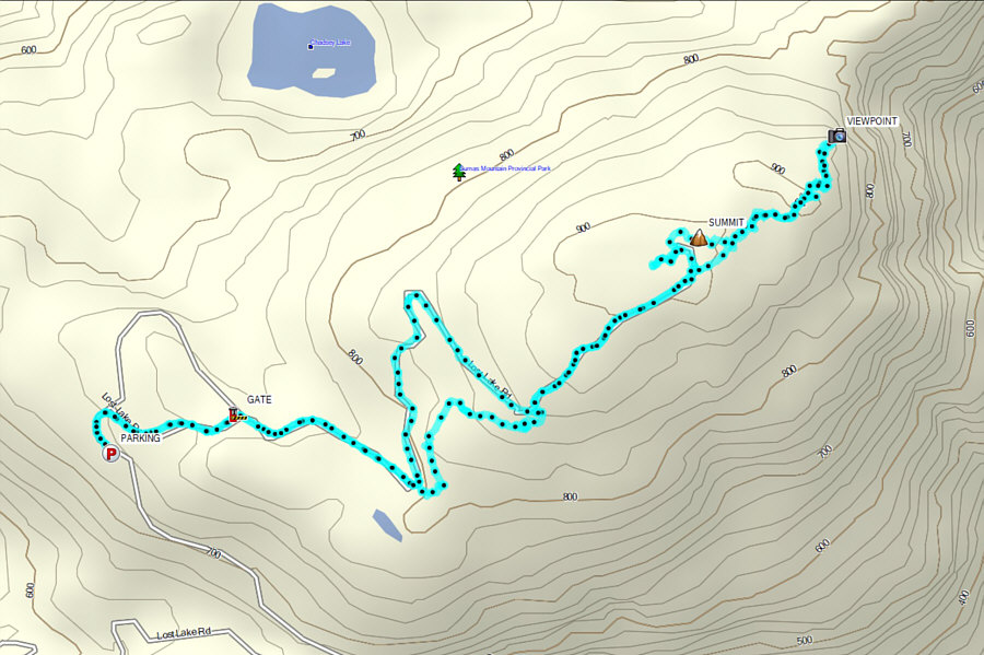 |
Total Distance: 7.0 kilometres Round-Trip Time: 2 hours 23 minutes Cumulative Elevation Gain: 196 metres |