BOU AVENUE
Bee Line Hill

Wrapping up our spring break on 12 April 2026, Zosia Zgolak and I hiked "Bee-Line Loop" near Cranbrook, British Columbia as described in AllTrails.com.  Originally designed for mountain biking, this loop has become a favourite hike for locals because of its easy access and perfect length--not too long and not too short!  Part of the loop goes over an unnamed hill which Bob Spirko suggested calling "Bee Line Hill" in his 2025 trip report.  Joining us were our gracious hosts, Angie Keller and Ken Gray, who had already hiked this loop before but were more than happy to repeat it.  They also brought along Angie's daughter's Welsh Corgi named Toby.

From a pullout (49.55989, -115.70266) along Highway 3/95, Ken, Angie, Zosia and I plus Toby followed a trail down an embankment and passed through a short stretch of trees before intersecting Chief Isadore Trail.  Turning left, we walked along the old rail bed for about 70 meters before turning right onto another unmarked trail which initially crosses a marshy ditch before heading into forest.  We soon reached a split--the start of the loop--and continued straight along the right-hand branch.  A somewhat lengthy ascent ensued, but we were entertained partway up by a pileated woodpecker which rained wood chips down on us.  As we circled around to the south side of Bee Line Hill, we abandoned the trail and descended to a nearby pond which Chris Doering calls "Hobgoblin Lake".  The name is likely derived from the namesake mountain biking trail which circles around the north side of the pond.  When we had our fill of the pond, we backtracked to the trail and climbed to the top of Bee Line Hill.  The actual high point is slightly off the trail and is also largely viewless, but the south side of the hilltop is open enough to grant some far-reaching views.  An even better viewpoint can be found further along the trail where it drops down the east side of the hilltop.  Carrying on from this viewpoint, we followed the trail down several long sweeping turns on the north side of the hill before eventually returning to the split.  A short hike back to the highway pullout concluded our trip.

A huge thank you goes out to Angie and Ken for again accommodating and feeding Zosia and me on short notice in their fabulous home in Cranbrook.  A special thank you goes to Toby for being such a good dog on the hike.
Look for pasque flowers here! 
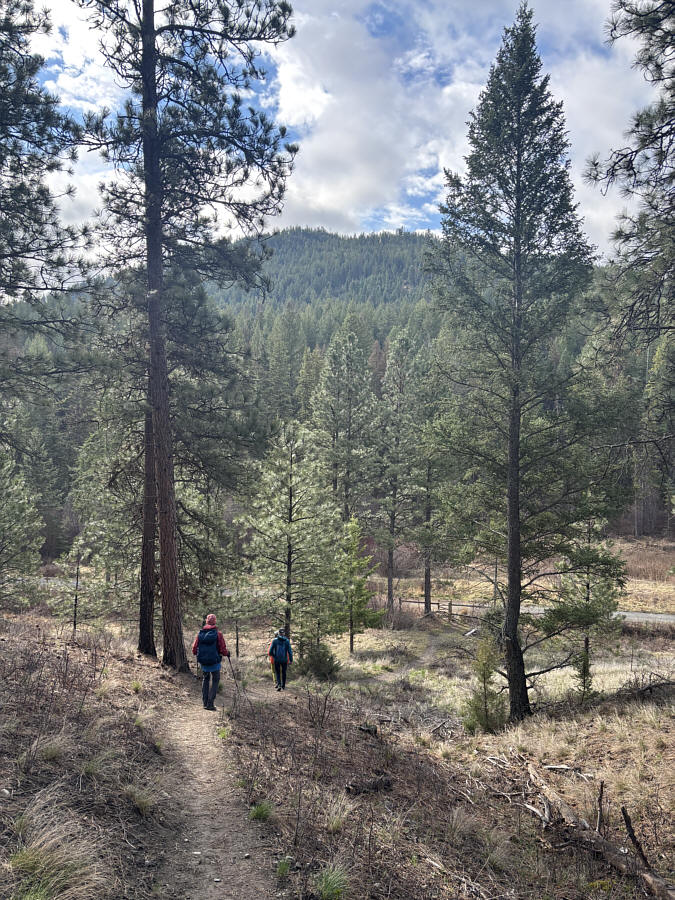
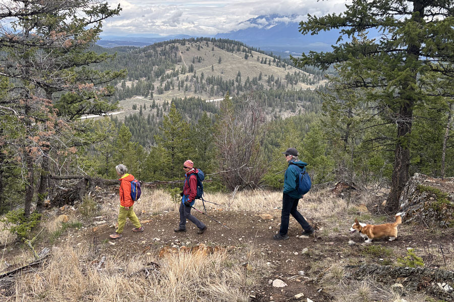
"Bee Line Hill" is the forested ridge in the background.
It would be nice to bike this trail someday. 
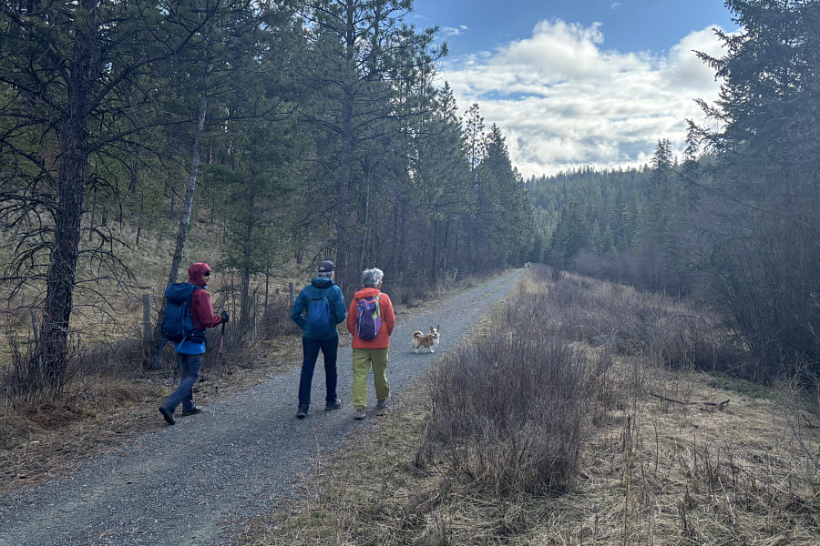
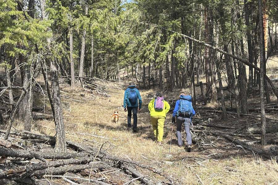
Zosia, Ken, Angie and Toby walk briefly along Chief Isadore Trail, a major recreational thoroughfare running between the city of Cranbrook and the town of Wardner.
I don't remember what Angie was talking about here... 
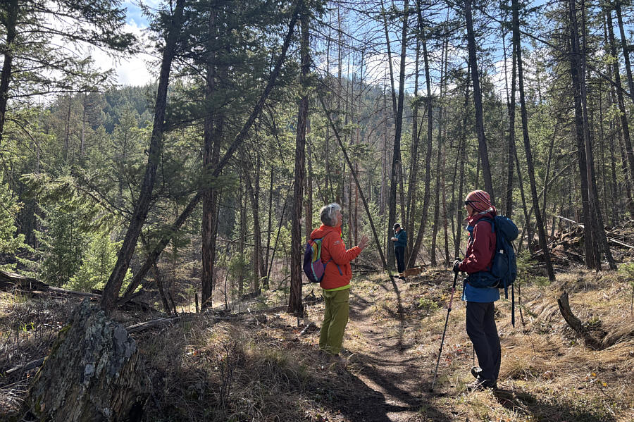
The mostly forested trail invites long conversations about wide-ranging topics.
Click here to hear the Woody Woodpecker song! 
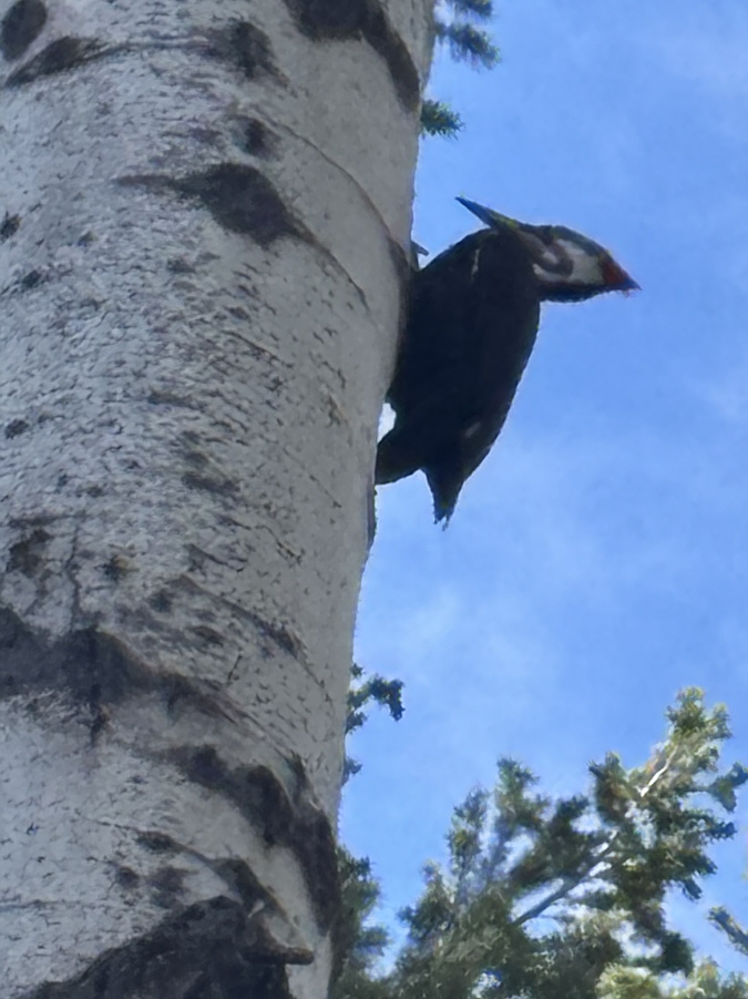
A pileated woodpecker is hard at work hollowing out this aspen tree.

No hobgoblins here--just ducks!

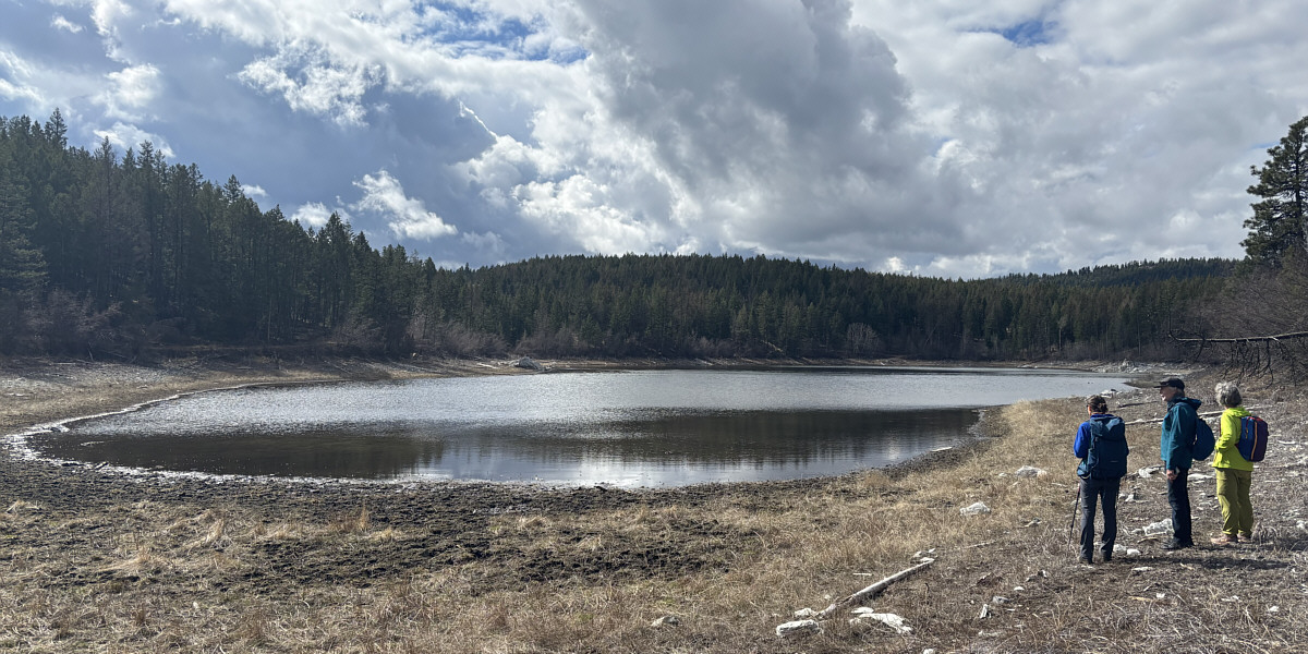
This pond to the south of Bee Line Hill is unofficially known as "Hobgoblin Lake".


Toby is leading the way! The group climbs off-trail away from Hobgoblin Lake.
We were there last June right after Angie's and Ken's wedding reception! 
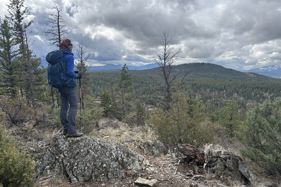
Not far from the high point of Bee Line Hill (1141 metres), Zosia gets a view of another forested ridge to the southwest which Sonny refers to as "The Wall".
The only sure way to get Toby to pose for a photo! 
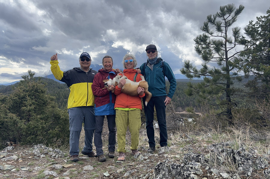
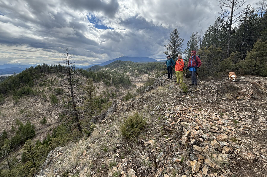
Sonny, Zosia, Angie (holding Toby), and Ken stand at the south side of the hilltop overlooking Hobgoblin Lake.
The views from here would be amazing on a bluebird day. 
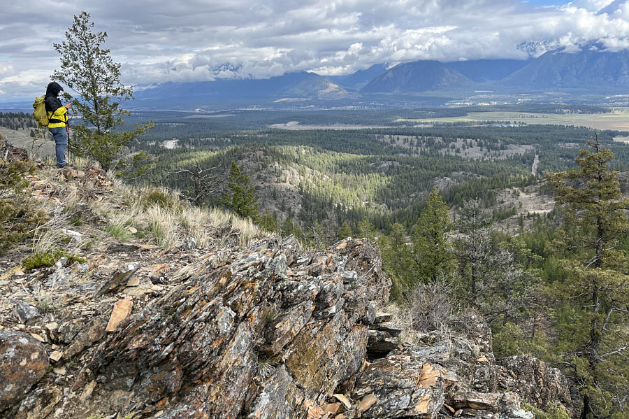
Sonny stands at another viewpoint on the east side of Bee Line Hill.

Photo courtesy of Zosia Zgolak

Poop? Ken, Angie and Zosia enjoy the far-reaching views while Toby seems more interested in something on the ground.
This descent took longer than expected. As the group descends Bee Line Hill, a break in the trees reveals Eager Hills Lookout to the north.
A deservedly popular hike close to Cranbrook. 
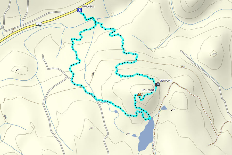
Total Distance:  5.3 kilometres
Round-Trip Time:  2 hours 42 minutes
Cumulative Elevation Gain:  265 metres

GPX Data