BOU AVENUE
Eager Hills Lookout

Kicking off our spring break road trip on 7 April 2023, Zosia Zgolak and I hiked up Eager Hills Lookout in British Columbia's Cranbrook Community Forest Recreation Site.  Due to its close proximity to the city of Cranbrook, this diminutive hill is popular with local hikers and mountain bikers and can probably be ascended year-round.  For us, it made for a convenient leg-stretcher to help break up a lengthy first day of driving.  The trailhead is accessed via a short gravel road on the north side of Highway 3/95 about 4.6 kilometres east of the interchange with Highway 95A or 1.5 kilometres west of the interchange between Highways 93/95 and 3/93.  The trailhead's small parking area can accommodate about a dozen cars.

Zosia and I initially headed north along a trail known as "Waterpark" before turning eastward to follow "Eager Lookout" up to the high point marked by a concrete foundation.  Far-reaching views are somewhat limited here, but by heading another 150 metres further to the east, we found another concrete foundation with a picnic table and a fairly satisfying panorama.  From there, we backtracked to the high point before dropping down open south-facing slopes to intersect a lower section of "Eager Lookout".  Turning westward, we easily followed this trail back to the trailhead to complete a loop.
A map helps, but simply go uphill! Zosia follows a good trail through light forest during the ascent.
More scenic than the actual high point!

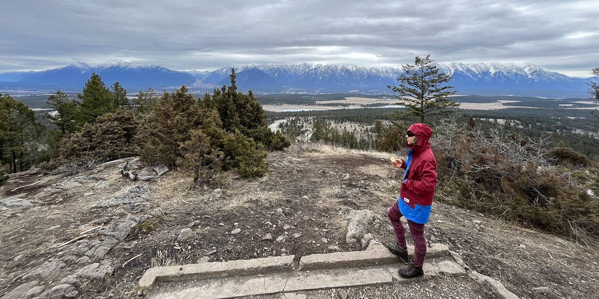
Views open up behind Zosia as she climbs higher up the trail.

Zosia appears to be looking for Halley's Comet! 
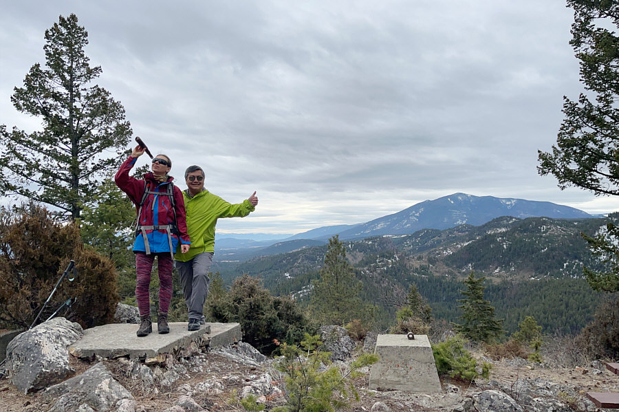
Zosia and Sonny stand on the high point of Eager Hills Lookout (1062 metres).  Mount Baker is visible in the distance.

Zosia needs her lunch even on this short hike!

East of the high point is what appears to be a former fire lookout site.


This would be a great ski slope...if only there was enough snow!

Zosia drops down grassy south-facing slopes to intersect a trail that will lead her back to the trailhead.
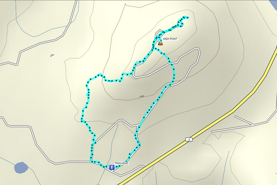
A local favourite that makes for a great shoulder-season hike or if you're short on time. Total Distance:  2.3 kilometres
Round-Trip Time:  1 hour 8 minutes
Net Elevation Gain:  128 metres

GPX Data