BOU AVENUE
Horsefly Hill
On 6 June 2026, Zosia Zgolak and I ventured
out to the Racehorse Creek region of Alberta's Livingstone Public Land
Use Zone to ascend unofficially-named "Horsefly Hill" as coined by
Bob Spirko. Spirko made short work of this modest but scenic
hiking objective in July of 2023, but at the time, he was able to take
advantage of a short approach by fording Racehorse Creek. We had
originally hoped to follow in his footsteps, but there was a lot of
uncertainty about whether or not we could given the high water levels
from spring snow melt and after a recent unusually long stretch of heavy
rainfall. Had I done a little more research, I would have
discovered that there is actually a bridge (49.85131, -114.40681)
spanning Racehorse Creek about 2.5 kilometres north of Spirko's starting
point at Racehorse Provincial Recreation Area (49.83287, -114.42439).
This bridge is the eastern terminus of the very same ATV road that he
stumbled upon after fording the creek, and even without bicycles, this
would have been the simplest way to approach Horsefly Hill without
getting our feet wet. Alas, we would end up taking a longer and
more arduous approach along the south bank of Racehorse Creek.
Starting from the recreation area's day-use
parking lot, Zosia and I walked to the west end of the campground to
cross a bridge spanning Vicary Creek near its confluence with Racehorse
Creek. Both creeks were raging torrents, and we already had serious
doubts about the feasibility of fording Racehorse Creek safely.
Spirko's trip report mentions a shallower crossing further upstream, and
we continued westward along the south bank in vain hope that we would
find such a spot. Eventually, we had to concede that fording
Racehorse Creek was out of the question on this day, but we were not yet
ready to give up on ascending the hill which looked tantalizingly close.
Consulting my GPS map, we spotted a major road to the west that appeared
to cross over to the north bank of Racehorse Creek, but of course, we
were not absolutely certain if a bridge existed there. Furthermore,
this would lengthen our approach considerably, but we had all day and
were up for an adventure. Getting to the road would not be easy
though. While there are numerous cattle or game trails running
along the south bank of Racehorse Creek, they become increasingly
intermittent further upstream (west). More than once, we had to
climb high above the creek to avoid either impenetrable deadfall or
eroding cliffs. We eventually veered away from the creek and ended
up in a series of large cut blocks. Besides the usual slash and
ankle-breaking logging debris, we had to tiptoe through numerous swampy
sections which added to the unpleasantness of hiking through the cut
blocks. Ultimately, we reached the road as marked on the map, and
to our great relief, the road crosses Racehorse Creek on a good bridge.
In retrospect, we could have driven to this bridge from the forestry
trunk road, and I have earmarked this area for future exploration.
On the north side of Racehorse Creek, Zosia and I followed the road for
about half a kilometre before turning onto an ATV road (orange marker
"229"). This is actually the same ATV road found by Spirko and
mentioned earlier in this report. We followed the ATV road for a
little less than a kilometre before abandoning it at a hairpin turn to go
up yet another cut block. Thankfully, this one was drier than the
ones south of the creek, and we soon picked up a cattle trail which we
followed across a shallow ravine. On the other side of the ravine,
we entered an open meadow at the base of a forested ridge that winds up
the west and northwest sides of Horsefly Hill. Ascending this ridge
was straightforward, and we had no further difficulties climbing up to
the high point of the hill.
Just as Zosia and I settled down for a lunch break on top of Horsefly
Hill, an ATV rider named Derek and his dog, Kona, came up Spirkos route
from the east. He had started from Dutch Creek to the north and, as
such, did not come from the aforementioned eastern terminus of the ATV
road. Having just started ATV riding and being unfamiliar with many
of the routes in the area, he could not confirm if there was another
bridge over Racehorse Creek east of Horsefly Hill. Although Kona
was eager to play fetch with us, Derek convinced her that it was time
to leave, and they promptly departed to let us finish our lunch in peace.
Zosia and I discussed our options for descent and ultimately decided to
simply back out the same way we came rather than risk having to ford the
raging creek if we were not lucky enough to find another bridge to the
east.
Zosia and I had no trouble descending the
same ridge we ascended, and we even ran into Derek and Kona again when we
regained the ATV road. Back on the south side of the creek, we were
a little more efficient at finding cattle trails through the large cut
blocks, but we ran into some route-finding problems later when we
re-entered forest and stayed too low in the valley. We then tried
staying on higher ground and ended up in another series of cut blocks
which were again quite swampy, but at least there were fewer ups and
downs and less deadfall. We finally re-entered forest near the last
bend in the creek and soon connected with the good trails close to the
first bridge. The remaining walk back to the day-use parking lot
was easy.
In retrospect, Spirko's route probably makes
the most sense as long as fording the creek is feasible. If water
levels are too high, then the bridge further north would be the simplest
access, and the entire ascent can be done along the ATV road perhaps with
the help of a bicycle. There is still some merit to the ridge route
that Zosia and I climbed, but it would be much easier to drive to the
western bridge than to muddle on foot along the south bank of Racehorse
Creek.
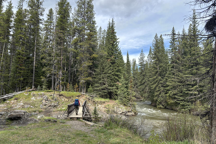 |
At the start of the hike, Zosia
crosses a bridge over Vicary Creek right at its confluence with
Racehorse Creek. |
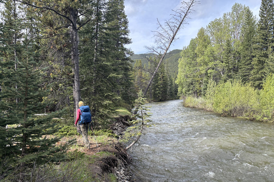 |
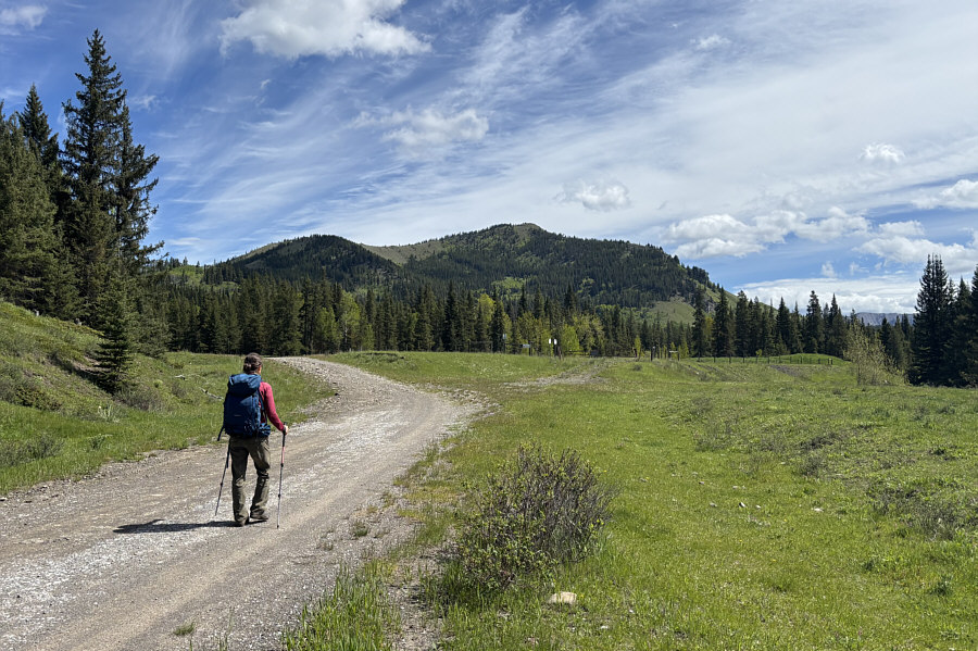
Zosia searches in vain for a suitable place to ford Racehorse Creek on
this day. |
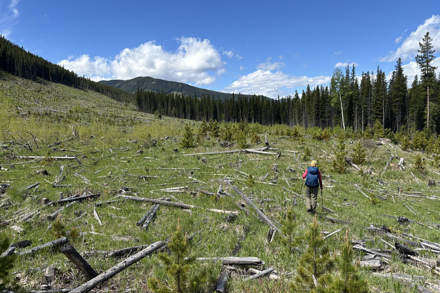 |
Zosia makes her way through the
tedious slash of several large cut blocks. |
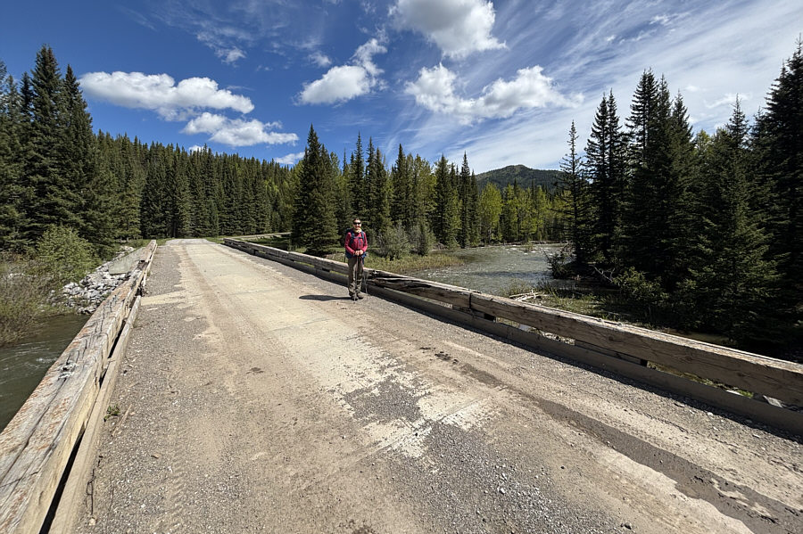 |
Zosia is relieved to find a good
bridge along a forestry road to cross over to the north side of
Racehorse Creek. Horsefly Hill is visible in the distance
through the trees. |
 |
Here is a more complete view of
Horsefly Hill from the forestry road. |
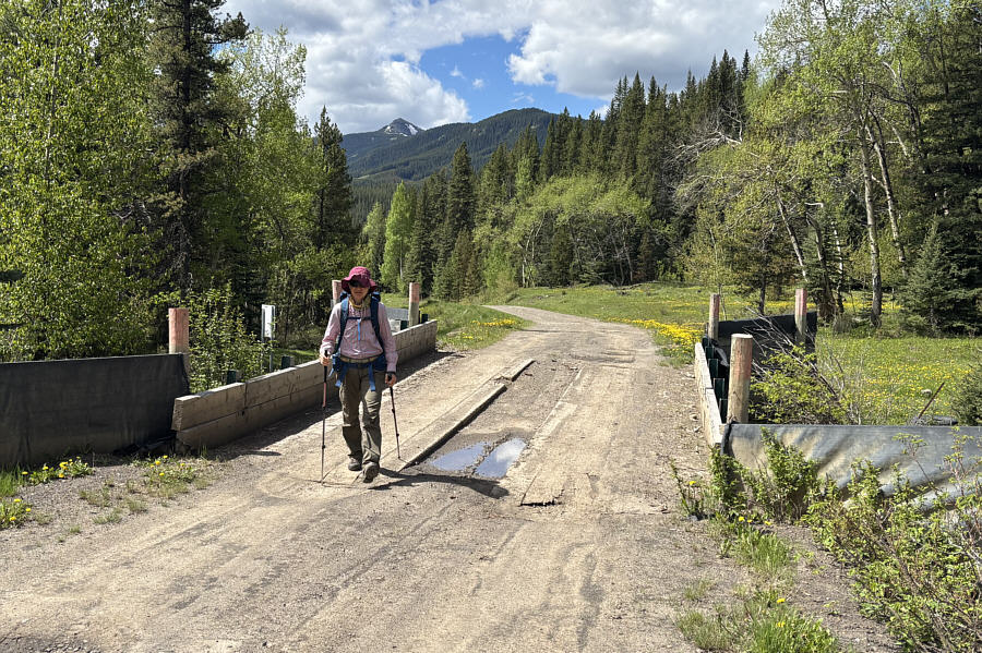 |
Zosia crosses a bridge over Wintering
Creek. |
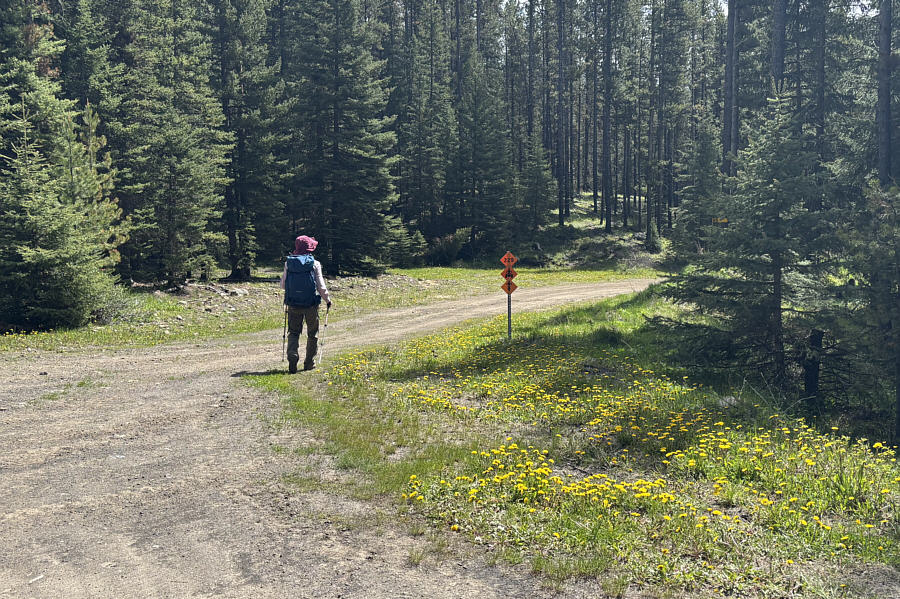 |
Zosia turns off from the forestry road
to follow an ATV road. |
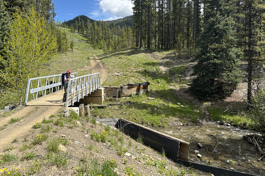 |
The ATV road crosses Salt Creek on
this bridge. |
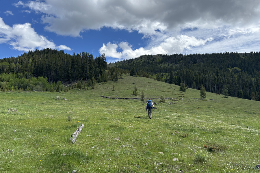 |
After abandoning the ATV road, Zosia
ascends an open meadow toward the forested ridge at left. The
top of Horsefly Hill is directly ahead of her. |
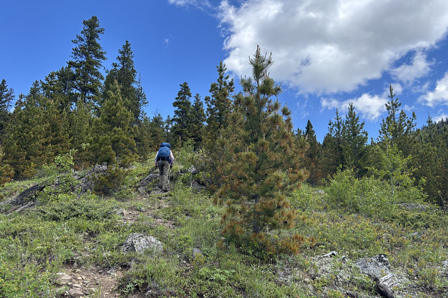 |
The forested ridge presents no
significant challenges. |
 |
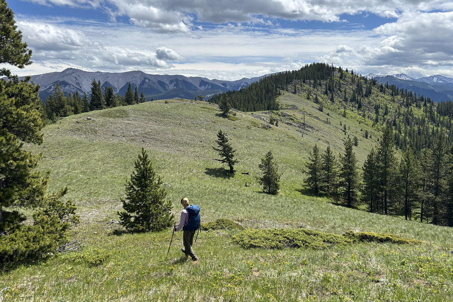
Higher up the ridge, there are good views of the High Rock Range to the
west. |
 |
Zosia crosses a slight dip to reach
the northwest ridge of Horsefly Hill. |
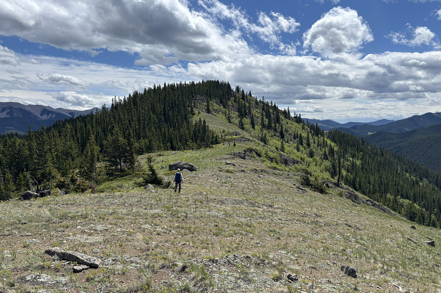 |
Zosia ascends the final stretch before
the top. |
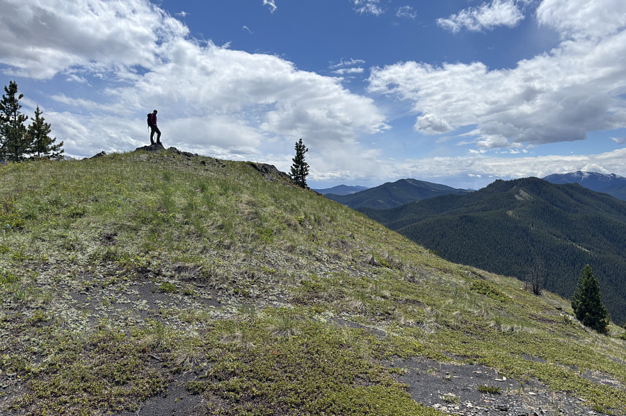 |
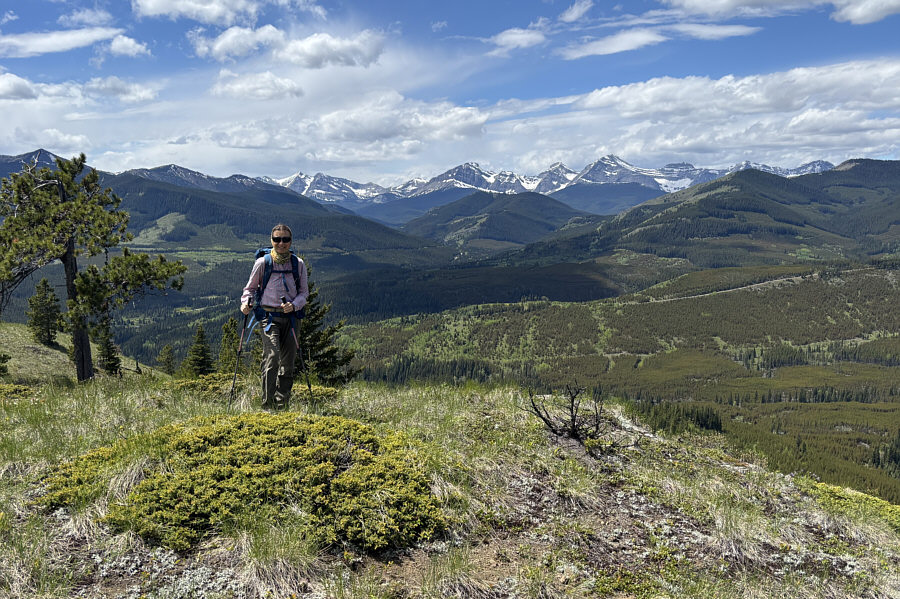
Zosia reaches the top of Horsefly
Hill. Visible on the horizon at far right is
McGillivray Ridge. |
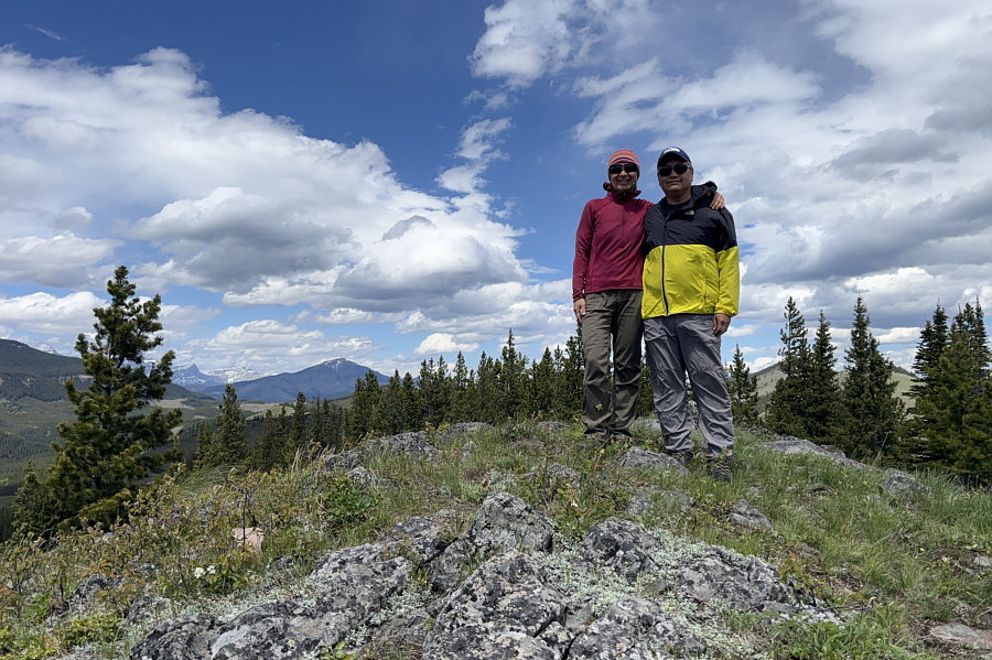 |
Zosia and Sonny stand on the high
point of Horsefly Hill (1871 metres). |
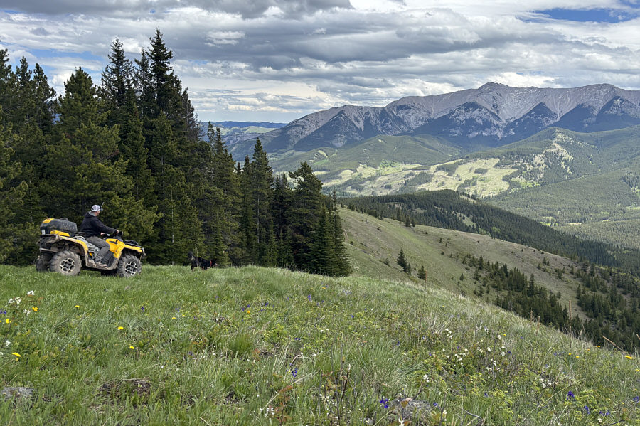 |
An ATV enthusiast, Derek, and his dog, Kona, descend the east side of
Horsefly Hill. Visible on the right horizon is
Thunder Mountain. |
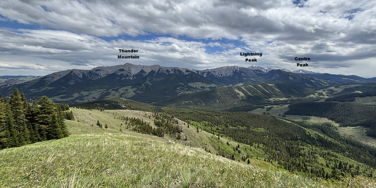
Here is the view to the southeast from the top of
Horsefly Hill.
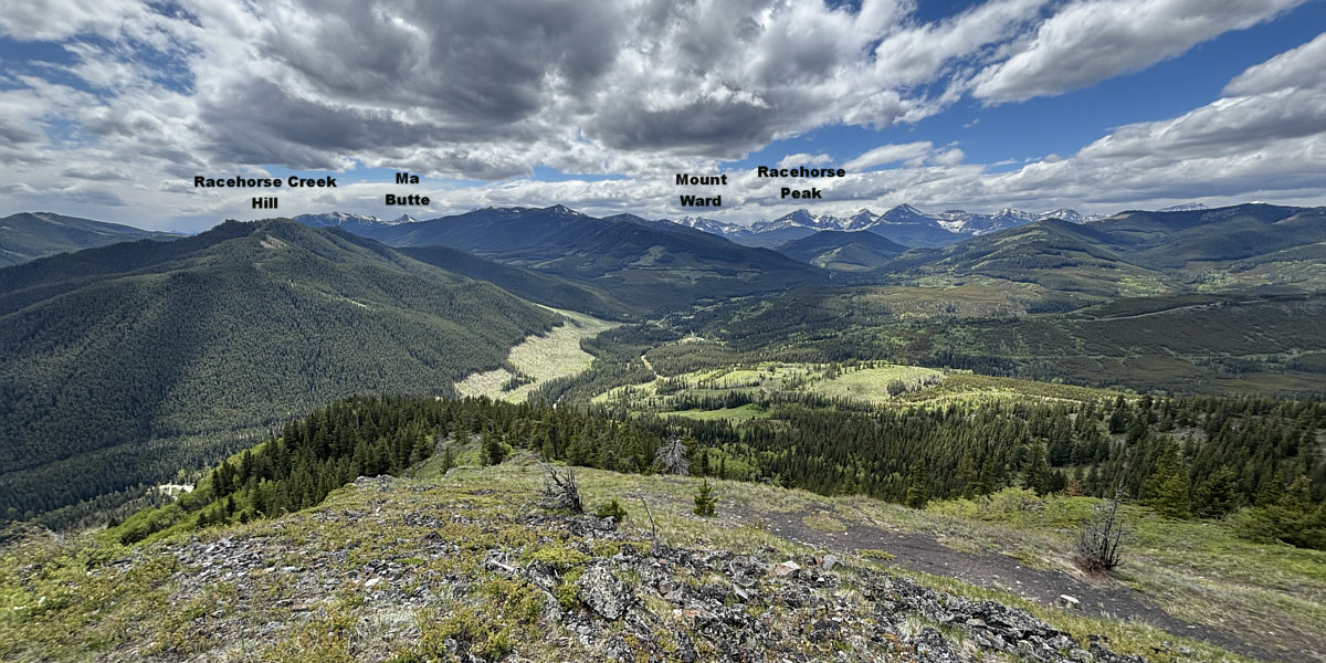
Here is the view to the southwest from the top of
Horsefly Hill.
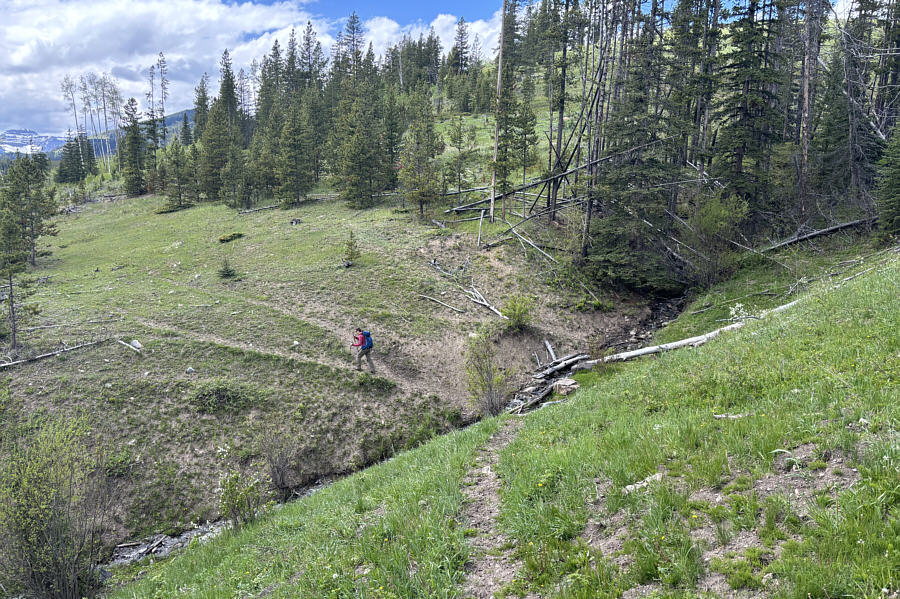 |
On the descent, Zosia follows a
convenient cattle track across a ravine. |
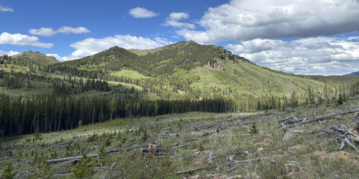
Here is a last look at Horsefly Hill from one of the
cut blocks on the south side of Racehorse Creek.
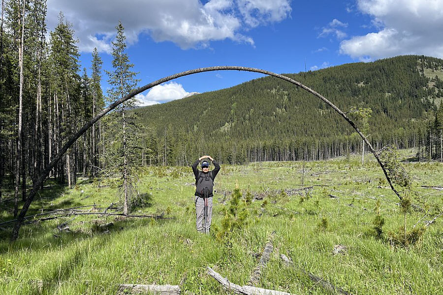 |
Sonny stands under a natural arch. Photo courtesy
of Zosia Zgolak |
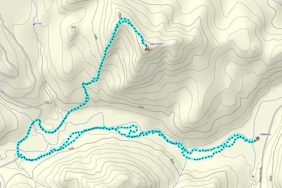 |
Total Distance: 16.6 kilometres
Round-Trip Time: 7 hours 55 minutes
Cumulative Elevation Gain: 527 metres
GPX Data |