BOU AVENUE
McLean Hill
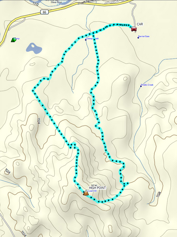
On 28 March 2026, Zosia Zgolak and I hiked
up McLean Hill in Alberta's McLean Creek Off-Highway Vehicle Public Land
Zone. We both last tagged this hill in
2017, but
this time, I wanted to try a different route that would perhaps be a
little less bushy. We would end up taking the same approach road
that we used for our 2022 ascent of "Mclean
Hill East" albeit with a different starting point. For some
added variety, we would descend via the hill's north ridge and complete a
loop via convenient off-highway vehicle (OHV) and logging roads.
From the intersection with Highway 22
south of Bragg Creek, drive west on Highway 66 for 5.1 kilometres, and
just past the Kananaskis Country sign with flags, turn left (south) onto
an unnamed road (a sign here says "SERVICE ROAD LOCAL TRAFFIC ONLY" but
does not explicitly prohibit public access). Drive 400 metres to a
Texas gate (passing a fenced compound with buildings on the right) and
continue straight for another 200 metres before pulling off to the right
and parking near a locked gate with a sign that says "ROAD CLOSED".
Be sure to not block access to a private ranch just to the south.
Zosia and I climbed over the locked gate and
followed a snow-covered road westward for a little over 800 metres to
where it begins to bend southward at a junction with another road coming
from the west. We continued southward along the same road for
another 3.3 kilometres to a four-way junction with a dirt bike road along
an east-west cut line. Turning right, we climbed the dirt bike road
which runs up the east side of McLean Hill. A couple of quads had
just descended here and had conveniently packed down the snow for us, but
a few sections were steep and icy enough to give us a bit of trouble with
our traction. Upon reaching another four-way junction on the ridge
crest, we turned right onto an OHV road which we followed
for the remaining short distance to the top of McLean Hill. The
weather was so nice on this day that we spent well over an hour there
which included a long phone conversation with our friend, Bob Parr (Mr.
Incredible), who had frequently ventured up McLean Hill in the past.
When we resumed hiking, Zosia and I followed
the continuation of the OHV road which winds partway down
the north ridge of Mclean Hill before joining a north-south cut line.
We dropped down this cut line and eventually entered a vast cut block
where we reached yet another four-way junction. Turning right
(northeast), we followed a logging road--the very same one described earlier
as "coming from the west"--all the way back to the very first junction
near the start of the trip. Some sections of this road had thawed
out and were quite mucky to walk on, and we tried our best to stick to
odd patches of snow or grass when possible. Fortunately, the last
section of road back to the locked gate was still mostly snow-covered,
and we managed to mostly clean our muddy boots before returning to our
parked car.
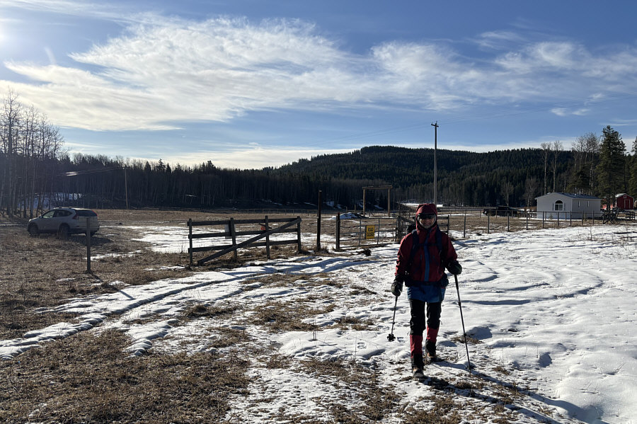 |
Zosia begins hiking from a locked gate near a
private ranch. |
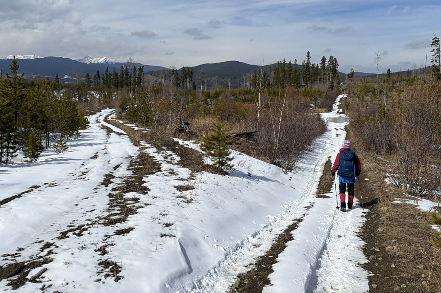
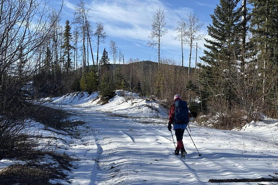 |
Zosia hikes along a snow-covered road with McLean Hill visible in the
distance. |
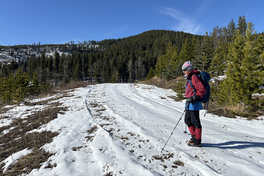 |
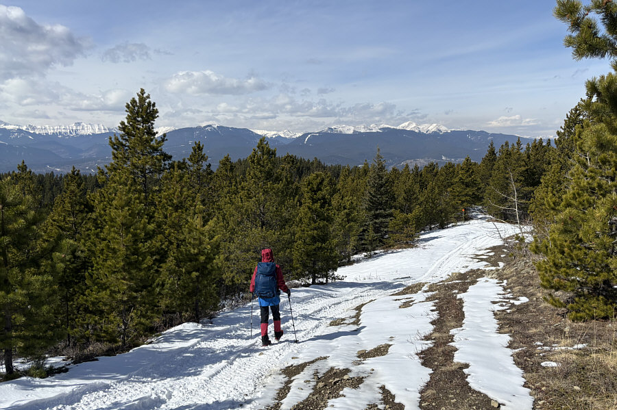
As Zosia winds around the east side of
McLean Hill, the dirt bike road that she will take to the top is
barely discernible at distant far left. |
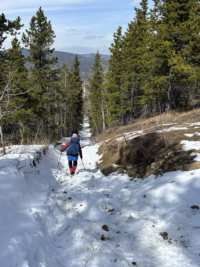
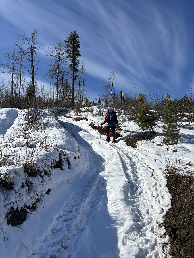 |
Zosia climbs a steep section along the
dirt bike road. |
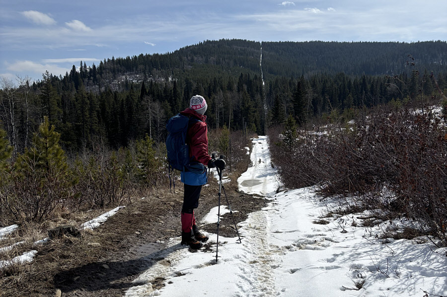
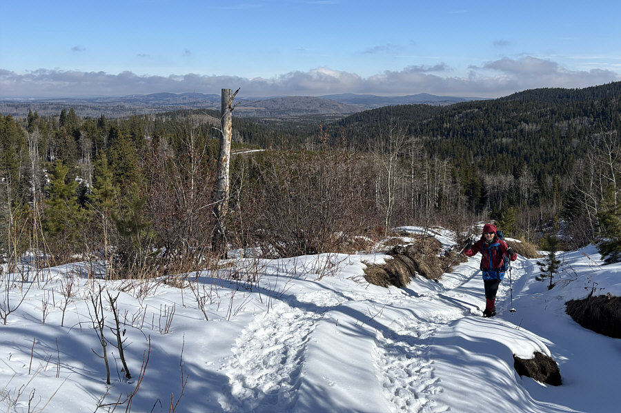 |
Some distant foothills become visible
to the north as Zosia climbs higher up the dirt bike road. |
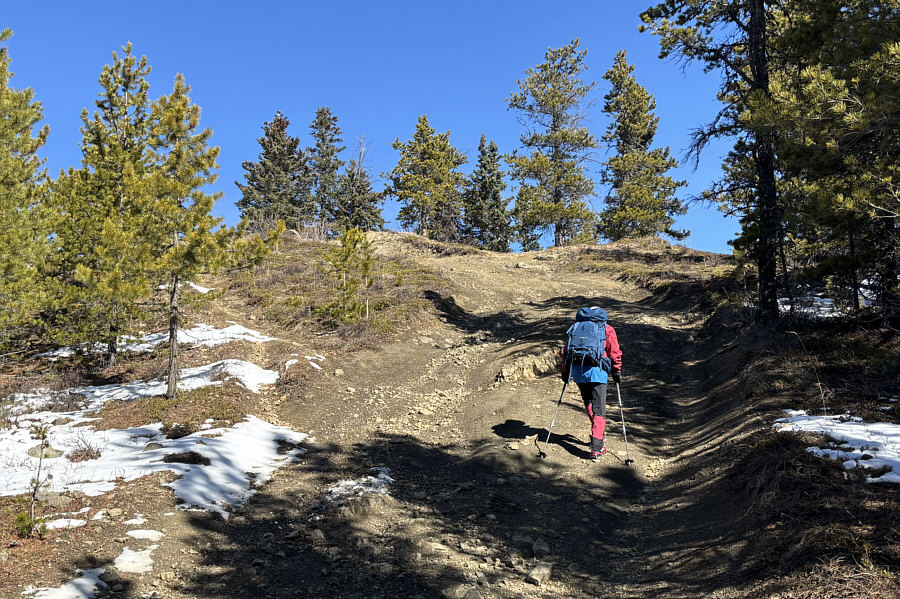 |
Zosia climbs the last bit of an
off-highway vehicle road before the top of McLean Hill. |
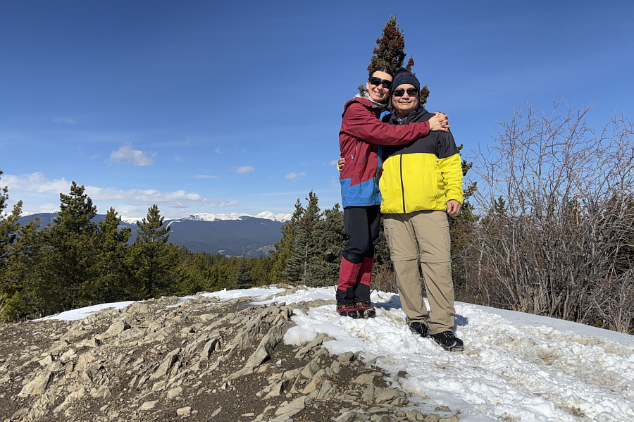 |
Zosia and Sonny stand on the high
point of McLean Hill (1720 metres). |
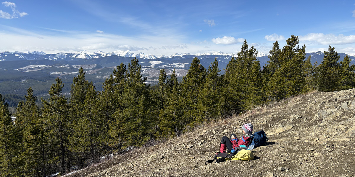
Zosia enjoys lunch under sunny and calm conditions at
the top of McLean Hill.