Starting from the parking lot (50.49146, -114.80691) at Lantern Creek Provincial Recreation Area, Zosia and I carefully crossed to the east side of Highway 40 and walked about 200 metres north to the signed trailhead just past a culvert. We had no problems hiking the well-maintained trail along Lantern Creek for about four kilometres to a forested saddle which is the gateway to Picklejar Lakes. Instead of descending to the lakes, we abandoned the trail here and turned westward to ascend the east ridge of Picklejar Hill. There are smatterings of a beaten path here and there, but for the most part, we climbed off-trail up the ridge which is quite steep but not too bushy. From the saddle, it took us about half an hour to reach the more northern of two distinct high points on Picklejar Hill, and the southern one is only another ten-minute walk away. Both high points are very scenic and more than worth the minimal effort to climb them.
After stopping for a twenty-minute break on
the southern high point, Zosia and I dropped down steep grassy slopes
into the dip separating Picklejar Hill from another unnamed hill to the
southwest. Although this second hill appears to be more heavily
forested, the terrain is similar to that on the east ridge of Picklejar
Hill, and it took us only twenty minutes to climb from the dip to the
top. Surprisingly, we found a cairn on the high point even though
it is devoid of far-reaching views. From there, we wandered
southward for a short distance to a rocky outcrop with some limited views
before taking a short cut down to the trail along Lantern Creek.
According to satellite imagery, there are several large swaths of open
slopes lower on the western and southern aspects of the second hill, but
since I did not plot a proper route in my GPS beforehand, we ended up
descending the mostly forested southeastern slopes. These slopes
are very steep but generally easy to navigate, and we had no issues until
lower down when we ran into increasingly thick bush closer to the trail.
Thankfully, any miserable bushwhacking we had was short-lived, and once
we regained the trail, we enjoyed a pleasant and trouble-free hike back
to the highway.
Photo courtesy
of Zosia Zgolak
Here is the view to the south from the southern high
point of Picklejar Hill.

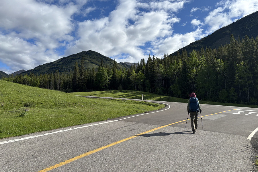
Zosia begins hiking near the entrance
to Lantern Creek Provincial Recreation Area. At left is the
westernmost of two distinct hills tucked between Picklejar Creek and
Lantern Creek. The easternmost hill--named "Picklejar Hill" by
Bob Spirko--is also visible through the gap but hard to discern from
the ridge behind it.

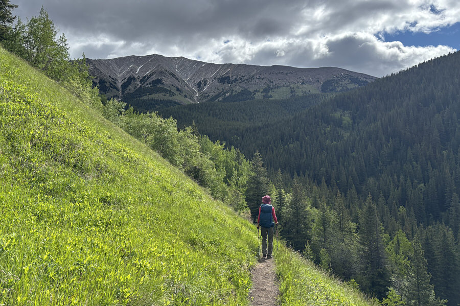
"Lineham Ridge" dominates the view at the head of the valley as Zosia
hikes the trail along Lantern Creek.

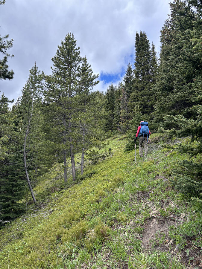
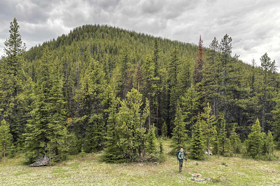
After abandoning the trail to
Picklejar Lakes, Zosia climbs steeply up the east ridge of Picklejar
Hill.

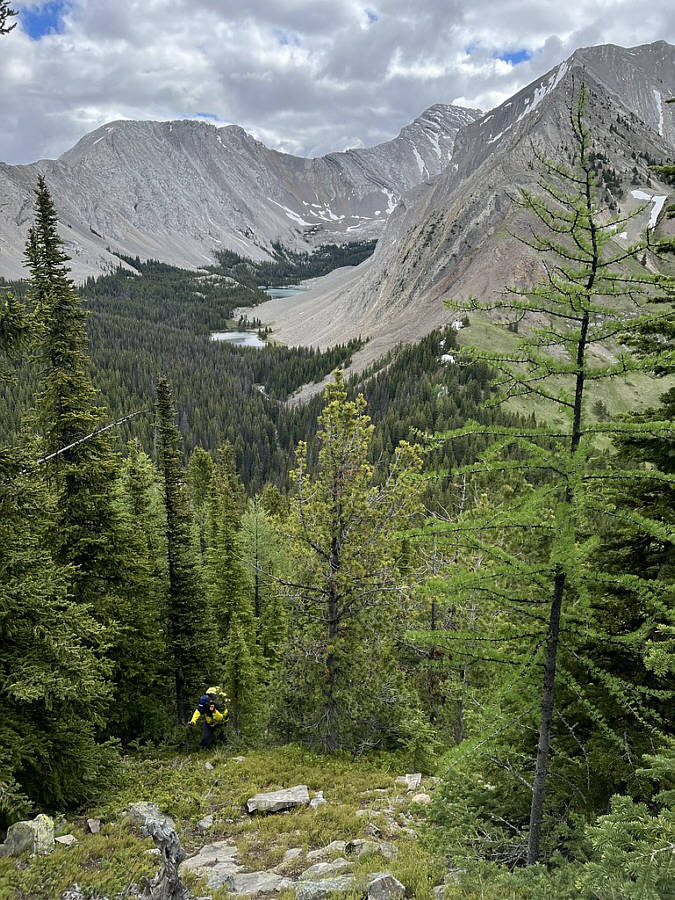
Two of the four Picklejar Lakes can be
seen in the distant valley as Sonny grinds his way up Picklejar Hill.

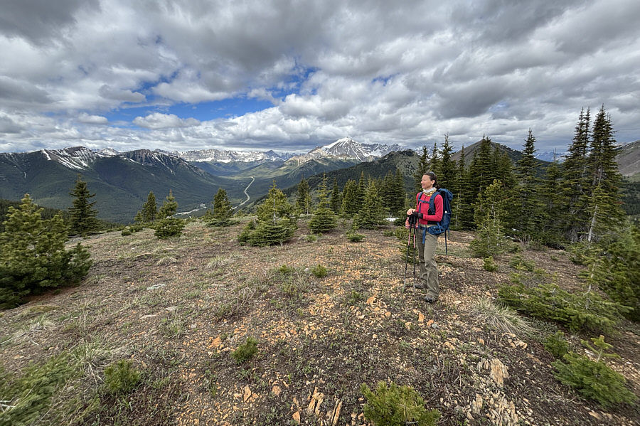
Zosia reaches the more northern (HP1;
2283 metres) of two distinct high points on Picklejar Hill.

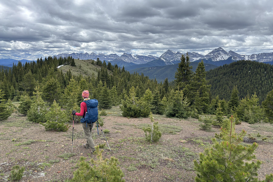
Zosia heads for Picklejar Hill's more
southern high point at left.

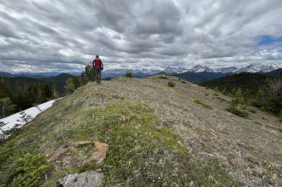
The southern high point is even more
scenic than the northern high point.

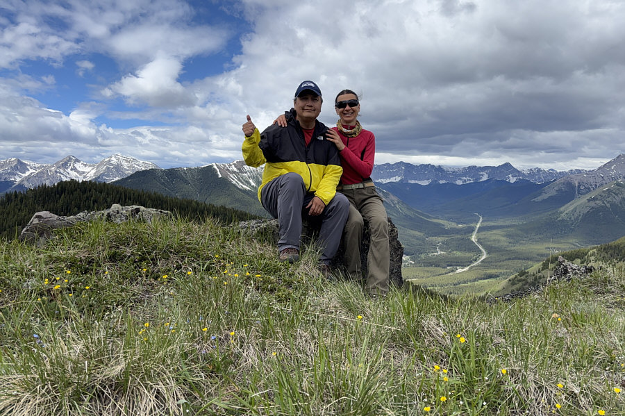
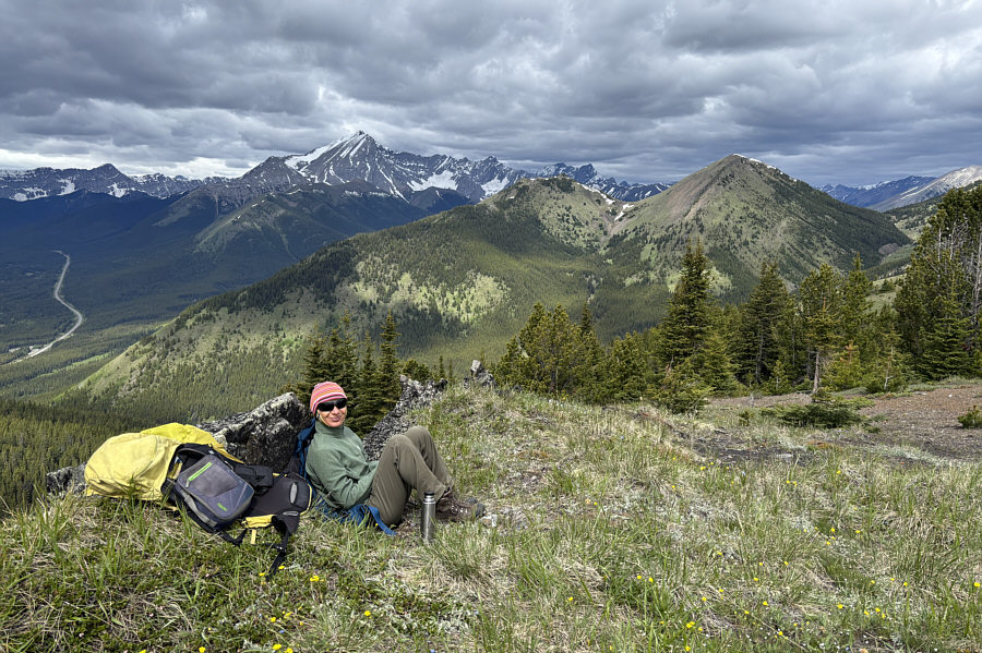
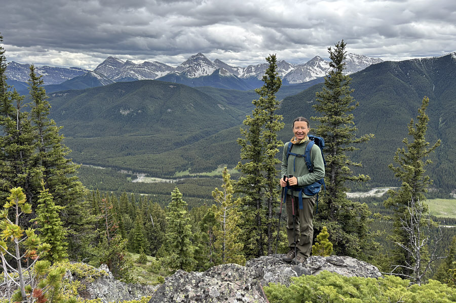
Sonny and Zosia relax on the southern
high point (HP2; 2284 metres) of Picklejar Hill.

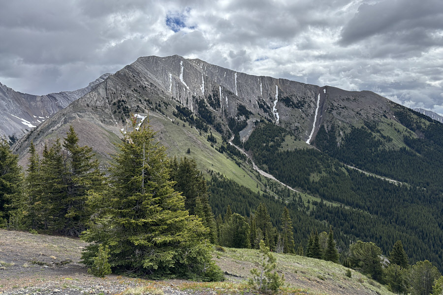
Mist Mountain
(left horizon) and
South
Mist Hills (right) draw most of the attention to the northwest.

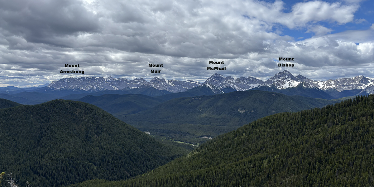
Here is a more comprehensive view of
Lineham Ridge to the east.


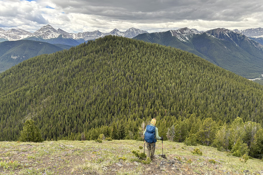
Zosia drops down the west side of
Picklejar Hill and heads for the westernmost hill which is unnamed.

Zosia finds an old fire ring in an
unexpected glade below the unnamed hill.

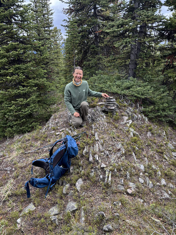
Zosia is surprised to find a cairn on
the viewless high point (HP3; 2278 metres) of the westernmost hill.

Zosia stands on a rocky outcrop a
short distance from the unnamed hill's high point.

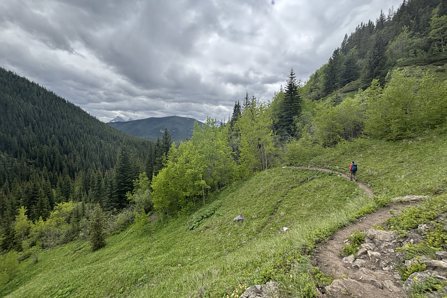
After regaining the trail along
Lantern Creek, Zosia easily hikes out the valley.

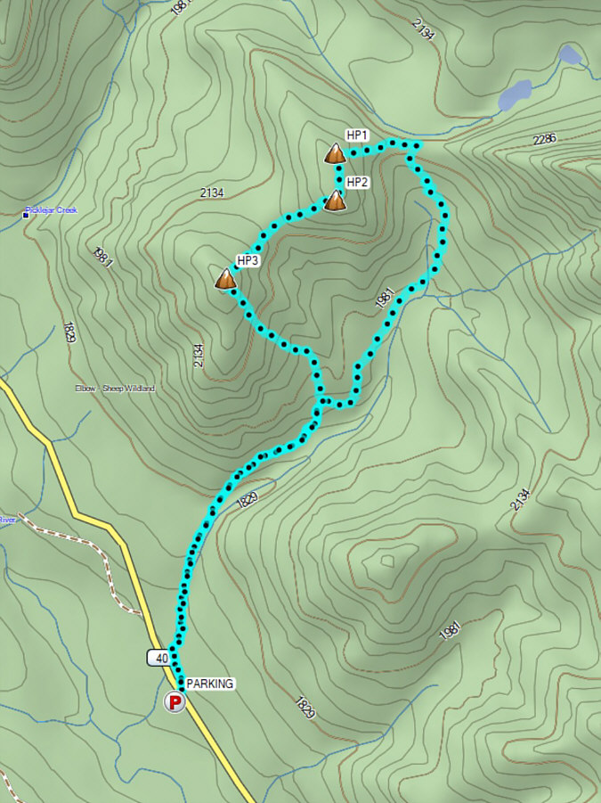
Total Distance: 9.0 kilometres
Round-Trip Time: 4 hours 53 minutes
Cumulative Elevation Gain: 646 metres