BOU AVENUE
Sugarloaf Lookout
I hooked up with Dinah Kruze and Bob Spirko on 13 October 2007 to hike up Sugarloaf Lookout near the headwaters of the Oldman River in southwest Alberta.  Since I was continuing alone to Cranbrook, British Columbia at the end of the day, we drove two separate vehicles on this trip.  Our original intension was to hike up nearby Livingstone Lookout from the northwest, but after a quick perusal of the necessary ford of the Livingstone River, I "chickened out" (as Dinah so aptly described my decision to bail).  Besides getting cold feet, I was also not particularly keen about the ensuing long approach (8.3 kilometres one-way from the ford).  Therefore, we decided to ascend Sugarloaf Lookout instead.  After leaving Bob's car near Dutch Creek Campground, we piled into my car and drove west along Dutch Creek Road.  Although neither Bob nor I had brought along a route description, I felt confident that we would have no problems since I had previously hiked partway up the road leading to the lookout.  Unfortunately, extensive logging activity had significantly changed the look of the landscape near the access point, and I had a difficult time remembering the location of the correct turnoff.  Bob actually had a map with a cursory description of the access point for Sugarloaf Lookout, but he had left it in his car because I had assured him that I knew where I was going!  After a couple of false starts (one of which turned out to be the correct road after all), we drove all the way back to Bob's car to pick up his map, and then we drove all the way back to the correct turnoff (8 kilometres west of Dutch Creek Campground).  Since my previous visit here, not only had a lot of the forest disappeared, but the rough road had been improved such that I was able drive much further than before (saving us at least 2 kilometres one-way and about 300 metres of elevation gain).  After all the driving around that morning, we were relieved to finally start hiking, but apart from some off-trail diversions, the hike itself was unremarkable.  Still, the fantastic views and an abundance of golden larches made the outing worthwhile.  Our round-trip time was a little more than 3.5 hours.

Be sure to check out Bob's trip report here.
I wasn't daring enough to drive this far in my car. Dinah and Bob hike up the road to Sugarloaf Lookout.
This is a much more interesting route than the boring, meandering road. 
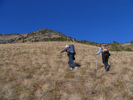
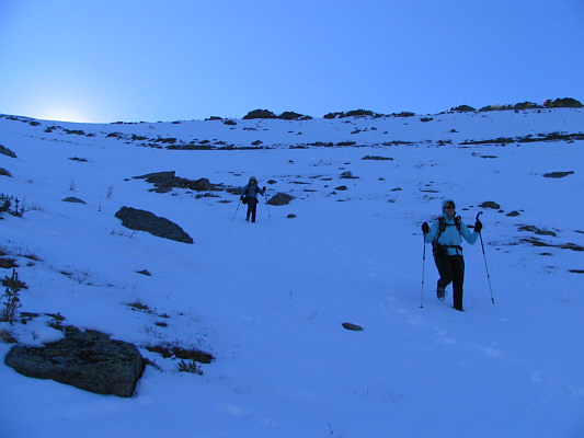
After leaving the road, Bob and Dinah head straight up the hillside.
Not too difficult! Dinah grinds her way up the grassy slope.
These rock bands are completely avoidable but make the ascent more interesting. 
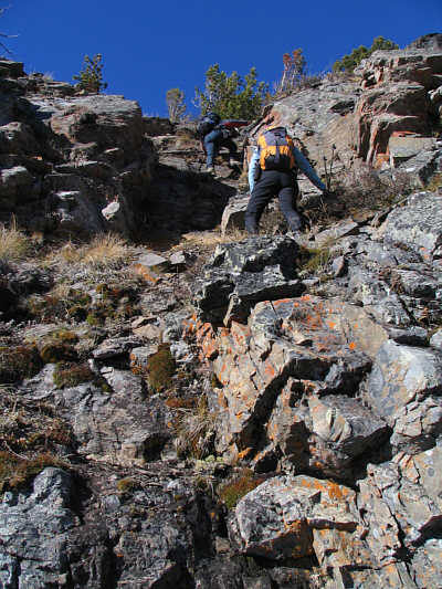
Bob and Dinah scramble up some rock bands on the way up.
A sign in the biffy asks you to place your used toilet paper in a bucket inside the door...yuck! 
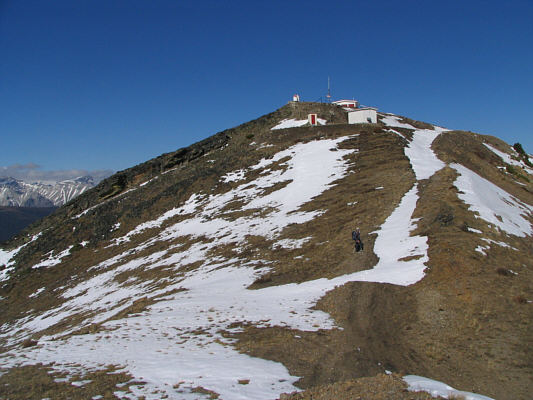
Bob plods up the last few metres to Sugarloaf Lookout.
Someone had a LOT of time on their hands! 
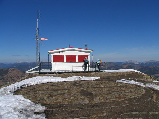
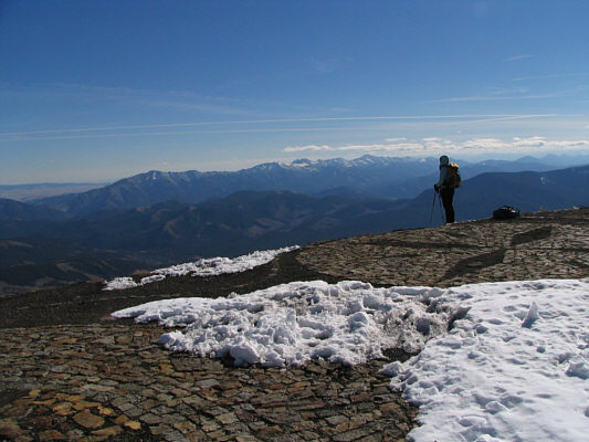
Sugarloaf Lookout is the highest active lookout in Canada with an elevation of 2517 metres.  The compass rose in the mosaic is apparently oriented accurately.
Looks like an interesting scramble... This is Gould Dome (2894 metres) as seen from Sugarloaf Lookout.
Great scramble but lousy approach! 
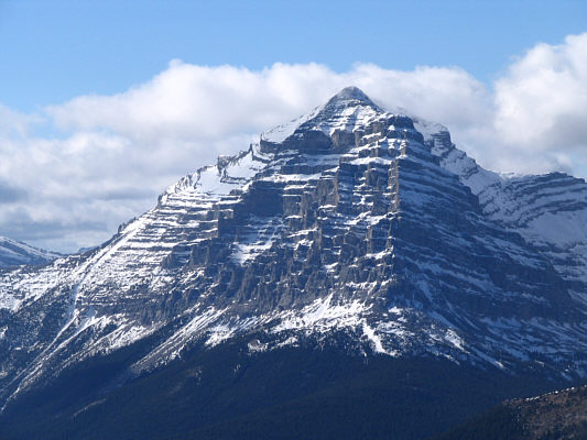
Tornado Mountain (3099 metres) looks impressive to the west.
Looks kinda like Everest, doesn't it? 
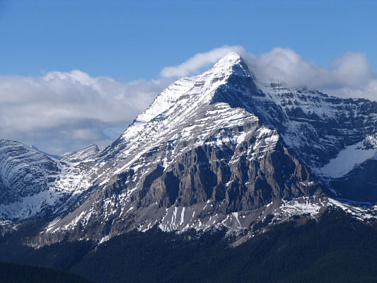
Here is a close-up of the upper part of Tornado Mountain.
Beautiful day, eh? Dinah looks southeast toward the Livingstone Range.  Thunder Mountain (2347 metres) is the bump on the left.
So who has the nicest jacket? 
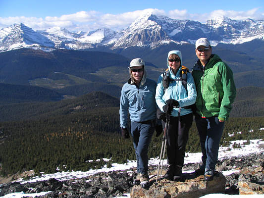
Bob, Dinah and Sonny pose for a group photo with Gould Dome and Tornado Mountain in the background.
Coming up this road would have been really boring! Dinah eases on down the road.
The crusty snow wasn't exactly pleasant to descend. Bob and Dinah take a short cut to skip a few switchbacks.
That's one sturdy stick that Dinah is holding! 
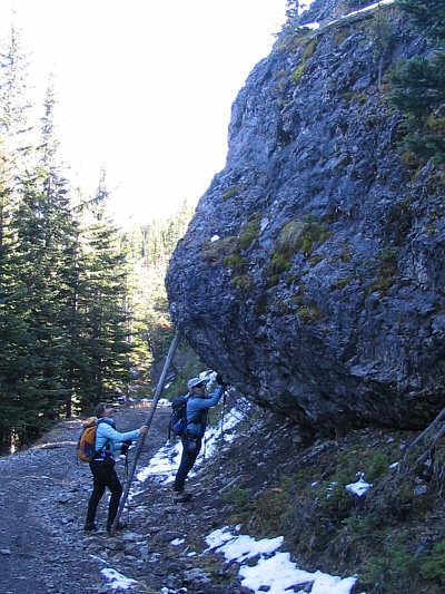
Dinah and Bob try to keep this rock from rolling across the road.