BOU AVENUE
Southfork Mountain
Southfork Mountain is the official name given to the northern end of Barnaby Ridge in the Castle-Crown Wilderness.  After a previous aborted attempt, Dinah Kruze and Bob Spirko invited me to join them for their second try at Southfork Mountain's summit on 25 October 2008.  The day started off inauspiciously when we were flagged down by a stranded hunter along Highway 22.  He had apparently fell asleep in his truck with the radio turned on and inadvertently drained his vehicle's battery.  Unfortunately, there was no cellular phone coverage in that particular area, and Dinah, who was driving, did not have any jumper cables.  We could have offered him a lift, but because he was headed in the opposite direction (he was meeting his father to go hunting), that would have meant a substantial loss of time for us.  Despite the chilly morning temperatures, the hunter did not appear to be seriously distressed, and we were confident that someone else who could offer more practical assistance would soon come along.  The hunter thanked us for stopping, and we continued on our merry way.  As we pulled into the trail head for Southfork Lakes, the weather was not very appealing.  The sky was overcast with an occasional sprinkling of snow, and the wind was blowing with a vengeance.  Admittedly, I would not have objected if someone suggested turning around and going for breakfast, and Dinah was probably thinking the same thing.  However, since neither of us wanted to be a party pooper, nothing was said, and we simply geared up and started hiking.  Right off the bat, we had to ford West Castle River which was fairly shallow and slow moving at this time of year.  I was quite willing to brave the short stretch of cold water with a pair of sandals, but Dinah and Bob brought along hip waders and offered to let me try them out.  I was sufficiently impressed with how well the hip waders worked that I am now considering buying myself a pair.  After the ford, we hiked through a confusing maze of trails, and I was thankful that Dinah and Bob knew which way to go (they had some trouble here on their first attempt).  Once we were on the proper trail, we began climbing steeply through the forest and were soon out of the trees.  Despite the wind, we had a generally pleasant hike to the first of the three Southfork Lakes.  A good description of this hike can be found in Robert Kershaw's Exploring The Castle: Discovering The Backbone Of The World In Southern Alberta.  At the second lake, we left the trail and scrambled up the hillside to the summit of Southfork Mountain.  The wind was at its worst at the top, but the sky was also gradually clearing which granted us some sunshine and nice views.  Since we still had some time left on our hands, we wandered further south along Barnaby Ridge.  Although the hiking was easy here, we were occasionally knocked around by the fierce wind.  A map in Kershaw's guidebook suggests that a high level loop around the Southfork Lakes is possible, but from our perspective, some of the pinnacles along the route appeared much too technical to attempt without a rope.  Instead, we easily scrambled up to the next highest point along Barnaby Ridge before retracing our steps back over Southfork Mountain.  Our descent was uneventful, and we were back at Dinah's car after a round-trip time of 8.5 hours.  On the drive home, we noticed that the hunter and his truck were no longer stranded on Highway 22.  We were then able to enjoy our dinner at the Subway in Nanton, Alberta with clear consciences.

Be sure to check out Bob's trip report here.
Also what you can't see in this photo is the howling wind! 
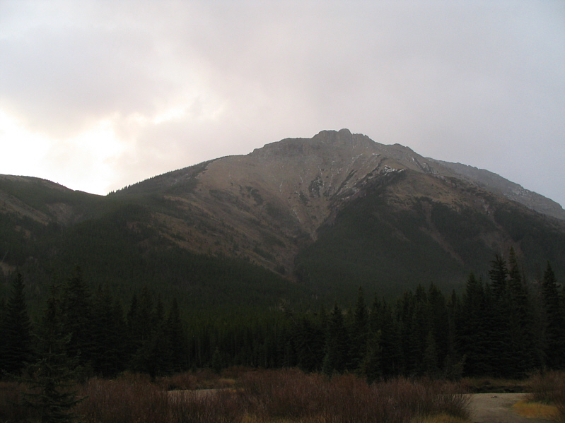
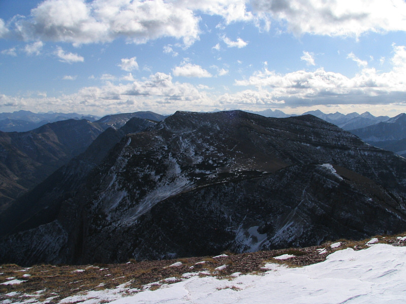
This is the northernmost end of Barnaby Ridge.  The summit of Southfork Mountain is not visible here.
Dinah doesn't look overly thrilled! 
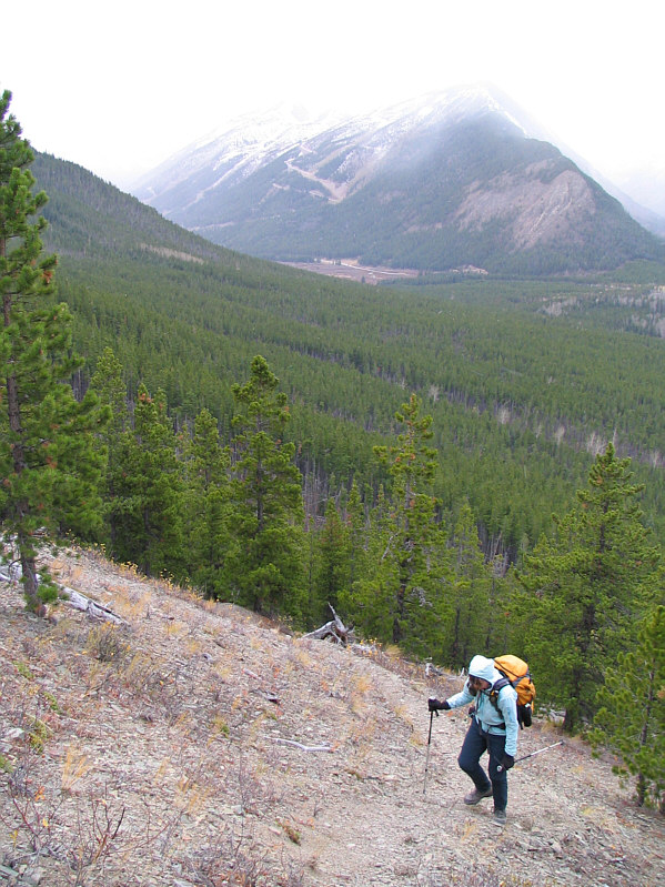
Dinah climbs up the steep trail that leads to the Southfork Lakes.  Gravenstafel Ridge is barely visible in the distance.
Nice camping spot if you don't mind the wind! 
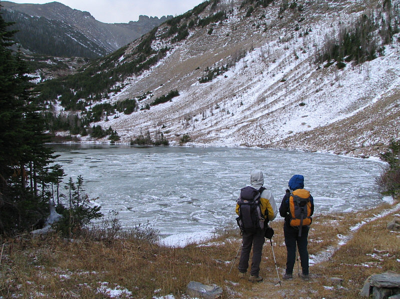
Bob and Dinah reach the first and lowest of the three Southfork Lakes.  The two upper lakes are beyond the ridge in the distance.
Note the technical-looking pinnacles on the ridge top. 
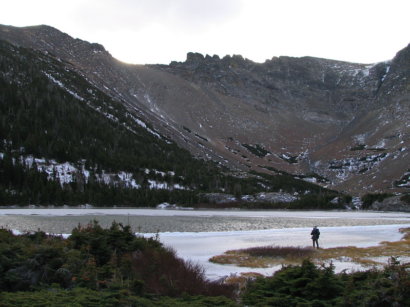
Bob wanders along the frozen shore of the second lake.  The third lake (not visible here) is just beyond the far shore.
A little bit of route-finding is required here, but it's nothing tricky. Bob and Dinah climb up easy slopes above the second lake.
Unfortunately, we missed seeing all the larches here in their full glory. 
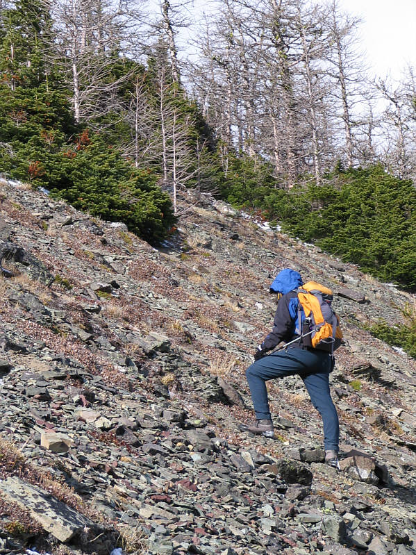
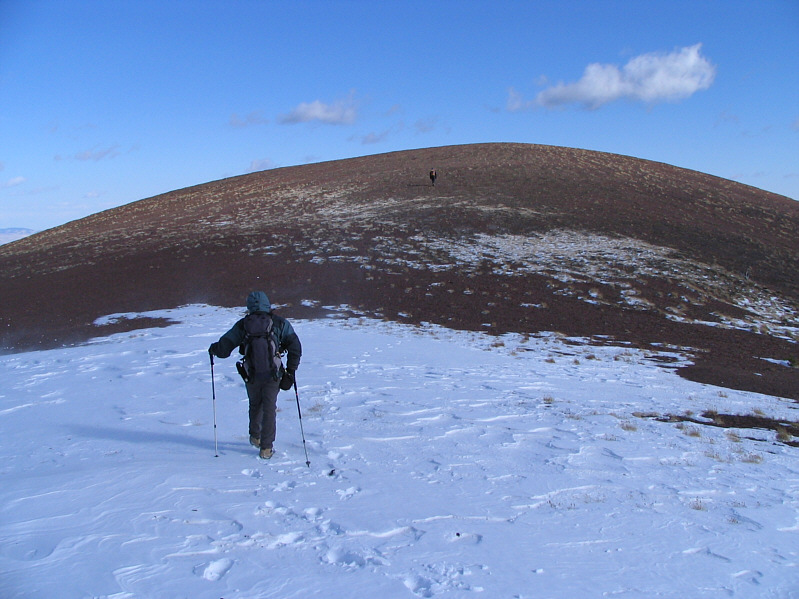
Dinah trudges up the hillside.
Cool, eh? 
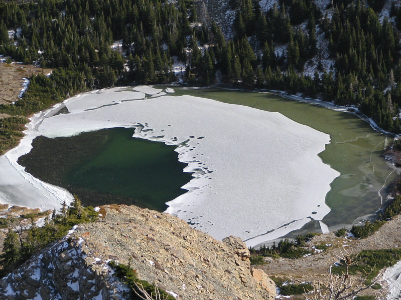
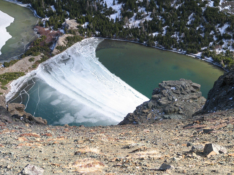
Here is an aerial view of the second lake.
Darn photographer's shadow! Bob waits for Dinah to come up the ridge.  At centre is the northernmost end of Barnaby Ridge.
She still looks rather gloomy! Dinah walks in front of Syncline Mountain.
About 960 metres elevation gain from the trail head. 
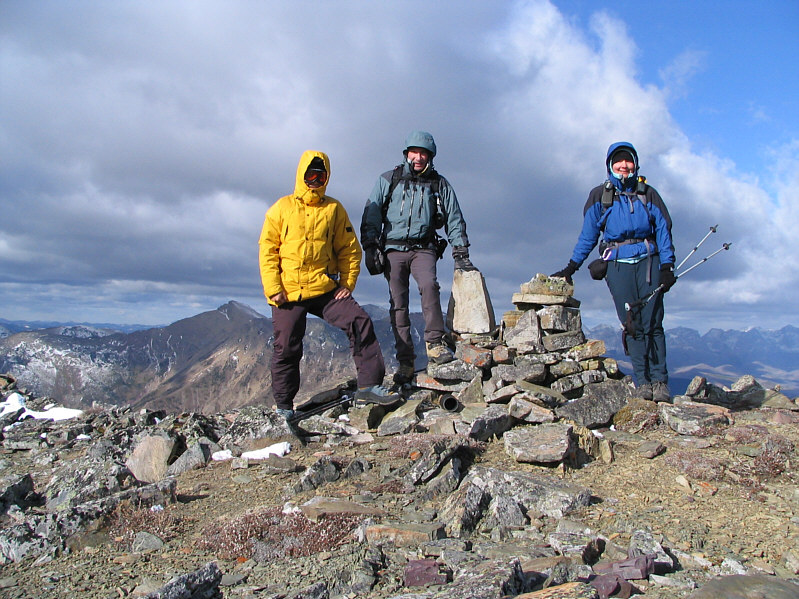
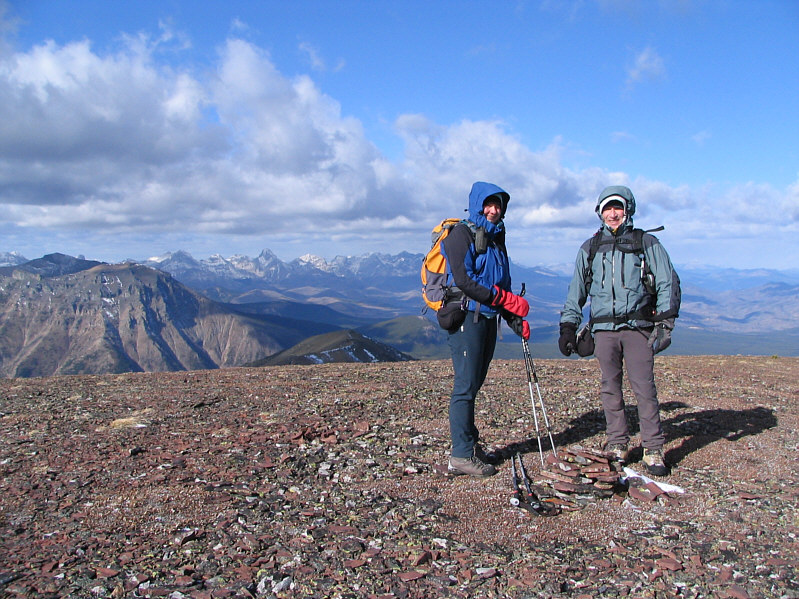
Sonny, Bob and Dinah stand on the 2354-metre summit of Southfork Mountain.
Taking these summit photographs nearly turned my bare hands into icicles! 
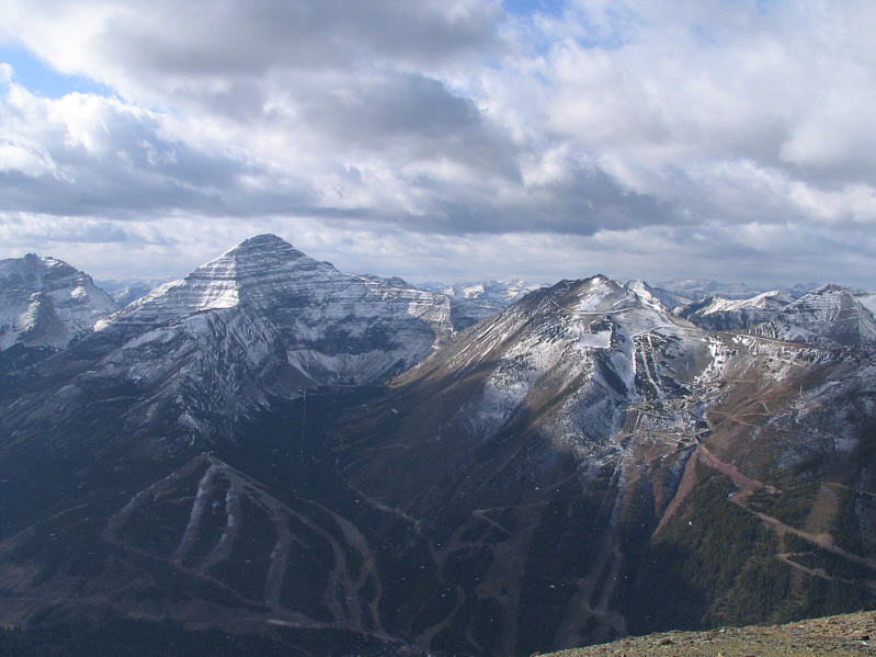
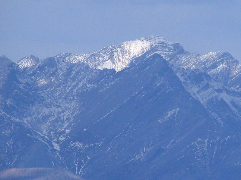
Mount Haig and Gravenstafel Ridge grab all the attention to the west.
There's an easy way up if you circle around the other side of the outcrop. Here is a partial view of the third lake from the summit of Southfork Mountain.  Bob and Sonny would scramble up the rock outcrop in the foreground later on their descent.
We got clobbered by the wind while traversing this ridge. 
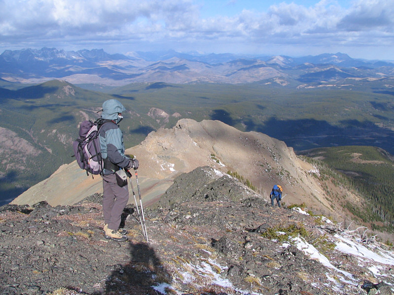
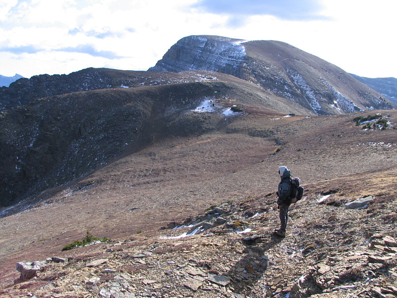
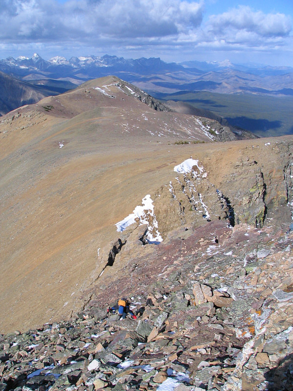
Bob is on his way to the next highest point of Barnaby Ridge.
A beautiful peak.  Definitely high on my to-do list. 
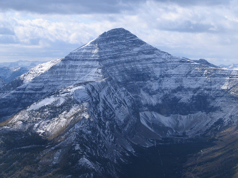
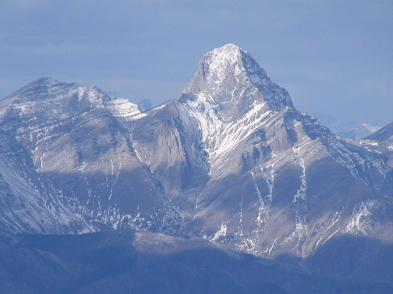
Here is a closer look at Mount Haig.
Can you claim the summit if you ride a chairlift most of the way up?? 
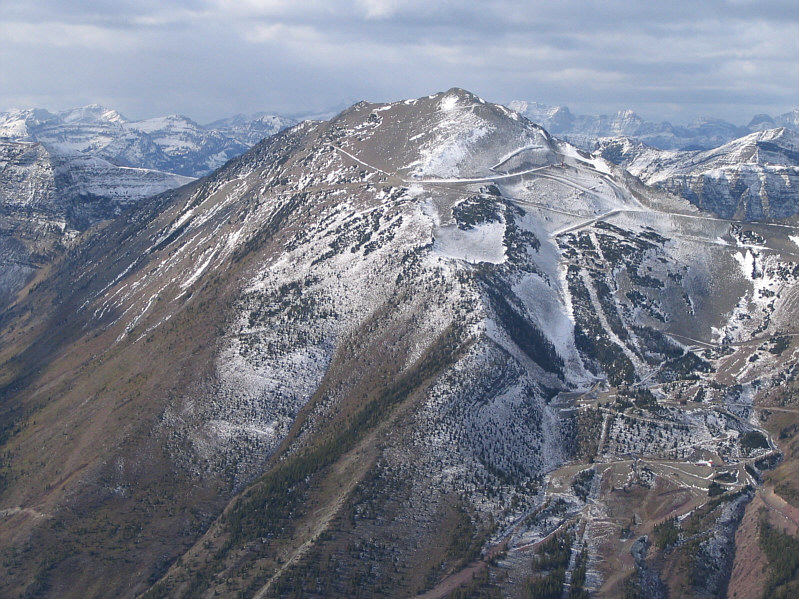
The ski runs and trails of Castle Mountain ski resort are evident all over Gravenstafel Ridge.
This was my favourite part of the trip. Dinah scrambles up the only rock band of any consequence on the way south from Southfork Mountain to the next highest point of Barnaby Ridge.
Head left and start losing significant elevation to continue on to the true summit of Barnaby Ridge. 
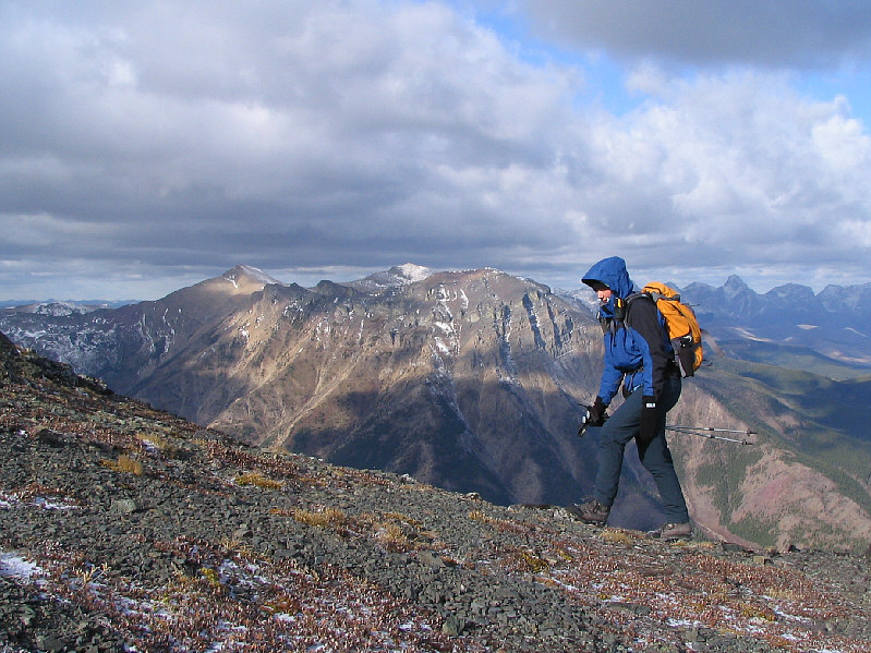
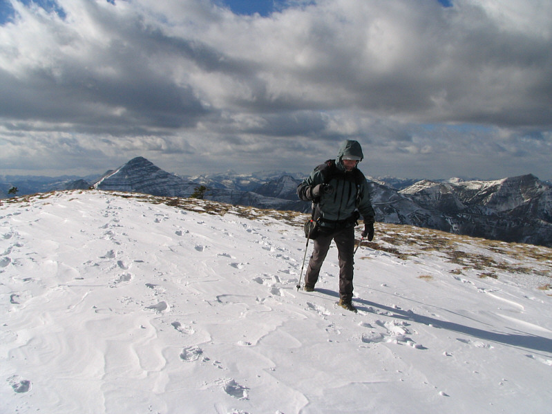
Bob tramps through some early season snow on Barnaby Ridge.  Mount Haig is visible at left.
An easy hike for sure, but we didn't have enough daylight...not that that's ever stopped me before... The true summit of Barnaby Ridge is about 1.8 kilometres further south.
Too easy. Bob follows Dinah up to the next highest point of Barnaby Ridge.
It's only about 30 metres lower than the true summit. Dinah and Bob stand on the next highest point of Barnaby Ridge (2438 metres).
Some great ridge walking there! 
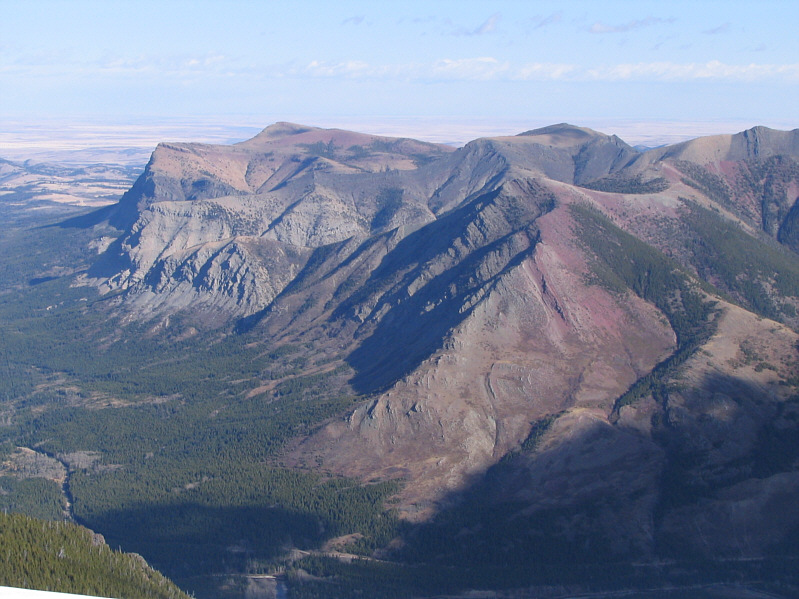
To the east are Table Mountain (left) and Whistler Mountain (right foreground).
Doesn't appear to be any easy way up this mountain... Mount Darrah is the most striking peak to the northwest.
I wouldn't want to try that south ridge now with all that snow! Sunshine illuminates Mount Ptolemy in the distance.
There aren't any easy shortcuts down the east side of the ridge.  It's best to head back over Southfork Mountain. 
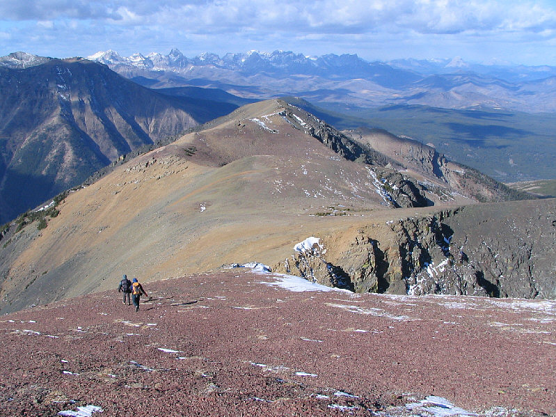
Bob and Dinah head back to Southfork Mountain.
Bob and Dinah affectionately refer to Castle Peak as "rabbit ears".  Check out http://bobspirko.ca/Hiking/WhistlerLookout/WhistlerLookout.htm to find out why. 
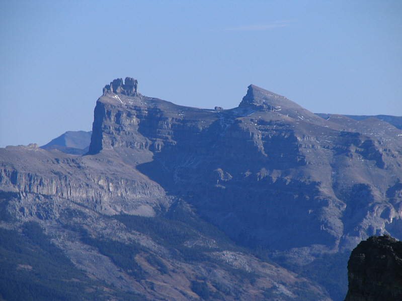
No trip to the Castle-Crown Wilderness would be complete without a view of Castle Peak and Windsor Mountain.
A fun, short diversion! Bob descends from the aforementioned rock outcrop.
I took this photo while standing on the partially ice-covered lake. 
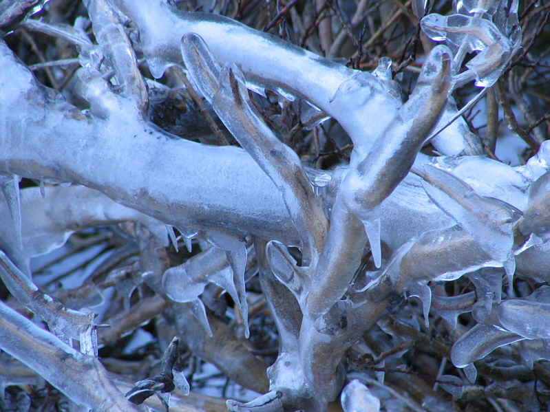
Ice on the vegetation along the shore of the second lake attest to the powerful winds that blow here.
Ice, ice baby! Here is a close-up of some of the branches from the previous photo.
It's sunnier than in the morning, but that wind hasn't stopped howling! 
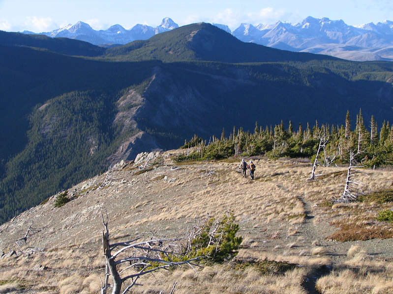
Bob and Dinah descend the ridge late in the afternoon.
All we need is a fishing rod! 
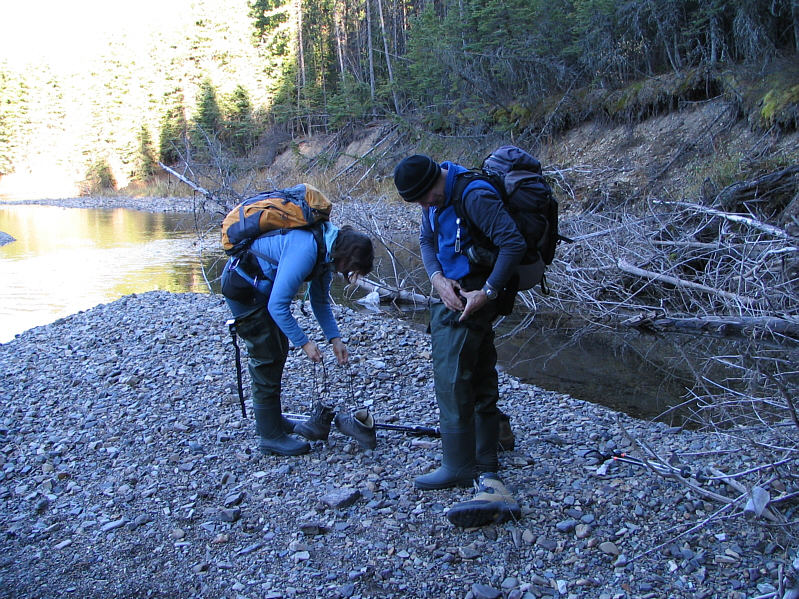
Dinah and Bob put on their hip waders before fording West Castle River.