


Round-Trip Time: 10 hours 56 minutes
Total Elevation Gain: 1300+ metres
There is a good trail that goes partially around the south side of Sheep Lake, but it eventually disappears in a huge boulder field near the base of the peak known as She Devil. Despite the lack of a trail, I easily worked my way up to a saddle north of He Devil (my GPS batteries died somewhere here, and it took me awhile before I noticed and had them changed). From the saddle, I traversed across a large bowl to reach the northwest ridge of He Devil. To minimize elevation loss, I stayed high in the bowl, but this put me on some steeper and less pleasant talus slopes. After gaining the crest of the northwest ridge, I began feeling the effects of not having done any significant climbing for seven weeks. I slowed down considerably, and while I pressed on up the ridge, I approached some of the hands-on sections with less enthusiasm than usual. The top of He Devil sports two distinct summits of roughly equal height separated by a dip with a rock fin that is more annoying than tricky to get around. As I sat down for a break on the more northerly summit, I began considering routes to get to She Devil to the east.
SummitPost.com describes a Class 3 route up the east ridge of He Devil which I could have used to descend and traverse over to She Devil. However, I had not studied the route carefully enough to remember all the details, and I was worried about getting hung up on some cliff bands I had seen earlier from below. Instead, I dropped down a Class 4 gully to the southeast and traversed ledges along the south side of the east ridge. The terrain on the ledges is complicated and entail a fair bit of difficult scrambling. Thus, getting to the col between He Devil and She Devil took much longer than I had anticipated. As I scrambled up the west ridge of She Devil, I struggled to fight my fatigue, and an eternity seemed to pass before I finally reached the summit. Concerned about the lateness of the day, I radioed Kelly and told her to start heading back to camp without me. I was certain that I would be hiking back in the dark as I eyed the next bump to the east--unofficially named Mount Baal.
Catching my second wind, I encountered few difficulties descending to
the col between She Devil and Mount Baal, and the short ascent to the top
of Mount Baal was embarrassingly easy. Although the next peak along
the ridge, Tower of Babel, looked inviting, I was both disappointed and
relieved that I did not have enough daylight and energy to continue.
I returned to the She Devil-Mount Baal col and stumbled down a wide gully
back to Sheep Lake. The climb back up to Goat Pass was wearisome
but not as bad as I was expecting. The remainder of my hike back to
camp was mostly done in the dark but was otherwise uneventful.**
Kelly and I spent another chilly night at Seven Devils campground before
packing up and resuming our road trip the following morning.
|
|
This is the view of Heavens Gate Lookout (left of centre) from below the headwall. Also visible is the access road. |
|
|
Mirror Lake sits below Tower of Babel in this view from the pass above the headwall. |
|
|
This is Devils Tooth as seen from the trail on the west side of Goat Pass. |
|
|
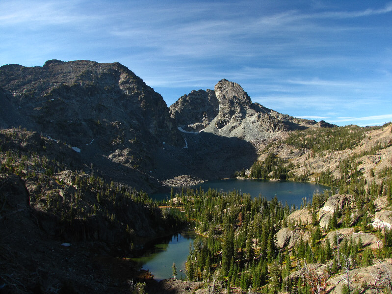
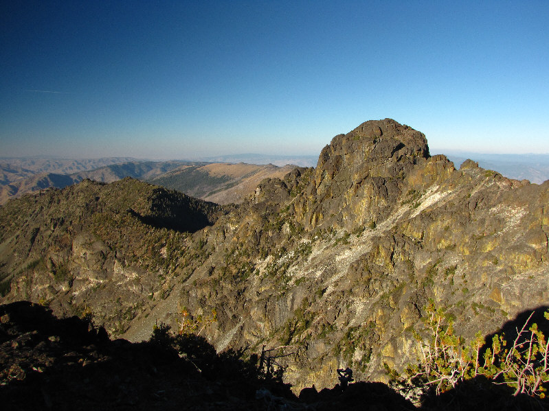
Coming down from Goat Pass, this is one of the first clear views of She Devil (left), He Devil, and Sheep Lake. |
|
|
Kelly descends the trail from Goat Pass to Sheep Lake. |
|
|
He Devil is reflected in the unnamed pond near Sheep Lake. |
|
|
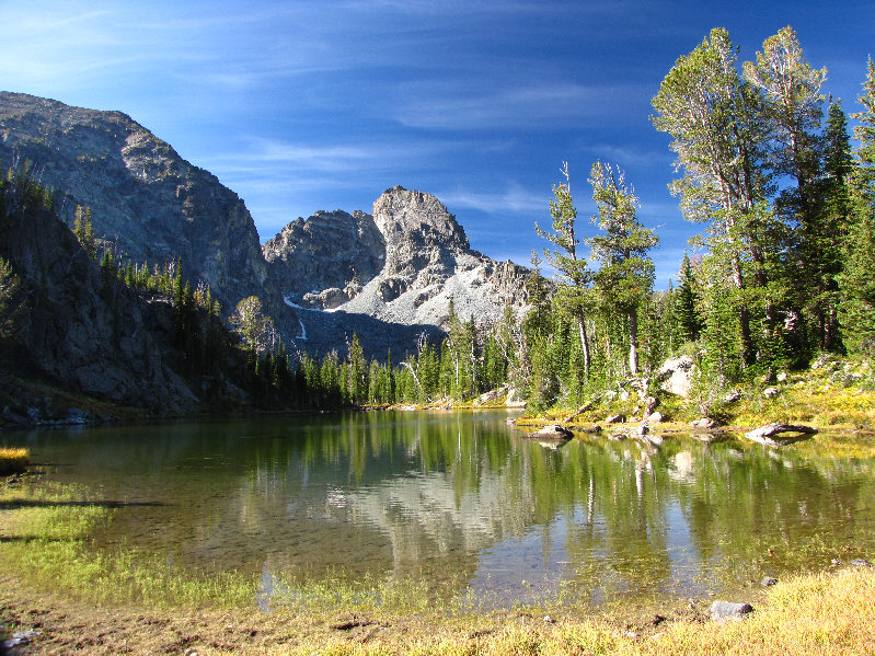
Here is He Devil from the shoreline of Sheep Lake. At right is the saddle that leads to He Devil's northwest ridge (not visible here). |
|
|
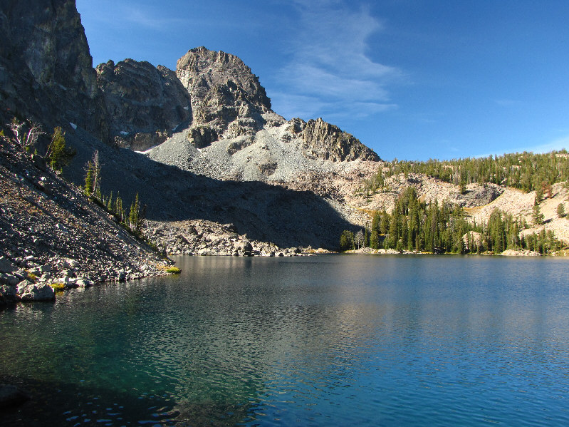
This is Sheep Lake as seen from the boulder field below She Devil. |
|
|
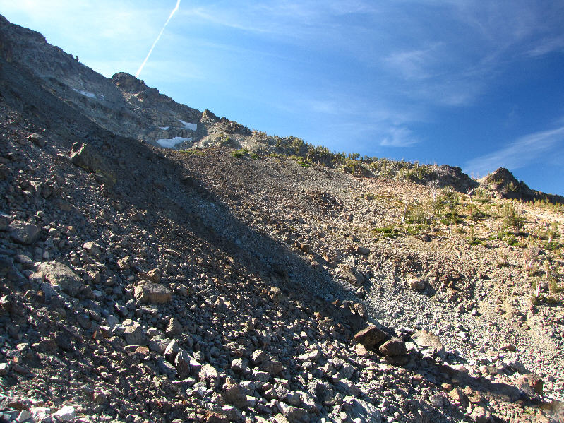
The northwest ridge of He Devil is on the far side of this bowl. |
|
|
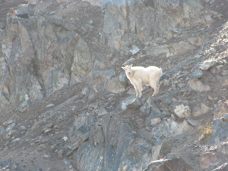
A goat near the northwest ridge looks back curiously. |
|
|
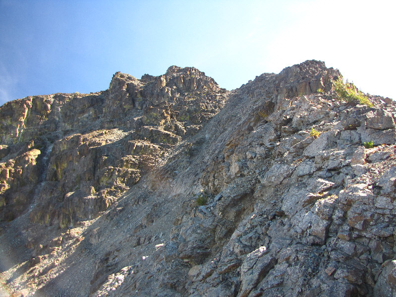
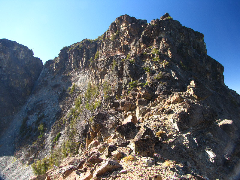
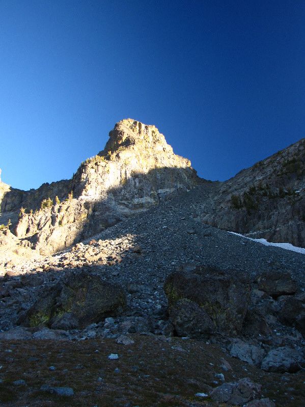
This is looking up the northwest ridge of He Devil. |
|
|
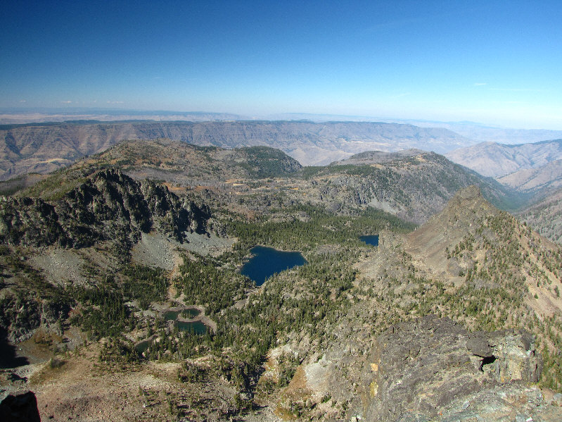
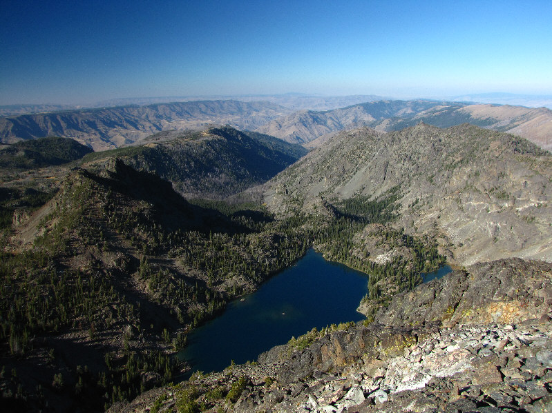
West of He Devil are (L to R) Triangle Lake, Quad Lake (barely visible at centre), He Devil Lake (with island), and Echo Lake. Hells Canyon is visible beyond the lakes while the Wallowa Mountains of Oregon can be seen on the horizon. |
|
|
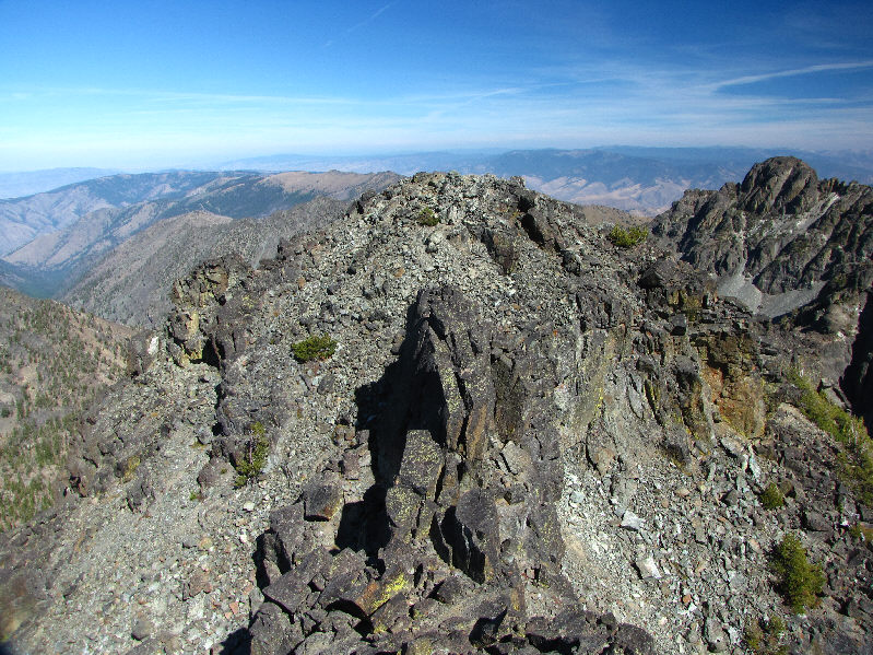
This is the north summit of He Devil as seen from the south summit. Note the rock fin in the dip. |
|
|
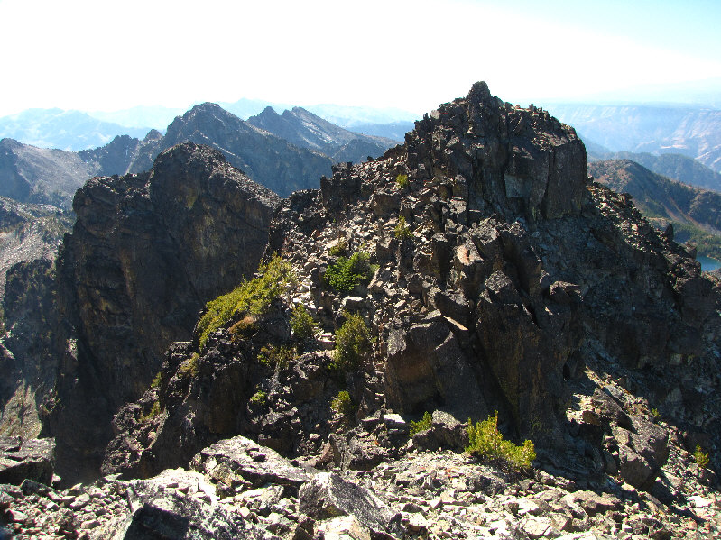
This is the south summit of He Devil as seen from the north summit. Note the large cairn on top. |
|
|
Sonny sits on the 2860-metre summit of He Devil. |
|
|
North of He Devil are (L to R) Appendix Lake, Rock Island Lake (the "island" is now a peninsula!), Gem Lake, and Shelf Lake. More of Hells Canyon can be seen in the distance. |
|
|
Sheep Lake dominates the view to the northeast. At right is Tower of Babel. The access road to Heavens Gate Lookout is also visible in the distance. |
|
|
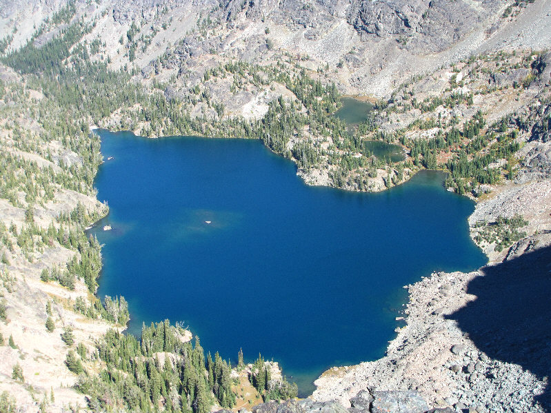
Here is a closer look at Sheep Lake from He Devil's summit. |
|
|
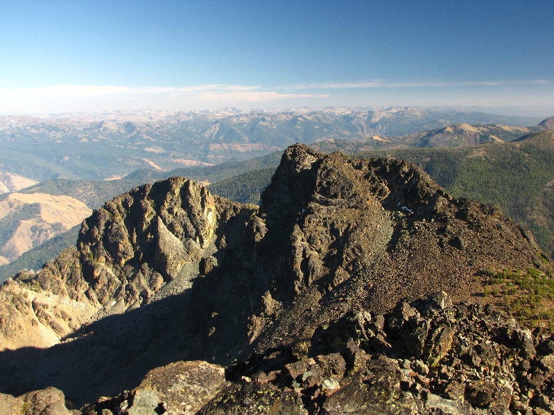
To the east is She Devil which is flanked by Tower of Babel on the left and The Ogre on the right. |
|
|
This is looking up from the bottom of the Class 4 gully on the southeast side of He Devil. |
|
|
This is the east ridge of He Devil from the col between He Devil and She Devil. |
|
|
Sonny holds up a couple of register canisters on the 2860-metre summit of She Devil. |
|
|
This is the view of Sheep Lake from the top of She Devil. |
|
|
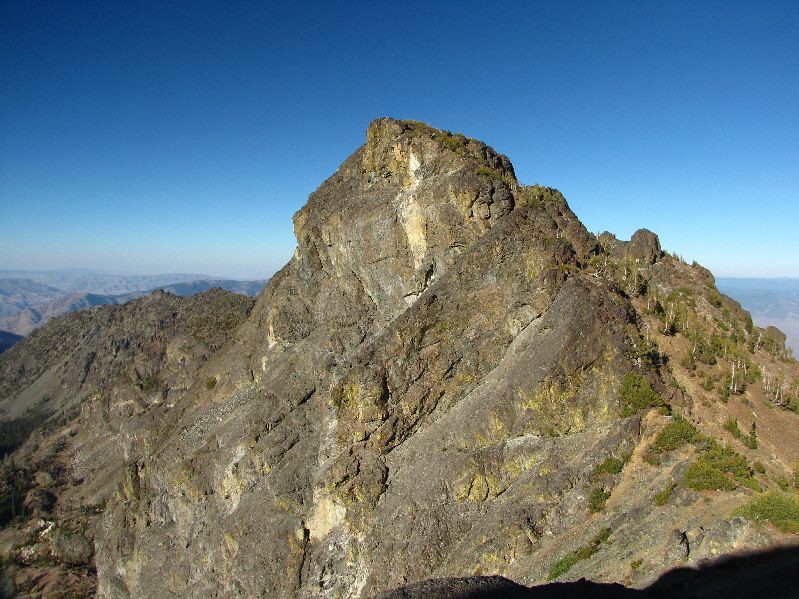
Southeast of She Devil are The Goblin (left) and The Ogre. |
|
|
The late afternoon sun shines on Mount Baal. |
|
|
Sonny stands on the 2795-metre summit of Mount Baal. |
|
|
Here is Tower of Babel as seen from the summit of Mount Baal. |
|
|
This is looking up the descent gully below the west face of Mount Baal. |
|
|
He Devil is reflected in the unnamed pond near Sheep Lake. |
|
|
Mount Baal glows in the last rays of sunlight for the day. |
|
|
Total Distance: 11+ kilometres Round-Trip Time: 10 hours 56 minutes Total Elevation Gain: 1300+ metres |
** Unbeknownst to Kelly and me at the
time, a 39-year old hunter named Todd Hofflander disappeared in the
general area on the same day. His dog was found nearly three weeks
later, but Hofflander's whereabouts and fate would remain a mystery until
27 April 2020 when his remains were discovered by another hunter.
Details of Hofflander's disappearance and discovery can be found
here.