BOU AVENUE
Reynolds Mountain
On 22 August 2011, Kelly Bou and I visited Glacier National Park in Montana to do some hiking and camping.  We stopped first in Saint Mary to pick up some food before heading to the Rising Sun campground to set up our tent.  After paying our camp fee ($20 US or CDN per night), we drove to Logan Pass along the Going-to-the-Sun Road.  Heavy traffic and construction created delays on the road, but those were not nearly as aggravating as trying to find parking at Logan Pass.  We joined a long line of cars slowly circling the parking lot in a seemingly hopeless endeavour, but just when I was about to give up and go elsewhere, I spotted a family getting ready to leave just in front of me.  They certainly took their sweet time to pull out of their parking spot, but I was elated just to be able to park my car.

As Kelly and I joined the hordes of tourists crawling up the boardwalk to the Hidden Lake overlook, I was torn between several scrambling objectives in the Logan Pass area.  Kelly was not keen on scrambling that day but was generous enough to let me take off while she went to mingle with goats near the overlook.  Given my late start, I figured that Reynolds Mountain would be the quickest summit to tag, and I was happy to find the well-defined approach trail branching off from the main tourist trail near Hidden Lake Pass.

Although the approach trail was still covered by snow patches in a few spots, I had no problems following it all the way up to the col northwest of Reynolds Mountain and around to the southwest face.  Multiple cairns mark the start of the route up the southwest face, and I easily ascended through the first cliff bands before churning up the large scree slope on a well-beaten path.  At the base of the cliffs guarding the summit, I followed a zig-zagging line of cairns that led me through most of the difficult terrain.  One particular cairn prompted me to traverse an exposed ledge around a rock window which then led me to a wide Class 4 chute.  This chute is not really exposed, but it requires a couple of awkward moves to get up.  I was probably off-route, but being too lazy to backtrack, I simply climbed up the chute and continued without further problems to the summit.

On descent, I pretty much retraced my steps all the way down the mountain.  I bypassed the chute on skier's right by stepping down a series of very small footholds which are not so obvious from below.  Otherwise, the rest of my descent went without a hitch until I rejoined Kelly at the visitor centre.  Here, we were accosted by a couple from Texas who were really eager to chat us up and even dragged us to meet the wife's long lost aunt who was waiting by the parking lot!  An eternity seemed to pass before Kelly and I were able to tear ourselves away and escape to the safety of my car.  We subsequently capped the day off with an enjoyable dinner at the Two Dog Flats Grill just outside our campground.
Ahhh, it's nice to finally get away from all the tourists! 
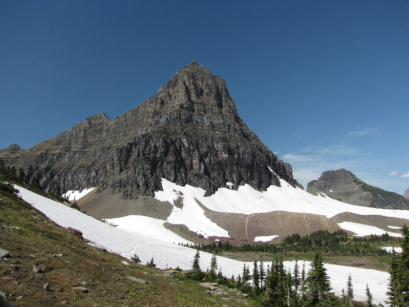
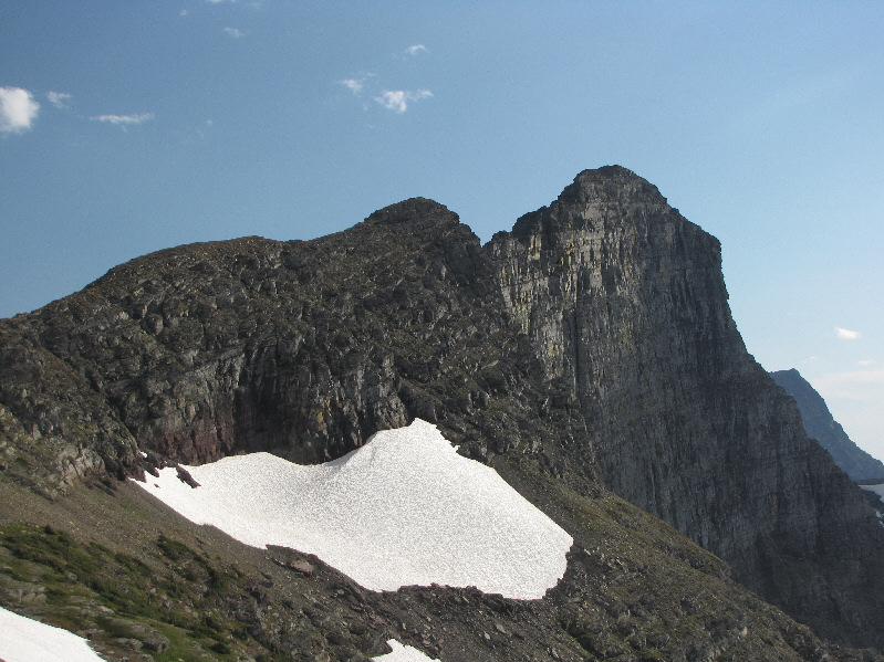
This is looking back at Clements Mountain from the approach trail to Reynolds Mountain.  Mount Oberlin is also visible at right.
Reynolds Mountain is extremely popular! 
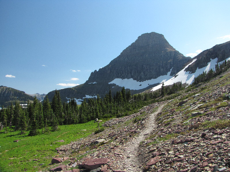
The approach trail for Reynolds Mountain is well-defined.
I think the trio dropped down to retrieve a hat that had blown off someone's head. 
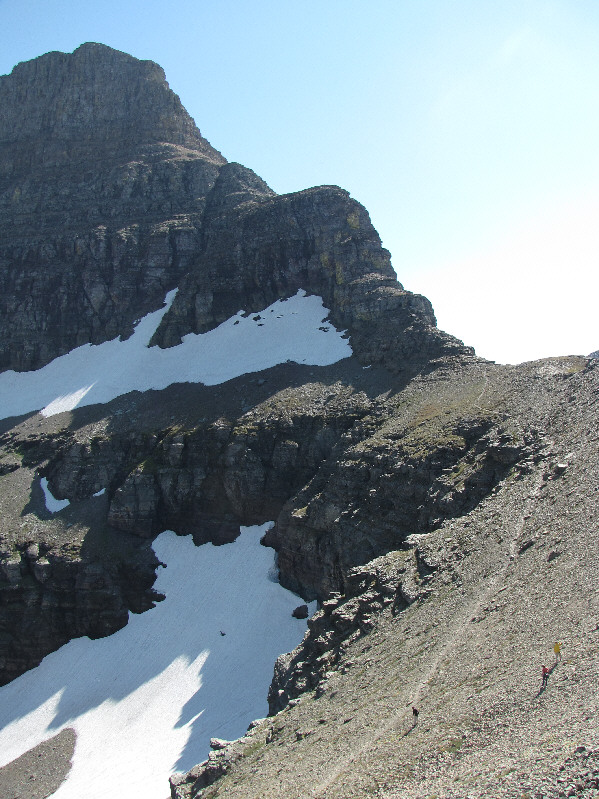
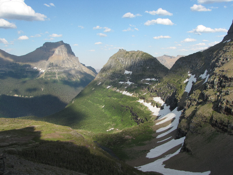
Some people descend from the gap northwest of Reynolds Mountain.  Note that the trail here is not the main approach trail.  The main approach trail takes a higher line to the gap and is out of the photo to the right.
Hard to believe how much snow is still clinging to the mountain this late in the summer! Bearhat Mountain dominates the view to the west.
Kelly was lounging around somewhere down in that patch of green. 
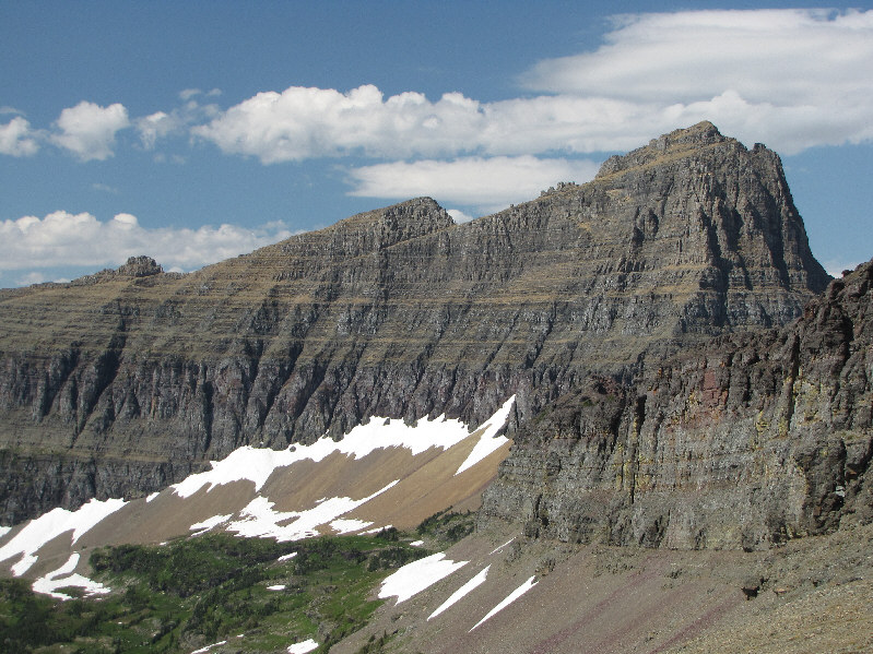
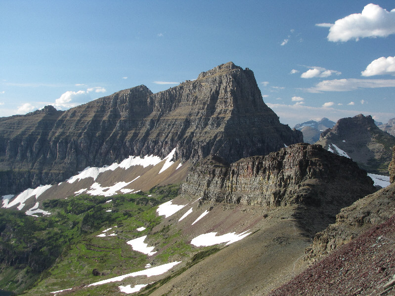
This view shows off Clements Mountain's west ridge.
Probably the most photographed lake in the park. 
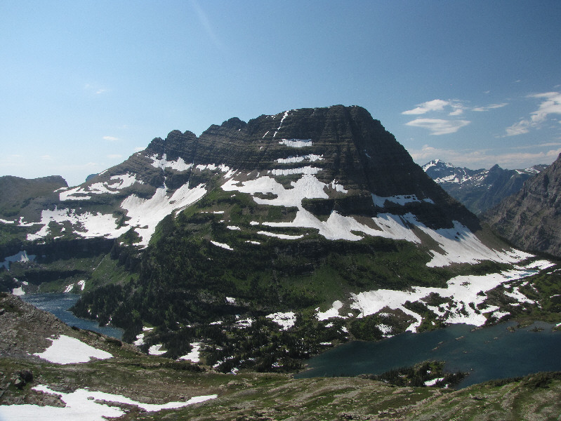
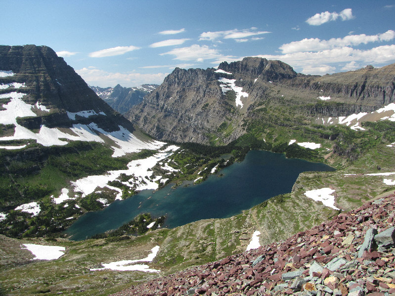
Hidden Lake sits just to the west of the Continental Divide.  Mount Cannon is the peak in the background.
Time to stop and smell the...creeping beartongues?? 
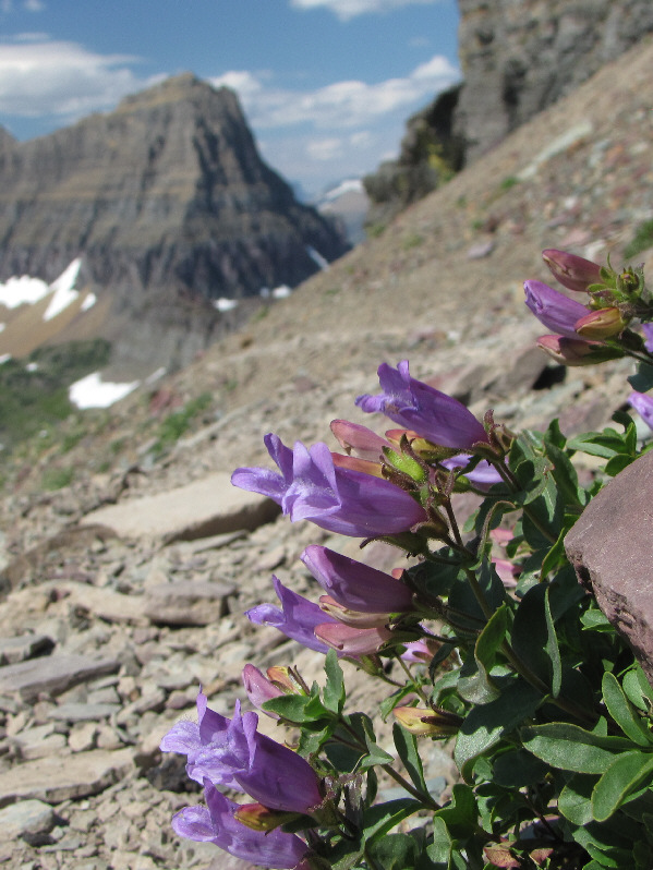
Some creeping beardtongue grow beside the approach trail.
Easy scrambling here. 
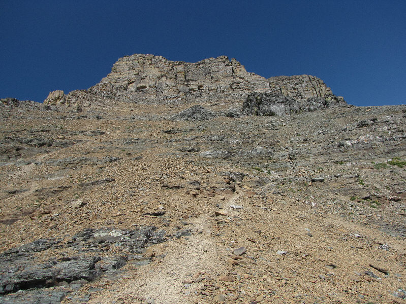
The route up the southwest face begins here.
And I think that's Mount Stimson peeking over the shoulder of Blackfoot Mountain. 
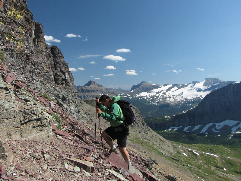
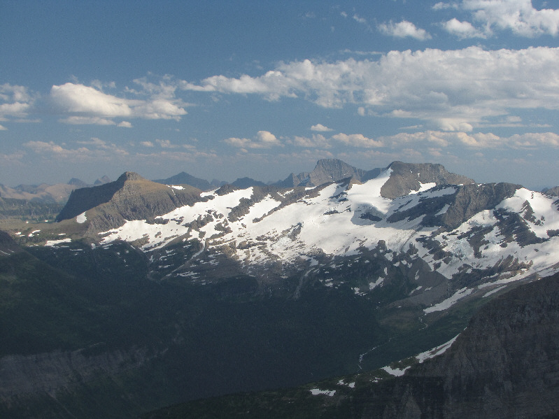
Sonny grinds his way up the slope.  Some of the peaks visible in the distance include Citadel Mountain (left), Mount Logan (right of centre), and Blackfoot Mountain (far right).
Scree slogging doesn't get any easier than this! The beaten path heads diagonally up to the right from here.
The path is great for scree surfing. 
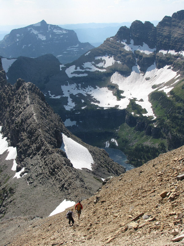
A couple of hikers descend the beaten path.  Mount Brown is visible in the distance.
This is where you play "follow the cairns"!  Can you spot the first one? The terrain becomes more complex on the upper mountain.
It might be fun to climb these with a rope though! 
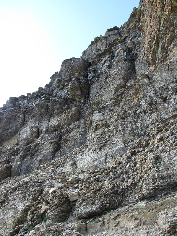
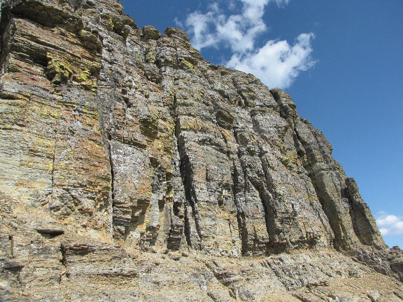
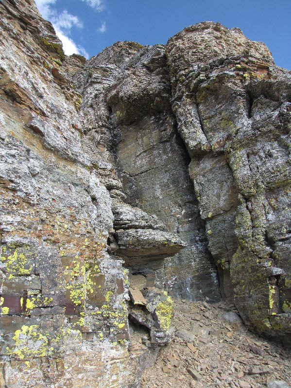
These cliffs are not for scramblers!
Not a great place for people suffering from vertigo... 
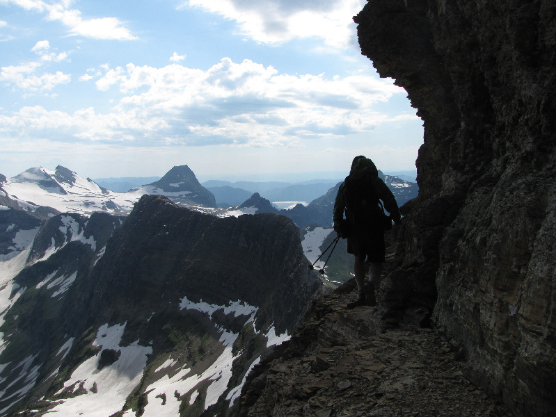
Sonny traverses an exposed ledge.  Visible behind the dark block known as the Dragon's Tail are Edwards Mountain (left) and Little Matterhorn (centre).
This route is probably a lot more "fun" than the correct one! Sonny's route hugs the cliffs here before ascending the wide chute at distant right.  A small window in the cliff can be seen at left.
If I was truly desperate, I probably could have crawled through this window. 
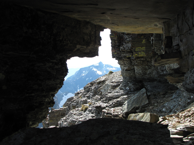
This is looking through the window in the cliff from the other side.  Mount Brown is the distant peak.
Took awhile to get this photo as the sun was obscured by clouds for much of my summit stay. Sonny stands on the 2774-metre summit of Reynolds Mountain.
I think if you started out early enough, you could probably bag both Reynolds and Clements on the same day... Here is yet another view of Clements Mountain.
I might try and climb this one before the end of the season... 
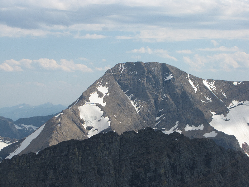
Mount Jackson is the hulking peak to the south.
There's a boat-load of peaks I wanna climb in this photo! 
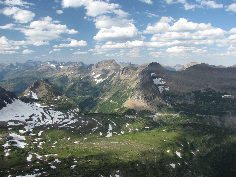
This is a more comprehensive view of the Logan Pass area from Reynolds Mountain's summit.
J. Gordon Edwards has a photo of someone on top of Bishops Cap in his guidebook but makes no mention of the peak in his text! Here is a closer look at Mount Gould (left of centre) and Bishops Cap (right) to the north.
The pointy peak to the right of Mount Siyeh is simply called "Cracker". 
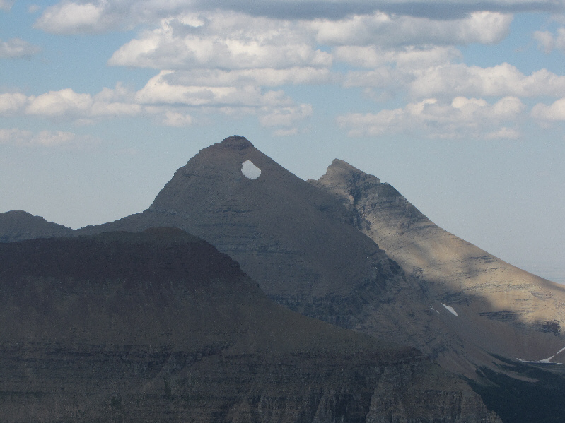
The peak to the northeast with the snow patch is Mount Siyeh.
Divide Mountain is also visible in the distance behind the intervening ridge. 
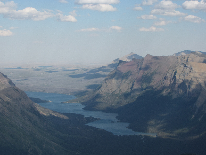
Saint Mary Lake is visible to the east.
Mount Stimson is the second highest peak in the park.   
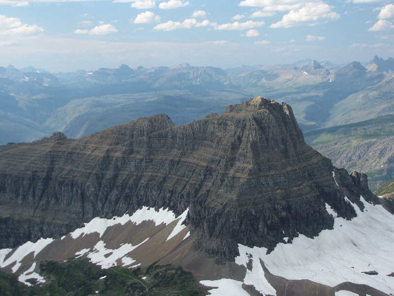
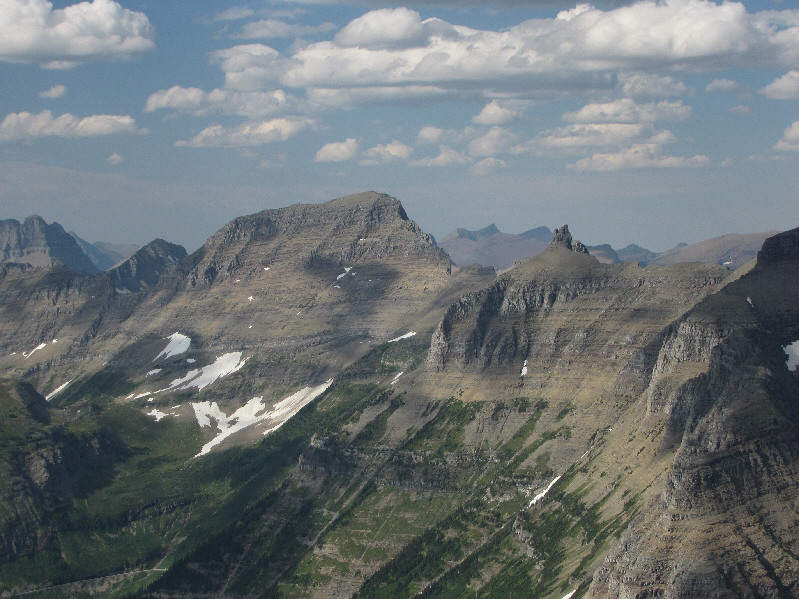
The most prominent peaks to the southeast are Mount Logan (left), Blackfoot Mountain (right), and Mount Stimson (right of centre).
This is also looking down my ascent route. Note the trail in the scree far below. 
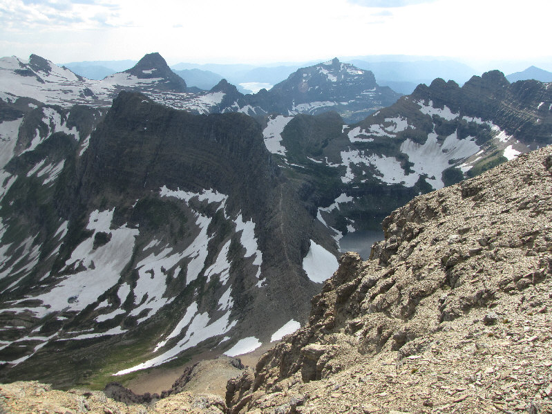
This is looking southwest toward the Dragon's Tail.  The surrounding peaks include (L to R) Edwards Mountain, Little Matterhorn, Mount Brown, and Bearhat Mountain's true summit.  Lake McDonald is also partially visible between Little Matterhorn and Mount Brown.
Best view of the day. 
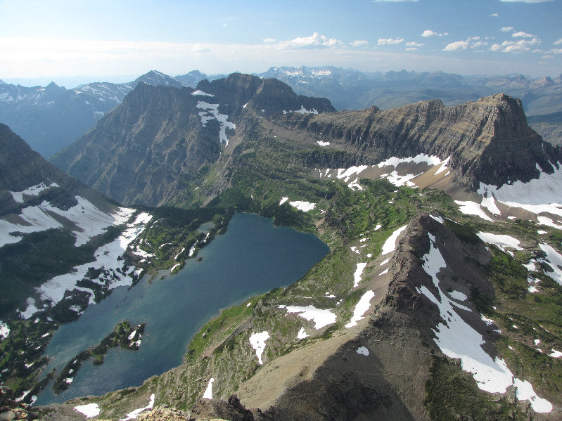
Here is an aerial view of Hidden Lake.  Mount Cannon is left of centre and Clements Mountain is at far right.
I managed to downclimb the wall on the left on descent. Here is a closer look at the wide (Class 4) chute that Sonny used on his ascent.
I ran into these guys on my way down. There was also another couple coming up behind these guys. 
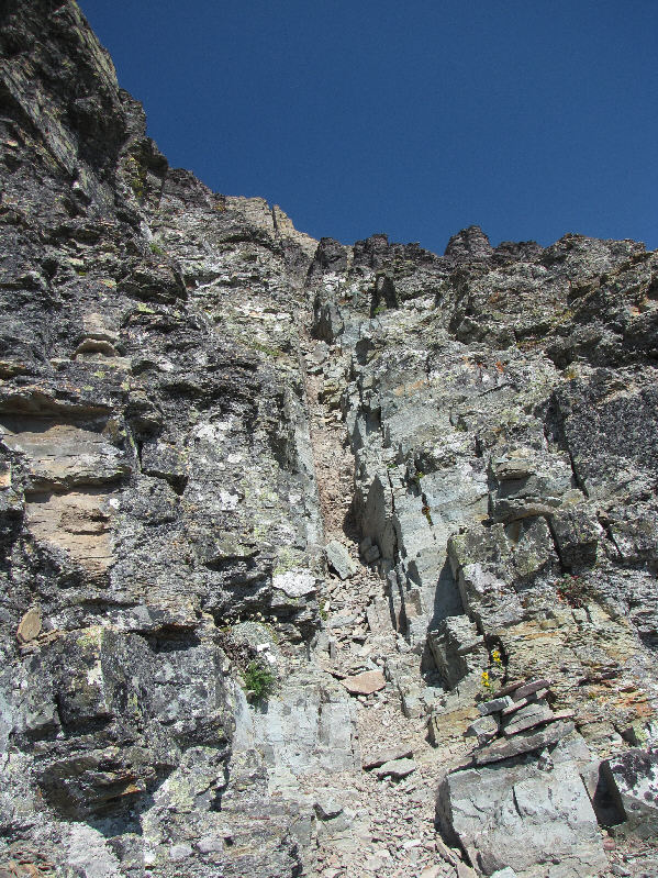
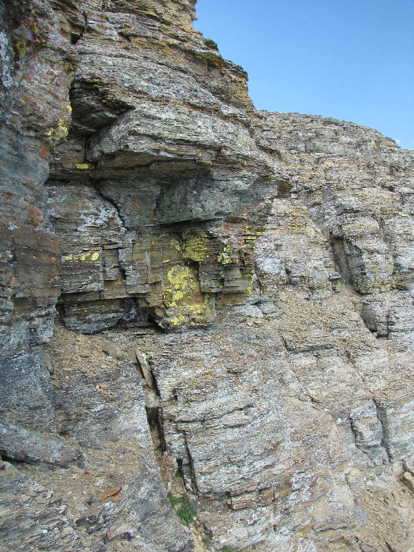
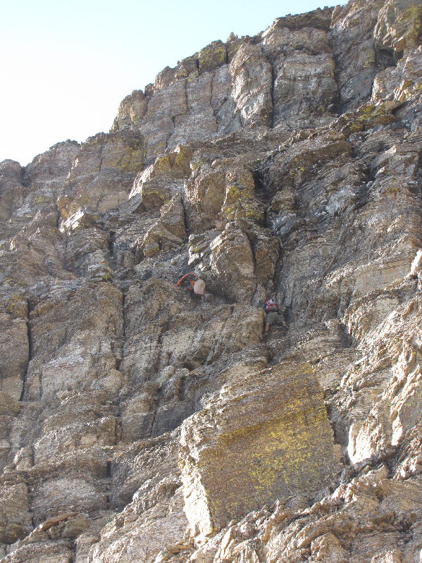
Looking up from the base of the cliff bands guarding the summit, a couple of scramblers work their way up the complex terrain.
The high point of the Dragon's Tail is not visible here. This is the dramatic north face of the Dragon's Tail.
Sick and tired of looking at Clements Mountain yet? Never! Here is a view of Clements Mountain from the approach trail on the west face of Reynolds Mountain.  Mount Oberlin is also visible at far right.
How can you tell I love photographing this peak? 
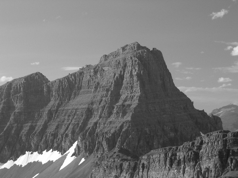
Here is Clements Mountain in black and white!
Looks daunting, doesn't it? 
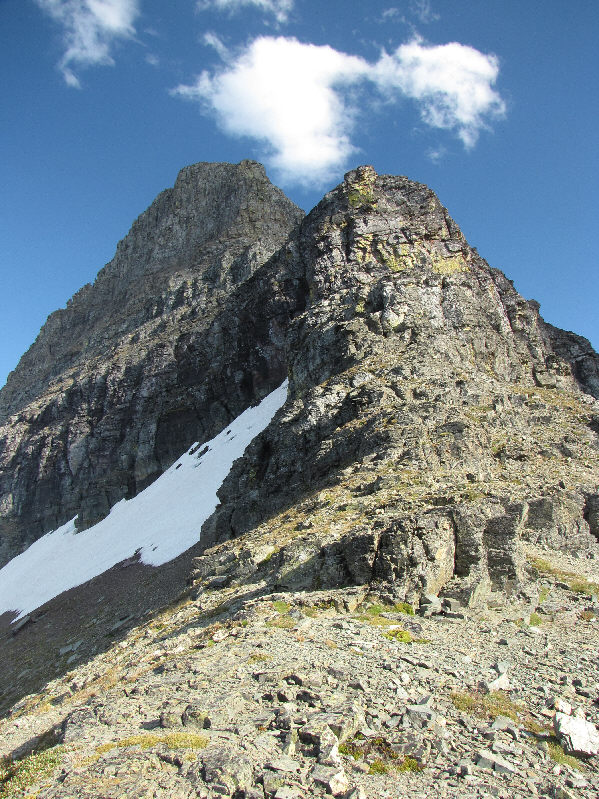
This is looking up the northwest ridge of Reynolds Mountain.
Heavy Runner Mountain? Who picked that name?? Going-to-the-Sun Mountain (left) and Heavy Runner Mountain (centre) are visible to the east from the col northwest of Reynolds Mountain.
That diagonal ledge across the north face is actually a part of a Class 3 ascent known as the Grand Tour Route. 
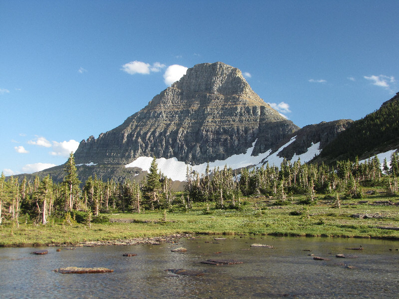
Here is a last look at Reynolds Mountain from a pond near Hidden Lake Pass.
I highly recommend this trip! 
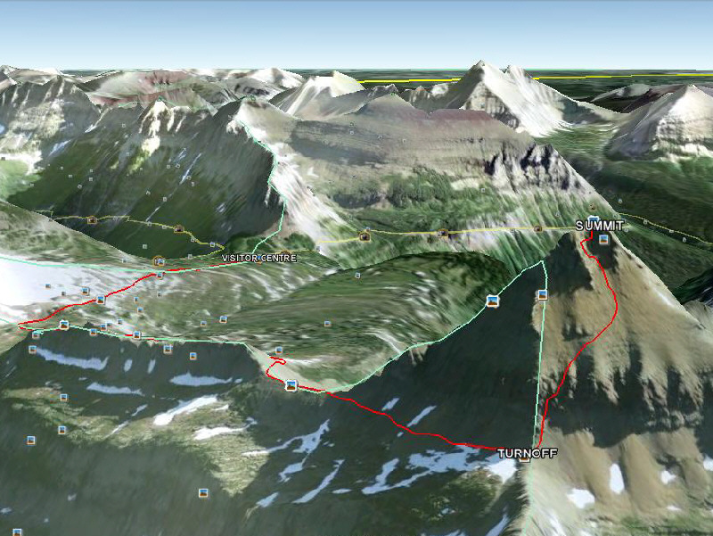
This is the route as viewed in Google Earth.
J. Gordon Edwards states that the one-way distance to the summit is 5 miles, but I highly doubt it.

Total Distance:  11.5 kilometres
Round-Trip Time:  5 hours 38 minutes
Net Elevation Gain:  729 metres

GPX Data