

*According to my GPS. The official figure is 4167 feet or 1270 metres.





While visiting my brother's family in Kirkland, I took advantage of an unusually good weather window on New Year's Day 2013 and headed out early to climb Mount Si. Upon my arrival at the trailhead (different than the one for Little Si), there was already a large crowd gathered in the parking lot. To my dismay, I noticed signs indicating that a parking pass (Discover Pass) was required. I approached another hiker in the parking lot and inquired about where I might be able to purchase a pass, but he was less than helpful going so far as to suggest that I take a chance and forego getting one. Being New Year's Day, it was quite likely that nobody would be coming around to check on vehicle passes, but given the immense popularity of this hike especially on a statutory holiday, it was equally likely that someone would come by to check. Rather than risk a hefty fine, I backtracked to the I-90 where I spotted a local general store that surprisingly was open early. A girl there with a distinct Southern twang in her voice said that the store did not sell any passes, but she suggested that I try a hardware store in the nearby town of North Bend. I had my doubts about the hardware store being open early if at all on this day, but I headed to the town anyway. Along the way, I spotted the local ranger station and stopped to see if I could get a pass there. The ranger station turned out to be closed, but a sign on a window stated that, while passes were not sold there, they could be obtained at a number of places in town including the aforementioned hardware store as well as a couple of gas stations. That was encouraging news, and shortly thereafter, I was able to purchase a parking pass ($11 USD per day or $32 USD annually) from one of the gas stations.
After wasting about 45 minutes hunting down a parking pass, I was back at the trailhead, and although the large crowd had already departed up the trail, there were more cars arriving in the parking lot. It would be very busy on the trail on this day. Most of the ascent of Mount Si is on a signed, well-graded trail that switchbacks gently up the south ridge. The snow line on this day was about halfway up, and some sections of the trail in this transition zone were icy enough in the morning to warrant the use of hiking cleats which I noticed on a great many other hikers' boots. I was fine with just my winter hiking boots, and once I transitioned fully into the snow zone, traction on the trail was not as much of an issue. The fact that the snow was packed down solidly on the trail attests to how popular this hike is even in the winter. The trail eventually breaks out of the trees amidst a jumble of rocks below the feature known as the Haystack, a towering wall that guards the summit of Mount Si. This area was teeming with people ogling the expansive views and socializing amongst themselves, and the carnival-like atmosphere was not unlike that found on the most popular hikes in Alberta's Banff National Park or Kananaskis Country.
The summit of Mount Si is usually reached by a Class 3 gully--the crux--on the north side of the Haystack. Unable to see the route from where I emerged from the trees, I impatiently asked a hiker who was heading down if he had gone up to the summit. Sounding a bit annoyed, he said that he did not and added that he would not even consider trying the route in such conditions. "Too steep, too much snow, too far to fall," were his words as I recall. Undaunted, I followed tracks around the east side of the Haystack and eventually climbed past a wooden bench to the base of the crux, a steep gully about 30-40 metres high. In dry conditions, the crux would likely be a delightful romp, but on this day, the gully was choked with snow which made climbing it a much more serious endeavour. Some old faded tracks in the snow indicated that someone had gone up recently but not on this day. Though I had my crampons and ice axe with me, I did not feel the need to use them as I easily kicked steps up the semi-hard snow. As I got higher, it suddenly dawned on me that a slip here, while not likely fatal, would be sufficiently unpleasant and probably debilitating. Since my position was too precarious to stop and remove my pack, I continued upwards cautiously ensuring that all my holds were as secure as possible. At least two spots in the snowy gully were troublesome to climb up, and the final short push to the summit was a bit unnerving given the serious exposure to climber's right.
Seeing so many people milling about below the Haystack, I found it gratifying to have the
summit all to myself, but despite the mild weather and far-reaching views, I was anxious to get
down the Haystack before having lunch. Taking no chances, I took out my ice axe and donned my
crampons. With the added security of this gear, I made short work of descending the Haystack and
was back at the wooden bench in a relatively short time. Just as I was about to remove my
crampons though, I noticed that my small nylon crampon bag was missing. I had inadvertently left it
at the summit! After some hesitation trying to figure out how much the cheap little bag was
worth, I dropped my pack beside the bench and returned to the bottom of the gully. Wearing
crampons, I had an easier time re-ascending the Haystack, but upon my return to the summit, my
crampon bag was nowhere in sight, likely blown off somewhere down the steep west face. Disappointed
that all that extra effort was for naught, I turned around to descend the crux for a second
time. This time on my way down, I encountered a fellow following my tracks up the crux. Equipped with only ice cleats, he expressed some of the same apprehension I had on my first
ascent. Despite stating that he had already reached the summit on a previous occasion and
expressing some reservations about continuing, he kept climbing anyway. I wished him well as we
moved in opposite directions. He would be the only other person I
would see reach the summit on this day. At the bottom of the gully, I met a couple who congratulated
me on my descent but had no intentions of going any further. After removing my crampons and
retrieving my pack, I found a nice spot below the Haystack to eat lunch before resuming my
hike back to the trailhead.
All the way down, I encountered lots of people still going up, and
much like my descent of
Humphreys Peak in Arizona, I wondered if many of these people were going
to make it to tree line before sunset. I reached my car well before
sunset after a round-trip time of 6.5
hours.
 |
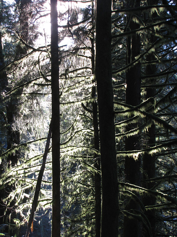
The morning sunshine illuminates the forest. |
 |
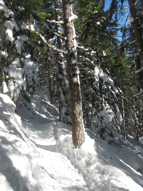
Despite an abundance of snow, the trail is packed down well. |
 |
The views open up at tree line. At left is Mount Washington while in the distance at right is Mount Rainier. |
 |
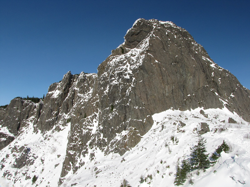
The summit of Mount Si is at the top of the feature ahead known as the Haystack. |
 |
The Olympic Mountains make a stunning backdrop for the city of Seattle in this view to the west from below the Haystack. |
 |
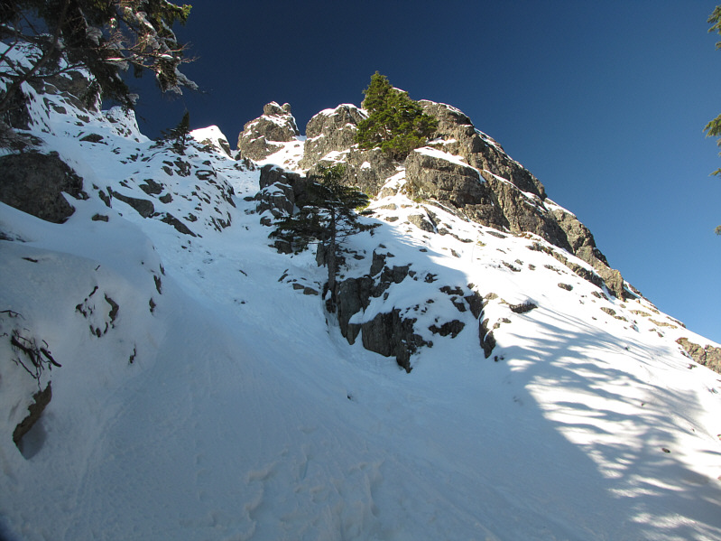
This is looking up at the crux section on the north side of the Haystack. |
 |
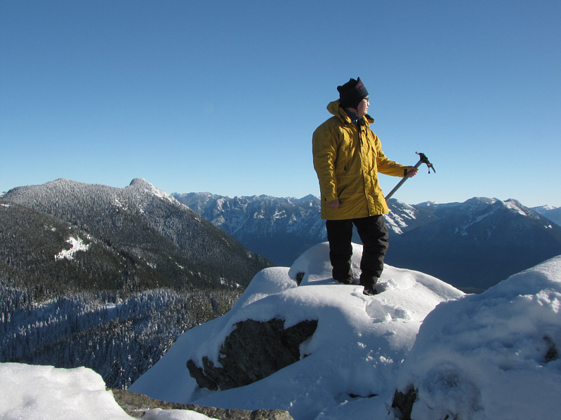
Sonny stands on the 1282-metre* summit
of Mount Si. *According to my GPS. The official figure is 4167 feet or 1270 metres. |
 |
Across the valley to the southwest is Rattlesnake Mountain. |
 |
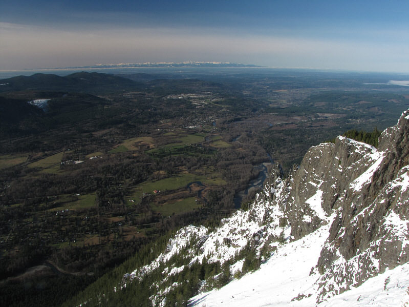
The Snoqualmie River valley stretches out to the west. On the horizon are the Olympic Mountains. |
 |
Puget Sound is visible to the northwest. On the northern horizon at right is Mount Baker. |
 |
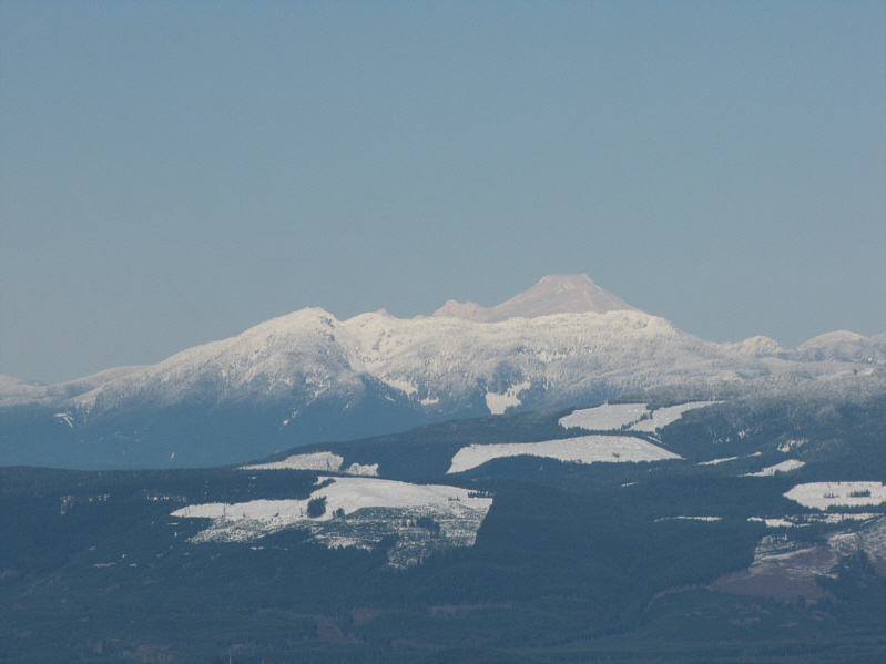
Here is a closer look at Mount Baker. |
 |
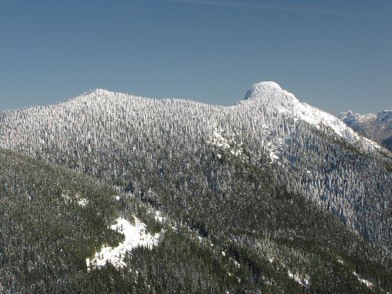
Mount Teneriffe is about three kilometres due east of Mount Si. |
 |
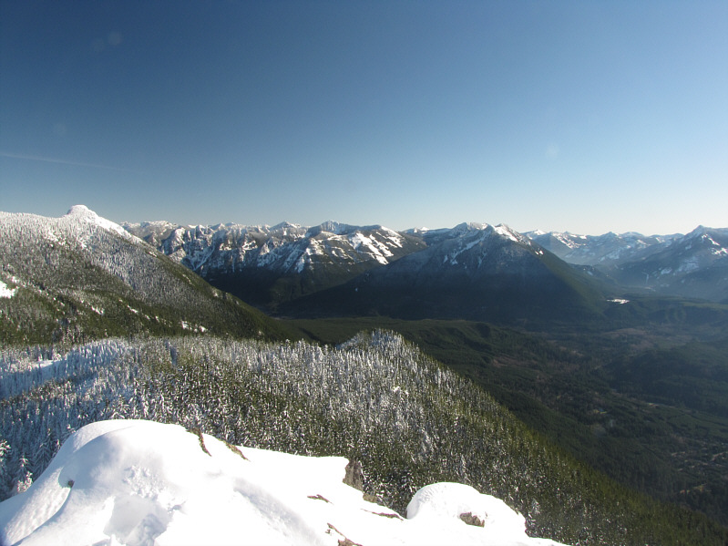
The view eastward includes Mount Teneriffe (far left) and a host of other peaks in the Cascade Range. |
 |
This is looking back up at the crux route after Sonny's first descent. |
 |
This is looking up the south face of the Haystack. |
 |
Here is a more comprehensive view of the Haystack from a nearby knob. |
 |
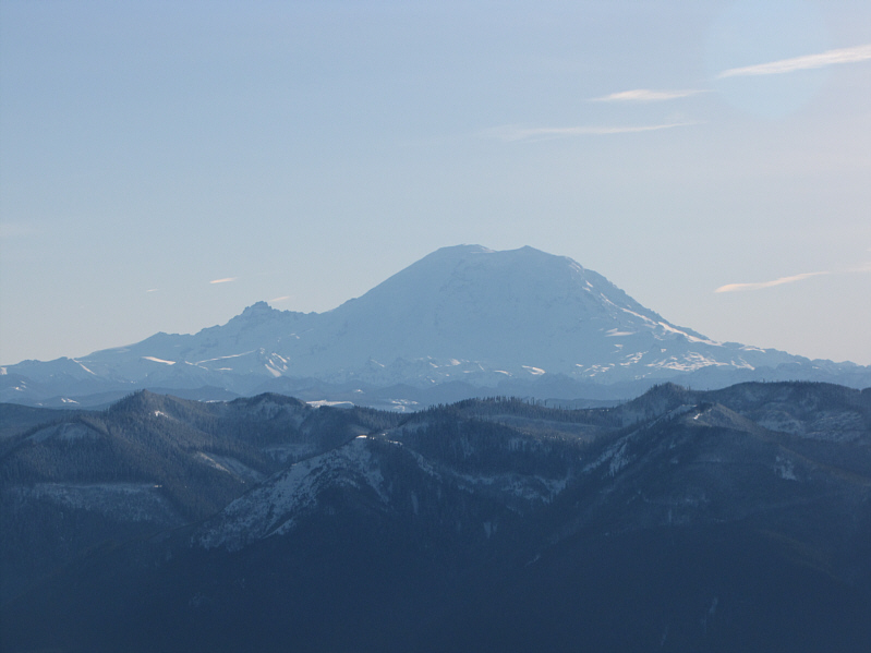
Mount Rainier is captivating even on its shadowy side. |
 |
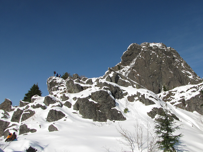
Other hikers can be seen milling about on the rocks below the Haystack. |
 |
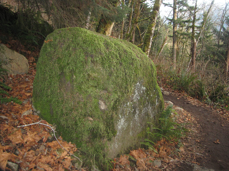
Moss covers a large boulder beside the trail. |
 |
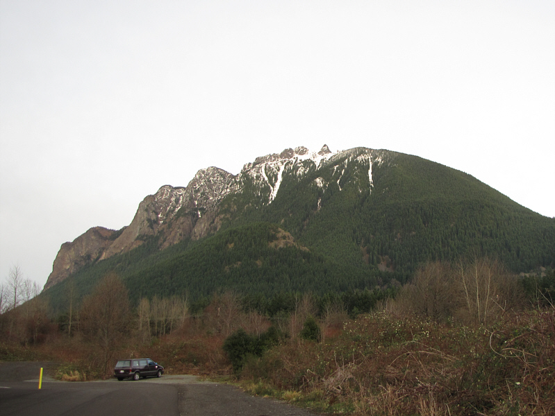
This is Mount Si as seen from just outside the town of North Bend. |
 |
Here is a zoomed-in view of the Haystack. |