BOU AVENUE
Mount Jackson
The fourth highest mountain in Montana's
Glacier National Park (GNP), Mount Jackson is an alluring peak-bagger's
objective and had been high on my to-do list for quite some time.
Of the six mountains in GNP which exceed 10,000 feet, Mount Jackson has
one of the easier approaches although this still entails a lengthy march
of at least 10 kilometres just to get to the base of the mountain.
As such, two days are normally recommended for the ascent with an
overnight stay at Gunsight Lake campground. Getting backcountry
permits at GNP is a bit of a hassle though (no matter how experienced a
backcountry traveler you are, they always make you sit and watch a
15-minute video on backcountry safety before selling you a permit), and
after reading Andrew Nugara's
report of
his one-day ascent of Mount Jackson with Rafal (Raff) Kazmierczak, I was
convinced that going light and fast over a single long day would be the
preferred strategy. Of course, "light" and "fast" are seldom
synonymous with my scrambling style, and knowing that it still took over
14 hours for Andrew and Raff to complete their trip, I was skeptical that
I could even do the same in less than 16 hours which is exactly how long
the border crossing at Piegan/Carway is open on a daily basis during the
summer. Although the obvious solution to the limited border
crossing hours is to simply arrive the night before and car camp before
getting a good alpine start, I was loath to splurge for a $20 camping
site which I would only use for a few hours anyway. Instead, I came
up with the insane plan to arrive the night before and simply begin the
trip in the middle of the night. By doing the long but easy
approach in the dark, that would allow me to go up and down Mount Jackson
during the bulk of the day and still leave me plenty of daylight to
return to the trailhead and subsequently make the border crossing before
it closed. On paper at least it sounded like a good plan.
Ultimately, what I failed to anticipate was the hot weather and the
mosquitoes.
I drove out to the trailhead on the Going-to-the-Sun road on the evening
of 12 July 2014. Given the late hour, I was a little surprised at
how much traffic was still zooming up and down the road. This park
truly does not sleep during the summer! I eventually got under way
just before midnight (13 July 2014) on the well-maintained trail that
descends nearly 200 metres to the first junction near the bridge over
Reynolds Creek. A near-full moon was out, and I could largely
follow the trail without turning on my headlamp although I did use it
often partly as a means to warn any potential bears of my approach.
The hike to Gunsight Lake campground was quiet and uneventful, and I
arrived perhaps a bit too early since it was still too dark to take
photographs of the lake. After crossing the suspension bridge over
the lake's outlet, I took an extended break in hopes that the sky would
brighten a bit before I began tackling the lower slopes of Mount Jackson.
I put on all my extra clothing since the temperature had dropped
significantly, and then I had something to eat before lying down on a big
rock for a bit of a nap.When I
started moving again, I climbed up the Jackson Glacier trail and started
to encounter more and more snow. The trees eventually thinned out,
and I turned up the big slope below the northeast ridge of Mount Jackson.
As innocuous as it looks, this slope is actually deceptively steep. I
strapped on my crampons and climbed up some of the lower snow patches,
but higher up, I removed my crampons to ascend a rather miserable section
of treadmill rubble. My upward progress was painfully slow here,
and getting up to the crest of the ridge was proving to be wearisome and
time-consuming. By now, the sun had risen high enough to illuminate
the entire mountain, and I was more than a little troubled by how hot the
sun felt even at this early hour. At one point, I heard a clatter
off to my right, and I turned to see a rock about the size of a
television dislodge from a snow patch and go hurtling down the slope.
The rock tumbled for a very long distance, and it was sobering to realize
that I had climbed up through its fall line less than an hour earlier.
I pressed on and finally gained the ridge crest after what seemed like an
eternity.
From where I gained the ridge crest, I
got my first good look at the remainder of the route, and what I saw was
disheartening. I still had an enormous amount of elevation gain
(probably about 600 metres) to reach the summit, and the ridge, at least
from a distance, looked more complex than expected. The actual
scrambling on the ridge turned out to be not too difficult, but in my
tired state, I found little enjoyment in the endeavour. My biggest
enemy though was the hot sun. With virtually no wind, the heat from
the sun was becoming oppressive, and I was going through my supply of
water and liquid refreshments at an alarming rate. Whenever I found
shade on the ridge, I would linger there for an extended pause; I may
have even dozed off once or twice. A real godsend were the
lingering snow patches that were more frequently found higher up on the
ridge. What a great relief it was to rub cold snow all over my
head, neck and arms. On a couple of occasions, I even plugged both
my ears with snow! Another cool trick was to tuck a big snowball
under my baseball cap and let it melt on top of my head as I continued
climbing.
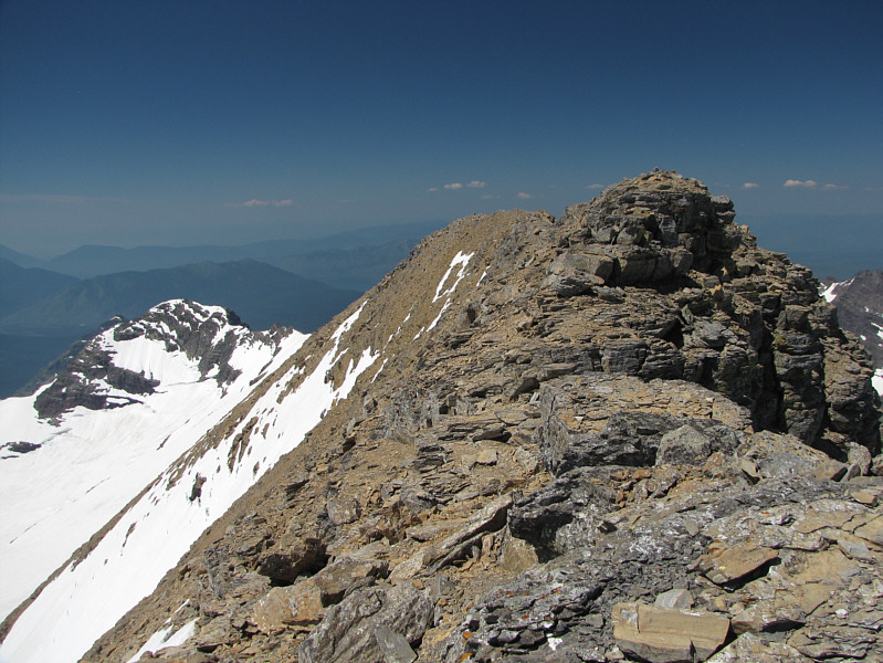
After yet another eternity, I finally
staggered onto the summit ridge and eventually the true summit. I
was numbed by exhaustion, and the first thing I did on the summit was sit
down and polish off a delicious soda pop (Fanta orange). It had
taken me over 12.5 hours to ascend Mount Jackson, and as wonderful as the
summit panorama was, it was hard to ignore the enormity of the return
journey that was still ahead of me. Despite feeling some urgency to
start descending, I spent an hour on the summit anyway doing my requisite
chores and somewhat recharging myself both physically and mentally.
Taking my boots and socks off, even temporarily, seemed to do wonders.
After leaving the summit, I retraced my
steps down the northeast ridge without any problems. I briefly
considered following the alternate descent taken by Andrew and Raff, but
because I was unsure of where exactly they went, I ended up just going
back down the big slope I originally ascended. Going down this
slope was far easier given that the loose rubble and snow patches could
all be glissaded fairly quickly (beware of big fissures in the snow
patches). With some luck, I regained the
snow-covered Jackson Glacier trail and hiked back to Gunsight Lake
campground. Upon re-entering forest, I was immediately accosted by
a swarm of mosquitoes. Up until this trip, I had seen relatively
few mosquitoes during my previous outings for this year, and
consequently, I had forgotten to bring bug repellent. I would pay
dearly for this oversight during the remaining 10-kilometre hike back to
my car. The last six kilometres or so were especially brutal as the
mosquitoes here were absolutely relentless. I was eventually forced
to don my hooded waterproof jacket to keep the mosquitoes at bay, but
this felt like I was hiking in my own portable sauna. Adding to the
misery was the 200-metre ascent from Reynolds Creek back up to the
trailhead. What a cruel way to end an already long and exhausting
day!
Epilogue: When I stopped
in Fort MacLeod, Alberta to get gas on my drive home, I was attacked by a
second swarm of mosquitoes as soon as I stepped out of my car at the fuel
pump. I must have looked really comical doing something akin to the
Chicken Dance, swatting at waves of mosquitoes while simultaneously
trying to pump gas.
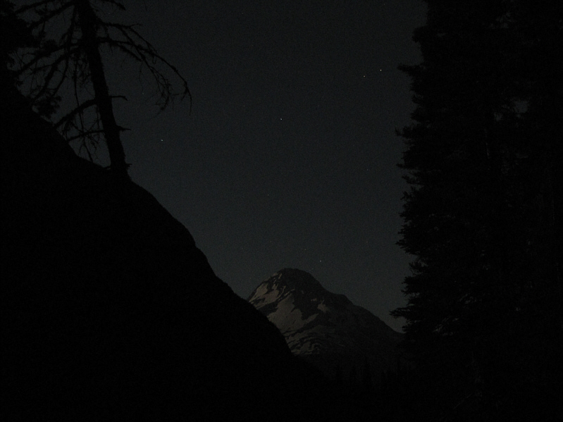 |
A break in the trees along the
approach trail grants a moonlit view of Mount Jackson. |
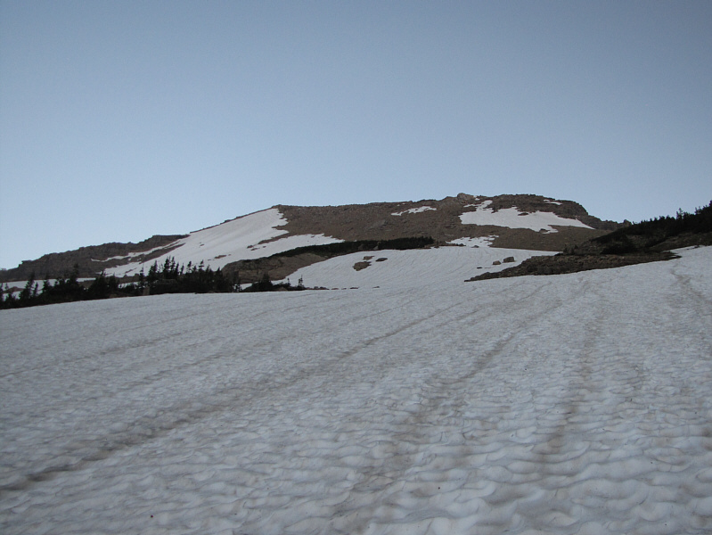 |
The sky begins to brighten over the
slopes below the northeast ridge. |
 |
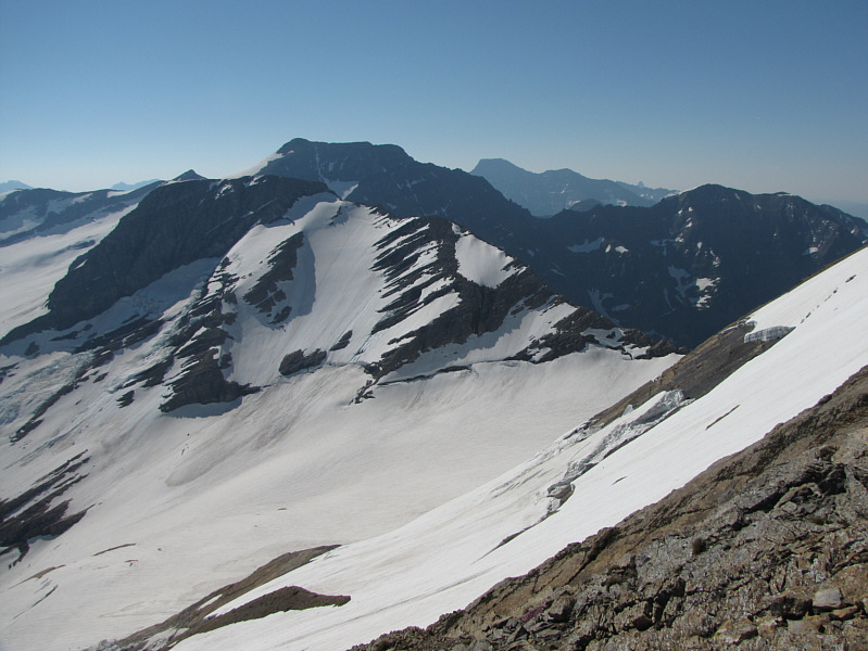
The first rays of sunshine illuminate
an outlying ridge of Blackfoot Mountain. Note the part of the
snowfield/glacier that has slid off revealing the rock underneath. |
 |
The morning sun also shines on
Fusillade Mountain to the north. |
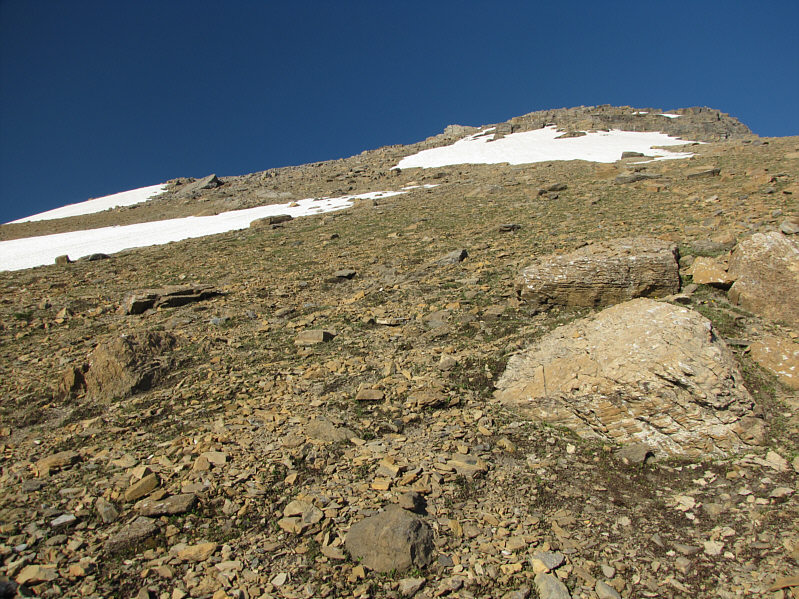 |
Despite appearances to the contrary,
the rubble is horribly loose on this slope. |
 |
Gunsight Mountain looks wonderfully
complex. Also visible at far left is diminutive
Lincoln Peak. |
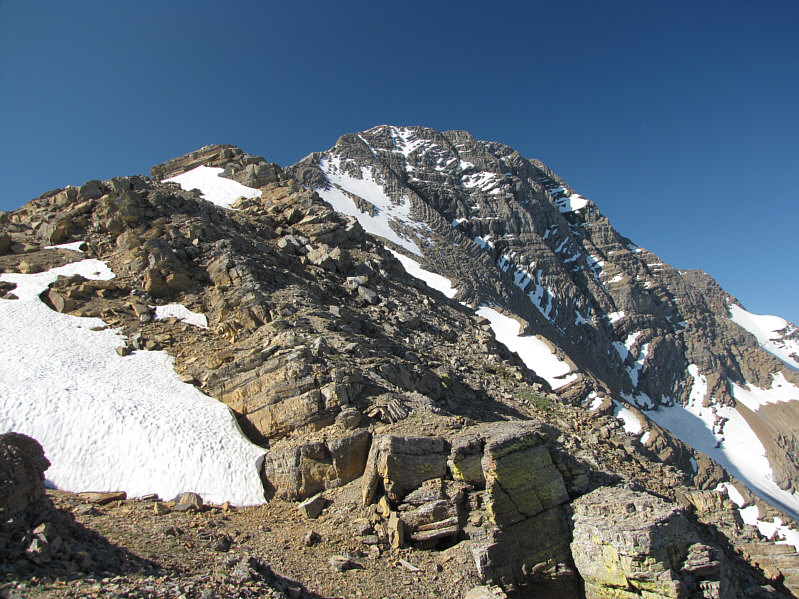 |
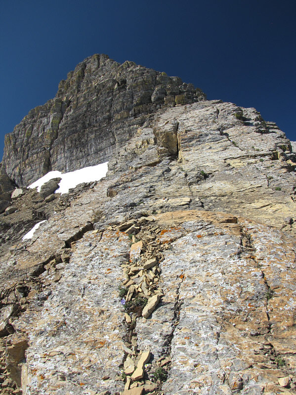
This is the view of the upper part of
Mount Jackson from where Sonny gained the northeast ridge. |
 |
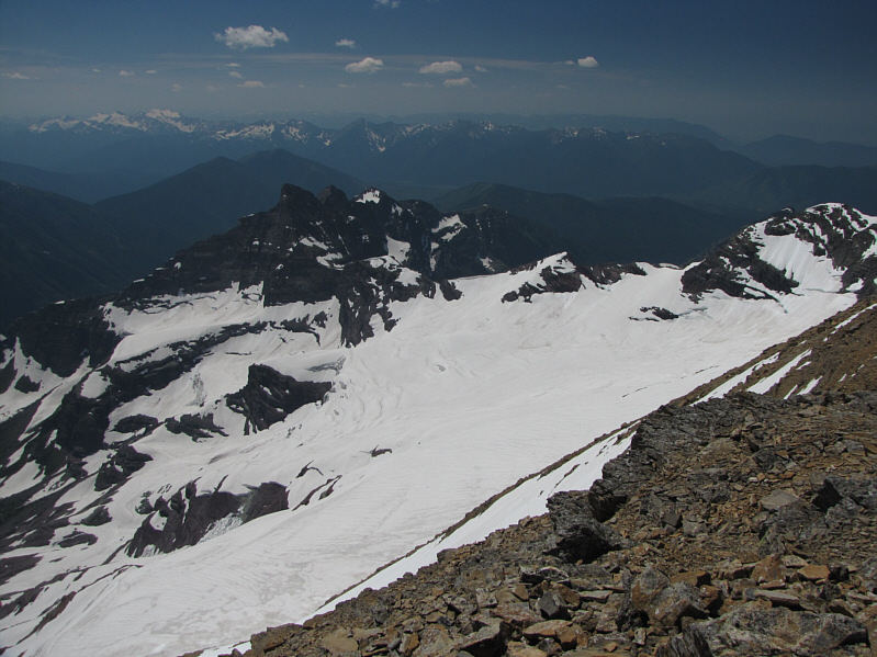
The north face of Mount Jackson still
harbours a fairly large glacier. |
 |
Here is a closer look at a crevasse in
the glacier on the north face of Mount Jackson. |

The upper part of the northeast ridge presents some
interesting challenges.
 |
Mount Stimson (right of centre) is
barely visible in the distance behind Blackfoot Mountain. Note
another large chunk of snow/ice sliding off the upper slopes of Mount
Jackson. |

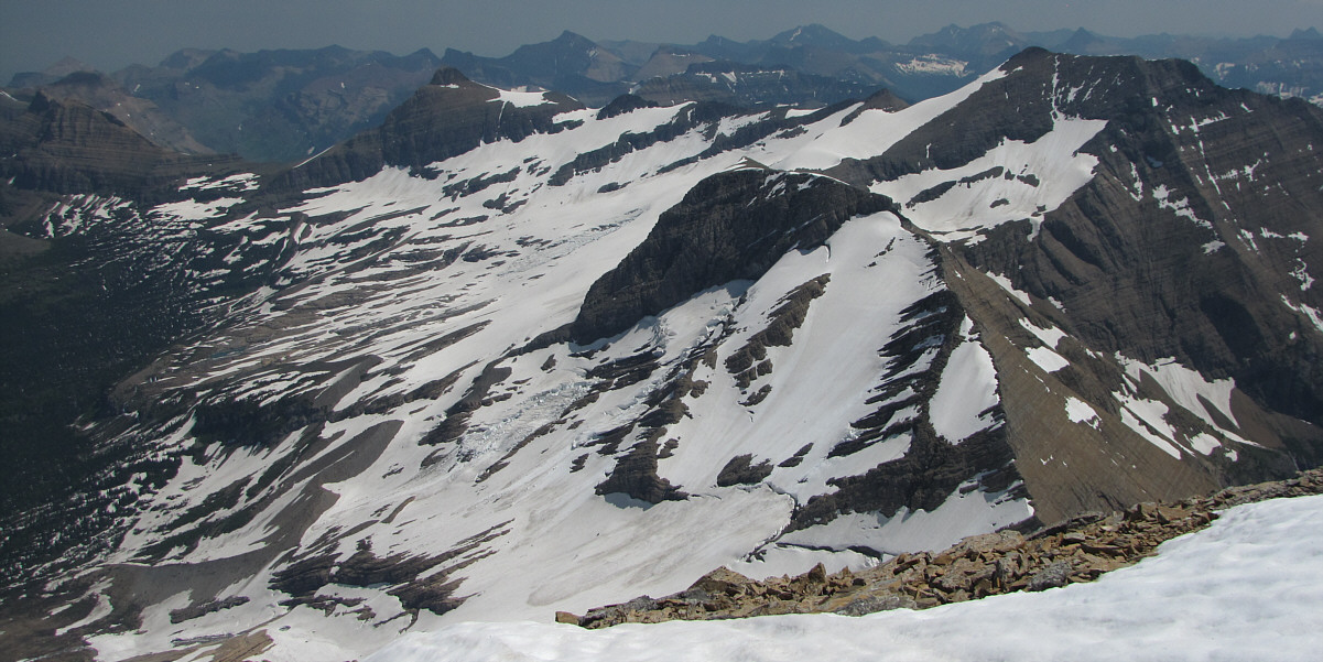
An enormous section of snow and ice appears to have
slid down the lower slopes of Mount Jackson.

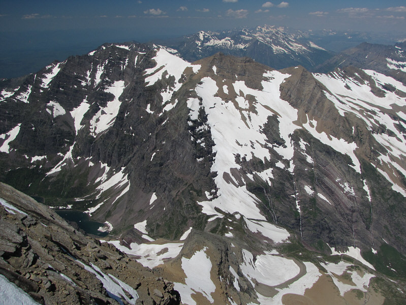
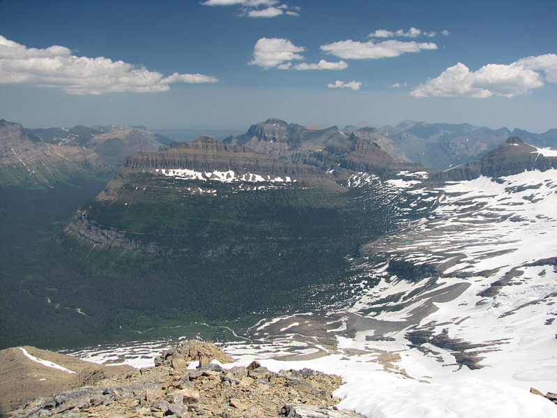
Here is a closer look at Mount Siyeh, Cracker,
Matahpi Peak, and Going-to-the-Sun Mountain.
 |
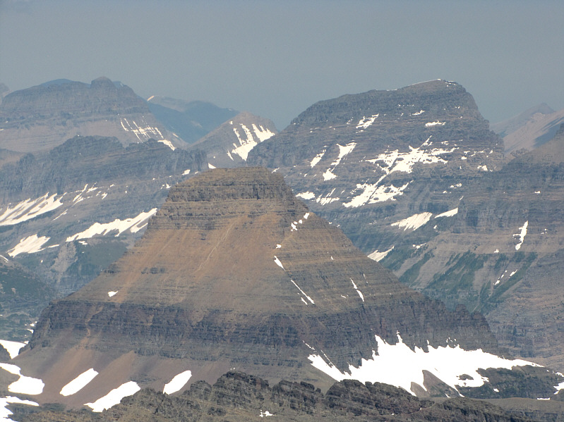
Some of the more prominent peaks to
the east include Citadel Mountain (left of centre), Little Chief
Mountain (centre), and Mount Logan (far right). |
The remainder of the eastern view is dominated by
Mount Logan (left), Blackfoot Glacier, and Blackfoot Mountain (right).
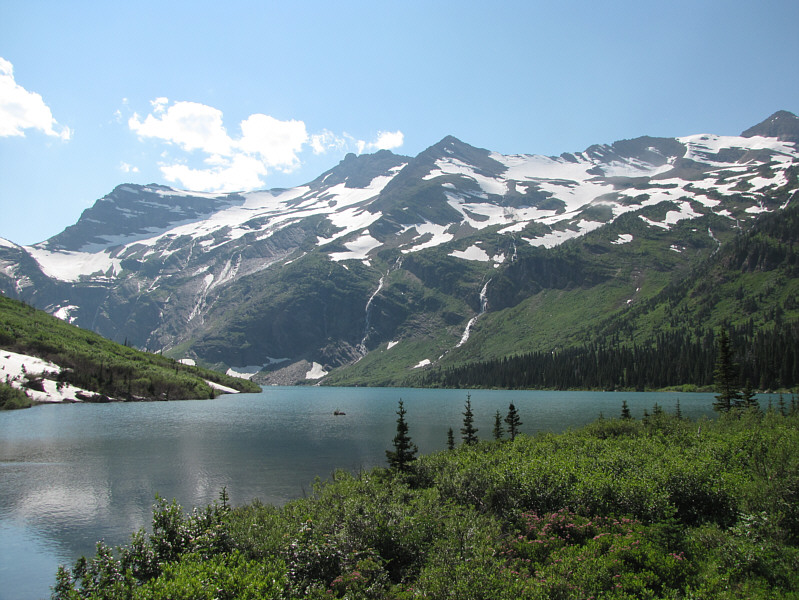 |
Gunsight Mountain is a stunning
backdrop for Gunsight Lake. |
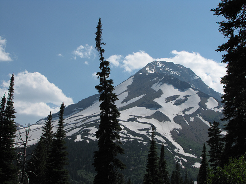 |
Here is a last look at Mount Jackson
from the trail on the hike out. |
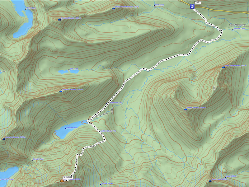 |
Total
Distance: ~27 kilometres
Round-Trip Time: 19 hours 40 minutes
Net Elevation Gain: ~1450 metres |