BOU AVENUE
Navvy Peak (Table Mountain)

Taking advantage of a favourable weather forecast for 28 May 2017, Peter Grant, Ben Hann, Zosia Zgolak and I drove to the outskirts of Golden, British Columbia to climb Navvy Peak (Table Mountain).  An explanation of the name, "navvy", can be found here.  Our inspiration for this trip came from goldenscrambles.ca, but to find the trailhead, we used the description found at trailpeak.com.  We began climbing right from the get-go on a brutally steep trail that rises 1250 metres over a distance of 5.5 kilometres.  Mosquitoes were out in force on this day, and not until we reached the snow-covered plateau on the upper mountain did they finally stop pestering us.  Unfortunately, we only traded one form of misery for another as we began crossing the plateau to the summit about 1.5 kilometres away.  Much of the snow had turned isothermal, and we started to sink often up to our hips.  Our progress quite literally slowed to a crawl.  I also snapped one of my hiking poles which made it even more challenging to maintain my balance while post-holing.  Thankfully, a few stretches of snow, mostly near the shade of trees, were still supportive enough to walk on, and these, along with the occasional oases of bare ground, provided enough relief to encourage us to continue with our sufferfest.  About 2.5 hours after we started across the plateau, we finally reached the summit, and despite all our tribulations, the mood of the group generally seemed upbeat.  After stopping for a well-deserved break at the top, we retraced our steps back across the plateau.  Despite having a broken trail to follow, we still had to endure some more post-holing, but overall, the return trip was markedly faster.  Once we regained the trail below the plateau, we settled into a long but uncomplicated descent back to the trailhead.
Let the grunting begin! 
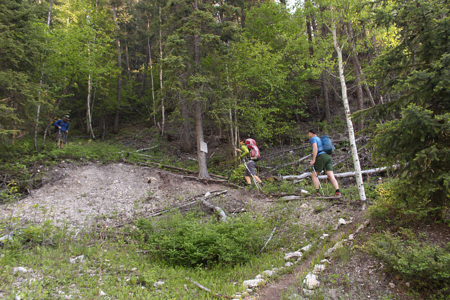
The trail rises steeply right from the beginning.
The only one we found on this day. Cute, eh? 
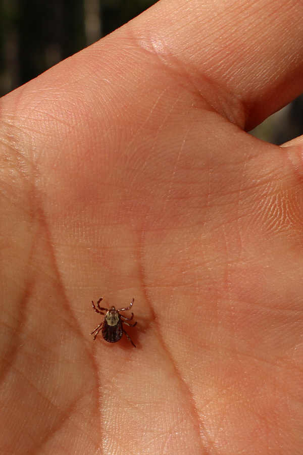
Only minutes into the hike, Sonny finds an unwanted hitchhiker on himself.

Golden rocks!

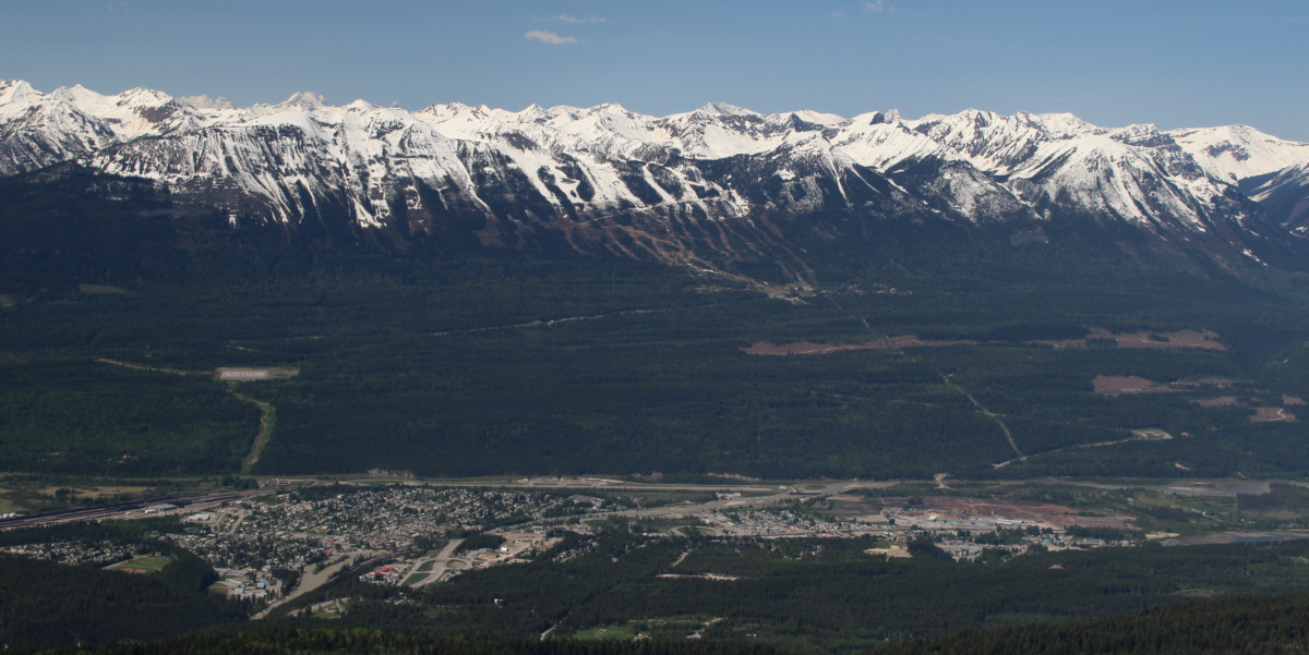
A break in the trees grants this view of the town of Golden.  Also visible on the other side of the valley is Kicking Horse Resort.


Not a good sign when the snow is soft... 
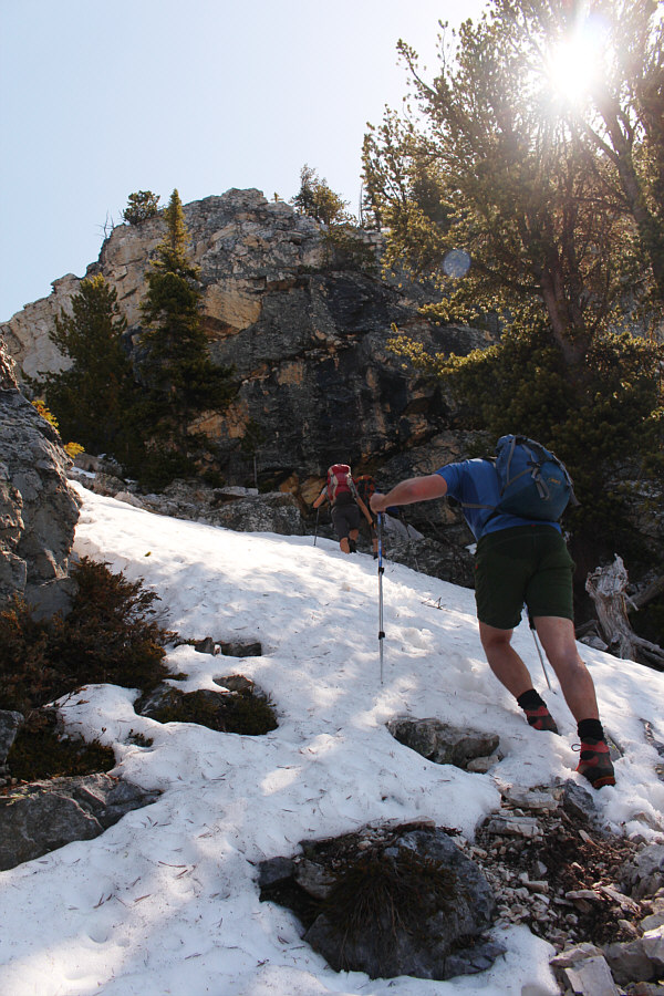
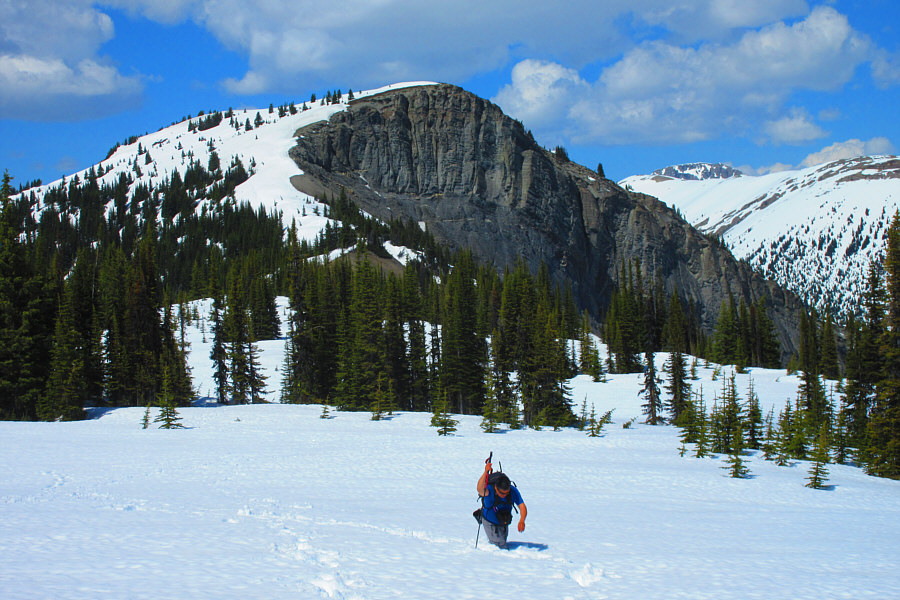
Zosia and Peter climb up a snow-filled gully near tree line.
Okay, most of the hard work is done...or so I thought!

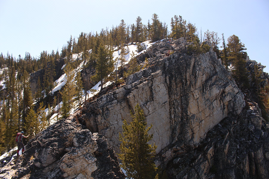
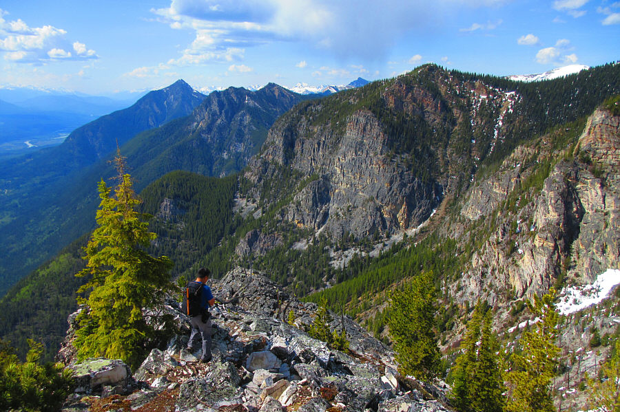
The trail follows the edge of this cliff before reaching the summit plateau.

The colour of the day is blue! 
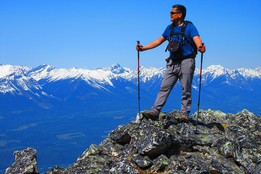
Sonny enjoys the far-reaching views from a small knob just off the trail.

Photo courtesy of Zosia Zgolak

Moberly looks like it's in great shape. The view from the knob includes Moberly Peak at right.  Mount Sir Sanford is barely visible on the distant horizon at left.
Why didn't we bring skis?? 
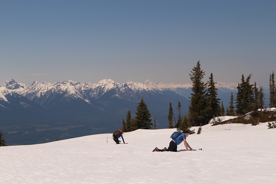
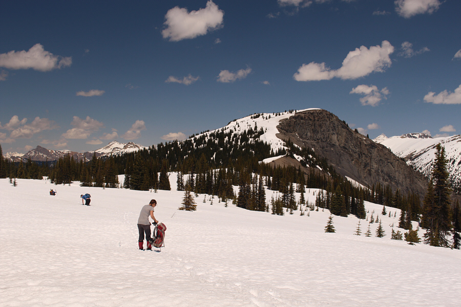
Ben and Peter struggle to make their way across the snow-covered plateau.
Polish post-holing! Zosia works hard post-holing through the snow.
Actually, the snow near the rocks can be surprisingly nasty... 
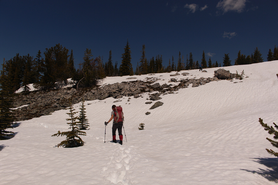
A few bare patches like this one offer some respite from the agony of post-holing.
Well, we're not turning around at this point! The summit block of Navvy Peak looks discouragingly far away as the group flounders in the snow.
Much better...I think we'll make it! Ben skirts along the edge of the snow on the ridge leading to the summit block.
Still some tough slogging through the snow here. Zosia and Peter grind their way up the summit block.
What an epic!
Peter and Sonny take the last few steps before the summit.

Photo courtesy of Zosia Zgolak

How are everybody's feet??

Ben, Peter, Zosia and Sonny stand on the summit of Navvy Peak (2355 metres).


Josée Ménard's favourite training mountain! 
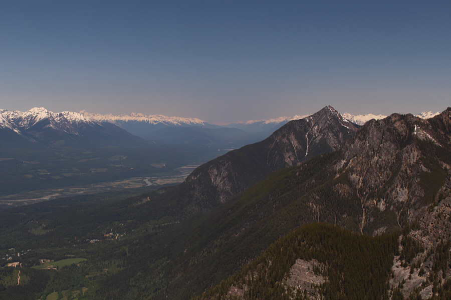
Mount Seven stands out to the south.
Some hard-to-access peaks here... To the north, Mount Laussedat is barely visible behind Hedberg Peak at left while at far right is Mount McBeath.
Some future projects...maybe... 
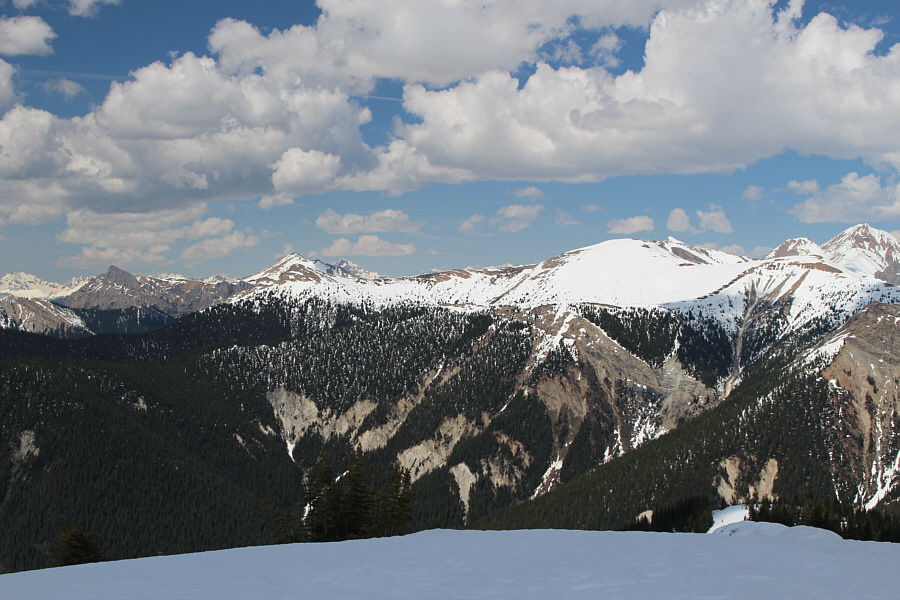
Among the recognizable peaks to the southeast are Porcupine Peak (left), Mount Vaux (right of centre), Mount Goodsir and Chancellor Peak.
Ready for some more post-holing? Zosia descends from the summit block and heads back to the plateau.
I did this once...I can do this again! Sonny endures another round of post-holing while returning across the plateau.

Photo courtesy of Zosia Zgolak

So weird walking on solid ground again... Back on terra firma, Sonny regains the trail below the summit plateau.

Photo courtesy of Zosia Zgolak

This feels gross initially, but it honestly really helps! Sonny prepares to wring out his wet socks before continuing his descent.

Photo courtesy of Zosia Zgolak

Should we call this the Golden Grind? Total Distance:  14.6 kilometres
Round-Trip Time:  9 hours 29 minutes
Net Elevation Gain:  1362 metres

GPX Data