Photo courtesy of Zosia Zgolak
With a grim weather forecast for 23 September 2018, Rafal (Raff) Kazmierczak, Marta Wojnarowska, Zosia Zgolak and I decided to pay a visit to Bison Mountain and The Head since the trip would entail nothing more difficult than off-trail hiking. After spending the previous night in a comfortable hotel in East Glacier, we checked out early and drove to the trailhead for Scenic Point located along Two Medicine Road about 11 kilometres west of the junction with Highway 49.
My recollections of the trailhead were vague at best, and right off the bat, we made the mistake of starting up an unsigned but obvious trail at the far (south) end of the parking lot. The trail quickly petered out, and we had to bushwhack a little to the east to intersect a service road which also begins in the same parking lot. The actual official trail begins closer to the north end of the parking lot, but most people probably take the short cut along the service road which runs past a utility hut and storage tank before ending in a clearing with a stockpile of abandoned picnic tables. A well-used trail continues beyond the south end of the clearing and quickly intersects the official trail descending from the left. This unnecessary elevation loss along the official trail is probably why the short cut is the more popular access route.
We quickly passed the junction to Appistoki Falls and began climbing steadily up the well-constructed trail. Much like my first time up here, we were buffeted by strong winds as we climbed higher up the slope, but otherwise, we had no difficulties reaching the broad plateau between Scenic Point and a higher unnamed bump (48.477526, -113.329631) to the southwest. Since it was so near, we made a short detour to tag the summit of Scenic Point before backtracking a bit and hiking southward along the connecting ridge to Medicine Peak. Below the northeast face of Medicine Peak, we slowly turned eastward, and with the wind now at our backs, we enjoyed an easy walk up to the summit of Bison Mountain.
|
|
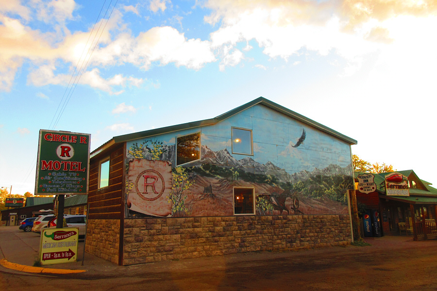
In East Glacier, a mural adorns the
side of the hotel in which the group stayed the previous night. Photo courtesy of Zosia Zgolak |

Raff, Zosia and Marta are ready to start hiking. The service road access is just out of view to the left.
 |
Zosia, Raff and Marta hike up the service road. |
 |
Sonny points out to Raff where they
are headed. Behind them is Appistoki Peak. Photo courtesy of Zosia Zgolak |
 |
Marta watches as Raff tries to climb
up one of the many dead limber pine trees scattered along the trail. Photo courtesy of Zosia Zgolak |
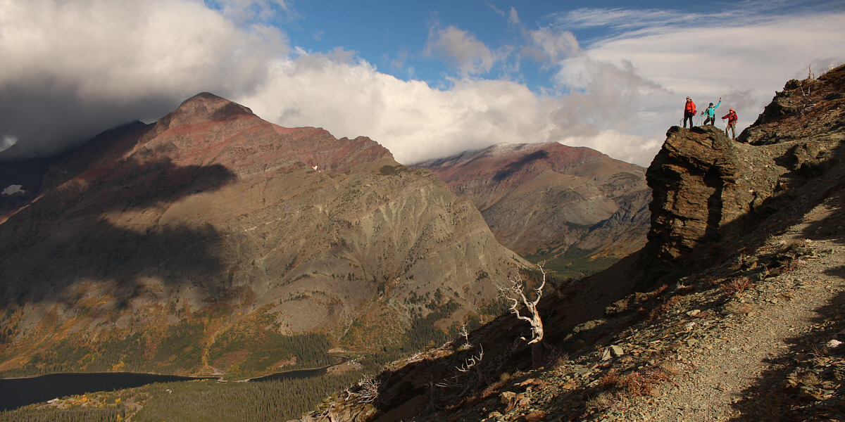
The group pauses on a rocky outcrop along the trail with views of Rising Wolf Mountain (far left) and Red Mountain (right of centre).
 |
Of all the named peaks visible behind Marta, only Sinopah Mountains summit is visible at left. |
 |
Scenic Point comes into view along the trail. The west end of Lower Two Medicine Lake appears to be dry (compare with Sonnys photo from five years ago). |
 |
The group follows the trail leading to the top of Scenic Point. |
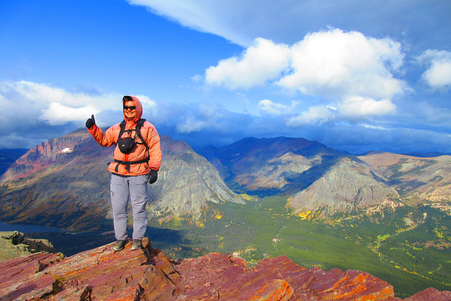 |
This is Sonny's second time on the
summit of Scenic Point (2289 metres). Photo courtesy of Zosia Zgolak |
 |
Raff, Marta and Zosia huddle against the wind on the summit of Scenic Point. |
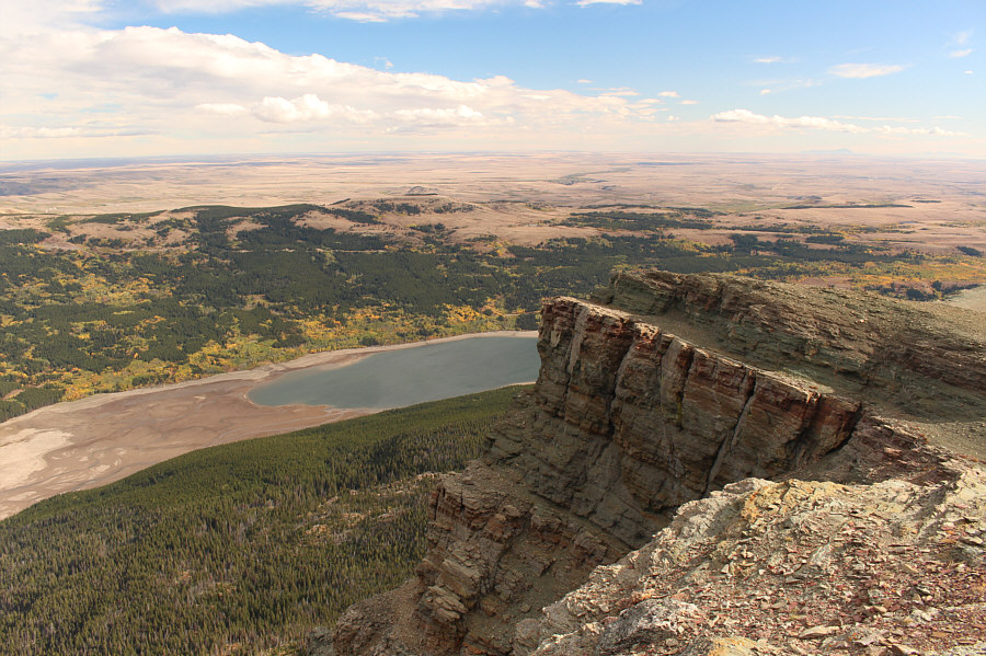 |
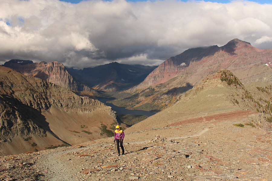
There is still some water left in Lower Two Medicine Lake in this view from the top of Scenic Point. |
 |
The Sweet Grass Hills stand out on the eastern horizon. |
 |
Zosia and Marta take a short break at the top of Scenic Point. Behind them are The Head (left) and Bison Mountain (right of centre). |
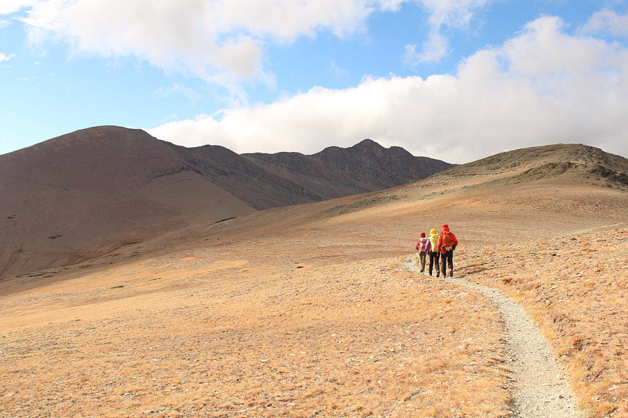 |
The group backtracks along the trail briefly before heading toward Medicine Peak (far left). Mount Henry is visible at centre, and at far right is an unnamed bump which Raff and Sonny would climb later in the afternoon. |
 |
Leaving Scenic Point behind her, Zosia hikes off-trail along the connecting ridge to Medicine Peak. |
 |
The group approaches the northern aspect of Medicine Peak. |
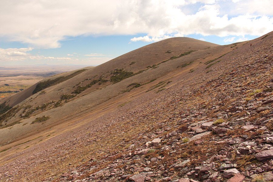 |
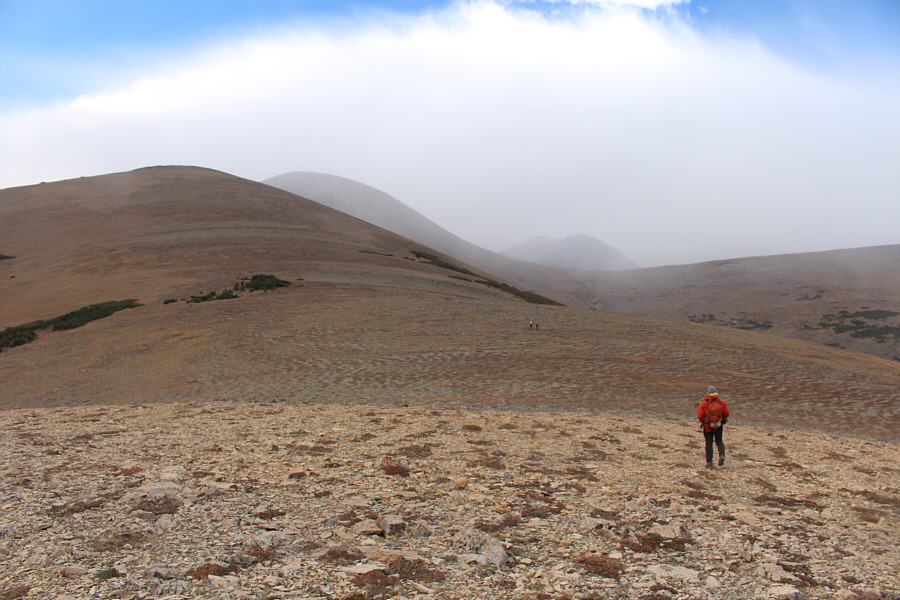
The terrain on the approach to Bison Mountain (right) is not too steep or complicated. |
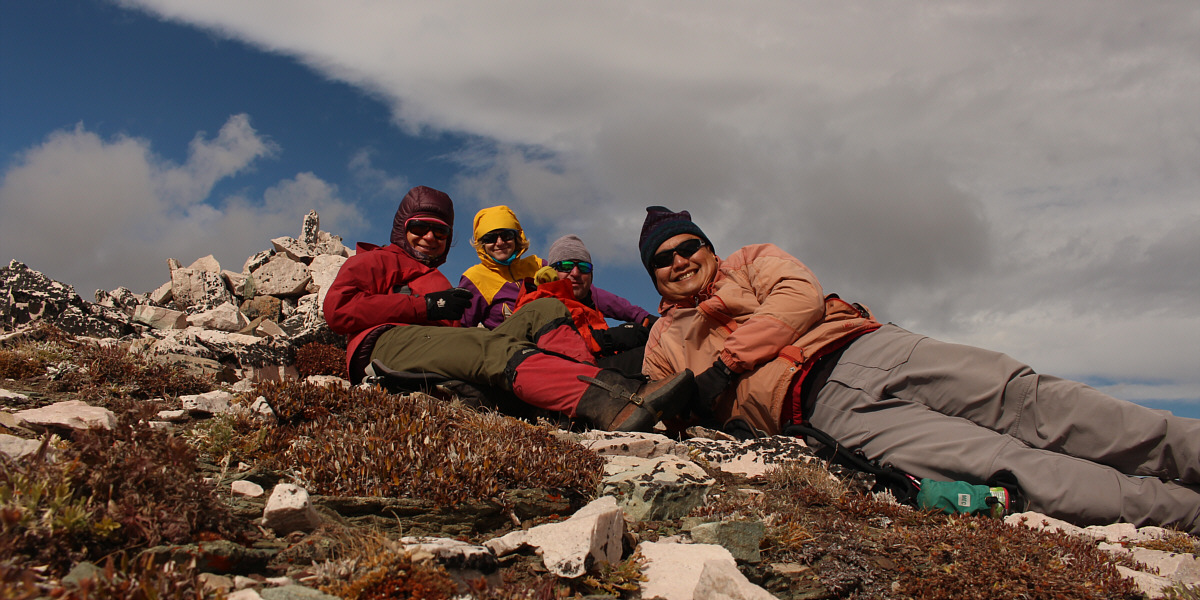
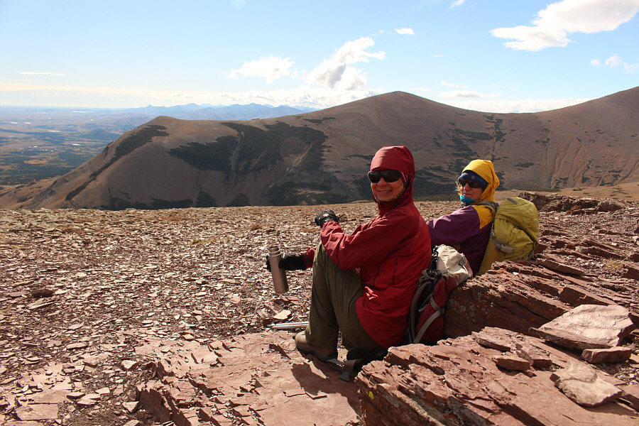
Zosia, Marta, Raff and Sonny take shelter from the wind on the lee side of Bison Mountain's summit cairn (2411 metres).
After a taking a break at the summit of Bison Mountain, we continued eastward and easily reached the top of The Head. At this point, we could see some nasty weather approaching from the west, and we took another short break before steeling ourselves for the return hike into the teeth of the impending storm. Sure enough, we got hammered by blowing sleet as we contoured around the north side of Bison Mountain and across the lower northeast face of Medicine Peak. The few scattered patches of krummholz here and there provided little to no shelter for us, and we simply had to bite the bullet and continue walking into the snowy onslaught. Fortunately, the storm was short-lived, and by the time we turned northward away from Medicine Peak, the sky was already clearing up nicely.
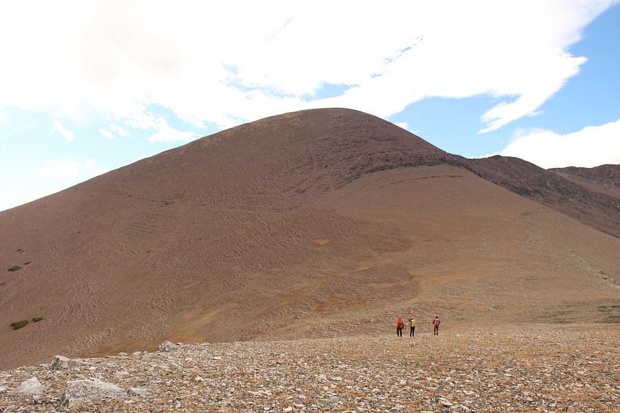
While Marta and Zosia made a beeline for our access trail, Raff and I stayed high and tagged the aforementioned unnamed bump to the southwest of Scenic Point. Raff and I got pummeled by the wind while atop this bump, and we only stayed long enough to snap a few photographs before dropping down the northwest slope to regain the trail. Raff and I eventually caught up with Marta and Zosia, and together, we enjoyed a pleasant and uneventful hike back to the trailhead.
 |
Zosia leaves the top of Bison Mountain and follows Marta and Raff down the slope toward The Head (right). |
 |
Numerous unfamiliar mountains stretch far away to the south well beyond Glacier National Parks boundaries. |
 |
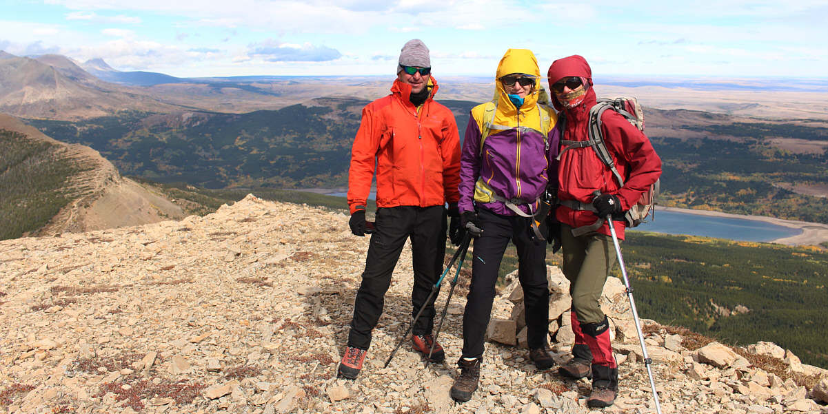
Sonny, Raff and Marta arrive at the
top of The Head (2231 metres). Photo courtesy of Zosia Zgolak |
Raff, Marta and Zosia huddle against the wind on the summit of The Head.
 |
Raff follows Marta and Zosia into the oncoming storm from the west. |
 |
The sky begins to clear as Raff puts Medicine Peak behind him. |
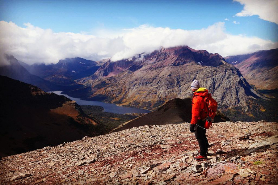 |
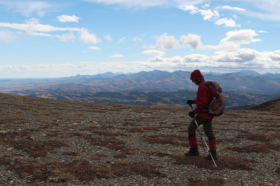
Raff admires Two Medicine Lake from
the top of the aforementioned unnamed bump (2323 metres). Photo courtesy of Rafal Kazmierczak |
 |
Raff descends easy terrain on the northwest side of the unnamed bump. |
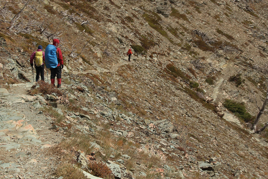 |
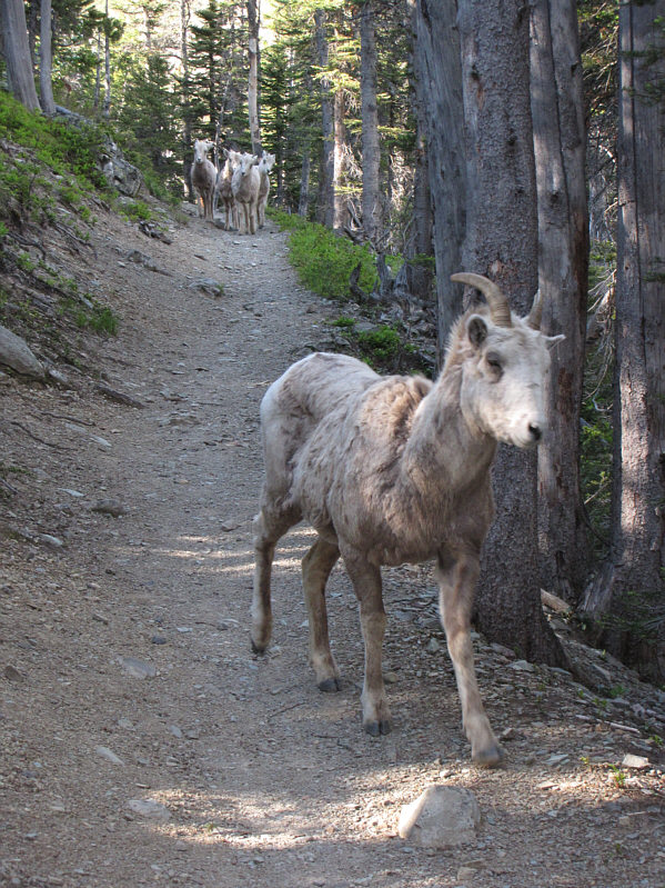
On the way down, the group runs into a herd of sheep blocking the trail. |
 |
This ram may very well be the one that Sonny ran into on the same trail five years ago. |
 |
Total
Distance: 19.2 kilometres Round-Trip Time: 7 hours 2 minutes Net Elevation Gain to Bison Mountain: 813 metres |