BOU AVENUE
Crystal Peak
Crystal Peak in western Utah is the remnant of an ancient volcanic eruption, and although the peak is not particularly high, its quartz-rich rock devoid of iron makes it stand out startlingly from the surrounding landscape like a beacon in the wilderness.  I have long been intrigued by Crystal Peak after reading about it in the guidebook, 100 Hikes in Utah by Steve Mann & Rhett Olson, but due to its remote location, it has always seemed to be too much out of the way to warrant a visit on its own.  While researching the area for a Christmas road trip with Zosia Zgolak, I discovered a nice campground (Amasa ATV Area) further to the north which led me to consider an ascent of another intriguing mountain nearby--Notch Peak.  After Zosia and I climbed Notch Peak, it made sense to follow that up with a visit to Crystal Peak.

Turn south onto a good gravel road from US Highway 50/6 about 70 kilometres west of Hinckley or about 63 kilometres east of the Nevada-Utah border.  About 1.5 kilometres from the highway, turn left and drive south along Tule Valley Road for 31.0 kilometres to a junction with Garrison Black Rock Road.  Turn right and drive westward for about 18 kilometres to the northeast side of Crystal Peak.  Avoid going too far and losing elevation as the road begins to descend.  There are numerous dispersed camping sites on both sides of the road here with markers showing the limits of where motorized vehicles are allowed to travel off-road.  The camping area on the south side of the road is the most logical place to begin hiking.  Unless conditions are wet or muddy, all roads described in this trip report are suitable for 2WD vehicles.

After camping the previous night in one of the dispersed camping sites, Zosia and I began hiking around the east side of Crystal Peak on the morning of 23 December 2019.  As per the guidebook's route description, we tried to stick close to the line delineating the transition between the surrounding desert scrub and the distinctive white-ish rock of Crystal Peak's main mass.  The approach route we took was perhaps not the most efficient, but we eventually reached the saddle southwest of the peak anyway and began scrambling up pockmarked slabs toward the summit.  Some route-finding is required here, and the ascent is more complicated than what the route description would suggest.  With some difficulty, we managed to surmount or circumvent all obstacles and find our way up to the spacious summit.

For our descent, we took a slightly different route down in order to avoid some of the more difficult sections we had climbed up earlier.  This worked out fairly well for us, and we only had to contend with a couple of difficult but short down-climbs along the way.  Ultimately, we regained our approach route at the base of the peak and had no problems hiking back to our starting point.

For an alternate exit from the area, continue driving westward along Garrison Black Rock Road for 9.0 kilometres to the junction with Crystal Peak Road.  Turn left and drive south for 31 kilometres to reach pavement again on Highway 21.
Lotsa nice campsites here, but there's no water! Crystal Peak rises up behind Zosia in this view from near the starting point of the hike.
It looks tempting to go up this way, but it's probably not a great idea without ropes. Here is a closer look at the northeast face of Crystal Peak.
Try to avoid climbing to the top of the bushy hill at centre! 
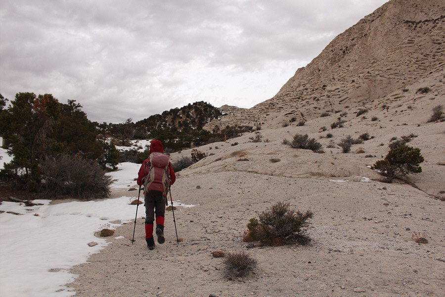
Zosia hikes along the interface between the regular desert scrub and Crystal Peak's volcanic tuff.
Make a right turn here! Zosia reaches the saddle on the southwest side of Crystal Peak.
It's a holy mountain! 
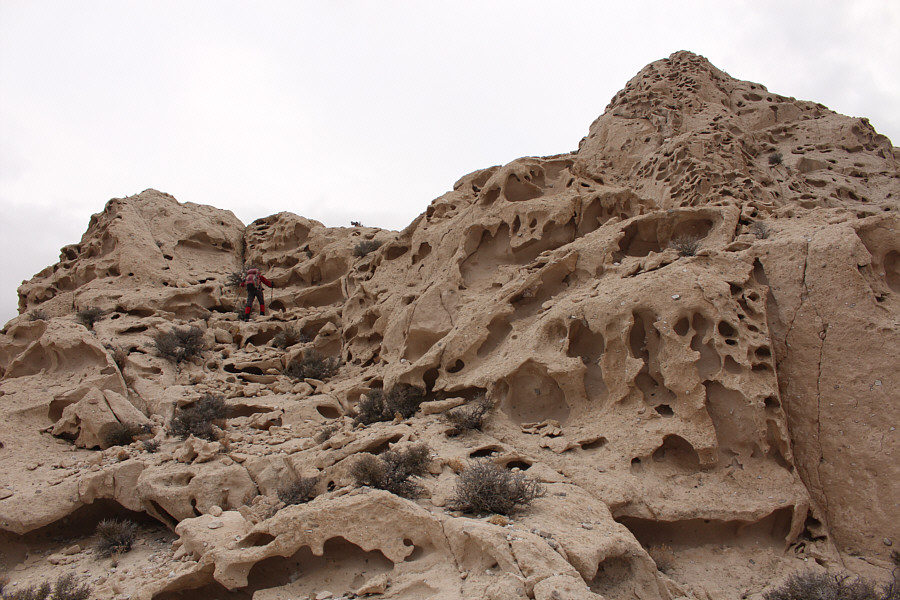
Zosia scrambles up pockmarked slabs.
The route to the summit is no walk in the park! Zosia descends an awkward step in order to bypass some steeper terrain.
Try not to get suckered into climbing Class 5 terrain! Route-finding can be a little challenging on Crystal Peak.
I would consider this moderate to difficult scrambling by Kane's standards. Sonny climbs up the crux--an exposed section about 3 or 4 metres high.

Photo courtesy of Zosia Zgolak

Nicely done, Zosia! 
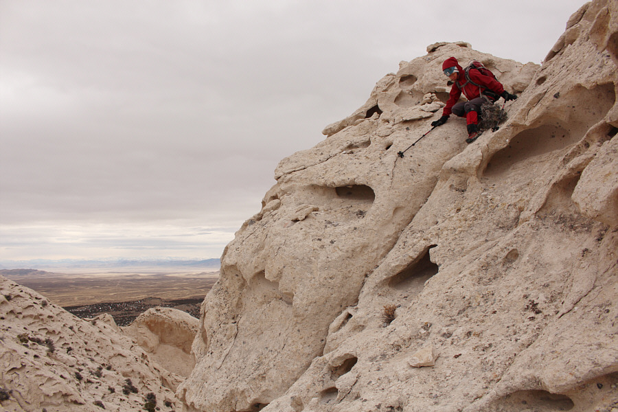
Zosia comes up the crux.  The exposure is better illustrated here.
Happy Holidays! 
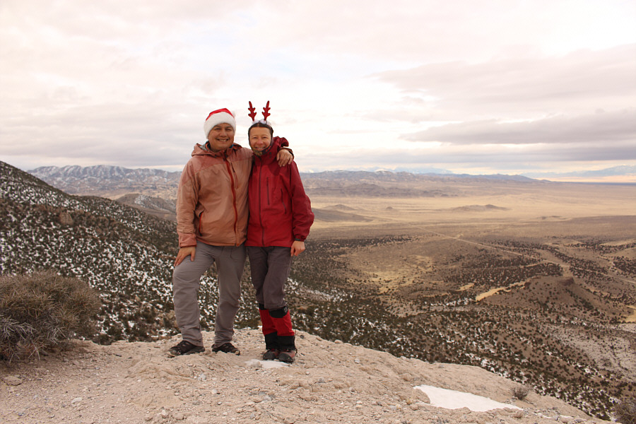
Sonny and Zosia stand on the summit of Crystal Peak (2160 metres).
"Wah Wah" supposedly means "good clear water".

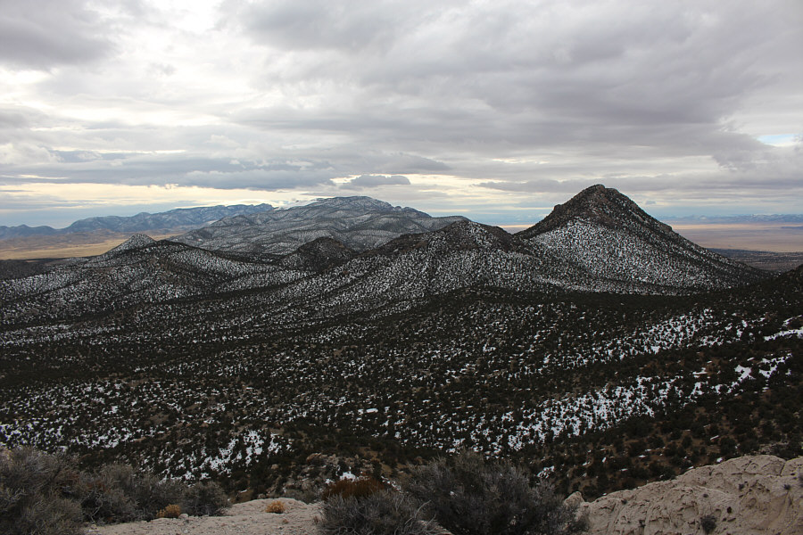
The Wah Wah Mountains stretch away to the south.  The peak at right is unnamed.

There's a whole lotta nothing out there! 
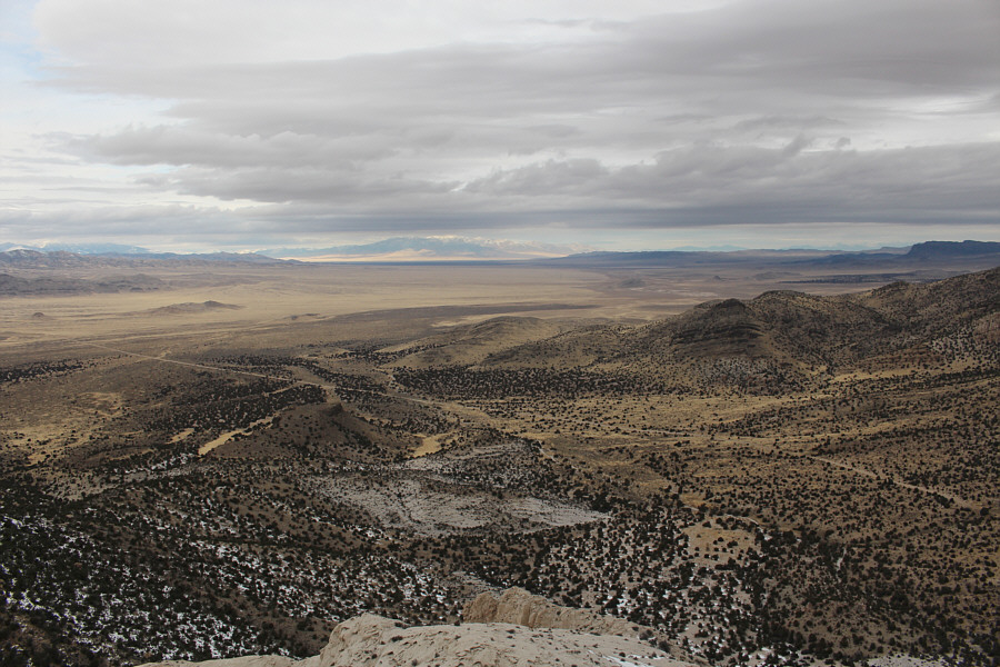
Garrison Black Rock Road can be seen continuing westward in this view from Crystal Peak's summit.  Though obscured by clouds on this day, the peaks of Great Basin National Park would normally be visible on the horizon at far left.
Might be worth a return trip... There are apparently a lot of fossil beds at the foot of the unnamed peak to the north.
Frisco Peak just moved up higher on my to-do list... 
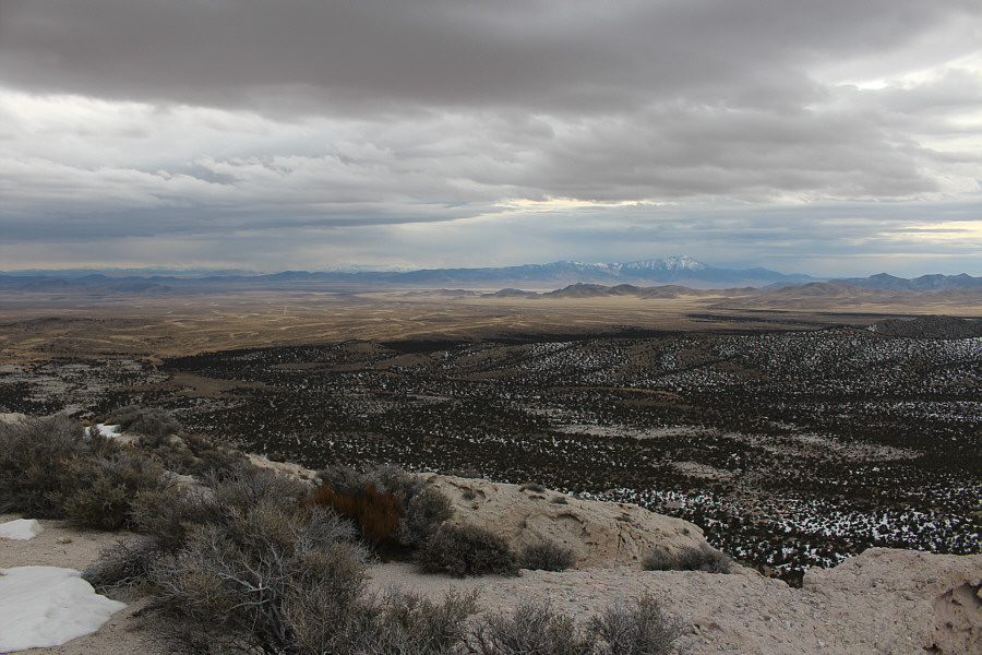
The most notable feature to the southeast is Frisco Peak on the right horizon.
Spider-woman? Zosia carefully descends an awkward drop-off on the way down.
This may also be a better ascent route than the one we originally took. Zosia is past all serious difficulties as she descends this south-facing gully.
Very cool! Here is a last look at the unique slopes of Crystal Peak.
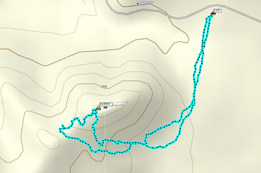
More challenging than expected! Total Distance:  4.2 kilometres
Round-Trip Time:  2 hours 44 minutes
Net Elevation Gain:  242 metres

GPX Data