BOU AVENUE
Four Points Mountain

Located just east of Windermere, British Columbia, Four Points Mountain is unlikely to ever garner much interest except from the most die-hard peak-baggers wanting to tag an officially-named summit.  Looking for a snow-free objective in the area on 9 June 2019, Zosia Zgolak and I decided to pay a visit to this mountain after spotting it on the Invermere And Columbia Valley topographical map (ITMB Publishing Ltd.).  The map shows a road of some sort on the north side of the mountain, and we thought that this might provide easy access for an ascent.  Without the benefit of any route information though (and no Internet access to Google Maps since we were camping), we embarked on this trip with a lot of uncertainty.

Just south of Valley Alley Bowling Centre along Highway 93/95 between Invermere and Windermere, turn east onto Windermere Loop Road and drive for about 3.3 kilometres.  Turn left onto a short connector road and immediately turn right onto Westrock Mine Road.  Drive east along Westrock Mine Road for 5.6 kilometres to a turnoff on the right with a locked gate.  Park here (do not block the gate) or at a large pullout (trailhead to Twin Lakes) about 550 metres before (west of) the turnoff.

From the locked gate, Zosia and I walked up the road and stayed right at the first junction we came across; the left fork enters an active mine site.  The road we stayed on winds around the northwest perimeter of the mine site before dead-ending at the edge of the forest.  Making a left turn here, we climbed up an open hillside along the edge of the forest and intersected an exploration road entering the valley on the north side of Four Points Mountain.  The exploration road heads more or less westward and follows the contours of Four Points Mountain's northern slopes before petering out just past a large clearing.  At this point, we were about 300 metres short of the mountain's main ridge, and with no other options available, we simply left the road and bushwhacked uphill.  This was not the worst bushwhack Zosia and I have ever endured, but the climbing was sustained and relentlessly steep.  When we reached the crest of the main ridge, we stopped for a well-deserved lunch break before carrying on eastward to the true summit on a rudimentary trail.  True to the mountain's name, the trail undulates over several bumps along the way, and although much of the trail is forested, there are occasional breaks in the trees which allow some far-reaching views.

After tagging the unremarkable true summit, Zosia and I abandoned the trail and descended a steep, north-trending ridge in hopes of making a bee line to the mine site.  This worked out well initially, but further down, we ran into some steeper terrain which forced us to detour a bit to skier's right.  We subsequently emerged from the forest into a huge cut block where we veered back to skier's left to try and regain our original line of descent.  Partway through the cut block and from a considerable distance away, we spotted a bear foraging near the edge of the forest below us.  Unfortunately, it was right where we were intending to descend, and although we made a lot of noise, the bear seemed unconcerned about our presence and was not in any rush to move away.  As a result, we took an even bigger detour and briefly ended up on a logging road heading eastward.  Although this road eventually circles back to the mine site, we decided to take a short cut once we were convinced that we had given the bear a wide enough berth.  We left the road and dropped down a clearing to some trees where we were expecting to bushwhack some more, but by chance, we stumbled onto a trail which conveniently led us to the edge of the mine site without too much hassle.  To avoid entering the mine site, we skirted along its western perimeter and eventually returned to the start of the exploration road to close our loop.  From there, we dropped down the open hillside we climbed earlier in the day and hiked out the same road we came up to complete the trip.
No "No Trespassing" signs, so I guess we're cool! Zosia begins the trip at a locked gate along a mine access road.
Not quite the same as Frank Slide! 
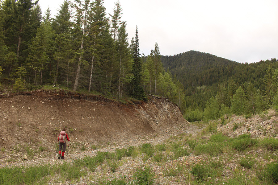
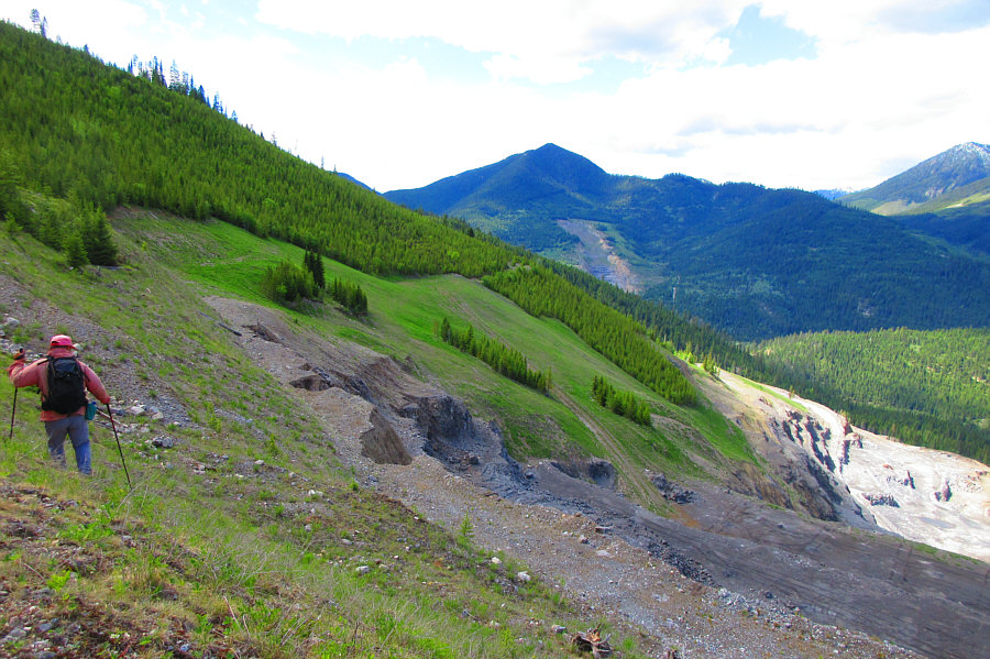
Zosia picks her way through a seemingly recent landslide which has partially buried the road.
Just trying to put off bushwhacking for as long as possible! 
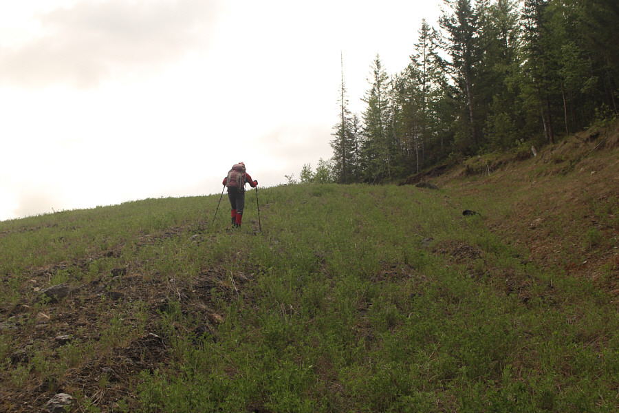
After reaching a dead end in the road, Zosia climbs up an open hillside in hopes of finding a break in the forest to the right.
Okay, let's see where this goes... Zosia finds an exploration road to follow up the valley.
Always a welcome sight! Some Indian paintbrush bloom in the middle of the exploration road.
Time to bite the bullet and start bushwhacking... 
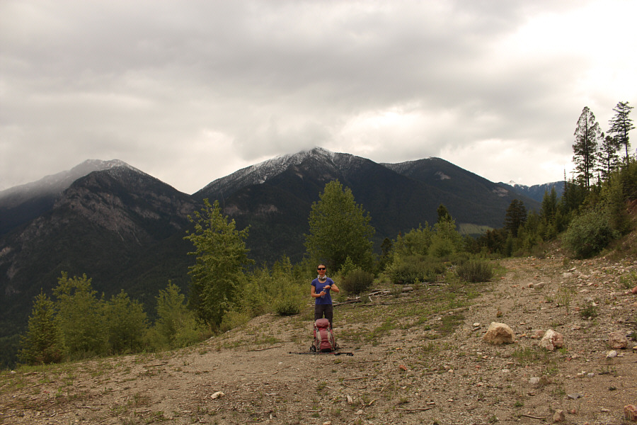
Zosia takes a break at a large clearing shortly before reaching the end of the exploration road.
Type 2 fun... 
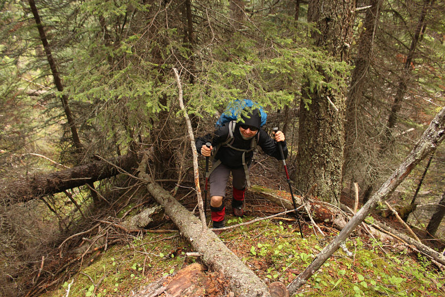
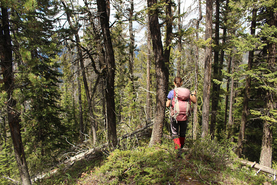
After leaving the exploration road, Zosia bushwhacks up a relentlessly steep slope.
I wasn't smiling as much... 
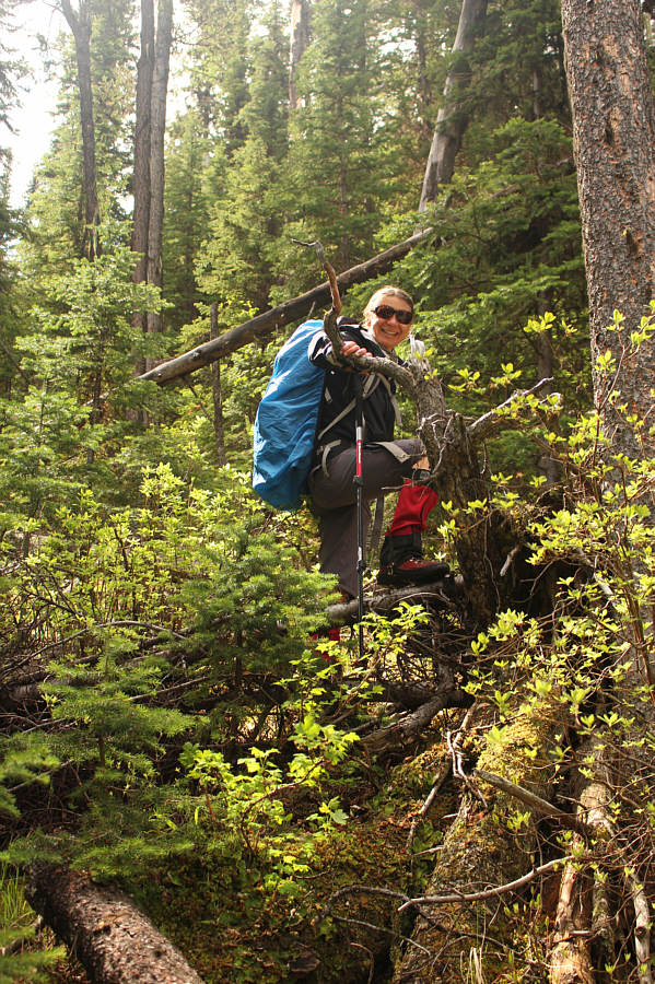
Zosia has experienced worse bushwhacks than this one which is why she is still smiling.
There's some hope! 
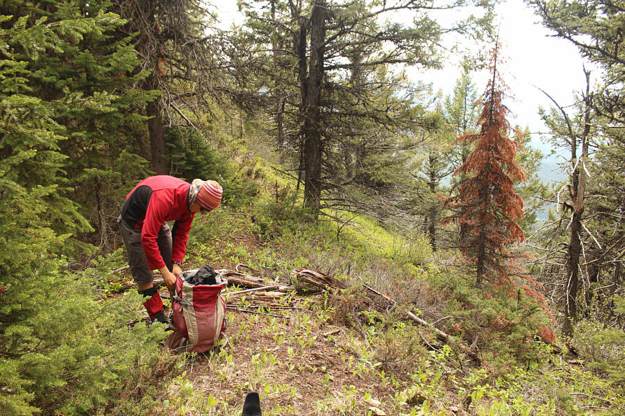
Zosia stops for a break after reaching the semi-open ridge crest.
Best view of the day. 
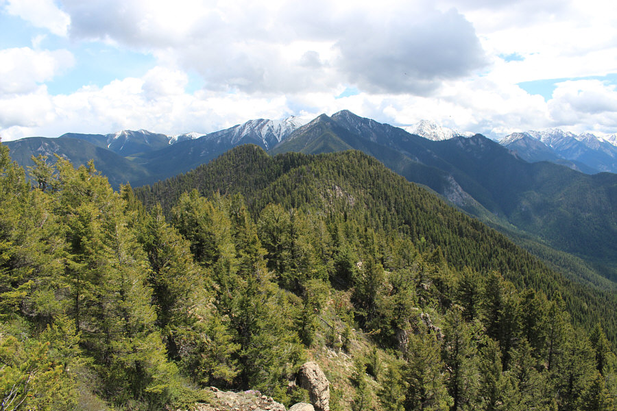
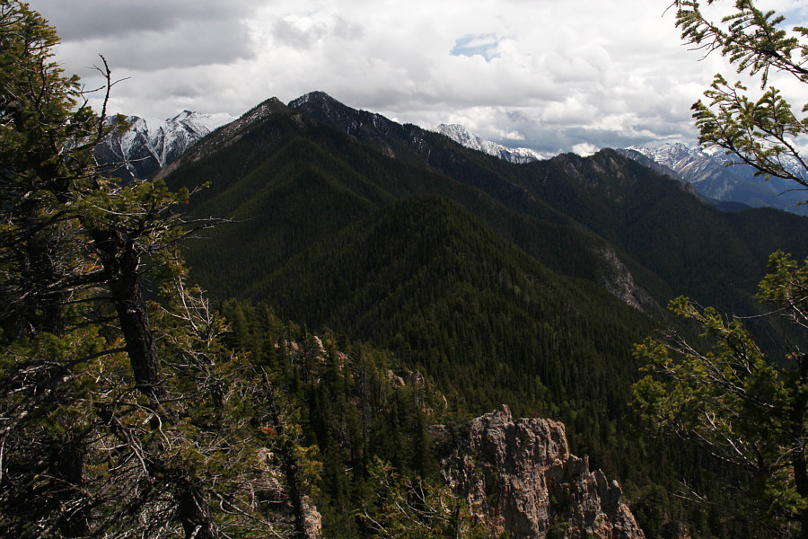
Zosia stands on the only viewpoint on Four Points Mountain with unobstructed views of Windermere valley.  At centre in the distance is Columbia Lake.
Oh great. Another viewless summit! From the viewpoint, the tree-covered true summit of Four Points Mountain can be seen just left of centre.
Still way better than having to bushwhack! To get to the true summit, Zosia follows a rudimentary trail which runs more or less along Four Points Mountain's ridge crest.
We've come a long way, baby (not really)! A break in the trees near the true summit allows a glance back at the connecting ridge to the viewpoint (rightmost of the two forested bumps).
Well that was sure worth the effort...NOT!!! 
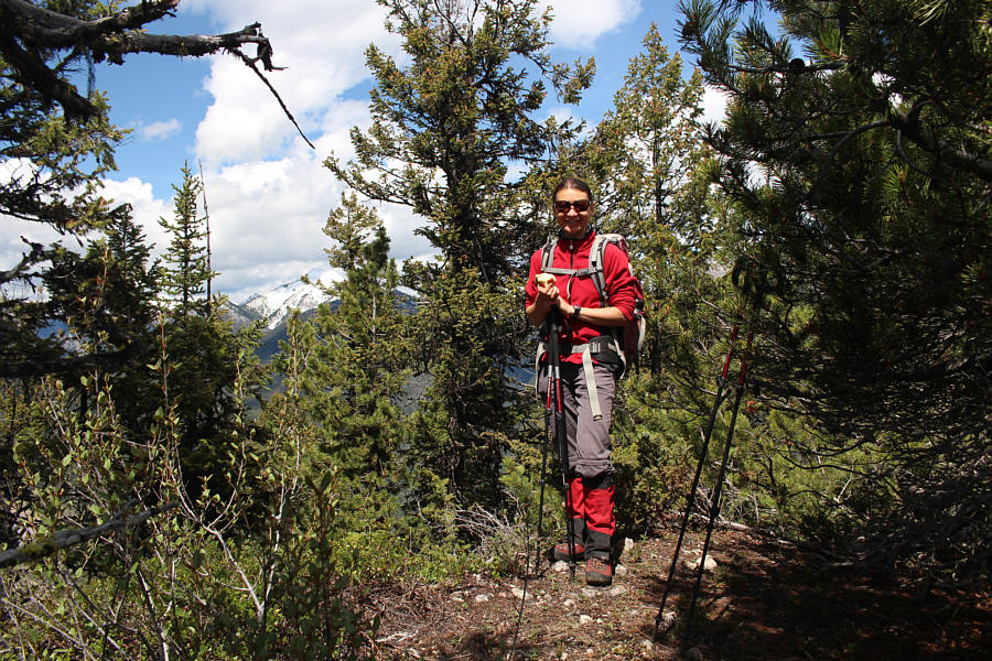
Zosia eats an apple on the true summit of Four Points Mountain (1924 metres).
We would climb Mount Tegart the next day but not from this ridge. This break in the trees near the true summit shows the ridge continuing to the southeast and ultimately all the way to the top of Mount Tegart.
A fairly pleasant descent with minimal bushwhacking...for now! Zosia descends a ridge to the north of the true summit.
We're not home-free yet at this point... 
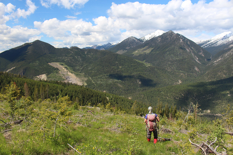
Zosia reaches a large cut block during her descent of Four Points Mountain.  The snowy peak partly behind the ridge at right is Pinto Mountain.
Hey Boo Boo! 
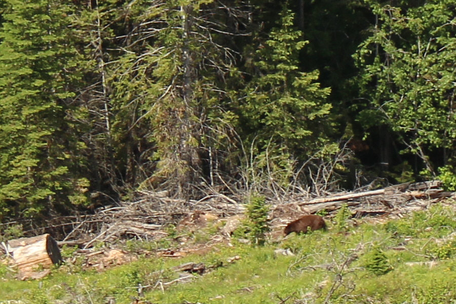
A bear forages near the bottom edge of the cut block.
Despite the brown coat, I think that this is a black bear. Here is a zoomed-in view of the bear.

Photo courtesy of Zosia Zgolak

Still some steep and mildly exposed sections along the way... Sonny begins a descending traverse along the top edge of the mine site.

Photo courtesy of Zosia Zgolak

On the road again... Zosia regains the mine access road on the hike out.
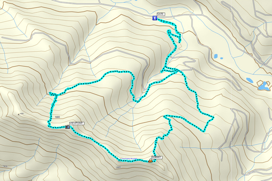
There's a good reason why this mountain is unpopular... Total Distance:  11.1 kilometres
Round-Trip Time:  7 hours 22 minutes
Net Elevation Gain:  806 metres

GPX Data