BOU AVENUE
Mount Crawford

On 15 August 2020, Zosia Zgolak and I hiked up Mount Crawford which overlooks the village of Crawford Bay, British Columbia.  We got our inspiration for this hike from yet another excellent trip report on the West Kootenay Hiking website.  The approach shares the same trail that leads to nearby Plaid Lake, and with a high starting point, the relatively short ascent grants superb views for only a modest amount of effort.

From Highway 3A, turn north onto Wadds Road 4.8 kilometres east of Kootenay Bay ferry terminal or 740 metres north of the Crawford Bay grocery store/gas station.  Drive 2.7 kilometres to a T-intersection with Crawford Creek Road and turn left.  Drive 7.5 kilometres (high-clearance vehicle recommended) to a junction with Hooker Creek Forest Service Road and keep left.  Drive another 1.1 kilometres and turn left.  Drive up several switchbacks for 4.5 kilometres to a 3-way junction and park here. A high-clearance vehicle with 4WD capability could probably continue for another 1.3 kilometres to reach the actual trailhead, but the first hundred metres or so are steep and very rough.

Before Zosia and I even had a chance to start hiking from the 3-way junction, a Toyota FJ drove by and quickly disappeared up the continuation of the access road.  With some determination, I probably could have followed suit with my Honda CR-V, but seeing how steep and rough the first part of the road was, I was more than happy to give my car a break and hike the extra distance and elevation gain (about 250 metres) to the trailhead.  Further up the road, we were also passed by a couple riding an ATV, but in the end, it took us less than forty minutes to reach the actual trailhead where we saw the parked Toyota FJ and ATV.  From the trailhead, we continued hiking on a well-maintained trail which climbs steadily through forest before breaking out of the trees onto an open ridge.  The trail follows the ridge as it curves north to a saddle below Mount Crawford's summit block.  At the saddle, the main trail drops down the other side and continues to Plaid Lake, but we followed a boot-beaten path which stays on the ridge crest before zigzagging up a very steep gully on the west side of the summit block.  Despite the presence of a beaten path, the rocks in this gully can easily be dislodged, and a helmet would not be out of place here.  The angle eases at the top of the gully, and we finished the ascent with a short scramble over easy rocks.

At the summit, Zosia and I chatted at length with a pair of local couples before they descended leaving us alone.  Enjoying the very pleasant weather, we lingered for a bit longer before commencing our descent.  Retracing our steps, we had no issues getting down the summit block and regaining the main trail.  We even caught up to the locals who were still chewing the fat beside their Toyota FJ and ATV when we got back to the trailhead.  The locals soon passed us along the road in their vehicles, but the couple with the ATV ultimately stopped at length to pick huckleberries.  We picked a few huckleberries ourselves before returning to my car and driving out.
Sucks to be me! An ATV passes by Sonny as he hikes up the remainder of the access road.

Photo courtesy of Zosia Zgolak

Unfortunately, there are no toilets here. Zosia arrives at the actual trailhead.
Can you spot the ferry on the lake? 
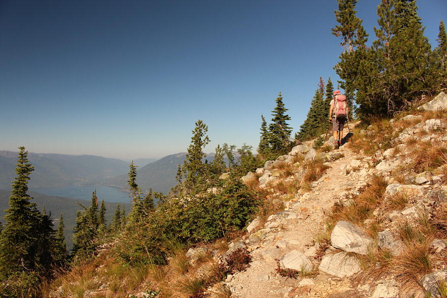
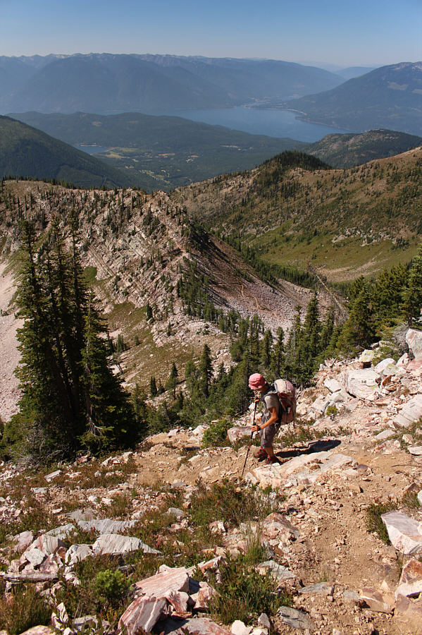
Kootenay Lake comes into view as Zosia climbs up the trail.

That didn't take long to get here!

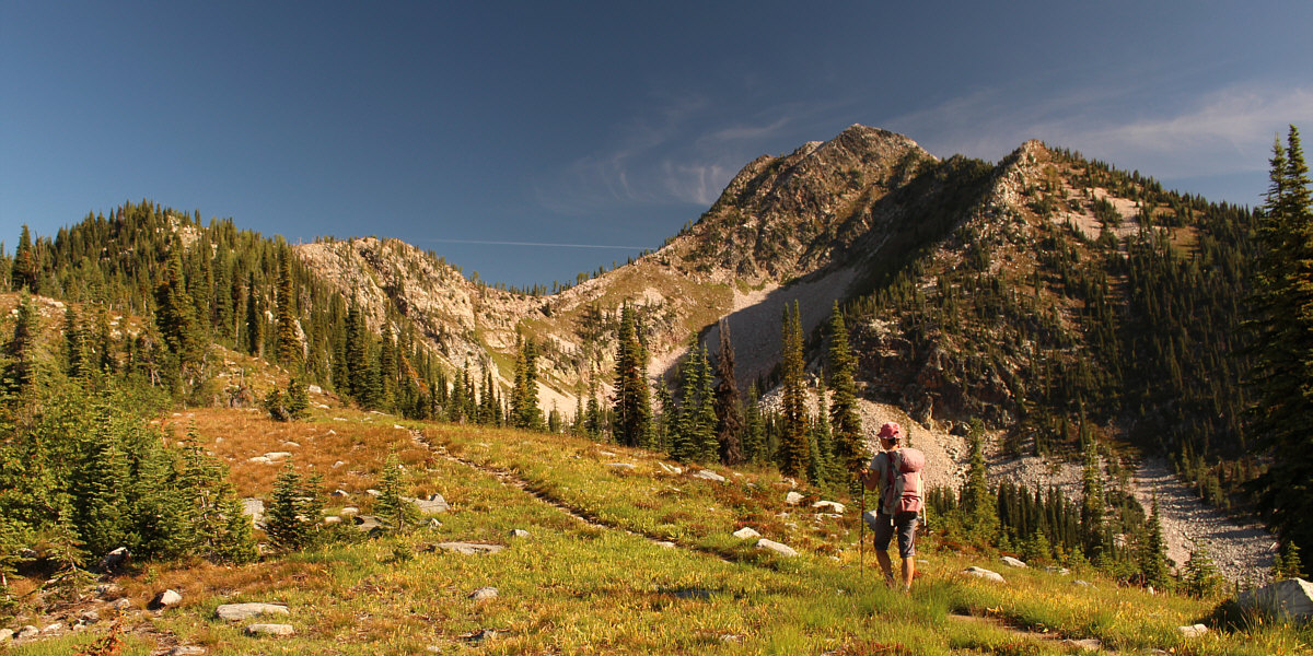
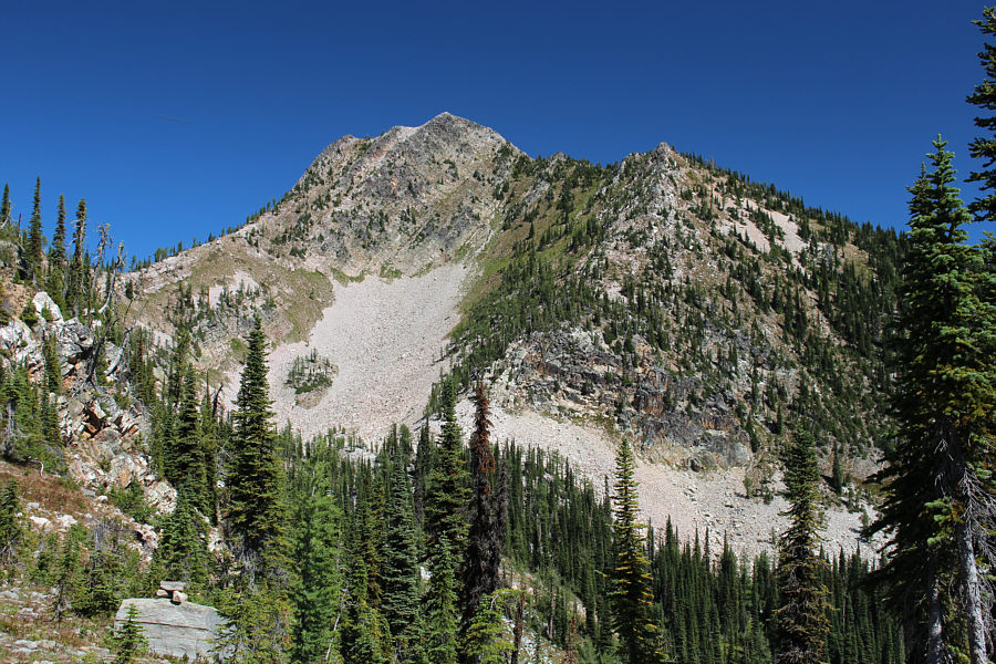
Here is the first clear view of Mount Crawford from the trail.


Looks like an exciting finish! 
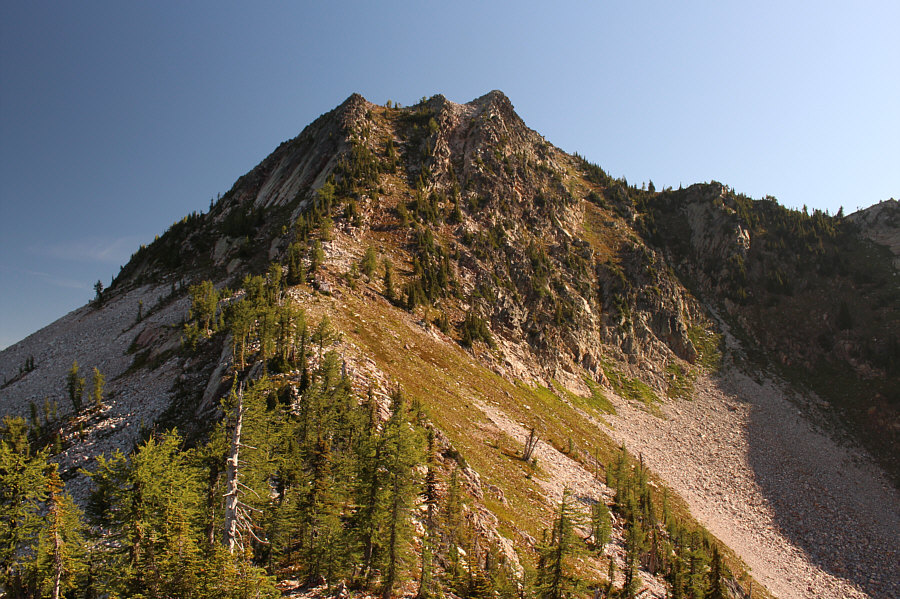
The trail zigzags up the gully between the left and middle bumps in the photograph.
Steeper than it looks! 
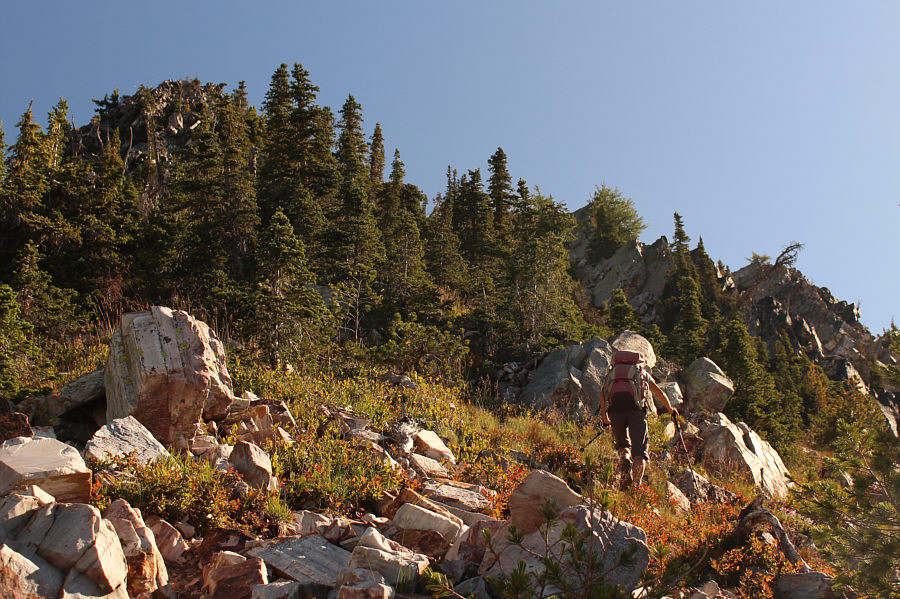
Zosia grinds her way up the steep gully.
Almost there! 
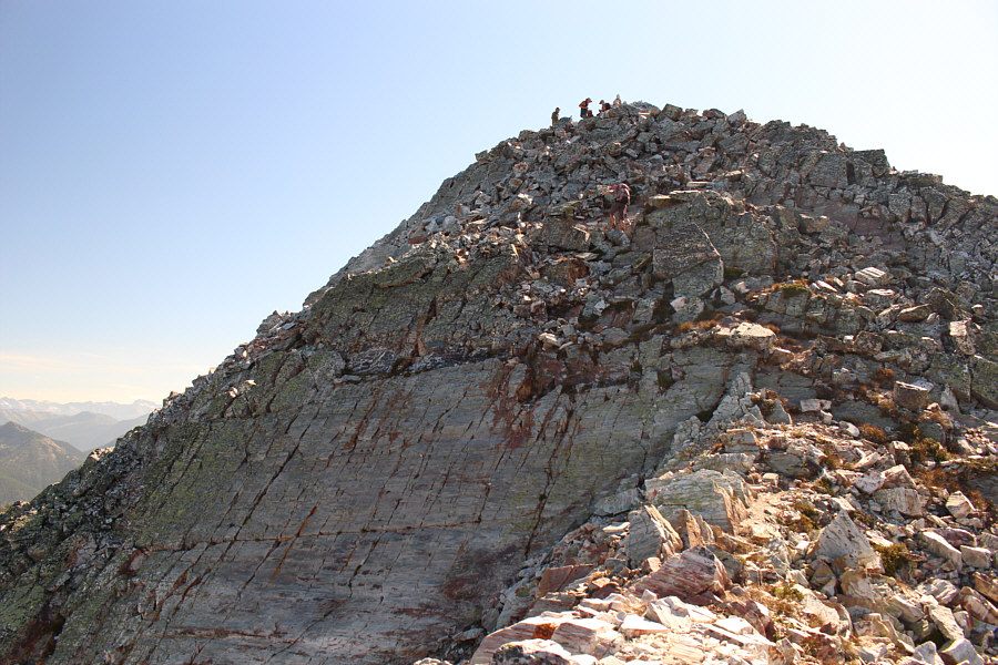
Zosia scrambles up the summit block.  Other hikers can be seen at the top.
Just another day in the office! Sonny and Zosia stand on the summit of Mount Crawford (2335 metres).
Snowcrest Mountain just moved up higher on my to-do list! 
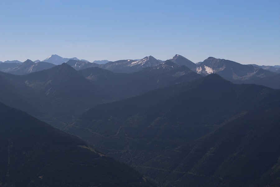
Sphinx Mountain is the second bump from the right in this view to the south.  The high peak on the left horizon is Snowcrest Mountain.
The village is a great place to restock on food, recharge batteries, and have a nice shower. 
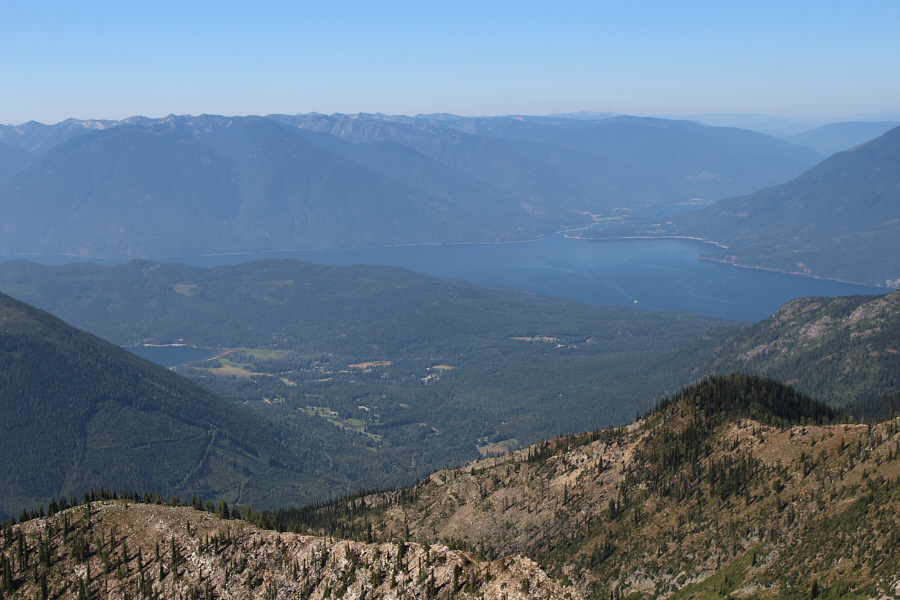
A ferry can be seen crossing Kootenay Lake to the southwest.  The body of water at lower left is Crawford Bay, and its namesake village is also visible.
There is a lot for me to explore there still! 
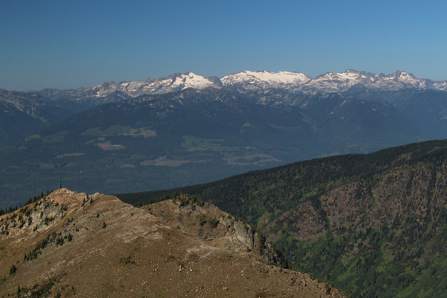
To the west are the rugged peaks of Kokanee Glacier Provincial Park.
Best view of the day. 
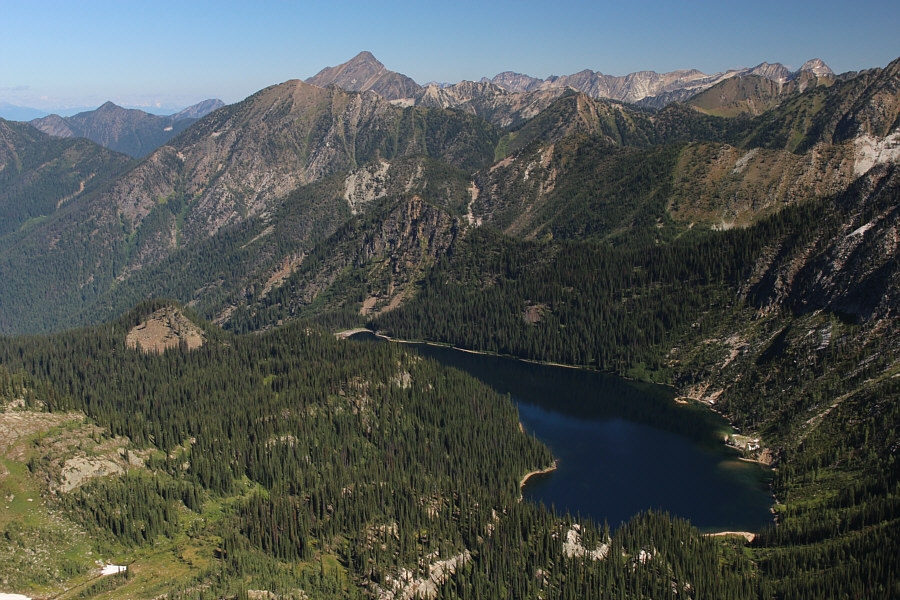
Mount Loki and Plaid Lake steal the show to the north.
Great reading material for lunch! 
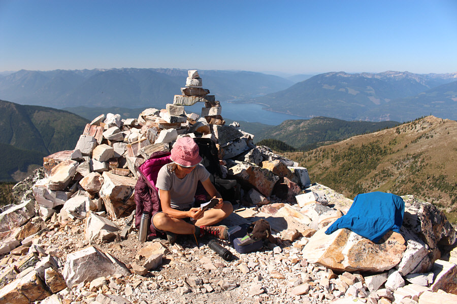
Zosia reads yet another well-maintained Kootenay Mountaineering Club summit register.  The booklets are always found inside a zip-lock bag in the PVC pipe and include a pencil and sharpener.
Salty. 
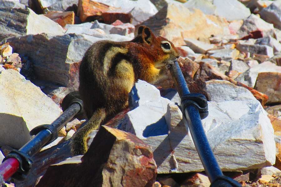
A golden-mantled ground squirrel sucks on a hiking pole.

Photo courtesy of Zosia Zgolak

Very loose and very steep! Zosia carefully descends the steep gully.
Farewell. We will probably never come back here again. Here is a last look back at Mount Crawford.
A nice post-summit snack! 
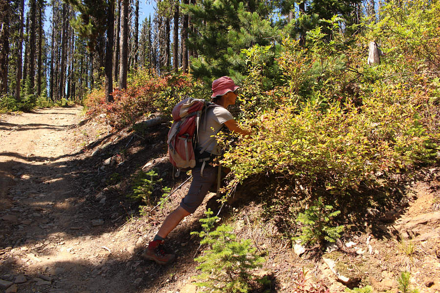
On the way back, Zosia stops to gorge on ripe huckleberries.
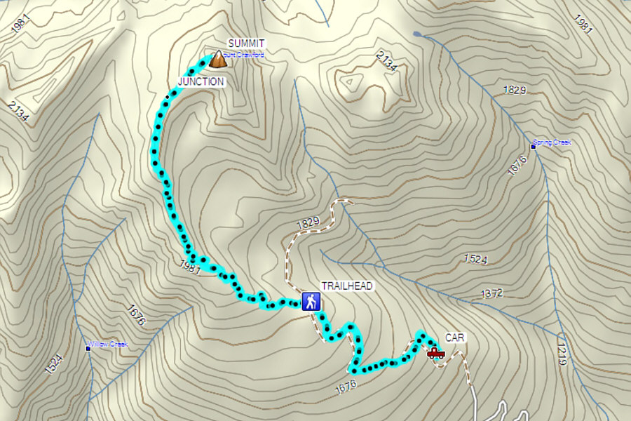
If you can handle the long drive up, this is a superb and relatively easy hike. Total Distance:  8.3 kilometres
Round-Trip Time:  5 hours 48 minutes
Net Elevation Gain:  777 metres

GPX Data