BOU AVENUE
Cypress Hills
Kicking off our Christmas holidays, Zosia
Zgolak
and I paid a visit to Cypress Hills Provincial Park in southeast Alberta
on 19 December 2020. Initially, we were unsure about what we would
be doing there given the uncertainties we had regarding the weather and
snow conditions. At one point, we thought about skinning up Hidden
Valley Ski Resort just outside the town of Elkwater and possibly doing a
couple of laps with our AT ski gear, but upon learning that we still had
to purchase a lift ticket to do so, we elected to move on. Our Plan
B was to visit the highest point of Cypress Hills located somewhere near
the west end of the park. During summer, it is possible to drive
nearly all the way to the high point via Murray Hill Road, but in winter,
this road is closed to vehicular traffic which then necessitates a
lengthy albeit flat approach on foot or skis.
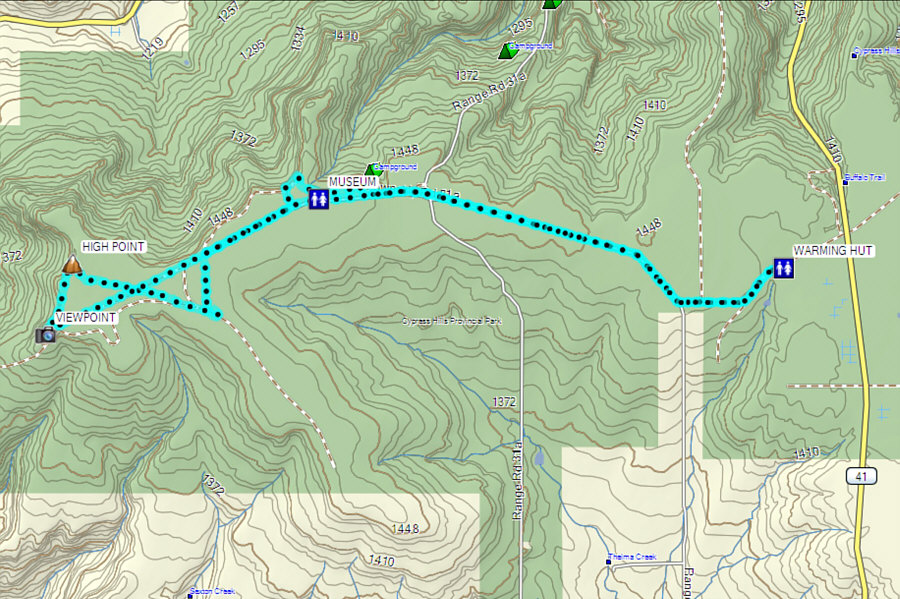
From Trans-Canada Highway, turn south
onto Highway 41 (Buffalo Trail) 25 kilometres east of Medicine Hat or 25
kilometres west of the Saskatchewan border. Drive for 36 kilometres
to reach Hidden Valley Ski Resort, and continue for another 2.8
kilometres to reach a 4-way junction. Turn right (west) onto Murray
Hill Road and drive another 750 metres to reach Spring Creek trailhead
(pit toilets and warming hut). In winter, the road is plowed as far
as this trailhead.
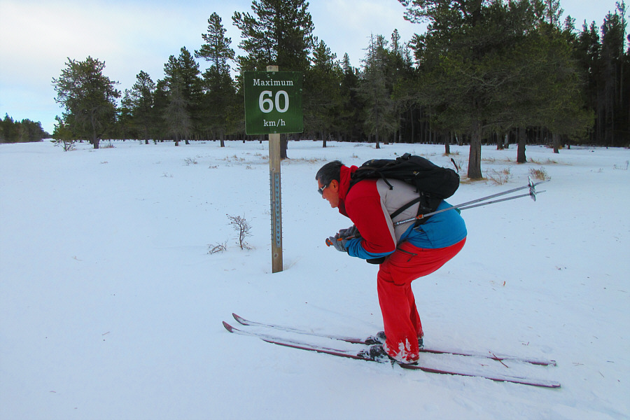
Seeing that there was enough snow
covering the continuation of Murray Hill Road, Zosia and I opted to use
our light touring ski gear for this trip. From the trailhead, we
skied past a seasonal gate and continued westward along the road which is
virtually flat for its entire length and is very easy to follow.
Occasionally, we skied into the teeth of some strong wind gusts, but
overall, the wind was not as much of a factor as I initially feared
possibly because the forests
alongside the road provide ample shelter. Most surprising for me
was how well my glide worked on the hard-packed snow covering the road,
and I do not recall the last time I skied so effortlessly in my light
touring gear. About 4.5 kilometres from the trailhead, we ventured
into the forest to briefly follow a designated cross-country ski trail
(Plateau Trail) which runs parallel to the road. The skiing was not
as fluid here since we had to break trail but also because the snow
seemed stickier in the trees for some strange reason. A few hundred metres along Plateau Trail, we
surprisingly stumbled onto a bunch of buildings and some antiquated
forestry equipment on display. This is the site of Tom Trott
Memorial Forestry Museum which was named in honour of Thomas Neil Trott,
a former Park Forest Officer. Besides the museum displays, there
are a couple of tidy backcountry huts here as well as some convenient pit
toilets. We spent about twenty minutes poking around here before
carrying on to visit Horseshoe Canyon viewpoint a few hundred metres
further to the northwest.
From Horseshoe Canyon viewpoint, Zosia
and I regained Murray Hill Road and continued westward for about another
kilometre. Here, we left the road again and headed south through
some forest toward what I thought might be the true high point of Cypress
Hills. Although a viewpoint known as "Head of the Mountain" near
the west end of Murray Hill Road is officially designated as the high
point of Cypress Hills, topographical maps of the area clearly show a
higher contour line about 800 metres north of this viewpoint.
Furthermore, an online elevation
map
suggests that there may be an even higher point located in some thick
forest about 1.7 kilometres east of the viewpoint. This would be
the first high point candidate that we would investigate, but after
reaching the spot (with some difficulty) I had previously marked in my
GPS device, I concluded that the online elevation map's datum is flawed
and incorrect. Moving on, we then made a beeline for the second
high point candidate located north of Head of the Mountain viewpoint.
Although the actual spot is rather nebulous owing to the flatness of the
terrain, this turned out to be the de facto high point of Cypress Hills
which reinforces the validity of the topographical maps' higher contour
line. For good measure, we also visited Head of the Mountain
viewpoint and confirmed that it is indeed lower than the true high point
by about six metres.
After taking a short break at Head of the
Mountain, Zosia and I turned around and headed back east along Murray
Hill Road. With the wind at our backs and no more detours, we made
short work of the eight-kilometre return ski and reached the trailhead in
less than a hundred minutes.
Despite the seemingly mundane terrain,
this ski trip turned out to be anything but boring. Highlights
included discovering the interesting forestry museum, seeing a coyote
dash away from us at quite a distance, and getting a surprising glimpse
of Montana's Sweet Grass Hills at Head of the Mountain viewpoint.
The skiing was also heavenly on this day, and best of all, I had the
privilege of sharing this fun adventure with my intrepid girlfriend.
 |
Zosia heads west past the seasonal gate along Murray Hill Road. |
 |
The ski along the road is virtually flat for most of the trip. |
 |
For a slight change of scenery, Zosia temporarily leaves the road to
follow Plateau Trail. |
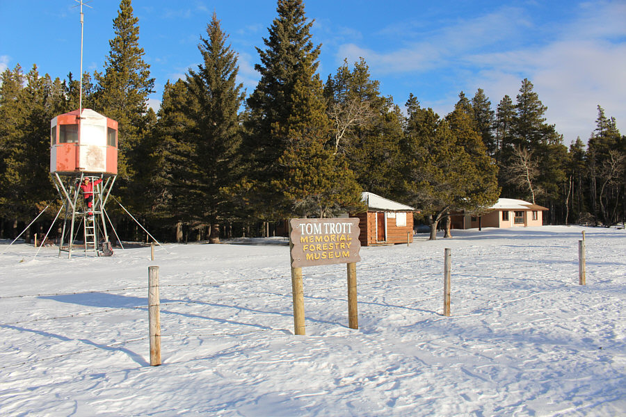 |
About five kilometres west of the trailhead is this quaint forestry
museum. |
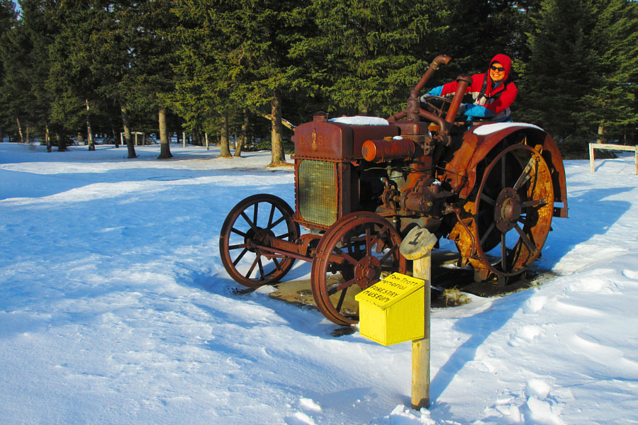 |
Looking for something that can handle rough back roads, Sonny takes this
tractor for a test drive.
Photo courtesy of Zosia Zgolak |
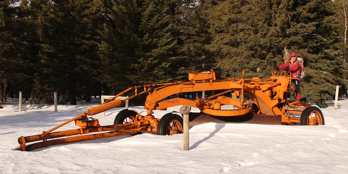
This snow plow probably could be put to good use right
now.
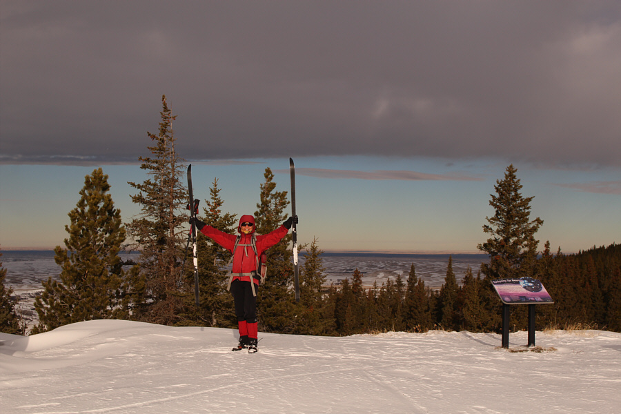 |
Zosia raises her skis near the Horseshoe Canyon viewpoint. |
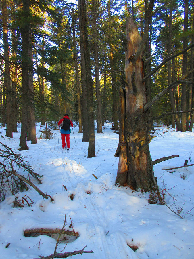 |
Sonny wanders into a forested area in a misguided attempt to find the
true high point of Cypress Hills.
Photo courtesy of Zosia Zgolak |
 |
Zosia passes a discarded tire en route to the highest point of Cypress
Hills somewhere on the horizon at left. |
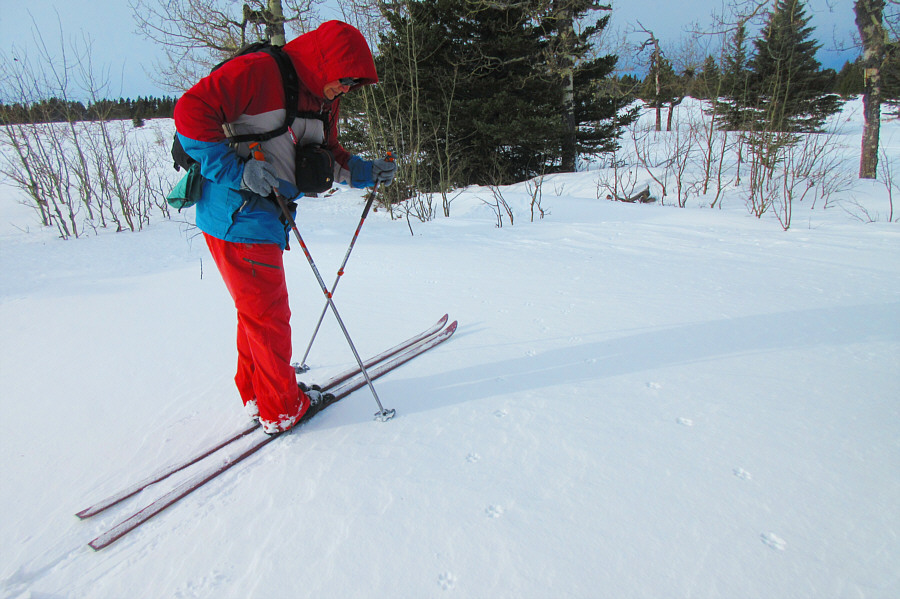 |
Sonny inspects the footprints of a coyote which he spotted running away
just moments earlier.
Photo courtesy of Zosia Zgolak |
 |
The true high point (1463 metres) of Cypress Hills is somewhere around
this spot. |
 |
The interpretive sign at this viewpoint claims that this spot--named
"Head of the Mountain"--is the highest point of the Cypress Hills with an
elevation of 1466 metres. However, Sonny's GPS device gives an
elevation of only 1457 metres for this spot. |
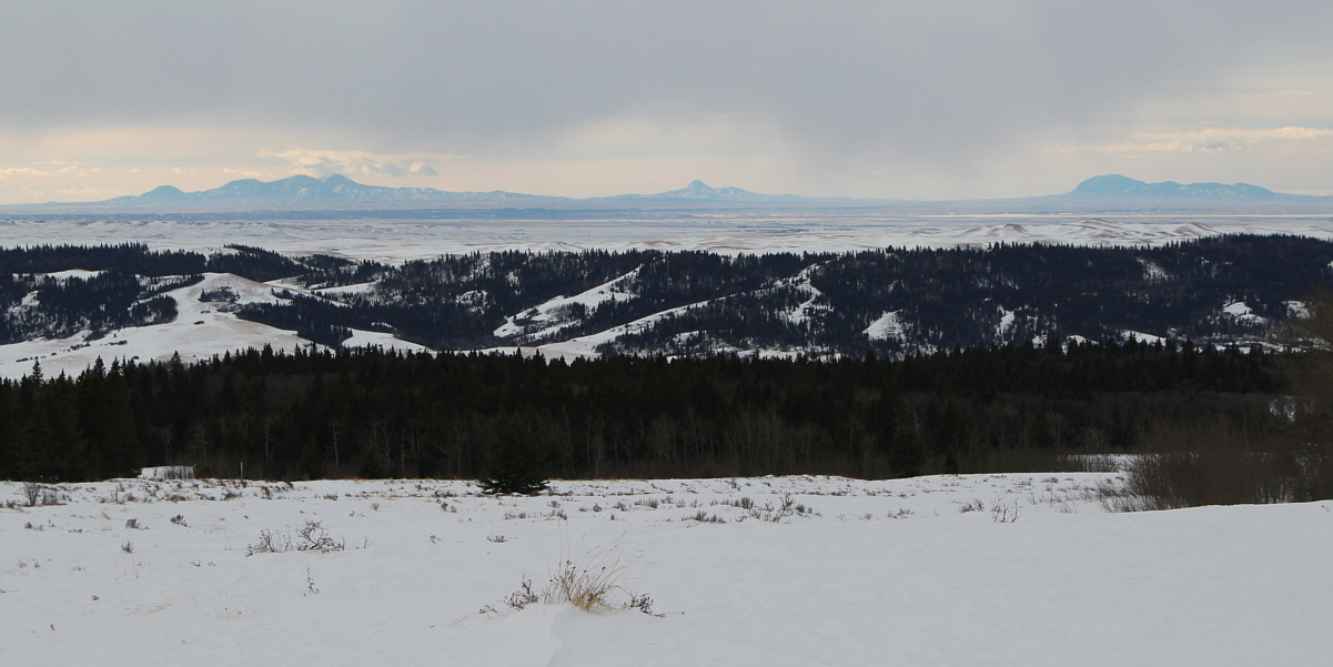
Montana's
Sweet Grass
Hills are visible on the southwest horizon more than a hundred
kilometres away.