BOU AVENUE
Crowsnest Mountain
Zosia Zgolak and I scrambled up Crowsnest Mountain near Coleman, Alberta on 24 August 2021.  Although I had already climbed the mountain in 2001, I was more than happy to repeat the ascent with Zosia.  The scramble route is described in Alan Kane's Scrambles in the Canadian Rockies, and given the easy access, the mountain is also exceedingly popular.  As a consequence, rockfall from other scramblers is a common occurrence on Crowsnest Mountain, and a helmet is strongly recommended.

From Highway 3, turn onto Allison Creek Road 6.1 kilometres west of the junction with Highway 40 in Coleman or 9.5 kilometres east of the provincial boundary.  Drive north for 2.7 kilometres and keep right at a split (left goes to Chinook Lake).  Continue north for 6.9 kilometres to reach an unsigned junction with an ATV track climbing to the right.  The official trailhead is about 220 metres further north, but the ATV track allows a slightly shorter approach.  Though rife with potholes, Allison Creek Road is suitable for most 2WD vehicles when conditions are relatively dry.

Zosia and I started from the official trailhead, but we immediately regretted not taking the alternative approach along the ATV track.  The bushes in the forest had not yet dried out from recent rainfall, and we were slowly getting wet as we walked along the narrow trail.  Fortunately, we intersected the wider ATV track before we got completely soaked, and we had no further issues with moisture for the rest of the trip.  We reached the last trees about seventy-five minutes after starting out, and although much of the mountain was shrouded with mist, we were still able to follow a well-worn path climbing up a huge rubble slope to the base of the first cliffs.  The route climbs to the right here and is still obvious to follow, but I was dismayed to see that someone had painted green and yellow streaks on the cliff walls to help point the way.  While I understand the sentiment, the painted lines are entirely unnecessary and even tantamount to unsightly graffiti.  I am even more incredulous that someone would make the effort to haul green and yellow paint all the way up there.

Above this section, Zosia and I scrambled up some easy cliff bands and picked up another good trail which makes a traverse to climber's left before entering a large amphitheatre.  The trail continues up to the base of another set of cliffs at the back of the amphitheatre before entering an obvious gully which is the crux.  Twenty years after I was last here, the amount of loose rock in this gully has seemingly not diminished.  Rockfall is still a very real hazard here, and we were fortunate that no one else was around as we climbed up the gully.  The two fixed chains near the top of the gully were still in good shape, and although the terrain is steeper than I remembered, we had no problems climbing up.

Once we cleared the gully, Zosia and I picked up a good beaten path rising up the upper mountain.  Although the rest of the ascent is generally easy, there are still one or two mildly exposed sections which require some care to surmount.  Upon reaching the summit, we took an extended break and chatted at length with a couple of guys who camped there the night before as well as a solo hiker who came up behind us.  While much of the mist shrouding the mountain had cleared up by the time we reached the top, we unfortunately did not get the far-reaching views I would have liked.

For the descent, Zosia and I retraced our steps down the mountain.  As we descended to the crux gully, we encountered numerous people still going up including a family with several children.  Thankfully, there was no one below us as we carefully dropped down the fixed chains one by one.  The solo hiker we met at the summit caught up to us here and graciously waited for us to clear the chains before zipping by and disappearing down the mountain.  Once we cleared the gully, the rest of our descent went mostly without a hitch.  Near the bottom, we opted to stick with the wide ATV track all the way back to Allison Creek Road, and once there, we simply turned right to return to our car.
Twenty years and twenty days after the last time I was here!

Crowsnest Mountain looms in the background as Sonny gets ready near the official trailhead.

Photo courtesy of Zosia Zgolak

Better bring along some holy hand grenades! The trailhead sign has some surprising information.
And it also climbs relentlessly...whew! The approach trail is very easy to follow.
It is supposed to clear up later...I hope! 
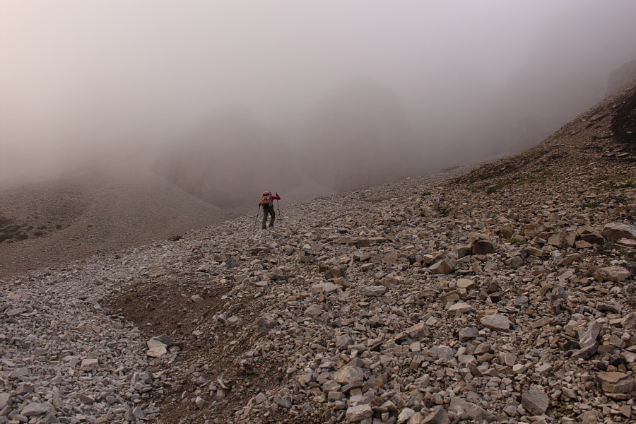
Mist shrouds much of the upper mountain as Zosia continues climbing up the trail.
Ugh. Above tree line, Zosia grinds her way up a massive rubble slope.
Utterly unnecessary! 
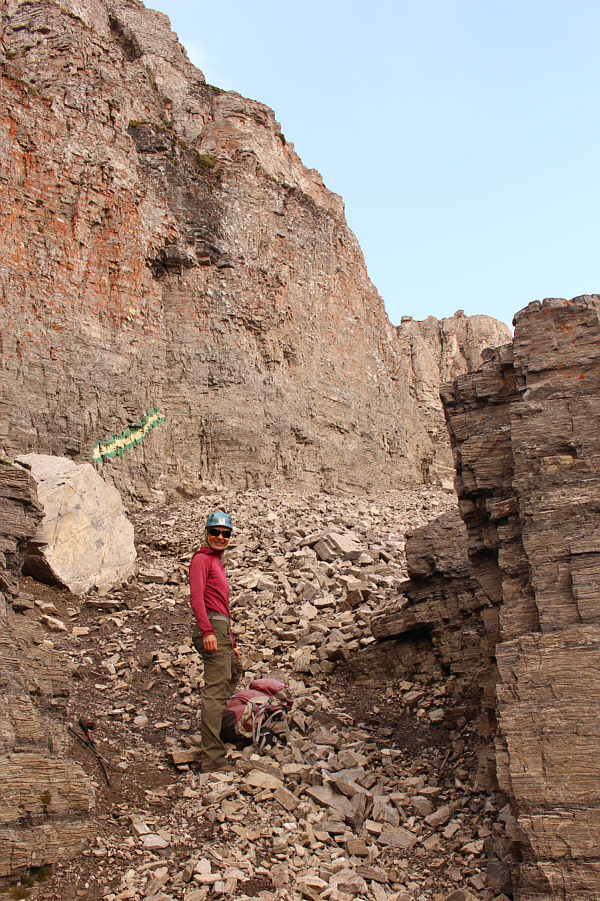
Someone has painted green and yellow streaks on the cliff walls presumably to point scramblers in the right direction.
This is still mostly just hiking here, but it's a good warm-up! 
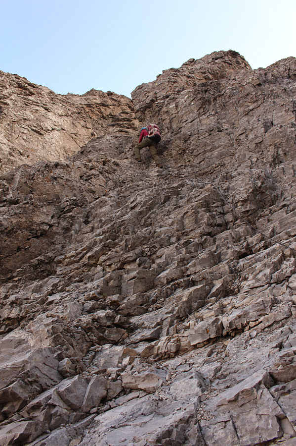
Zosia gets her first taste of some hands-on scrambling on this mountain.
Yes, we can thank the "Kane effect" for this nice trail! 
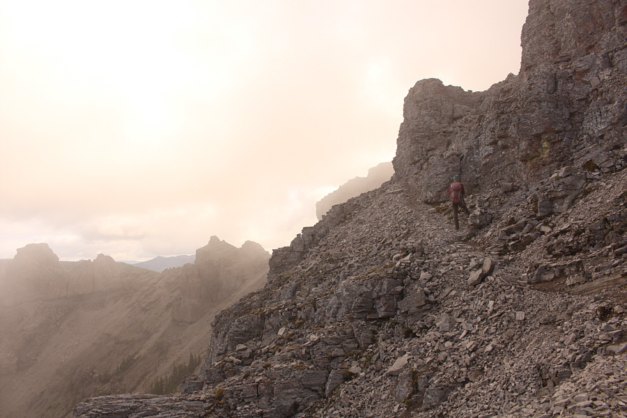
As Zosia climbs higher, the terrain starts to feel airy, but there is still a good trail to follow.
It's starting to look a bit daunting, but the beaten path is very reassuring! 
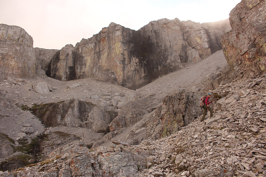
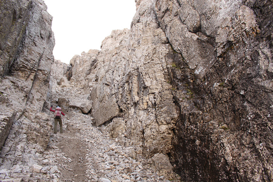
Entering a large amphitheatre, the trail climbs up to the base of the cliffs at centre before traversing left.
Beware of killer marmots! The entrance to the crux gully is at left.  The entrance to the Cave of Caerbannog is at right (just kidding).
After all these years, there is still a lot of loose rock in this gully! 
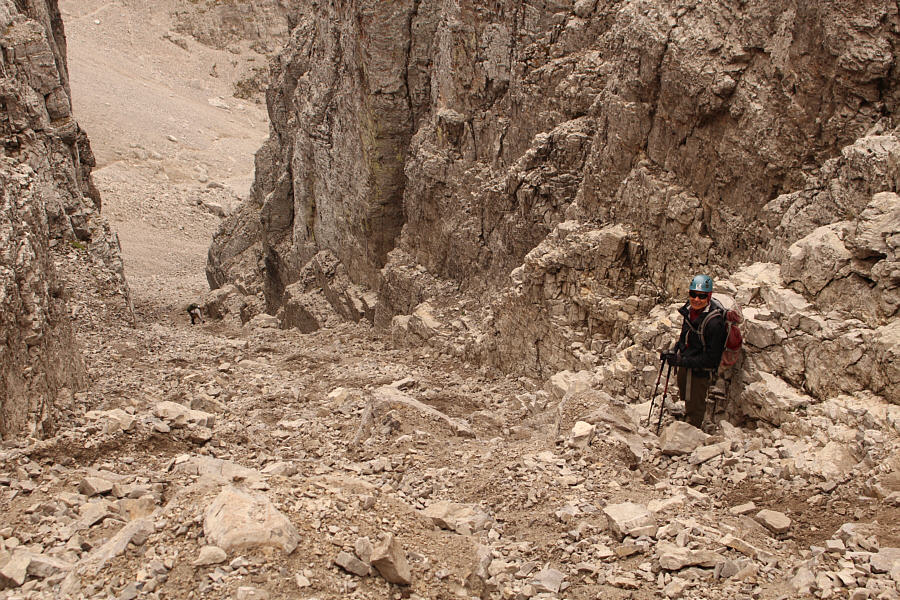
Zosia grovels up loose rocks on the lower half of the gully.
It's almost aid-climbing...almost. Zosia starts climbing up the section with the fixed chains.
Nicely done, Zosia! Zosia reaches the top of the first chain.
Still another 250 metres of elevation gain left. Zosia clears the gully and continues up the mountain.
Hmmm...it's steeper here than I remember! 
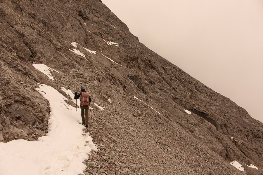
Some lingering snow patches on the beaten path are not of any consequence on this day.
Just be patient and be careful! 
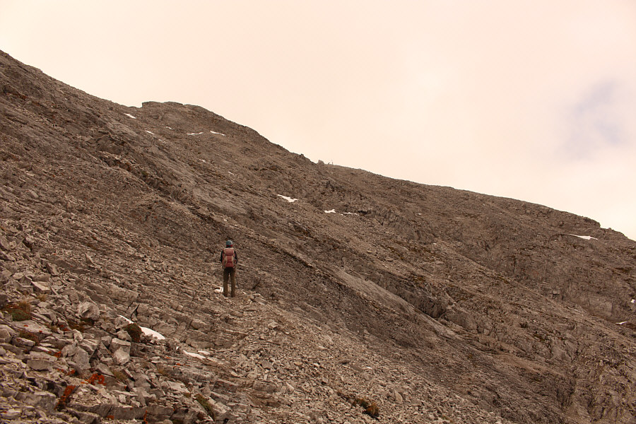
Although the remainder of the route on the upper mountain is mostly a hike, a few spots still require some hands-on scrambling and may be mildly exposed.
Ugh, I can't imagine hauling all that gear up here! 
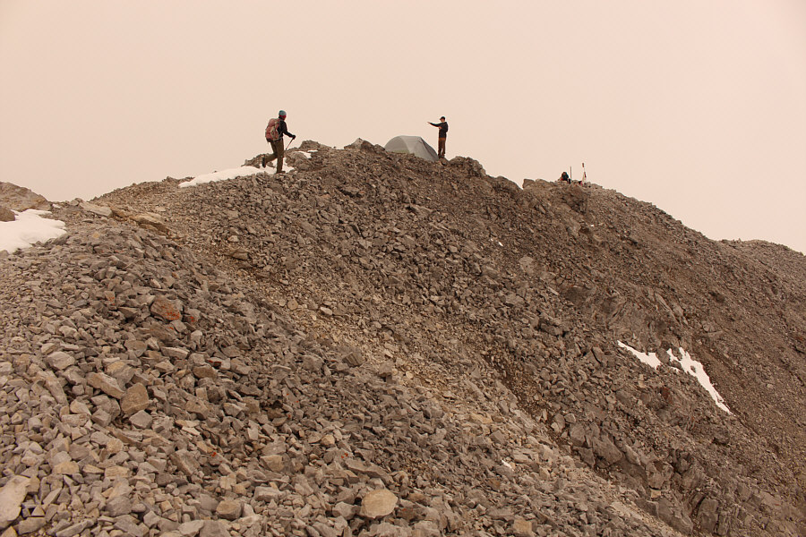
Zosia meets a couple of guys who camped on the summit the previous night.
Wow, the summit register canister sure has grown in 20 years! 
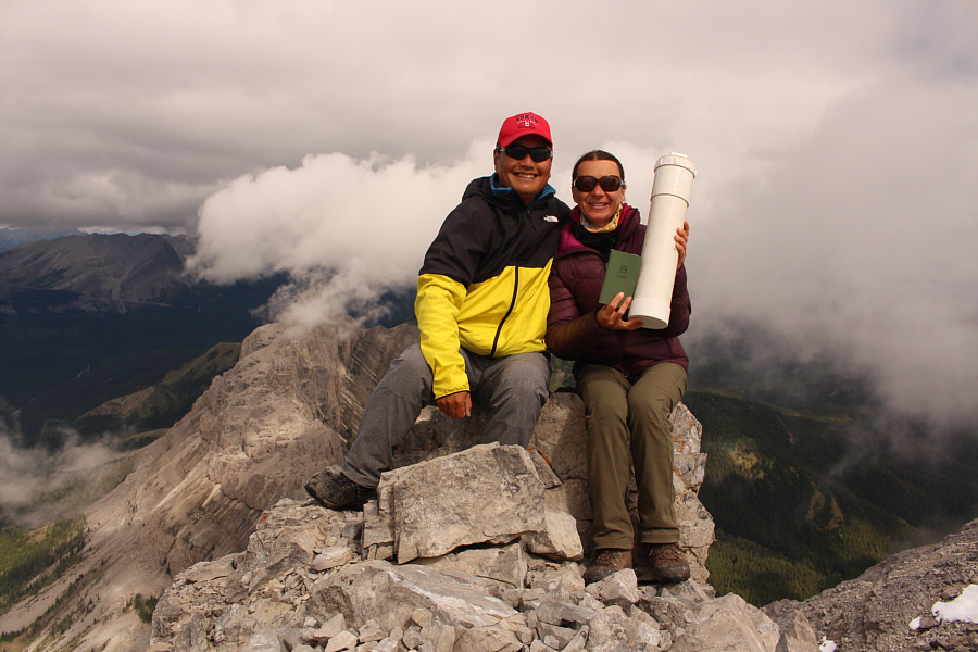
Sonny and Zosia sit near the summit of Crowsnest Mountain (2779 metres).

For some reason, I'm not that interested in climbing Deadman Pass Peak.

Despite some cloud cover, Mount Erickson (distant left) and Deadman Pass Peak (right of centre) are still visible to the west.


We couldn't wait any longer for the skies to clear! Zosia begins descending Crowsnest Mountain.
Best view of the day. The mist finally clears enough to grant a clear view of Seven Sisters Mountain to the north.
Hopefully nobody's coming up right now! 
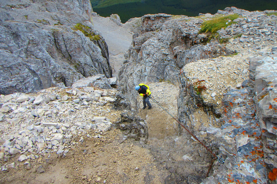
Zosia gets ready to descend the crux gully.
I should have put my hiking poles away! 
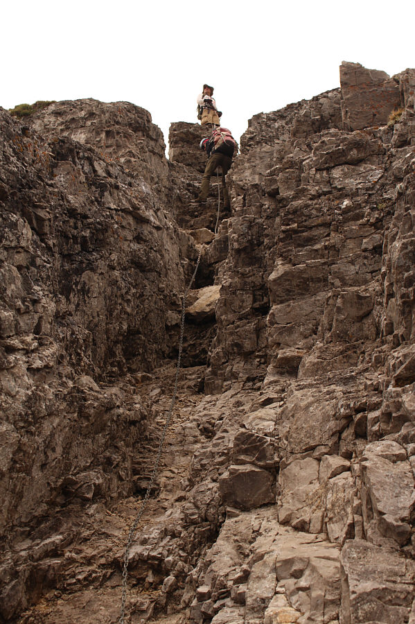
Sonny descends the second (upper) chain.

Photo courtesy of Zosia Zgolak

The Hilary Step of Crowsnest Mountain? Zosia descends from the top of the second chain while a solo hiker waits his turn.
Maybe let's wait until the guy below clears the gully... After clearing the fixed chains, Zosia tries to descend the remainder of the gully without raining rocks down on the solo hiker below.
We can breathe a little easier now! Zosia gets back to safer ground after clearing the crux gully.

Reminds me of Banff National Park's Dolomite Peak!

Here is another perspective of Seven Sisters Mountain from lower down.


Last obstacle of the day! 
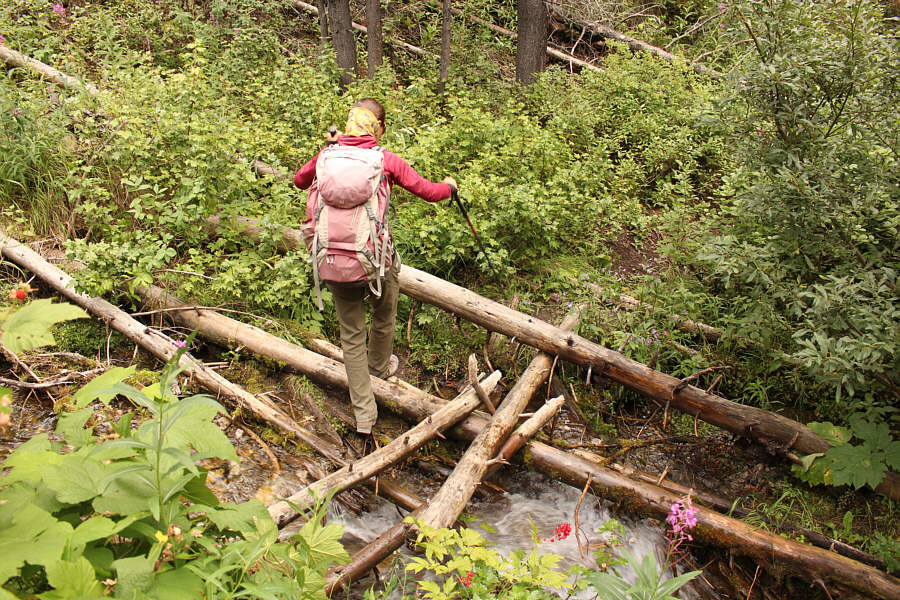
Zosia carefully crosses a creek on some slippery logs.
A classic scramble that is deservedly popular and even worth a second ascent! Total Distance:  8.8 kilometres
Round-Trip Time:  6 hours 46 minutes
Net Elevation Gain:  1112 metres

GPX Data