BOU AVENUE
John Ware Ridge North Summit And Carry Ridge

On 6 November 2021, Shaun Luong, Zosia Zgolak and I did a loop hike in the eastern fringes of Alberta's Kananaskis Country Public Land Use Zone (PLUZ) which included an ascent of the north summit of officially-named John Ware Ridge and a traverse of unofficially-named Carry Ridge.  When Zosia and I last hiked Carry Ridge in 2017, we inadvertently wandered into private land (Anchor D Ranch) on our descent.  Hoping to avoid conflicts with private land owners, we made a conscious effort this time to remain strictly within public land, but as a result, we would have to forego the true summit of John Ware Ridge.  Fortunately, the north summit of John Ware Ridge is completely within the PLUZ and is itself a worthwhile objective.

Starting from a huge Kananaskis Country sign with flags along the north side of Highway 546 (15 kilometres west of the 4-way stop in Turner Valley), Shaun, Zosia and I climbed a good trail rising up to meet a barbed wire fence demarcating the eastern boundary of the PLUZ.  Turning northward, we more or less followed this fence line for approximately the next six kilometres until we gained the crest of John Ware Ridge.  Along the way, we went over numerous intervening ridges including the main spine of Carry Ridge, and although the constant ups and downs were rather annoying, all of them were mercifully short.  We also had to contend with several boggy sections, but thankfully, most were frozen enough to allow for relatively easy travel.  On one of the grassy knolls of John Ware Ridge, we ran into a couple of friendly elk hunters who mentioned that they had entered the area via a publicly-accessible road to the north.  I was unaware of such a road, but this might be worth investigating for future trips into the area.  Shortly after our encounter with the hunters, we hiked over an open grassy hillside which turned out to be the highest elevation we would reach for the day.  We then dropped down into one more dip and squeezed through a barbed wire fence perpendicular to the boundary fence (we were still within the PLUZ) before finally gaining the crest of John Ware Ridge.  At this point, we abandoned the boundary fence and easily followed the remainder of the ridge crest to the north summit where we stopped to take an extended break.
I'm not sure what the flag is on the right.

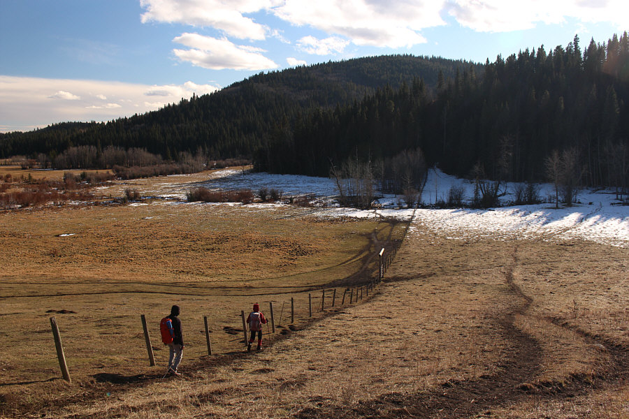
Shaun and Zosia start up a trail behind some flags near the highway.

Lots more ups and downs to come! 
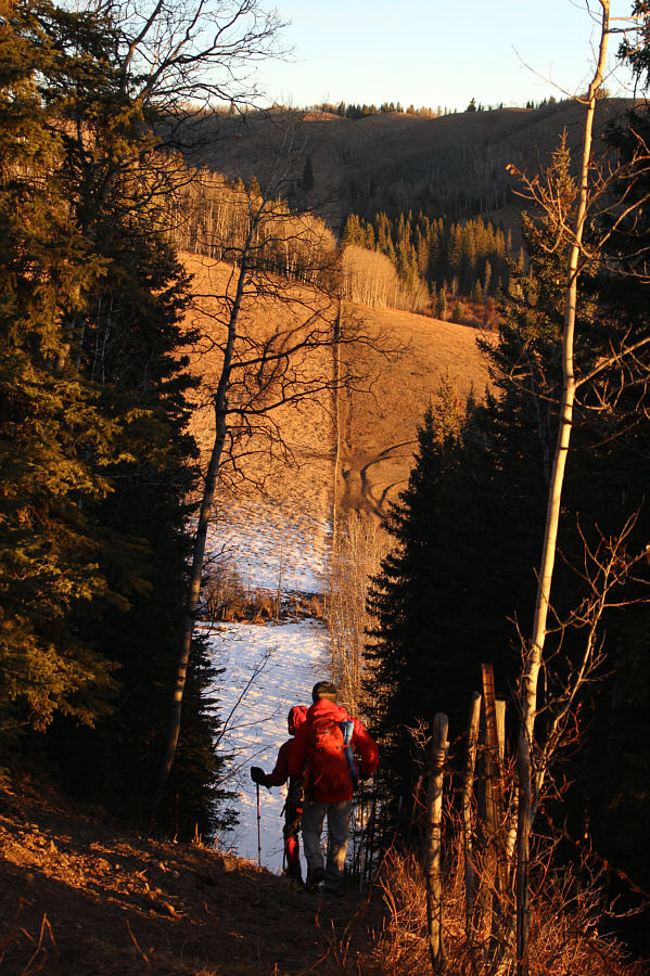
After a brief initial climb, Zosia and Shaun have to lose all that hard-won elevation as they drop down a very steep path beside the Kananaskis Country boundary fence.  On the horizon is Carry Ridge.

No trespassing!

The southern end of Carry Ridge is located within private land (Anchor D Ranch) on the other side of the fence.


Go left. 
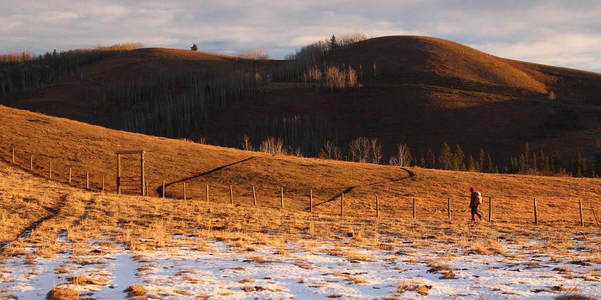
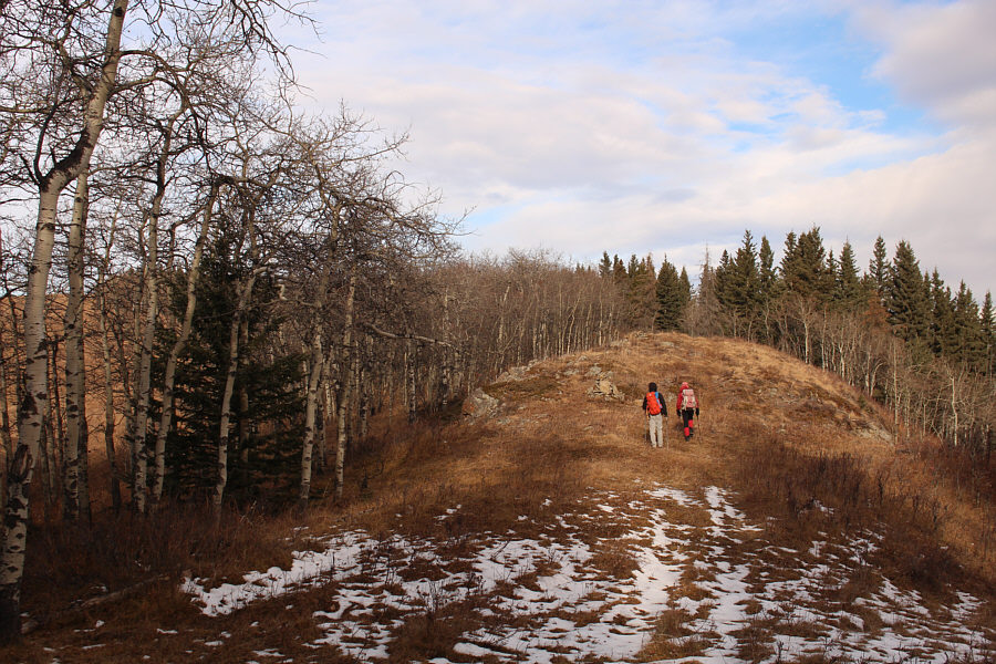
Shaun ascends Carry Ridge along the boundary fence.
We didn't see another car at the trailhead, so I'm not sure where these guys came from. Zosia briefly follows a couple of hunters in the distance along the crest of Carry Ridge.
Very pleasant hiking here.

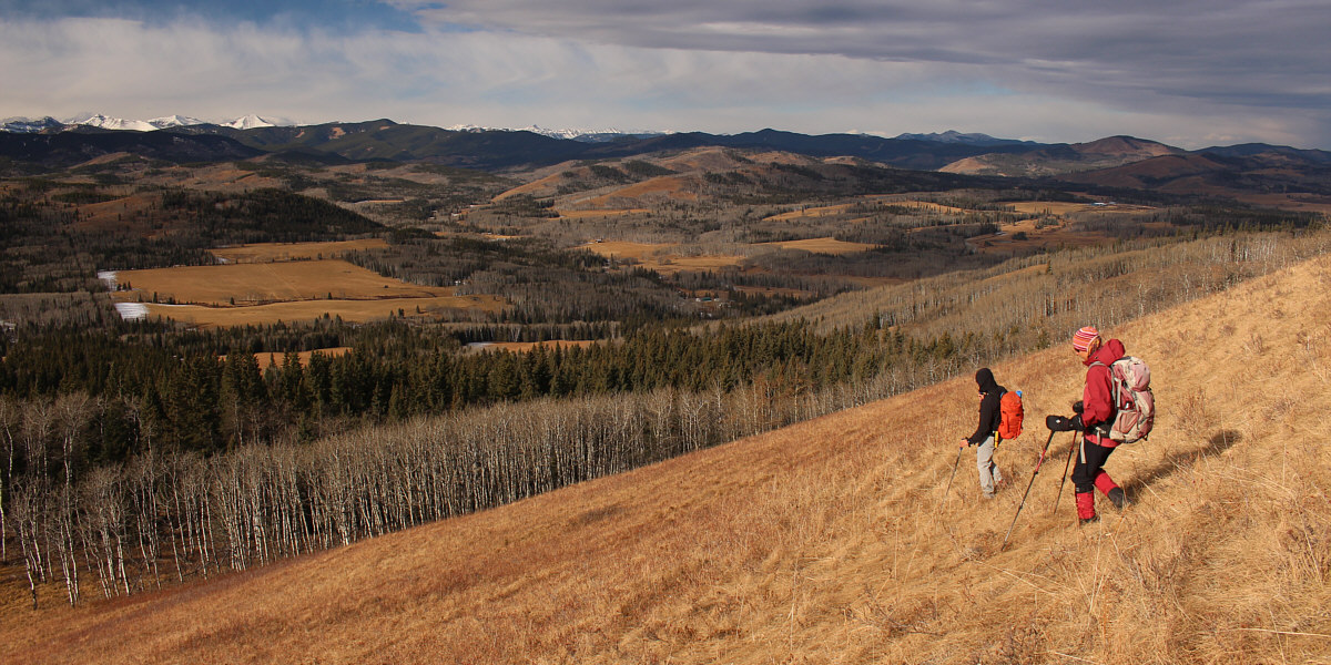
Zosia and Shaun continue to follow the boundary fence as they drop down the east side of Carry Ridge.  John Ware Ridge is visible in the distance.

It's best to hike this when the ground is frozen.

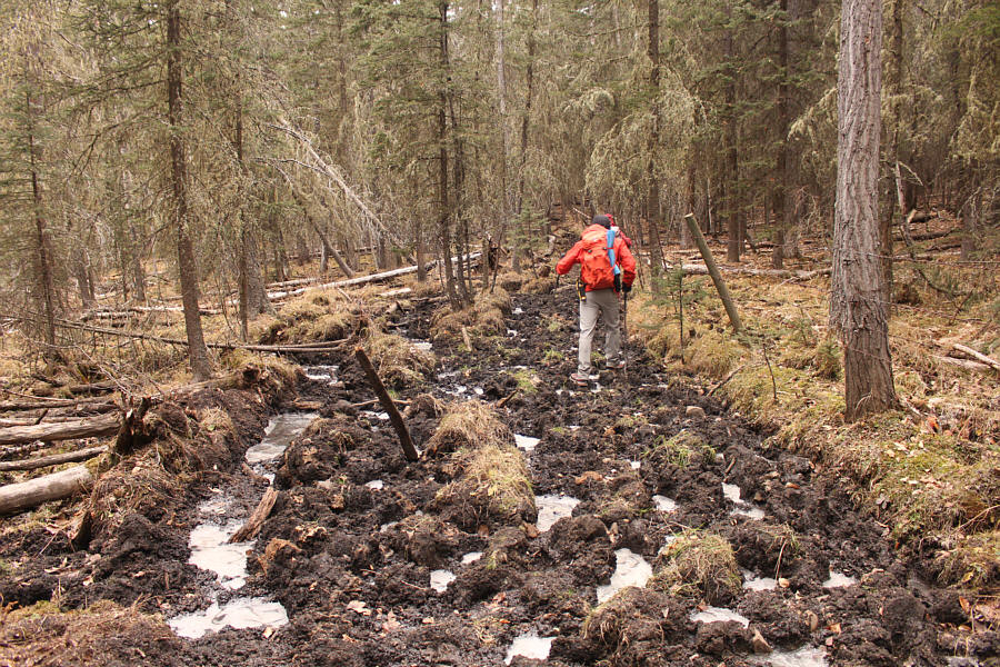
Along the boundary fence between Carry Ridge and John Ware Ridge are several boggy sections such as this one.

Maybe we can sneak up to the summit if we disguised ourselves as cows...

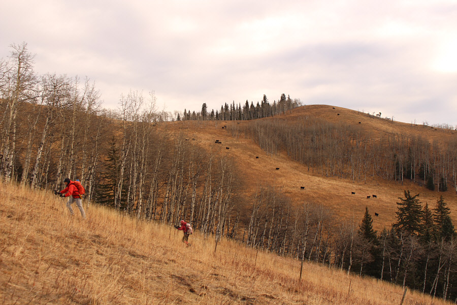
Cattle can be seen grazing on the part of John Ware Ridge located on private land.

These guys looked like the second coming of ZZ Top!

Zosia and Sonny have a friendly chat with a couple of elk hunters.

Photo courtesy of Shaun Luong

Reminds me of a few tough disc golf holes...

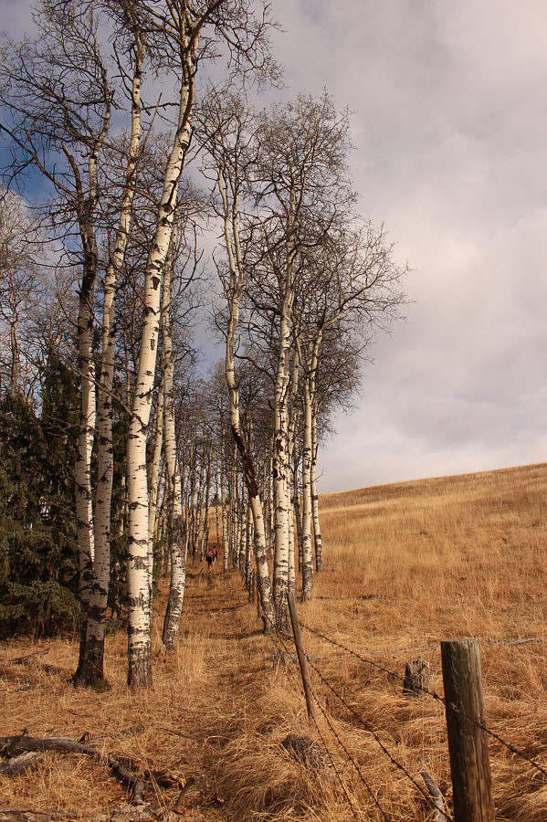
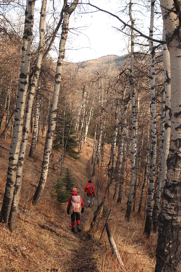
The boundary fence runs through a narrow corridor of aspen trees.

But, sadly, not the high point of John Ware Ridge.

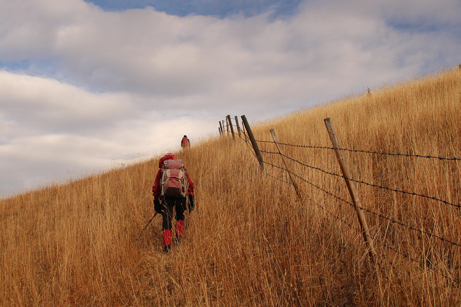
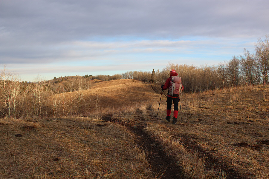
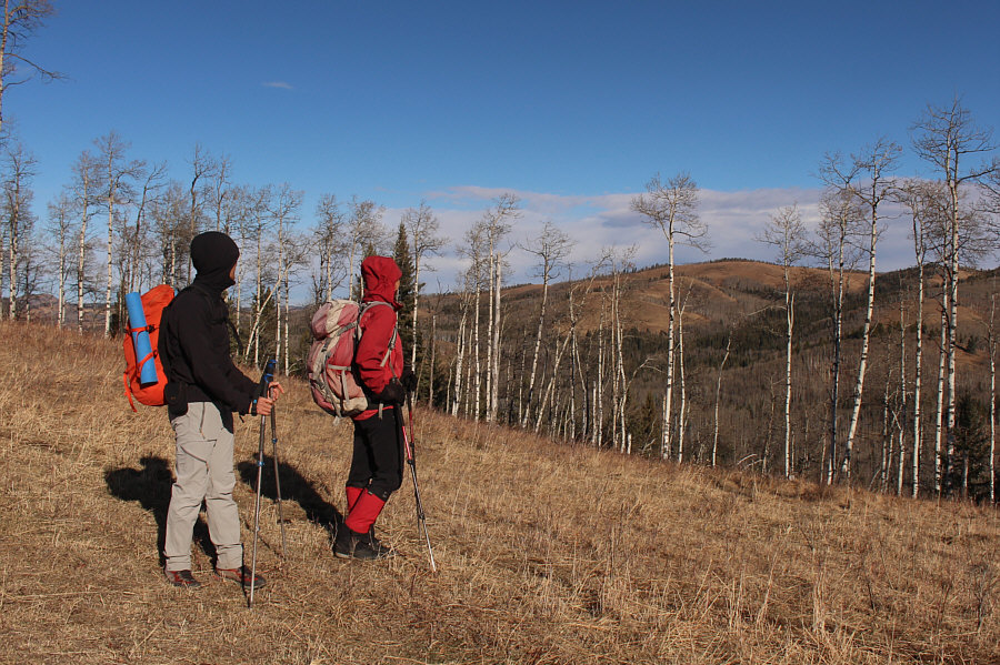
Zosia and Shaun climb over a grassy hillside which turns out to be the high point (1559 metres) of the trip.

We're finally ridge-walking...yay!

Shaun and Zosia abandon the boundary fence to follow the crest of John Ware Ridge northward.

I think we're gonna make it!

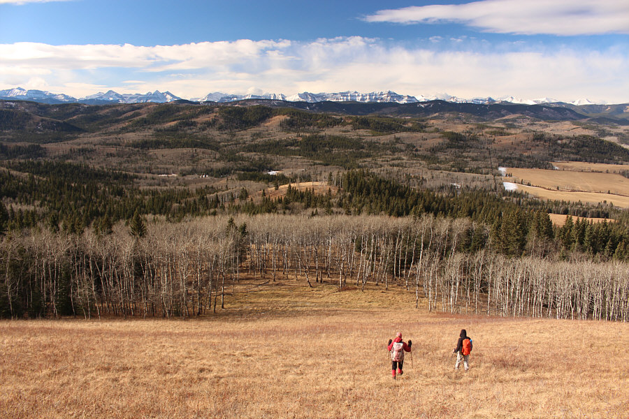
A large meadow precedes the north summit of John Ware Ridge.

Definitely a worthwhile objective even if it's not the highest point of John Ware Ridge.

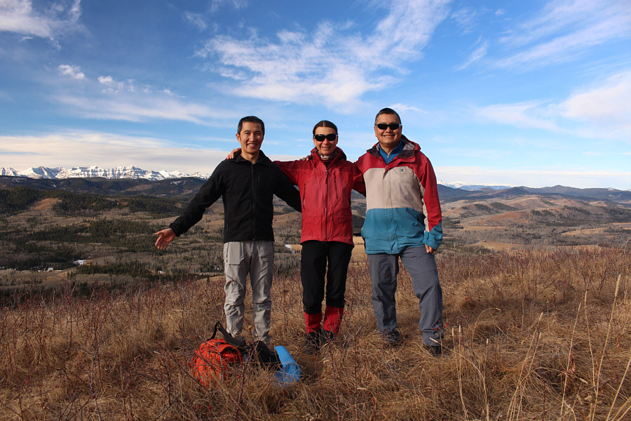
Shaun, Zosia and Sonny stand on the north summit (1550 metres) of John Ware Ridge.

When we resumed hiking, Shaun, Zosia and I headed further north along the crest of John Ware Ridge before descending open grassy slopes to the west.  We climbed over another barbed wire fence--likely the same one we squeezed through earlier--and worked our way down generally easy terrain until we eventually crossed a tributary of Ware Creek.  Continuing westward, we hiked up more easy terrain to reach the north end of Carry Ridge, and from there, we turned south to follow the ridge crest.  While we enjoyed calm conditions on John Ware Ridge, a chilly wind suddenly picked up as we gained Carry Ridge, but otherwise, we had no trouble traversing over Carry Ridge's nebulous high point and ultimately intersecting our up-track at the boundary fence.  Avoiding private land at the south end of Carry Ridge, we dropped off the ridge crest and simply retraced our steps along the boundary fence back to the highway.  The final uphill section before the highway is perhaps the steepest climb of the day, but fortunately, the normally muddy track was mostly dry and not too slippery.

Can you spot Banded Peak, Mount Cornwall, Mount Glasgow, Nihahi Ridge, Moose Mountain, and Mesa Butte?

Shaun and Zosia descend open grassy slopes below the north summit of John Ware Ridge.


Watch for an annoying barbed wire fence at the bottom of this grassy slope!

Zosia and Shaun head westward aiming for the northern end of Carry Ridge which is somewhere at far left.

Goodbye, John Ware Ridge North Summit! After gaining the crest of Carry Ridge, Shaun and Zosia take a last look back at the north summit of John Ware Ridge.
Not that anybody really cares! The high point (1544 metres) of Carry Ridge is not well-defined.
Couldn't they have moved the boundary just a little further east?? Shaun and Zosia face the steepest climb of the day at the very end of the trip.
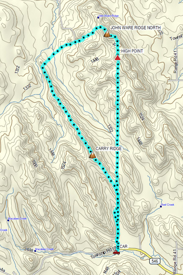
A very satisfying shoulder-season hike even without the true summit of John Ware Ridge. Total Distance:  15.7 kilometres
Round-Trip Time:  6 hours
Cumulative Elevation Gain:  766 metres

GPX Data