BOU AVENUE
Mokowan Butte
On 5 June 2022, Dave McMurray, Zosia Zgolak and I ascended the gazetted high point of officially-named Mokowan Butte located in the eastern margins of Alberta's Waterton Lakes National Park.  This mostly-forested and multi-humped ridge has largely stayed under most hikers' radars especially since it is overshadowed by so many superior hiking options nearby including those in Montana's Glacier National Park.  Moderately thick bush and a lack of trails also discourage visits by all but the most die-hard peak-baggers like the late, great Rick Collier.  I am not even certain if Collier actually tagged the true high point which is located on leased agricultural land (permission required for recreational access) outside of the park about 5.5 kilometres to the southeast.  Collier did not leave a route description, and his published photos of his ascent are not particularly inspiring.  With the help of Google Maps though, I was able to find some interesting features on Mokowan Butte, and this largely dictated how our route would unfold.  Incidentally, mokowan is the Blackfoot word for "stomach" as referenced in this Wikipedia article.

From the junction with Highway 5 (900 metres east of the turnoff to Waterton townsite), turn south onto Chief Mountain Highway (Highway 6) and drive 16.0 kilometres to the bridge over Belly River.  Park in a small pullout on the south side of the highway just east of the bridge.

Crossing to the north side of the highway, Dave, Zosia and I found a faint trail going up a short embankment, and we were soon walking through a large meadow.  We picked up a more prominent trail at the far end of the meadow but only followed it for a short distance before turning eastward and plunging into moderately thick bush.  We thrashed our way to a secluded tarn which surprisingly has an official name--Giants Mirror.  From there, we continued to make our way eastward through terrain that turned out to be more complex than expected.  Besides dodging deadfall and undergrowth, we had to navigate over several knolls and their accompanying annoying dips.  After a few ups and downs, we finally gained a grassy ridge which temporarily granted both easier travel and scenic views.  We inevitably ran into more deadfall higher up, but at least it felt like we were making positive upward progress.  About 2.5 hours after starting out, we climbed up to the south end of what had looked to me like bluffs on Google Maps.  In reality, this is merely an open slope likely blown clear of vegetation by the notorious winds that regularly pummel this area.  Calm conditions prevailed on this day, and we enjoyed far-reaching views as we traversed northward along the top of the open slope.  This was easily the highlight of the trip and more than justified the tedium of the bushy ascent.  Going past the north end of the open slope, we re-entered forest and bushwhacked for another few hundred metres or so to try and tag the gazetted high point of Mokowan Butte.  Given the inaccuracies of GPS readings, the flatness of the terrain, and a lack of any obvious markers, we had some difficulty pinpointing the exact location of the high point, and ultimately we just eyeballed a spot and declared it as such.  I wonder if Collier did the same when he snapped his "summit" photo.

With nothing of interest to see at the high point, Dave, Zosia and I took a "summit" photo of ourselves before backtracking to the scenic open slope we traversed earlier.  We stopped there for an extended break before resuming our descent.  Instead of retracing our steps exactly, we took a slightly different line down to the highway and generally followed the path of least resistance mostly along a couple of broad drainages.  The bushwhacking was seemingly no worse or better than what we encountered going up, but at least our route-finding was a little more efficient while descending.  We eventually popped out of the forest slightly east of where we parked and finished with an easy walk along the side of the highway.

Unless Andrew Nugara adds it to the next edition of his newly published guidebook, Popular Day Hikes: Waterton, Mokowan Butte is likely to remain an obscure objective that few will bother to visit.  There are just so many other hikes in the area that are more pleasant and worthwhile to invest precious time and effort.  With that said, this was a corner of Waterton Lakes National Park that had long piqued my curiosity, and I was pleasantly surprised to find that it was not completely devoid of interesting things to see.  Perhaps someday, Parks Canada may even consider building a trail here to possibly help alleviate congestion in other more popular areas of the park.

I want to thank Dave and Zosia for their excellent company and undying enthusiasm in spite of all the miserable bushwhacking we endured.  A very special thank you goes out to Andrew and his step-father, Larry Poulin, for their generous hospitality in accommodating Zosia and me at their cabin in Mountain View for the weekend.  I especially enjoyed our game of four-way cribbage the previous evening; it has been much too long since I last played a card game of any sort!

Be sure to check out Dave's more detailed trip report.
Maybe the least frequented corner of Waterton National Park!

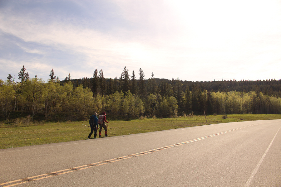
Dave and Zosia cross the highway to start the trip.  A lower part of Mokowan Butte stretches across the horizon.

Good place for skinny dipping on a hot day!

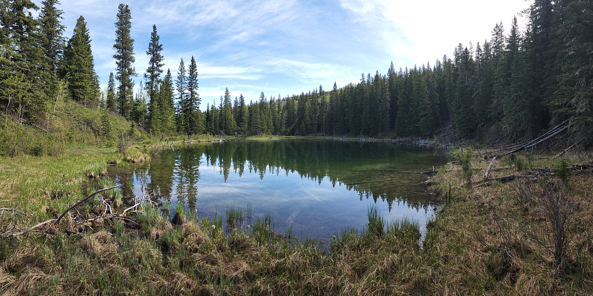
Giants Mirror is a secluded tarn situated at the foot of Mokowan Butte.

Photo courtesy of Dave McMurray


Zosia's hat almost matches Dave's shirt!

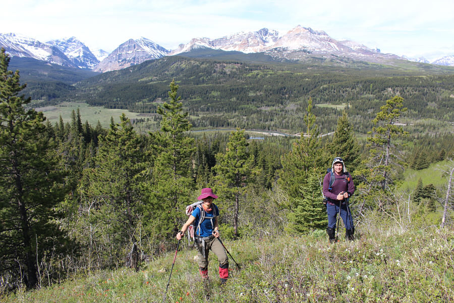
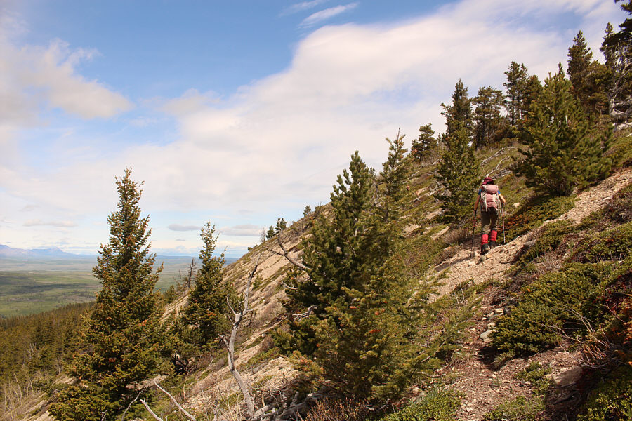
Far-reaching views open up as Zosia and Dave climb up a grassy ridge.

Enjoy this while you can...more deadfall ahead! 
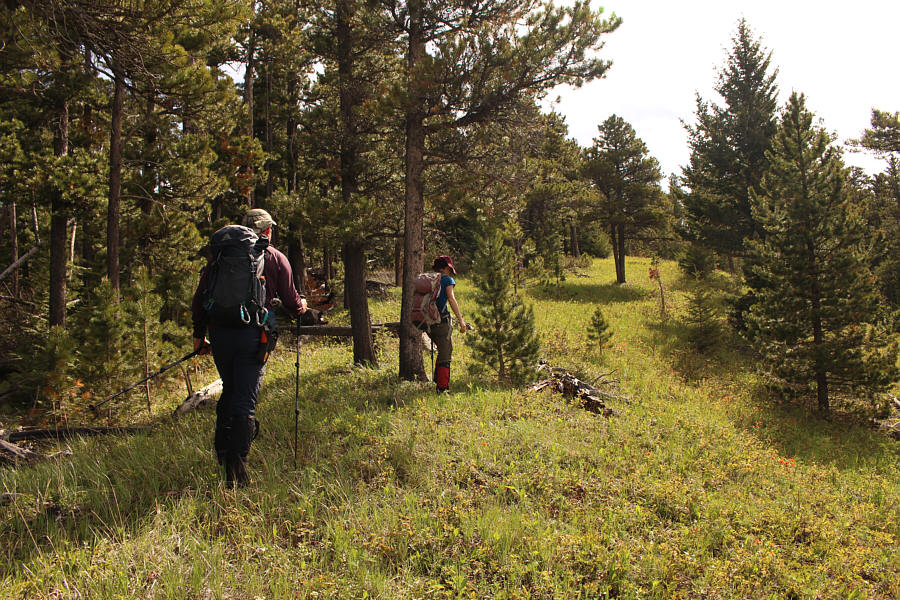
The grassy ridge allows easier travel albeit only temporarily.
This was how I got seriously injured on Chancellor Peak a few years ago!

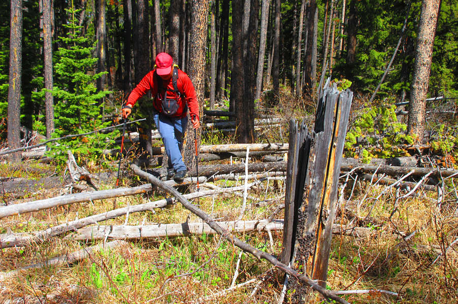
Sonny balances precariously on some toothpick deadfall.

Photo courtesy of Zosia Zgolak

Probably don't wanna be here when it's really windy! The trees begin to thin out as Zosia approaches the crest of the ridge.

How many peaks can you name on the horizon?

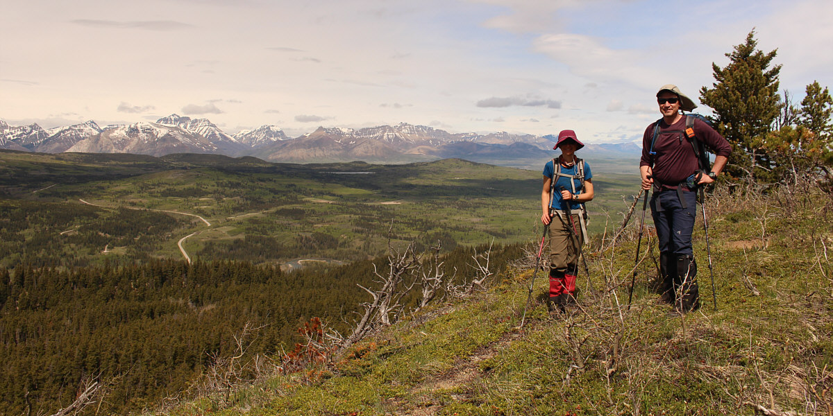
Visible to the west are many of the mountains of Waterton Lakes National Park and Castle Wildland Provincial Park.


So many peaks I wanna climb here! 
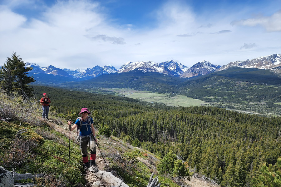
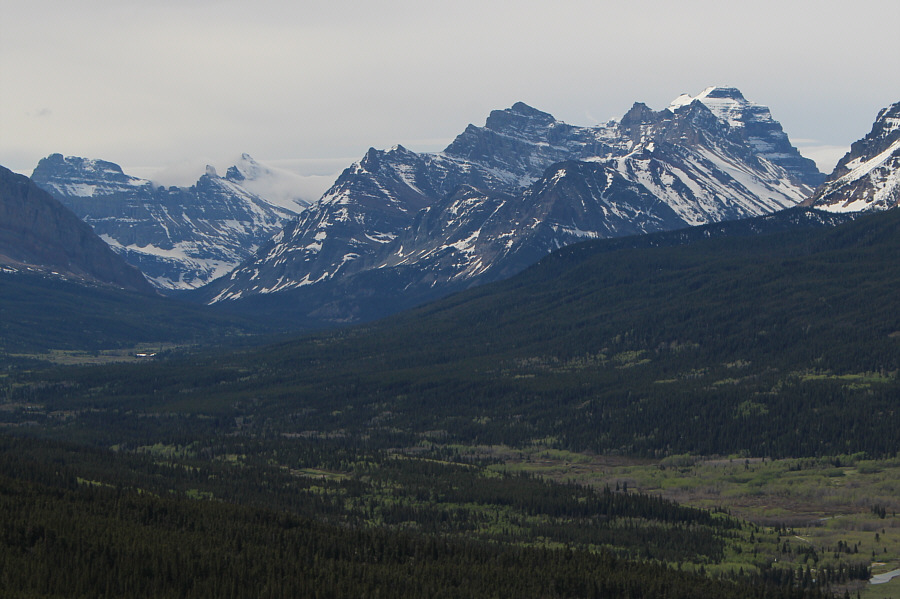
Most of the mountains in this view to the southwest are located in Montana's Glacier National Park.

Photo courtesy of Dave McMurray

Iceberg and Merritt are so unbelievably high on my to-do list! Here is a closer look at some of the amazing peaks in Glacier National Park including Mount Wilbur (far left), Iceberg Peak (draped with clouds at left), Natoas Peak (right of centre), and Mount Merritt (highest at right).
Feels like a lifetime ago when I climbed this... 
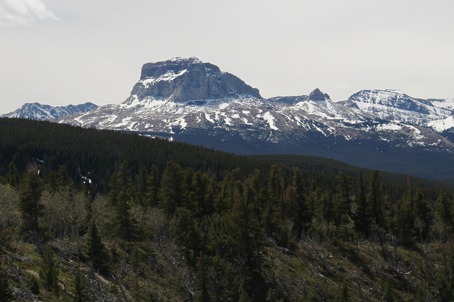
Almost directly south is the striking form of Chief Mountain.
Close enough that nobody will really care! 
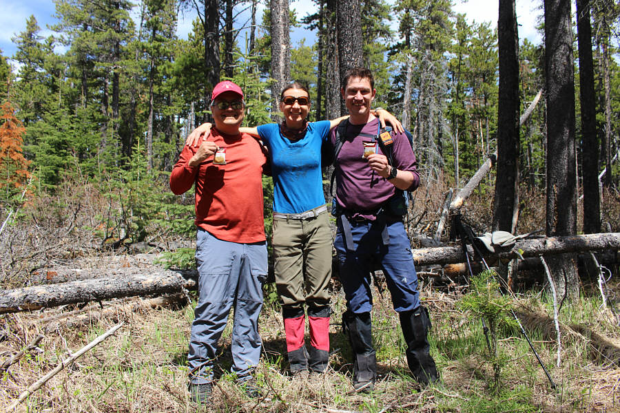
Sonny, Zosia and Dave stand approximately on the gazetted high point of Mokowan Butte (1771 metres).

So much for the views--time for more bushwhacking!

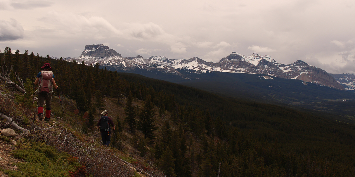
Here is a last look at Chief Mountain (left) and Gable Mountain (right) as Zosia and Dave make their way back across the open slope near the top of Mokowan Butte.


Zosia finds dead things! 
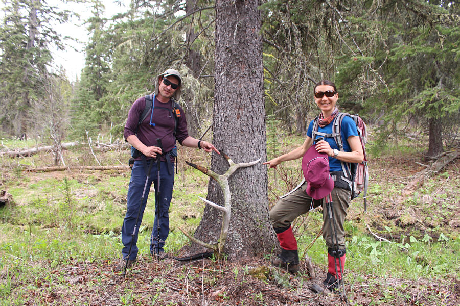
Dave and Zosia stand next to a very large elk antler which Zosia found during the descent.
It's just starting to rain! 
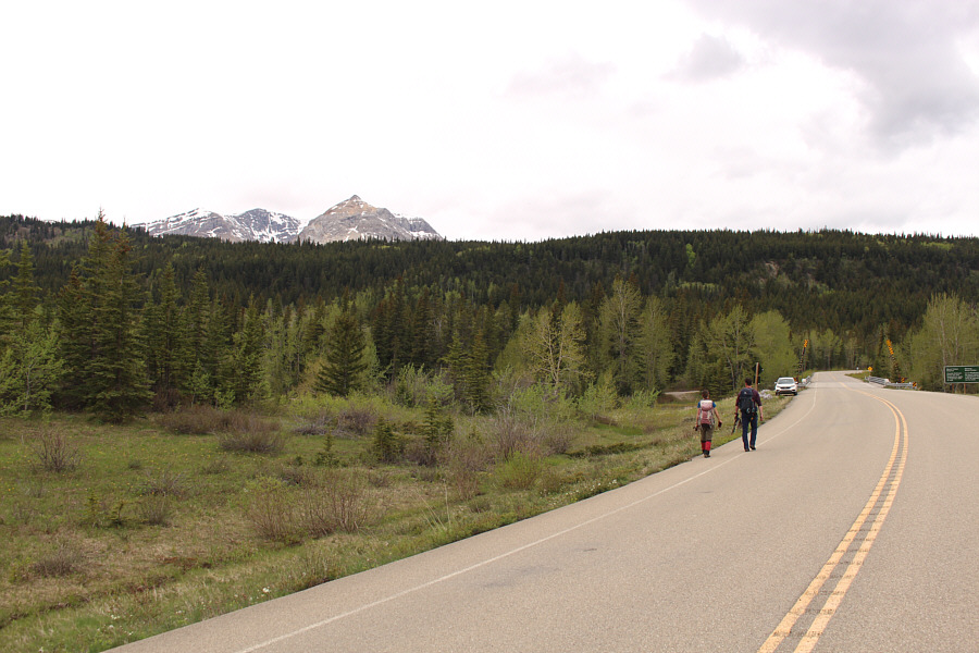
Zosia and Dave finish their hike with an easy walk along the highway.
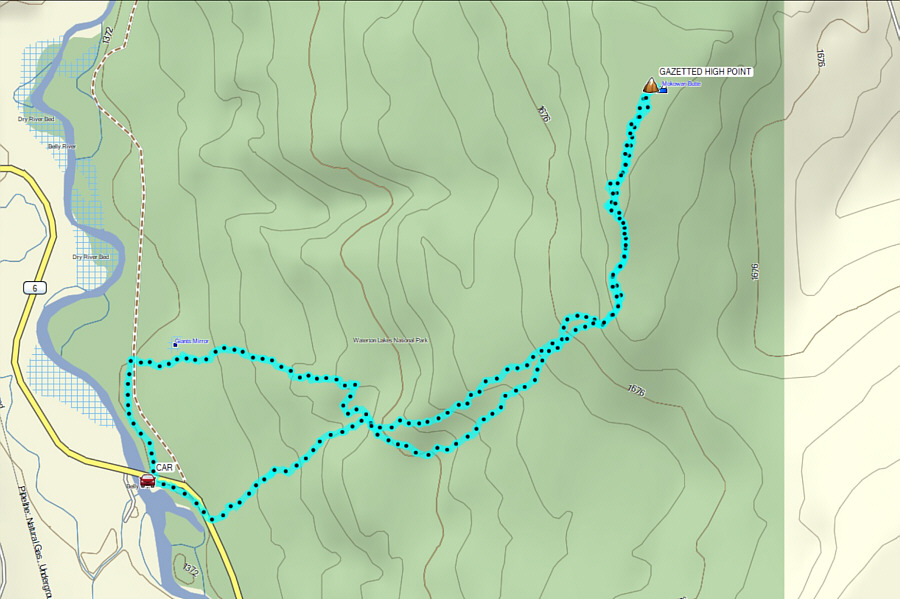
Mokowan Butte deserves more love than it gets! Total Distance:  8.7 kilometres
Round-Trip Time:  5 hours 29 minutes
Net Elevation Gain:  389 metres

GPX Data