BOU AVENUE
Fox Tree Hill
Wrapping up the final day of our summer road
trip on 19 July 2025, Zosia Zgolak and I hiked up Fox Tree Hill located
south of Creston, British Columbia. I got the idea for this short
hike from an unusual AllTrails entry called "Creston
Airport Horse Trails". The Creston Valley Horse Association (CVHA)
maintains a network of equestrian trails situated on a small
forested hump beside the Creston Valley Regional Airport. Although
the hump is officially unnamed, a residential road on its south side is
erroneously named "Fox Tree Hill Road" in
OpenStreetMap (actual street signs read "Fox Tree Rd").
Naturally, I presumed that "Fox Tree Hill" is the name that locals
ascribe to the hump, and upon further research, I found at least two
other references that support this--an online birding
site and a scientific
report on the restoration of skink habitat in the area. Since
the trails are meant to be used primarily by equestrians, motorcyclists
and mountain bikers are prohibited from riding here, but I did not find
anything explicitly saying that hikers are also not welcome.
From Highway 21, turn east onto Mallory
Road 3.0 kilometres south of the intersection with Erickson Road in
Creston or 6.9 kilometres north of Porthill Road near the Canada-US border. Drive 3.0 kilometres and turn
south onto Airport Road. Drive 270 metres and turn right into the
CVHA Trails staging area. If the gate
is closed, parking here might be tricky (pretty much in the roadside
ditch), and it may be necessary to drive another 550 metres further south
to the airport entrance where there might be a little more space to park
off the road.
Somewhat surprisingly, the gate to the
staging area was closed on this Saturday, and Zosia and I would not see a
single person or horse throughout our hike. I parked my car partly
in a ditch near the gate, and we started hiking from there. There
is a somewhat useful trail map at the staging area which can also be
found on the CVHA
website.
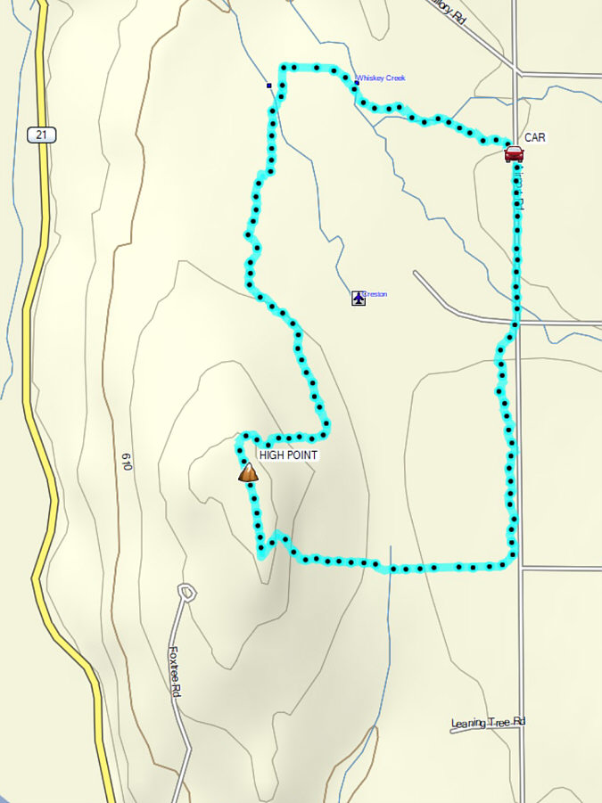
From the staging area, we headed westward on a well-defined trail and
soon popped out of the forest near the northern boundary of the airport.
We continued westward along the airport boundary fence until it turned
southward. We also turned southward, but instead of following the
fence line, we re-entered forest aiming for the high point of Fox Tree
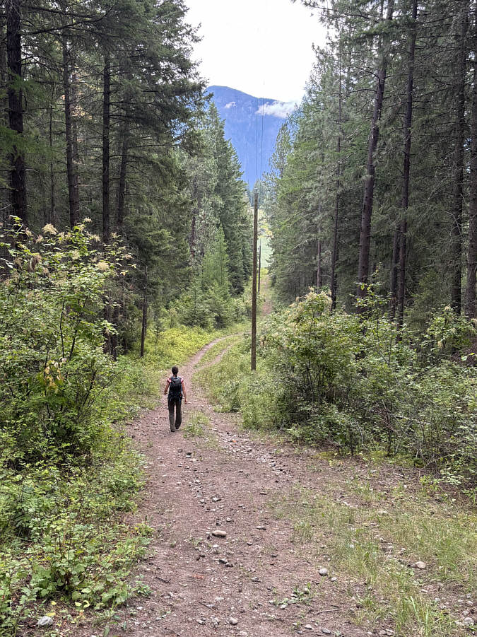
Hill. Despite running across occasional makeshift signs, we had
some trouble trying to reconcile the trails we hiked through with the
ones marked on the CVHA map, and numerous side trails made route-finding
even more confusing. As a result, we probably did not take the most
efficient ascent route and even had to bushwhack a little to get where we
needed to go. Fortunately, this was not Mount Everest we were
climbing, and we eventually found our way to the high point situated near
a telephone pole in a small clearing.
Rather than return the way we came, Zosia
and I opted to traverse southward and make the hike into a loop. We
had a much easier time figuring out the trail layout on the south side of
Fox Tree Hill and soon descended to the boundary fence at the south end
of the airport. Heading eastward, we hiked along the fence line
nearly to Airport Road before turning northward to follow the trail
through a narrow patch of forest tucked between the road and the
airport's eastern boundary fence. When we passed by the airport
entrance, we could not figure out where the trail continued, but at this
point, we were content to simply walk on the pavement of Airport Road for
half a kilometre back to our parked car.
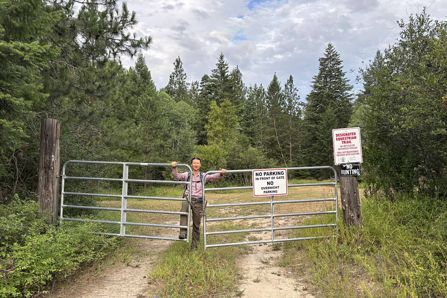 |
A locked gate prevents motorized
vehicles from parking in the trailhead's staging area on this day. |
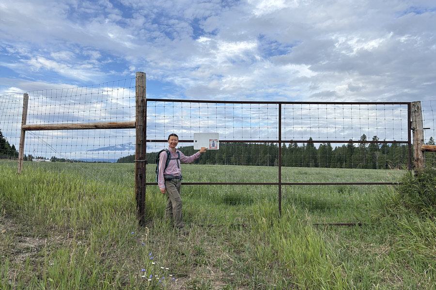 |
Zosia passes another locked gate at
the north end of Creston Valley Regional Airport. "Fox Tree
Hill" is visible behind the gate. |
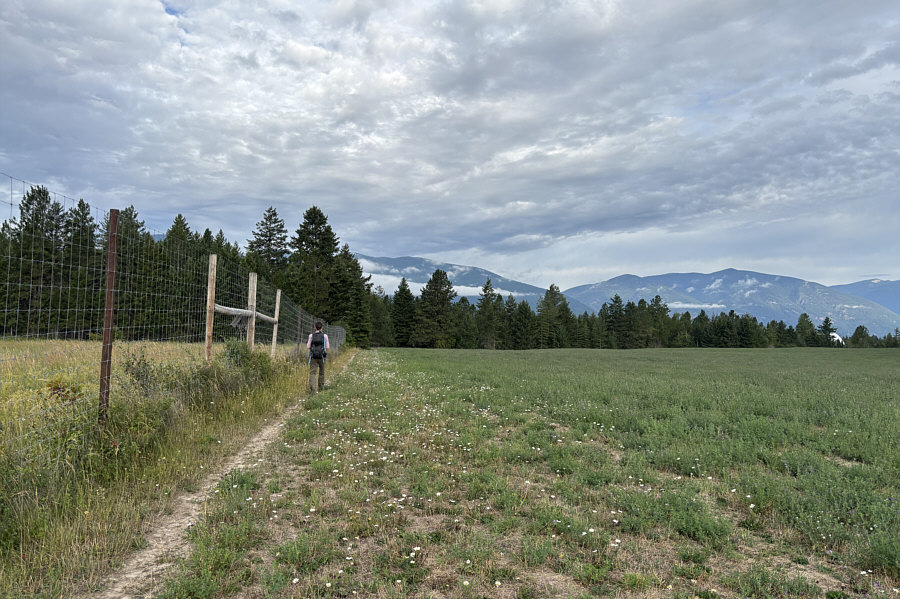 |
Zosia hikes along the northern
boundary of the airport. |
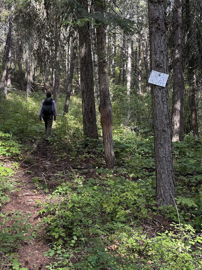 |
Despite the presence of makeshift
signs, the trails on Fox Tree Hill
can be confusing to follow at times. |
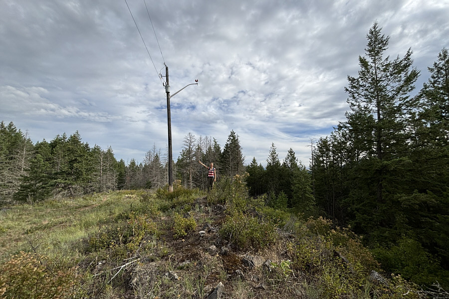 |
Zosia stands on the high point of Fox
Tree Hill (718 metres). |
 |
Zosia descends a steep trail called
"Pepsi Challenge" near the south end of Fox Tree Hill. |
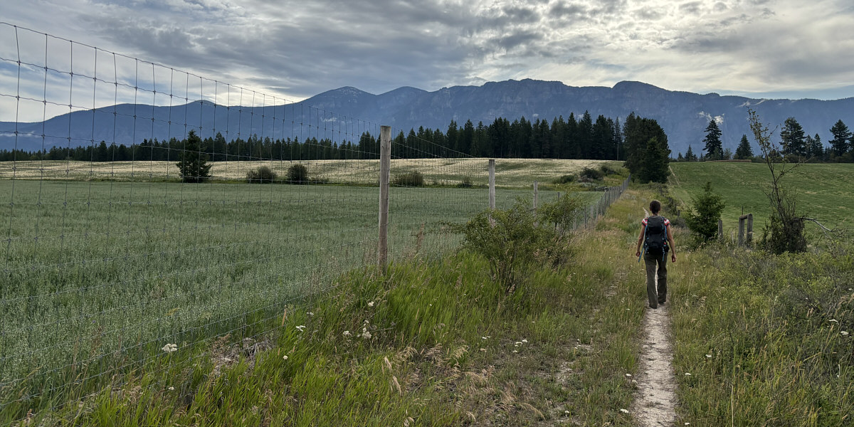
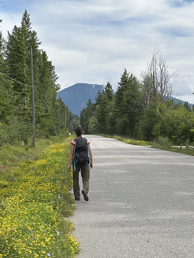
Zosia follows a fence along the southern boundary of the
airport with the
Mount Thompson massif in the background.