After canceling an initial attempt in late August 2015 due to smoke from nearby forest fires, I sent out another invitation in mid-September, and Doug Lutz from Red Deer, Alberta agreed to join me for this ambitious trip. My rationale for choosing to climb on 26 September 2015 was that it was National Public Lands Day in the US which meant free entry to all National Parks. After getting confirmation a few days earlier from park staff that climbing conditions were ideal, I arranged with Doug to meet me at my place in Calgary the evening before the climb. From a previous trip, Doug knew about a spot just outside the park where we could camp for free, and we agreed to head into Montana that night in order to save ourselves a lengthy drive in the morning. After getting across the border and driving through the town of Babb, we found Doug's campsite as promised just off the highway near the turnoff to Duck Lake. We did our best to clear the ground of broken glass before pitching our tent and settling into our sleeping bags for the night. In retrospect, the campsite was perhaps not the most restful place to sleep. A highway pullout just above the campsite was a popular spot for travelers to stop and likely relieve themselves (Why do they have to be so obnoxiously loud when doing so?), and a nearby farmer's field held hundreds of cattle which were constantly mooing throughout the night as if lamenting their sorrowful lives. Even some coyotes started howling at one point like they were also relieving themselves! In any case, not having to get up in the middle of the night to drive for three hours more than compensated for the imperfect sleep, and we felt restful enough in the morning to tackle two mountains. We quickly packed up our tent and stopped briefly in St. Mary before heading to Logan Pass.
Arriving at Logan Pass, we geared up and hiked the easy tourist trail to Hidden Lake Overlook. We paused a few times on the way to study our intended route on Clements Mountain. From the Overlook, the south ridge of Clements Mountain looks rather intimidating, and we had to search a bit to find the best place to go up. Once we got up into the rocks though, I found the scrambling to be very enjoyable. We were able to follow some cairns up to an obvious feature known as the "finger", and from there we traversed northward along ledges out onto the east face. This is where the route-finding got tricky as I had a difficult time reconciling Edwards' descriptions with what I was seeing on the east face. The foreshortened view definitely did not help matters, and cairns were nowhere to be found. At one point, Doug led us up an increasingly steep rock band, and in hindsight, this was probably the correct route. However, I turned us around thinking that we had not yet traversed far enough. Continuing along the ledges and constantly looking for obvious routes going up, I eventually realized we were off-route when I turned a corner to see the whole north face of the mountain--we had traversed across the entire east face!
At this point, we backtracked a little 
       and climbed up various rock bands using the route of least resistance.  Doug finally 
       found a goat track on a higher ledge, and we 
       followed this southward until we reached the bottom of an obvious couloir 
       which looked feasible to ascend.  Although we did not know it at the 
       time, we had stumbled onto the east face couloir which is another Class 
       3/4 route described by Edwards.  The hardest part about this route 
       is right at the bottom of the couloir.  Both Doug and I had some 
       difficulty surmounting the Class 4 wall here.  Doug wished out loud 
       that he was a little taller while I stated matter-of-factly that I would 
       not be able to descend what I climbed up.  Once we got into the 
       couloir, we were committed to going all the way to the top, and there 
       would be no turning back.  As it turned out, the climbing became 
       easier once we cleared the Class 4 wall, and despite being pelted a 
       little by graupel on our way up the couloir, we encountered no further 
       difficulties in reaching the summit of Clements Mountain. 
           Photo courtesy of Doug Lutz 
           Photo courtesy of Doug Lutz On our return trip, 
       I managed to down-climb the crux while Doug, with a flair for the 
       dramatic, actually jumped down!  Our descent of Mount Cannon's 
       southeast ridge was briefly interrupted when we encountered a couple of 
       goats heading in the opposite direction.  The goats eventually grew 
       tired of a couple of men staring at them and moved on up the slope.  
       Doug and I retraced our steps past the aforementioned low point before 
       continuing along the beaten path I had taken from Clements Mountain.  
       A good trail connects the beaten path with Hidden Lake trail further 
       below, but somehow, I had missed seeing this junction both times I passed 
       it!  Luckily Doug knew where he was going, and I simply followed him 
       down the slope.  We eventually regained Hidden Lake trail and 
       completed our loop by climbing back up to the Overlook.  From there, 
       I enjoyed a pleasant walk back to the parking lot.  Doug, for some 
       reason, actually jogged back ahead of me.  Perhaps he wanted to 
       avoid engaging in small talk with some of the other tourists on the 
       trail!  Regardless, Doug and I had plenty to chat about as we made 
       the long drive back to Calgary that evening, and Doug still had to drive 
       home to Red Deer after that. Climbing both Clements Mountain and Mount Cannon turned out to be an 
       extraordinary adventure, and I am thankful to have shared it with a 
       dedicated mountain nut like Doug. Be sure to check out Doug's 
       photos as well as his slick 
       video of this 
       trip. 
           Photo courtesy of Doug Lutz 
           Photo courtesy of Doug Lutz 
          Mount Cannon appears impregnable from the low point 
         of the connecting ridge. Photo courtesy of Doug Lutz   
           Photo courtesy of Doug Lutz 
           Photo courtesy of Doug Lutz
       
         
After a brief but well-deserved break on the summit of Clements 
       Mountain, Doug and I turned our attention to Mount Cannon to the west.  
       Compared to the route-finding complexities of the east face, descending 
       the west ridge of Clements Mountain was a piece of cake.  One of the 
       highlights of the day was traversing an exposed goat track on the north 
       side of the ridge.  We eventually switched over to the south side of 
       the ridge, and I briefly lost Doug here as he continued to stay high near 
       the crest while I descended a beaten path leading to the low point of the 
       connecting ridge to Mount Cannon.  Doug soon rejoined me at the low 
       point, and together, we started climbing up Mount Cannon.  Unlike 
       the east face of Clements Mountain, the route up the southeast ridge of 
       Mount Cannon is well-marked with cairns, and we had no real issues until 
       we reached the summit ridge.  After crossing a gap in the ridge, we 
       climbed up a short but awkward crack to gain a staircase-like feature in 
       the rock.  This would turn out to be the crux of the route.  
       From there, we had no further problems reaching Mount Cannon's summit 
       where Doug and I took another well-deserved break.


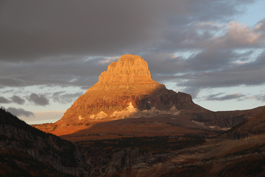
Early morning sunshine lights up 
           Clements Mountain. 


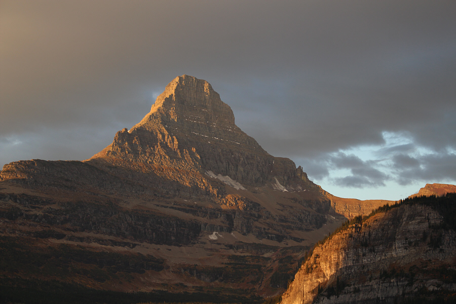
           Reynolds Mountain is also illuminated 
           nicely by the morning  sun. 


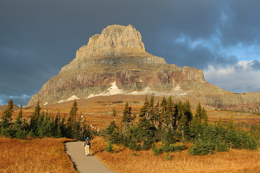
Doug starts up the paved path toward 
           Clements Mountain. 


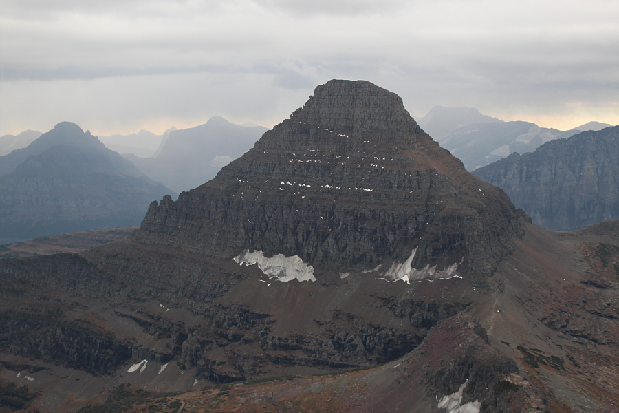
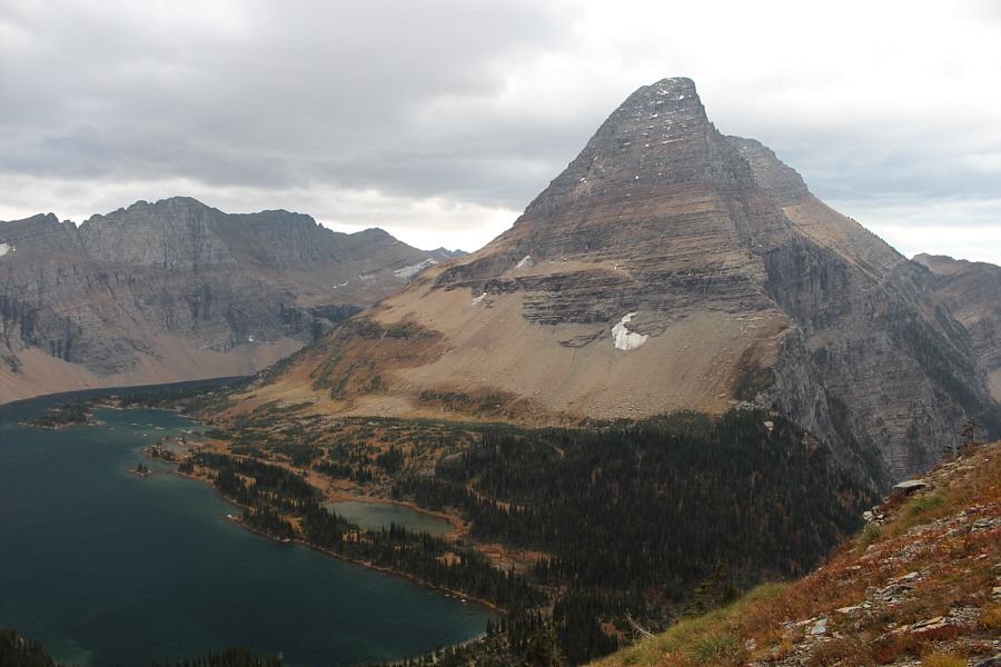
Here is the standard tourists' view of 
           Bearhat Mountain from Hidden Lake Overlook. 


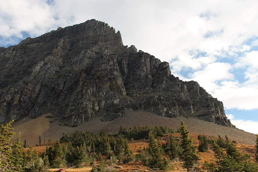
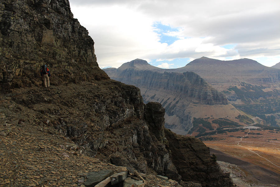
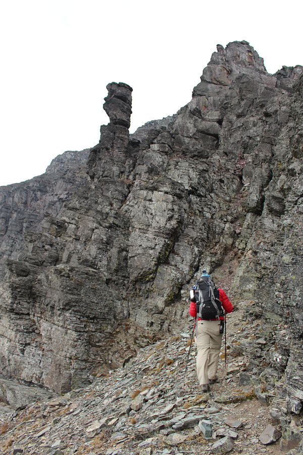
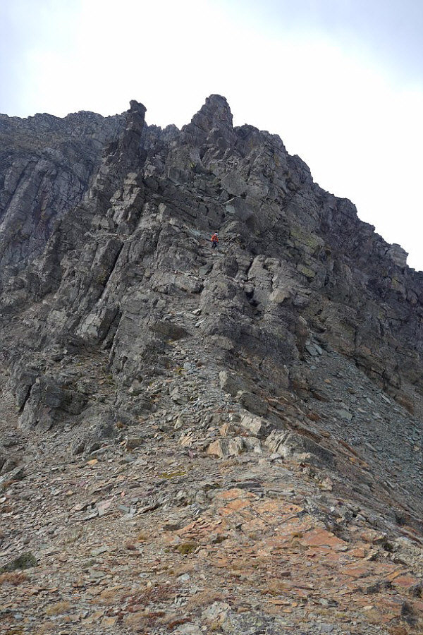
The south ridge of Clements 
           Mountain is an intimidating sight from Hidden Lake Overlook. 


Doug tackles the ridge with fervor. 


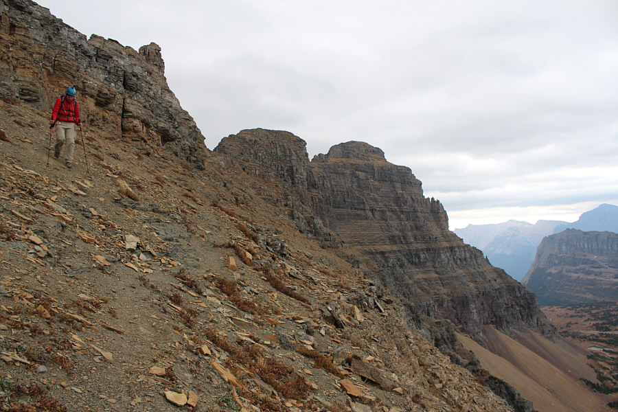
Doug starts up the gully ahead of him. 


Doug begins the traverse across the 
           east face of Clements Mountain.  Pollock Mountain and Piegan 
           Mountain are visible across Logan Pass. 


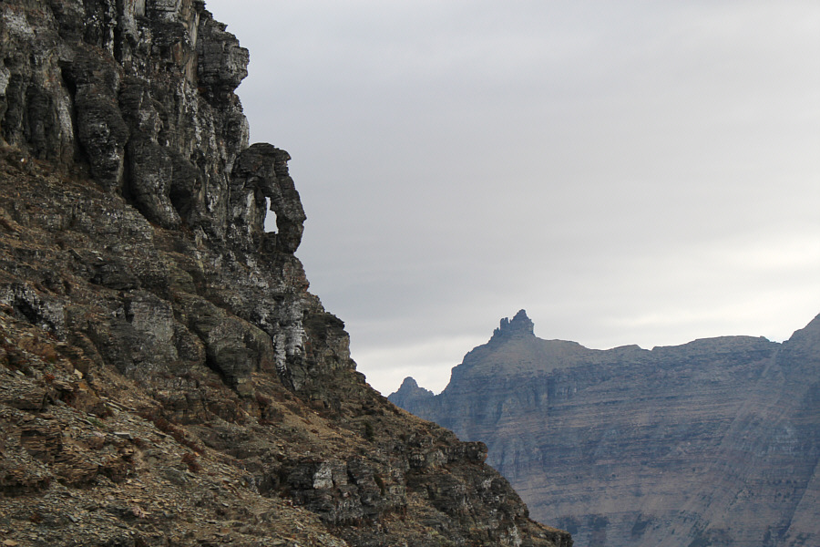
This "keyhole" is a distinctive 
           landmark on the east face.  Bishops Cap is visible in the 
           distance. 


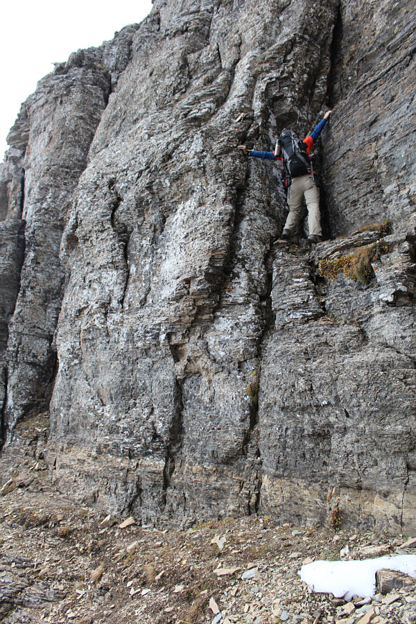
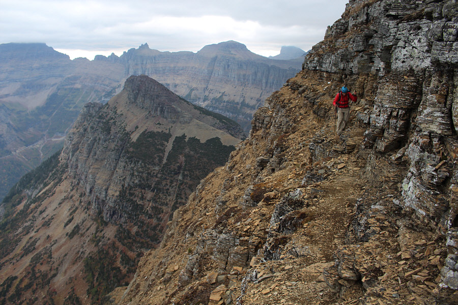
Doug climbs up typical Class 3 terrain 
           on the east face. 


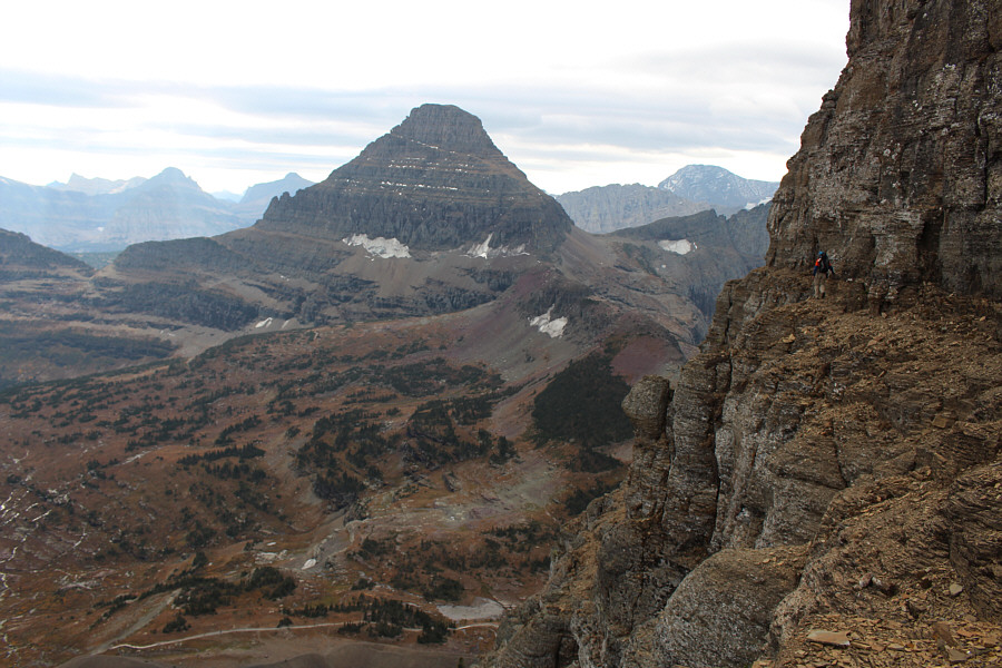
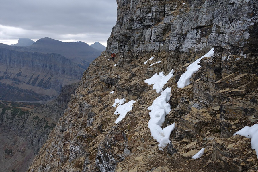
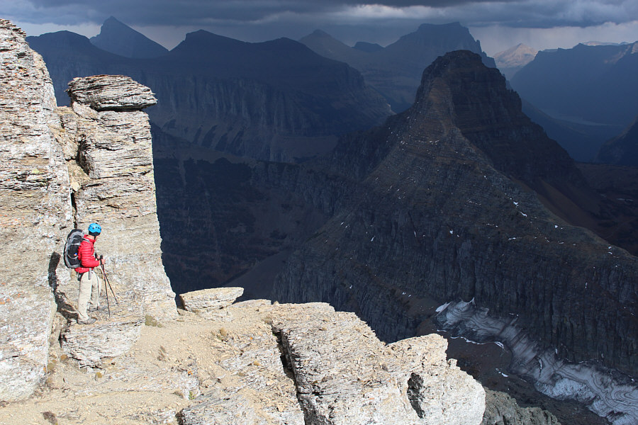
Doug traverses an exposed ledge high 
           on the east face with Reynolds Mountain in the distance. 


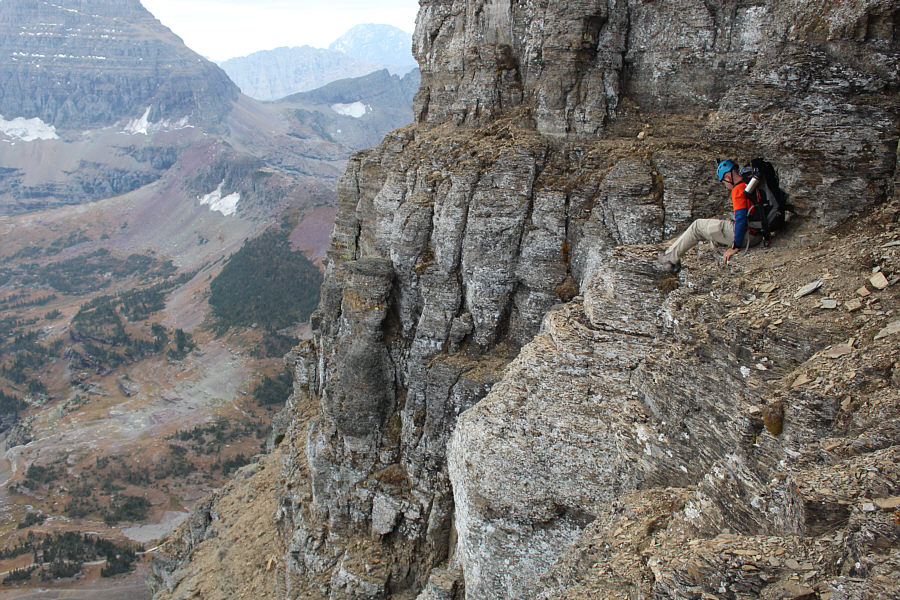
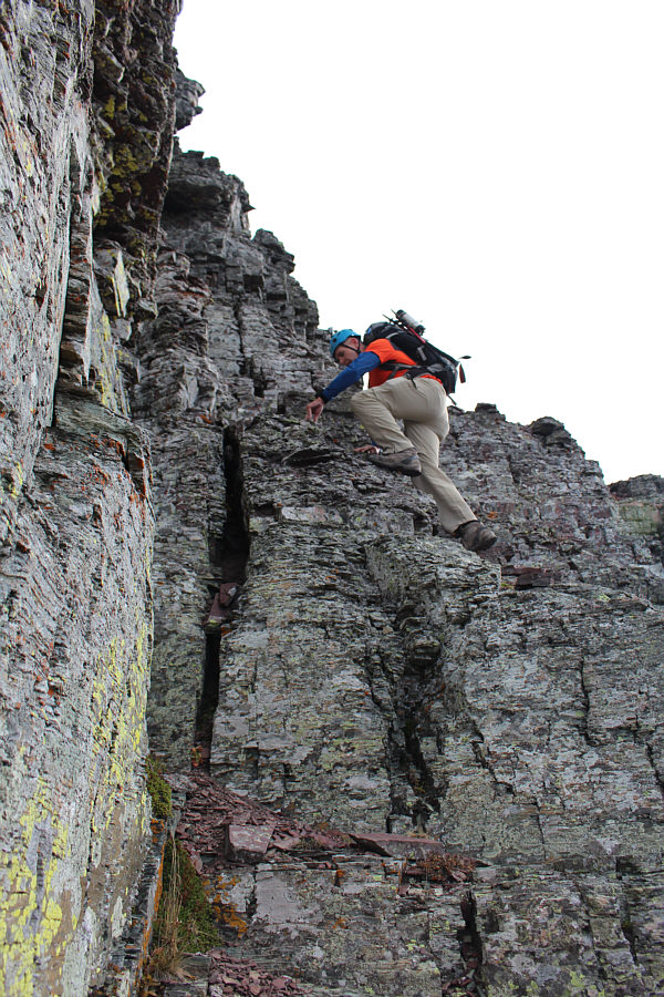
An overhanging rock forces Doug to 
           scoot across a very exposed ledge on his butt. 


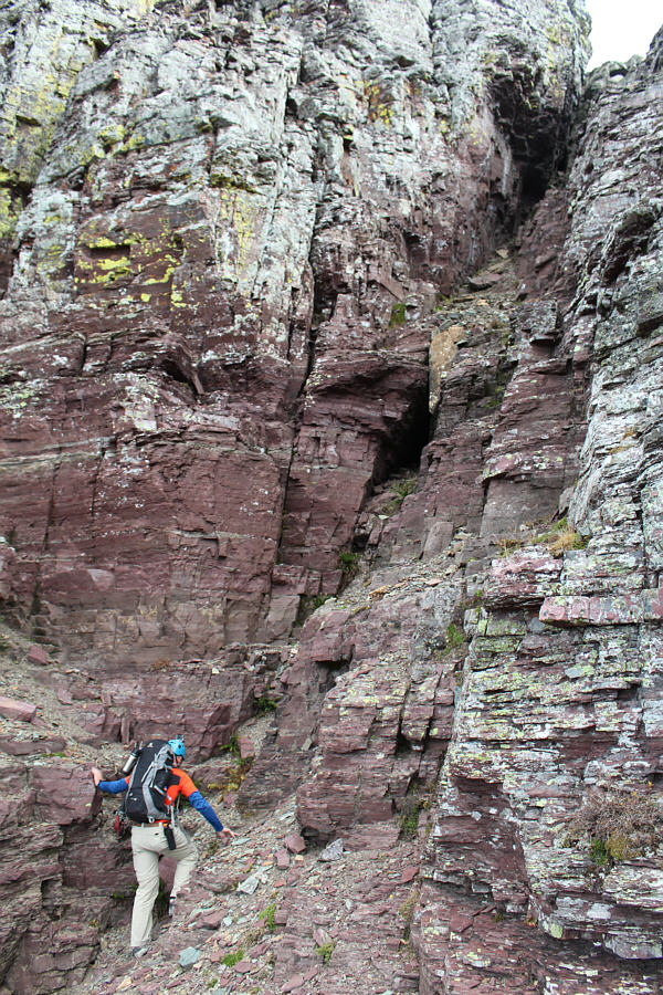
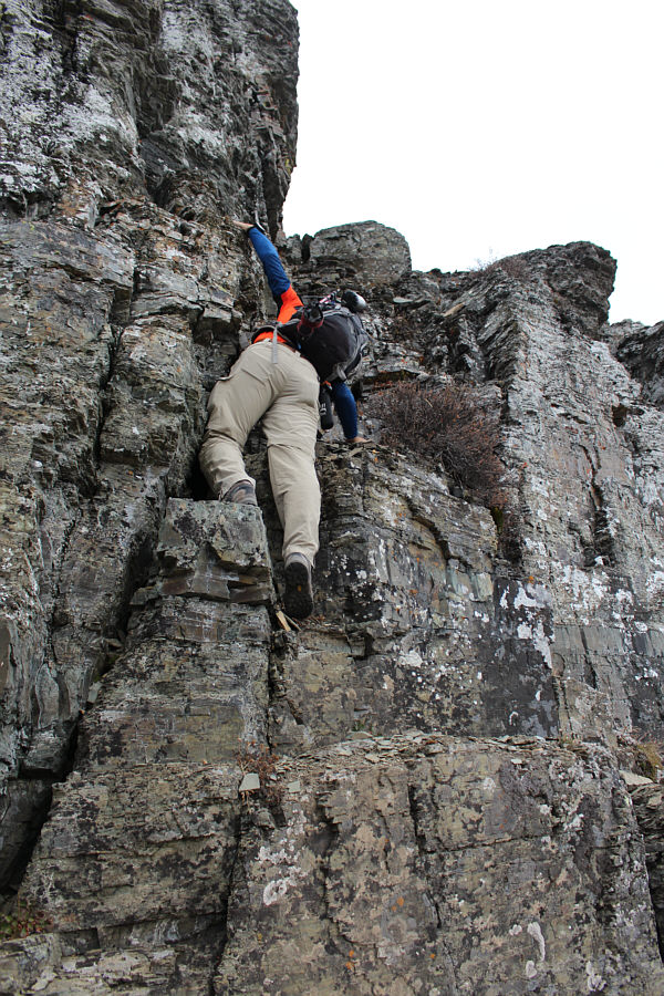
Doug tries to find some solid 
           handholds on Class 4 terrain near the start of the east face couloir. 


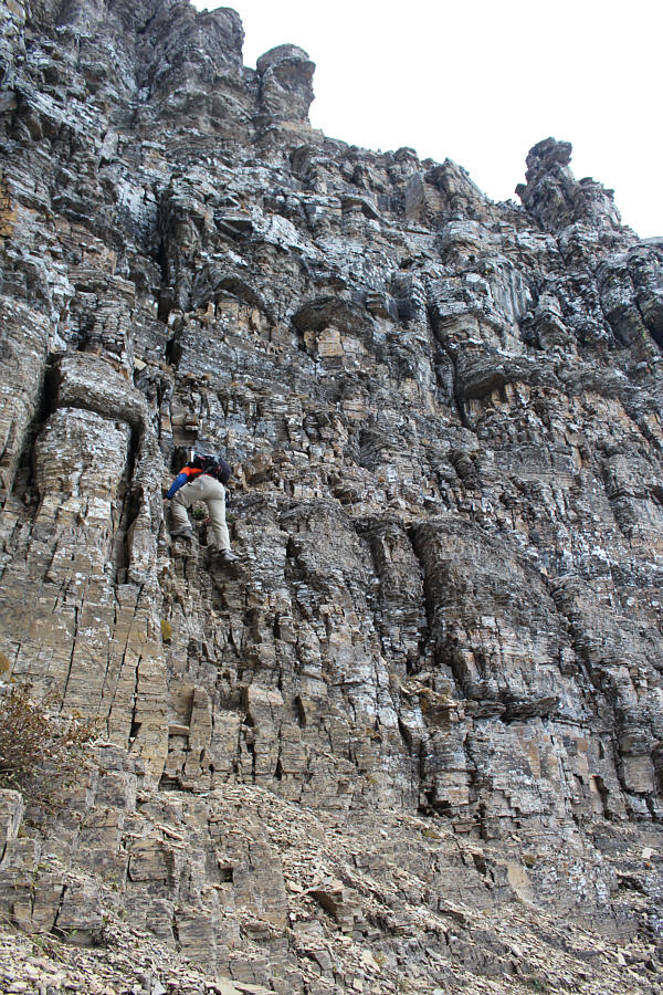
Doug tackles some Class 3 rock in the 
           east face couloir. 


Sonny slowly follows Doug up the east 
           face couloir. 


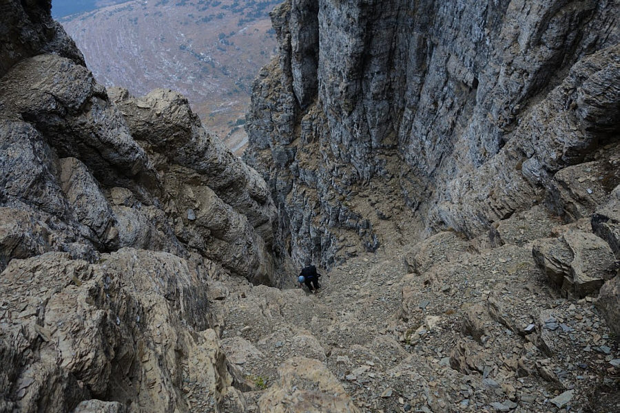
Here is another view looking down the 
           east face couloir from higher up.  Heavy Runner Mountain is 
           framed by the walls of the couloir. 


The east face couloir begins to curve 
           to the right as Doug climbs higher. 


Doug reaches the summit of Clements 
           Mountain. 


Sonny takes the last few steps before 
           the summit.  Directly behind him are Mount Oberlin and Mount 
           Gould. 


Doug and Sonny stand on the summit of 
           Clements Mountain (2668 metres). 


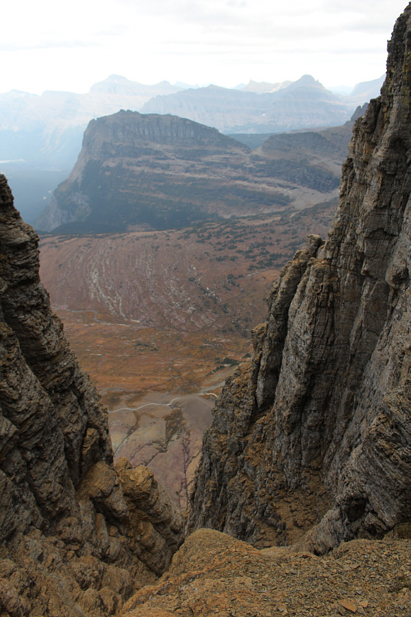
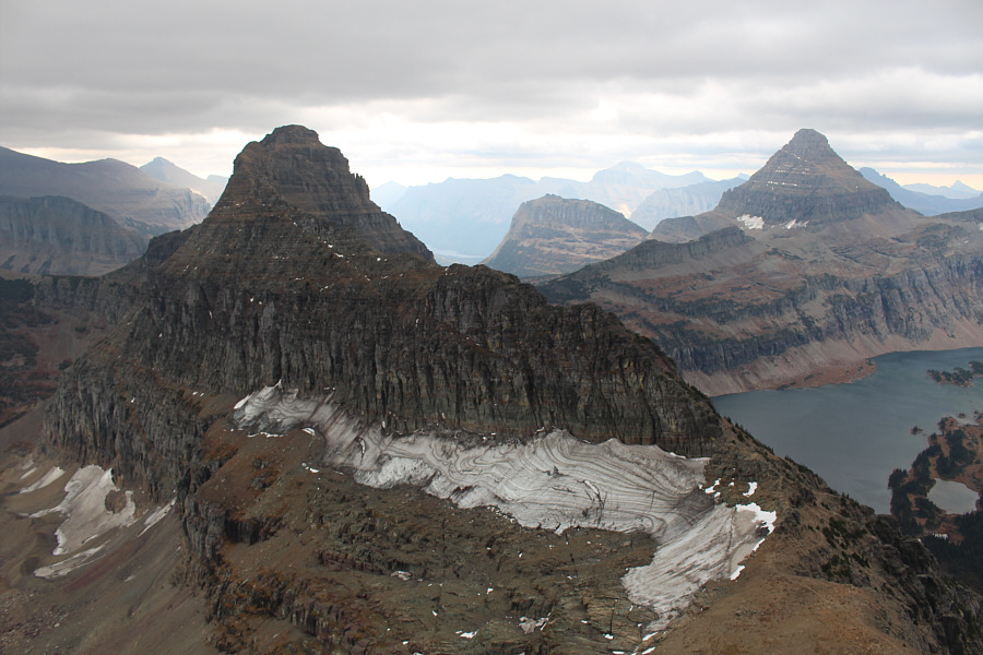
Bearhat Mountain and Hidden Lake 
           attract the most attention to the southwest. 


The connecting ridge to Mount Cannon 
           looks complicated.  Part of Hidden Lake trail is visible at 
           lower left. 


To the south is Reynolds Mountain. 


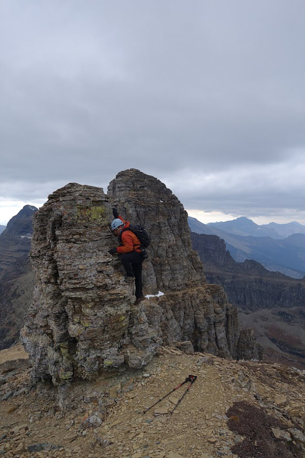
At Doug's request, Sonny climbs up a 
           small pinnacle along the west ridge of Clements Mountain. 


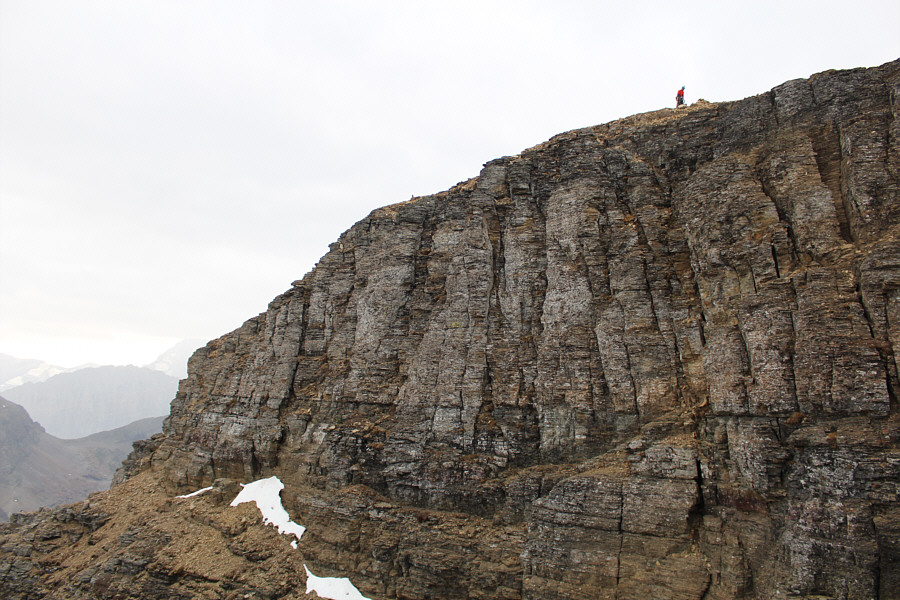
Doug (snow patch) walks along a goat 
           track on the north side of this much larger pinnacle. 


Doug pauses to wait for Sonny to join 
           him on the ledge. 


Sonny continues traversing the north 
           side of Clements Mountain's west ridge. 


Mount Oberlin is visible at left as 
           Doug finishes up the traverse on the north side. 


Doug switches over to the south side 
           of the west ridge.  To the right is Clements Mountain. 
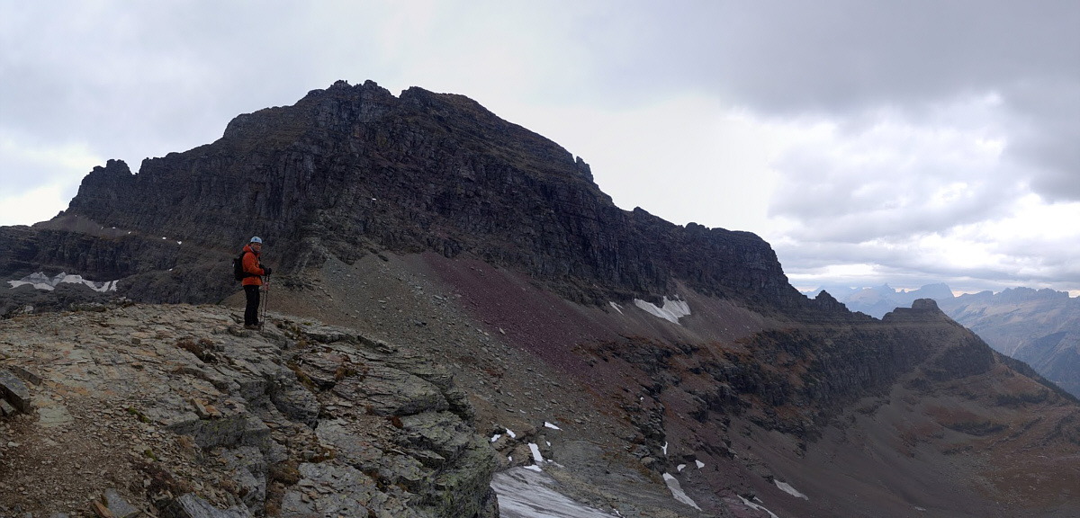
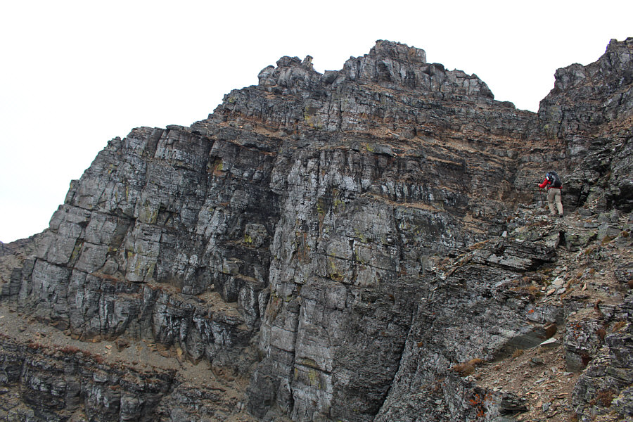


Doug follows a beaten path up Mount 
           Cannon. 


Here is a more comprehensive view of 
           Clements Mountain and its west ridge. 


Doug approaches the summit ridge of 
           Mount Cannon. 


Doug checks out the gap that separates 
           him from the summit ridge. 


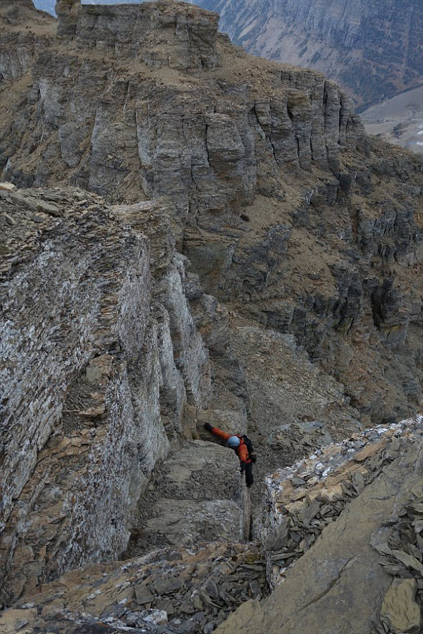
After crossing the gap, Sonny climbs 
           up the crux to gain Mount Cannon's summit ridge. 


Doug and Sonny are elated to tag the 
           summit of Mount Cannon (2721 metres).  Clements Mountain is 
           visible in the distance. 


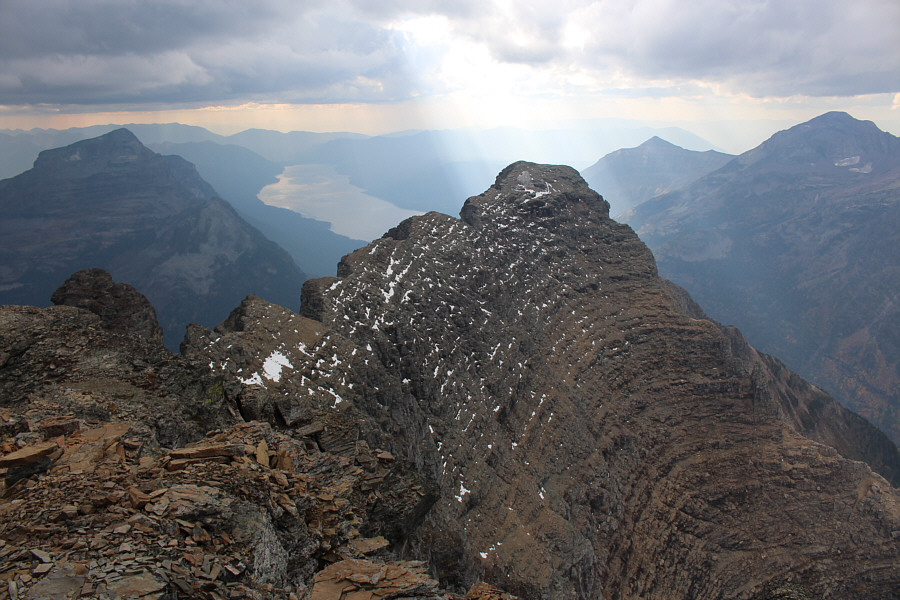
Sunbeams appear to shine on the 
           marginally lower southwest peak of Mount Cannon. 


Behind Clements Mountain is
           
           Going-to-the-Sun Mountain.  Bathed in sunshine on the 
           distant horizon at centre is
           Divide Mountain. 


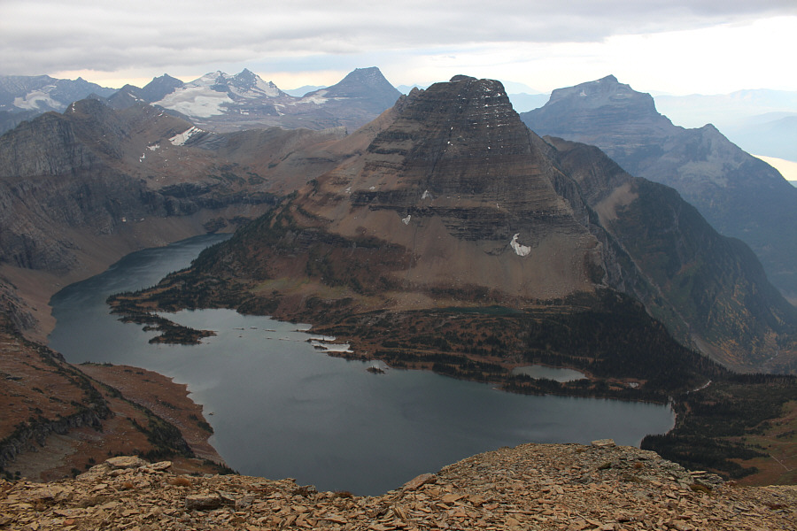
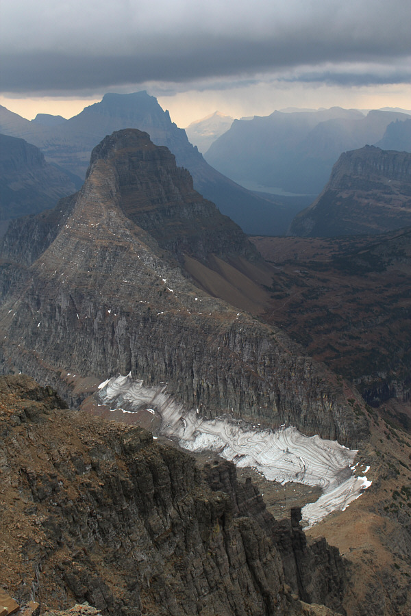
To the south, Hidden Lake is 
           surrounded by Reynolds Mountain, Dragon's Tail, and Bearhat Mountain. 


The sun comes out as Doug works his 
           way back along Mount Cannon's summit ridge. 


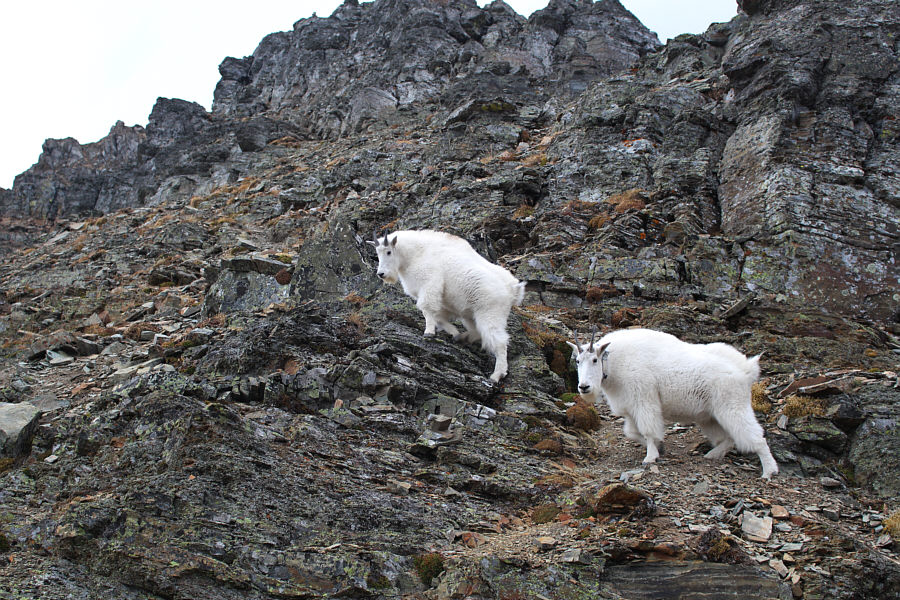
 A couple of goats keep their 
           eyes on Doug and Sonny. 


Sonny carefully descends the southeast 
           ridge of Mount Cannon. 


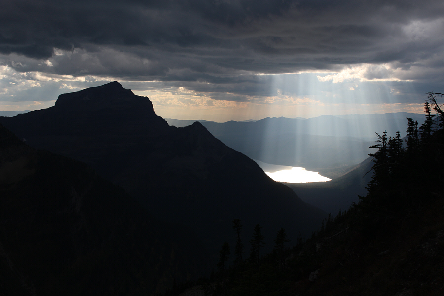
Sunbeams light up the north end of 
           Lake McDonald.  At left is Mount Brown. 


Here is one last look at Bearhat 
           Mountain. 


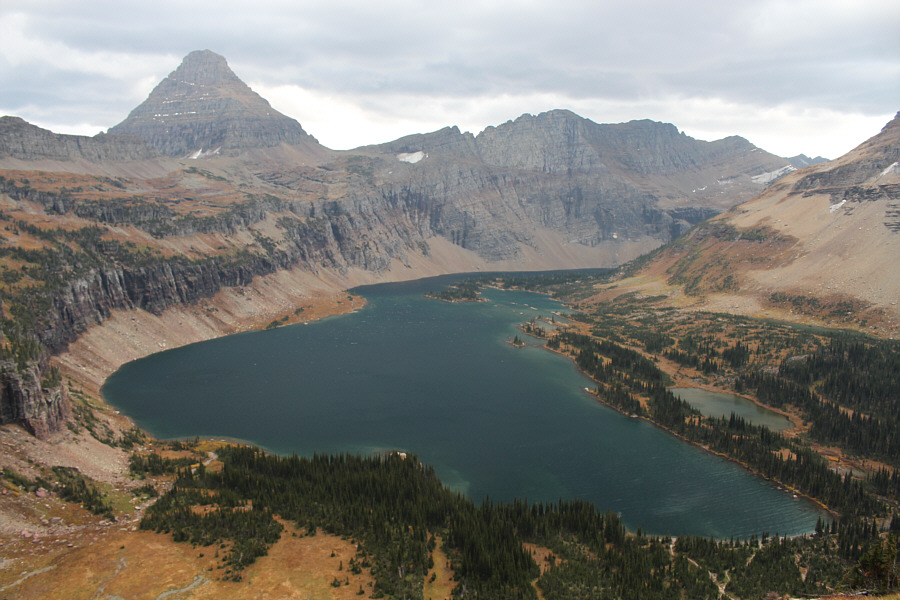
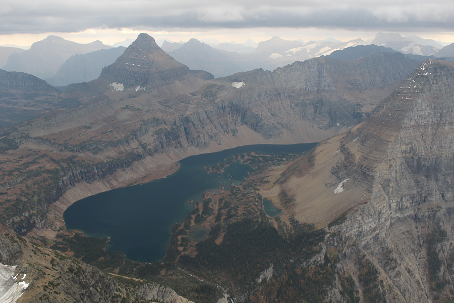
Reynolds Mountain and Hidden Lake 
           deserve one final look as well. 
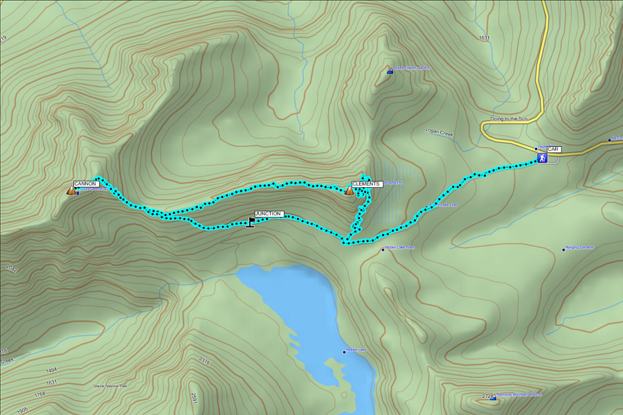


Total 
           Distance:   15.2 kilometres 
         
           Round-Trip Time:  9 hours 45 minutes
           Total Elevation Gain:     ~985 metres