BOU AVENUE
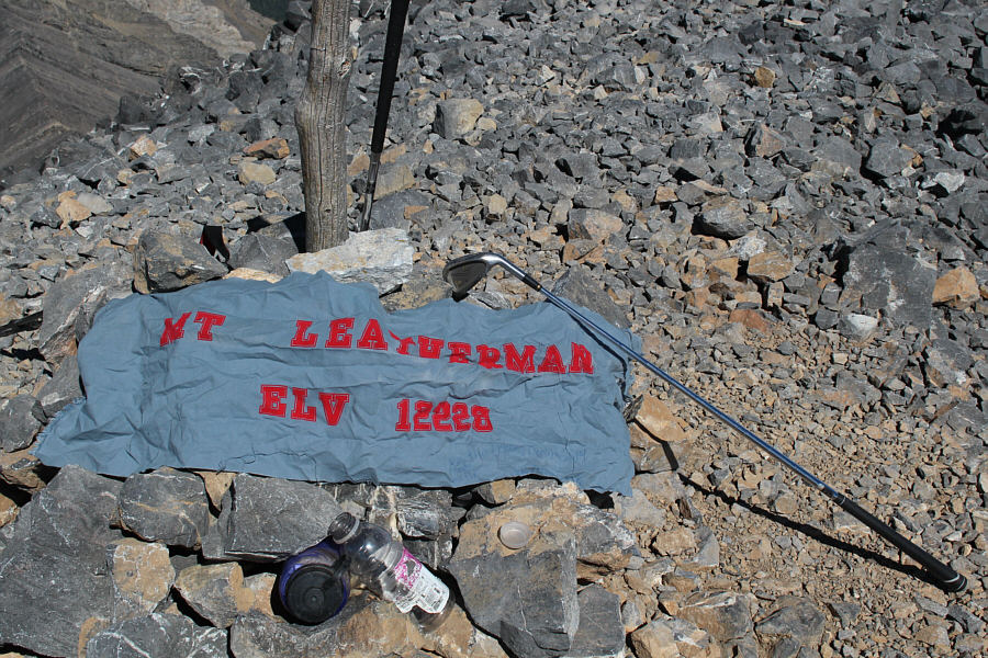
Leatherman Peak
Unsure about where to go after climbing
Grays
Peak, I stopped briefly in Ketchum, Idaho to gas up and re-stock on food.
There is a fantastic grocery store here called
Atkinsons. It's pricey, but
the food selection is amazing. I was tempted to check into a hotel
in Ketchum but thought better of it after perusing the inflated room prices on
the Internet. Instead, I drove northeast along Trail Creek Road and
eventually found a deserted Bureau of Land Management campground (Garden
Creek; pit toilet, fire rings, picnic tables, no fees) where I spent the
night. Being so close to the Lost River Range, I figured that it
would be remiss of me to not bag a 12,000-foot summit while I was in the
area. Having already climbed
Borah Peak in 2009,
I set my sights on the second highest mountain in Idaho--Leatherman Peak.
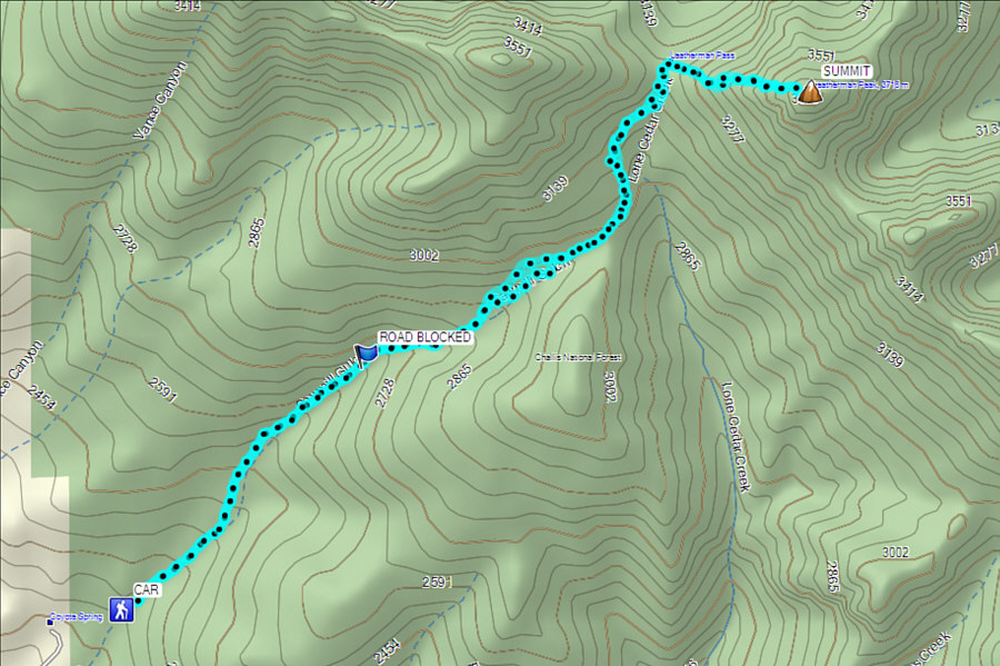
On the morning of 31 August 2015, I left the
campground and drove east before turning south onto US Highway 93.
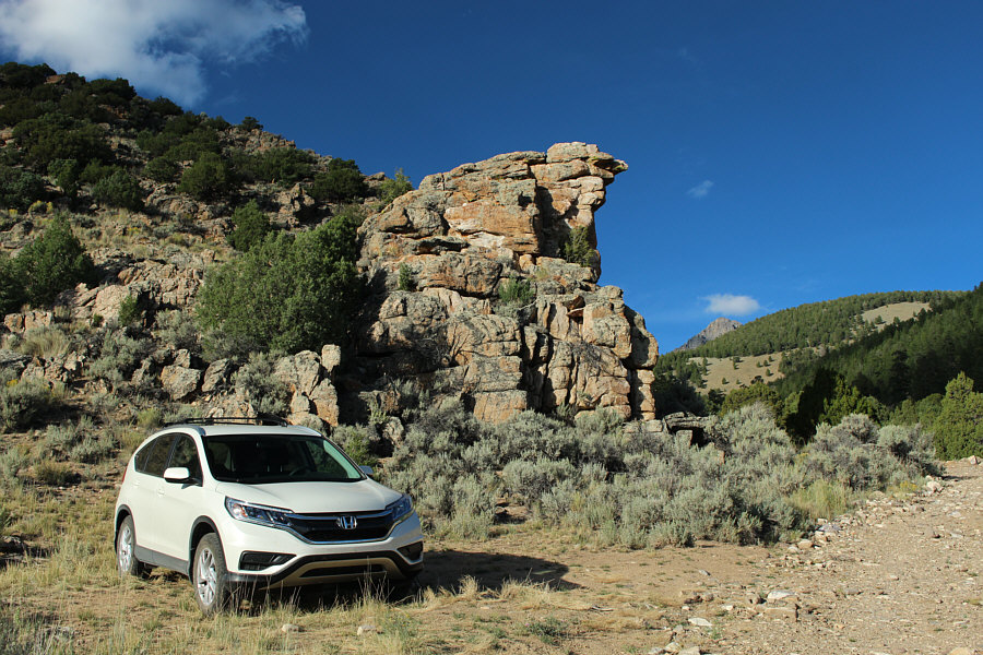
It was not long before I found the turnoff to Sawmill Gulch Road
(FS-411). A bit rough in spots, this road climbs steadily from the
highway up into a forested valley leading to Sawmill Pass which is the
western approach for Leatherman Pass and its namesake peak.
Although I probably could have driven all the way to a log barrier well
within the valley, I decided to give my car a break and
parked about 2 kilometres short. Doing so also added about 400
metres of extra elevation gain albeit on a rocky road which is quite easy
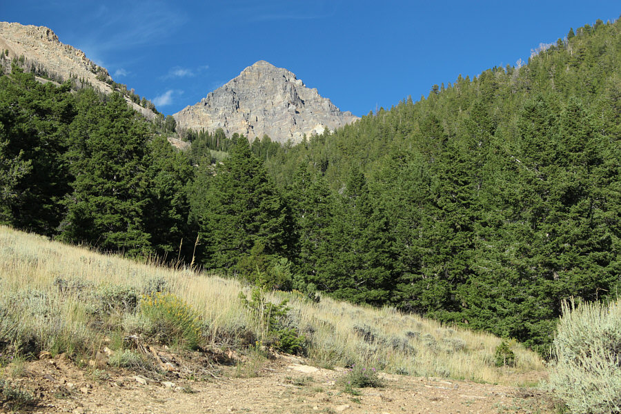
to hike. Shortly after passing the log barrier, I left the road to
hike up Sawmill Pass trail (FST-089) which is unsigned but fairly obvious
(cairn). At one point, I lost the trail in a small glade, but a
short bushwhack led me to an open creek bed which I followed briefly
before climbing over a talus-covered ridge into the semi-open environs of
Sawmill Pass. The trail is faint or sometimes non-existent here,
but the route is still obvious. Instead of dropping down
the east side of Sawmill Pass into Lone Cedar Creek, I stayed high by
heading north and found the trail strengthening again as it traverses the
southeast slopes of White Cap Peak. The trail forks beside a very
large boulder about 300 metres short of Leatherman Pass, but either
branch works. After taking a short break at Leatherman Pass, I
followed game trails up the loose scree at the base of Leatherman Peak's
west ridge. The scree eventually transitions to more rugged Class 3
terrain on the upper mountain which requires some route-finding and
perseverance. The looseness of the rock here was reminiscent of
that found in the Canadian Rockies--I felt like I was home! After
what felt like a lengthy ordeal of traversing ribs and ascending chutes,
I finally set foot on the spacious summit. I spent
about half an hour there before commencing my descent.
While it had taken me about 2 hours to climb the 500 metres from
Leatherman Pass to the summit, it only took an hour for me to retrace my steps back down as I took advantage of some of the loose rock
to do some scree surfing. From the pass, I enjoyed a pleasant and
worry-free hike back to my car. I also built a more
obvious cairn in the small glade where I lost the trail earlier. Upon
returning to my car, I pulled out a lawn chair and sat in the shade of my
car to enjoy a cold drink and a teriyaki chicken wrap that I had bought at Atkinsons'.
It was a wonderfully satisfying moment after a fantastic day of hiking
and scrambling. After finishing off the wrap, I packed up and drove
back out to the highway. I would eventually head north to the town
of Challis where I checked into a much more reasonably-priced hotel for
the night.
 |
A lot of elevation gain can be saved
by driving up the Sawmill Gulch road, but a vehicle with high
clearance and possibly 4x4 capability is recommended. |
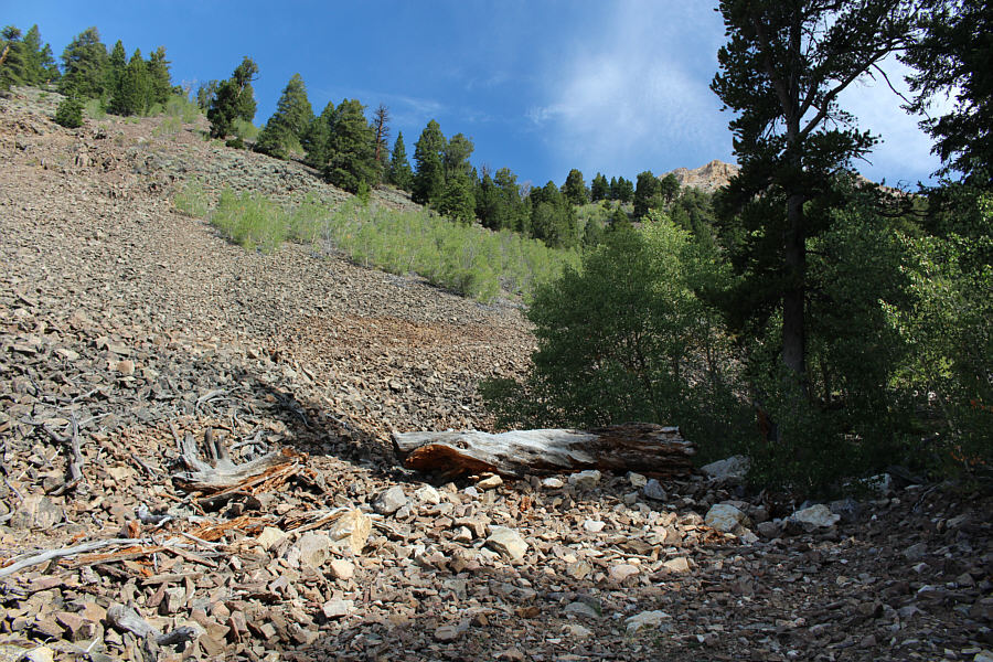 |
A giant log effectively blocks any
motorized traffic except for maybe dirt bikes beyond this point.
The Sawmill Pass trail (FST-089) starts about 125 metres further
along the road. |
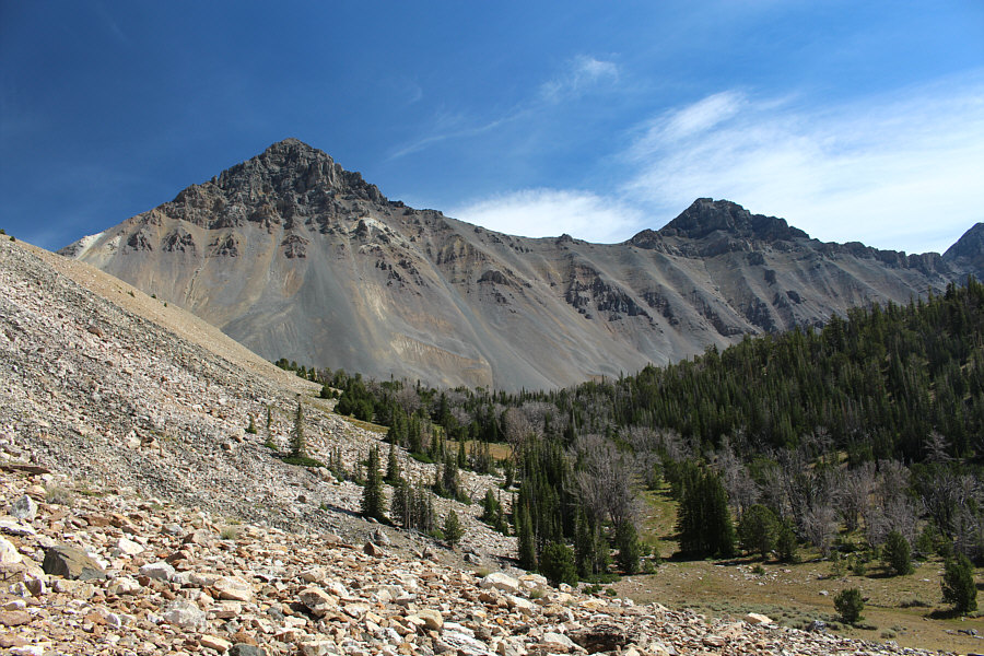 |
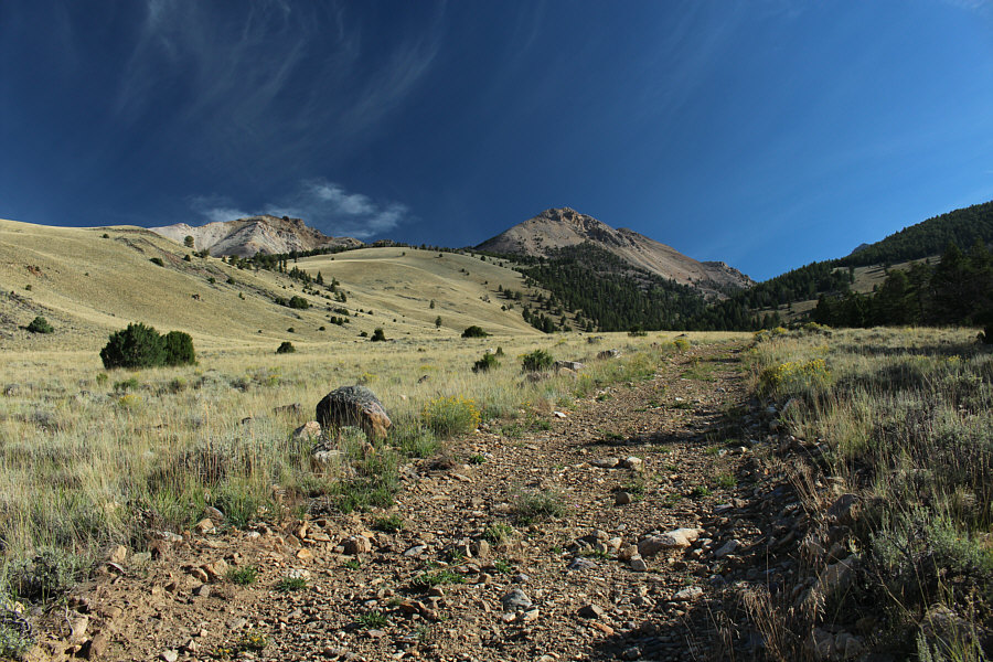
Leatherman Peak and Bad Rock Peak
dominate the view east of Sawmill Pass. |
 |
From Sawmill Pass, a good trail
traverses the slope at far left to reach Leatherman Pass. |
 |
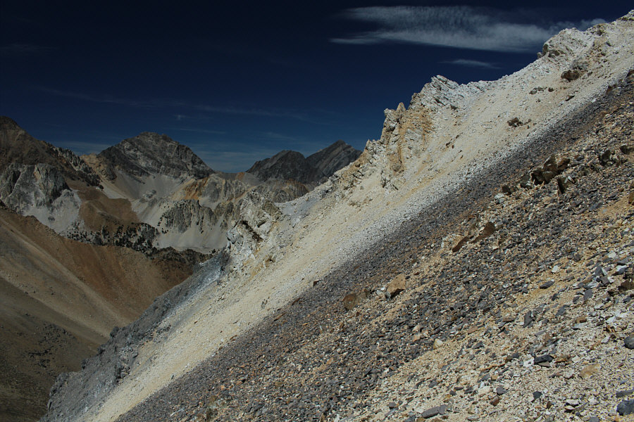
The West Fork Pashimeroi River valley
is an alternate approach to Leatherman Pass. Visible at left is
Borah Peak. |
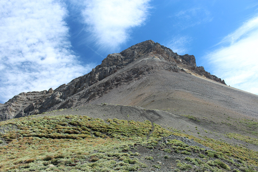 |
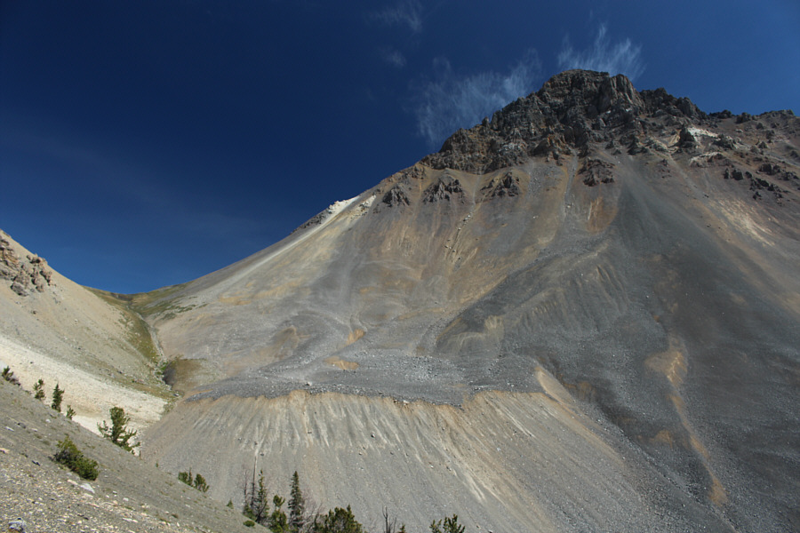
This is a foreshortened view of
Leatherman Peak's west ridge from Leatherman Pass. |
 |
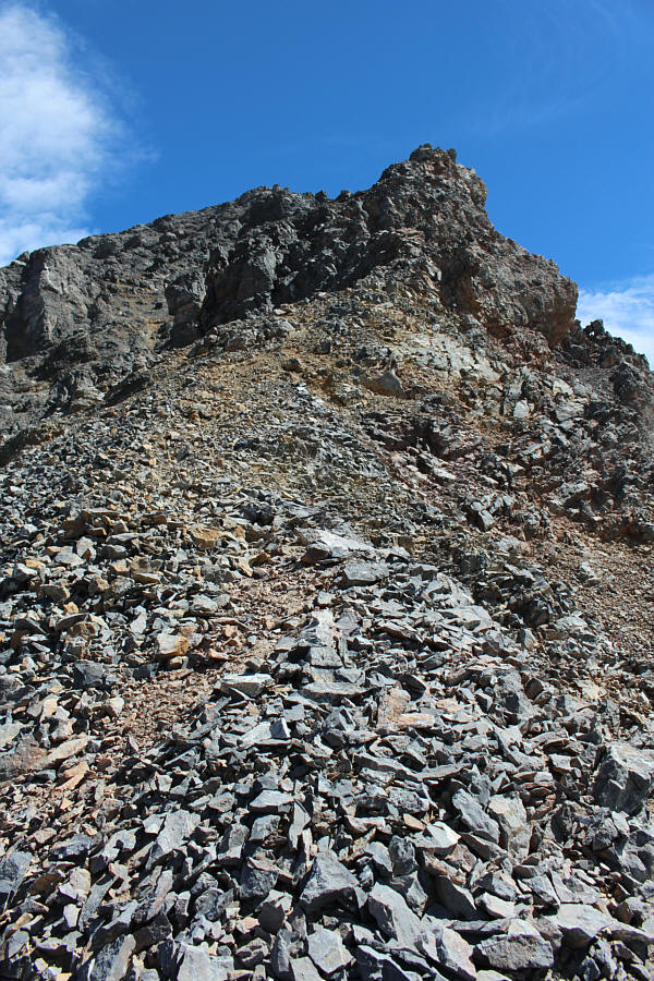
The initial climb from Leatherman Pass
is mostly up loose scree as shown. |
 |
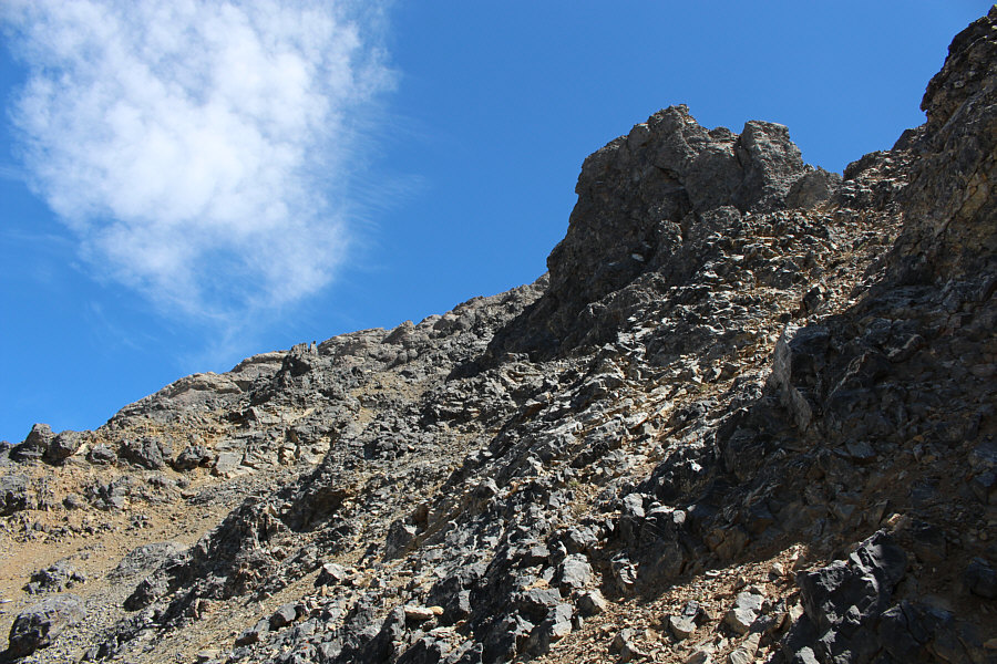
The terrain becomes more complex
higher up. |
 |
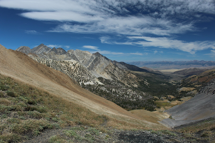
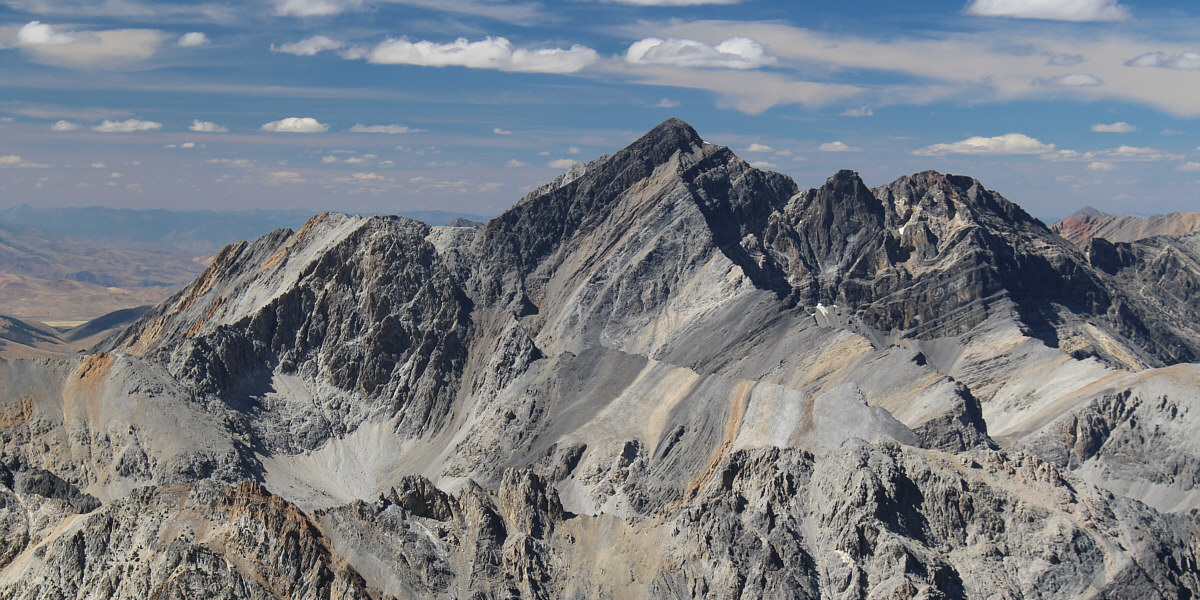
Pass Lake is situated below Peak 11967
at left. On the right is Mount Idaho, the seventh highest peak
in the state. |
 |
This is typical of the Class 3 terrain
on the upper mountain. |
 |
Embedded in this rock are some
crinoid fossils. |
 |
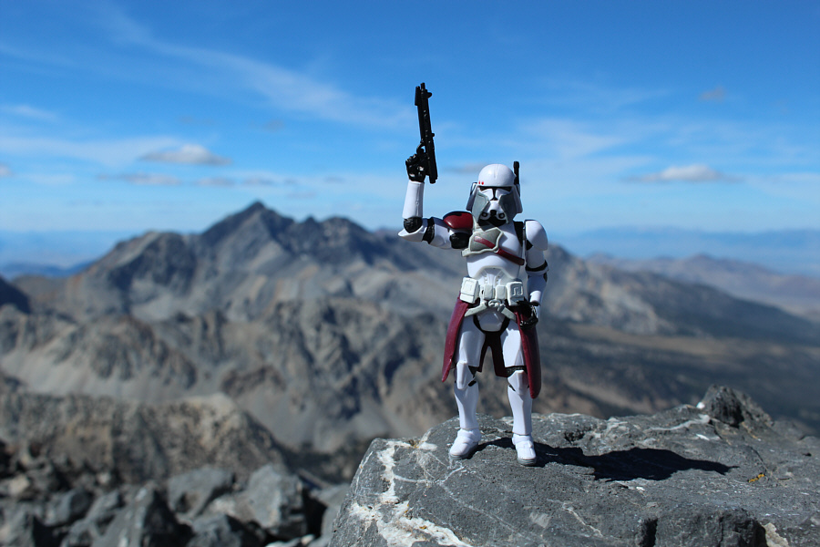
Sonny stands on the summit of
Leatherman Peak (3719 metres). |
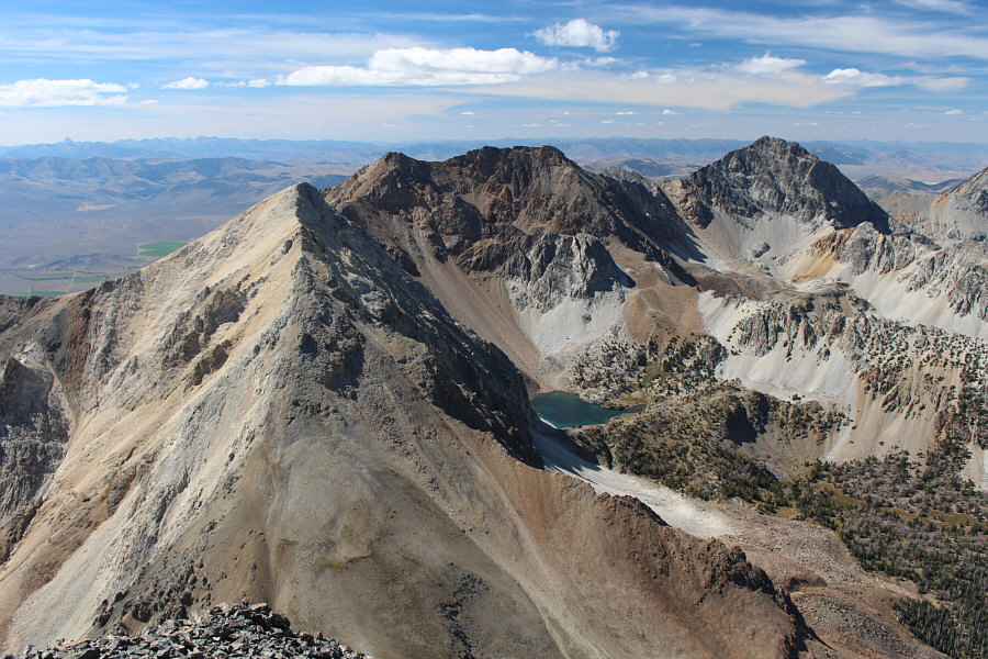 |
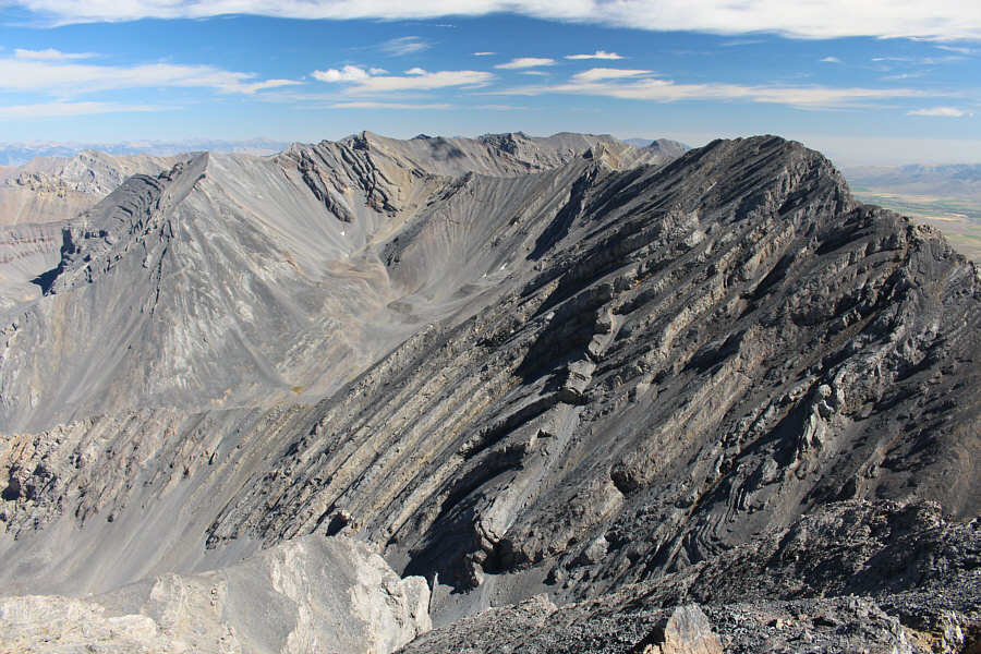
Here is a more comprehensive view of
Pass Lake, Peak 11967 (centre), and Mount Idaho (right). At
left is White Cap Peak. |
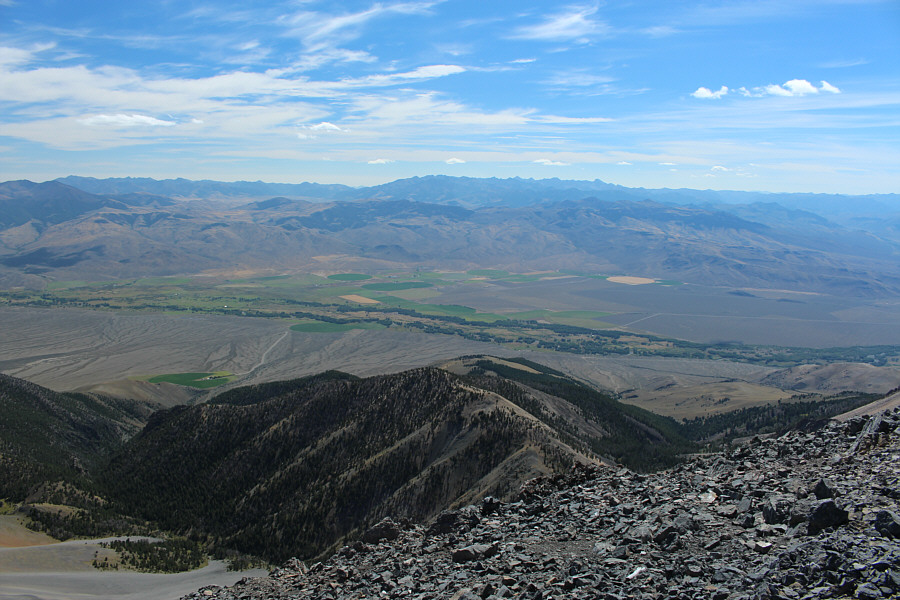
Borah Peak attracts all the attention to the northwest.