BOU AVENUE
Sweet Grass Hills:  Devils Chimney And Mount Royal

When I climbed Mount Brown in the East Butte complex of Montana's Sweet Grass Hills the previous year, I regrettably did not have time to visit slightly lower Mount Royal to the south.  This turned out to be a blessing in disguise as it gave me an excuse to return to the area, and thanks to an online trip report (link no longer available) I had only recently discovered, I found a much more interesting route to ascend Mount Royal from the east.  Using the trip report and Google Maps, I cobbled together driving directions to the trailhead.  It is worth mentioning that this route entails crossing a small section of private land near the beginning, and although the land owner is, as of this writing, amenable to allowing access to non-motorized recreational users, he requests that all visitors sign a guestbook prior to entering the area (see trailhead directions for more details).

Leaving Calgary early on the morning of 13 May 2017, Zosia Zgolak and I drove south to the Alberta-Montana border crossing at Coutts.  Traffic was light, and we experienced no significant delays in getting across the border. My trailhead directions turned out to be pretty accurate, and all the roads in and around the East Butte complex were in generally good shape.  Just before turning onto the final dirt track leading to the trailhead, we had to stop to open a barbed wire gate.  We spotted a sign here stating that visitors were to sign a guest book at an unidentified ranch before proceeding beyond the gate.  Up to this point, I had assumed that all of the land to the southeast of the East Butte complex was open for public access as mentioned in an online article (link no longer available), and after the long drive, I was not really motivated to spend more time and energy locating some mysterious ranch just to sign a guest book.  Adhering to the adage, "It's better to beg for forgiveness than to ask for permission", we ignored the sign and drove beyond the gate to the trailhead located near a large cairn at the top of a hill.

After gearing up, we hopped the fence and followed a well-worn double track which heads northwest across grassy meadows.  We then descended a bit to cross over to the north bank of Iron Creek before continuing westward up the valley.  At a glade, we turned north and hopped over another fence before climbing steadily up to a ridge crest with views of nearby Mount Lebanon.  From here, the trail undulates a bit as it traverses across several drainages before finally dropping into another glade which was the site of a former mine.  Just before dropping to the mine site, we made a quick detour up to a high point which is marked as the "summit" of East Butte on the Garmin Topo USA map.  Of course, this is not the true summit of the East Butte complex, nor is it even the bump most commonly referred to as "East Butte" according to Google Earth.  That distinction is given to a higher bump about 1.5 kilometres southeast of Mount Royal.  Still, the high point proved to be a very scenic spot to take a break and was more than worth the minimal extra time and effort to climb it.
Old school...literally! Mount Royal can be seen in the distance behind the historic Hill School.

Photo courtesy of Zosia Zgolak

Blah, blah, blah, blah, blah... 
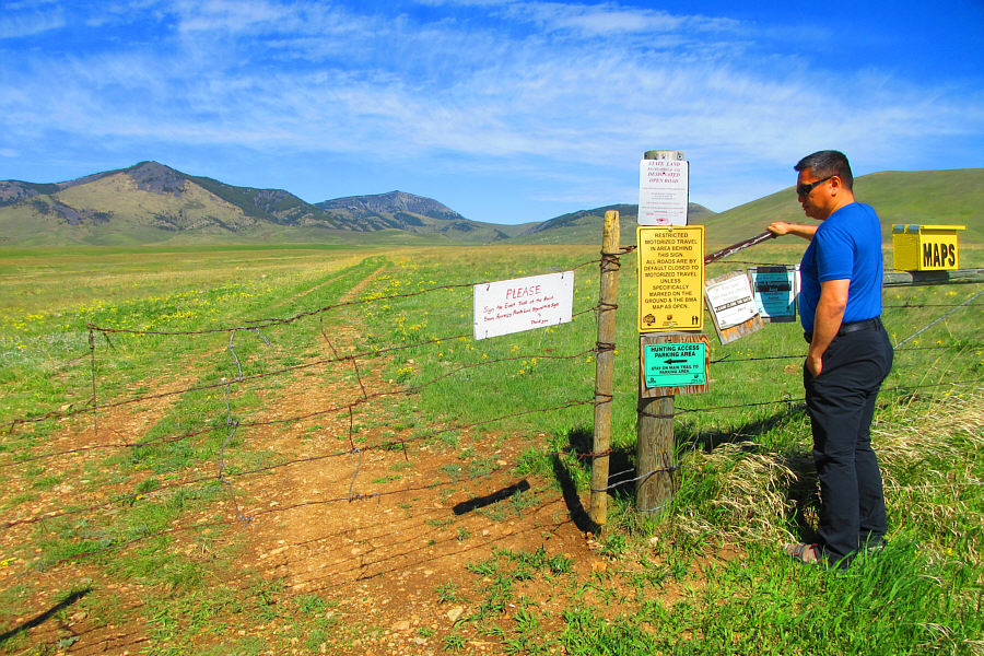
Sonny reads a plethora of signs before opening the gate at the main road.

Photo courtesy of Zosia Zgolak

Breaking the law already!! 
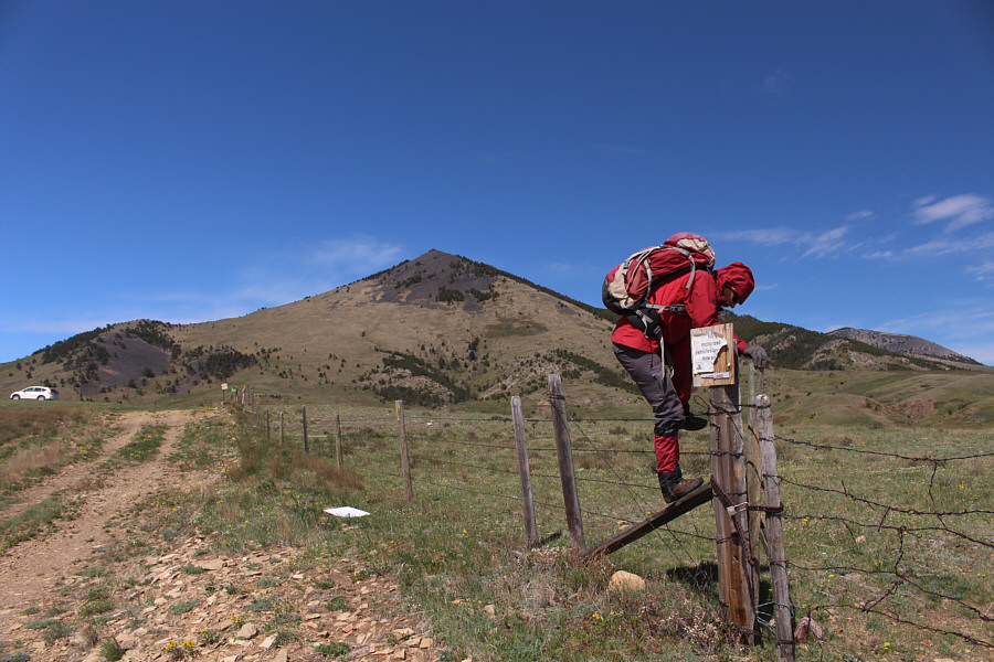
Since the gate is locked, Zosia climbs over a fence at the trailhead to begin the hike.
We're on the right track, Zosia!

The double track continues up the valley after dipping slightly to cross Iron Creek.

A very delightful section to walk! 
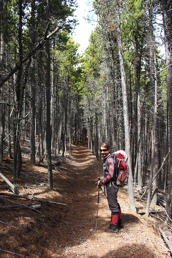
The trail appears to be well-maintained and largely free of deadfall.
I don't recall ever seeing this wildflower before! 
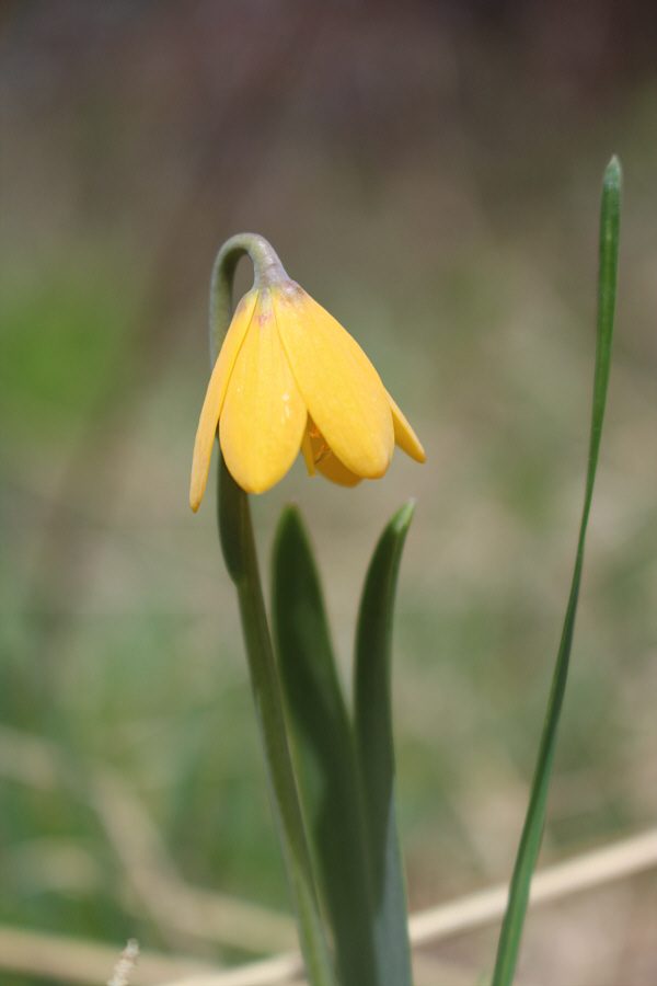
This is one of many yellow bells blooming in the area on this day.
We would later climb up that grassy ridge to the right. 
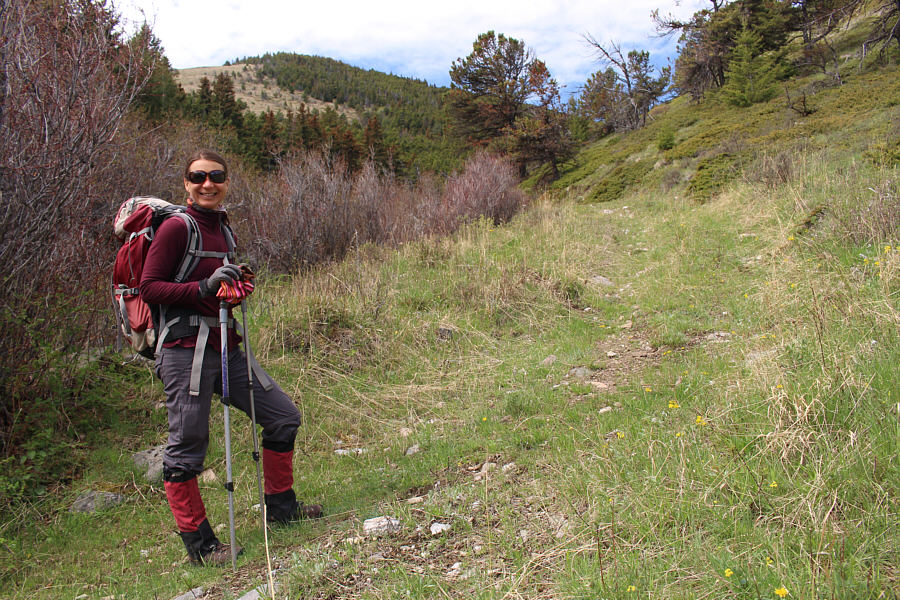
Zosia leaves the trail for a quick ascent of a bump to the north.  Behind her is Mount Royal.
Not the real summit of East Butte but a splendid viewpoint regardless! 
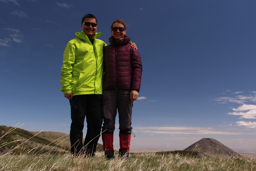
Sonny and Zosia stand on the gazetted "summit" of East Butte (1697 metres) as marked on Garmin's Topo USA map.
And it is without question the least scenic summit of them all! 
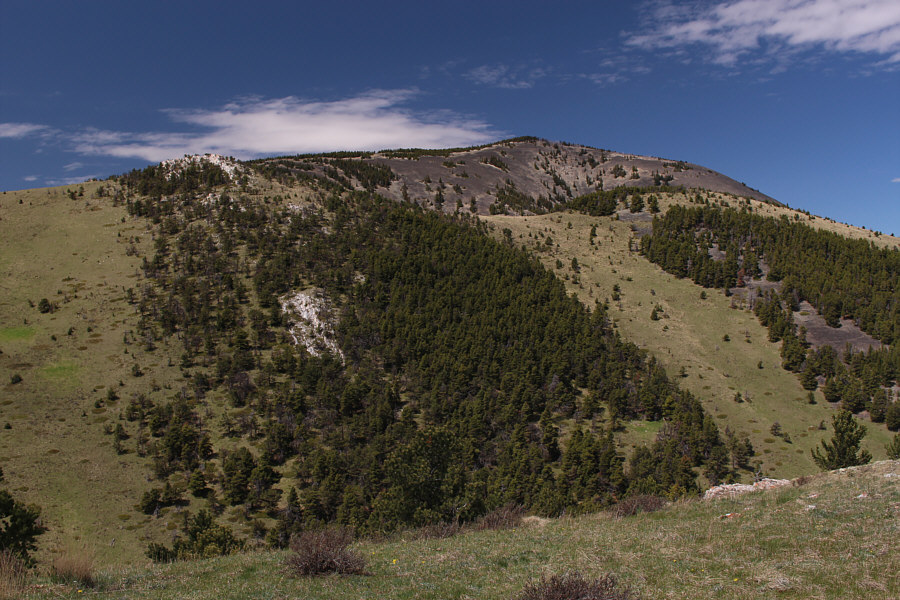
Mount Brown is the highest summit in the East Butte complex of Sweet Grass Hills.
Easier said than done though! 
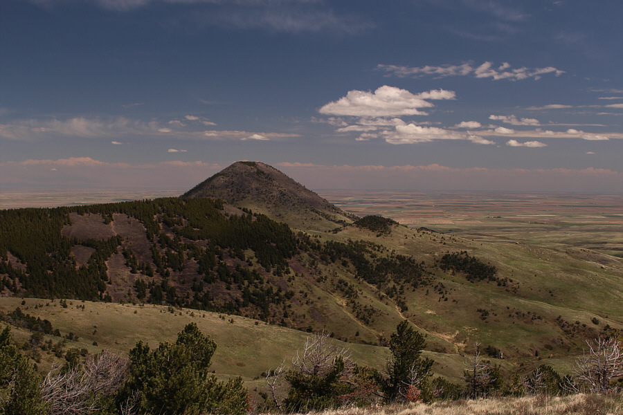
To the east, Mount Lebanon is begging to be climbed.
When Zosia and I resumed hiking, we descended to the mine site and made yet another detour to visit Devils Chimney, a cave that has some cultural significance.  Entering the cave entails slithering through a short but narrow tunnel which would not appeal to claustrophobes, but we had a blast wiggling in on our bellies.  The main cavern is quite spacious, and enough light pours in from a couple of natural skylights to obviate the need for headlamps.  At the far end of the main cavern, there is a narrow passageway that appears to go somewhere upwards, and closer to the entrance, there is a lower, darker chamber that apparently goes nowhere (a survey of the cave was done in 2001).  Not really equipped for spelunking (there is not really much more to explore anyway), we were content to just look around the main cavern for awhile before crawling back outside.
With a creek nearby, this is also a great camping spot! 
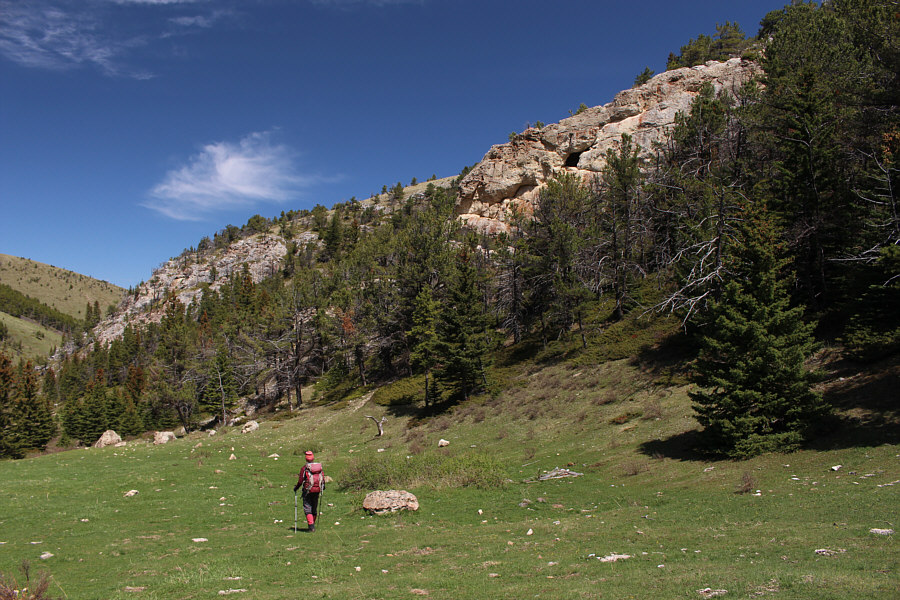
The entrance to Devils Chimney is located right below the visible skylight window in the rocks at right.
Prepare to get down and dirty! 
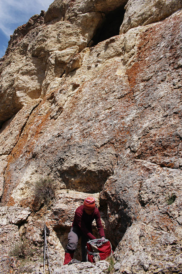
Zosia ditches her poles and pack at the entrance to the cave.  Above her is one of the natural skylight windows of Devils Chimney.
Oh no, I'm stuck! Just kidding... 
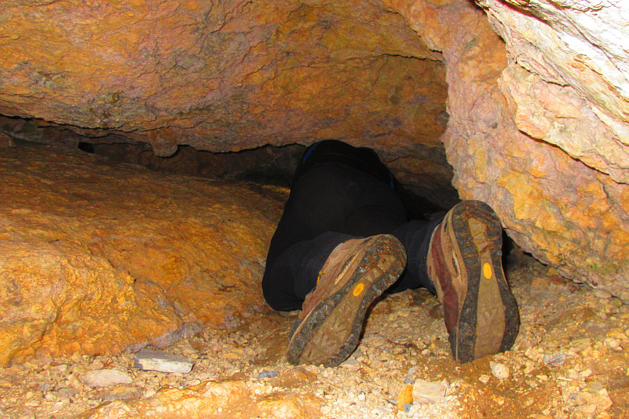
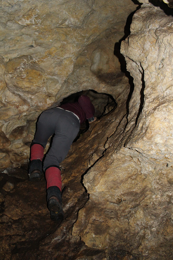
Sonny crawls through a narrow tunnel to enter the cave.

Photo courtesy of Zosia Zgolak

Are we having fun yet?? 
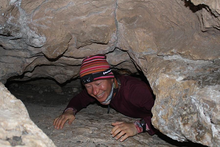
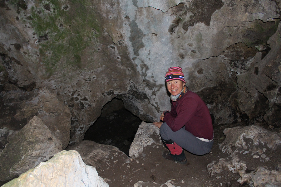
Zosia emerges from the tunnel inside the cave.
Watch your step here; the ground is down-sloping and slippery. Zosia wanders to the back of the main cavern.
Nice butt! Zosia investigates a narrow passageway at the back of the cave leading upwards.
Yeah, I'm not going down there...besides, aren't we here to climb a mountain?? Zosia checks out the entrance to a lower cavern.
Cue the theme from "The Great Escape"! Zosia crawls back outside.
Back out in the open, Zosia and I hopped across Tootsie Creek and climbed steeply up a grassy ridge leading to the north slopes of Mount Royal.  We had to contend with a few lingering snow patches in the trees below the summit, but otherwise, the rest of the ascent was straightforward.  We took some time at the top to wander among the many telecommunications structures and buildings, and once we had our fill of snooping around, we descended the southeast ridge to the col between Mount Royal and its southeast outlier ("East Butte" according to Google Earth).  Instead of climbing over the outlier, we traversed its north side on an overgrown road before muddling our way down tedious rubble slopes to regain our original access trail.  The remainder of our hike back to the trailhead was uneventful.
Back to the grind! Sonny climbs up and away from the former mine site.  One of the natural skylight windows of Devils Chimney is visible at upper left.

Photo courtesy of Zosia Zgolak

The open rubble slopes at left should be avoided at all cost! 
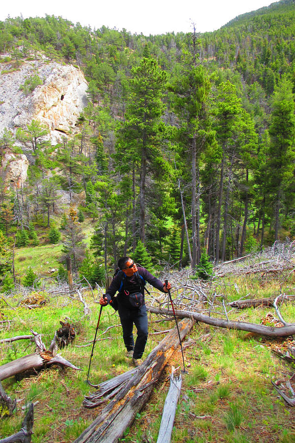
After a stiff climb out of Tootsie Creek, Zosia aims for the north (right-hand) slope of Mount Royal.
This would have been a great spot to view a herd of elk, but sadly, they were absent on this day. 
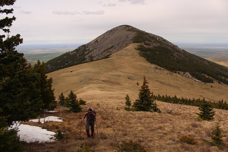
Zosia begins to climb up the north slope of Mount Royal.  Behind her is Mount Brown.
The snow was already isothermal, but thankfully, there wasn't much of it left. 
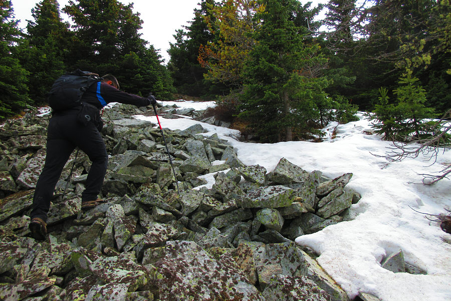
Sonny contends with some rubble and lingering snow patches on his way up Mount Royal's north slope.

Photo courtesy of Zosia Zgolak

There is a benchmark hidden in the grass at our feet here. Sonny and Zosia embrace each other on the summit of Mount Royal (2102 metres).
We'll visit this one soon... Haystack Butte sticks up like a sore thumb to the southwest.
Just start hiking without me, Zosia. I'll catch up with you later! 
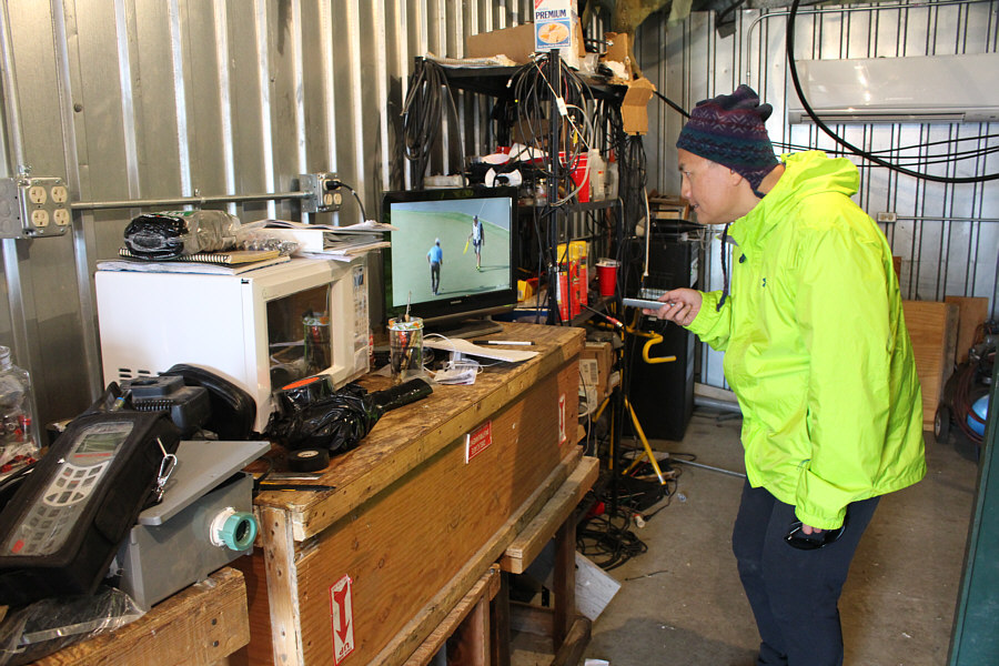
In one of the unsecured telecommunications buildings, Sonny is able to watch the TPC Sawgrass golf tournament in high definition.
I've already been there once and don't feel the need to return! Here is a view of the connecting ridge to Mount Brown.
Gold Butte, West Butte, everywhere a butte butte, Old MacDonald had a farm, E-I-E-I-O! 
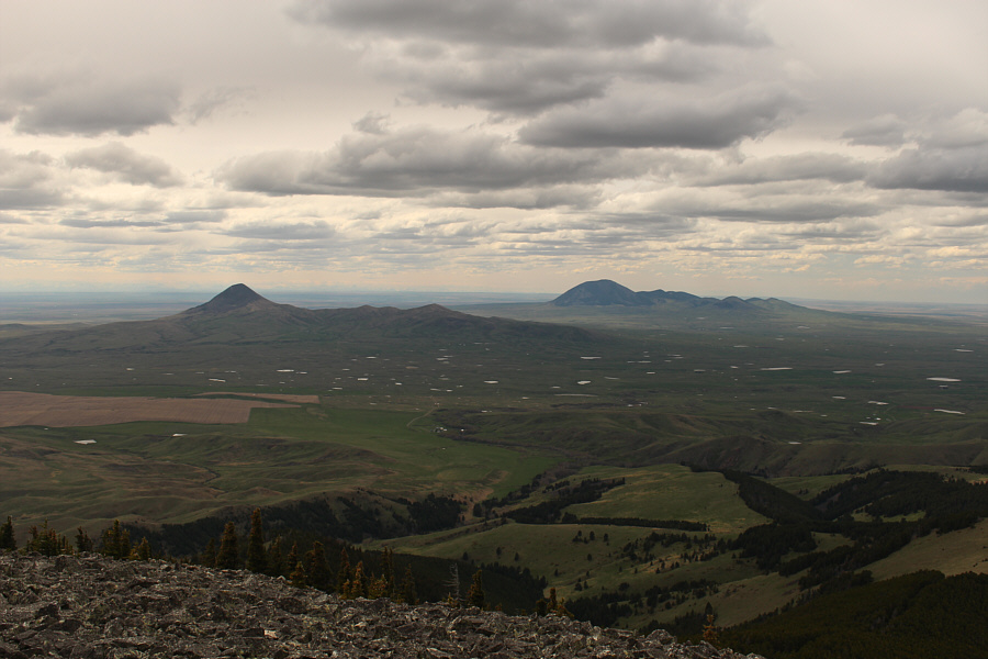
Gold Butte (left) and West Butte are clearly visible from the west end of Mount Royal's summit.
Still trying to figure out which one of these is the biffy! 
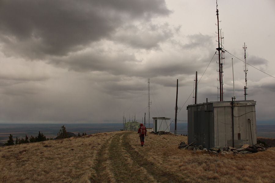
Zosia walks past some more telecommunications buildings as she heads for the east end of the summit.

We missed climbing this East Butte, but perhaps that's a good reason for another return trip...

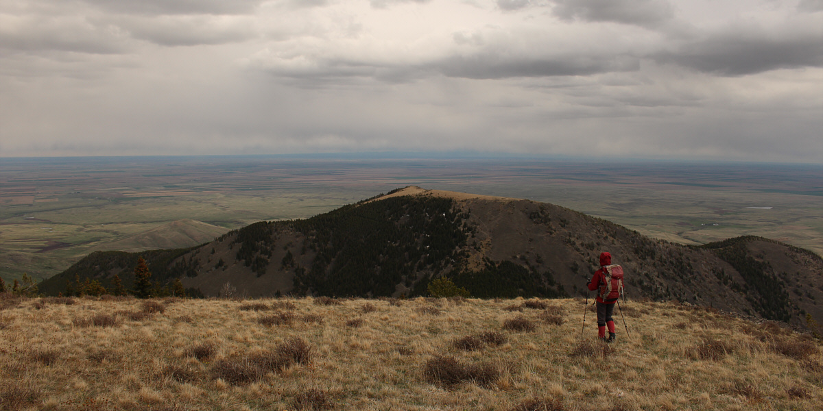
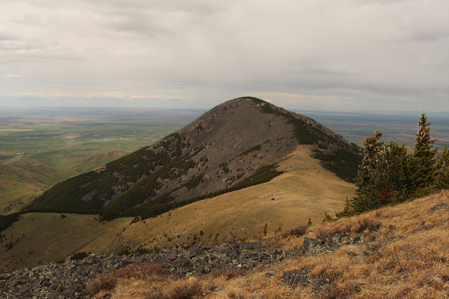
Zosia begins to descend the southeast ridge of Mount Royal.  Ahead is the outlier known as East Butte according to Google Earth.


Actually, the bushwhacking wasn't bad, but the rubble was painfully tedious. 
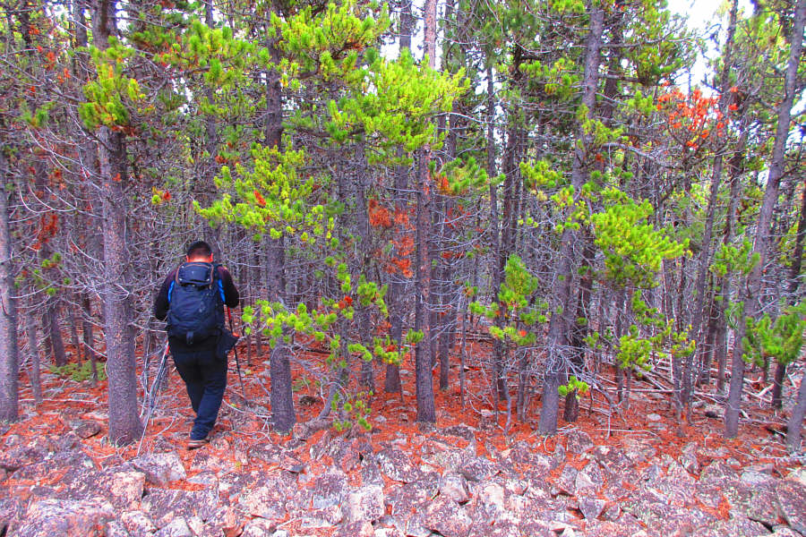
Sonny squeezes between some tree trunks on descent.

Photo courtesy of Zosia Zgolak

I feel like I'm in Ireland! 
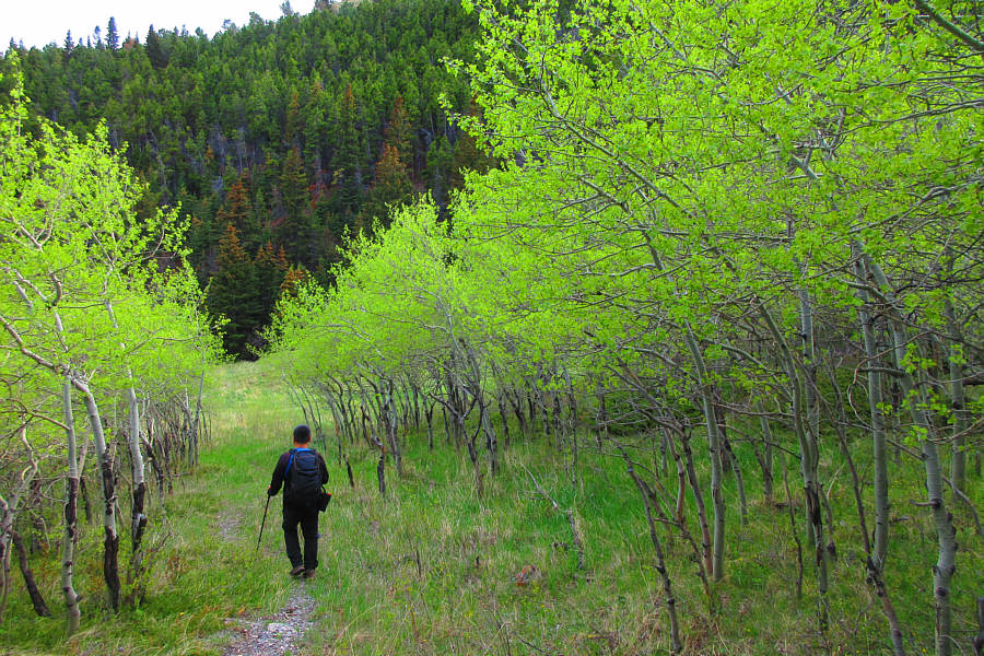
Sonny hikes through a stand of aspen trees near the first glade.

Photo courtesy of Zosia Zgolak
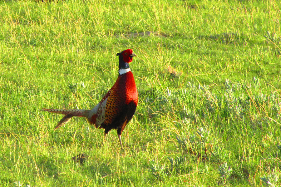
When we returned to my car, Zosia and I were surprised to find a note attached to my windshield wiper.  Someone had spotted my car from a distance and went to the trouble of driving all the way in from the main road to remind us to sign the guest book before trespassing on their private land.  We were originally planning to camp for the night at the same trailhead, but the note made us a bit uneasy since we were still unsure if we were on private land (we would later learn that both the dirt track and the trailhead are on state land).  After eating a quick dinner, we drove back to the main road in search of the mystery ranch, and with some trial and error, we eventually located the person--Dan--who left us the note.  Despite some awkwardness, I apologized for not first coming to sign the guest book, but Dan took it all in stride and admitted that the jumble of private land, state land and BLM land in the area was confusing to sort out for visitors.  After I signed the guest book, Dan generously gave Zosia and me an invaluable map showing the exact locations of the private lands in the area, and he also provided some helpful advice about where to get access permission for our next day's adventure--an ascent of Mount Lebanon.
I've never tasted pheasant before... A ring-necked pheasant wanders among the grass near Meissner Ranch.

Photo courtesy of Zosia Zgolak

Look out for some dogs in the yard, and ask for Dan! 
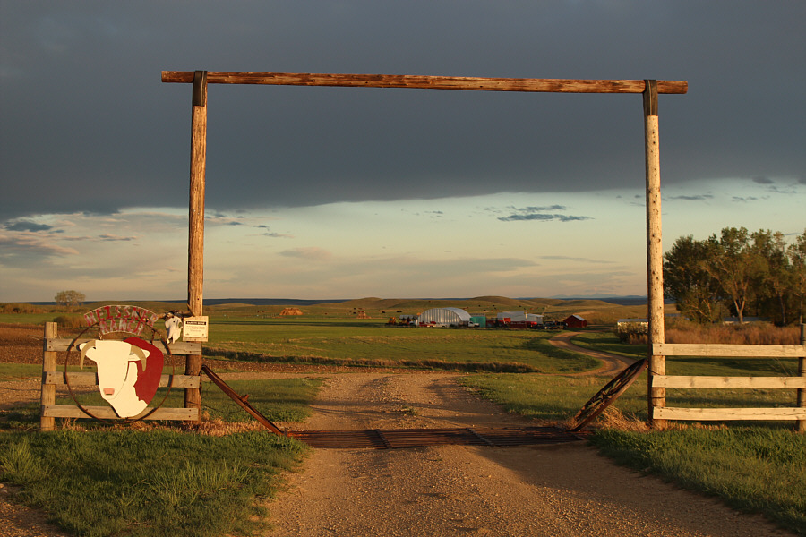
Permission to cross private land near the start of the eastern approach to Mount Royal can be obtained here at Meissner Ranch.
An interesting trip in many respects! Total Distance:  12.2 kilometres
Round-Trip Time:  7 hours 31 minutes
Net Elevation Gain:  652 metres

GPX Data