 |
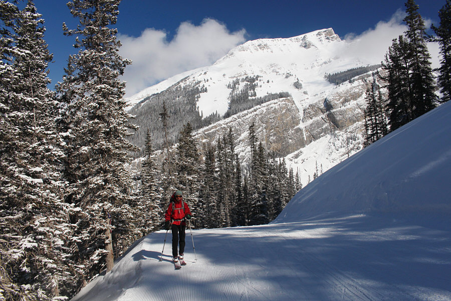
Zosia climbs up the ski-out. |

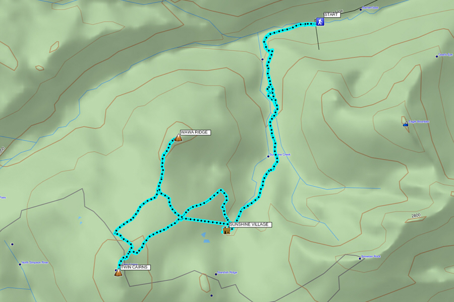
Leaving the ski resort behind, Zosia heads toward Twin Cairns.
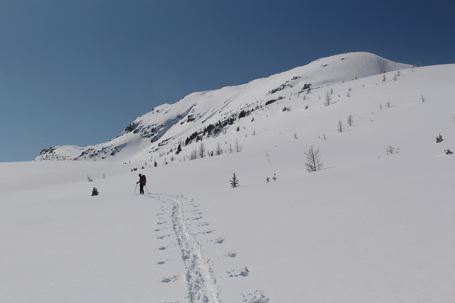 |
Zosia approaches the base of Twin Cairns. |
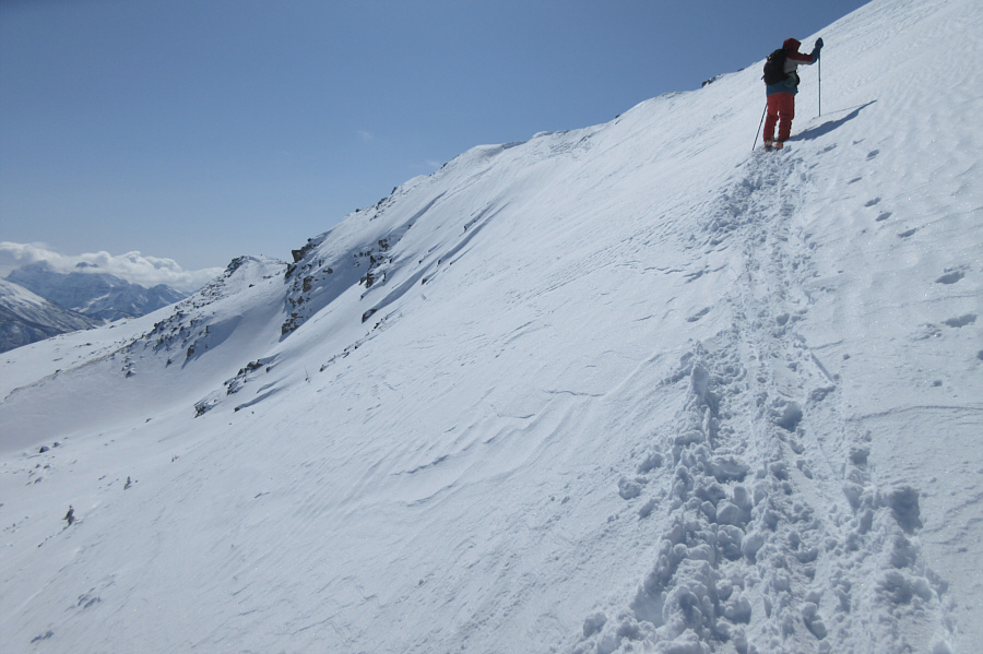 |
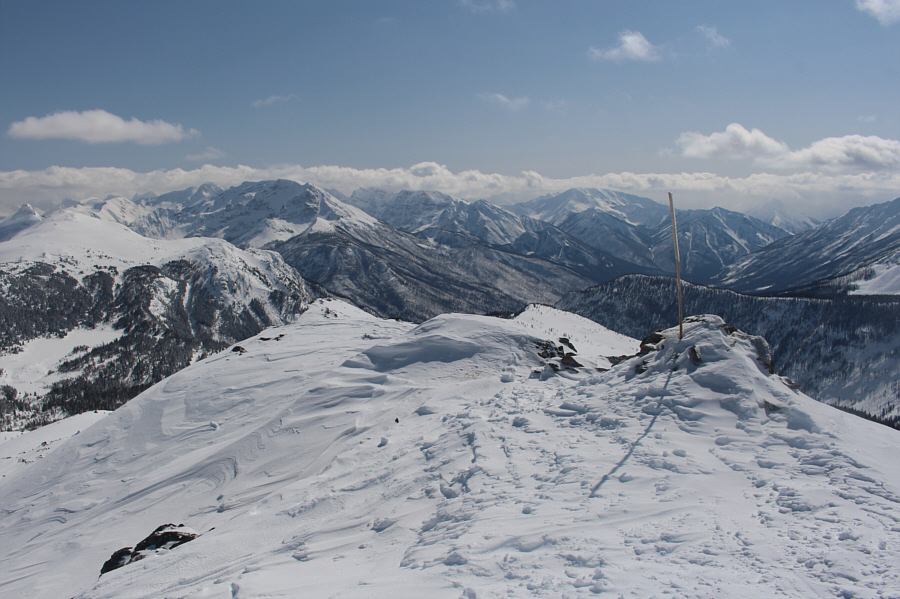
The slope becomes considerably steeper
as Sonny climbs up to the summit ridge. Photo courtesy of Zosia Zgolak |
 |
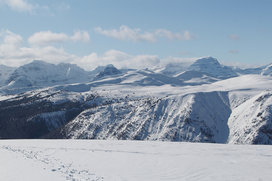
Sonny's approach tracks can be traced all the way back to the top of Wawa chairlift in this view from the summit ridge. |
 |
This is looking south past the summit cairn into British Columbia's Mount Assiniboine Provincial Park. |

Sonny stands on the summit of Twin Cairns (2551 metres) for the second time in his life.
 |
The Monarch lives up to its name to the southwest. |

Visible to the northwest are Sugarloaf Mountain (far left), the highest of the Pharaoh Peaks (centre), and Mount Ball (right).
 |
Mount Bourgeau (right) is the easiest peak to identify on the northern horizon. |

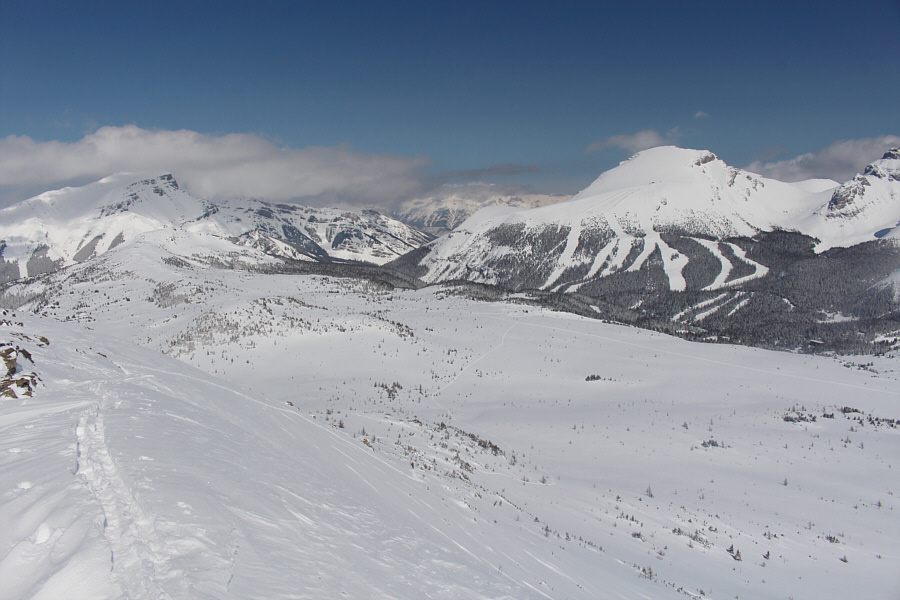
The summit of Twin Cairns provides a great overview of Sunshine Village ski resort including Eagle (or Goat's Eye) Mountain to the left and Mount Howard Douglas to the right.
When I made it back down to the base of Twin Cairns, Zosia was nowhere to be seen. However, I was able to follow her ski tracks and eventually found her wandering in the meadows north of Twin Cairns. After reuniting, we both decided to head north and ascend Wawa Ridge. Zosia and I had already climbed Wawa Ridge together in 2016, but like my first trip up Twin Cairns, we were not rewarded with any views.
We skied across the intervening flats and made it to the crest of the south ridge before putting our climbing skins back on (Zosia had removed her skins while I was on top of Twin Cairns). The remainder of the ascent was very easy and straightforward. While Zosia chose to ditch her skis and boot-pack up the last few metres to the summit, I was feeling like a ski purist and managed to skin all the way up.
Although we were granted far-reaching views on this day from the top of Wawa Ridge, a chilly wind made it too uncomfortable to linger. Zosia promptly headed back down to where she left her skis, but I stuck around a bit longer to take a few photographs before joining her. With our climbing skins off for good, we skied down the south ridge and worked our way back to the ski resort at the top of the Wawa chairlift. The resort had already closed for the day, and except for a few stragglers, we generally had the ski runs all to ourselves. Unfortunately, that also meant that there had already been a lot of maintenance vehicle traffic on the ski-out which created some rather choppy snow conditions for much of our descent.
The marginal skiing at the end notwithstanding, this was still an outstanding day of ski touring, and it was great to return to these two summits under much sunnier skies.
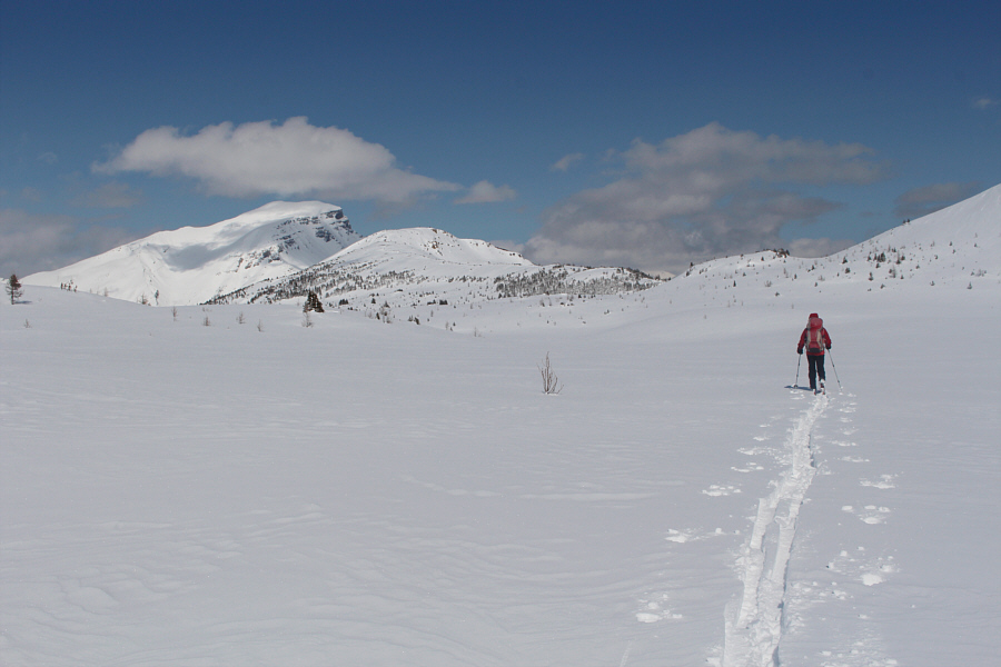 |
Zosia heads for Wawa Ridge (left of centre). |
 |
Sonny follows Zosia's tracks across
the meadow north of Twin Cairns. Photo courtesy of Zosia Zgolak |
 |
Zosia comes across some tracks heading up Wawa Ridge. |
 |
Zosia ditches her skis just before the top of Wawa Ridge. |
Sonny and Zosia both stand for a second time on the summit of Wawa Ridge (2473 metres).
 |
Here is another perspective of Sunshine Village ski resort from the top of Wawa Ridge. |
 |
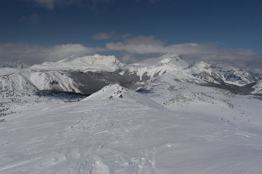
Twin Cairns and The Monarch stand out to the south. |
 |
Here is a comprehensive view of the terrain near Healy Pass (left). |
 |
The view to the northeast includes Mount Bourgeau (left) and Vermilion Lakes near Banff town site. |

Zosia descends Wawa Ridge to return to the ski resort.
 |
The ski runs are deserted as Zosia re-enters the resort. |
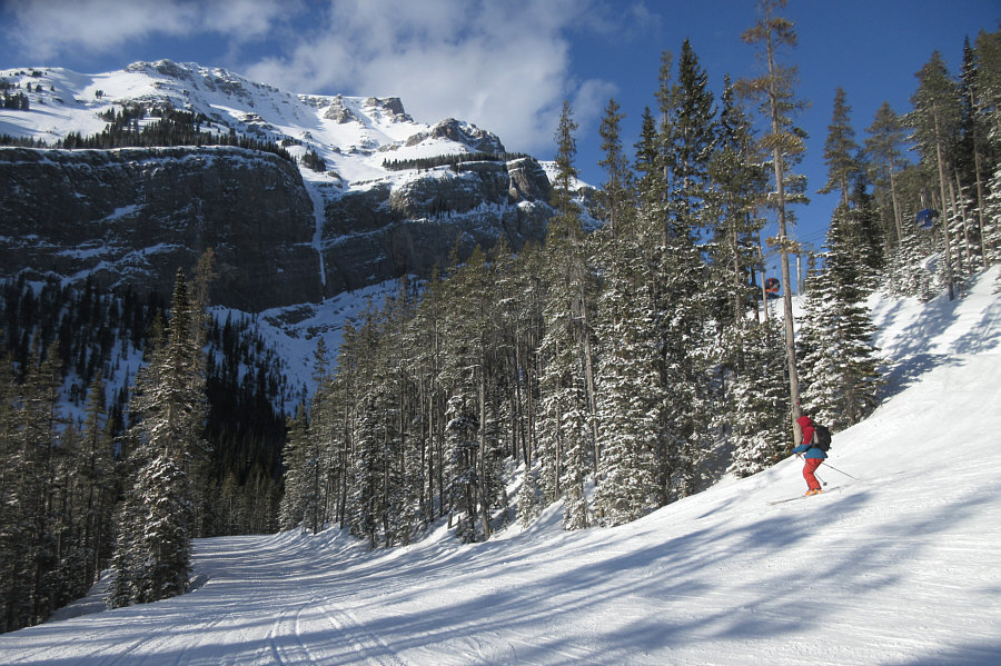 |
Sonny zips down the ski-out on what
would turn out to be his last run of the season. Photo courtesy of Zosia Zgolak |
 |
Total Distance: 20.2 kilometres Round-Trip Time: 7 hours 43 minutes Total Elevation Gain: 1144 metres* * Includes ~175 metres gained riding Wawa chairlift |