BOU AVENUE
Wilkinson Ridge
On 3 November 2018, Ali Shariat, Zosia Zgolak and I accompanied Bob
Spirko for a hike up an unnamed ridge located between Cummings Creek and
Wilkinson Creek near the south end of Albertas Kananaskis Country.
For simplicity, Bob refers to this ridge as Wilkinson Ridge although this
name has previously been applied by The Rocky Mountain Ramblers to
another ridge (referred to as Ridge 735663 in Gillean Dafferns
Kananaskis Country Trail Guide) located further east between the
Forestry Trunk Road and Plateau Mountain. For our objective, Bob
mapped out a route which follows a series of logging roads winding up the
southern aspect of Wilkinson Ridge.
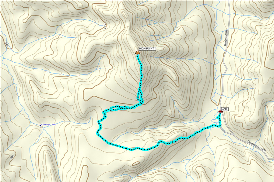
From Highwood Junction, drive south along the Forestry Trunk Road
(Highway 940) for 22 kilometres before turning right onto another road
which is gated a short distance further. Park in a clearing just
before a locked gate. Note that this is the same trailhead for
hiking up Pasque
Mountain.
Beyond the locked gate, we headed south along the continuation of the
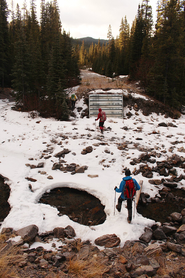
road and crossed Wilkinson Creek before turning right onto a side road.
We immediately crossed a bridge over a tributary of Wilkinson Creek and
soon arrived at an open meadow with clear views of Wilkinson Ridge.
Sticking to the road, we began a steep and sustained climb over a minor
ridge to reach a signed junction with Cummings Creek road. Turning
right, we followed Cummings Creek road for about a kilometre until we
reached what we expected to be an exploration road heading toward the
southwest side of Wilkinson Ridge. Instead of a road though, we
found a swath of logging devastation cutting through the forest and
subsequently widening into an enormous cut-block. Initially, it was
easier to bushwhack through the trees on the fringes of the devastation,
but once we reached the cut-block, we had no choice but to plow through
some unpleasant terrain full of logging debris.
 |
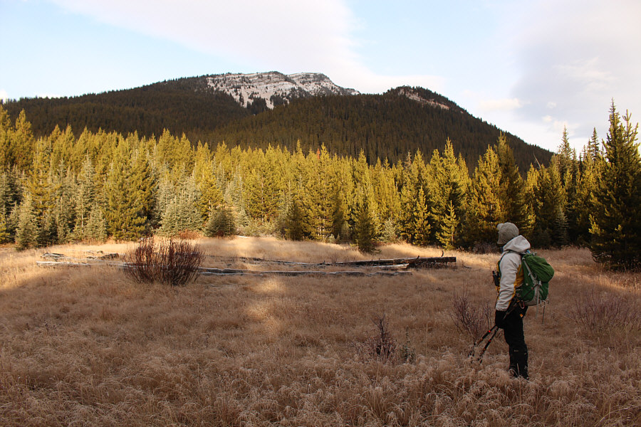
Wilkinson Ridge is visible from a
break in the trees along Wilkinson Creek. |
 |
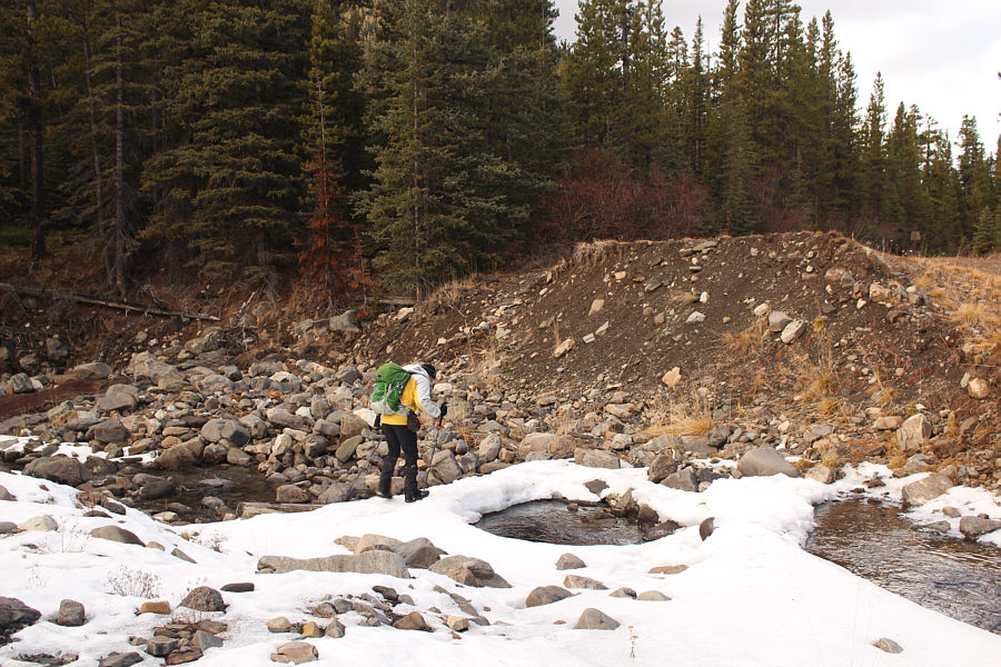
A snow bridge allows Bob, Zosia and
Ali to easily cross Wilkinson Creek. |
 |
Bob gets a clearer view of Wilkinson
Ridge from a meadow along an exploration road. |
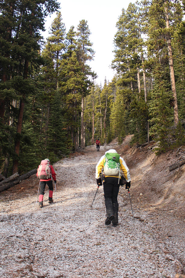 |
Zosia and Bob follow Ali up the
exploration road. |
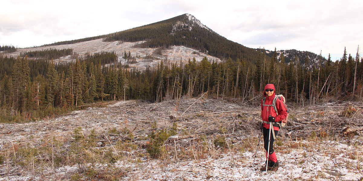
Because a hidden gorge would complicate a direct approach from this
clear-cut along Cummings Creek road, Spirko's route winds around to far
left before returning to the trees just below the rocky ridge at
centre.
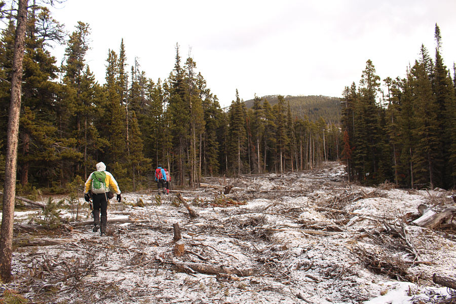 |
Bob, Ali and Zosia turn off from
Cummings Creek road to follow this swath of devastation leading to
Wilkinson Ridge. |
 |
Ali, Zosia and Bob reach a large
clear-cut on the southwest side of Wilkinson Ridge. |
Ali, Bob, Zosia and I eventually worked our way to the edge of
the cut-block just below the south end of Wilkinson Ridge, and upon
re-entering forest, we came across a reclaimed road which likely was the
one that Bob had intended to follow after turning off Cummings Creek
road. We did not stay on this road for long before leaving it to
ascend the south ridge of our objective. While Ali, Bob and Zosia
hiked up a grassy slope slightly to the east, I opted to climb the rocky
ridge crest which entails some easy to moderate scrambling. We
reunited further up the ridge, and other than some slippery footing due
to snow, we generally had no difficulties with the remainder of the
ascent.
 |
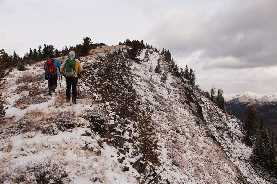
The rocky south ridge is mostly an
easy to moderate scramble. |
 |
A few overgrown sections of the south
ridge require some awkward maneuvers through the trees. |
 |
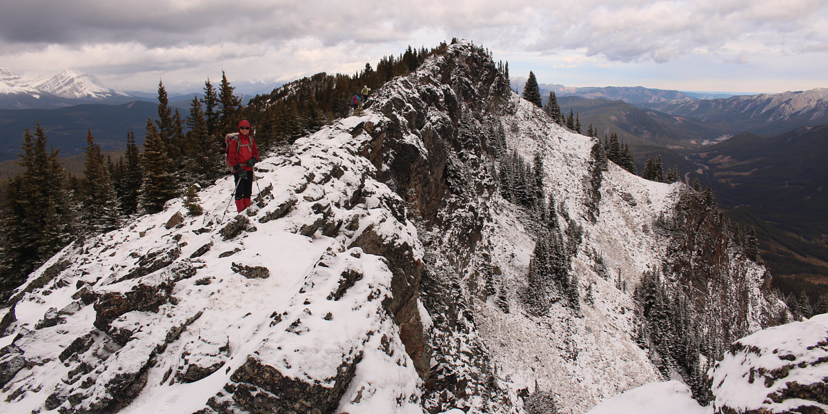
The ridge becomes much easier to hike
higher up. |
Here is the final approach to the high point of
Wilkinson Ridge.
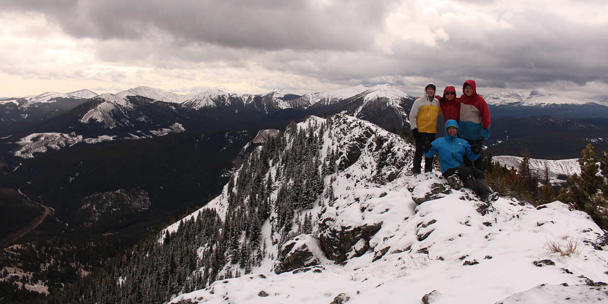
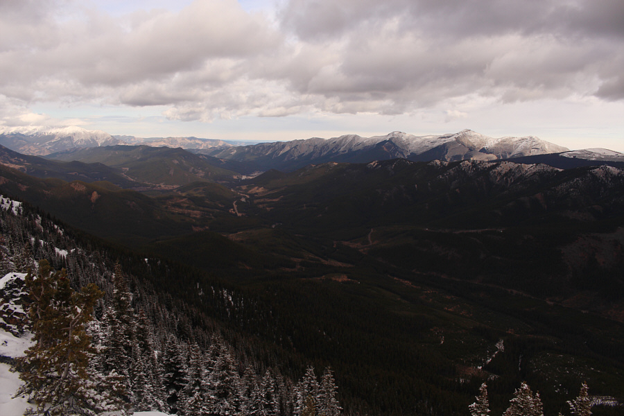
Bob, Zosia, Ali and Sonny gather near the high point
of Wilkinson Ridge (2409 metres). Visible behind them to the
south is Pasque
Mountain (right of centre).
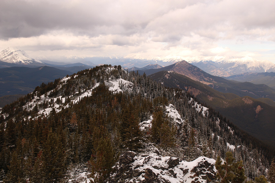 |
The most notable feature to the north
is Raspberry Ridge (right). |
 |
Mount Burke
(right) is visible to the northeast. |
Cool temperatures made it too uncomfortable to linger, and Ali,
Bob, Zosia and I were on the move again after spending only about 25
minutes on the high point of Wilkinson Ridge. We all descended the
grassy slope east of the ridge crest and followed the reclaimed road back
to the cut-block. A second crossing of the cut-block felt just as
unappealing as the first time, and we felt a measure of relief when we
eventually regained Cummings Creek road. Despite some annoying
uphill sections on the way back, our return to the trailhead was
uneventful. Be sure to check out
Bob's trip
report.