BOU AVENUE
Mount Galwey North Summit

On 4 July 2020, Alda Sigvaldason invited me to join her for an ascent of the north summit of Mount Galwey in Alberta's Waterton National Park.  A route description for this extension to the scramble up Mount Galwey can be found in the 3rd edition of Alan Kane's Scrambles in the Canadian Rockies.  Having already climbed the gazetted summit of Mount Galwey in 2005, I was admittedly a little hesitant about a second visit to the mountain, but since the north summit would be new terrain to me, I felt that there was some merit for a return trip especially since the weather forecast promised to be fantastic.  Besides, it was a good excuse to visit Waterton National Park again since I was last there in 2016, and I was curious about the state of the park in the wake of the Kenow wildfire which had ravaged much of the area in 2017.  Joining us on this excursion were Alda's friends, Jeannine Martel and Brian Pinter.

Starting from Coppermine Creek picnic area (no toilets--likely destroyed in the wildfire), we picked up an unmarked trail and started climbing quickly up the approach ridge for Mount Galwey.  Jeannine, Brian and Alda are all very fit, and I had a tough time keeping up with them all day.  Although trees were already sparse on the approach ridge, all of them had been scorched and left as lifeless trunks.  We would see more of these later in the day.  On the south face of Mount Galwey, we chose to ascend an obvious water-worn gully instead of Kane's diagonally-rising scree trail.  The gully entails some easy hands-on scrambling which is probably better than the drudgery of grinding up the scree trail, but higher up, we had to traverse to climber's left anyway to regain Kane's route on the southwest ridge.  Unlike in 2005 when I had the whole mountain to myself, on this day there were probably some two dozen scramblers--some better equipped than others--slithering up and down Kane's route.  Rockfall was a serious possibility in the steep gully leading to the crux, but everyone I encountered seemed very conscientious about the hazard and were careful not to dislodge rocks onto each other.  The crux is a short, exposed traverse to reach the bottom of a chute next to a natural window.  Fortunately, the ledges here are still as solid as they were in 2005, and we had no serious problems with the traverse.  A short scramble up the chute brought us to the crowded top of Mount Galwey.  Sadly, the summit register canister that had been there in 2005 was missing (I left a new register booklet that day with a politically incorrect limerick to boot).  We took about a 20-minute break on the summit before dropping down to take a closer look at the celebrated natural window.  We then retreated back across the crux and dropped down further to about 50 metres below the top before beginning the traverse to the north summit.
Sadly, the toilet here was lost to the Kenow wildfire in 2017. 
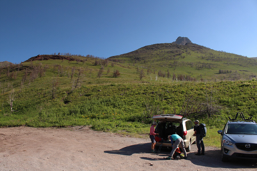
The group gears up at the Coppermine Creek trailhead.  The top of Mount Galwey is peeking over the approach ridge.
Whew! I can't keep up to these people! The group follows a trail up the approach ridge.

Doesn't look that inviting from here...

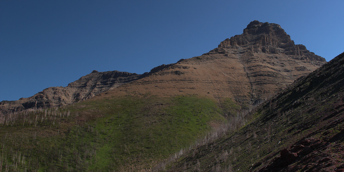
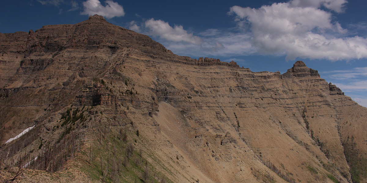
Here is one of the first views of Mount Galwey's north summit (left).


It's a grunt just to get this far. Prepare for more grunting! 
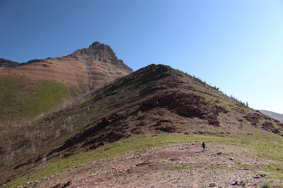
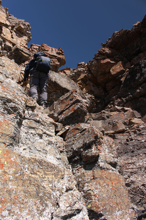
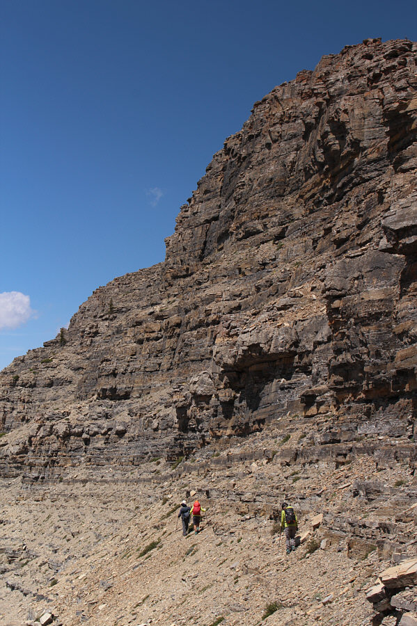
The group begins to climb up Mount Galwey's south face.  Note the obvious water-worn gully at left.
Natural staircase! 
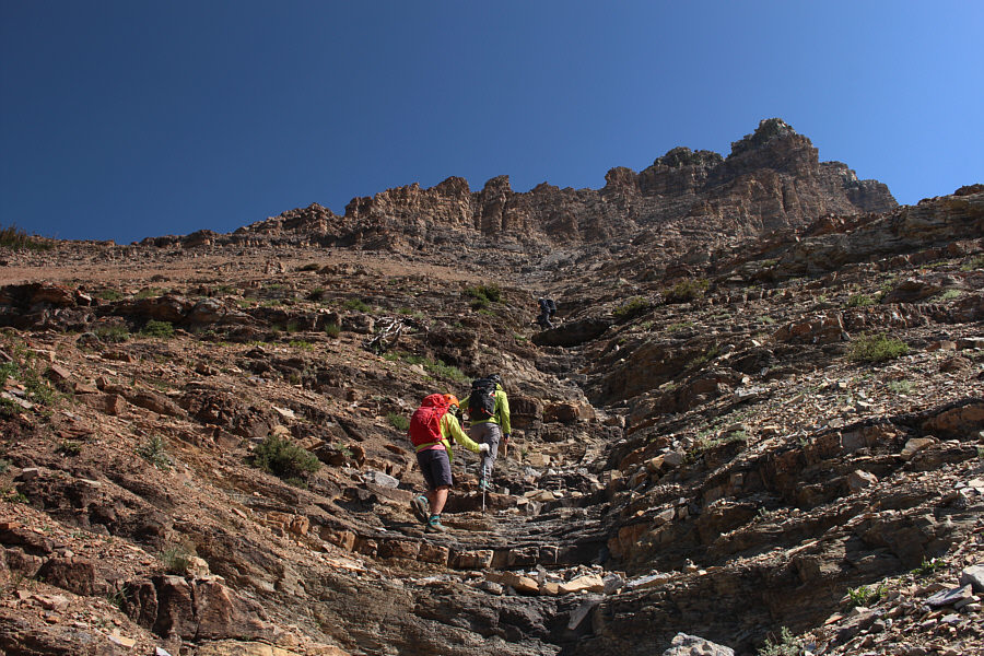
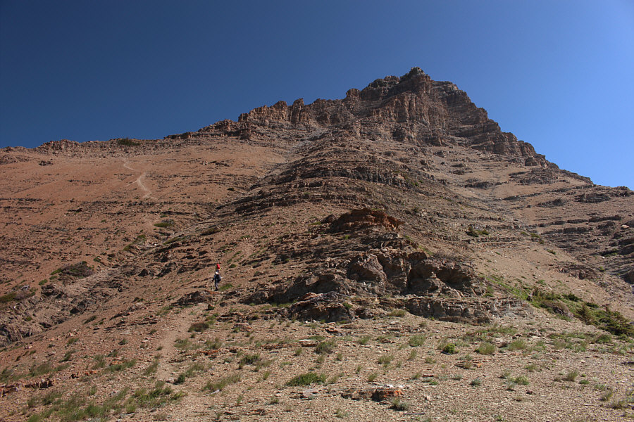
The group ascends the water-worn gully.
Mount Blakiston is pretty much off-limits for the next couple of years due to the closure of Akamina Parkway from the Kenow wildfire. 
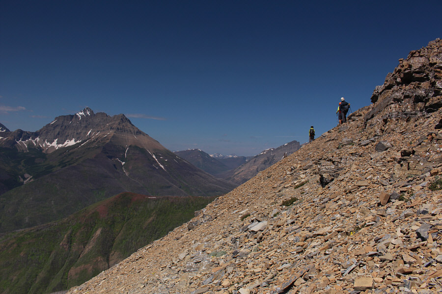
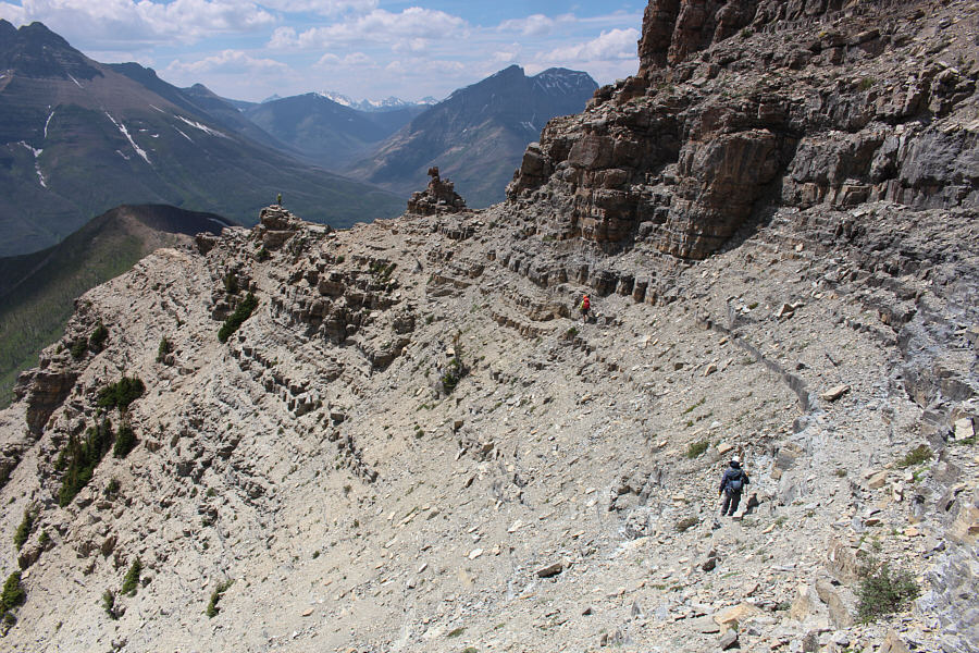
The group traverses across loose scree to regain Kane's ascent route.  At left is Mount Blakiston, the highest peak in Waterton National Park.
Hmmm...I don't remember any of this! 
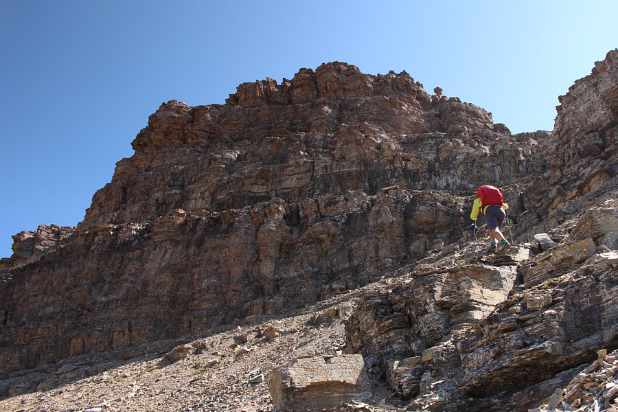
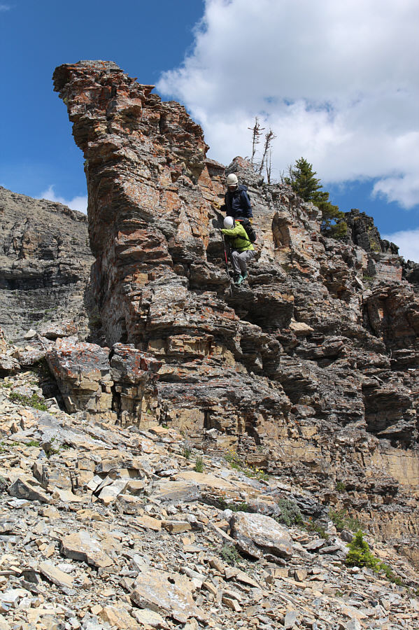
Alda follows Brian up a steep gully leading to the top of Mount Galwey.  Note the rock resembling a mushroom (upper right) which is a key landmark mentioned by Kane.
This section justifies Kane's "difficult" rating. 
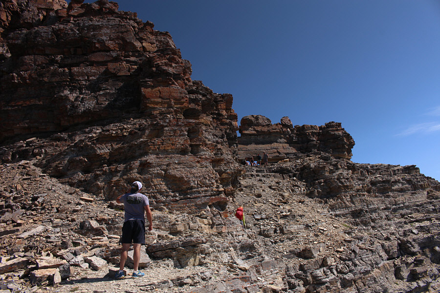
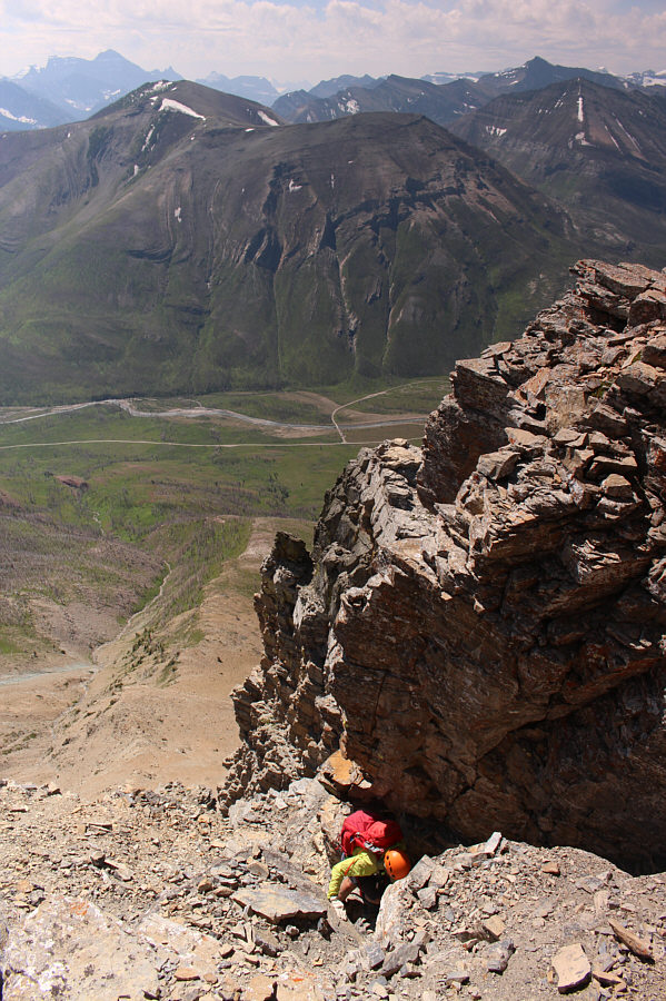
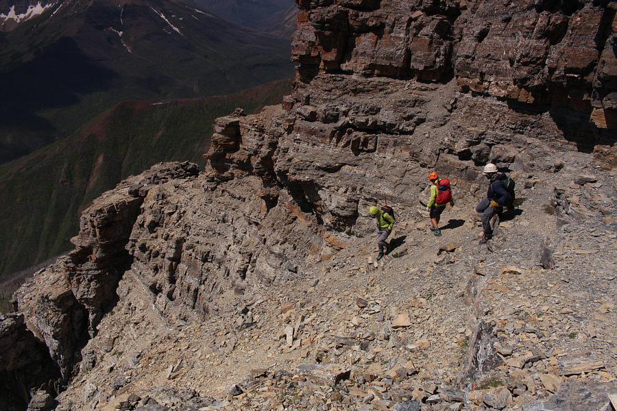
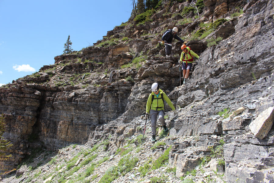
This is the exposed traverse (crux) mentioned by Kane.  Some hikers can be seen congregating in front of the natural window which is also mentioned by Kane.
Great fun--just watch out for people coming down and possibly kicking rocks down on you! Brian scrambles up a steep chute just below the summit.
A helmet is recommended here! Alda comes up the same chute.

And our next objective is right behind us!

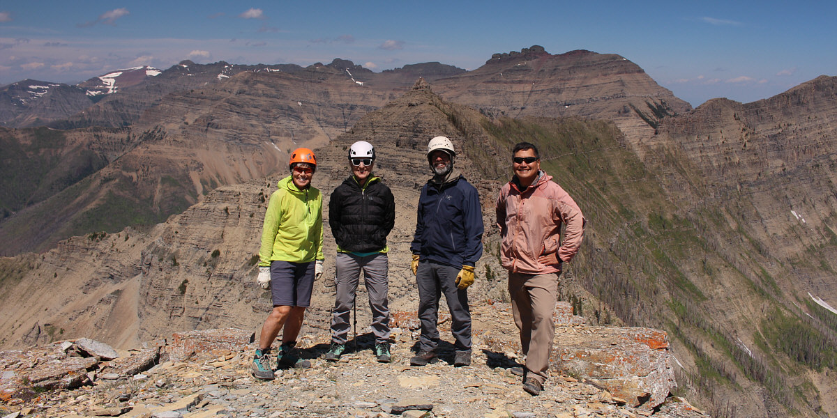
Alda, Jeannine, Brian and Sonny stand on the gazetted summit of Mount Galwey (2376 metres).


More interesting peaks in the US can be seen on the distant horizon! 
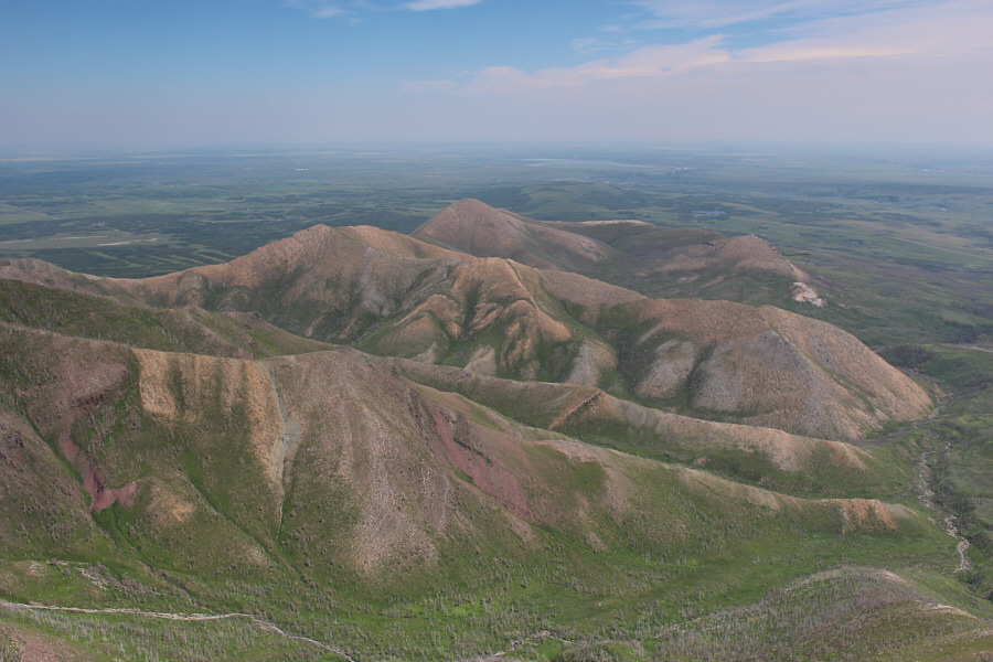
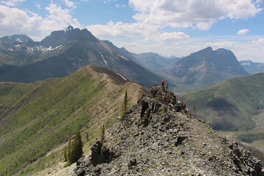
The view to the southwest includes Ruby Ridge (left), Mount Lineham (left of centre), and Mount Blakiston (right).
I should probably climb Mount Dungarvan one of these days... Behind the north summit of Mount Galwey are Cloudy Ridge (far left) and Mount Dungarvan (right of centre).
Another one I haven't done yet...maybe next fall or winter... Lakeview Ridge sits to the northeast.
If you have a sharp eye, you can even spot Chief Mountain! Part of Lower Waterton Lake can be seen behind Bellevue Hill to the east.
Yep, I'm a deadbeat! 
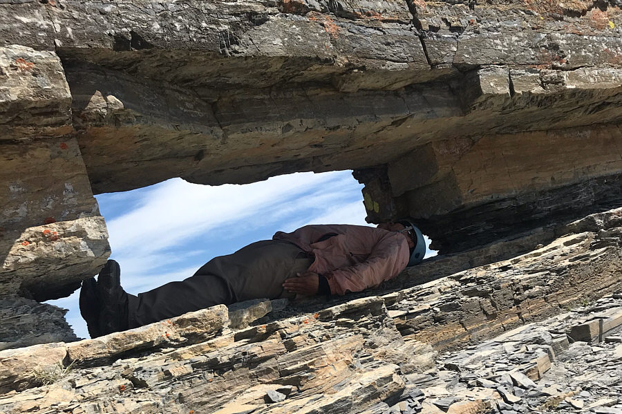
Sonny recreates Andrew Nugara's burial pose in the natural window.

Photo courtesy of Jeannine Martel

I'm not sure why everyone was traversing lower and not at the level of the cairn which is Kane's described route. The group prepares to traverse back across the exposed ledges below the summit block of Mount Galwey.  Note the cairn on the ledge at the corner.
En route to the north summit, we followed Kane's advice and generally stayed below the crest of the connecting ridge.  The sidehill-bashing on rubble-covered ledges was somewhat tedious but not nearly as bad as I was expecting.  As we passed the base of the cliffs below the north summit, we began looking for weaknesses to scramble upward.  The further to climber's left we went, the more options presented themselves to us, and after another round of moderate scrambling, we were standing atop the north summit of Mount Galwey.  The traverse between the two summits took us about an hour, and since we had the north summit all to ourselves, we took a much longer break here to enjoy the surrounding views.
Looks like a lot of sidehill bashing ahead... 
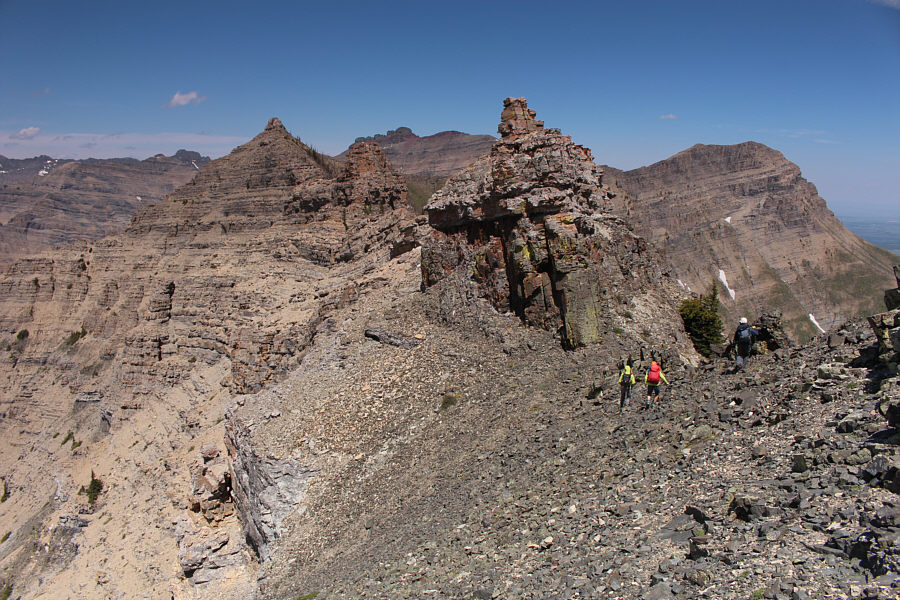
The group needs to bypass a couple of pinnacles en route to the north summit of Mount Galwey.
Anderson-Lost-Bauerman traverse is also on my to-do list...sigh. 
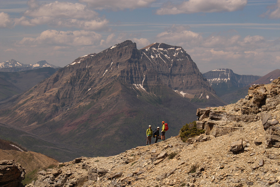
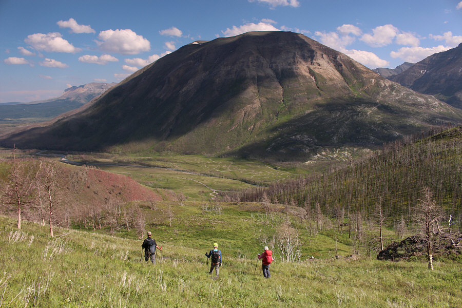
The group waits for Sonny to catch up.  Behind them is Anderson Peak.
Looks more impressive from this angle! Here is an unusual perspective of Mount Galwey from partway along the traverse to its north summit.  Note the figures at lower right.
So much choss, so little time! 
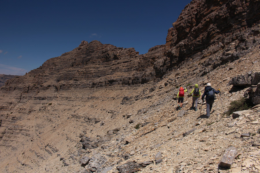
The sidehill-bashing to get to the north summit is tedious but not bad.
Keep traversing to the left! The group looks for a weakness in the cliff bands guarding the north summit.
Lotsa route variety here! Pick your own line. The group starts scrambling up moderate terrain just below the north summit.
Some might call this the true summit of Mount Galwey... Sonny, Jeannine, Alda and Brian reach the top of Mount Galwey's north summit (2385 metres).
It's weird that the gazetted summit of Mount Galwey looks higher from here but really isn't. 
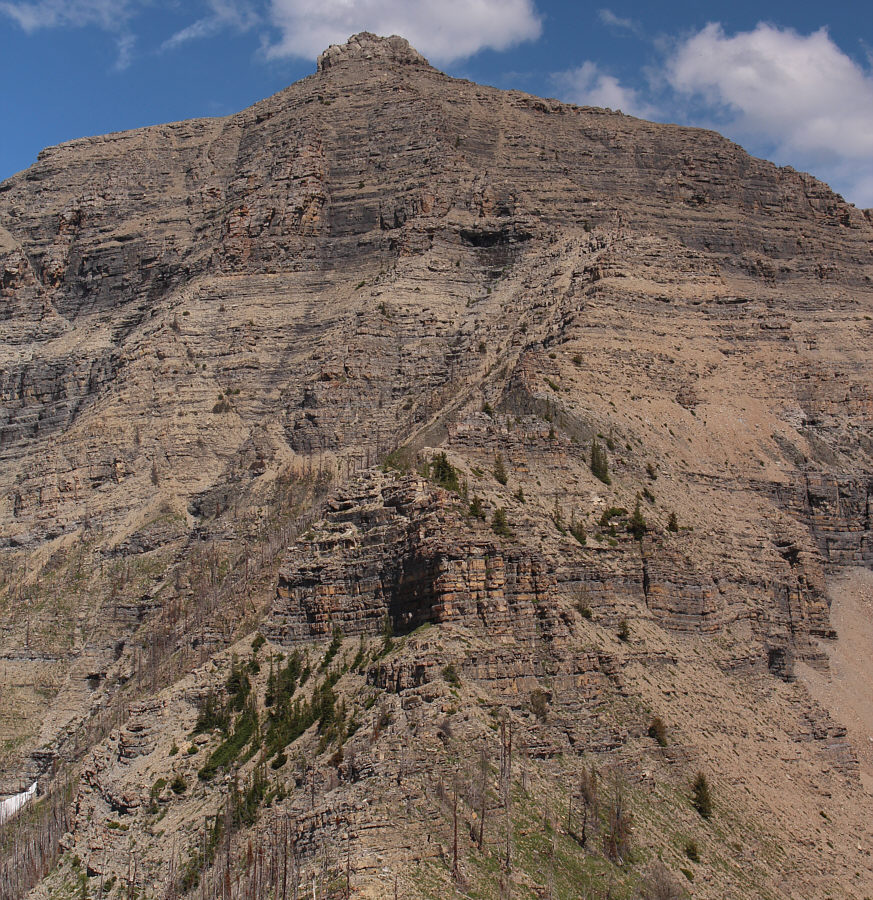
Here is a look back at the gazetted summit of Mount Galwey.
More sufferfests for the future! 
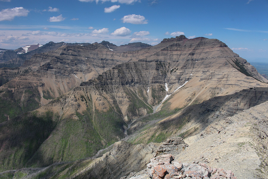
Visible to the northwest are Glendowan Mountain (left), Cloudy Ridge (centre), and Mount Dungarvan (right).
I'm gonna re-name it something else...when I get around to climbing it! 
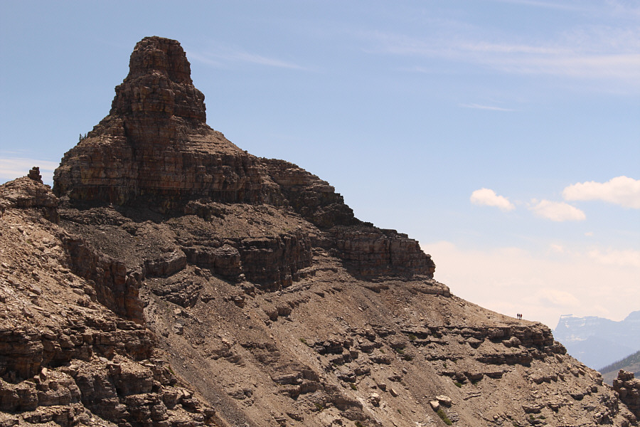
The next high point to the north is known locally as "The Horn" (as indicated on an interpretive sign along Highway 6) but has recently been dubbed "Dunwey Peak" and then "Rogan Peak" by Andrew Nugara.
For our return, we opted to do the loop suggested by Kane by descending the ridge west of the north summit.  The terrain below the summit is steep and loose, and it was a bit tricky to descend here in a group without sending a hail of rocks down on each other.  We could relax a bit once we muddled our way over to the crest of the west ridge, but there are a couple of drop-offs further down that proved problematic.  I was able to find a way for us to down-climb the first drop-off directly, but the second drop-off proved to be a bit too unnerving to attempt.  Instead, we had to backtrack slightly and descend, with some difficulty, a weakness on the south side of the ridge.  A bit of sidehill-bashing allowed us to circumvent the second drop-off and resume our descent along the crest of the ridge.  The ridge eventually turns southward flanking the west side of Coppermine Creek, and although we began to see more scorched trees lower down, there was surprisingly not a lot of ankle-breaking deadfall to trip us up.  Near the end of the ridge, we had some discussions about whether or not we should drop down into Coppermine Creek and follow the drainage out to the trailhead.  Ultimately, we dropped down far enough to take a peek and decided that it was better to stay higher up on the bank.  We endured another few hundred metres of sidehill-bashing until we were nearly across the creek from the trailhead.  We completed our loop with an easy rock-hop across the creek followed by an inconsequential bushwhack.

This trip exceeded my expectations and turned out to be a lot of fun.  Certainly, the fabulous weather helped, but as always, it is all about sharing the triumphs and tribulations on the trail (or off-trail) with great company.  I want to thank my companions for all the intriguing discussions throughout the day and for their patience and understanding.  It is not easy to hike with a slowpoke like me!  A special thank you goes to Alda for inviting me and for driving us all in her minivan; being able to relax in a comfortable back seat after a long hike was heavenly for me!
Lotsa loose shit here! The group carefully makes its way to the ridge west of the north summit.
Should be an easy ridge walk, right? The group gains the crest of the west ridge which can be seen curving to the left (south) in the distance.
I cut my finger on some of the sharp rocks here! Jeannine and Brian down-climb the first of two steep drop-offs along the west ridge.
If there were no other alternatives, I would have down-climbed the second drop-off. The group finds an alternate route to bypass the second drop-off (not visible here) along the ridge.

Everything looks impossibly steep from here!

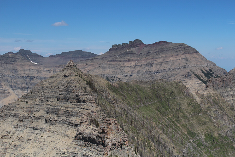
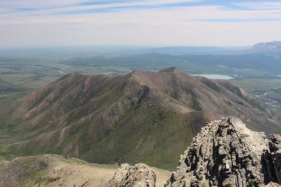
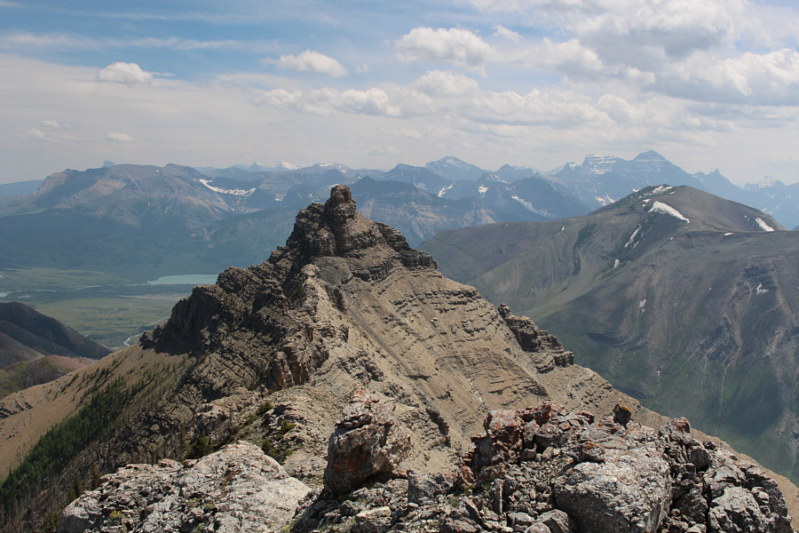
As seen from the west ridge, this a comprehensive view of Mount Galwey (right) and its higher north summit (left).


Jeez, how did we ever get down this nightmare of a ridge? Here is a closer look at the upper sections of the west ridge below the north summit.  The second drop-off is the shadowy cliff at lower centre.
Any geologists out there that can explain this? 
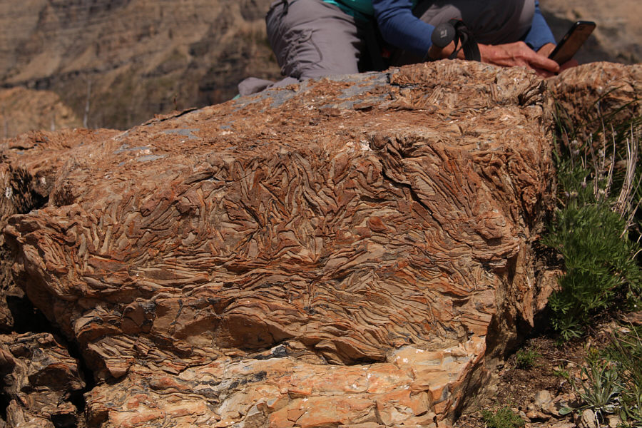
Further down the ridge, there are some rocks with some unusual patterns.
Put your mind on cruise control...for now! The group enjoys easy hiking along the undulating ridge as it turns southward.  Crandell Lake is visible in the distance at left.
It's better to steer clear of Coppermine Creek until the very end. From here, the group will cross a hidden creek at lower right before sidehill-bashing along the west bank of Coppermine Creek.  In the background is Mount Crandell.
Me so horny! Me love you long time! 
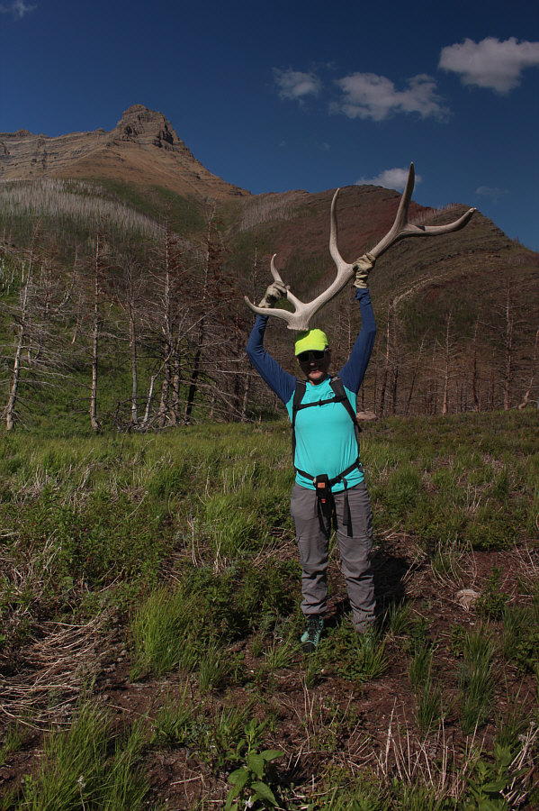
Jeannine lifts up a huge antler--apparently the same one found by the Nugara brothers in 2004!
A worthwhile and challenging extension to the Mount Galwey scramble. 
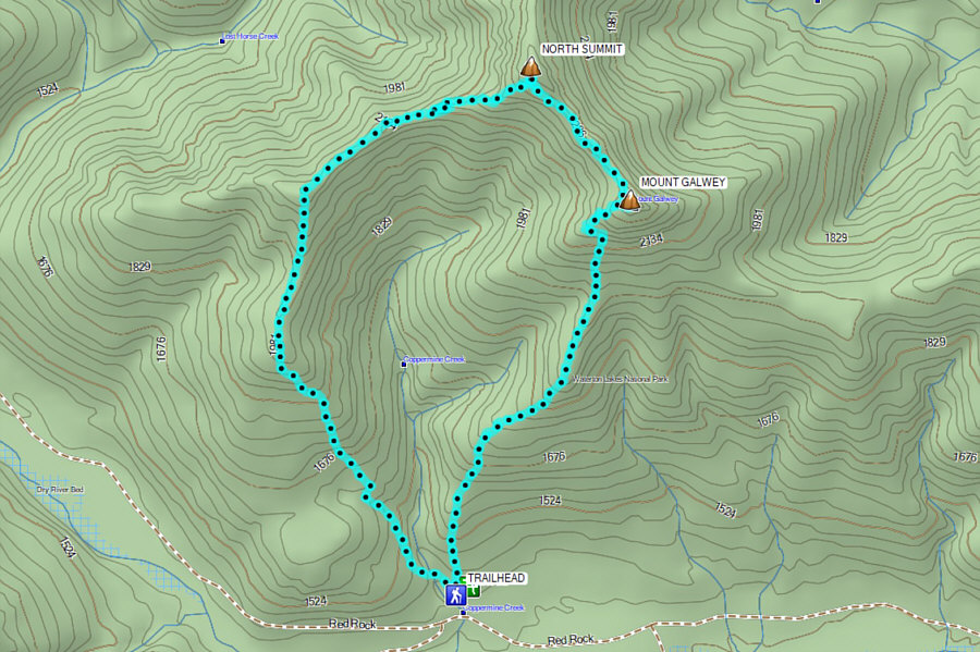
Total Distance:  9.7 kilometres
Round-Trip Time:  8 hours 21 minutes
Cumulative Elevation Gain:  1203 metres

GPX Data