BOU AVENUE
The Turret
Taking advantage of a great weather forecast
on 18 July 2020, I headed out to Alberta's Peter Lougheed Provincial Park
for a solo ascent of The Turret. Although there are numerous trip
reports for The Turret published online (the earliest of these by
So
Nakagawa in February 2010), apparently none of them utilize the
approach described by Alan Kane in his guidebook, Scrambles in the
Canadian Rockies. Granted, most of the online reports were
posted before Kane's latest edition came out in 2016, but having the
utmost faith in Kane, I decided to give his route description a shot.
I even carefully read it for a change!
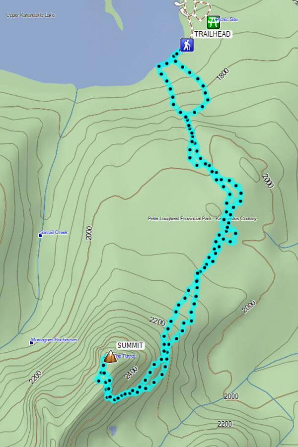
Kane's approach starts from the Upper
Kananaskis Lakes trailhead, and the parking lot was already teeming with
people when I arrived late in the morning (I had a personal commitment
earlier in the day). Joining the hordes of hikers on the lakeshore
trail, I passed a small clearing on the left about 150 metres from the
trailhead sign, but this did not seem to fit Kane's description of "a
tiny water trickle with a bit of animal trail on its left".
Instead, I continued along the lakeshore trail for another 150 metres
before I came across the described feature. Without dwelling too
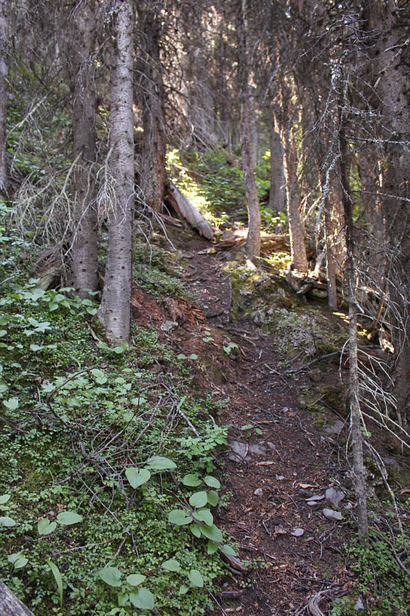
long on the insanity of eschewing a perfectly good trail to go plunging
into dense forest, I started up the animal trail which soon petered out
in the mossy carpet adjacent to the water trickle. Actually, the
trickle was more like a tumbling stream. As Kane promised, the
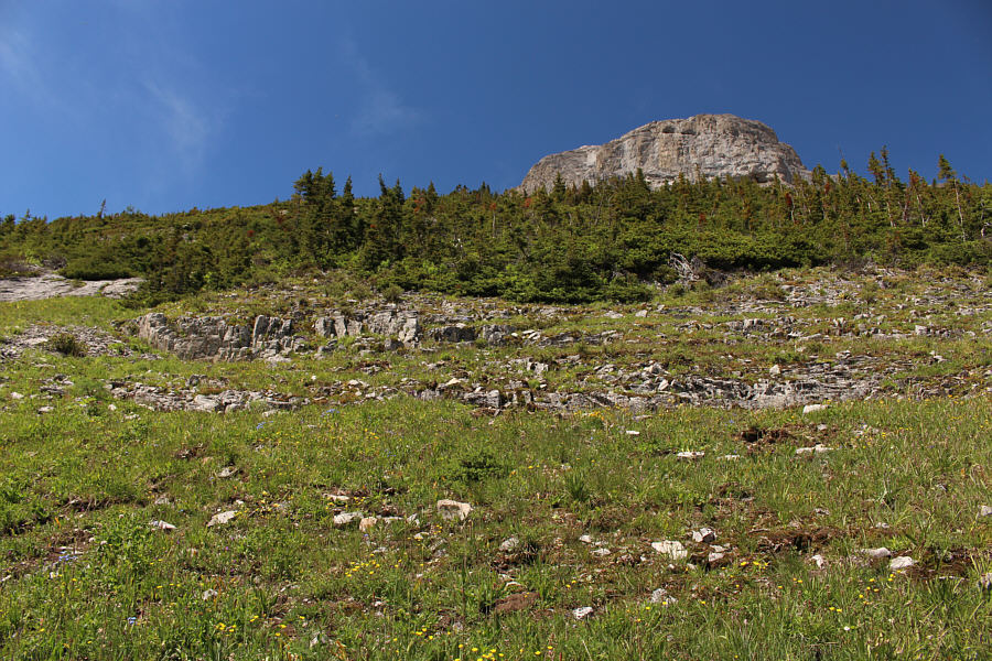
worst of the bushwhacking is during the first few hundred metres of
elevation gain, and even then, I did not think it was too bad except for
getting my feet wet due to lingering moisture from recent rains. I
stayed to climber's left of the stream as Kane suggested and generally
tried to follow the path of least resistance while climbing steadily
uphill.
About 170 metres (of elevation gain) up the
slope, I stumbled onto a remarkably good trail which led to a plateau of
sorts to the west of Blueberry Hill. The trail peters out in the
plateau, but the forest is open enough to allow for fairly easy travel.
I actually stumbled onto the wide Blueberry Hill ski trail at one point,
but knowing that I had to veer further west, I did not follow the trail
for very long before plunging back into forest. Completely missing
the "open meadow corridor at 331066" described by Kane, I was a bit
off-route at this point and endured some moderate bushwhacking while
aiming for the "east side of the peak at about 330056". When I
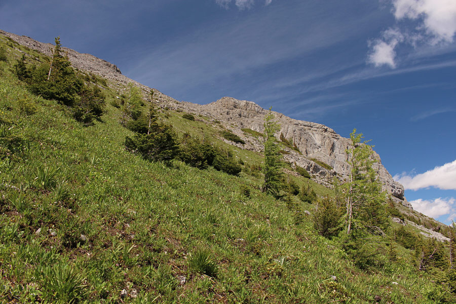
eventually emerged from the forest, I found myself under some significant
cliff bands guarding the east side of The Turret. I began
traversing to climber's left on faint game trails and ascending where
feasible. This entailed some more thrashing through a few
unavoidable sections of forest which abut the cliff bands. Even
after circumventing the majority of the cliff bands, I had some more
challenges weaving through the numerous hedgerow-like krummholz.
Fortunately, the passage of previous scramblers has created a few tight
corridors that allow upward progress. Clearing the last of these
obstacles, I still had a bit of a grunt left to reach the ridge crest,
but there were no more route-finding difficulties the rest of the way to
the summit. Given the jaw-dropping views and the fabulous weather,
I extended my stay at the summit to well over an hour.
On descent, I carefully retraced my steps back along the ridge crest and
down the steep slopes through the krummholz. While traversing
northward across the east side of The Turret, I hoped to avoid some of
the thrashing I encountered during my ascent by staying a little higher
up the slope, but by doing so, I ended up above a scary cliff band which
was maybe about 25 metres high. Loath to backtrack, I took a quick
peek downward and felt that I could safely down-climb this cliff band by
following a series of ledges, ramps and short drop-offs. As it
turned out, there were definitely a couple of tense moments mostly
because my bulky pack forced me into some awkward positions while
descending, but in the end, I managed to slither down the cliff band in
one piece. From the bottom of the cliff band, I continued to
traverse northward and soon began descending into the forest on more
gentle slopes.
Back on the plateau, I meandered a bit
following various shallow drainages and game trails, but fortunately, my
GPS kept me from straying too far. I eventually regained the good
trail that I picked up during my ascent, and I thought that it might lead
me easily back down to the lakeshore trail. Unfortunately, the
trail appears to traverse eastward high above and well past the Upper Kananaskis Lakes trailhead, and I ultimately abandoned it to drop down a
mossy gully. Initially, this gully was very easy to descend, but
toward the bottom, I began encountering more toothpick deadfall.
Thankfully, this bit of unpleasant bushwhacking was short-lived, and I
soon popped out into the small clearing I passed near the start of the
trip.
In retrospect, I think Kane's approach for
The Turret is perfectly reasonable. The bushwhacking is moderate at
worst and is certainly not sustained. Also, there is no need for a
boring walk along the long-winded ski trails (ie. Kane's approach is
significantly shorter). I can see some merit in using a bicycle for
the approach on the ski trails; the ride out would be a blast.
However, for those who are not so keen on mountain biking or the
associated logistics of transporting bicycles, Kane's approach would make
the most sense.
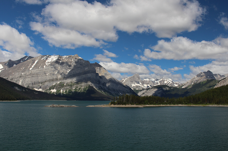 |
The view across Upper Kananaskis Lake
from the trailhead will be the last far-reaching view for the next
several hours. |
 |
Alan Kane advises to stay to climber's left of this stream while
bushwhacking uphill. |
 |
A well-defined trail materializes higher up the slope. |
 |
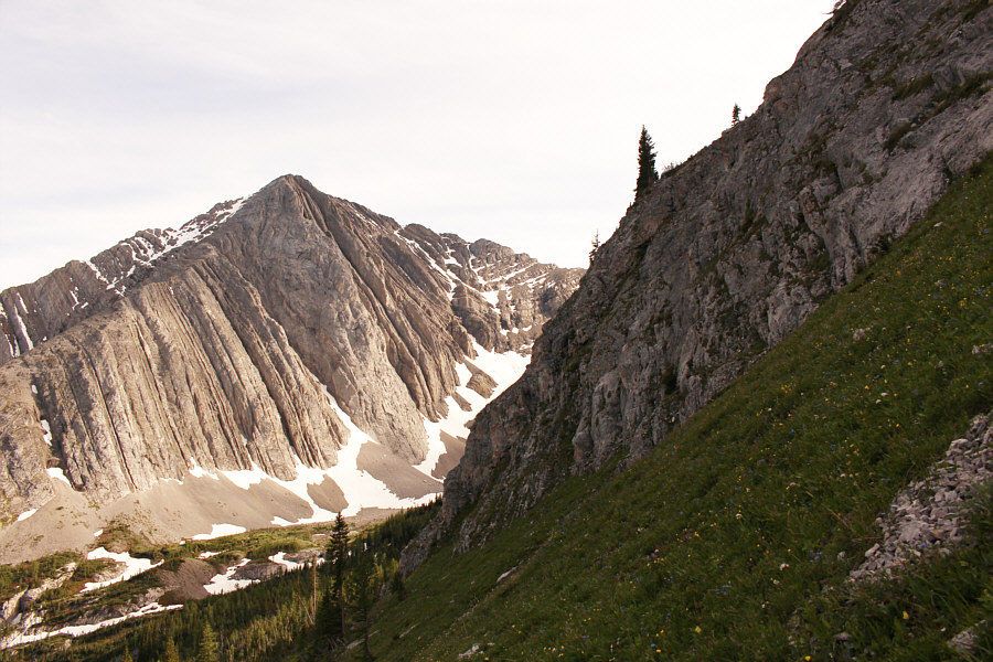
Mount Fox comes into
view on the eastern slopes of The Turret. |
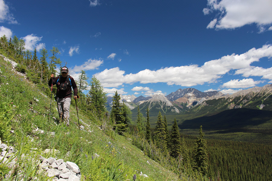 |
Sonny follows a faint game trail across the slope. |
 |
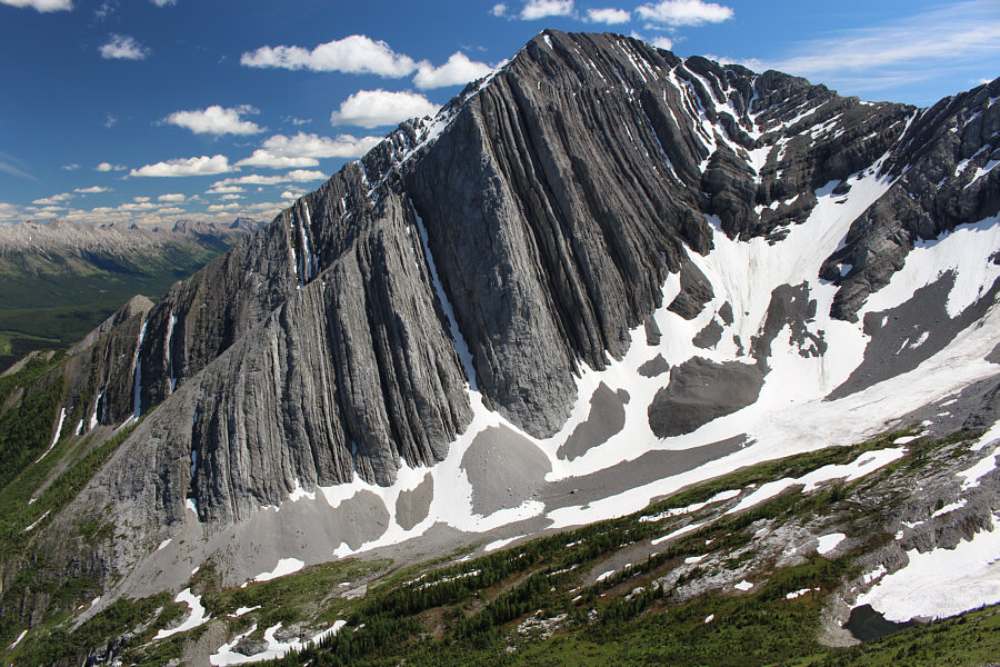
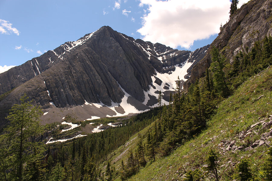
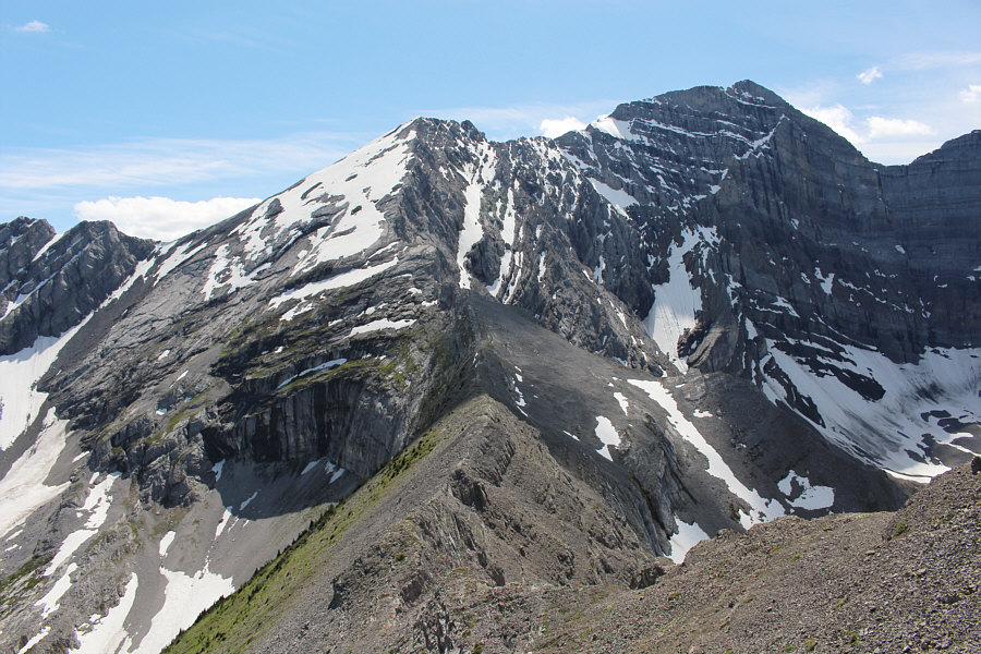
Ahead is the eastern outlier of Mount Foch. Note the rock bands at
right which need to be circumvented to ascend The Turret. |
 |
Route-finding on the southeastern slopes of The Turret is challenging
because of strips of krummholz like this one. |
 |
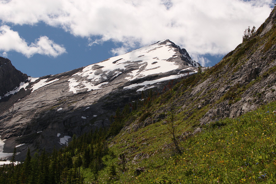
Even without krummholz, the southeastern slopes are still relentlessly
steep. |
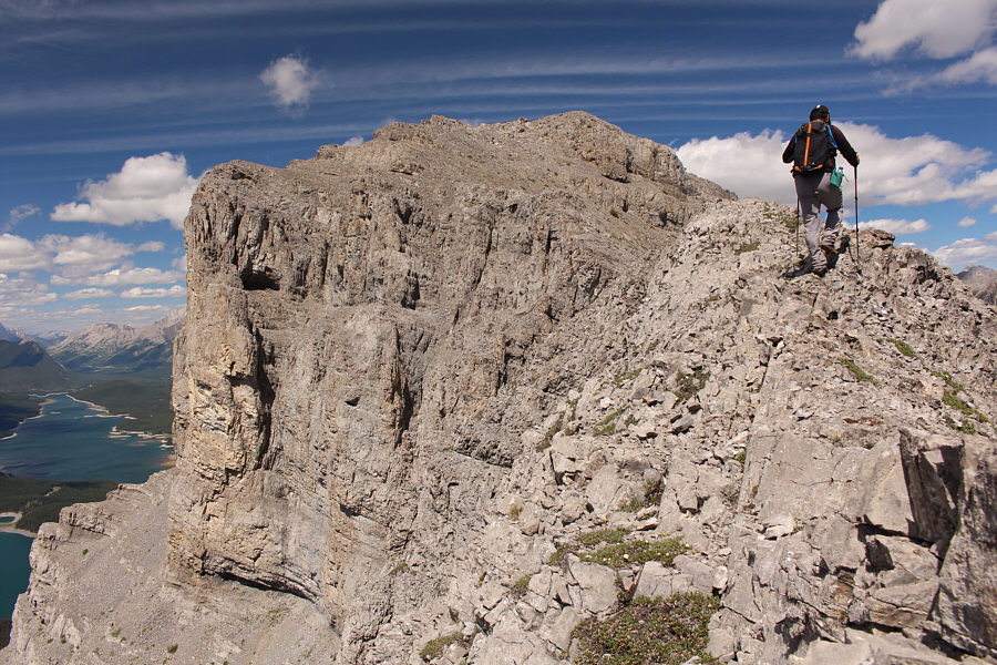 |
Sonny finally gains the crest of The
Turret's south ridge. |
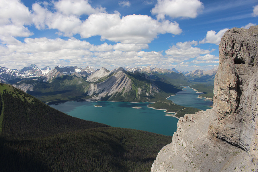 |
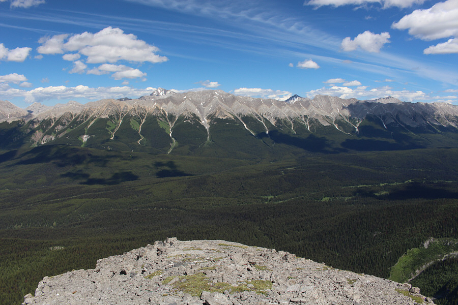
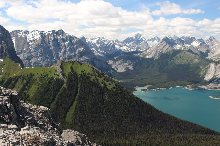
There is already a stunning view of Upper and Lower Kananaskis Lakes from
the south ridge. |
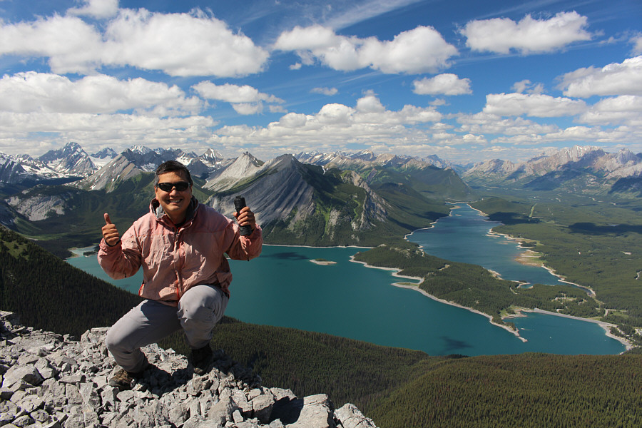 |
Sonny holds up the register canister on the summit of The Turret (2566
metres). |
 |
To the southwest is the connecting ridge to Mount Foch (right). |
 |
Rawson Ridge
looks verdant to the west. The highest peak on the right horizon is
Mount Sir Douglas. |
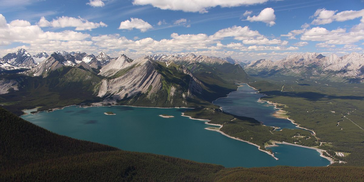
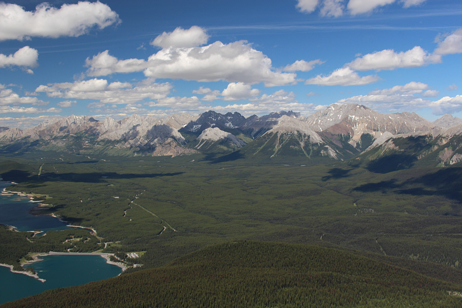
This is the million-dollar view of Upper and Lower
Kananaskis Lakes from the top of The Turret.