BOU AVENUE
Forgetmenot Ridge North
Anticipating a so-so weather forecast, Asieh Ghodratabadi, Shaun Luong, Ali Shariat, Zosia Zgolak and I chose to hike up the north end of Forgetmenot Ridge in Alberta's Don Getty Wildland Provincial Park on 18 September 2021.  Most of us had already hiked Forgetmenot Ridge previously (Zosia and I were up there most recently in 2019), but none of us had ever visited the distinct high point at the north end of the ridge.  I will refer to this as the north point of Forgetmenot Ridge.

Starting from the Little Elbow day use area, Asieh, Shaun, Ali, Zosia and I headed west to cross a bridge over to the south side of Little Elbow River before turning back east and crossing the dry flats of Big Elbow River.  A little more than half a kilometre east of Big Elbow River, we turned onto the marked trail heading up the north end of Forgetmenot Ridge.  We had no problems hiking up to tree line where we had a good view of our main objective, the north point.  We eventually left the main trail and contoured around an open slope to reach the ridge leading to the north point.  There are no difficulties with this off-trail route.  A short distance below the north point is a massive cairn, and we descended here to take a break and chat at length about the fate of the universe.

Once we arrived at a consensus about the pointlessness of all human endeavours in light of our inevitable extinction, Asieh, Shaun, Ali, Zosia and I proceeded to climb back over the north point and visit Forgetmenot Ridge's northeast outlier.  Hiking off-trail to the plateau-like outlier was generally easy, and we had no issues reaching a cairn marking the highest point.  We also wandered a bit further northeast to a much larger cairn before turning around and returning to the main crest of Forgetmenot Ridge.  We ultimately picked up the trail we came up on, and the remainder of our descent and return to Little Elbow day use area was uneventful.
Likely the only spot around Little Elbow where you won't step in horse poop!

The group starts off by crossing Elbow River.

When was the last time water flowed here? 
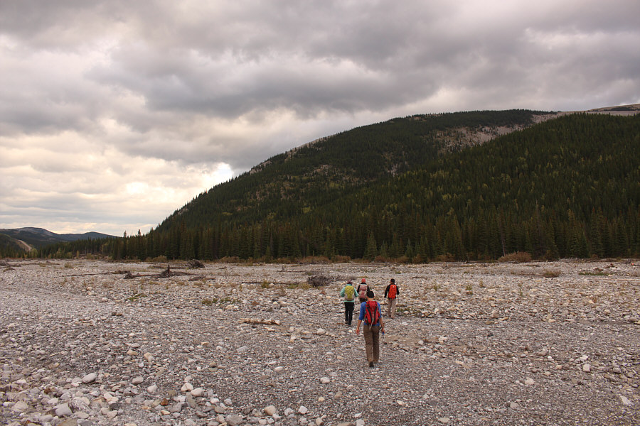
The group crosses the dry bed of Big Elbow River.
A better grind than the one on Prairie Mountain! 
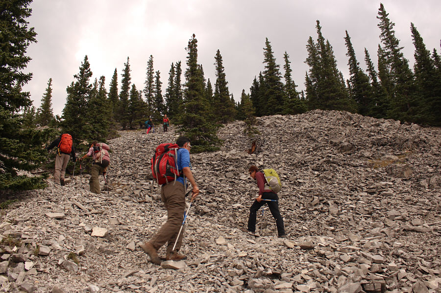
The group climbs up the steep trail at the north end of Forgetmenot Ridge.
The actual high point is not where you think! 
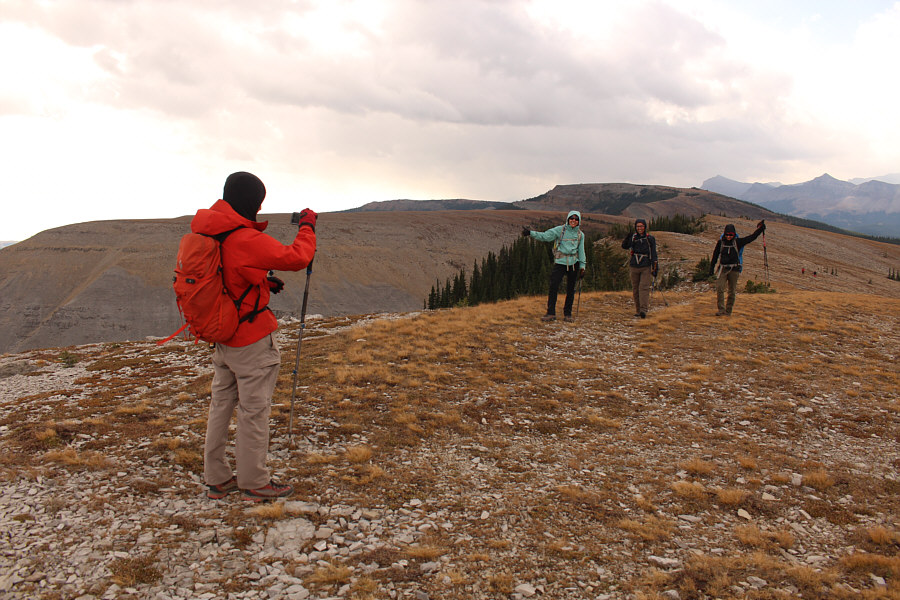
The north point of Forgetmenot Ridge comes into view as the group reaches tree line.
Woo-hoo! Shaun snaps a photo of Asieh, Ali and Zosia as they take the last few steps to the north point of Forgetmenot Ridge.  Behind Shaun is the northeast outlier.
That was easy! 
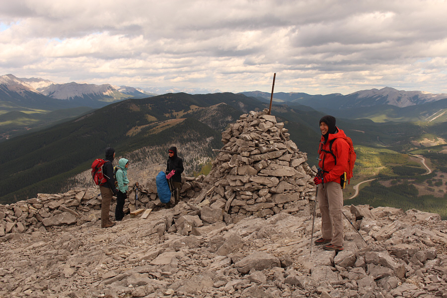
Sonny, Shaun, Zosia, Ali and Asieh stand on Forgetmenot Ridge's north point (2244 metres).
Ephraim Roberts left his signature pink ammo box here! 
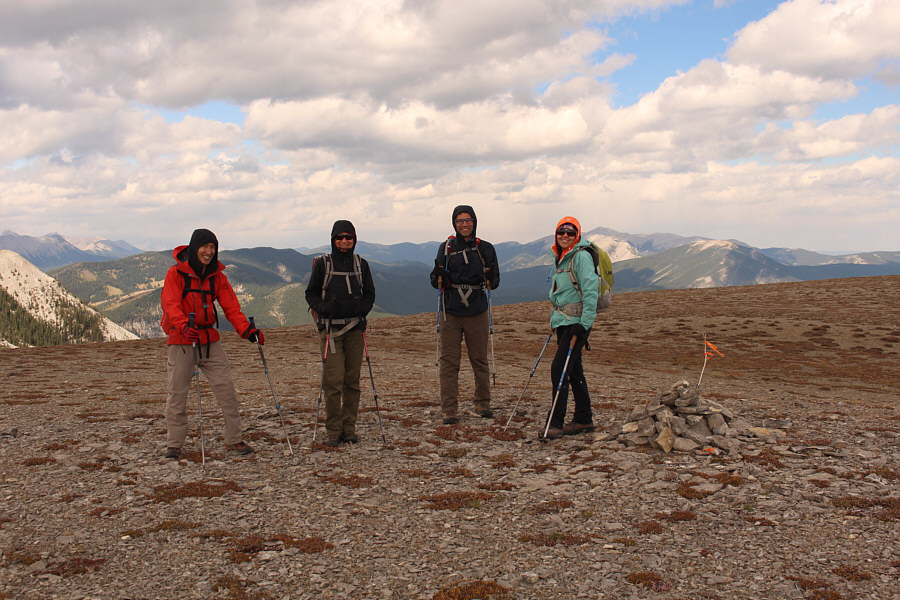
Ali, Asieh, Zosia and Shaun visit a massive cairn further down the ridge from the north point.
The open cut blocks look so innocuous from up here... To the north is a comprehensive view of Mustang Hills just across Elbow River.

Thankfully, we don't need to revisit Old Forgetmenot on this day!

The group hikes off-trail on easy terrain with the high point (Old Forgetmenot) of Forgetmenot Ridge in the background.


Good place to play football or fly a kite! 
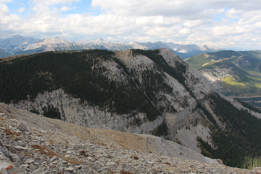
The northeast outlier of Forgetmenot Ridge is essentially a big flat plateau.
Hardly a definitive high point... Shaun, Zosia, Ali and Asieh stand on the high point of Forgetmenot Ridge's northeast outlier (2246 metres).
Count it as a separate summit? Here is a view of Forgetmenot Ridge's north point from the northeast outlier.
Good enough for today! Familiar peaks stretch across the western horizon as the group heads for home.
A short drive and good workout make this an ideal backup trip when the weather is so-so further west. Total Distance:  14.9 kilometres
Round-Trip Time:  6 hours 48 minutes
Cumulative Elevation Gain:  837 metres

GPX Data