Zosia Zgolak and I ascended Victoria Peak in
Alberta's Castle Wildland Provincial Park on 10 September 2022. A
moderately difficult scramble route via the east face is described in
Andrew Nugara's More Scrambles in the Canadian Rockies, but the
approach has now become problematic due to new restrictions placed on the
access road as detailed
here.
Regardless, I had already been contemplating a different approach after
reading Nugara's and
Dave McMurray's accounts of their combined ascent via the northwest
ridge (as pioneered by Robb Schnell apparently). In particular, I
was intrigued by their alternate descent route via what McMurray lovingly
refers to as "Whitney Ridge", and together with Nugara's glowing
endorsement--"In short, this descent route was OUTSTANDING! (the
grammatically questionable capitalization of the word hopefully conveys
how outstanding it was)."--I was eager to try and ascend Victoria
Peak this way. I even managed to convince Zosia to do likewise!
From Highway 507, turn south onto Range Road 20A, 3.6 kilometres east
of the junction with Highway 774 or 15 kilometres west of the roundabout
in Pincher Creek. Drive 6.5 kilometres and turn left (south) onto
Range Road 21A. Drive another 6.6 kilometres to cross a bridge, and
reach the provincial park boundary in another 1.5 kilometres.
Continue for an additional 2.0 kilometres to reach a junction with a road
that is blocked by a locked gate. Park here.
Going past the locked gate, Zosia and I rode our bicycles along the
gravel road which goes past a gas well site before crossing a bridge over
Whitney Creek. Immediately before a second bridge about 750 metres
further, we ditched our bicycles and set off on foot to follow a faint
and somewhat intermittent trail running along the west bank of Whitney
Creek's southern tributary. We were able to follow the trail for a
little more than a kilometre before it completely petered out, and we
then grinded uphill through light bush until we gained the crest of
Whitney Ridge. From there, we settled into a long and sometimes
problematic ascent up the ridge. As promised by Nugara and
McMurray, there is no shortage of hands-on scrambling here, but the
novelty of navigating the various rock formations and precipitous
drop-offs began to wear thin after awhile. Our progress up the
ridge seemed painfully slow, and more than once, we dropped off the crest
to find less technical terrain to ascend. Once we cleared the last
of the complicated sections on the ridge, we were able to mentally relax
a bit and just hike up easy slopes to the juncture with Victoria Peak's
broad west ridge. Other than having to tiptoe through a stretch of
tedious boulders guarding the upper slopes of Victoria Peak, we had no
further issues reaching the summit. Astonishingly, the ascent had
taken us a whopping six hours, but despite the lateness of the day, we
could not resist taking an extended break on the summit to enjoy the
fabulous views and weather.
For our descent, Zosia and I more or less retraced our steps down the
mountain. Descending Whitney Ridge was just as time-consuming as
the ascent although we modified our route to avoid a few troublesome
spots the second time around. When we dropped off the ridge crest,
we pushed a little too far north of where we ascended and ended up on
some uncomfortably steep slopes with a lot of thick vegetation. The
bushwhacking was rather unpleasant in a few spots here, but thankfully,
it was short-lived. Somehow, we managed get down safely and find
our faint approach trail in growing darkness, and the subsequent hike
back to our bicycles was trouble-free. The ride back to the locked
gate was fast but also quite cold in the dark, and we were happy to turn
up the car's heaters once we packed up our gear and drove home.
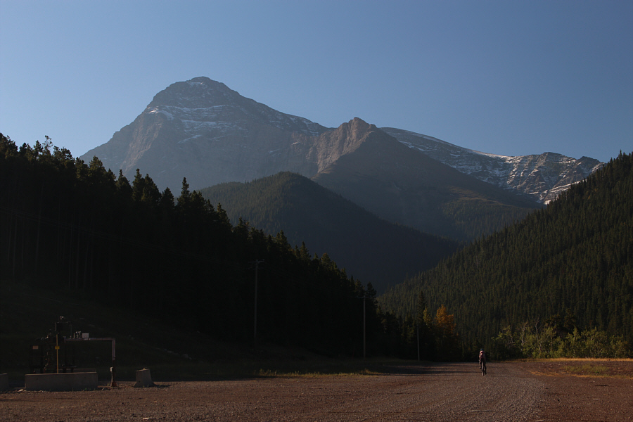 |
Victoria Peak looms in the distance as Zosia rides past a gas well site.
The upper part of the ascent route is also visible starting from the
snowy ridges at far right. |
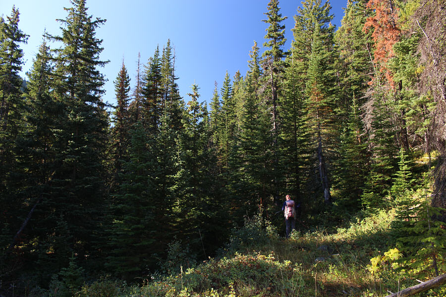 |
After ditching her bicycle just before the second bridge along the access
road, Zosia follows a faint trail into the forest. |
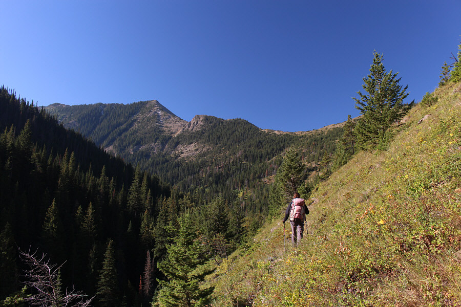 |
"Whitney Ridge", as coined by Dave
McMurray, comes into view as the trail begins to peter out further up
this valley. |
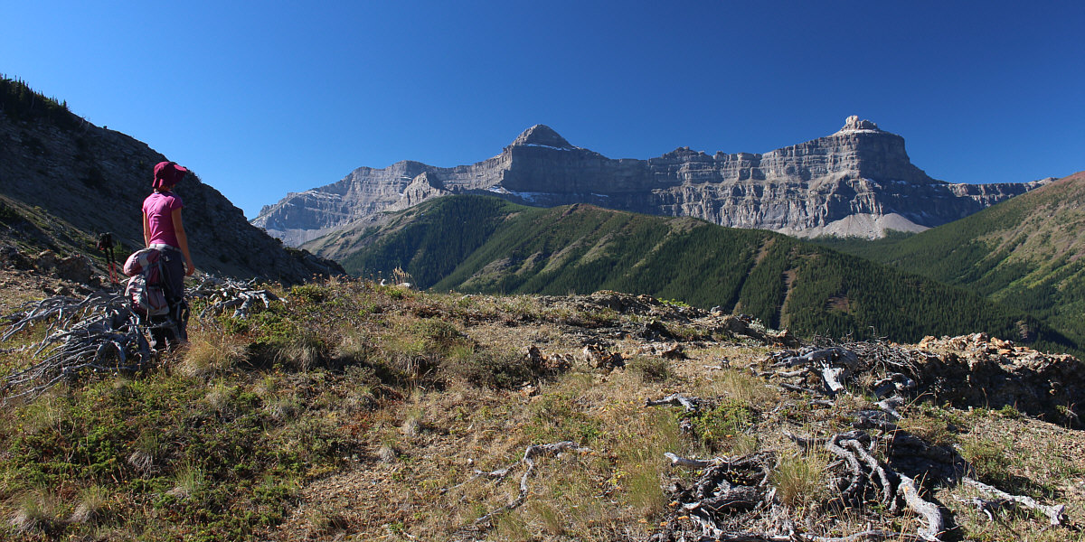
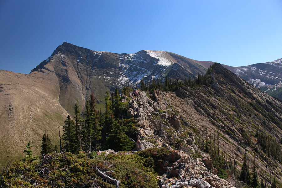
Upon gaining the crest of Whitney Ridge, Zosia is
granted fine views of Windsor Mountain and Castle Peak.
 |
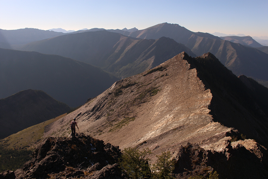
The summit of Victoria Peak is about 2.7 kilometres away as the crow
flies from this spot along Whitney Ridge. |
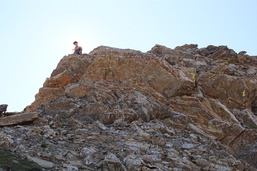 |
Zosia looks back down after climbing
up a steep rock band. |
 |
The tilted slabs here require some care and focus to traverse safely. |
 |
Many sections of Whitney Ridge demand good route-finding. |
 |
Zosia drops below the ridge crest in search of less complicated terrain
to ascend. |

Putting the complexities of Whitney Ridge behind him,
Sonny grinds up easier terrain. At left in the background is Mount
Gladstone, and at far right is
Whitney Creek
Mountain.
Photo courtesy of Zosia Zgolak
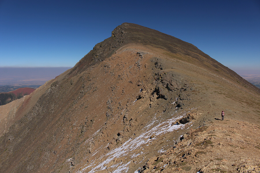 |
The west ridge of Victoria Peak poses no significant challenges. |
 |
Sonny and Zosia relax on the summit of Victoria Peak (2565 metres). |

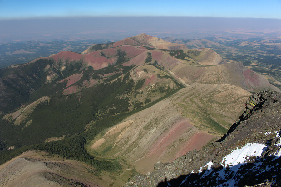
The view to the southeast includes many of the
colourful ridges of Castle Wildland Provincial Park as well as the
highest peaks of both Waterton Lakes National Park and Glacier National
Park (Montana).
 |
Pincher Ridge (left) and
Victoria Ridge
(right) converge far to the south. |
 |
The striking forms of Windsor Mountain and Castle Peak draw the most
attention in this view to the west. |
 |
Here is another view to the northwest of Mount Gladstone (left) and part
of Whitney Ridge (centre). The access road is also visible in the
valley at far right. |
 |
Prairie Bluff
rounds out the view to the northeast. |

On the return trip, Zosia descends to Whitney Ridge.
 |
Zosia retreats along the crest of Whitney Ridge. |
 |
Sonny carefully makes his way down a steep drop-off along the ridge.
Photo courtesy of Zosia Zgolak |
 |
The complex terrain on Whitney Ridge never seems to end. |
 |
Sonny is still muddling along the ridge late in the day.
Photo courtesy of Zosia Zgolak |
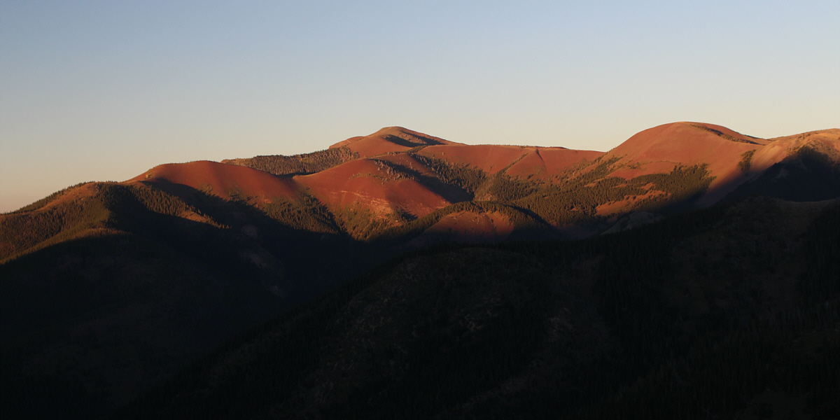
The late day sunshine really brings out the colours in
Prairie Bluff.
 |
Sonny inadvertently ends up in some thick bush on his way down into the
valley.
Photo courtesy of Zosia Zgolak |
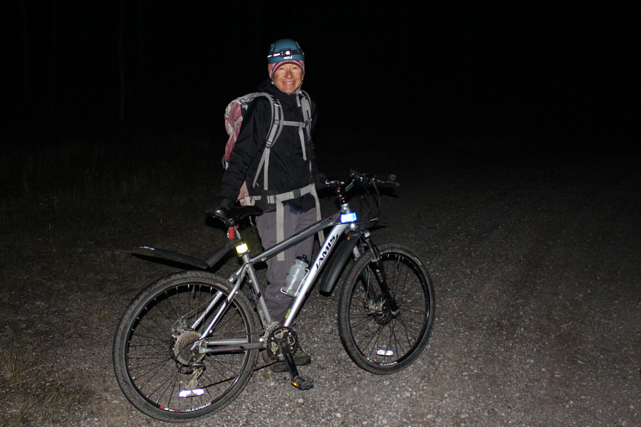 |
Zosia retrieves her bicycle in the dark and is ready to ride back to the
starting point. |
 |
Total
Distance: 20.4 kilometres
Round-Trip Time: 12 hours 4 minutes
Cumulative Elevation Gain: 1483 metres
GPX Data |